An agreement between the National Anthropology and History Institute (INAH) and Google means that many of Mexico’s most famous archaeological sites can now be explored using Google’s Street View. Perfect for the armchair traveler!
The system allows for viewers to rotate street level views the full 360 degrees horizontally, and 290 degrees vertically to take a “virtual walk” through such major sites as Teotihuacan, Xochicalco, Monte Albán, Chichén Itzá, Tulum, Palenque, Tula and Paquimé.
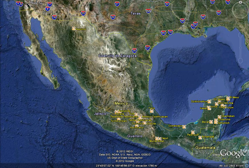
Sites included in INAH/Google system
Google’s images were captured by specially-designed equipment on bicycles that could navigate the paths and ruins without causing damage to the ancient structures.
Google Street Views can be accessed via either Google Earth or Google Maps.
The INAH/Google system includes the following sites in the Maya World region (Mundo Maya):
Dzibilchaltún
Uxmal (Street view) – Uxmal (article)
Kabah
Ek Balam
Chichén Itzá (Street view) – Chichén Itzá (article)
Kohunlich
Dzibanché
Chacchoben
Tulum (Street view) – Tulum (article)
El Rey
El Meco
Cobá
Becán
Palenque (Street view) – Palenque (article)
Bonampak
Comalcalco (Street view) – Comalcalco (article)
It also includes these noteworthy sites in other parts of Mexico:
Teotihuacan (Street view) – Teotihuacan (article)
Xochicalco (Street view) – Xochicalco (article)
Monte Albán (Street view) – Monte Albán (article)
Mitla (Street view) – Mitla (article)
Yagul (Street view) – Yagul (article)
Peralta
Plazuelas
Tzintzuntzan (Street view) – Tzintzuntzan (article)
Tajín
Paquimé (Street view) – Paquimé (article)
Cuicuilco
Cholula, Puebla (Street view) – Cholula (article)
Xochitécatla
Tula
Related posts:
- Map of Yucatán Peninsula including Mérida, Cancún, Riviera Maya and Cozumel
- The geography of the Maya: does central place theory apply to ancient Maya settlements?
- Where is the best place in Mexico to celebrate the Spring Equinox?
- How did the Aztecs get their food? Sustainable farming in Aztec times
- The Aztecs knew their geography!