Aug 042023
 

How is this possible???? The 2023-2024 editions of Mexico’s free textbooks for school students are being roundly and rightly criticized on various fronts. Prepared and published by the Education Ministry (SEP), one of them includes this map:

v

Map in SEP textbook, 2023 edition

Time to play “Spot the Mistake.” Answer: Map has flipped the names of two states: Guanajuato and Querétaro. Astonishing! How is this possible?

Dear SEP: For future reference, Geo-Mexico is always happy to be contracted to provide proof reading and geography fact-checking…

And, if you thought the map was bad . . . at least it is almost correct, which is more than can be said for this graphic of the Solar System, taken from another 2023-2024 free SEP textbook:

We’re not going to insult the intelligence of our readers by pointing out why this is totally misleading!

To students and teachers everywhere: Have a happy and successful 2023-2024 Academic Year.

Aug 232019
 

A recent edition of the New Scientist has an interesting article about dinosaurs and the rapid shifts in our knowledge of these ancient beasts based on recent fossil discoveries. If the New Scientist is to be believed, these discoveries have not only revolutionized our views of dinosaurs, they have also rearranged the Earth’s geography.

  • The demise of the dinosaurs came about after “An enormous asteroid struck what is now the Yucatan peninsula  in Central America, sparking a mass extinction.”

Hmm… first up, it should be the “Yucatán Peninsula” (with an uppercase “P”) to refer to that region of Mexico. And, more importantly, the Yucatán Peninsula, as part of Mexico, is clearly in North America, not Central America, unless the impact of that danged asteroid is still reverberating around the world and shifting the continents.

For more about dinosaurs and the Chicxulub impact crater –

Source:

  • Riley Black. “The undiscovered dinosaurs”. New Scientist, August 3-9, 2019, page 46

US Airways customer service redefines the geography of North America

 Other  Comments Off on US Airways customer service redefines the geography of North America
Mar 102014
 

According to a US Airways customer service agent in Phoenix, “US Airways does not charge for the first checked bag on international flights. Flights from the US to Mexico and Canada are NOT considered international flights because they do not cross water.”

This statement was made in response to a query regarding a charge of US$25.00 for a single checked bag on a flight from Guadalajara to Phoenix, following a Geo-Mexico fact-finding trip to Jalisco.

Hmm… does this mean no passports required? Does this mean that Canada, the USA and Mexico share a common currency, language and government. Me thinks not!

Defining “international” as requiring the crossing of water actually gave me a vivid flashback to my early days teaching in the Caribbean, where I discovered, to my great surprise, that some students had a similar idea. Because they knew that different Caribbean islands were (generally) different countries, they assumed that all countries were islands. In one extreme case, a student colored the political boundaries between all the countries of South America blue, justifying this by saying that each country was an island and must have water separating it from the next country!

Fortunately, the customer service agent’s interpretation of international is not echoed by the airline’s own webpage about Baggage Policies. In the circumstances, perhaps US Airways should consider upgrading its training programs for its customer service staff. Geo-Mexico would be pleased to assist.

Related post:

National Post graphic enters our “North America” hall of shame

 Mexico's geography in the Press  Comments Off on National Post graphic enters our “North America” hall of shame
Jan 162013
 

Geo-Mexico feels compelled to add a graphic from a recent article in Canada’s National Post to its “North American Hall of Shame”. The article itself is about the shortcomings of some Canadian university students when asked basic world geography questions. While we share the author’s concern about the standards of geography teaching in many parts of Canada (and elsewhere for that matter), the graphic chosen to illustrate the article leaves a lot to be desired. Ironically, it incorporates various geographical blunders.

Map used in National Post, 15 Jan 2013.

Map used in National Post, 15 Jan 2013.

For example (see graphic above), not only does Mexico appear to have swallowed up several not-insignificant Central American countries (Belize, Guatemala, Honduras, El Salvador, Nicaragua, Costa Rica and Panama), but it is also shown as not belonging to North America. And, before we move on to look at another part of the graphic, perhaps we’d better ask the inhabitants of Greenland, Iceland and the Faroe Islands how they feel now that they have moved continent?

Map used in National Post, 15 Jan 2013.

Map used in National Post, 15 Jan 2013.

The main map in the graphic (shown above) does have a (slightly) more accurate depiction of North America. However, it shows Europe as extending across the Middle East and well into Asia!

The readers of the National Post deserve better. How can we expect standards of world geography to improve if graphic artists produce images like these, and if the editors and fact-checkers of national newspapers do not do a better job of selecting appropriate images to illustrate their articles?

Related posts:

The geography of Mexico in the 21st century (cartoon)

 Other  Comments Off on The geography of Mexico in the 21st century (cartoon)
Sep 022011
 

Below is Mexican cartoonist Negrinho’s view of the “Geography of Mexico in the 21st Century“, which shows how “In the course of history, the geography of Mexico has changed: its natural environment due to deforestation, its politics, society and even its security…”

Geography of Mexico in the 21st Century

Geography of Mexico in the 21st Century. Credit: Negrinho

The cartoon dates from a few years ago, and features references to politics, drug cartels and their leaders, the spate of unsolved murders of young women in Ciudad Juárez and “mojados” (“wetbacks“, undocumented migrants crossing the border into the USA).

This cartoon is one of a series entitled Mexico 32: Futbol y Caricaturas Políticas.

Our top 10 list of “googled” phrases which led to Geo-Mexico.com

 Other  Comments Off on Our top 10 list of “googled” phrases which led to Geo-Mexico.com
May 072011
 

Our trusty server stats include these “top ten” search phrases. Each of them (when entered into a certain famous leading search engine) magically brought one or more viewers to Geo-Mexico.com:

  • 10- parangaricutiro tongue twister – our post Geographic tongue-twister relating to a volcano explains this tricky-to-pronounce search
  • 9- what kind of aztec indian would you have been if u lived in El Salto mexico – perhaps an Aztec Indian?? Or, given the qualifier of “El Salto”, possibly a leaping Aztec Indian? [salto = jump or waterfall]
  • 8- what are the five countries in Mexico – We acknowledge that Mexico has suffered national identity crises various times in its tumultuous history, but fortunately never quite to this extent!
  • 7- are canada and Mexico equally linguistically diverse -Even counting the languages spoken by the various “First Nations” groups (as Canadians call their native peoples), Mexico wins this one easily. Some 60+ languages (not dialects) are spoken in Mexico
  • 6- what kind of cars do mexican cartels drive – hmm…hopefully, NOT the car you were driving just before they stopped you at a fake roadblock and took your set of wheels! [Unfortunately, this tactic has been used by drug cartels all too frequently in the past couple of years.]
  • 5- non churches in the 1600s – this intriguing concept needs narrowing down slightly before we can venture a more detailed response
  • 4- mexican cartel 1911 – possibly this was meant to be 2011 not 1911. However, Pancho Villa would indeed have been a powerful cartel leader, given half the chance; his cross-border excursions would have been very useful in that line of work, though his preferred method (horseback) was nowhere near as imaginative as the tunnels, catapults, aircraft and mini-subs used by cartels in 2011
  • 3- geographical routes from mexico to US – beyond the obvious road, railway and airline routes, we think “Geo-Mexico, the geography and dynamics of modern Mexico” has this well covered, since our chapters are clearly linked to the four major traditions of geography in the USA, and the five themes identified by the Association of American Geographers and the National Council for Geographic Education in 1984 for the teaching of geography – click the link to buy your copy today!
  • 2- names of all the volcanoes in mexico – definitely a challenging request. Assuming all categories—active, dormant and extinct—are included, the number must certainly run well into the hundreds
  • 1- spanish speaking states in mexico map – The answer to this, or the parallel question of “How many English-speaking states are there in the USA?”, might not be as obvious as it appears. However, to clear up any possible confusion, click HERE for our map of Spanish-speaking states in Mexico, and HERE for a fascinating, interactive map showing the distribution of Spanish-speakers (and other languages) in the USA. Zoom in for detailed views of individual states.

Our previous “Top Ten” list:

Jan 272011
 

How can the producer of a major TV documentary get it SO wrong? A multi-part documentary, Racing Green, is currently running on BBC World. It describes the extraordinary achievement of students in the Racing Green Endurance (RGE) team and Radical Sportscars in manufacturing a battery-powered SRZero electric sportscar and then driving it the full 26,000 km length of the Pan-American Highway, from Alaska to Argentina. The momentous trip required 70 days of driving and the vehicle became the first battery-powered vehicle ever to complete this challenging route. This is a truly laudable achievement (kudos to the students and organizers) and marks another vital step in the development of electric vehicles, and their acceptance by the general public as a viable alternative to driving contaminating gas-guzzlers.

racing-green

Photo: racinggreenendurance.com

The documentary series and the Racing Green Endurance website share “the aim of communicating our core values to the widest possible audience.” The documentary is well worth watching for the adventure-packed story and the incredible engineering accomplishment. However, the geography in the documentary’s commentary is not quite so inspirational.

Here is the narrator of Racing Green, preparing viewers for the next installment: “The easiest part of the trip – North America – is nearly over. Ahead lies Mexico and South America…”

Excuse me??

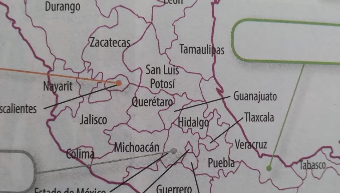
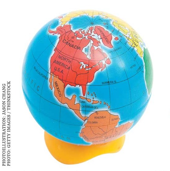
Q. Has some major continental movement taken place that we haven’t been told about? Has Mexico left North America?

A. No! Mexico is most definitely (still) very much in North America.

Dear BBC,

PLEASE get your geography right next time, or at least consult an atlas. If you can’t find an atlas, Geo-Mexico is always ready and willing to undertake consultancy work relating to the geography of Mexico, ranging from the simple (eg “Is Mexico really in North America?” and “How long is Mexico’s coastline?“) to the complex (eg “What are the likely impacts of the new Durango-Mazatlán highway?”)

Please, call us first next time, before you put your foot in your geographical mouth…

Sincerely,

Geo-Mexico

Rant over! Our normal service of insights into Mexico’s geography will be resumed tomorrow.

Our ten favorite phrases “googled” by readers en route to Geo-Mexico.com

 Other  Comments Off on Our ten favorite phrases “googled” by readers en route to Geo-Mexico.com
Jun 302010
 

Reviewing Geo-Mexico blog statistics, we have found some curious search phrases. In each case, when these phrases were entered into a famous leading search engine, a Geo-Mexico page appeared in the results, and someone, somewhere, followed that link to reach our humble site. Here are our current favorite “top ten”:

  • 10. gender basis in mexico [is there an expectation that there is something distinctive in this regard in Mexico?]
  • 9. www.indonesian coffee exporter.com [an interesting mix of web search and url search]
  • 8. ancient mariners map north arrow design [we like our north arrow design, thank you, and don’t mind being called “mariners”, but do not consider ourselves “ancient”, at least not yet]
  • 7. the local economy [what one expects from this search, we’re not sure, but we’re delighted they found us!]
  • 6. any irish people in Toluca Mexico [presumably looking for the links, which genuinely do exist, between Toluca, the Irish and the potato famine]
  • 5. what changed in mexico [lack of temporal or spatial qualifiers makes this a tough question to answer]
  • 4. why is shopping quality improves geography [we really do believe that our blog can improve geography, but we’re not so sure about shopping quality]
  • 3. total 2010 birth rate for mexico [given that we’re only in June, maybe the last six months of this year will be birth-free?]
  • 2. how long is mexico [another interesting question – this is actually the commonest query in our current “top ten”]
  • 1. full size map of mexico [sadly, we don’t yet have one of these on our site…]

While Geo-Mexico: the geography and dynamics of modern Mexico can’t answer all of those search inquiries, it does have loads of fascinating information about Mexico, some of it guaranteed to be very useful in trivia competitions. Buy your copy today!!