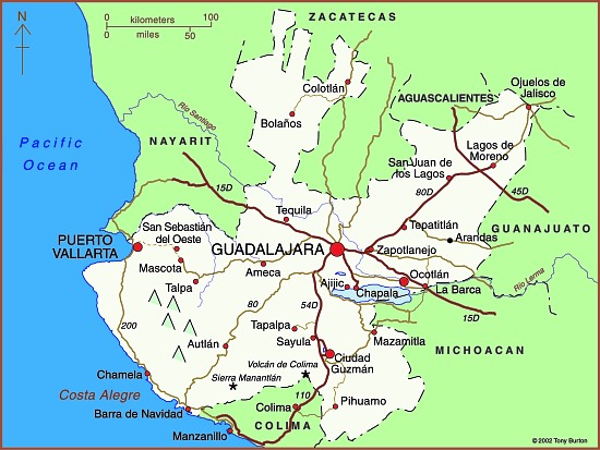
The state Jalisco (see map) has an area of 78,609 square kilometers and a population of 7,070,555 (2010 estimate). The state’s capital city is Guadalajara, Mexico’s second largest city (2009 population: 4,365,000). On the outskirts of the city is an area of industry that is known as Mexico’s “Silicon Valley” because of its various computer-related factories.
The state is entirely within Mexico’s “Volcanic Axis” with varied scenery, encompassing everything from inland plateaus to rift valleys, volcanic peaks, calderas and coastal landforms. Its diverse altitudes mean that there are significant climate differences within the state.
Jalisco’s economy is very diversified. The state is a major agricultural producer, but also has an important manufacturing output, and also has a significant tourism industry, centered on the coastal resort of Puerto Vallarta. The villages of Ajijic and Chapala on the northern shore of Lake Chapala, Mexico’s largest natural lake, are the home to several thousand US/Canadian retirees.
Previous blog posts about Jalisco include:

Sorry, the comment form is closed at this time.