Acapulco airport to get a new terminal building

 Mexico's geography in the Press  Comments Off on Acapulco airport to get a new terminal building
Jul 072016
 

Acapulco international airport (ACA), in Guerrero state, currently handles about 800,000 passenger movements each year. The airport is operated by Grupo Aeroportuario del Centro-Norte (GACN), which also manages airports in another 12 cities. With suitable fanfare in 2014, GACN announced plans to replace the terminal building.

Acapulco, Mexico's first major resort. Photograph by Tony Burton. All rights reserved.

Acapulco, Mexico’s first major resort. Photograph by Tony Burton. All rights reserved.

Last month, GACN reiterated it is investing $30.5 million to build a new terminal building for Acapulco capable of handling 1.3 million passengers a year. The group claims that the new terminal, which will be more than 18,000 square meters in area, will have a state-of-the-art design that will reduce the risks associated with natural hazards and provide much greater space for passengers, airlines and all other supporting services. In addition, it will adopt a range of electricity-saving measures, lowering the airport’s regular operating costs.

Now scheduled to be completed by mid-2018, the Acapulco terminal is the most significant single investment that GACN plans to make in the next five years, and comes at a time when city authorities are busy revitalizing the famous resort. An improved public transit system known as Acabús was officially inaugurated in the city in June 2016.

The new terminal will, however, no longer be ready in time for 2017, when Acapulco will once again host Mexico’s massive annual tourism trade fair, the Tianguis Turístico.

Related posts:

Acapulco’s ACAbus system finally begins operations

 Other  Comments Off on Acapulco’s ACAbus system finally begins operations
Jun 162016
 

On 21 June, the public transit system known as ACAbús will finally officially begin operations in the resort city of Acapulco in Guerrero. ACAbús began trial operations on 31 May, following several years of delays.

acabus

The service employs 135 Dina buses of various kinds, all equipped with state-of-the-art technology to reduce emissions, save fuel and will substitute 366 old, less efficient vehicles to the benefit of both locals and tourists.

The system represents an investment of around $140 million, roughly two-thirds for highway and transit stop refurbishment and one-third for operating equipment (vehicles and travel card machines).

ACAbús connects the resort’s many tourism attractions and facilities. The main central axis (map) is a 16-km (10 mile) long route from Las Cruces along Avenida Cuauhtémoc to Caleta, with 18 stops along the way. This portion will be confined solely to rapid transit articulated buses.

Map of ACAbús network; click forlarger pdf map

Map of ACAbús network; click for larger pdf map

Four trunk routes supplement this central axis, each with a limited number of stops. The ones of interest to most tourists will be Routes 4 and 5, which run along the main Costera Miguel Alemán highway. A series of shorter feeder routes provides easy access from most parts of the city to the nearest trunk route.

Passengers are required to obtain a pre-paid card in order to use the system. Most journeys, including connecting service, will cost $10 pesos (less than 60 cents U.S.).

The number of different bus routes in Acapulco has been reduced from about 220 to 120, but travel times should be greatly improved. Authorities claim that the system should cut regular traffic by about 25%, and that everyone will benefit as it means that older vehicles have been removed from the roads with a decrease in total emissions.

Related posts:

Mar 212016
 

Cancún International Airport (CUN) has opened a new terminal, Terminal 3. The airport is the nation’s busiest for international traffic and second only to Mexico City for national traffic. The airport served a total of more than 19 million passengers in 2015, 11% more than the previous year.

The new 60-million-dollar, state-of-the-art Terminal 3 is exclusively for international passengers, and increases operating capacity by 4 million passenger movements a year. An additional terminal, Terminal 4, is scheduled to open in 2017.

New terminal at Cancun airport

New terminal at Cancun airport

According to federal officials, airport investments in the first three years of the current administration have exceeded 1.8 billion dollars. This has triggered the addition of 260 national and 186 international air routes. Passenger movements in the past three years have risen 33% (to 73 million), while air freight has grown 17%.

Related posts:

The Trans-Isthmus mega-project

 Mexico's geography in the Press  Comments Off on The Trans-Isthmus mega-project
Jul 272015
 

A huge industrial development plan looks set to get underway shortly in the narrow Isthmus of Tehuantepec in southern Mexico. The low-lying Isthmus of Tehuantepec separates the Chiapas Highlands and the low Yucatán Peninsula from the rest of Mexico. The Isthmus was once considered as an alternative location to Panama for a trans-continental canal.

During Mexico’s internal Reform War (1858‑60), between the liberals, led by Benito Juárez, and the conservatives, both sides encountered serious financial problems. At one point in this war, the liberals accepted an offer from the USA to receive four million pesos in exchange for the USA having the “right of traffic” across the Isthmus of Tehuantepec “in perpetuity”. Fortunately, this treaty was never ratified by the US Senate.

Proyecto-Transistmico

In recent years, the Tehuantepec area has received massive investments in wind power, with several major wind farms already operational and more on the drawing board. The latest plans will build on those investments to provide upgraded infrastructure meeting the preconditions for industrial development.

The 300 million dollars allocated to the first phase of the Trans-Isthmus Project will improve railroads, highways, airports, and the ports of Coatzacoalcos on the Gulf Coast and Salina Cruz on the Pacific Coast (see map).

During the second phase, private sector financing will add industrial development areas, which should boost the area’s contribution to national GDP from 2% to 4.5%, and raise the regional GDP/person to $10,000 a year, close to the national average.

The federal government has designated this region as a special economic zone, offering several fiscal incentives to new enterprises. Chinese investors have already expressed interest in building a 200-million-dollar steel manufacturing plant in the isthmus, utilizing nearby iron ore reserves to produce 3 million tons of steel a year.

Posts related to the same general area of Mexico:

Jun 082015
 

Mexico’s official online database of all the country’s roads and highways has just been updated. As of May 2015, Mexico has a total of 322,859 kilometers of roads and highways.

They are all shown on a map accessed via this web-page. [Link to http://www.imt.mx/micrositios/sistemas-de-informacion-geoespacial/servicios-tecnologicos/red-nacional-de-caminos/ver-datos.html no longer working.]

Mexico's major highways (Fig 17-3 of Geo-Mexico, the geography and dynamics of modern Mexico).

Mexico’s major highways, 2009 (Fig 17-3 of Geo-Mexico, the geography and dynamics of modern Mexico). All rights reserved.

Here is a summary of some of the more useful statistics found in the database:

  • 158,180 km of paved highways, including
    • 48,685 km of federal highways,
    • 92,590 km of state highways
    • 9412 km of toll highways
  •  36,139 km of urban roads
  • 118,812 km of rural (unpaved) roads.

The highway network connects 25,844 places, and has links to 39 ferry routes. It also includes 847 toll stations, 3476 bridges and 178 tunnels.

According to the report, Mexico currently has 6480 gas stations. However, this number is expected to increase rapidly in the next few years as competitors enters a market over which PEMEX previously held a monopoly, prior to recent energy reform laws.

If you are planning to drive across Mexico, then the online system at http://ttr.sct.gob.mx/mappir/ will give you routes, distances and estimated times and costs.

Further reading:

May 252015
 

The Mexican government is funding a 100-million-dollar project to build Mexico’s first cruise ship home port at Puerto Peñasco (Rocky Point) in Sonora on the Sea of Cortés (Gulf of California). Construction began in 2013 and is scheduled to be completed by early in 2017.  Proponents hope that the port will help transform the existing town (population about 60,000) into a fully-fledged tourist resort, taking advantage of its proximity to Phoenix and Tucson in Arizona. The project includes a state-of-the-art terminal and convention center.

pinacate-map-google

The town already has a small international airport, inaugurated in 2008, which has a daily capacity of 2000 passengers and would need to be expanded if the port takes off.

Puerto Peñasco has an embryonic tourism industry at present, mainly attracting Arizonans (it is their nearest beach), fishing enthusiasts, and school and college students during spring-break (attracted, in part, by the legal drinking age being 18 in the town, compared to 21 in Arizona).

puerto-penasco

Puerto Peñasco also has research stations of the Universidad de Sonora: its Centro de Investigaciones Científicas y Tecnológicas (Scientific and Technological Research Center) and its Centro de Estudios del Desierto (Center for Desert Studies).

According to cruise line statistics, the number of Mexicans taking cruises in 2014 rose by 15%, but analysts argue that many Mexicans stay at home and are unable to take cruises at present because they lack a U.S. visa. Establishing a home port in Mexico, they argue, would therefore open up a significant new market. A cruise ship port at Puerto Peñasco would clearly have immense impacts on the town, boosting the local economy and generating up to 2,500 direct and 5,000 indirect jobs.

However, critics say this will come at a cost. They cite potential problems related to local residents, wildlife and biodiversity. They fear that development of the town will raise property prices beyond the level of affordability of local residents. A Tucson-based non-profit, The Intercultural Center for the Study of Deserts and Oceans is working with local fishermen and government agencies to “empower coastal communities in the Northern Gulf of California region with the knowledge and tools to create sustainable livelihoods that exist in concert with the surrounding natural and multicultural environment”. The research center believes the port development will lead to environmental changes adversely affecting important fishing grounds. The center has also expressed concern about the potential hazards to nesting sites used by sea turtles.

Related posts:

Author David Lida on Mexico City’s transportation systems

 Books and resources, Mexico's geography in the Press  Comments Off on Author David Lida on Mexico City’s transportation systems
Apr 272015
 

David Lida is a well-known and highly respected author who has lived in Mexico City (on and off) for over twenty years. His books include First Stop in the New World: Mexico City, Capital of the 21st Century and the short-story collection Travel Advisory: Stories of Mexico. He also blogs about Mexico City:

lida-bookHis article a few months back in the Guardian about life in Mexico City – An urbanist’s guide to Mexico City: ‘Transport is an adventure and often a nightmare” – is an informative account of his love-hate relationship with the city. The following short extracts from his article, relating to the geography of the city, should sharpen your appetite to read more:

“The greater metropolitan area of Mexico City is home to about 22 million people (known as chilangos) and is laid out over about 600 square miles…. The most recent study, from 2007, says that it takes chilangos an average of an hour and 17 minutes to get from one place to another.”

“Half of the working population toils in the informal economy – parking cars, cleaning houses, packing groceries, selling things on the street. The middle class is squeezed month by month rather than daily, while perhaps 10% has a jolly time with plenty of discretionary income. According to Forbes, Mexico’s elite upper class is made up of 1.7% of the population.”

“Although it is not comprehensive, and the stations are spaced further apart than they are in some other places, if your destination is on the route the metro is the fastest, cheapest and best way to get around Mexico City…. Taxis are abundant and cheap, and depending on your route, can also be quick. As in any big city, you want to avoid getting stuck in rush-hour traffic whenever possible.”

“Bicycling has definitely become more popular in the city, but because of the way people drive cars, I think it is a terrifying prospect.”

“What I believe we are seeing here is a worldwide phenomenon in which the well-to-do are getting sick and tired of long commutes from gated communities on the outskirts and want to move closer to the centre. Many of the poor will probably end up being shunted further and further away from where they have to work.”

“In greater Mexico City there are about 85,000 streets and 5,000 neighbourhoods. Of those streets, about 850 are called Juárez, 750 are named Hidalgo, and 700 are known as Morelos. Two hundred are called 16 de Septiembre, while 100 more are called 16 de Septiembre Avenue, Alley, Mews or Extension…. Like London’s A to Z or Michelin’s Paris Plan, there is a street map in book form here called the Guía Roji, which weighs in at over 150 two-sided pages of maps. If you only own one book while you live here, better make it the Guía Roji.”

Extracts come from David Lida’s – An urbanist’s guide to Mexico City: ‘Transport is an adventure and often a nightmare”. Enjoy!

Related posts:

Mexico City looks to expand its metro network

 Mexico's geography in the Press  Comments Off on Mexico City looks to expand its metro network
Dec 222014
 

Plans to expand Mexico City’s metro network, announced by the federal government, will require investments totaling around 2.8 billion dollars. The first contracts are expected to be awarded next year, with most projects due to be completed by 2018, the final year of this administration.

Mexico-City-Metro-MapThe major proposals affect three metro lines:

Metro Line A (Pantitlán to La Paz) will be extended 12.9 kilometers to the southeast, with six new intermediate stations, to Chalco in the state of Mexico, at a cost of about 1 billion dollars. [Update – March 2016 – officials have described the proposal to extend line A as “cancelled“]

The lengthening of Metro Line 4 (Martín Carrera to Santa Anita) northeastwards to reach Tepexpan will require investments of 1.5 billion dollars and add 19 intermediate stations as well as a terminal in Tepexpan. It will have improved links to other Metro and Metrobús lines.

Metro Line 12 will be extended northwards beyond its present terminus in Mixcoac to include new two intermediate stations and a new terminal station in Observatorio. This line will improve transit through Observatorio for passengers, including those using the future high-speed train link between Toluca and Mexico City.

Note that the elevated (above ground) southern section of Metro Line 12 between Tlahuac and Atlalilco stations, closed for repairs since March 2014, remains closed and is not expected to reopen until the second half of 2015. A replacement bus system has been established between those stations.

Useful links:

Related posts:

A new airport for Mexico City

 Mexico's geography in the Press  Comments Off on A new airport for Mexico City
Sep 032014
 

The Mexico City Benito Juárez International Airport handled 31.5 million passengers in 2013, but is operating at near capacity. To ease its congestion, the federal Communications and Transportation Secretariat (SCT) has announced plans to expand the airport eastwards, by annexing 5500 hectares of adjacent federal land bordering Lake Texcoco. The expansion will take several years to complete.

A long-term 9.2-billion-dollar master plan for the airport, with two main phases of construction, was developed by engineering consultancy Arup.

Earlier this week during his second state-of-the-nation address, President Enrique Peña Nieto announced that the winning proposal for designing the new terminal building that forms an integral part of the first phase was submitted by UK-based architect Sir Norman Foster and his Mexican associate Fernando Romero, Carlos Slim’s son-in-law, in association with Netherlands Airports Consultants.

Peña Nieto described the new airport as “the biggest infrastructure project in recent years… and one of the biggest in the world.” He emphasized that his administration was not adopting the easiest short-term path, but “choosing the responsible path”, adding that a project of this scale would inevitably extend well beyond his time in office.

He expected that the new airport would boost tourism, allow more airlines to serve Mexico City, and also help to regenerate an area that has previously suffered severe environmental degradation.

The winning design for the iconic new terminal takes the shape of an “X”, incorporates national symbols in its details, and offers ample space for airport operations, passenger services and exhibitions. The architect is confident that the new airport will be the most sustainable airport in the world, and exceed LEED platinum standards, the highest level of LEED certification.

The first stage, due to be concluded by 2020, involves construction of a new terminal building, control tower and all the infrastructure for operating two runways simultaneously, handling up to 50 million passenger movements a year. Initial work on drainage and foundations will begin later this year. The first phase will generate an estimated 50,000 direct jobs and 160,000 jobs in total.

By 2050, a second phase would have added four more runways and more than doubled the airport’s capacity to 120 million passenger movements.

Record passenger levels in Mexican airports

During the first five months of 2014, Mexico’s airports registered 26,797,688 passenger movements (about 45% international, 55% national), a new record, and 10.8% more that for the same period in 2013. Aeroméxico, the nation’s flagship carrier, accounted for 35.3% of all passenger movements in Mexico, followed by Interjet (23.4%), Volaris (23.3%) and VivaAerobus (12.5%). Aeroméxico recently added several new routes, including links from the northern industrial city of Monterrey to Aguascalientes, San Luis Potosí, Cancún, Puerto Vallarta and Los Cabos.

Related posts:

Passenger cable car for Mexico City

 Other  Comments Off on Passenger cable car for Mexico City
Jan 252014
 

Update (20 January 2016): The 4.8-kilometer-long Mexicable cable car linking San Andrés de la Cañada (in the Sierra of Guadalupe) to Vía Morelos (in Ecatepec) should be in operation within a few weeks, according to latest press reports. The cable car will be Mexico’s first cable car system specifically aimed at public transit. Several locations in Mexico already have cable car systems designed for tourists.

The Mexicable line, which cost around $70 million to build, will have 190 10-passenger cars and be able to carry up to 6000 passengers an hour. It will reduce travel time between San Andrés de la Cañada and Vía Morelos from 45 minutes to less than 20 minutes. There are five intermediate stations in addition to the two terminals.

Original post (2014):

Work will begin shortly on building a 5-kilometer-long intraurban cable car in the Sierra de Guadalupe region of Mexico City. The cable car, formally known as “‘Teleférico Mexicable Sierra de Guadalupe” will link residents of the densely populated San Andrés de la Cañada settlement to Vía Morelos in Ecatepec.

cable-car-mexico-cityThe cable car system will be similar to tried and tested cable car systems that have proved successful in Zurich (Switzerland) and Medellin (Colombia).

The Sierra de Guadalupe cable car will have 190 cabins and 7 stations in total, including the 2 terminals. The 95-million-dollar system will benefit up to 300,000 people, and be able to carry 6000 people an hour. It will more than halve the current travel time of 45 minutes from one terminal to the other to less than 20 minutes.

The Via Morelos terminal will be close to the existing mass transit options such as line 4 of the city’s Mexibús system and the Mexico City metro. About 300 workers will be employed during construction which is scheduled to be completed by early 2015. Once completed, the system will provide about 40 permanent jobs. The standard fare on the system is expected to be 9 pesos (about 70 cents).

A similar project is still under consideration for a western section of Mexico City, linking Santa Fe to Chapultepec.

Related posts:

Plans to improve the Mexico City-Toluca transport corridor

 Mexico's geography in the Press  Comments Off on Plans to improve the Mexico City-Toluca transport corridor
Jan 202014
 

The Mexico City Metropolitan Area (dark grey on the map), which occupies the Valley of Mexico, extends well beyond the northern boundary of the Federal District and includes many municipalities in the State of Mexico. The two administrations (the Federal District and the State of Mexico) have to work closely together in order to coordinate actions in the Metropolitan Area, which had a population in 2010 of 20.1 million.

Map of Mexico City urban system

Map of Mexico City urban system. Click to enlarge. (Geo-Mexico Fig. 23.1; all rights reserved)

Toluca, the capital of the State of México, is Mexico’s 4th largest urban area, and a fast-growing industrial city in its own right, with a 2010 population of 1.8 million.

Toluca’s airport (the “Licenciado Adolfo López Mateos International Airport”) is mainly used by low-cost carriers like Interjet, Volaris and Aeroméxico Connect as an alternative to using the Mexico City International Airport, which is more expensive and operating at close to capacity. Passenger traffic through Toluca airport has grown rapidly, from 145,000 passengers in 2002 to a peak of almost 4 million in 2008, before falling back to about 1 million passengers in 2012.

Not surprisingly, the Mexico City-Toluca highway is one of Mexico’s busiest major routes, linking the Federal District via Toluca (see map) to western Mexico.

In recent months, several related plans have been announced that are designed to improve the two major transportation issues in this area:

  1. The near saturation of Mexico City International Airport
  2. The very busy (and often slow) highway between Mexico City and Toluca

To ease the situation of Mexico City International Airport, the federal Communications and Transportation Secretariat (SCT) plans to expand the airport eastwards, onto 5,500 hectares of federal land. The expansion is likely to take several years to complete, and will increase flight capacity even though it will not include an additional terminal.

Meanwhile, State of Mexico authorities have authorized a second runway for the Toluca International Airport, which will significantly expand that airport’s capacity. The SCT has proposed that Toluca Airport become an alternate airport for Mexico City, with the two airports linked by high-speed trains.

The SCT has already announced that a new rail link between Toluca and Mexico City will be jointly financed by the federal government and the State of Mexico. The existing plan is for the first phase of the “Toluca-Valley of Mexico Interurban Passenger Train” to end at the Metro Observatorio station in Mexico City, but a later phase would extend this line to Mexico City Airport. This new 2.7-billion-dollar rail line, capable of carrying 300,000 passengers a day, will run from Toluca via the upscale Mexico City neighborhood of Santa Fe to Metro Observatorio, reducing the travel time between Toluca and Metro Observatorio by more than an hour to around 40 minutes, with corresponding positive environmental impacts. Construction of the new line, which will include 4 intermediate stations, is due to begin later this year, and scheduled to be completed by 2018.

A separate 115-million-dollar project is underway to reduce highway congestion between Toluca and Mexico City. To boost the road transport capacity between the two cities, a multi-lane second tier is being added to 15 kilometers of the existing Mexico City-Toluca highway, from La Marquesa to Paseo Tollocan, at the entrance to Toluca.

Related posts:

New public transportation system should help rejuvenate Acapulco

 Other  Comments Off on New public transportation system should help rejuvenate Acapulco
Aug 222013
 

Several developments connected to public transportation are an integral part of Acapulco’s ongoing efforts to modernize and rejuvenate itself as a tourist destination.

ACAbús

Acapulco city authorities have been working hard to complete a new public rapid transit system called ACAbús in time for the next influx of sun-seeking winter tourists. The system represents an investment of around $140 million, roughly two-thirds for highway and transit stop refurbishment and one-third for operating equipment (vehicles and travel card machines).

acabus

ACAbús will connect the resort’s many tourism attractions and facilities. The main central axis is a 16-km (10 mile) long route from Las Cruces along Avenida Cuauhtémoc to Caleta, with 18 stops along the way. This portion will be confined solely to rapid transit articulated buses. Five trunk routes will supplement this central axis, each with a limited number of stops. The one of interest to most tourists will be that along the main Costera Miguel Alemán highway. When the system is complete, the number of bus routes in Acapulco will be reduced from about 220 to 120, but travel times will actually be greatly improved. Authorities estimate that the system should cut regular traffic by about 25%, and claim that everyone will benefit as it will lead to older vehicles being removed from the roads and a decrease in total emissions.

Caleta Beach, Acapulco. Photo: Vanguardia/El Universal

Caleta Beach, Acapulco. Photo: Vanguardia/El Universal

Maribús

At a later stage, the ACAbús system will be complemented by a maritime equivalent Maribús. This water taxi system will operate over about 3 kilometers of coast and have six access wharves: Acapulco Diamante, Puerto Marqués, Icacos, The Maritime Terminal (Terminal Marítima), Playa Manzanillo and Caleta. It would cut some transfer times in half. For example, it is estimated that the Golden Zone-Zona Diamante trip would take about 16 minutes.

Acabici

A bike-sharing system, Acabici, is also planned. This would initially have 450 bikes distributed between 30 “stations”.

The Scenic Alternative

Drivers of private vehicles in Acapulco will benefit from construction of an alternative route to the slow and congested Scenic Highway (Carretera Escénica) that links the resort’s airport to its Zona Dorada (Golden Zone) hotels and main beach, Playa Icacos, via the rapidly growing upscale Acapulco Diamante district. Acapulco Diamante is the newest of Acapulco’s three major tourist zones, known for its exclusive homes, stores, hotels and resorts. ,

The 270-million-dollar project, just begun by Mexican firm ICA, and dubbed Avenida Escénica (Scenic Alternative), is a 5 mile (8 km) toll highway that includes a tunnel 2 miles (3.3 km) long. It will slash travel time to a few minutes, instead of the hour or more sometimes required at present when traffic is heavy. This is the state of Guerrero’s largest infrastructure project for several decades. It will cost around $270 million, involve 1,000 workers and will take two years to complete. When the new link is opened, the tunnel will be the longest highway tunnel anywhere in Mexico.

Related posts:

Will Mexico City add cable cars to its mass transit system?

 Other  Comments Off on Will Mexico City add cable cars to its mass transit system?
Apr 292013
 

Mexico City is one of the world’s largest cities, and the metropolitan area of Greater Mexico City (population about 22 million) extends well beyond the borders of the Federal District (Mexico City proper) into neighboring states. The city is ringed by hills. Homes have sprawled up the hillsides, often in a haphazard or unplanned way, gradually becoming established, densely-packed settlements of low cost housing, but often lacking adequate access by road for the number of people now living there. This is a particularly serious problem where settlements have been built on marginal land, in hazardous locations where the slopes are too steep or where the land is dissected by canyons. Given the terrain, it would be very expensive to improve road access sufficiently to ensure a smooth daily flow of commuters.

Unfortunately, many of these areas of the city are not reached by the city’s metro system, so the only public transport is by using microbuses, colectivos or peseros (so-called because the fare was originally one peso).

Similar cable car system in a South American city. Credit: unknown

Similar cable car system in a South American city. Credit: unknown

Earlier this year, officials from both the Federal District and the State of Mexico suggested that the answer to the transport problems of some of these marginal zones could be resolved by adding cable cars to the city’s transit system. Similar systems are already used in some cities in South America, including Medellín (Colombia).

The State of Mexico is considering installing five cable cars (teleféricos) in different parts of Greater Mexico City. The proposed system, christened “Mexicable”, would have several lines between 5 and 7 km in length. Feasibility studies for the first two lines are already underway. The first line, in the Ecatepc municipality (see map), would link San Andrés de la Cañada and la Sierra de Guadalupe, while the second line in Naucalpan would run between El Molinito and Chamapa. If approved, the state would help the municipalities concerned finance the construction of the cable car system, which would probably then be operated on a concession basis by a private operator.

The initial proposal claims that between 50 and 60 cabins, each holding 8-12 people, would leave every 12 seconds or so, allowing for the movement of up to 2800 people an hour at peak times, and up to 20,000 people each day. The system is likely to cost around $5 million (dollars) a kilometer and could be operation before the end of 2014. The government of the State of Mexico has already committed $80 million towards the preparatory studies needed for the Ecatepec cable car system.

Mexico City Metropolitan Area (Geo-Mexico Fig 22.2; all rights reserved)

Spatial growth of Mexico City Metropolitan Area (Geo-Mexico Fig 22.2; all rights reserved)

In the Federal District, a similar system, known as “Cablebús”, is being touted an an integral part of a city-wide mobility program for the next five years. The first Cablebús would run from the Sierra de Santa Catarina to Iztapalapa metro station, in the south-eastern borough (delegación) of Iztapalapa, one of the lowest-income parts of the city.

Unlike Mexico’s existing cable cars, in cities like Durango and Zacatecas, these systems are definitely aimed to serve the local people in their daily lives, and are not designed as tourist attractions. Commuting by cable car could soon become the accepted way to get to work for some residents of Mexico City, a more rapid and less-polluting alternative to existing transport options.

Related posts:

Mexico’s Puente Baluarte, the world’s tallest cable-stayed bridge, now officially open

 Mexico's geography in the Press, Updates to Geo-Mexico  Comments Off on Mexico’s Puente Baluarte, the world’s tallest cable-stayed bridge, now officially open
Jan 052012
 

Earlier today, President Felipe Calderón inaugurated the Puente Balarde, the world’s tallest cable-stayed bridge.

The bridge is 1.124 km long and wide enough for 4 lanes of traffic. Its central span extends 520 meters. At its highest point, it is a gravity-defying 403 metres (1322 feet) above the River Baluarte from which it takes its name. The bridge’s largest supporting pillar is 153 meters high, with a base measuring 18 meters by 30 meters.

Puente Baluarte Bicentenario. Photo: TRADECO

Construction, by Mexican firm TRADECO, has required 103,000 tons of cement and almost 17,000 tons of steel. The bridge joins the states of Durango and Sinaloa and removes the need for drivers to negotiate a very dangerous stretch of highway known as the Devil’s Backbone.

It is the centerpiece of a new highway between Durango and the Pacific coast resort of Mazatlán. The 312 km drive between the two cities, which took about five hours prior to the completion of the bridge, will now be dramatically shortened.

“This project will unite the people of northern Mexico as never before,” President Calderón said at the inauguration ceremony. Accordoing to the BBC, officials from the Guinness World of Records were on hand to present him with an award recognising the engineering feat. The previous record holder was the elegant Millau Viaduct in France.

Travel Note:

Even though the bridge has been inaugurated, the new Durango-Mazatlán highway is still many months from completion.

Update: New Durango-Mazatlán highway officially open(Oct 2013)

Related posts:


Do paved roads lead to development?

 Excerpts from Geo-Mexico, Updates to Geo-Mexico  Comments Off on Do paved roads lead to development?
Jan 042012
 

In chapter 24 of Geo-Mexico, we described a typology of rural settlement locations and wrote that “rural localities near roads” (defined as those settlements within 3 km (2 mi) of a paved road) are an important category since they house 54% of all Mexico’s rural population. In fact, such settlements account for almost 90% of rural population in Quintana Roo and over 70% of the rural population in the states of Zacatecas, Yucatán, Campeche, San Luis Potosí, Nuevo León and Coahuila.

We explained that while “One of us believes that the location of paved roads is having an impact on rural settlement patterns, the other believes that rural settlement patterns are having an impact on the location of paved roads! Both viewpoints may be correct with their relative importance depending on the region in question.”

Shortly after the publication of Geo-Mexico, a loyal reader (“Jerezano“) wrote to us, agreeing with us, and sharing his personal insights into “rural localities near roads” based on his 23+ years living in the beautiful, small town of Jerez, in the state of Zacatecas. He writes,

“You are both correct, of course.”

“The rural settlement was in most cases located where it was long before the roads were paved. A municipality (municipio), when it decides to pave a road, considers many things:

  • a) Where does the money come from? Local residents, associations of residents in foreign countries who send money back for improvements? and municipal and federal matching funds?
  • b) Existing population figures which of course influence the traffic on the roads.
  • c) Economic contribution of that rural community to the welfare of the state and municipality.”

“So, a rural community with a fairly large population, a robust economy, and an active out-of-town group of supporters, will get a paved access road long before a different community which lacks those attributes. That is easily observable in almost any location.”

“But, once that access road has been paved, the influence is also usually observable by the improved economy of that community. Easy access of products to markets, easy access of potential new residents to the city, etc. will stimulate increases in costs of real estate, living, etc.”

“Here in Zacatecas, for example, the paving of the road to Susticacán from the Jerez-Guadalajara highway stimulated a building boom which is still in progress. The construction of the new 4- lane divided highway from Zacatecas City to Concepción de Oro, and now underway from Concepción de Oro to the Coahuila border, has created an extremely active trailer stop at the Villa de Cos intersection. Before the new highway was started, that intersection was a place with potential and people who had constructed facilities such as restaurants, hotels and a gasoline station were waiting with baited breath.”

Mexican trucks“They are now reaping the benefits of the movement of many, many tractor-trailers from the Ramos Arizpe to San Luis Potosí highway and on to Mexico over to the new Ramos Arizpe to Zacatecas to Mexico highway. At the Villa de Cos intersection where, in the past, you would see pickups, quarter ton, 3/4 ton and a maximum of 4 to 10 ton trucks, you can now see as many as 10 to 20 semi-trailers and doble-remolques (double drop trailers) parked in front of the main restaurant and hotel. All this because the road has been steadily improved over the years from a narrow, two lane Federal highway, with a bad surface most of the distance, to the modern 4 lane divided highway easily transited by rigs which (God forbid) are really too big to be on the highways.”

We sincerely thank Jerezano for taking the time to share these valuable personal insights into rural roads in his “neck of the woods” in Zacatecas, and hope that the New Year brings him and all our readers Health, Happiness and Prosperity.

Dec 072011
 

The federal government has announced a six-year overhaul of Mexico’s domestic natural gas market, coupled with building some major extensions to the existing natural gas pipeline network.

Recent discoveries of massive reserves of shale gas have prompted the government to abandon plans to build more nuclear power stations and focus more attention on natural gas. New combined-cycle power stations are planned, alongside 4,400 km of new pipelines, which will be funded by 8 billion dollars of public-private financing and bring natural gas to more than 5 million potential consumers for the first time.

The expansion of Mexico’s pipeline network will extend the system into four states–Zacatecas, Colima, Sinaloa and Morelos–where natural gas was previously unavailable. The improvements in infrastructure should persuade many businesses to switch from oil and liquid petroleum gas to cleaner and less expensive natural gas.

Projected gas pipeline network, 2020.

Mexico's projected natural gas pipeline network, 2020.

The major projects are shown on the map (green pipelines already exist). The Manzanillo-Guadalajara section (shown in red) is already built and being subjected to final testing before being brought on-stream early in 2012. It will immediately increase the competitiveness of companies in several key parts of central Mexico.

Related posts:


The geography of road transport in Mexico

 Excerpts from Geo-Mexico, Updates to Geo-Mexico  Comments Off on The geography of road transport in Mexico
Oct 202011
 

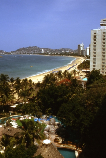
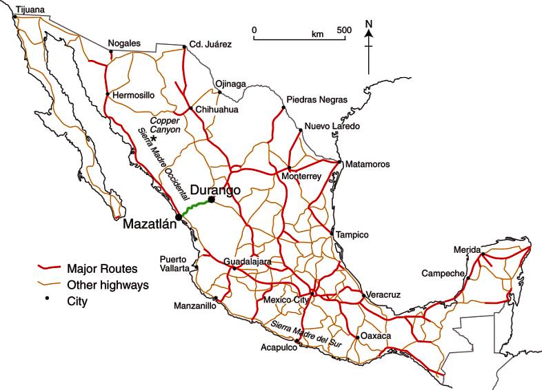
Mexico’s road network is heavily used, accounting for over 95% of all domestic travel.  On a per person basis, Mexicans travel an average of 4500 km (2800 mi) by road each year.

In this post, we try to answer several general questions relating to the geography of road transport in Mexico.

How many cars are there?

On average there are about seven people per car in Mexico, compared to about six in Argentina, ten in Chile and less than two in the USA and Canada. There are far more cars in urban areas with their many businesses, taxis and wealthy residents. In poor rural parts of southern Mexico, private car ownership is quite rare.

Is there an efficient bus system?

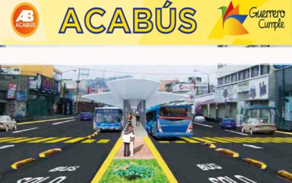
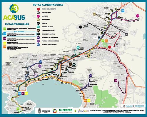
Mexico also has an inter-city bus system that is one of the finest in the world. The nation’s fleet of more than 70,000 inter-city buses enables passengers to amass almost half a trillion passenger-km per year.

Where are Mexico’s vehicles made?

Almost all the vehicles on Mexico’s roads were built in Mexico. Mexico’s automobile-manufacturing sector produces about 2.2 million vehicles a year but the majority of production (about 1.8 million vehicles each year) is for export markets. Mexico is the world’s 9th largest vehicle maker and 6th largest vehicle exporter. In recent years, the relaxation of strict import regulations has resulted in more vehicles being imported into Mexico; many of them are luxury models not currently made in Mexico.

The major international vehicle manufacturers with plants in Mexico include Volkswagen, Ford, Nissan, GM, Renault, Toyota and Mercedes-Benz. Mexican companies include Mastretta, which specializes in sports cars, and DINA, a manufacturer of trucks, buses and coaches.

For more information about vehicle manufacturing in Mexico:

Where are Mexico’s vehicles?

Mexico has about 20 million registered vehicles, about one for every five persons (2005). Which areas have the most and least vehicles? It turns out that the northernmost state, Baja California, has the most with 37 registered vehicles per 100 people. The southernmost states, Chiapas and Oaxaca, have about one sixth as many with 6.6 and 6.9 respectively. In fact there is a very strong statistical relationship between latitude and vehicles (see graph). How can this be?

Scattergraph of latitude and vehicle registrationsWe are not suggesting a direct causal relationship. Many factors are interrelated. First, the states in the north tend to be wealthier; the Spearman rank correlation for GDP/person and latitude is 0.58. Vehicle ownership is closely related to GDP/person (rs = 0.59). Both these correlations are significant at the 99% level.

In addition, northern states are close to the USA, a vehicle-oriented society. However, there are some anomalies to the general pattern. The very wealthy Federal District has 50% more vehicles than would be expected from its latitude alone. States with many migrants, such as Jalisco and Michoacán, also have more vehicles than expected given their latitude. An added complication is that more than a million foreign-plated cars in Mexico (imported temporarily by returning migrants or foreigners) are not included in these figures.

How many road accidents are there in Mexico?

Mexico’s National Council for Accident Prevention estimates that there are 4 million highway accidents each year in Mexico. The latest figures (for 2010) show that there were 24,000 fatalities as a result of these accidents, with 40,000 survivors suffering some lasting incapacity. These figures include some of the 5,000 pedestrians struck by vehicles each year. Traffic accidents are currently the leading cause of death for those aged 5-35 in Mexico, and the second cause of permanent injury for all ages.

Why are there so many accidents?

Driver education plays a major role in road safety. Part of Mexico’s problem is the low budget it allocates each year for road safety—just US$0.40 compared to more than $3.00/person in the USA, more than $7.00/person in Canada and up to $40.00/person in some European countries.

It is no surprise that a high percentage of drivers involved in traffic accidents in Mexico have alcohol in their system. This is one of the reasons why accidents are statistically more frequent in the evenings from Thursday to Saturday. One study reported that as many as 1 in 3 of drivers in Guadalajara was under the influence of alcohol while driving, and 1 in 5 of Mexico City drivers.

Driving without insurance is common in Mexico; according to insurance companies, only 26.5% of Mexico’s 30.9 million vehicles have any insurance.

Related posts:

Aviation history as Mexico’s Aeroméxico uses biofuel for transatlantic passenger flight

 Mexico's geography in the Press  Comments Off on Aviation history as Mexico’s Aeroméxico uses biofuel for transatlantic passenger flight
Aug 132011
 

Aeroméxico, Mexico’s major international airline, made aviation history in July. Aeroméxico flight AM1, from Mexico City to Madrid, was the first ever commercial transatlantic passenger flight using bio-fuel. The Boeing 777 flew on a mixture of biofuel and regular jet fuel. Earlier this year, another Mexican airline, Interjet, began using renewable jatropha-based biofuel for flights between Mexico City and Tuxtla Gutierrez in the southern state of Chiapas. Jatropha is a genus of plants, mainly shrubs, that grow wild in several parts of Mexico, including Chiapas. Plantations of jatropha require four or five years of cultivation before the plant is sufficiently mature for commercial harvesting.

Jatropha-based biofuel is marketed as “green jet fuel” and is currently significantly more expensive than regular jet fuel. However, the price of biofuel is expected to fall rapidly as more of it is produced. The “life-time” emissions from using jatropha (including its growing period, processing and combustion) are estimated to be at least 60% less than using conventional jet fuel.

Sources of biodiesel.

Sources of biodiesel. Credit: Bayer CropScience

Mexico’s aviation sector will need 40 million liters of biofuel a year by 2015 in order to meet the national target of 1% of all airline fuel coming from renewable sources. The aviation industry’s long-term target is to halve its 2005 carbon footprint by 2050.

Despite Mexico’s recent adoption of jatropha-based biofuel, there is considerable controversy about the plant’s real value as a sustainable source of renewable energy. See, for example, the critique “Hailed as a miracle biofuel, jatropha falls short of hype” on Yale Environment 360, a publication of the Yale School of Forestry & Environmental Studies.

Driving in Mexico: is it safe relative to other countries?

 Books and resources  Comments Off on Driving in Mexico: is it safe relative to other countries?
Jul 282011
 

About 24,000 people were killed last year in traffic accidents in Mexico according to Ángel Martínez, Director of the Mexican Traffic Safety Research Center (Spanish acronym CESVI) . In the USA, the number was about 33,000 in 2010. Does this mean that is safer to drive in Mexico than the USA?

The simple answer is “no” because the USA has three times as many people, about ten times as many registered vehicles, and probably drives over ten times as many vehicle-miles as Mexico. Comparing traffic deaths among countries is relatively complicated because the data are often lacking or not comparable.

A large 2009 World Health Organization (WHO) study indicates that traffic deaths are related to numerous factors. Obviously, the number, age, condition and mix of motor vehicles are very important. Two-wheeled motor vehicles can be more dangerous than automobiles, buses or trucks. Furthermore, road quality, traffic infrastructure, laws, and enforcement are major factors. Many countries do not require use of seat belts, helmets or child seats. The training, skill level and behavior of drivers, as well as pedestrians, are also important. Other factors are alcohol use by drivers and pedestrians, as well as the quality and efficiency of emergency medical teams and health care systems.

50-vehicle pile-up in fog, Saltillo, January 2011

50-vehicle pile-up in fog, Saltillo, January 2011

According to the WHO study, Mexico ranked 12th in the world in total traffic fatalities. China ranked first with 221,000 deaths per year, followed by India, Nigeria, Pakistan, Indonesia, Russia, Brazil, USA, Egypt, Ethiopia, Iran and then Mexico. Total deaths are related to population, number of vehicles and pedestrians, poor traffic control and emergency medical systems, as well as crowded roads shared by everything from trucks, buses, cars and motor bikes to livestock and pedestrians.

Mexico has about 21 traffic deaths per year per 100,000 population. This is a fairer way to compare countries. On this statistic, Mexico does slightly worse than Brazil (18), China (17), India (17), Indonesia (16), and Thailand (20). Though Mexico is slightly better than Peru (22), Venezuela (22), Russia (25), and Pakistan (25), considerable improvement is needed. President Calderón has set as a goal of reducing traffic deaths by 50% by 2020. Mexico is significantly behind some of the other Western Hemisphere countries such as Canada (9), USA (11), Argentina (14), Colombia (17) and even Guatemala (15).

The major countries with the safest traffic are Japan (5), UK (5), Germany (6), and France (8). The least safe countries are mostly in Africa and include Egypt (42), Ethiopia (35), Kenya (34), Nigeria (32), the Congo (32) and South Africa (33).

Wear your seat belt and drive safely!

Nov 092010
 

In an earlier post, we looked at why ground subsidence has become such as serious problem in Mexico City.

The uneven subsidence poses a major challenge for engineering projects such as constructing (and maintaining) the city’s metro system.Mexico City metroThe Mexico City metro has 11 lines linking 175 stations, with a total length of 201 km (125 miles); an additional line is under construction. The metro is used by 5 million passengers a day. Some parts of the system are overground, but 56% of the network is underground. The deepest station is 35 m below street level. The Mexico City metro is the 7th most widely used in the world, after the metros in Tokyo, Moscow, Seoul, New York, Paris and Beijing.

  • many archaeological finds, including a pyramid, were made during the excavation required for Mexico City’s metro
  • Pino Suárez station was built around an ancient pyramid unearthed during metro construction
  • stations are named, but are also identified by simple glyph-like logos designed for easy use by people who have difficulty reading or writing
  • a single trip between any two stations on the network costs $3 pesos (about 25 cents US).; the metro is free for the elderly and physically-challenged
  • during peak hours, the Metro reserves some carriages for women and children only (no men)
  • almost all Mexico City metro cars run on rubber tires, making for a smooth, quiet ride

When the first line was built in 1969, one of the strategies adopted by engineers to limit damage from subsequent subsidence was apparently to build the metro tunnels and stations in such a way that their total weight was very similar to the weight of the mud and sediments removed during construction. Presumably, if the weights were identical, at least the tunnels would be likely to remain in the same relative positions over time, even if the subsoil contracted and sank. To a large extent, the engineers were successful, and the metro has experienced  amazingly few structural problems in its 41 years of operation. In the devastating 1985 earthquakes, Mexico City’s metro system sustained no serious damage despite the widespread destruction and loss of life above ground.

Mexico City’s metro network is administered by the Metro Transportation System (Sistema de Transporte Colectivo Metro, STCM). STCM ackowledges several recent problems related to small-scale earth movements on five of its eleven lines: Lines 4, 5, 9, A and B. For example, the maximum permitted velocities for metro trains were reduced for the section of Line A between Pantitlán and La Paz while repairs costing 36 million dollars were completed. Even as STCM undertakes the necessary repair work, it is starting to install a state-of-the-art, 1.6-million-dollar fiber-optic monitoring system which will eventually cover the entire network.  The system enables the “real time” detection (with live video feeds) of any subsidence, fissures, inundations or related issues.

Useful link:

Key question, based on the map:

  • Why does the metro system have a much higher density in eastern and southern Mexico City than in the northern and western parts of the city?

Chapters 21 and 22 of Geo-Mexico: the geography and dynamics of modern Mexico analyze Mexico’s 500-year transition to an urban society and the internal geography of Mexico’s cities. Chapter 23 looks at urban issues, problems and trends. To preview more parts of the book, click here and use amazon.com’s “Look Inside” feature; buy your copy today!

The route taken by Mexico’s first international scientific expedition, 1874-5

 Maps, Other  Comments Off on The route taken by Mexico’s first international scientific expedition, 1874-5
Sep 232010
 

Mexico’s first international scientific expedition in 1874 left Mexico City with only a few months to travel half way around the world to Japan to set up their instruments in time for the transit of Venus on 9 December.

Mexico’s international scientific expedition to observe the 1874 transit of Venus

Looking at a map, the quickest route would appear to be via Acapulco and then by boat across the Pacific. However, in 1874, the “road” to Acapulco was often in appalling condition, especially after the rainy season, and boats crossing the Pacific from Acapulco were few and far between.

The Commission of Mexican Astronomers opted to travel via San Francisco, from where more vessels left regularly for the Far East. Getting from Mexico City to San Francisco in 1874 was nowhere as simple as it is today. For the first part of the trip, the intrepid group was able to take advantage of the Mexico City-Veracruz railway line, inaugurated only the previous year.

Rail bridge on Mexico City-Veracruz line

Infiernillo Bridge on the Mexicano Railroad (from Viaje de la Comisión Astronómica Mexicana al Japón)

This was an arduous and long trip in those days. Fortunately, the railway from Mexico City to Veracruz had just been completed. The expedition’s memoirs include a charming sketch of the Infiernillo railway bridge (see image).

Boats from Veracruz did not operate on a strict timetable either, and the group decided to wait in Orizaba for news of a suitable vessel rather than risk exposing themselves to the tropical diseases prevalent in the port itself. They had left Mexico City on 18 September and eventually set sail from Veracruz six days later—to Havana, Cuba. This was because vessels were much more frequent to the USA from Cuba than from Mexico.

Landing in Philadelphia on 30 September, the group was placed in temporary quarantine until diplomatic efforts succeeded in getting them released. A few days later, they caught a train to New York, and then the following day, to Chicago and on to San Francisco. Within a week, they had berths on board the Vasco de Gama to Japan.

Route taken by Mexico's first international scientific expedition, 1874-5

Route taken by Mexico’s first international scientific expedition, 1874-5. All rights reserved

Their route back home was via Hong Kong, Ceylon (now Sri Lanka), the Suez Canal, Italy and France (see map). By the time they arrived back in Mexico, they had completed a world tour, though it had taken somewhat longer than that of Jules Verne’s fictional tale Around the World in Eighty Days.

Source: Odisea 1874 o el primer viaje internacional de cientificos mexicanos by Marco Arturo Moreno Corral (Fonda de Cultural Economica,  1986)

Mexico’s long connection with the Philippines – exploration, seafaring and geopolitics

 Other  Comments Off on Mexico’s long connection with the Philippines – exploration, seafaring and geopolitics
Aug 232010
 

In 1559, King Philip II of Spain ordered a fleet to be prepared to sail west from New Spain (Mexico) to the Philippines. Barra de Navidad, on the shores of Jalisco, was one of the centers of New Spain’s maritime activity at the time. It offered a sandy beach in a well-protected bay; with tall forests inland to provide the necessary timber. Barra de Navidad echoed to the sounds of hammering and sawing, as the Spanish fleet was readied.

Mexican postage stamp commemorates 400 years of Mexico-Philippines friendship

Mexican postage stamp commemorating 400 years of Mexico-Philippines friendship

All western Mexico was mobilized to support the venture. Roads were built to ferry supplies from the city of Guadalajara to the Barra de Navidad boatyards. To this day, the main Guadalajara-Barra de Navidad road is known as The Philippines Way. Food, planks, sails and rigging – all had to be acquired and transported to the port. Every village had to support the effort, which was not without its dangers. For example, the Indians from Ameca complained of “many killed in the transport of rigging to Puerto de la Navidad where they are building boats to go to China.”

The expedition finally set sail at 3:00am on 21 November 1564, marking the start of more than 400 years of friendly contact between Mexico and the Philippines.

The expedition’s commander, López de Legazpi, fearing a mutiny, did not reveal their true destination to his sailors until the boats were well under way; no previous expedition had ever managed to find its way back across the Pacific Ocean. The expedition landed in the Philippines in March 1565. López de Legazpi remained there, putting his 17-year-old grandson in charge of finding the way back. In one of the most amazing feats of sailing of all time, his grandson was successful, but when the expedition reached Acapulco in October the crew was too exhausted to drop anchor. The return voyage had cost more than 350,000 gold pesos, and is commemorated today by a simple monument in Barra de Navidad’s small plaza.

The map on the stamp issued in 1964 to celebrate 400 years of friendship between Mexico and Philippines shows the expedition’s routes across the Pacific. The southern line marks the outward route, the northern line the route home.

The Spanish authorities quickly decided that bringing Asian goods from their colony in the Philippines back to Spain by crossing the Pacific, transshipping the cargo across Mexico and then sailing from Veracruz to Spain was preferable (more secure) to any alternative. Barra de Navidad soon became a regular port-of-call for Spanish sailors plying the so-called China route between Acapulco and Manila. To enable easier communication between Mexico City and Acapulco, a Camino Real (Royal Road) for pack mules was built between Mexico City and Acapulco. (A road suitable for wheeled vehicles between these cities was not completed until well into the 20th century.)

Demonstrating strong complementarity, for 250 years Spanish galleons carried Mexican silver to Manila and returned with spices, silk, porcelain, lacquer ware and other exotic goods from the Orient. These “China galleons” displaced 2000 tons and were the largest seafaring vessels of their time in the world.

But the lure of easy treasure drew pirates such as Englishman Francis Drake. In 1579, Drake sacked the small port of Huatulco, now a premier multi-million dollar tourist resort in the state of Oaxaca, and attacked the Manila galleon off the coast of California, exposing the vulnerability of Spanish sea traffic. For the next forty years, all the west coast ports, including Barra de Navidad, saw more pirates and corsairs than was good for them. Then, slowly but surely, the center of colonial operations moved further north into Sinaloa and Baja California.

Related Post

The development and characteristics of Mexico’s transportation network are analyzed in chapter 17 of Geo-Mexico: the geography and dynamics of modern Mexico. Buy your copy of this invaluable reference guide today!

Absolute distance, relative distance and the vagaries of air travel within Mexico

 Excerpts from Geo-Mexico  Comments Off on Absolute distance, relative distance and the vagaries of air travel within Mexico
Jul 152010
 

In an earlier post we looked at the importance of Mexico City airport in the national network of airports. In this post, we focus our attention more on the network, and much less on any individual airport.

Alberto Braniff's biplane, modern jet and Mexico's airport network in 1960

Air travel greatly distorts the map of Mexico and the world. In terms of travel time on public transport, Mexico City’s airport is closer to Guadalajara, in the state of Jalisco, than to some areas in the Mexico City Metropolitan Area!

Similarly, Guadalajara is closer to Hong Hong by air—21 hours for the 13,000 km—than to some communities only 200 km away in northern Jalisco which require a trek of over 24 hours by bus, taxi and foot.

Business executives fly 2300 km from Tijuana to Mexico City, work for six hours in the city, and fly back the same day. Commuting to the same office takes longer for some Metro area residents who live only 50 km away, but have to contend with traffic congestion.

Air travel, coupled with  familiarity, significantly influences our perceptions of distance. A Guadalajara traveling executive perceives Mexico City as being closer to his home than slum areas within 20 km of his house. Downtown Mexico City seems much closer to a person who commutes there daily from 40 km away than to a neighbor who works locally and only goes downtown once a year.

Transportation systems greatly affect our perception of distance. Depending on connections, air travel is not always the quickest means of transport.

The straight line distance from Mazatlán to Durango is 245 km. The fastest air connection goes through Mexico City and involves flying over 1500 km. It takes seven hours, longer than the inter-city bus! A direct flight would take about 45 minutes. When an expressway connects the two cities, the drive will take less than three hours. Though the straight line distance between them is about the same as that between Querétero and Mexico City, the travel and perceived distance is far greater. This example demonstrates how existing transportation systems affect our perceptions of distance.

“Distance” can also be looked at in terms of costs. In Geo-Mexico, we look at the distinction between absolute distance measured in kilometers and relative distance in terms of cost. We include a graph plotting distance against the price of one-way economy-class direct flights from Mexico City to 28 cities for a random mid-week day in April 2009. The graph shows that there is very little connection between flying distance (or flight times) and ticket price (For statistically inclined readers, rs = 0.14).  Rather than discussing this further here, we suggest you consider purchasing a copy of the book for a more in-depth analysis!

This is an excerpt from chapter 17 of Geo-Mexico: the geography and dynamics of modern Mexico. which discusses transportation systems, including air travel and the national network of airports.

Jun 282010
 

About 1900 one of the densest railroad networks on earth was operating in the Yucatán Peninsula. Between 1870 and 1920 the area experienced an economic boom based on the production of twine from sisal (oro verde or green gold). The numerous plantations in the area needed a way to move the sisal from the fields to processing centers and from there to ports for export. The plantation owners built a very extensive (4500 km) system of narrow gauge railroad system to move sisal as well as sugar and corn.

Map of Yucatan's railways

Map of Yucatan's railways. Copyright Allen Morrison. Reproduced by kind permission (see link to original map near end of this post). Click map for larger version.

The tracks stretched up to 100 km in all directions from Yucatán’s capital, Mérida. Rolling stock and complete sections of track with steel ties were imported mostly from Europe but also from the USA. The small trains were powered by mules, steam engines, electric batteries, and later by gasoline motors. There was no standard design. Several different gauges were in use ranging from 400 to 930 mm (15.7 to 36.6 in).

Foreign competition, the Mexican Revolution, and synthetic fibers brought an end to the sisal boom. Many of the plantations closed in 1930s. Soon small entrepreneurs were providing rail passenger services between the scores of towns in the area. Many families used the small sisal hauling cars as personal transport, powered by a horse or mule. This was far more efficient than animal drawn carts on the rough dirt roads, but required occasional de-railing to allow those going in the opposite direction to pass. Some of the Yucatán’s narrow gauge lines have survived into the 21st century, and some of the former sisal haciendas have reopened as luxury hotels for tourists.

Acknowledgments: Grateful thanks to Allen Morrison, who generously allowed us permission to reproduce his excellent map of Yucatán railways.

Mexico’s transportation systems are the subject of chapter 17 of Geo-Mexico: the geography and dynamics of modern Mexico. Buy your copy today!

Yucatán’s main line railway was not linked to the rest of Mexico until about 1950.

Mexico’s export trade in drugs

 Mexico's geography in the Press  Comments Off on Mexico’s export trade in drugs
Apr 282010
 

These paragraphs come from a Stratfor Global Security and Intelligence Report by Fred Burton and Ben West, When the Mexican Drug Trade Hits the Border, published 15 April 2009 (republished with permission of STRATFOR).

Though the drug trade as a whole is highly complex, the underlying concept is as simple as getting narcotics from South America to the consuming markets — chief among them the United States, which is the world’s largest drug market. Traffickers use Central America and Mexico as a pipeline to move their goods north. The objective of the Latin American smuggler is to get as much tonnage as possible from Colombia, Peru and Bolivia to the lucrative American market and avoid interdictions by authorities along the way.

However, as narcotic shipments near the U.S.-Mexican border, wholesale trafficking turns into the more micro process of retail distribution. In southern Mexico, drug traffickers move product north in bulk, but as shipments cross the U.S. border, wholesale shipments are broken down into smaller parcels in order to hedge against interdiction and prepare the product for the end user. One way to think about the difference in tactics between trafficking drugs in Central America and Mexico and distributing drugs in the United States is to imagine a company like UPS or FedEx. Shipping air cargo from, say, New York to Los Angeles requires different resources than delivering packages to individual homes in southern California. Several tons of freight from the New York area can be quickly flown to the Los Angeles area. But as the cargo gets closer to its final destination, it is broken up into smaller loads that are shipped via tractor trailer to distribution centers around the region, and finally divided further into discrete packages carried in parcel trucks to individual homes.

As products move through the supply chain, they require more specific handling and detailed knowledge of an area, which requires more manpower. The same, more or less, can be said for drug shipments. This can be seen in interdiction reports. When narcotics are intercepted traversing South America into Mexico, they can be measured in tons; as they cross the border into the United States, seizures are reported in kilograms; and by the time products are picked up on the streets of U.S. cities, the narcotics have been divided into packages measured in grams. To reflect this difference, we will refer to the movement of drugs south of the border as trafficking and the movement of drugs north of the border as distributing.

As narcotics approach the border, law enforcement scrutiny and the risk of interdiction also increase, so drug traffickers have to be creative when it comes to moving their products. The constant game of cat-and-mouse makes drug trafficking a very dynamic business, with tactics and specific routes constantly changing to take advantage of any angle that presents itself.

The only certainties are that drugs and people will move from south to north, and that money and weapons will move from north to south. But the specific nature and corridors of those movements are constantly in flux as traffickers innovate in their attempts to stay ahead of the police in a very Darwinian environment. The traffickers employ all forms of movement imaginable, including:

  • Tunneling under border fences into safe houses on the U.S. side.
  • Traversing the desert on foot with 50-pound packs of narcotics. (Dirt bikes, ATVs and pack mules are also used.)
  • Driving across the border by fording the Rio Grande, using ramps to get over fences, cutting through fences or driving through open areas.
  • Using densely vegetated portions of the riverbank as dead drops.
  • Floating narcotics across isolated stretches of the river.
  • Flying small aircraft near the ground to avoid radar.
  • Concealing narcotics in private vehicles, personal possessions and in or on the bodies of persons who are crossing legally at ports of entry.
  • Bribing border officials in order to pass through checkpoints.
  • Hiding narcotics on cross-border trains.
  • Hiding narcotics in tractor trailers carrying otherwise legitimate loads.
  • Using boats along the Gulf coast.
  • Using human “mules” to smuggle narcotics aboard commercial aircraft in their luggage or bodies.
  • Shipping narcotics via mail or parcel service.

These methods are not mutually exclusive, and organizations may use any combination at the same time. New ways to move the product are constantly emerging.

“This report is republished with permission of STRATFOR” © Copyright 2010 STRATFOR.

An overview of the geography of drug trafficking in Mexico forms part of chapter 20 of Geo-Mexico: the geography and dynamics of modern Mexico. Buy your copy today!

Related articles in this mini-series:

The geography of drug trafficking in Mexico

 Maps, Mexico's geography in the Press  Comments Off on The geography of drug trafficking in Mexico
Apr 242010
 

This article dates back to 2010. For updates, see:

This map of drug cartel territories and drug trafficking and export routes comes from a Stratfor Global Security and Intelligence Report by Fred Burton and Ben West, When the Mexican Drug Trade Hits the Border, published 15 April 2009.

Map of Cartel Territories. Copyright Stratfor. Click map for enlarged version.

Click here to see map in its original context. Map © Copyright 2008 Strategic Forecasting Inc, STRATFOR www.stratfor.com. This map is republished with permission of STRATFOR.

The map shows the major routes for Mexico’s imports, transport and exports of drugs.  The boundaries between cartel territories are in a constant state of flux as rival cartels fight to enlarge their territories.

Perhaps the single biggest shift in the geography of drug trafficking in Mexico in recent decades has been that involving drugs originating in Colombia. Prior to the 1980s, Colombian drugs reached the US and Canada either direct or via the Caribbean. During the 1980s, as US pressure mounted on these routes, Colombian cartels shifted their supply routes to Mexico, where they needed the help of Mexican gangs. These gangs rapidly became better organized and have become the powerful Mexican cartels operating today.

Mexico’s on-going “war” against drugs cartels has had most success so far against the Gulf cartel and the Zetas, who started life as the enforcing arm of the Gulf cartel. On the other hand, the influence of the Sinaloa cartel appears to be spreading. For an analysis of the Gulf cartel, including the effects of globalization on its operations, see Stephanie Brophy’s “Mexico Cartels, corruption and cocaine: A profile of the Gulf cartel” (Global Crime, vol. 9, #3, August 2008, pp 248-261)

This article dates back to 2010. For updates, see:

An overview of the geography of drug trafficking in Mexico forms part of chapter 20 of Geo-Mexico: the geography and dynamics of modern Mexico. Buy your copy today!

Related articles in this mini-series:

The importance of Mexico City’s International Airport

 Excerpts from Geo-Mexico, Updates to Geo-Mexico  Comments Off on The importance of Mexico City’s International Airport
Apr 132010
 

Mexico City’s Benito Juárez international Airport handled 26.2 million passenger movements last year, making it the world’s 43rd busiest terminal, according to the Airports Council International. In terms of flights, Mexico City airport was the world’s 30th busiest, with 366,000 take-offs and landings. For freight, it was the 48th largest in the world, with 376,000 tons of cargo going through it last year. The Airports Council International is a non-profit organization which serves as the “voice of the world’s airports”.

The numbers make Mexico City airport the most important in Latin America. The on-going modernization of Terminal 1 will expand the airport’s capacity to 32 million passenger movements a year. The airport has parking spaces for 6,514 vehicles, and is served by a metro line, city bus lines, and 1,485 licensed taxis (belonging to 7 different companies). The terminal is also served by 8 mid-distance bus lines, offering regular service to the cities of Córdoba, Cuernavaca, Pachuca, Puebla, Querétaro, Tlaxcala and Toluca.

Nationwide, of the roughly 50 million air passengers each year, about half are domestic and half international. Commercial air service started in Mexico in the 1920s. The main route was Mexico City–Tuxpan–Tampico–Brownsville, Texas. By the 1930s, flights were available to Los Angeles, Cuba, Guatemala and El Salvador. Jet services to USA and European cities started in the 1960s. The routes have expanded steadily and now connect Mexico’s 29 national and 57 international airports.

Mexico City’s airport accounts for about 35% of the national total number of passenger movements, followed by Cancún (10.5%),  Guadalajara (almost 9%), Monterrey (7.4%), Tijuana (5.3%) and Puerto Vallarta (Jalisco) and San José del Cabo (Baja California Sur) each with 3.6%.

International comparisons

Mexico averages about 370 air passenger movements per year per 1000 population, compared to 2430 for the USA, 1400 for Canada, 202 for Brazil and 179 for Argentina. While air travel is growing, it remains a distant third behind automobile and bus travel.

Mexico’s transportation systems, including airports, are discussed in chapter 17 of Geo-Mexico: the geography and dynamics of modern Mexico.