Oct 272014
 

The following account of Mexico’s traditional (folkloric) and introduced musical instruments consists of extracts from an article by Andrea Teter. [1]

Pre-Columbian instruments

Archaeologists have noted the existence of more than 1,400 musical instruments used in pre-Columbian Mexico and Central America. These were used primarily for religious, and healing rituals and for ceremonies, but also for war, dances, fiestas and entertainment. Some of these instruments, primarily the huehuetl, and teponaztli, both percussion, and the tlapitzalli, a four-hole flute, were considered divine or endowed with supernatural powers, say Mexican archeologists, and were worshiped as idols.

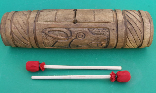
Teponaztli

Teponaztli

The Mexica (Aztecs) used flutes and trumpets made of clay, bamboo and metal. Drums, including the ayotl, made of tortoise shells, and other percussion instruments were used extensively. The huehuetl was the principal drum used by the Mexica and was made from animal skin stretched over a hollowed-out tree trunk. The teponaztli was made from hollowed-out trees or dried gourds, and sometimes gold and silver, with grooves or tongues cut into the top. Rich and varied tones are produced when played with small mallets. Pre-Columbian musicians also used cymbals, maracas, bells and even stones to produce their music.

The Youtube clip below is one interpretation of what some of Mexico’s indigenous musical instruments may have sounded like when played:

Europeans arrive

With the invasion of the Spanish, these musical instruments were immediately used to help convert the indigenous population to Christianity, while the Conquistadors began introducing European musical methods and instruments. A Franciscan missionary, Pedro de Gante, established the first music school in Mexico in 1523 and trained students in the construction and playing of European instruments.

Little by little, all of the European instruments were introduced to Latin America, starting in the 16th century with organs, guitars, harps and flutes, and later followed by the violins, trumpets, mandolins and accordions. Especially important and influential were guitars, which rose to prominence in the seventeenth century, as an easier-to-play alternative to the lute.

Six-string guitars, viheulas, became extremely popular in Mexico with other instruments of the same family also put into general use: five-string charangos, tiples, or treble guitars, and a large 12-string guitar similar to a bass, the bajo sexto.

Another string instrument that became popular in Mexico was the mandolin. The mandolin, which comes from Southern Italy, is the most recent development of the lute family. It was popularized in Mozart’s “Don Giovanni” and Verdi’s “Othello”.

The salterio, originally from Egypt, is a stringed instrument a little larger than a briefcase with a sound resembling a harpsichord and a playing method resembling a steel guitar or autoharp. The musician plucks the 97 strings while it rests on his knees; the sound is unique and quite beautiful.

Once the Spanish began importing slaves from Africa, these blacks began constructing marimbas, which imitated the African xylophone. As early as 1545, a Spanish scribe in the state of Chiapas wrote of an instrument of eight wood bars played with heavy sticks by the local natives at tribal ceremonies. The modern sophisticated Mexican marimbas was developed by Chiapas musician Corazon Borraz, who in 1896 brilliantly added a second row of half-tone bars to the common single row (like a piano’s black keys) adding to the musical scope of the original instrument, allowing it to play more complex music.

marimba

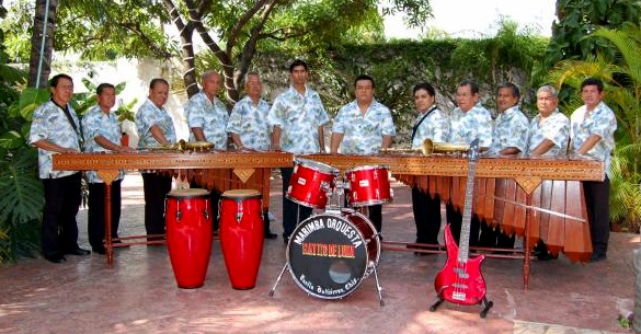
A marimba band: two marimbas plus guitar and drums

Today, a concert marimba can be three meters long, have 70 keys and weigh more than 55 kilos. This grand instrument demands four musicians; the bass man at the wide end with two sticks or baguetas having small rubber balls on the striking tips. This end has long resonance boxes hanging below the sound keys. Then the harmonics man with one or two sticks in each hand above shorter resonance boxes. Then comes the melody maker and leader, wielding two sticks per hand; then the narrow end controlled by the treble master, a stick in each hand producing counterpoint to the melody. Talk about a compact orchestra!

The variety of instruments Mexican musicians and composers have access to has resulted in a distinctive music for this country. At least one Mexican composer, Carlos Chavez, has gained international fame with his integration of Mexican pre-Hispanic instruments in his works such as “Sinfonia India,” “Xochipilli” and “Macuilxochitl.”

Some Mexican composers have been even more innovative. For example, Julián Carrillo (nominated for the Nobel Prize in Physics in 1950), one of Mexico’s top violinists, invented a microtonal music system known as Sonido 13. The system became sufficiently famous that Carrillo’s birthplace in the state of San Luis Potosí felt obliged to rename itself Ahualulco del Sonido 13: an interesting place to visit for any geographers interested in microtonal music! Ahualulco del Sonido 13 is located 39 kilometers northwest of the city of San Luis Potosí. Leaving that city, first follow federal highway 49 towards Zacatecas and then turn north on the road signed Charcas.

Want to read more?

Note:

[1] The bibliographic details for Andrea Teter’s article are currently unknown. Please contact us if you are able to supply any further information about these extracts, so that we can update to include the full reference.

Related posts:
Mexico’s January weather serves as a long-range forecast

 Other  Comments Off on Mexico’s January weather serves as a long-range forecast
Jan 042014
 

Many Mexicans use January’s weather to forecast what the weather will be like for the rest of the year.

Many Mexicans, especially campesinos (peasant farmers), who are closer to the land than most, believe that the weather during the month of January serves as a long-range forecast for the entire year. The precise prediction system, known as las cabañuelas, is thought to be based on long cycles of observations carried out in an age when people depended far more on the weather than they do today. The system is quite complicated.

The first twelve days of January are known as las cabañuelas “a derechas”. The weather on January 1 foretells the likely weather for the rest of the month. The weather on January 2 predicts the weather for February and so on, with the weather of January 12 suggesting likely conditions for December. The next twelve days (January 13 to 24 inclusive) are known as las cabañuelas “a rataculas”. This time, the weather of January 13 foretells December, that of January 14 November, and so on.

Jan 18: Pondering a miserable July

Next, each of the six days from January 25 to January 30 inclusive is divided at noon. The morning of January 25 represents January, the afternoon February. The morning of January 26 hints at March’s weather, while the afternoon applies to April’s, and so on.

Finally, even the 24 hours of January 31 are used. Each hour in the morning will be reflected in the weather from January to December. (Presumably the weather from midnight to 1.00am is a true reflection of what has already happened in January!) Then, each hour in the afternoon can be used to forecast future weather in the reverse direction. Hence, noon to 1.00pm gives us clues for December, 1.00 to 2.00pm for November and so on. Apparently, an alternative version, used in some parts of northern Mexico, divides January 31 into 12 periods of 2 hours each, with each division corresponding to the months in reverse order.

Whatever the details, the system is said to be at least as reliable as scientific forecasts over the same time period. (Though, thinking about it, perhaps that is not that hard!)

The same cabañuelas system is used in various parts of Spain, but the annual forecast does not always begin on the same day. For instance, in Alcozar, las cabañuelas “a derechas” begin on December 13. Elsewhere in Spain, they start on August 2 or August 13. According to Divina Aparicio de Andrés, predictions in Alcozar based on las cabañuelas lasted until well into the 1940s, but their use has declined since.

See also: The origins of the cabañuelas system of weather forecasting

This is an edited version of an article originally published on MexConnect.com

The climate of Mexico is discussed, with several maps,  in chapter 4 of Geo-Mexico: the geography and dynamics of modern Mexico. Climatic hazards, such as hurricanes, droughts and floods, are looked at in detail in chapters 4 and 7. Mexico’s cultural geography and cultural landscapes are discussed in chapter 13.

Holy Innocents’ Day (28 December)

 Other  Comments Off on Holy Innocents’ Day (28 December)
Dec 272013
 

Among the many interesting facets of Mexico’s cultural geography are the subtle differences between beliefs in Mexico and similar beliefs in the USA and Canada. For example, 28 December, Day of the Holy Innocents ( Día de los Santos Inocentes) is the Mexican equivalent of north-of-the-border April Fools’ Day (1 April).

This is when Mexican children will borrow, but not repay, small loans from unsuspecting friends and relatives that they consider a soft touch. Once they’ve received the loan, they say either the following verse (quoted in Frances Toor, A Treasury of Mexican Folkways, 1947) or something similar:

Inocente Palomita
Que te dejaste engañar
Sabiendo que en este día
Nada se debe prestar.

Innocent little dove
You have let yourself be fooled
Knowing that on this day
You should lend nothing

So, be careful on 28 December if anyone admires one of your prized possessions… especially if it is your only copy of Geo-Mexico: the geography and dynamics of modern Mexico!

Related post:

The geography of the Huichol Indians: cultural change

 Other  Comments Off on The geography of the Huichol Indians: cultural change
Feb 182013
 

Huichol Indians may have retained many of their ancestral traditions, such as shamans and their annual cycle of ceremonies, but Huichol culture has changed significantly in the past three hundred years.

During colonial times, the Huichol adopted string instruments, the use of metal tools, and the keeping of animals such as sheep, horses and cattle. They also accepted some aspects of Catholic religion.

Beginning in the 1950s, government programs financed the first airstrips in the region. Government agencies have since improved roads, opened clinics and constructed schools for basic education and trades. The government’s efforts have included agricultural aid stations, the drilling of wells, and support for the introduction of more modern agricultural techniques and equipment, such as barbed wire and tractors. Other programs have focused on providing alternative sources of revenue such as beekeeping.

Modern adaptation: Huichol "vocho" exhibited at the Smithsonian in 2012

Modern adaptation: Huichol “vocho” exhibited at the Smithsonian in 2012

All these changes have come at a price. The ancestors of the Huichol practiced a nomadic lifestyle over a large expanse of land in order to acquire the resources they needed for survival. When the Huichol were pushed back into the mountains,they adapted by undertaking an annual migration to gather their sacred peyote. At the same time, they became increasingly dependent on the cultivation of corn. However, in such marginal areas where rainfall is unreliable the corn harvest is never guaranteed and in bad years starvation is a real possibility.

Closer links to the outside world have meant that the Huichol can now buy cheap, bottled alcohol, and face increased pressure from outsiders who want more grazing land, timber and minerals. They have also led to the out-migration of many Huichol, whether permanently to nearby cities or seasonally to work on tobacco plantations in Nayarit. In the past fifty years, this has led to some innovations in Huichol art, including the addition of large yarn paintings and larger items decorated with complex bead work (see image) to their traditional arts and crafts.

Even though the Huichol are one of the most isolated (not just geographically but also economically and socially) indigenous groups in Mexico, there is nothing static about their culture. It will be interesting to see what changes the future brings.

Related posts:

Bibliography:

This mini-series has made extensive use of several resources, including:

  • Barrin, Kathleed (ed) Art of the Huichol Indians. The Fine Arts Museums of San Francisco, 1978.
  • Mata Torres, Ramón. La Vida de los Huicholes. Tomo I. 1980. Guadalajara, Jalisco.
  • Mata Torres, Ramón. El Arte de los Huicholes. Tomo II. 1980. Guadalajara, Jalisco.
  • Neurath, Johannes. Pueblos Indígenas del México Contemporáneo: Huicholes. Comisión Nacional para el Desarrollo de los Pueblos Indígenas / UN Development Program. 2003. [link is a pdf download]

The cultural geography of Mexico’s carnival celebrations

 Other  Comments Off on The cultural geography of Mexico’s carnival celebrations
Feb 092013
 

Carnival celebrations are underway in many Mexican towns. Carnival (carnaval) is a time for merry-making in the days prior to Ash Wednesday, the beginning of Lent in the Christian liturgical calendar. (In 2013, Ash Wednesday falls on 13 February.) Carnival originated in Italy and was introduced into Mexico several centuries ago by the Spaniards. Even though the proportion of Mexico’s population that is Catholic has fallen steadily in recent decades – see Religious diversity is increasing in Mexico – the popularity of carnival shows no signs of decline.

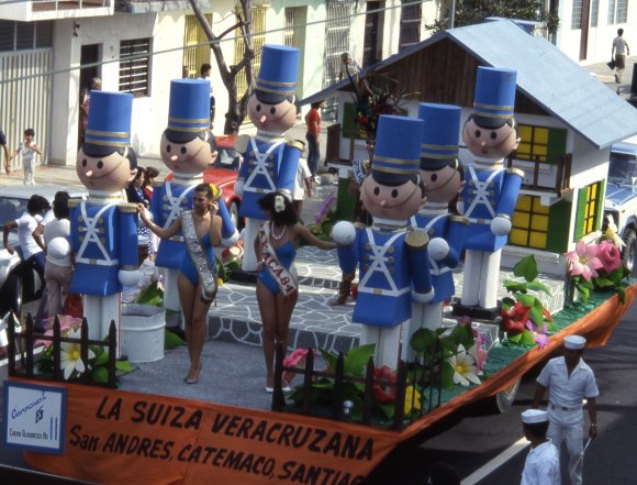
Carnival float, Veracruz

Carnival float, Veracruz

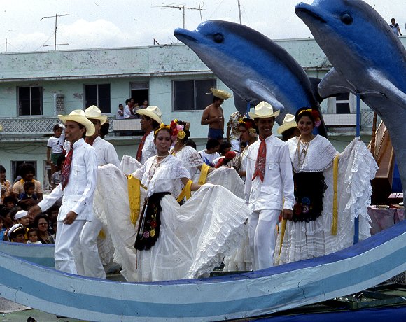
According to Wikipedia, more than 220 towns in Mexico celebrate Carnival. Frances Toor, an authority on Mexican folklore, claims that carnival festivities in Mexico City “reached their climax about the middle of the nineteenth century and have died out since the 1910–1920 Revolution.” Very few large cities in Mexico have important carnival celebrations, the most notable exceptions being Veracruz, Mérida and Mazatlán.

Carnival float, Veracruz

Carnival float, Veracruz

By far the most interesting carnival celebrations in Mexico are those held in smaller towns and villages in non-tourist areas. In this regard, the carnival in Huejotzingo, in the state of Puebla, stands out. It is aptly labeled by Toor in “A Treasury of Mexican Folkways”, published in 1947, as “the most elaborate and brilliant of the village carnivals”. Toor describes this carnival in considerable detail, saying that it “dramatizes the capture and death of Agustín Lorenzo, a famous bandit, who with his men used to rob convoys between Mexico City and Vera Cruz and then hide in the near-by gorges or mountains. According to the carnival plot, he ran off with the beautiful young daughter of a rich hacendado, took her to one of his hideouts and was having a wedding celebration when the federal soldiers fell upon them.”

In Toor’s time, about 1000 villagers participated each year, dressed as soldiers in elaborate costumes representing several different battalions. She notes that “In recent years [1940s] some new features have been added to the Huejotzingo carnival. At dawn, all the forces fight against the French, who occupy the plaza, which is besieged and taken. The bride is said to be the beautiful daughter of the French Emperor Maximilian, instead of a rich hacendado”. Today, more than 2000 villagers take part. Most modern descriptions of the carnival in Huejotzingo describe it is an intermixing of three separate plots: the Battle of Puebla (where Mexican forces defeated the French on 5 May 1842), the kidnapping of the mayor’s daughter, and the first Christian marriage in Mexico.

Other places with idiosyncratic carnival celebrations include Huixquilucan (State of México), Calnali (Hidalgo), Tlayacapan (Morelos), Tuxpan de Bolaños (Jalisco), San Juan Chamula and Chenalho (both in Chiapas) and Zaachila (Oaxaca).

This Youtube video clip shows 2012 carnival revelry in Cozumel:

As with almost every aspect of Mexico’s cultural geography, there is no one fixed or rigid “tradition”. Instead, there have been so many significant changes over time that today’s celebrations of carnival across Mexico are characterized as much by their distinctive regional variations as by their similarity.

Related post:

Mexico’s Magic Town program loses its shine

 Other  Comments Off on Mexico’s Magic Town program loses its shine
Jan 212013
 

Regular readers will be well aware of our concern about the number of towns in Mexico designated Magic Towns in the past few months. As we have written previously, some of the towns chosen are far from “Magic” and offer very little indeed of interest to any regular tourist.

Not content with devaluing the program by some dubious choices, at the end of November 2012, the outgoing administration of President Felipe Calderón rushed through the designation of no fewer than 17 more towns in its last few days in office, to bring the total number of Magic Towns to 83.

Added to the list at the end of November 2012 were:

  • 67   Tacámbaro, Michoacán
  • 68    Calvillo  Aguascalientes
  • 69    Nochistlán, Zacatecas
  • 70    Jiquilpan, Michoacán
  • 71    Tlatlauquitepec, Puebla
  • 72    Tzintzuntzan, Michoacán
  • 73    Mapimí, Durango
  • 74    Papantla, Veracruz
  • 75    Tecate, Baja California
  • 76    Arteaga, Coahuila
  • 77    Viesca, Coahuila
  • 78    Jalpa de Cánovas, Guanajuato
  • 79    Salvatierra, Guanajuato
  • 80    Yuriria, Guanajuato
  • 81     Xicotepec, Puebla
  • 82     Jala, Nayarit
  • 83     El Rosario, Sinaloa

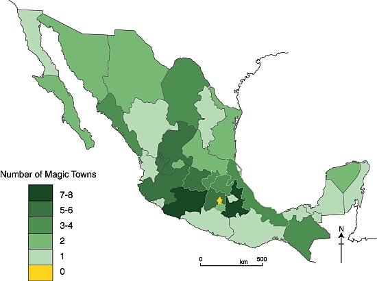
The considerable charms of Mapimí, Durango were described in a previous post. Several of the latest towns to be included are well worthy of Magic Town status, but others are not. In future posts, we will take a closer look at some of the other towns on this list, and their relative merits for inclusion as Magic Towns. For now, we content ourselves with presenting an updated map of the distribution of Mexico’s Magic Towns, as of 1 January 2013:

Mexico's Magic Towns, as of 1 December 2012. Credit: Tony Burton / Geo-Mexico

Mexico’s Magic Towns, as of 1 December 2012. Credit: Tony Burton / Geo-Mexico

The domination of central and western Mexico is clear. All states (excluding the D.F.) now have at least one Magic Town, but southern Mexico still appears to be somewhat undervalued in terms of its cultural tourism potential.

Note: Four towns in the latest list—Tacámbaro, Jiquilpan and Tzintzuntzan (all in Michoacán) and Jala (in Nayarit)—are described in the recently published 4th (Kindle/Kobo) edition of my “Western Mexico: A Traveler’s Treasury” (Sombrero Books, 2013). The book describes no fewer than 17 of Mexico’s Magic Towns as well as several more (such as Ajijic and Bolaños) that are reported to have begun their approval process.

Related posts:

The important role of telenovelas and historietas as forms of communication in Mexico

 Excerpts from Geo-Mexico  Comments Off on The important role of telenovelas and historietas as forms of communication in Mexico
Dec 312012
 

The highest rating programs on TV are televised novels, telenovelas. A telenovela is a limited‑run television serial melodrama, somewhat like a soap opera but normally lasting less than a year, and where the eventual ending has already been scripted.

image of los ricos tambien lloranThe first global telenovela was Los ricos también lloran (“The rich cry too”), originally shown in 1979. Telenovelas are now a $200 million market. Some critics claim they are effective promoters of social change, others deride them as being nothing more than mass escapism. Whichever view is more accurate, their portrayals reflect society’s values and institutions.

Advocates of telenovelas point to their role in challenging some traditional Mexican media taboos by including story lines about urban violence, racism, homosexuality, birth control, physical handicaps, political corruption, immigration and drug smuggling. Early telenovelas tended to be shallow romantic tales. The form subsequently evolved to include social commentaries and historical romances, some applauded for their attention to historical detail. Some were used for attempts at social engineering. An early government-sponsored telenovela promoted adult literacy programs. Several others openly advocated family planning and have been credited with contributing to Mexico’s dramatic decline in fertility rate. Other telenovelas have targeted younger audiences, focusing on issues connected to pop music, sex and drugs.

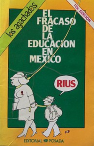
Rius historieta: The failure of education in Mexico

Rius historieta: The failure of education in Mexico

Besides the shallowness of the plot lines in most telenovelas, the other common criticism is that their stars are almost always white-skinned, blue-eyed blondes. Sadly, all too often, actors with indigenous looks are relegated to roles portraying menial workers such as home help or janitors.

Telenovelas have been extraordinarily successful commercially. They have become immensely popular not only in Latin America and among the US Hispanic population but also in more than 100 other countries, mainly in Eastern Europe and Asia.

In print media, a similar role to the telenovela has been played by historietas (comic books), the best of which have tackled all manner of social, political and environmental issues well before such topics made the main-stream press. Historietas helped educate millions of Mexicans and were also a commercial success. Their circulation peaked in the 1980s but has since declined due to competition from television and, more recently, the internet. The most influential creator of historietas is the cartoonist and writer Eduardo del Río (Rius) whose work earned him a 1991 United Nations Environment Programme prize.

Related posts:
The geography of music and dance in Mexico

 Excerpts from Geo-Mexico, Maps  Comments Off on The geography of music and dance in Mexico
Nov 272012
 

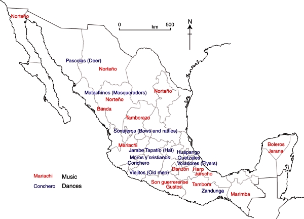
Numerous different regional music styles are found in Mexico (see map), some strongly influenced by indigenous instruments but most relying on the string and brass instruments brought by early Spanish settlers. Curiously, mariachi music, which is often considered Mexico’s national musical style, is believed to owe its origin to French immigrants and refer to wedding (mariage) music. Other popular music types include rancheras (country style songs), corridos (songs telling stories, often about heroes), norteño (northern), rock and pop.

Music and dance in Mexico.

Music and dance in Mexico. Fig 13.3 of Geo-Mexico, the geography and dynamics of modern Mexico. All rights reserved.

Musical instruments vary regionally as well. For instance, the marimba, a kind of wooden xylophone, is most often heard in Chiapas whereas the harp is more characteristic of Veracruz.

Regional dance styles have provided the stimulus for Mexico’s numerous baile folklórico (folkloric ballet) groups, many of which tour internationally. Some examples of regional dances are shown on the map.

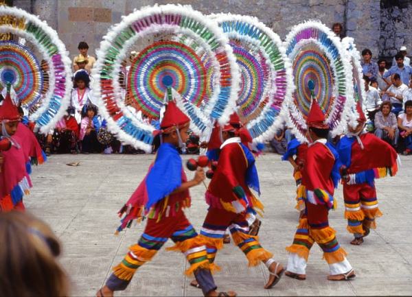
Dance of the Quetzals, Cuetzalan, Puebla.

Dance of the Quetzals, Cuetzalan, Puebla. Photo: Tony Burton; all rights reserved.

Some of these dances are very localized. For example, the Quetzal Dance, with its elaborate headdresses (see photo)  is performed almost exclusively in the village of Cuetzalan in the state of Puebla.

In addition to these cultural manifestations there are significant spatial variations among many other facets of culture, including sport, dress, architectural styles and handicrafts. Regional differences are also found in some forms of literature.

Related posts:

The Guelaguetza, the major cultural festival of Oaxaca state

 Other  Comments Off on The Guelaguetza, the major cultural festival of Oaxaca state
Jul 282012
 

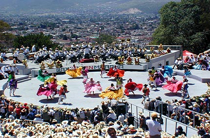
Oaxaca’s single biggest cultural event, held in the second half of July, has come to be known as the Guelaguetza, which is Zapotec for “offering” or “mutual help”. It celebrates the cultural and ethnic diversity of the state. This year’s edition (the 80th) of the Guelaguetza ends on Monday 30 July, so this is the final weekend.

A massive open-air amphitheater, seating 100,000 people, is a permanent fixture on the side of the Fortín hill which overlooks the north west quadrant of Oaxaca city. The original Aztec garrison (for the collection of tributes), known as Huaxyacac, was established by Ahuitzotl at the end of the fifteenth century on this very hill. Today, a massive statue of Benito Juárez (cast in Rome in 1891) stares out over the suburbs.

Guelaguetza

The Guelaguetza

The Guelaguetza may have its origins in Mixtec and Zapotec celebrations of their corn crop. Later, the festival was carried on by the Aztecs in honor of their corn god, Xilonen. Later still, in the eighteenth century, the Spanish Carmelite missionaries linked the festival to their own Christian rites for the Virgen del Carmen (16-24 July). The timing holds even more significance today since July 18 also marks the anniversary of the death of Juárez, a much-revered politician of humble, indigenous origin, who served five terms as president of Mexico in the nineteenth century.

Guelaguetza

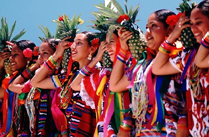
In the 1930s, the fiesta of the Guelaguetza took on its modern hybrid form, which includes a parade of stilt-walking “giants”. During the Guelaguetza, the Fortín hill is the scene for spectacularly colorful regional folkloric dances performed by several different ethnic groups (Mixtec, Zapotec, Trique, Popolac, Chootal, Chinantec, Mazatec, Mixe) from the seven main geographic regions of the state. The entire city comes alive with color. Color is everywhere from the beautifully hand-embroidered dresses and huipiles, to the food, to the paper streamers decorating the streets and to the mixture of merchandise sold on the sidewalks.

For travelers unable to visit in July, some central hotels, including the Camino Real, luxuriously housed in an architecturally-gorgeous former convent, and the Monte Alban opposite the cathedral, offer a weekly, scaled-down version of the Guelaguetza, year-round.

Want to read more?

Related posts:


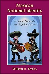
Review of “Mexican National Identity, Memory, Innuendo and Popular Culture”, by William H. Beezley

 Books and resources  Comments Off on Review of “Mexican National Identity, Memory, Innuendo and Popular Culture”, by William H. Beezley
Sep 152011
 

William H. Beezley, a professor of history at the University of Arizona, has written widely about Mexican history. He was co-editor, alongside Michael C. Meyer, of the Oxford History of Mexico, an illustrated “narrative chronicle” through the centuries, and a landmark modern history of Mexico. In this book, first published in 2008, Beezley explores the development of Mexican National Identity through a history of some facets of its popular culture.

As in the case of his earlier work (Judas at the Jockey Club and Other Episodes of Porfirian Mexico), Beezley’s Mexican National Identity. Memory, innuendo and popular culture (University of Arizona Press), is wide-ranging and engaging. The book consists of five essays on different themes which Beezley considers central to the development of Mexican National Identity.

In the first chapter, Beezley looks at how the character known as El Negrito came to be “one of the most famous marionettes of nineteenth-century puppet theater”. El Negrito, an Afro-American usually portrayed as a Veracruz cowboy, personified the attitudes of nationalistic Mexicans in the nineteenth century, with his mocking of the French and Maximilian, his temper tantrums, his infidelity, his wit and his resistance to the American invaders.

beezley - coverFrom a geographic perspective, chapter two is the book’s most interesting. The chapter opens by looking at the development of maps which “like symbolic physical features and regional individuals, portrayed Mexico with diversity as the salient attitude”. He describes two 18th century maps, drawn specifically for clerical travelers, highlighting altitude (and therefore climate) and language (ethnicity), but lacking scales, physical features or other landmarks. The modern era of Mexican map-making began with Alexander von Humboldt, and was extended later in the 19th century by others including Antonio García Cubas.

The production of maps necessarily included decisions as to which landmarks, places and features were most important. It also prompted clearer definitions of national boundaries, in both the north and south. In Beezley’s words, “This question of borders had political significance, and both cultural and social dimensions as Mexicans believed the boundaries divided their civilized society from the barbarians beyond.”

Chapter 2 then examines the role of almanacs and lotería (lottery cards), the quintessential Mexican parlor game, in helping to foment national attitudes. Almanacs were “a source of popular or local history and collective memory”. They gave potted summaries of the lives of the saints and martyrs, lists of holy days, images and biographies of political leaders and so on.

Lottery cards shared stereotypical views of objects and characters, often related to local stories. Beezley says that the version played in Campeche eventually gained the greatest popularity. The images used in Campeche formed the basis for the earliest commercially produced sets of cards when Clemente Jacques (a French immigrant and founder of the eponymous food processing brand)  first launched his range of culinary products, from chiles, olive oil and mole sauce to beans, jams and honey, and founded his own printing business to print his own labels. Jacques promoted his brand at the world’s fairs in Chicago (1893) and St. Louis (1904), using printed decks of lotería cards as a form of advertising. His cards became the basis for the modern packs of lotería cards sold throughout Mexico. Many of the most common images have multiple associations, some even including an overtly sexual double meaning. Some figures such as El Borracho (The Drunk) and El Valiente (The Brave One) and La Sirena (The Siren/adultery) are not associated with a particular region or place. Others such as The Scorpion and The Toad are readily associated with specific geographic regions or states: Durango and Guanajuato respectively. Almanacs and lotería cards helped reinforce a sense of national identity while recognizing regional and ethnic differences.

In Chapter 3, Beezley focuses on how celebrations of Mexican Independence gradually came to assume a massive significance for national identity. Independence came in 1821, but it was not until 1869 that annual celebrations of Independence Day really took off. On September 16, 1869, the Mexico City-Puebla railway line was inaugurated, beginning an exciting new era for transportation, which was to have far-reaching effects. During the presidency of Porfirio Díaz, Mexico celebrated its centenary of Independence, an event marked with banquets, parades and the opening to the public of a hastily-restored section of “The Pyramids” at the archaeological site of Teotihuacan. Beezley outlines how the popular perception of Mexico’s patron saint, the Virgin of Guadalupe, changed in less than a century from “the terrifying emblem of Padre Miguel Hidalgo’s insurrection, and the patron of downtrodden, rebellious Mexicans, to the patron saint of the dictatorship’s elite.”

Chapter 4 looks at the role of itinerant puppet theater in molding Mexico’s national identity. The largest and most famous single troupe was the Rosete Aranda troupe, formed by two Italian immigrants in 1850. The troupes went from strength to strength in the next half-century. By 1880, the Rosete Aranda company had 1,300 marionettes and by 1900 a staggering 5,104. Their creativity knew few bounds, and by undertaking annual tours around the country, they helped influence opinions and attitudes. Incidentally, their need to undertake annual tours was in keeping with the established principles of central place theory. As described in Geo-Mexico, the same principles apply in the case of traveling circuses.

In the hierarchy of central places, each step up sees a smaller number of places, each providing a wider range of goods and services, and serving a larger market area. This occurs because for a service to be provided efficiently there must be sufficient threshold demand in the central place and its surrounding hinterland to support it. For this reason we do not find new car dealers, heart surgeons or ballet schools in every small village. These activities can only survive in much larger centers where there is sufficient demand. Individual residents are not prepared to travel far in order to access a service of relatively low value. This poses a challenge for services such as puppet shows which are unable to command a high ticket price, but which need large numbers of potential viewers (a large threshold population) if they are to succeed. This quandary can be resolved by moving from one mid-sized center to another throughout the year, gaining access to a new audience in every location.

Needless to say, the invention of modern communications systems such as television means that this is no longer entirely true, except for live performances.

Beezley’s entertaining romp through Mexican popular culture and its links to national identity is well worth reading. It may not discuss all aspects of how Mexico’s national identity developed during the 19th century, but it provides numerous valuable insights into how a country of such diversity gradually acquired a clearer sense of national identity and purpose.

Where to buy:

Mexican National Identity. Memory, innuendo and popular culture, by William H. Beezley (link is to Sombrero Books’ amazon.com page).

Chiles, one of Mexico’s heritage crops

 Other  Comments Off on Chiles, one of Mexico’s heritage crops
Apr 092011
 

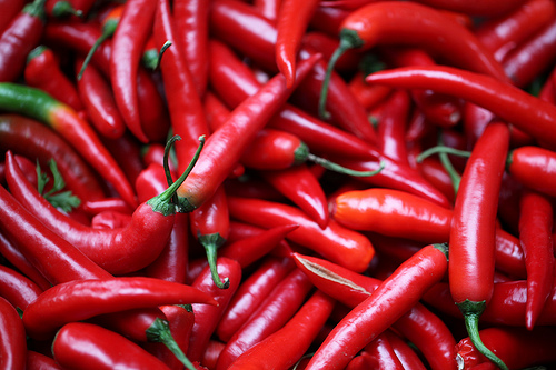
Chiles (Capsicum spp.) have been cultivated in Mexico for centuries and are a vital ingredient in Mexico’s traditional cuisine, recently recognized by UNESCO as an “Intangible Cultural Heritage of Humanity.” Spicy chiles also have numerous medicinal uses. Graphical representations of chiles have even been used as a national symbol.

Chiles are native to Mexico and central America. Evidence for chiles in the diet of indigenous groups in Puebla’s Tehuacán Valley dates back at least as far as 6500BC; by 4100BC, the plant was already domesticated.

Chiles

Chiles. Photo: zoonabar (flickr); creative commons license

There are more than 100 varieties of chiles, grouped into 22 groups of green chiles and 12 of dried chiles. Green chiles by far the most important in volume and value of production and trade. Mexico remains the world’s leading exporter of green chiles and is the sixth largest exporter of dried chiles. The world’s leading producer of green chiles, almost entirely for domestic consumption, is China.

The ideal conditions for cultivating chiles are:

  • growing season temperatures of 18-27̊C daytime and 15-18̊C during the night.
  • rainfall of 600-1250 mm/yr, with no marked dry season.
  • light, humus-rich soils with adequate moisture retention and drainage
  • soils with a pH between 5.5 (slighty acidic) and 7.0 (neutral)
  • growing season of at least 120 days

Crop yields can be adversely affected by:

  • plagues,
  • plant diseases,
  • climatic hazards, such as hailstorms, rainstorms (fields need efficient drainage systems) and frost, the risk of which is countered by burning waste to create smoke to maintain temperatures above freezing

Time frame for cultivation

  • on commercial chile farms, seeds are usually sown in enclosed, heated, nursery beds, since temperatures of 20-24̊C are considered ideal for germination
  • seedlings are transplanted after 25-35 days when they are about 10-20cm in height – optimum yields require 20,000-25,000 plants per hectare
  • the first flowers appear 1-2 months later, by which time the plant is 30-80 cm tall
  • the first green chiles ripen about a month after that; chiles can then be picked every week or so for up to 3 months in rain-fed fields, or sometimes over an even longer period in irrigated fields.

In ideal circumstances, harvesting is possible all year. There are two major, overlapping harvest periods each year, with a fall-winter crop from December-August, and a spring-summer crop from June to March.

Yields vary greatly, reflecting different qualities of soil, water supply and technification employed. The average yield across Mexico is 14-15 metric tons/hectare. Yields in Zacatecas (which has a larger cultivated area of chiles than any other state in Mexico) are only 7 tons/ha, while yields in Sinaloa reach as high as 40 tons/ha.

Types of chile grown in Mexico

The most commonly grown chiles in Mexico are jalapeño, serrano, habanero, poblano and morrón (bell pepper). Seven varieties of green chiles represented 90% of Mexico’s total production of chiles in 2008, and 60% of its total revenue from chiles. Chiles vary in color, heat, size and texture:

Even for a single species, the “heat” of its chiles varies from one plant to the next, as well as from one soil or location to another. The heat of chiles is measured in Scoville units. The hottest chile is generally thought to be the habanero (100,000-445,000 Scoville units). By comparison, the jalapeño is 2,500-5,000 units and the morrón chile (bell pepper) registers 0 Scoville units.

Main source for statistics (pdf file): Un panorama del cultivo del chile, SAGARPA: Servicio de Información Agroalimentaria y Pesquera, June 2010. [accessed January 28, 2011]

Agriculture in Mexico is analyzed in chapter 15 of Geo-Mexico: the geography and dynamics of modern Mexico. Ask your library to buy a copy of this handy reference guide to all aspects of Mexico’s geography today! Better yet, order your own copy…

The geography of Thanksgiving: no Thanksgiving feast is complete without pumpkin pie

 Other  Comments Off on The geography of Thanksgiving: no Thanksgiving feast is complete without pumpkin pie
Nov 252010
 

In earlier posts in this Thanksgiving mini-series, we examined how several of the essential ingredients of a Thanksgiving feast—turkey, corn and potatoes—originated in Mexico. We round off this Thanksgiving series with a  look at pumpkin pie.

All varieties of pumpkin, whatever their size and shape, belong to the Cucurbita genus. While there are some doubts about the precise origin of the wild forms of pumpkin, they were certainly being cultivated in Mexico as long ago as 5500 BC and were an integral part of the daily diet of many Indian groups. The use of “pumpkin” in English can apparently be traced back to the year 1547. For many people, pumpkins are eternally associated with both Thanksgiving and with Halloween.

Pumpkin pi

Pumpkin pi

Given that the first Thanksgiving was held in New Spain (Mexico) and that many of the essential ingredients of modern-day celebrations of Thanksgiving are Mexican in origin, when the residents of the USA sit down for their Thanksgiving meal, they really are taking part in an “All-American” celebration.

Many traditional Thanksgiving and Christmas dinners would simply not be the same were it not for a few key ingredients from Mexico!

So, wherever you are this festive season, keep your eyes open for Mexican influences…

¡Happy Thanksgiving, and seasonal greetings to all!

Previous posts in the Thanksgiving mini-series:

Cultural and eco-tourism in the Copper Canyon region of Mexico

 Other, Teaching ideas  Comments Off on Cultural and eco-tourism in the Copper Canyon region of Mexico
Sep 102010
 

The Copper Canyon area is one of Mexico’s most popular destinations for eco-tourism activities. The canyons offer plenty of opportunities for canyoneering (like mountaineering, but starting from the top!), wilderness hikes and adventure trips. Mexico’s two highest waterfalls—Piedra Volada and Baseaseachi— are also in this area. The Basaseachic Falls are about 250 meters (820 ft) in height, beaten only by the virtually inaccessible 453-meter-high Piedra Volada falls, also in the state of Chihuahua. The Basaseachic National Park is easily accessible via paved roads from Chihuahua City.

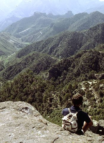
Magnificent scenery attracts hikers from all over the world.

Magnificent scenery attracts hikers from all over the world. Photo: Tony Burton; all rights reserved.

Adding to the allure of the Copper Canyon region is the fact that it is the home of some 50,000 indigenous Tarahumara Indians with their distinctive language, customs and lifestyle. The Tarahumara are one of the most culturally distinct groups in all of Mexico, famous especially for their long distance running ability and communal spirit.

Relatively easy access to this region is possible because of the railway line which runs from Chihuahua City to the lumber town of Creel, close to the canyons, and then skirts the canyon rim before descending to El Fuerte (once the capital of Arizona) and Los Mochis in Sinaloa. This railway is an incredible feat of engineering brilliance, matched by few railway lines anywhere on the planet. The railway is the lifeline of this remote region.

Travel articles:

Tourism in this area is not without its discussion points. Tourists place more pressure on scarce resources such as potable water. As noted in an earlier post, tourism has led to changes in the items made by indigenous Tarahumara women. Some hotel developers have viewed the Tarahumara as a human resource to be exploited as a quaint experience for their clients, though others have quite rightly viewed the Tarahumara as the area’s most important assets, one to admire and appreciate for what they are and how they have adapted to the harsh environment in which they live.

Points to ponder (discussion topics in class):

  • Should tourists encourage a monetary economy by buying Tarahumara souvenirs?
  • Is there a risk of tourists introducing a disease to which the Tarahumara have no resistance?
  • Should tourists be allowed to pick flowers and collect souvenir rock samples in the Copper Canyon area?
  • What are the pros and cons of tourists giving small items such as T-shirts to the Tarahumara?
  • What items, if any, are appropriate for tourists to offer the Tarahumara if they wish to give them something for sharing their ancestral homeland?
  • Is it right to take photos of Tarahumara homes, such as their cave dwellings?

Previous Geo-Mexico posts related to the Copper Canyon:

Chapter 10 of Geo-Mexico: the geography and dynamics of modern Mexico is devoted to Mexico’s indigenous peoples, including the Tarahumara Indians. If you have enjoyed this post, please suggest to your local library that they purchase a copy to enhance their collection.

Sep 032010
 

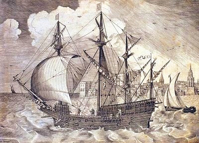
The “China galleons” greatly stimulated spatial interactions between Acapulco and Manila, 15,000 km away. Many Mexicans settled in Manila and scores of Nahuatl words entered Tagalog, the main Filipino language. These included atole, avocado, balsa, cacao, calabaza, camote, chico, chocolate, coyote, nana(y), tata(y), tocayo and zapote.

The Nao de China galleon

The China Galleon

As well as vocabulary, some aspects of Mexican cuisine, customs and dress were also introduced to the Philippines, along with a variety of plants and flowers. In addition, the Filipino currency has the same name as Mexico’s: the peso.

Mexico’s long connection with the Philippines – exploration, seafaring and geopolitics

A large number of Filipinos migrated in the other direction, escaping from their life of servitude aboard a galleon by jumping ashore on the coasts of Colima and Guerrero. One sizable Filipino community settled in Coyuca, on the Costa Grande, 50 km north of Acapulco. Coyuca was apparently known as Filipino Town at one point in its early history.

The Filipinos settling in Mexico introduced mangoes and a game called “cara y cruz” (heads and tails). The settlers were known locally as “Chinese Indians” and brought their expertise in the cultivation and use of palm trees with them. In Tagalog, palm fronds are known as “palapa” and by the end of the 18th century, this name was in use, too, for the palm-roofed shelters which remain a distinctive style of architecture along Mexico’s coasts.The coconut palm’s sap is known locally as tuba. Filipino newcomers fermented the resulting coconut wine into a potent drink. Henry Bruman, a University of California geographer, documented how Filipino seamen on the Manila Galleon also introduced simple stills, for making coconut brandy, to western Mexico during the late 16th century. These techniques were quickly adopted by Mexicans who were then able to turn the hearts of their native agave plants into tequila.

This is an excellent example of how developments in transportation can encourage cultural exchanges, and diminish the social, economic and cultural distance between places.

According to some historians, Mexico’s “China Poblana,” the woman who supposedly arrived from the East as a slave during the early 1600s and subsequently captured the hearts and minds of the people of Puebla, was actually a Filipino noblewoman who had arrived in Mexico aboard one of the Spanish galleons.

Mexico’s independence from Spain (1821) brought an end to the Manila–Acapulco galleons, though the network of shipping links then expanded from Veracruz to New Orleans and New York.

Mexico-Phillipines friendship has continued down the years.

For instance, in the second world war, several Mexican air force pilots, in the elite Escuadrón 201, were sent by the US government to lend their support in the Philippines. The pilots were decorated by the Philippine’s government for their heroism.

Related post

The development of Mexico’s transportation system is discussed in chapter 17 of Geo-Mexico: the geography and dynamics of modern Mexico. Its cultural geography is the subject of chapters 10, 11 and 13. Ask your library to buy a copy of this handy reference guide to all aspects of Mexico’s geography today! Better yet, order your own copy…

The cultural geography of Mennonite enclaves in Mexico

 Excerpts from Geo-Mexico  Comments Off on The cultural geography of Mennonite enclaves in Mexico
Jun 082010
 

Among the first Mennonite settlers were a group of more than 1300 families (about 9300 individuals) of German-Russian descent who arrived from Canada in 1922. They had been guaranteed tax concessions, freedom of worship and exemption from military service by President Obregón. At the time the Mexican government wanted to encourage more settlement in northern Mexico which had unrealized agricultural potential. After the Mexican Revolution, the large landowners in northern Mexico wanted to sell part or all of their vast holdings before the federal government forced the break up of their estates.

Mennonites bought 100,000 hectares for 600,000 pesos (8.25 dollars per acre) and started a colony near Ciudad Cuauhtemoc, west of Chihuahua city.  The group’s spartan lifestyle is reflected in their conservative dress habits and the fact that their villages (campos) are numbered, rather than named.  The people are taller than the average Mexican, speak German, and have northern European physical features. Today, about 50,000 Mennonites live in the Ciudad Cuauhtemoc area. They also founded colonies at Patos, in northern Durango state, and near Saltillo in Coahuila. Today, there are also several Mennonite villages far to the south, in Campeche.

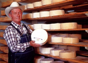
Mennonite cheese

Mennonite cheese (queso menonita)

The landscapes of Mennonite areas in northern Mexico are very distinctive. They transformed desolate areas of semi-arid scrubland into prosperous farms.

Houses built of adobe on wood frames line the main street of each campo. These elongated street villages (about sixty in number) are totally different to the compact, nucleated villages found elsewhere in Mexico.  Surrounding the villages are large relatively flat fields divided into blocks by wide roads.

The Mennonite farming areas look more like parts of the US Midwest than Mexico. The farms are neatly kept and dotted with wind pumps used to raise water for irrigation. Tractors are common though horse-drawn buggies are also used. The main crops are wheat, oats, beans, corn and in some areas apples. The Mennonites are experienced dairy farmers and their most famous contribution to Mexican cuisine is the production and marketing of Chihuahuan cheese (queso menonita). It is a common sight to see Mennonite men selling their delicious cheese at major intersections in several of Mexico’s major cities.

See also:

The geography of Mexico’s religions is discussed in chapter 11 of Geo-Mexico: the geography and dynamics of modern Mexico.

May 242010
 

The growth of Protestantism in Mexico has been rapid among low income groups, particularly in poor states and indigenous areas. Many of these gains are considered less a conversion from true Catholicism than a first time acceptance of a modern religion by people who previously adhered to Indian Folk Catholicism. Protestantism, and especially Pentecostalism, is thought to be compatible with indigenous values and spiritual practices. Some Protestant groups have specifically focused their proselytizing efforts in indigenous areas.

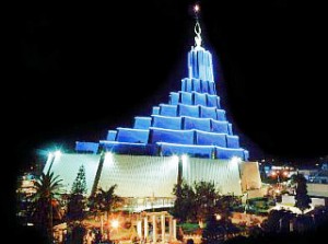
La Luz del Mundo, Guadalajara

The Mexican census divides non-Catholic churches into two groups. The first, “Protestant and Evangelical,” includes about 5% of Mexicans. The percentage varies from less than 2% in western Mexico to over 10% in southeastern Mexico. Pentecostal and Evangelical churches now make up 85% of this group. Dozens of Evangelical denominations have engaged in strong recruitment efforts since 1970, with considerable success in southeastern Mexico. In 2000, Protestants and Evangelicals comprised 14% of the population in Chiapas and Tabasco, 13% in Campeche, and 11% in Quintana Roo. The 2010 census is expected to show a significant increase in these percentages.  This group also includes Lutheran, Methodist, Presbyterian, Mennonites and Luz del Mundo, a Protestant denomination founded in Mexico.

The second non-Catholic group, “Biblical, not Evangelical,” is still rather small, but has grown very rapidly in the past two decades. It includes the Seventh Day Adventist Church, which is particularly popular in indigenous areas, as well as Jehovah’s Witnesses, which have so far had little influence in indigenous areas. Also in this group is the Church of Jesus Christ of Latter Day Saints (Mormons), which first arrived in Mexico in 1875.  Several English-speaking Mormon colonies were established in Chihuahua (Colonia Juárez is the most prominent today) and Sonora. As a result of impressive proselytizing efforts, Mormon membership surged from 248,000 in 1980 to 617,000 in 1990 and more than 1 million in 2005. Mexicans belonging to the Mormon Church have, on average, much higher incomes, higher rates of literacy and, interestingly, lower fertility rates than members of other churches.

The geography of Mexico’s religions is discussed in chapter 11 of Geo-Mexico: the geography and dynamics of modern Mexico.

Previous posts in this mini-series on the geography of religion in Mexico:

The decline of Catholicism in southern Mexico

 Excerpts from Geo-Mexico  Comments Off on The decline of Catholicism in southern Mexico
May 172010
 

The geography of religion in Mexico is changing quite rapidly.

Mexico is a predominately Catholic country, but is becoming less so with each passing decade.  In 1980 96% of Mexicans said they were Catholics; this dropped to 88% in 2000 and is estimated at about 80% in 2010. While the proportion non-Catholic is growing in all parts of the country, it is most apparent in southeastern Mexico.

In 2000, only 64% of those in Chiapas identified themselves as Catholics, fully 24% below the national average.  Other southern states were not far behind: Tabasco – 70%, Campeche – 71%, Quintana Roo – 74%; followed by Veracruz – 83%, Yucatán – 84% and Oaxaca – 85%.  Given existing trends, these percentages are expected to be considerably lower in the 2010 census.

About 10% of those in southern Mexico are classified as Protestant or Evangelical. Close to 10% are classified as having “no religion”, 13% in Chiapas. Indigenous language speakers and males were most likely to place themselves in this category.  The smallest, but fastest growing group in southern Mexico is the “Biblical, not Evangelical” group, which includes Seventh Day Adventists, Jehovah’s Witnesses, and Mormons.

The geography of Mexico’s religions is discussed in chapter 11 of Geo-Mexico: the geography and dynamics of modern Mexico.

Where to find Mexico’s most beautiful señoritas

 Other  Comments Off on Where to find Mexico’s most beautiful señoritas
May 142010
 

The British-born journalist William English Carson (1870-1940) spent four months in Mexico, in 1908-1909, collecting material for his “Mexico, the Wonderland of the South“, never straying far from the railways. Always an enthusiastic traveler, many of his views about Mexicans will strike modern readers as stereotypical. For example, Carson devoted an entire chapter to “The Mexican Woman“. Many of Carson’s pronouncements read today as outrageous over-generalizations. Select quotes from the chapter include:

  • “no foreigner, unless he be associated with diplomacy, is likely to have any chance of studying and judging the Mexican women”
  • “the Mexican girl has but two things in life to occupy her, love and religion”
  • “As a rule, the Mexican women are not beautiful”.

Miss Mexico 2009

After due analysis, the latter claim can be swiftly disposed of! See, for example, this article on MexConnect.

Want to find out which state in Mexico has the most beautiful young señoritas? In chapter 13 of Geo-Mexico: the geography and dynamics of modern Mexico, we use locational quotients to analyze the geography of beauty pageant winners in Mexico

This is an edited version of an article originally published on MexConnect, partly based on chapter 52–“A place of contrasts”–of Lake Chapala Through the Ages, an anthology of travellers’ tales (Sombrero Books, 2008).

Oaxaca is the most culturally diverse state in Mexico

 Excerpts from Geo-Mexico, Maps  Comments Off on Oaxaca is the most culturally diverse state in Mexico
May 042010
 

The inter-census population count in Mexico in 2005 found that more than one million people in Oaxaca spoke at least one indigenous Indian language. Close behind came the state of Chiapas with about 950,000 indigenous language speakers.

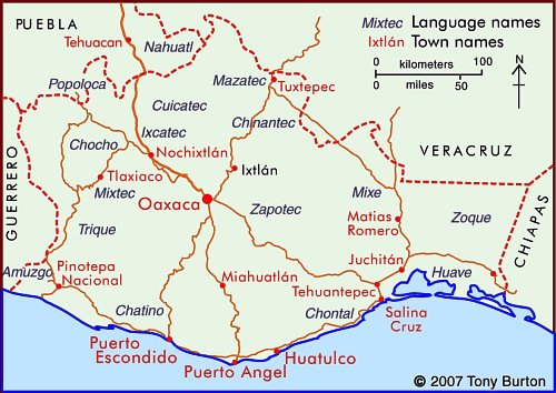
Indigenous Indian groups in the state of Oaxaca

In Oaxaca, according to the National Commission for the Development of Indigenous Peoples, more than 1.5 million people live in a home where at least one of the residents either speaks an indigenous language or considers themselves indigenous (even if they do not speak an indigenous language). This is 50% more people than are found in the same category in Chiapas.

Not only does Oaxaca have more indigenous people, it also has a much greater linguistic and cultural diversity than Chiapas or any other state in Mexico.

Oaxaca’s one million indigenous speakers represent 35% of the state’s total population. The largest indigenous linguistic groups in the state include about 350,000 Zapotec, 230,000 Mixtec, 165,000 Mazatec, 100,000 Chinantec, 100,000 Mixe, and 40,000 Chatino.

Almost 90% of Zapotec speakers also speak Spanish, which considerably enhances their education and employment opportunities. On the other hand, 23% of Mixtecs do not speak Spanish, and hence face a tougher challenge in the workplace. Tens of thousands of Mixtecs have migrated away from Oaxaca looking for work. Mixtec speakers tend to migrate to Mixtec-speaking neighborhoods; there are about 16,000 Mixtecs in Mexico City, 14,000 in Baja California, 13,000 in Sinaloa, and perhaps 50,000 in the USA. A sizable number of these migrants are essentially monolingual, with very limited Spanish.

The map shows the regions where the main indigenous groups in Oaxaca reside. One of the reasons for Oaxaca having retained such an extraordinary diversity of Indian groups is the state’s very rugged terrain, which has isolated numerous indigenous groups, cutting them off from mainstream Mexican society. This diversity of cultures helps to make Oaxaca one of Mexico’s most interesting states. The cultures find expression today not only in language, but also in modes of dress, handicrafts, music and dance. The state of Oaxaca celebrates its ethnic diversity in its annual extravaganza, the Guelaguetza festival, normally held in July.

Mexico’s cultural diversity is discussed in chapters 10 and 13 of Geo-Mexico: the geography and dynamics of modern Mexico.

This is an edited version of an article originally on MexConnect website.

The disparities in Mexico between indigenous peoples and the remainder of the population

 Excerpts from Geo-Mexico  Comments Off on The disparities in Mexico between indigenous peoples and the remainder of the population
Apr 292010
 

Most of Mexico’s indigenous population lives in small, isolated rural localities with under 500 inhabitants. These communities are very disadvantaged compared with other Mexican communities. About one-third of the nation’s 2442 municipalities are indigenous. However, almost half of all the municipalities defined by the National Statistics Institute (INEGI) as “highly marginalized” are indigenous, as are a whopping 82% of the “very highly marginalized” municipalities.

The incidence of extreme poverty is much higher in indigenous municipalities than in non-indigenous municipalities. Indigenous villages are among the nation’s poorest rural communities. Indigenous language speakers trail behind other Mexicans in virtually every socioeconomic indicator. About 33% are illiterate, compared to the national rate of only 9.5%. Most leave school prematurely to help their families earn a living.

Indigenous females get a year’s less schooling than indigenous males. They suffer from poor nutrition and their fertility rate is 40% higher than the national average, but 5% of indigenous infants die before reaching their first birthday. About 85% of indigenous household are below the Mexican poverty line and over half live in “extreme poverty”. Over one third of houses lack electricity and over half lack piped water. There is no question. Indigenous peoples have a far lower standard of living than other Mexicans.

Despite their extreme poverty, indigenous communities have managed to remain remarkably stable while collectively pursuing their relatively well organized survival strategies. Their belief systems and rich knowledge of nature remain largely intact. Over 90% of indigenous peoples own their homes and farm plots.

Mexico’s indigenous groups are the subject of chapter 10 of of Geo-Mexico: the geography and dynamics of modern Mexico; variations in the quality of life within Mexico are analyzed in chapter 29.

The geography of languages in Mexico: Spanish and 62 indigenous languages

 Excerpts from Geo-Mexico  Comments Off on The geography of languages in Mexico: Spanish and 62 indigenous languages
Apr 232010
 

Most people realize that the national language of Mexico is Spanish and that Mexico is the world’s largest Spanish speaking country. In fact, its population, now numbering 105 million, represents about one-third of all the 330 million or so Spanish speakers in the world. Spanish is the majority language in nineteen other countries besides Mexico, and is the world’s third most spoken language, after English and Chinese.

Far fewer people realize that, in addition to Spanish, another 62 indigenous languages are also spoken in Mexico. This makes Mexico one of the most linguistically diverse countries in the world, in terms of the number of languages spoken, behind Papua New Guinea, Indonesia and India, but well ahead of China, Brazil and just about anywhere else.

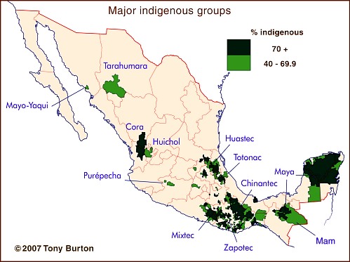
The major indigenous groups in Mexico

Some estimates put the number of different Indian languages in use at the time of the Spanish Conquest in the 16th century as high as 170. This number had dwindled to about 100 by 1900, and has continued to decline to the present day. The latest estimates are that at least 62 distinct languages (and 100 dialects) are still spoken somewhere in the country.

The largest indigenous groups are those speaking Nahuatl (2,563,000; dispersed locations, and therefore not shown on the map), Maya (1,490,000), Zapotec (785,000) and Mixtec (764,000), followed by those using Otomí (566,000), Tzeltal (547,000) and Tzotzil (514,000). Other well known groups include the 204,000 having Purépecha (or Tarasco) as their first language and the 122,000 speaking Tarahumara.

At the other end of the spectrum, only about 130 people still speak Lacandón and only 80 use Kiliwa. Only 60 people still use Aguacateco in Mexico and only 50 speak Techtiteco (or simply Teco), though both languages are spoken by several thousand Indians in neighboring Guatemala.

Of course, we shouldn’t forget that many Mexicans not only speak Spanish and/or an indigenous language, but also manage pretty well in English, French, Japanese and many others!

This is an edited version of an article originally published on MexConnect – click here for the original article

Indigenous languages and cultures are analyzed in chapters 10 of Geo-Mexico: the geography and dynamics of modern Mexico.

Baseball is not the oldest ballgame in the Americas

 Other, Teaching ideas  Comments Off on Baseball is not the oldest ballgame in the Americas
Mar 052010
 

Forget modern “traditions” like the World Series! Forget soccer, tennis and golf! By far the oldest ballgame in the Americas is the little known game of Ulama. Amazingly, this game is still played in some regions of Mexico, where it is believed to have originated more than 3000 years ago!

The precise rules of the ancient game are lost in the mists of antiquity, but three distinct forms of Ulama (using the hip, arm and a stick respectively) were played at the Mesoamerican ballgame (Ulama) Festival in Mazatlán in April 2002. The Festival was organized by the Mazatlán Historic Society, which was pushing for the game to be included in the “Intangible Heritage Category” of UNESCO’s World Heritage denominations. (As of March 2010, it had not yet made the list.)

The original ballgame, played by the Aztecs and other Nahuatl speaking peoples in Mexico at the time of the Spanish Conquest, was known as Ullamaliztli, a name deriving from ullama, which means the playing of a game with a ball, and ulli, rubber. Many archaeological sites in Mexico boast the ruins of one or more ballcourts where the game was played and hundreds of representations are known in Pre-Columbian art of ballgame players with their characteristic protective gear, some dating as far back as 1500 B.C. The protective padding was necessary because the solid rubber ball used in the game weighed five to eight pounds (2 – 3 kilos) and was propelled at speeds of up to 95 kph (60 mph). While most ballgame relics are of single players, one polished clay model found in the state of Nayarit actually depicts a game in progress.

Before you say “What a load of (old) balls!”, consider the fact that the ballgame has had profound consequences on sports all around the world. When the Spanish conquistador Hernán Cortés returned to Spain in 1528, he took with him ballplayers who demonstrated their skills at the court of King Charles V. The rubber ball they used amazed the Europeans as much as the game itself, since it bounced much more than the hair-stuffed leather balls in use at the time in Europe. The smuggling of the first rubber seeds out of Brazil led to rubber-tree plantations being established in Malaysia and rubber quickly became a world commodity, with the widespread uses we know today.

The research establishing the links between the relatively modern versions of Ulama, played in Sinaloa, and the pre-Columbian game of Ullamaliztli was carried out by Dr. Ted Leyenaar of the Rijksmuseum voor Volkenkunde in Leiden, Holland. Emphasizing the game’s immense historical importance, he says, “That the Mesoamerican ballgame has survived and flourished for more than 3000 years earns it the distinction of being one of humanity’s great cultural expressions”.

The details, meaning and significance of the game are explored more fully on the Mazatlán Historical Society’s webpages at http://www.ulama.org, the main source for this article. The Society is hoping to set up the world’s first Ulama Museum and has begun collecting related artifacts.

“A load of old balls!”? – I don’t think so!

This is an edited version of an article originally published on MexConnect.

Click here for the complete article

“Indigenous peoples” is the title of chapter 10 of Geo-Mexico: the geography and dynamics of modern Mexico and “Mexico’s cultural landscape” is the title of chapter 13.

Sports-related teaching idea:

  1. Map the locations of Mexico’s top fútbol (soccer) clubs.
  2. To what extent do these locations match a map of Mexico’s population density (Figure 8.2 in Geo-Mexico)?
  3. Does it appear that factors such as GDP/capita (Figure 14.3) or Mexico’s highway system (Figure 17.3) have also influenced where the top soccer clubs are located?
  4. Suggest what other factors may have influenced where Mexico’s soccer clubs are located.

The geography of Mexican cuisine

 Other  Comments Off on The geography of Mexican cuisine
Feb 102010
 

Mexican cuisine is extraordinarily varied and has become one of the most popular in the world. Diana Kennedy, the foremost authority on the subject, has devoted her life to researching the regional variations in ingredients, cooking methods and typical local dishes.

The ingredients used reflect different climates and ecosystems (see Geo-Mexico chapters 4 and 5). For instance, corn (maize) tortillas predominate in southern and central Mexico while wheat tortillas are more commonly found in the north of the country.

Pork and hominy stew (pozole) is largely restricted to the Pacific coast states of Jalisco and Guerrero. The grilled beef of cattle ranges in the northern interior of Mexico contrasts with the seafood found along the coast.

Cuisines are strongly influenced by trade routes and migration, especially the arrival of immigrant groups. Mexican cuisine is a fusion of  ndigenous and Spanish cooking, influenced in some regions by Cuban, Italian, French and other migrants.

On a more local scale, miners from Cornwall in the UK who came to work in the silver mines of Real del Monte in the state of Hidalgo brought with them their meat and vegetable-filled pastries called Cornish pasties. These were quickly assimilated into the local cuisine, and pastis, admittedly with some chilies added, are still sold in the town.

[Note: This post is an edited extract from chapter 13 of Geo-Mexico]

For more about Mexican cuisine, visit the amazing award-winning blog Mexico Cooks! and also browse the huge selection of recipes, articles and tips about all aspects of Mexican food and cooking in the “Cuisine” section of MexConnect. ¡Buen provecho!