The relief and landforms of Mexico have been greatly influenced by the interaction of tectonic plates.
The resulting relief patterns are so complex that it is often claimed that early explorers, when asked to describe what the new-found lands were like, simply crumpled up a piece of parchment by way of response.
The map below shows Mexico’s main physiographic regions. The core of Mexico (both centrally located, and where most of the population lives) is the Volcanic Axis (Region 10 on the map), a high plateau rimmed by mountain ranges to the west, south and east. Coastal plains lie between the mountains and the sea. The long Baja California Peninsula parallels the west coast. The low Isthmus of Tehuantepec separates the Chiapas Highlands and the low Yucatán Peninsula from the rest of Mexico.
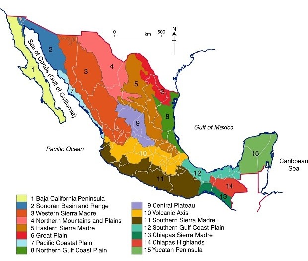
Mexico’s physiographic regions. Color version of Figure 3.2 of “Geo-Mexico, the geography and dynamics of modern Mexico”; all rights reserved.
We looked in more detail at the Volcanic Axis in several previous posts, including
and will look more closely at some of the other physiographic regions in later posts.
Sorry, the comment form is closed at this time.