The pattern of Catholicism in Mexico

 Excerpts from Geo-Mexico  Comments Off on The pattern of Catholicism in Mexico
Jan 162017
 

The map shows the percentage of the population of each state who profess themselves to be Catholic. Mexico’s population is predominantly Catholic but Mexican Catholicism is extremely varied in practice. It ranges from those who support traditional folk religious practices to those who adhere to the highly intellectualized liberation theology.

Catholicism in Mexico

Catholicism in Mexico, 2010.

While the population remains predominantly Catholic, allegiance to the church has declined steadily since 1970. In 1970 96% of the population five years of age and older identified itself as Roman Catholic. By the 2010 census the figure had fallen to 84%. Though the proportion of Catholics is declining in Mexico, it is still considerably higher than in Mexico’s southern neighbors. For example, only about 70% in Guatemala are Catholic.

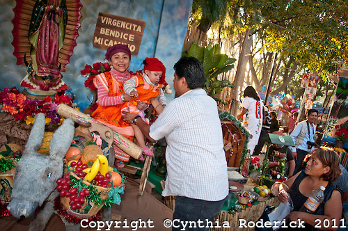
There are significant regional variations. Catholicism is strongest in a band of central-western states, extending from Zacatecas to Michoacán, where only one in twenty is not Catholic. In such areas, religion is a strong force in everyday life, with visible manifestations not only in the number of churches and other ecclesiastical buildings but also in the cultural importance and frequency of religious festivals and processions.

In contrast, about one in six is not Catholic in the northern border states. In southeastern Mexico (Chiapas, Campeche, Tabasco and Quintana Roo), about one in four is not Catholic. Interestingly, non-Catholics are concentrated in both the prosperous northern states and in the relatively poor south and southeastern states.

In summary, the pattern of Catholicism in Mexico exhibits a clear distance-decay pattern around the strongly-Catholic western states, with minor anomalies such as the state of Yucatán.

For more details, see these previous related posts:

Fresnillo, Mexico’s leading silver mining town

 Other  Comments Off on Fresnillo, Mexico’s leading silver mining town
Aug 242013
 

The city of Fresnillo, founded in the sixteenth century, is a place that most people speed by en route to somewhere else. Yet Fresnillo, in the state of Zacatecas, holds several surprises. It was once an important city on the colonial silver route (El Camino Real or Royal Road, the spine of the colonial road system in New Spain), and still boasts many fine buildings, including a lovely old theater and several churches.

fresnillo-plcFresnillo is still an important mining center today. Fresnillo plc, incorporated in the UK, is Mexico’s largest single silver mining company and the country’s second largest gold producer. It operates mines in three major mining zones in Mexico—Fresnillo (Zacatecas), Ciénega (Durango) and Herradura (Sonora)—and is actively developing or exploring numerous other sites.

Fresnillo became a major mining center from 1568, when a garrison of soldiers, complete with a fort, was installed in the town to help protect mule-trains carrying silver from Sombrerete (and the San Martín mine) further north and Zacatecas. By the mid-nineteenth century, Fresnillo’s own mines had serious flooding problems. Mine owners sent to England for experienced Cornish tin miners to come and help. The Cornishmen knew how to assemble and operate powerful steam engines, a novelty at that time in Mexico, and a reliable way to help drain deeper mine shafts.

Location of mining districts near Fresnillo. Credit: 321gold.com

Location of mining districts near Fresnillo. Credit: 321gold.com. Click to enlarge

George Ruxton, a nineteenth century traveler and author, described Fresnillo when he visited as “paltry” but “busy and frenzied” with 2500 miners hacking away at the nearby mountains. Ruxton thought the work ethic of the Cornish was superior to other English settlers and to the local Mexicans. He was especially impressed by how the miners had planted a beautiful garden, full of fruit-bearing trees, complete with a fountain and ornamental summerhouse.

Silver bars were regularly taken from Fresnillo to Zacatecas for smelting and subsequent stamping in the Zacatecas mint. The wagon-trains carrying silver bars, called conductas while under military protection, were frequently assaulted by large groups of bandits, up to several hundred strong.

Fresnillo also has significant artistic interest. Two very famous, yet very different, Mexican artists—musician Manuel M. Ponce and painter Francisco Goitia—were born in (or at least very near) the city in the same year, 1882.

The patron saint of silversmiths

From Fresnillo, it is only seven kilometers along a wide, well-paved road to Plateros, a place of pilgrimage. The baroque Santuario de Plateros was built at the end of the eighteenth century to be a suitable residence for the Santo Niño de Atocha and the Señor de Plateros (the patron saint of silversmiths). The fame of the Santo Niño de Antocha spread rapidly following a fight between two miners. One miner was sure he had killed the other but then prayed to this saint for his recovery. Lo and behold, his companion recovered! Ex-votos (retablos) tell the stories of the numerous “miraculous” interventions performed by the Santo Niño de Antocha to resolve all manner of problems in more recent years.

Source: Most of this post is based on chapter 20 of my “Western Mexico: A Traveler’s Treasury” (link is to Amazon’s “Look Inside” feature), also available as either a Kindle edition or Kobo ebook.

Other Mexican mining towns previously described on Geo-Mexico.com include:

Striking photographs of Oaxaca by Cynthia Roderick

 Books and resources  Comments Off on Striking photographs of Oaxaca by Cynthia Roderick
Apr 162013
 

Cynthia Roderick is an award-winning photographer whose work has been widely published in major newspapers, magazines and TV news programs. However, I had not realized until recently that Roderick has a strong affection for Oaxaca. Several portfolios of work related to Oaxaca can be accessed via her website:

  • San Mateo Rio Hondo (40 images) San Mateo Río Hondo, a town and municipality in Oaxaca, is situated in the Miahuatlán District in the south of the Sierra Sur.
Credit: Copyright held by Cynthia Roderick

Credit: Copyright held by Cynthia Roderick

Festival Our Lady of Guadalupe – Image by Cynthia Roderick

Her informal images capture the personalities and sights of these events, warts and all. Roderick has a keen eye for subject matter, color and detail. Her fine photographs bring these events and the magic of Oaxaca to life for her viewers.

Related posts:

The sacred geography of Mexico’s Huichol Indians

 Other  Comments Off on The sacred geography of Mexico’s Huichol Indians
Jan 242013
 

The remote mountains and plateaus where the states of Jalisco, Nayarit and Zacatecas all meet is home to some 18,000 Huichol Indians, as well as their close cousins, the Cora. The Huichol (Wixárika = “the healers” in their own language) live in scattered, extended family, settlements (ranchos) and rely entirely on oral tradition. They are intensely religious, and see their time-honored responsiblity as protecting nature’s creations. Their shamen perform elaborate ceremonies to a pantheon of gods to ensure  bountiful crops, health and prosperity, as well as to preserve nature and heal the Earth.

The center of the Huichol world – Tee’kata (see map) – coincides with the village of Santa Catarina in the Huichol heartland. Central to some Huichol ceremonies is peyote, an hallucinogenic cactus, obtained from an annual pilgrimage eastwards to the sacred land of Wirikuta, near Real de Catorce in San Luis Potosí. The pilgrimage is an 800 km (500 mile) round trip. Peyote (Lophophora williamsii) is called jicuri by the Huichol.

Map of the sacred geography of Mexico's Huichol Indians

The sacred geography of Mexico’s Huichol Indians. Credit: Tony Burton/Geo-Mexico; all rights reserved.

Equally important points in the Huichol cosmos lie to the north, west and south:

  • north: Huaxa Manaká =  the mountain of Cerro Gordo in Durango
  • west: Tatéi Haramara = the Isla del Rey, an island near San Blas
  • south: Xapawiyemeta =  Scorpion Island (Isla de los Alacranes) in Lake Chapala

The sacred geography of the Huichol (shown by the rhombus on the map) echoes the significance they attach to the number 5. They view the world as having five regions, corresponding to five mothers (one under the earth and the other four at cardinal points). They believe that the sun is carried through the universe by five serpents. The flowers of their sacred peyote come in five colors, as do their cobs of corn  (Blue, white, reddish purple, yellow, multicolor). The Huichol have different terms for the five colors of corn, which are closely associated with the five main points of their cosmos:

  • yuawime – blue – south
  • tuxame – white- north
  • ta+lawime  – purple – west
  • taxawime – yellow – east
  • tsayule – multicolor – center

huichol-yarn-crossEvery rhombus has four corner points and a center. Their traditional yarn crosses (often mistakenly referred to as “God’s Eyes”) are made by wrapping colored yarn around two twigs to form a rhombus of color. Most yarn crosses use several different colors. Compound yarn crosses are made by adding small yarn crosses at each end of the two main supporting twigs, giving five crosses (eyes) in total. Huichol fathers will make a simple yarn cross when a child is born, adding additional crosses annually until the yarn cross is considered complete. This, of course, is assuming that the child survives, given that infant mortality among the Huichol is very high.

The colors used in Huichol artwork also carry lots of symbolism. For example, blue is taken to mean water or rain and associated with Lake Chapala to the south. Black symbolizes death and is linked to the Pacific Ocean in the west. Red, the color for mother, is usually reserved for sacred places such as Wirikuta in the east. White (clouds) is associated with the north.

Related posts:

Magic Towns #63, 64 and 65: Chignahuapan (Puebla), Cholula (Puebla) and Pinos (Zacatecas)

 Mexico's geography in the Press  Comments Off on Magic Towns #63, 64 and 65: Chignahuapan (Puebla), Cholula (Puebla) and Pinos (Zacatecas)
Nov 072012
 

Three more Magic Towns have been added to the list: Chignahuapan and Cholula (both in the state of Puebla) and Pinos (Zacatecas). The new additions mean that Puebla now has five Magic Towns and Zacatecas has four.

Christmas ornaments in Chignahuapan

Christmas ornaments in Chignahuapan

63 Chignahuapan

Chignahuapan is a town of some 20,000 inhabitants set in the beautiful mountainous landscape of the Sierra Norte in the state of Puebla, very close to Zacatlán, also a Magic Town. Chignahuapan sits at an elevation of 2,290 meters above sea level, only 8 kilometers from an impressive 200-meter-high waterfall, the Salto de Quetzalapa, and several thermal spas. The town has several historic buildings, including the main church which dates back to the sixteenth century and has colorful wall decorations. Inside are several alterpieces and a monument showing St. James astride his horse. A short distance away a modern church, the Church of the Immaculate Conception, houses an amazing wooden sculpture of the Virgin Mary, almost 12 meters in height, reputed to be the largest interior sculpture of its kind in Latin America. A third church, the Iglesia del Honguito in the Ixtlahuaca quarter of town, was built in honor of one of the most unusual religious items in Mexico: a tiny petrified mushroom, found in 1880, which according to believers embodies several religious images.

Chignahuapan is one of the most important towns in Mexico for the manufacture of glass Christmas ornaments. Some 200 workshops in the town produce more than 70 million blown-glass ornaments a year, 20% of them for export.

Portales in Cholula decorated for fiesta

Portales in Cholula decorated for fiesta. Credit: Turismo Puebla.

64 Cholula

Cholula is a delightful city of around 80,000 inhabitants located 22 kilometers west of the city of Puebla, and now virtually contiguous with it. Founded in 1557, Cholula has numerous buildings of historic and architectural importance. The city is said to have as many churches as days in the year. Perhaps the most famous church is the one perched on top of one of, if not the, largest pyramids in Mexico. Tunnels into the pyramid, which was originally dedicated to the featherd serpent Quetzalcóatl, allow visitors to walk through the hill beneath the church. This church on top of a pyramid is often used as a symbol of how Catholic religion was superimposed on existing beliefs. Cholula’s massive central plaza is one of the largest in Latin America. The city is home to the main campus of the University of the Americas and is well worthy of its Magic Town designation.

For more information, see these two lengthy Wikipedia entries:

65 Pinos

This former gold and silver mining town, often called Real de Pinos, was founded in 1594 relatively close to the Camino Real that linked Mexico City to Santa Fe, and approximately equidistant from the cities of Zacatecas, Aguascalientes and San Luis Potosí. Pinos (Pines), in the Sierra de Pinos at an elevation of 2700 meters above sea level, now has about 8,000 inhabitants. The attractive town has several historic buildings, including the San Francisco convent with its beautifully restored patio and 17th century decorations, and the church of San Matías, with fine stonework, which dates back to the same period. Pinos is the fourth Magic Town in Zacatecas, joining Sombrerete, Teúl de González Ortega and Jerez.

Related posts:


Religious diversity is increasing in Mexico

 Updates to Geo-Mexico  Comments Off on Religious diversity is increasing in Mexico
May 282011
 

Mexico is still considered to be a Catholic country, but it is slowly becoming less Catholic. In the 2010 census 82.7% said they were Catholics compared to 88.0% in 2000 and 89.7% in 1990. In a recent report, Sociologist Roberto Blancarte, who specializes in research into religions, claims that for each day of the last decade, more than 1,000 Mexicans left the Catholic Church. He concludes that Catholicism is “destined to be abandoned” in Mexico.

Conversely, the percentage of the population who declared themselves non-Catholic went from 12.0% to 17.3% in 2010, almost a 50% increase.

The percentage of Protestants or Evangelicals increased to 9.7% in 2010 from 5.2% in 2000 and 4.9% in 1990. The proportion following “Other Religions” was 2.5% in 2010, 2.4% in 2000 and 1.5% in 1990. While the percentages in these latter two groups are rather low, Mexicans in non-Catholic religions tend to be far more religiously active than the majority of those who consider themselves Catholics. A total of 4.6% indicated that they had no religion in 2010, compared to 3.5% in 2000 and 3.2% in 1990.

Women tend to be more religious than men and more apt to have specified religions. About 5.5% of males indicated that they had “No Religion” compared to 3.9% for women. Women were a bit more likely to indicate they were Catholics (83.1% versus 82.3%) or Protestants or Evangelicals (10.2% versus 9.2%).

Western Mexico is still the most Catholic area of the country, though other religions are gaining converts. The state with the highest proportion of Catholics is Guanajuato with 93.8% followed closely by Zacatecas with 93.5%. Other states with over 90% Catholics are Querétaro, Jalisco, Michoacán, and Tlaxcala.

The least Catholic states are in Southern Mexico, led by Chiapas where only 57.8% are Catholic. Over 27% in Chiapas are Protestants or Evangelicals and 12% indicated that they had “No Religion.” Other states with under 65% Catholics include Campeche, Quintana Roo and Tabasco. The percentage Catholic in Oaxaca is just over 80% which seems surprisingly high given that Oaxaca is a southern state and has the largest proportion of indigenous-language speakers.

Related posts:

The geography of Mexico’s religions is discussed in chapter 11 of Geo-Mexico: the geography and dynamics of modern Mexico. Ask your library to purchase a copy today!

The cultural geography of Mennonite enclaves in Mexico

 Excerpts from Geo-Mexico  Comments Off on The cultural geography of Mennonite enclaves in Mexico
Jun 082010
 

Among the first Mennonite settlers were a group of more than 1300 families (about 9300 individuals) of German-Russian descent who arrived from Canada in 1922. They had been guaranteed tax concessions, freedom of worship and exemption from military service by President Obregón. At the time the Mexican government wanted to encourage more settlement in northern Mexico which had unrealized agricultural potential. After the Mexican Revolution, the large landowners in northern Mexico wanted to sell part or all of their vast holdings before the federal government forced the break up of their estates.

Mennonites bought 100,000 hectares for 600,000 pesos (8.25 dollars per acre) and started a colony near Ciudad Cuauhtemoc, west of Chihuahua city.  The group’s spartan lifestyle is reflected in their conservative dress habits and the fact that their villages (campos) are numbered, rather than named.  The people are taller than the average Mexican, speak German, and have northern European physical features. Today, about 50,000 Mennonites live in the Ciudad Cuauhtemoc area. They also founded colonies at Patos, in northern Durango state, and near Saltillo in Coahuila. Today, there are also several Mennonite villages far to the south, in Campeche.

Mennonite cheese

Mennonite cheese (queso menonita)

The landscapes of Mennonite areas in northern Mexico are very distinctive. They transformed desolate areas of semi-arid scrubland into prosperous farms.

Houses built of adobe on wood frames line the main street of each campo. These elongated street villages (about sixty in number) are totally different to the compact, nucleated villages found elsewhere in Mexico.  Surrounding the villages are large relatively flat fields divided into blocks by wide roads.

The Mennonite farming areas look more like parts of the US Midwest than Mexico. The farms are neatly kept and dotted with wind pumps used to raise water for irrigation. Tractors are common though horse-drawn buggies are also used. The main crops are wheat, oats, beans, corn and in some areas apples. The Mennonites are experienced dairy farmers and their most famous contribution to Mexican cuisine is the production and marketing of Chihuahuan cheese (queso menonita). It is a common sight to see Mennonite men selling their delicious cheese at major intersections in several of Mexico’s major cities.

See also:

The geography of Mexico’s religions is discussed in chapter 11 of Geo-Mexico: the geography and dynamics of modern Mexico.

May 242010
 

The growth of Protestantism in Mexico has been rapid among low income groups, particularly in poor states and indigenous areas. Many of these gains are considered less a conversion from true Catholicism than a first time acceptance of a modern religion by people who previously adhered to Indian Folk Catholicism. Protestantism, and especially Pentecostalism, is thought to be compatible with indigenous values and spiritual practices. Some Protestant groups have specifically focused their proselytizing efforts in indigenous areas.

La Luz del Mundo, Guadalajara

The Mexican census divides non-Catholic churches into two groups. The first, “Protestant and Evangelical,” includes about 5% of Mexicans. The percentage varies from less than 2% in western Mexico to over 10% in southeastern Mexico. Pentecostal and Evangelical churches now make up 85% of this group. Dozens of Evangelical denominations have engaged in strong recruitment efforts since 1970, with considerable success in southeastern Mexico. In 2000, Protestants and Evangelicals comprised 14% of the population in Chiapas and Tabasco, 13% in Campeche, and 11% in Quintana Roo. The 2010 census is expected to show a significant increase in these percentages.  This group also includes Lutheran, Methodist, Presbyterian, Mennonites and Luz del Mundo, a Protestant denomination founded in Mexico.

The second non-Catholic group, “Biblical, not Evangelical,” is still rather small, but has grown very rapidly in the past two decades. It includes the Seventh Day Adventist Church, which is particularly popular in indigenous areas, as well as Jehovah’s Witnesses, which have so far had little influence in indigenous areas. Also in this group is the Church of Jesus Christ of Latter Day Saints (Mormons), which first arrived in Mexico in 1875.  Several English-speaking Mormon colonies were established in Chihuahua (Colonia Juárez is the most prominent today) and Sonora. As a result of impressive proselytizing efforts, Mormon membership surged from 248,000 in 1980 to 617,000 in 1990 and more than 1 million in 2005. Mexicans belonging to the Mormon Church have, on average, much higher incomes, higher rates of literacy and, interestingly, lower fertility rates than members of other churches.

The geography of Mexico’s religions is discussed in chapter 11 of Geo-Mexico: the geography and dynamics of modern Mexico.

Previous posts in this mini-series on the geography of religion in Mexico:

Western Mexico, Mexico’s Catholic heartland

 Excerpts from Geo-Mexico  Comments Off on Western Mexico, Mexico’s Catholic heartland
May 202010
 

As mentioned in an earlier post, Mexico is a predominately Catholic country. In 1980, 96% of Mexicans said they were Catholics; this dropped to 88% in 2000 and is estimated at about 80% in 2010. However, Catholicism seems to be maintaining its strength in Western Mexico.

Tzintzuntzan monastery and church. Artist: Mark Eager. All rights reserved.

In 2000, 96% of those in Guanajuato and Aguascalientes professed to be Catholic, followed closely by Jalisco, Querétaro, Zacatecas and Michoacán with 95%. Colima (93%) and Nayarit (92%) were not far behind.

The 1917 Constitution which followed the Mexican Revolution placed severe restrictions on the Catholic Church. It forbade churches from participating in primary and secondary education, it denied legal standing to religious marriages, and denied the right of church personnel to criticize the government or wear religious attire in public. These laws began to be rigorously enforced in 1926, stimulating the Cristero Rebellion by 50,000 armed devout Catholics in Western Mexico. This three year war cost 80,000 lives and reduced the number of priests in Mexico from 4,500 to only 334. Many Catholic leaders and followers immigrated to the USA.

Gradually, the severe restrictions were virtually all rescinded. In 1992 the government re-established diplomatic relations with the Vatican after over a century of estrangement. The last two Presidents of Mexico have come from the pro-Catholic PAN political party.

The geography of Mexico’s religions is discussed in chapter 11 of Geo-Mexico: the geography and dynamics of modern Mexico.

The decline of Catholicism in southern Mexico

 Excerpts from Geo-Mexico  Comments Off on The decline of Catholicism in southern Mexico
May 172010
 

The geography of religion in Mexico is changing quite rapidly.

Mexico is a predominately Catholic country, but is becoming less so with each passing decade.  In 1980 96% of Mexicans said they were Catholics; this dropped to 88% in 2000 and is estimated at about 80% in 2010. While the proportion non-Catholic is growing in all parts of the country, it is most apparent in southeastern Mexico.

In 2000, only 64% of those in Chiapas identified themselves as Catholics, fully 24% below the national average.  Other southern states were not far behind: Tabasco – 70%, Campeche – 71%, Quintana Roo – 74%; followed by Veracruz – 83%, Yucatán – 84% and Oaxaca – 85%.  Given existing trends, these percentages are expected to be considerably lower in the 2010 census.

About 10% of those in southern Mexico are classified as Protestant or Evangelical. Close to 10% are classified as having “no religion”, 13% in Chiapas. Indigenous language speakers and males were most likely to place themselves in this category.  The smallest, but fastest growing group in southern Mexico is the “Biblical, not Evangelical” group, which includes Seventh Day Adventists, Jehovah’s Witnesses, and Mormons.

The geography of Mexico’s religions is discussed in chapter 11 of Geo-Mexico: the geography and dynamics of modern Mexico.