Yet another tourism megaproject, this time in Nayarit

 Mexico's geography in the Press  Comments Off on Yet another tourism megaproject, this time in Nayarit
Jun 272016
 

Despite some recent setbacks to hotel projects planned for the Caribbean side of Mexico, hotel building continues to gather pace elsewhere in the country, seemingly regardless of the long-term advantages and ecological value of retaining an undisturbed, or minimally-disturbed, coastline

In April, at Mexico’s major tourism trade fair, the Tianguis Turistico, in Guadalajara, authorities announced the go-ahead for Costa Canuva, a $1.8 billion tourism project in the state of Nayarit. The project is a joint venture between the federal tourism development agency, Fonatur, and Portuguese construction firm Mota Engil.

Costa Canuva is in the municipality of Compostela, and is situated about 65 km (40 mi) north of Puerto Vallarta international airport and will be under three hours driving time from Guadalajara once the new Guadalajara-Puerto Vallarta road is completed.

Costa-Canuva

The 255 hectares (630 acres) of beach, estuary and mountains involved in Costa Canuva has 7 kilometers (4.3 mi) of beachfront, and was designated by Fonatur several years ago as the site for a purpose-built resort. The original version of the project, which never got off the ground, was known as Costa Capomo.

The revamped project, Costa Canuva, will add five hotels and more than 2,500 homes to this stretch of coast known as Riviera Nayarit. The first phase, expected to take three years and create more than 2,000 direct jobs, includes a luxury Fairmont Hotel, residential areas, and a golf course designed jointly by golf supertars Greg Norman and Lorena Ochoa.

The master plan for the project includes a beachfront village with 2,500 residential units, more than 20 kilometers of cycling tracks designed by the International Mountain Bicycling Association and an adventure park featuring canopy rides and ziplines.

The centerpiece Fairmont hotel will have 250 guestrooms and suites, more than 22,000 square feet of meeting and event space, six restaurants and bars, an expansive outdoor swimming pool and a massive spa, as well as a center for children and young adults.

Related posts:

How was Playa Escondida (“Hidden Beach”) formed?

 Other  Comments Off on How was Playa Escondida (“Hidden Beach”) formed?
Jun 022016
 

Following on from our look at the potentially disastrous environmental consequences of publicizing Playa Escondida (“Hidden Beach”), one of Mexico’s most beautiful small beaches, we take a look at how this extraordinary beach was formed.

Playa Escondida. Source: Google Earth. Scale: The beach is about 30 m (100 ft) long.

Playa Escondida. Source: Google Earth. Scale: The beach is about 30 m (100 ft) long.

Playa Escondida is on one of the small, uninhabited Marieta Islands, in the Marieta Islands National Park, off the west coast of Mexico, and relatively close to Puerto Vallarta.

playa-escondida

The beach is an “eye to the sky” and is aptly described by travel writer Brandon Presser, as follows:

At the center of Isla Redonda [is] a quirk of nature seen only on the pages of a fantasy novel—a sandy beach carved into the rounded core of the island like the hole of donut. Although completely invisible from the shoreline, a bird’s eye view reveals lapping crystal waters and an empty dune like dazzling colors at the end of kaleidoscope’s funnel.”

The Marieta Islands are formed of volcanic rocks and are an extension of Mexico’s Volcanic Axis.

Just how was this beach formed? Prosser describes two alternative suggestions. The first is that the volcanic rocks were not uniform in composition and hardness but had differences in resistance to subaerial weathering and erosion. According to this theory, the weaker, less consolidated rocks were eroded more quickly than the surrounding rocks to leave a giant chasm in the ground. This chasm was then breached on one side by marine action.

The alternative theory mentioned by Prosser, and the only one mentioned (though without citation) by wikipedia, is that the chasm was formed by human activity, specifically by the Mexican military who undertook bombing practice in and around the islands prior to when the area was given National Park status.

Coastal geomorphologists might argue the case for considering a third theory, involving the formation, first, of the cove on the outer coast of the island, followed by a combination of marine and subaerial action to exploit a line of weakness in the volcanic rocks to create a landform known as a geo (a narrow, deep, cleft extending inland from the coast). This geo may have gradually lengthened over time, by continued cave formation at the head of the geo, with marine erosion at the back of the cave opening up a blowhole, a small opening to the sky. A sequence of collapses and blowhole formation, over time, may have created Playa Escondida, where the interior beach is the base of a former blowhole, where the roof has collapsed and the material subsequently removed by marine action or pounded into beach sand.

Whatever the explanation, this particular geomorphosite is one of Mexico’s many natural treasures, and one well worth preserving for future generations.

Related posts

The downside to publicizing one of Mexico’s most beautiful beaches

 Mexico's geography in the Press, Other  Comments Off on The downside to publicizing one of Mexico’s most beautiful beaches
May 232016
 

In the past couple of years, Mexico’s federal tourism department has included a truly magnificent beach on some of its publicity posters. It is one of those advertising posters that really catches the eye. I first saw a poster featuring Playa Escondida (“Hidden Beach”) in a departure lounge at Vancouver’s International Airport and spent the next hour watching people’s reactions as they passed it. Several people paused and studied the photo, demonstrating its success in capturing people’s attention.

playa-escondida-tourism-poster-2The beach concerned, also known as the “Beach of Love”) is on one of the small, uninhabited Marieta Islands, in the Marieta Islands National Park, off the west coast of Mexico, and relatively close to Puerto Vallarta.

The posters, and resulting publicity, have led to so many tourists wanting to experience the beach for themselves – more than 2500 visitors a day during Easter Week this year – that Mexico’s National Protected Areas Commission (Conanp) has ordered the beach closed for at least three months due to concerns about environmental damage. Conanp has indicated that the local coral reef has already been adversely impacted by tourism.

Conanp’s decision follows a study by scientists at the University of Guadalajara which concluded that tourism has led to the death of coral, accumulation of garbage, and to pollution from hydrocarbons. The study estimated the beach’s environmental carrying capacity (the number of people that could visit the beach without causing lasting environmental damage) to be 625 visitors a day. Given the secluded nature of this beach, its perceptual carrying capacity (the maximum number of visitors that other visitors can tolerate, based on such impacts as noise) may be even lower.

To assuage some of the economic concerns of tour operators, Conanp is making plans to open a different beach on another of the Marieta Islands for tourism at some point in the near future.

During Easter week, there were numerous press reports that boats ferrying people to the Marieta Islands from El Anclote, Nayarit, were often overcrowded and carrying more passengers than their permits allowed. Boat owners, not surprisingly, deny this, and claim that this is yet another attempt to dislodge them from their remaining toehold on Punta de Mita, where a major upscale tourism development forced many fishermen out of their homes about thirty years ago. For details, see the text accompanying our Map of the Beaches of Jalisco.

islas-marietas-playa-excondida

The number of tourists traveling to Playa Escondida increased from 27,500 in 2012 to 127,372 in 2015. While the federal tourism poster was not the only publicity given the beach, it certainly appears to have played a part in increasing public awareness of this scenic geotourism location, ultimately resulting in the need to make it off limits for tourism, at least for now.

Related posts

We discuss the consequences of tourism, good, bad and neutral, at length, in chapter 19 of Geo-Mexico: the geography and dynamics of modern Mexico. Buy your copy (Print or ebook) today!

Apr 182016
 

Only weeks after the suspension of hotel construction work in the Malecón Tajamar area of Cancún due to the wanton destruction of mangroves, work on another major hotel project in Cancón has also been stopped.

This time, it is the building of Riu Hotel’s 95-million-dollar, 530-room, Hotel Riviera Cancún, with two 70-story towers, that has been halted. The project is in the Punta Nizuc area of Cancún’s Hotel Zone, off Boulevard Kukulcán. A judge has now ordered that the project be permanently suspended because it infringes a federally-protected zone that extends 100 meters from nearby mangroves in the Nichupté protected area.

Cancún by Arthur Gonoretzky (Flickr)

Cancún by Arthur Gonoretzky (Flickr)

The judge also ruled that Fonatur (the National Tourism Development Fund) had illegally sold a beach access road to benefit the Riu development. In addition, the municipal government of Cancún had approved a change of land use category (zoning) for the area in order for the hotel construction to begin. The original zoning limited construction to a height of only three stories.

According to press reports, Luis Riu, the president of the Riu hotel chain, claims the issue has nothing to do with mangroves but is about political influence, and because the wealthy owner of a neighboring hotel had been upset at not acquiring the land himself.

Despite these local successes, it is unlikely that this latest setback to hotel construction on the coast really signals a sea-change in Mexico’s attitude to unbridled development of its shoreline. There are still numerous other projects underway in other parts of the country that endanger local habitats, as well as many more major projects on the drawing board. Even so, it is encouraging that the judicial process is showing signs of siding with environmentalists and those seeking to ensure that Mexico’s magnificent coastline and scenery survive its grandiose tourism development plans.

Related posts:

Community-based ecotourism in La Ventanilla, Oaxaca: success or failure?

 Other  Comments Off on Community-based ecotourism in La Ventanilla, Oaxaca: success or failure?
Jun 182015
 

Ecotourism at La Ventanilla on the coast of Oaxaca, a small community of about 100 inhabitants, located between the beach resorts of Puerto Escondido and Puerto Angel, began more than twenty years ago. It is based on trips run by local guides through the mangroves lining a lagoon on the Tonameca River; the area’s wildlife includes iguanas, birds, crocodiles and sea turtles.

The main local cooperative that conducts tours is called Servicio Ecoturisticos de La Ventanilla (La Ventanilla Ecotourism Services). Income from its tours supports reforestation and other ecological projects, including a greenhouse for mangrove reforestation and a nursery to hatch and raise crocodiles for release on Uma Island, in the lagoon. A breakaway co-operative, Cooperativa Lagarto Real, also runs some local excursions, though its profits do not contribute to local conservation efforts.

La Ventanilla (Google Earth)

La Ventanilla (Google Earth)

Most visitors to La Ventanilla come only for the day; the small local community offers only limited services or accommodations for tourists. The community of La Ventanilla is often held up as a shining example of how a well-implemented “assistive conservation” ecotourism approach can combine environmental conservation with economic sustainability, while enhancing the local quality of life.

But is this apparent success story quite as idyllic as usually portrayed in the mainstream press? Dr. David Vargas-del-Río, a researcher at ITESO in Guadalajara, sets out to explore this question in his recent article, “The assistive conservation approach for community-based lands: the case of La Ventanilla”, published in the December 2014 issue of The Geographical Journal. The article is based on Vargas-del-Río’s doctorate thesis at the UPC University, Barcelona.

As Vargas-del-Río explains, “The assistive conservation approach includes strategies for conserving community-based lands based on a complex combination of traditional and modern scientific knowledge. It enjoys broad legitimacy and seems promising for conserving territories with autochthonous populations. However, as a novel strategy, it has been applied mostly to societies and environments that are fragile in conservationist terms.”

The author explores how there has been a gradual shift in the protection of natural areas from ‘top-down’ to ‘bottom-up’ models of environmental management, before turning to his case-study of La Ventanilla. La Ventanilla lends itself to such a case study since an assistive conservation approach was first implemented there more than twenty years ago, More than sufficient time to allow for some follow-up evaluation. His eventual conclusion is that while assistive conservation approaches sound good in theory, they may, over time, make local ecologies “more vulnerable to social and environmental degradation, especially as traditional management institutions once responsible for ecological integrity become obsolete”.

In reviewing the background literature, Vargas-del-Río asserts that there are “three broad critical currents” of criticism of the assistive conservation approach. These include the potential adverse impacts of utilizing protected areas for tourism. The provision of attractions, installations and other services, leads to “new dynamics, impacts and transformations” in terms of tourism providers, and may result in “competition between local actors and powerful tourism agents, both conventional and emergent.” Potential issues include changes in local consumption and behavior patterns, and the view that nature and local culture are commodities.

Just how was this manifested in the context of La Ventanilla?

Initial effects of the assistive conservation approach in La Ventanilla were positive. Restrictions were placed, and enforced, on “activities considered ‘disruptive’; that is, hunting, selling local species, harvesting turtle eggs, and felling mangrove trees…”The cooperative soon won praise for its environmental responsibility and received more funds from the government to conduct volunteer conservation projects, including reforestation in the mangroves, a deer reserve, a turtle egg nursery, and areas for iguanas, among other initiatives. Hence, it continued to receive financial and moral power which it exercised over the rest of the population, while promoting conservation and tourism over traditional uses.”

Following extensive fieldwork in the community, Vargas-del-Río found, “a marked tendency towards spatial segregation, social fragmentation, inequality and speculation; phenomena that have emerged as a direct result of the ‘conservation’ initiative with its nature-based tourism activities and imposed environmental restrictions.”The La Ventanilla Ecotourism Services Cooperative (CSELV) is “controlled by six local leaders who own the lands where the cooperative’s main assets are located, handle all accounts, and elaborate support and funding applications.” Other members of the co-operative are “simple wage earners”.

Inequality triggered by the project led to segregation, in terms of housing quality, in the central area of the community. A group of nine disgruntled members of the initial co-operative, broke away in 2004 and founded a second co-operative, Lagarto Real. They “disregarded the management plan”, “sabotaged some conservation and ecotourism initiatives undertaken in this sub-zone, and set up restaurants, shops and camping sites of their own that lacked the ‘green’ image that others were marketing.” The growth of ecotourism has led to land speculation, including a controversy over the construction and (illegal) sale of a small hotel built on communal property.

The island of Uma is controlled by the original co-operative and no longer accessible for traditional activities such as agriculture. There has been a dramatic shift in economic activities. “Agriculture and fishing are now practiced by just 7% of inhabitants and represent an important source of income for only 10.7% of households. In contrast, tourism-related activities occupy 34.7% of the people, represent 70.1% of the economically active population, and are the main source of income for 67.9% of households.”

Vargas-del-Río concludes that previous assessments failed “to take into account slow, gradual changes”. One outcome has been “a higher risk of land degradation in social and environmental terms as the local society fragments, inequality increases, more actors (external and local) strive to profit from the territory, and regulation becomes more difficult.”

In conclusion, “assistive approaches modify ways of approaching nature, restrict traditional uses in favour of tourism, weaken local management institutions and degrade environmental and social relations.” The assistive approach “undermines the cultural, economic and local environment while creating new spaces for consumption.”

Source:

David Vargas-del-Río, 2014. “The assistive conservation approach for community-based lands: the case of La Ventanilla”, The Geographical Journal, Vol. 180 #4 (December 2014) 377–391.

Related posts:

Oct 062014
 

According to press reports such as Buscan dar “nueva cara” a Puerto Arista (in El Economista), there are plans afoot to develop nearby mangrove swamps as part of an ecotourism project. Local architects in the coastal town of Puerto Arista in Chiapas are backing the project to build what might best be called Mangrove Riviera.

The state government has released this 4-min video that summarizes the plan, with models and images of the area:

The initial investment required to get Riviera Manglar “Pakal Ahau” under way is around $120 million. The major advantage, from the state’s point of view, is that it would open up a new region of the state for tourism, cashing in on the area’s natural wealth, especially its mangroves. Proponents argue that the town could easily become a major center for ecotourism and that provided that the project incorporates a high degree of sustainability, and prioritizes the cultural identity of each location, it could be a model for similar projects elsewhere.

The six main places involved in Riviera Manglar “Pakal Ahau” are

  • Puerto Chiapas
  • Zacapulco
  • La Encrucijada
  • Costa Azul
  • Chocahuital
  • El Gancho

The project would extend to a subregion including Bahía Paredón, Boca del Cielo, Playa del Sol, Bahía Marías, El Madresal, Mojarras, Laguna La Joya, Cabeza de Toro, Cerro Bernal, Manglares and Villa Tortuguero.

In time, Puerto Arista could become another “tourist gem” in Chiapas and offer an interesting continuation of the long-standing Ruta Maya.

Related posts:

Mexico’s shrimp farms tackle disease crisis

 Updates to Geo-Mexico  Comments Off on Mexico’s shrimp farms tackle disease crisis
Sep 202014
 

Mexico’s total shrimp production in 2007 was 178,000 tons. This total masks a significant trend in shrimping. The high-seas catch has declined since 1990 and less than a third of the total catch now comes from the 2100-vessel specialist shrimping fleet based in the port of Mazatlán. On the other hand, production of fish-farmed (“cultivated”) shrimp has risen sharply over the past 20 years and now accounts for almost 70% of total national production. In the past 24 months, fish-farmed shrimp have been hit by a serious disease, which has caused high mortality and a drop in production.

The main shrimp producing states are Sinaloa (520 shrimp farms; 35,000 hectares of shrimp ponds; 40% of cultivated shrimp production), Nayarit and Sonora (see map).

shrimp-map

Credit: Shrimp News International

Wild shrimp

Catches of wild shrimp have been in decline. Shrimp fishermen are worried about the overfishing of shrimp stocks in shallow coastal waters, allegedly due to clandestine fishing by non-authorized boats. Pollution of coastal waters from agricultural chemicals is also a major concern.  According to Adolfo Gracia Gasca, a researcher at UNAM’s Instituto de Ciencias del Mar y Limnología (ICMyL), only two species of wild shrimp are NOT overexploited: the brown shrimp in the Gulf of Mexico, and the brown shrimp in the Pacific.

Among the many wild shrimp populations that have collapsed are the white and pink shrimps of the Gulf of Mexico. Catches of pink shrimp in the Gulf of Mexico declined from 10,000-12,000 metric tons a year in the 1980s to around 500 metric tons in recent years. Catches of white shrimp in the same area over the same period fell from 1,600 metric tons/year to less than 200 tons/year. The major problem has been the failure to enforce a closed season for shrimping during their main reproductive periods. On the Pacific coast (including the Sea of Cortés), shrimping resumed on 5 September 2014.

The Shrimp Trade

Shrimp exports are worth $360 million a year. Shrimp imports have risen sharply in the past two years as disease has reduced domestic production. Indeed, Mexico is currently having to import more frozen shrimp than it exports.

Mexico’s shrimp exports in the first half of 2014 were worth US $91.4 million, slightly down from 2013, while imports shot up 935% to $106.6 million. Mexico is importing shrimp from Ecuador, Honduras, Guatemala, Nicaragua and Belize.

Cultivated shrimp

As a consequence of Early Mortality Syndrome (EMS), the production of farmed shrimp dropped sharply between 2012 and 2013, but is expected to recover in 2015. EMS first appeared in 2009 in the southern part of China, and then spread to Vietnam, Malaysia and Thailand. According to SAGARPA, the disease shows up in the first 20 to 30 days of life of the shrimp, and especially affects tiger (Penaeus monodon) and white (Litopenaeus vannamei) shrimp. The disease adversely impacted thousands of producers, with shrimp mortality rates as high as 98%.

The strain of EMS found in Mexico is very similar (but not identical) to the Asian strain. It is unclear how it arrived in Mexico and whether or not it was transferred across the Pacific.

The National Aquaculture and Fishing Commission (Comision Nacional de Acuacultura y Pesca—CONAPESCA) sets the closed season for fishing and shrimping. In general, the closed season is timed to coincide with the shirmp’s summer breeding season.

What is being done about EMS?

Among the strategies being adopted to combat the adverse impact of EMS are research, provision of financing and limits on shrimp imports from infected regions.

In June 2013, a breakthrough in EMS research was reported, when investigators attached to Kinki University and the National Research Institute of Aquaculture in Japan showed that the disease repeatedly manifests itself in ponds where the pH levels are between 8.5 and 8.8.

Shrimp farmers have needed emergency financing to help them restock shrimp ponds. In 2013, fish farmers in Sinaloa received $75 million to help with shrimp production and exports.

In April 2013, Mexico’s Agriculture, Fisheries and Food Secretariat (SAGARPA) ordered the temporary suspension of shrimp imports originating from China, Vietnam, Malaysia and Thailand. The suspension included all tiger and white shrimp, whether live, raw, cooked, dehydrated or “in any presentation”. However, this strategy was criticized by international experts as “counterproductive”, given that there is no evidence for EMS being spread via dead shrimp.

Related posts:

How fast are mangroves disappearing in Mexico?

 Updates to Geo-Mexico  Comments Off on How fast are mangroves disappearing in Mexico?
Sep 012014
 

It is surprisingly difficult to give a single, definitive response to this seemingly simple question, so in 2008, Arturo Ruiz-Luna and a group of researchers set out to answer the question once and for all, by taking a close look at the available data and its reliability.

The first challenge is to define precisely what counts as “an area of mangroves”. Since the edges of any one type of vegetation tend to merge gradually into the next, the boundaries between types are often not clear or discrete. The second challenge is to find comparable maps or records of the extent of mangroves in former times. In many cases, earlier maps were based on simple aerial photography as opposed to the more sophisticated satellite imagery available today. Equally, studies relying on different technology may produce quite different results.

Ruiz-Luna and his colleagues concluded that there was a high degree of uncertainty over the true extent of mangrove cover in Mexico and over the rates of mangrove depletion.  The unreliability stemmed from the very different estimates of mangrove cover given in earlier studies.

Opposition to mangrove destructon

Opposition to the destruction of mangroves, Cancún climate summit, 2010

They found that the earliest estimate of the extent of mangroves in Mexico, made in 1973, was 700,000 ha (1.7 million acres). From 1980-1991, a figure of 660,000 ha was widely quoted. This is thought to have been derived from the previous figure using a linear regression to include estimated deforestation rates.

On the other hand, a study in 1992, based on 1:3,800,000 scale maps, arrived at an areal extent of 932,800 ha. A 1993 government estimate, based on satellite imagery and supporting ground survey, came up with a figure of 721,554 ha. A 1994 estimate, also using satellite data, arrived at a similar figure.

Since 2000, estimates vary from a low of 440,000 ha (based on deforestation rates and linear regression) to a high of 955,866 (almost all of it mangrove, with a small area of secondary mangrove succession).

According to Ruiz-Luna and his co-authors, it is therefore likely that the true value of the extent of mangroves lies somewhere between 600,000 and 900,000 ha, with the authors plumping for 800,000 ha as a reasonable estimate.

Why are mangroves lost?

Mangrove habitats are lost due to damage (deforestation) from logging and land use changes. Examples of land use changes adversely affecting the extent of mangroves are:

  • the conversion of mangroves to harbors, as in Manzanillo (Colima)
  • mangroves being converted for hotels and tourist use (Cancún)
  • mangrove swamps being reassigned for aquaculture (San Blas)

The loss of mangroves can also result from changes to hydrological systems on the landward side of the mangroves. For example, when an artificial channel was opened in the 1970s in Cuautla (Nayarit) to connect the Marismas Nacionales with the sea, the channel was originally about 50m wide. It is now about 600m wide in the middle, and more than 1000m wide at its mouth, due to damage caused by the river flow, and from the greater exposure of mangroves to higher salinity water, as well as increased mangrove mortality from storms and hurricanes.

While there are some small-scale projects to replant mangroves in some tourist area, this is unlikely to be a good substitute for the original mature mangrove ecosystem. This is why Geo-Mexico is happy to help publicize public protests against mangrove destruction, such as the one pictured above which took place at the Cancún climate summit in 2010.

Reference:

Arturo Ruiz-Luna, Joanna Acosta-Velázquez, César A. Berlanga-Robles. 2008. “On the reliability of the data of the extent of mangroves: A case study in Mexico.” Ocean and Coastal Management 51 (2008) 342-351.

Related posts:


Aug 232014
 

Mangrove swamps have an undeserved reputation for being impenetrable thickets harboring noxious insects and reptiles. But they also have considerable value, in terms of both ecology and economics, as this case study of the Marismas Nacionales mangroves on the west coast of Mexico will demonstrate.

Map showing location of Marismas Nacionales

Map showing location of Marismas Nacionales

The Teacapán-Agua Brava-Marismas Nacionales Lagoon System extends northwards along Mexico’s Pacific Coast from San Blas in Nayarit to the southern part of Sinaloa. It is one of Mexico’s largest areas of mangroves. The total area of mangroves in the Marismas Nacionales is estimated at 58,100 hectares (224.3 square miles). Four species of mangroves are found here:

  • black mangrove (Avicennia germinans)
  • white mangrove (Laguncularia racemosa)
  • red mangrove (Rhizophora mangle)
  • button mangrove (Conocarpus erectus)

Mangroves in Mexico are estimated to be disappearing at a rate of at least 2% per year, though the available evidence suggests that the Marismas Nacionales mangroves are relatively undisturbed.

A 2012 study, undertaken by a group of Stanford Students for the Ocean Innovations Environmental Defense Fund considered the ecosystem services provided by Mexico’s largest area of mangroves, the Teacapán-Agua Brava-Marismas Nacionales Lagoon System of Nayarit and southern Sinaloa and attempted to calculate the mangroves’ carbon sequestration potential.

The ecosystem services considered included:

  • fisheries for shrimp, mollusk, fish and crustaceans.,
  • aquaculture (primarily shrimp), forestry (charcoal, firewood, wood and roofing materials),
  • agriculture,
  • coastal protection (mangrove roots help bind unstable coasts, preventing erosion and providing a natural barrier against hurricanes),
  • habitat for other species (breeding, shelter and feeding places for fish, crustaceans and birds) and
  • ecotourism (as in Mexcaltitán)
Mezcatitlán

Mezcatitlán, island settlement in Nayarit

The report tries to quantify the value of each of these services. For example, it finds that the total annual revenue brought in by coastal fisheries alone around Marismas Nacionales (including shrimp, catfish, crabs and sharks) almost certainly exceeds $10.8 million.

In terms of carbon storage, the study took into account the carbon sequestered in the form of biomass (as a result of photosynthesis) as well as the carbon exported from the ecosystem via processes such as respiration, sediment burial and mineralization. The total Net Ecosystem Production (NEP) of carbon in the Marismas Nacionales was calculated to be 8 metric tons of carbon/ha/yr or about 470,000 metric tons/yr for the entire area.

Reference:

  • Marismas Nacionales Conservation & Carbon Sequestration Study. Preliminary Report (pdf file)

Related posts:


Where are Mexico’s mangrove swamps?

 Updates to Geo-Mexico  Comments Off on Where are Mexico’s mangrove swamps?
Aug 142014
 

The National Commission for the Knowledge and Use of Biodiversity (Comisión Nacional para el Conocimiento y Uso de la Biodiversidad, CONABIO), has identified 81 distinct areas in Mexico that have mangroves with “biological significance and in need of varying degrees of ecological rehabilitation” (see summary map). These regions are distributed as follows:

  • 10 on the northern Pacific Coast
  • 6 on the central Pacific Coast
  • 13 on the southern Pacific Coast
  • 27 on the Gulf of Mexico and
  • 25 on the Yucatán Peninsula.

A national inventory has now been compiled by CONABIO. All areas have been surveyed and preliminary descriptions published including details of their location, size, physical characteristics, socioeconomic conditions, local uses of mangrove, biological details, including vegetation structure, and an assessment of local impacts and risks, management and existing conservation measures.

Map of distribution of mangroves in MexicoThe areas of mangroves have been mapped at a scale of 1:50,000 and satellite photos from 2005-2006 have been used in conjunction with fieldwork to calculate the areas of mangroves. The final map is believed to be more than 90% accurate, a reasonable baseline for future comparisons. CONABIO is planning to resurvey the mangrove areas every 5 years following the same methodology.

According to preliminary comparisons with previous attempts to quantify the extent of mangroves in Mexico (the subject of a future post), the loss of mangroves was greatest in the period 1970-1980, and in 2000-2005, but then diminished in the period 2005-2010.

Between 2005 and 2010, the states where mangrove loss remained high (as a percentage of the total area of mangroves in the state) included Chiapas, Baja Californa Sur and Sonora. However, the states losing the largest areas of mangroves in absolute terms were Quintana Roo, Campeche and Nayarit. Jalisco has the unfortunate distinction of being the state where coastal mangrove loss was highest (in terms of the proportion of its total coastline length bordered by mangroves).

Related posts:

May 272013
 

Kudos to the Earth Island Institute for responding to the many criticisms we and others made of a blog article (“Water Pollution Plagues Mexico’s Scenic Pacific Coast”) by pulling it from their website. The following post has been edited to reflect that fact.

Water quality is a serious concern in many parts of Mexico and Geo-Mexico regularly includes short articles about the main issues as well as case studies related to water pollution (see “Related posts” below).

Ron Granich, a regular Geo-Mexico reader who lives in Pátzcuaro (Michoacán) and recognizes our keen interest in Mexico’s water quality kindly drew our attention to a recent article published on the website of the Earth Island Journal. Sadly, the blog article left much to be desired. The article was subtitled, “Tourists largely unaware that industrial pollution from rivers upstream is making them sick”, and attempted to argue that the pollution of Mexico’s Santiago River is a direct cause of the poor water quality of beach towns such as Sayulita.

The slight problem with this thesis is that the Santiago River flows nowhere near Sayulita and has no connection to the miniscule Sayulita River, far to its south (see map). There is no question that the Santiago is polluted. It collects serious pollutants from the major industrial area of El Salto (a short distance southeast of Guadalajara) and from Guadalajara, and from many smaller settlements along the way. More contaminants are added near its mouth, where the swampy delta has been transformed into productive fields, including tobacco plantations.

Main rivers of Western Mexico.

Map of the main rivers of Western Mexico. Credit: Tony Burton / Geo-Mexico; all rights reserved.

Pollution of the River Santiago is particularly evident at the Juanacatlán Falls near El Salto:

After the Juanacatlán Falls, the Santiago flows in a deep, steep-sided canyon for most of its course (which explains why no fewer than three major dams for hydro-electric power have been built along this stretch, including the one at La Yesca) before meandering across its delta to flow into the Pacific Ocean a short distance north of San Blas.

The Santiago River has no conceivable influence on the pollution levels in the rivers near Sayulita and San Francisco or indeed on beaches in their vicinity. This is not to say that those beaches are clean. The beaches of the Nayarit Riviera may indeed have high levels of Enterococcus spp, as we reported recently when looking at the murky world of water statistics in Mexico.

Note on clean water standards in Mexico and the USA:

It is sometimes argued that Mexico and the USA have different standards for what represents “clean water”. For marine (beach) environments, the U.S. limit is 35 Enterococci per 100 ml. of water, and is based on calculating a geometric mean of counts performed over a five week period. This method greatly reduces the impact of peak Enterococci counts. However, the Mexican limit of 100 Enterococci/100 ml. is based on a single sample maximum value. As explained in this US EPA technical document, Water Quality Standards for Coastal Recreation Waters: Using Single Sample Maximum Values in State Water Quality Standards, the two limits are approximately equivalent in terms of water quality. In other words, a geometric mean of 35 Enterococci/100 ml. means that the water is about as clean as a single maximum value of 100 Enterococci/100 ml.

Water quality IS a major concern in much of Mexico, and we applaud the Earth Island Institute for seeking to draw attention to the issues involved, and for their recent action in removing the original article, which helps to ensure that discussions of these issues are based on facts and not on misconceptions.

As always, we welcome discussion about this (and all our posts) via the comments feature. If the comments feature is not visible, simply click the title of the relevant post, and scroll down.

Related posts:

Swim at your peril through the murky data for Mexico’s beaches

 Other  Comments Off on Swim at your peril through the murky data for Mexico’s beaches
May 062013
 

In the past few months, it has become harder than ever to assess the cleanliness of Mexico’s beaches. Alejandro Calvillo, director of the consumer rights organization “El Poder del Consumidor” recently published an alarming blog post alleging that Mexican authorities have gone to considerable lengths in recent months to mask the true state of Mexico’s contaminated beaches. (Playas contaminadas en México, un secreto de Estado)

Drain on Mocambo Beach, Veracruz. Credit: La Voz del Sureste.

Drain on Mocambo Beach, Veracruz. Credit: La Voz del Sureste.

Calvillo explains that for several years, government agencies published regular monthly statistics relating to the cleanliness of all the country’s major swimming beaches. While some people queried the veracity of some figures, at least the data was publicly available, and provided some starting point for analysis and discussion. Indeed, this data allowed us to write in Geo-Mexico (p 46) that,

“Coastal waters are also regularly monitored for contamination. The percentage of Mexico’s resort beaches that met national water quality norms rose from 93.7% in 2003 (when 226 beaches in 35 destinations were tested) to 98.4% in 2007 (276 beaches in 46 destinations). Seawater at all coastal resorts is now well within the national standard except for Ixtapa-Zihuatanejo on the Guerrero coast.”

However, soon after the new administration (of president Enrique Peña Nieto) took office, Calvillo claims that a decision was made to cease releasing regular monthly data for beach contamination and to remove the historical time series of beach cleanliness data from government internet sites (such as those of the Health Secretariat and Environment Secretariat). Fortunately, Calvillo’s claims are not the whole truth. Data are still being published for many beaches, via an interactive webpage titled Playas Limpias (Clean Beaches) hosted by the Health Secretariat. However, it does appear to be true that the historical series of pre-2013 data have vanished, and that no data is available, even in 2013, for several beaches that were previously regularly monitored.

There is no doubt that in recent years hundreds of Mexican beaches have on occasion had excessive levels of Enterrococos faecalis, the main bacteriological indicator. (About a decade ago, counts of Enterococcus spp. replaced fecal coliform counts as the best way to assess the water quality at public salt water beaches.) The major source of contamination, despite years of campaigning by environmental groups, comes from hotels, towns and cities that continue to dispose of their effluent directly into the sea, often in close proximity to popular swimming beaches (see photo). Progress has been made in some states, including Jalisco, Nayarit and Veracruz, but there is still a long way to go.

water quality on beaches

Water quality on Mexican beaches, 2011. Source: Atlas Digital del Agua México 2012;
(green=good; yellow=moderate; red=poor)

Calvillo writes that official reports in 2011 (see map) listed 99 beaches where Enterococus levels had been found in excess of 200 Enterococci/100 ml of water on at least one occasion. Values over 200 Enterococci/100 ml are considered to pose a “health risk”, according to Mexican norms. Of these 99 beaches, 70 were on the Pacific coast. The worst beaches included 1 in Baja California Sur (La Paz), 4 in Nayarit (including Sayulita, Rincón de Guayabitos), 3 in Jalisco (including Playa del Cuale in Puerto Vallarta), 10 in Michoacán (including Caleta de Campos, Chuquapan and Playa Nexpa) and 3 in Guerrero. In the worst locations, the Enterococci count was over 20,000/100 ml.

Of the 29 beaches with excessive values on the Gulf of Mexico and on the Caribbean coast, the most polluted were on the Gulf of Mexico, including locations in Tamaulipas, Veracruz and Campeche.

In summer 2012, the 22 beaches that posed a health risk according to the data included Regatas (Veracruz), Rincón de Guayabitos (Nayarit) and Playa Carabali (aka Playa Hornos) in Acapulco (Guerrero).

Despite having made less data available for 2013, in the days leading up to the 2013 Easter vacation period, federal and state government officials repeatedly stressed that all beaches were clean and ready to receive the anticipated hordes of holidaymakers. It is difficult to assess the accuracy of these claims in the absence of more data. Were the beaches really clean, or were tourists in some destinations risking potentially serious gastrointestinal and other diseases every time they went swimming?

Adding another layer of complexity to interpreting the statistics is the fact that several states have massaged the data tables by selectively changing the names of some beaches, and omitting others. For example, Calvillo points out that in 2011 the state government of Veracruz renamed four beaches that had previously experienced high pollution levels so that their historical records would be hard to find:

  • Costa de Oro I became Gaviota II
  • Iguana Norte was renamed Tortuga II
  • Iguana Sur became Pelícano II
  • Penacho del Indio was renamed Pelícano I.

In 2012 Veracruz removed two beaches from its list completely: Iguana Centro and Acuario, which it deemed “no longer of interest to tourists,” perhaps because its 2009 count was a record-breaking 159,490 Enteroccocus/100 ml.

Veracruz is not the only state to have “tweaked” its data. Jalisco decided (in 2009) not to monitor either Conchas Chinas or Boca de Tomatlán, both of which had registered high levels of contamination in previous years. In the state of Guerrero, the main beach in Zihuatanejo (historically one of the most polluted beaches) has not been monitored since 2011 because of “technical problems”. [Note: Measurements began again here in 2013, at about the time this post was first published.]

The moral of this post? The absence of data for any particular beach should not be taken as indicating that it is not contaminated. On the contrary, the absence of data might perhaps better be interpreted as a sure sign that the beach HAS or MIGHT HAVE a problem!

Related posts:

Protecting Mexico’s endangered marine turtles

 Updates to Geo-Mexico  Comments Off on Protecting Mexico’s endangered marine turtles
Sep 062012
 

Mexico is home to six of the world’s seven species of marine turtles, all of which are on the international Red List of endangered or critically endangered species.

The beaches along Mexico’s Pacific coast, those in the north-east state of Tamaulipas, and those in Quintana Roo on the Caribbean, are among the world’s most important breeding grounds for marine turtles. These turtles spend almost all their life at sea, but mature females come ashore in late summer and fall to burrow into the warm sand and lay their eggs.

On the Pacific coast, it is estimated that about 40% of these eggs will be stolen by wildlife poachers. When the remaining eggs eventually hatch six to eight weeks later, the baby turtles then stagger towards the relative safety of the ocean, hoping to avoid not only human poachers, but also predators such as crabs, iguanas and birds. Less than one in one hundred hatchlings will survive the fifteen or twenty years required to reach maturity.

The three turtle species most commonly found along the Pacific coast are the Olive Ridley or golfina (Lepidochelys olivacea), the Leatherback or laúd (Dermochelys coriacea) and the Green Turtle or tortuga verde (Chelonia mydas).

The Olive Ridley is relatively small in size with a narrow head. Its numbers are now recovering on the Nayarit and Jalisco coasts. Important nesting sites for the Olive Ridley include Caleta de Campos and Ixtapilla (both in Michoacán), and Playa de Escobilla and Morro Ayuta (both in Oaxaca). About 23.3 million baby turtles were born in the 1.2 million Olive Ridley nests recorded in the 2010-2011 turtle nesting season.

Leatherbacks, the world’s largest turtles, undergo amazing migrations, regularly crossing from one side of the Pacific to the other. Their numbers are in serious decliine. In 2010-2011, 15,400 baby Leatherbacks emerged from the 615 nests recorded. (Mexico is thought to have about 1,600 Leatherback nests in total.) Important nesting sites include beaches in Guerrero, Michoacán and Oaxaca. However, in the last-named state, the number of eggs laid has declined by about 20% a year over the last decade.

Selected marine turtle nesting beaches in Mexico.

Selected marine turtle nesting beaches in Mexico. Copyright 2012 Geo-Mexico; all rights reserved.

Green Turtles are an endemic species and their preferred nesting sites include Colola in Michaocán.

The three remaining species are the Kemp’s Ridley or lora (Lepidochelys kempii), the Loggerhead or caguama (Caretta caretta) and the Hawksbill or carey (Eretmochelys imbricata).

The Kemp’s Ridley is an endemic species and the only marine turtle to nest exclusively during daytime. Its most important nesting site is Rancho Nuevo, in Tamaulipas. While the numbers of Kemp’s Ridley at Rancho Nuevo fell from an estimated 40,000 or so in 1947 to about 5,000, this species appears to be well on its way to recovery. In 2010-2011, 20,574 Kemp’s Ridley nests were laid in Tamaulipas and an additional 534 in Veracruz, which produced a combined 18.9 million hatchlings.

The Loggerhead is found on both sides of Mexico, while the Hawksbill, smaller than the other species, is most common on Mexico’s Caribbean coast, though it can also be found, much more rarely, on the Gulf and Pacific coasts.

Mexico’s first turtle management program was launched in 1962. In 1990, the government enacted a total ban on the trafficking of all turtles, turtle products and byproducts. Even so, illegal poaching  (for meat, eggs or shell) continues to be a problem, especially since successful convictions relating to the capture or trafficking of turtles are rare. It is still possible to buy baby turtles (for pets) and turtle eggs (thought to be an aphrodisiac) on the black market.

The most successful strategy to date has been the establishment (since the early 1970s) of turtle protection camps on key beaches. During the egg-laying and hatching season conservation groups led by biologists, with the assistance of volunteers, local fishermen and Mexican navy personnel, guard the nesting sites, sometimes moving nests to better protected areas. This strategy has definitely been successful. For example, over the past few years, the conservation group patrolling San Francisco beach has seen the number of active Olive Ridley nests increase tenfold to 700. However, not all beaches can be protected. In Jalisco, for example, only about 80 km of the state’s 200 km of sandy shores are closely monitored.

Protection efforts at 33 nesting beaches are overseen by the National Commission on Natural Protected Areas (Conanp). Of these 33 beaches, 10 are natural protected areas, 3 are in biosphere reserves and 15 are internationally-designated Ramsar wetlands; the remaining 5 have no formal protection status.

Besides the threat from wildlife poachers and predators, marine turtles face numerous other long-term threats, including:

  • habitat destruction, when beaches are cleared for tourist development
  • the installation of coastal infrastructure, designed to prevent erosion, which may limit turtle access to beaches
  • hurricane damage destroying nests
  • the accidental bycatch of turtles by commercial fishermen
  • artificial lighting which may disorientate hatchlings who head towards the light assuming it is reflected off the ocean
  • ocean contamination by items as mundane as plastic bags, which may be mistaken for jelly fish, a favorite food of Leatherbacks

Further reading (Spanish language):

  • Programa de acción para la conservación de la especie Tortuga Laúd (Dermochelys coriacea)
  • Programa de Monitoreo de la Tortuga Golfina (Lepidochelys olivacea) en el Parque Nacional Lagunas de Chacahua

Related posts:


Jun 172012
 

Good news for Mexico’s coastline! The controversial Cabo Cortés mega-resort project in Baja California Sur, Mexico, has been cancelled, with President Felipe Calderón announcing that in “such an important area for the Gulf of California and the country … we should all be absolutely certain that [the project] will not cause irreversible harm”. However, Calderón did not rule out the possibility that a revised, more sustainable project might meet government approval.

As detailed in several previous geo-mexico.com posts, the Cabo Cortés project had been opposed by local residents, fishermen, environmental groups including Greenpeace and many academics:

The president of the Mexican Center for Environmental Law, Gustavo Alanis, hailed the government’s decision as “a triumph for conservation, environmental protection and nature.” He said that it is “a message in favor of legality and the rule of law in the environmental sphere” that would make clear to potential investors that they are welcomed as long as they respect nature and comply with existing environmental laws.

Mar 072012
 

Artificial reefs are usually created by sinking a ship (after it has been thoroughly cleaned to prevent any toxic substances from entering the marine environment) or some other massive metal or concrete structure. Marine sediments gradually collect in, on, and around the objects, which are rapidly colonized by marine life. For rapid reef building, individual corals are sometimes transplanted onto the new structures.

The latest artificial reefs in Mexico are works of art. Jason deCaires Taylor, a British artist and dive instructor, has built an extraordinary collection of concrete sculptures and then carefully positioned them underwater in a marine park near Cancún, Mexico’s most popular tourist resort. The objective was to create an underwater “museum”, which divers and snorkelers can explore, while simultaneously providing a variety of structures for sea-life to inhabit.

Concrete sculpture, CancúnOne of the more remarkable sculptures is entitled “The Archive of Lost Dreams”. It features a librarian (pet dog at his feet) caring for and cataloging a collection of messages in bottles into “hopes”, “fears”, etc.. Another of the sculptures is a full-size model of the iconic Volkswagen Beetle.

The art-park, begun in 2009, is planned to house 400 sculptures in all and is billed as the largest underwater art museum in the world.

Another work now under construction is modeled on the ears of every child in a grade school class; it will be fitted with a hydrophone to enable marine biologists to analyze reef sounds (New Scientist, 17 December 2011).

Marine grade concrete is used for the exhibits, which are built to withstand a Category 4 hurricane. It is anticipated that hard and soft corals will eventually cover the sculptures, partially making up for the damage done to natural reefs by storms, tourists and boats, and reducing visitor pressure on the natural reefs. The natural reef off the coast of Quintana Roo, is part of the Mesoamerican Reef, the longest coral reef in the northern hemisphere and the second largest coral reef in the world. It is under constant pressure from coastal developments such as new hotels and cruise ship berths, as well as from climate change. The marine park near Cancún is visited by about 800,000 tourists a year.

The artist may think his idea is laudable, but not everyone is convinced. Critics argue that art works are not a good fit with the natural world, and why try to improve on nature? In addition, if artificial reefs are not carefully sited and well managed, they may be torn loose during storms and then cause extensive damage to any nearby natural reefs.

Related posts:

Nov 142011
 

A few months back, we wrote of the conflicts surrounding the proposed tourist mega-development near Cabo Pulmo. The controversial plans for Cabo Cortés involve building on the virgin sand dunes, and will undoubtedly have adverse impacts on the small village of Cabo Pulmo and the ecologically-sensitive Cabo Pulmo National Marine Park and its coral reef.

Later, we followed up with an in-depth look at how the establishment of a Cabo Pulmo Marine Park had led to an astonishing recovery of the area’s biodiversity:

Cover of Greenpeace's position paper on Cabo Cortés

"Cabo Cortés: destroying paradise" (Greenpeace)

This story, which essentially pits mass tourism against ecotourism, continues to attract lots of media attention. The latest major article is Plans for resort in Mexico ignite concern about reef, published in The Washington Post. The article looks at the Spanish companies involved in the ownership and construction of the proposed resort and quotes the opinion of local people who hope that the economic crisis in Europe will put an end to their grandiose plans.

The Spanish firms involved are “ailing Spanish development conglomerate” Hansa Urbana, which bought the meg-development site in 2007, and a  savings bank called CAM (Caja de Ahorros del Mediterraneo), which lent Hansa millions of dollars.

Later, Hansa gave CAM the property in exchange for having its debt wiped clean. CAM has since been bailed out to the tune of $3.8 billion by the Bank of Spain, in which the Spanish government has a controlling interest. The Bank of Spain plans to auction CAM, but only after the upcoming Spanish elections.

As a result, and as the Washington Post article makes clear, “environmental activists are not even sure who controls the resort project anymore.”

Mexico’s federal Environment and Natural Resources Secretariat (Semarnat) originally gave Spanish firm Hansa Urbana the green light to begin construction, but now say that construction can only begin if the developers can prove that the reef will remain unharmed.

Mexican authorities are reported to be consulting with “expert marine biologists and U.N. officials”:

  • Misión conjunta de la UNESCO y Ramsar visitará Cabo Pulmo la próxima semana
  • La UNESCO visitará Cabo Pulmo

The government has set a deadline of January 2013 for the submission of a detailed report showing that construction will not cause any environmental damage to the Marine Park.

The deadline comes only a month after President  Calderon leaves office, which, as many locals realize, could be very unfortunate for the future welfare of the reef and local ecotourism activities.

Can Mexico’s Environmental Agency protect Mexico’s coastline?

 Mexico's geography in the Press  Comments Off on Can Mexico’s Environmental Agency protect Mexico’s coastline?
Mar 242011
 

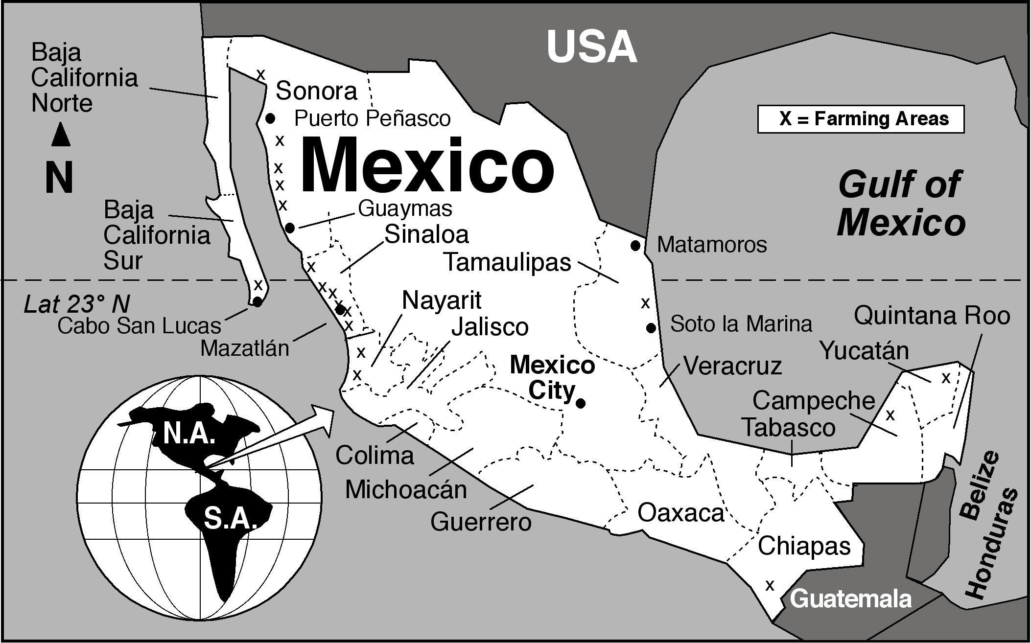
A case study of the Cabo Cortés tourism megaproject in Baja California Sur

Baja California Sur MapThe Cabo Cortés megaproject is planned for the area near Cabo Pulmo on the eastern side of the Baja California Peninsula. Cabo Pulmo, a village of about 120 people, is about an hour north of San José del Cabo, and on the edge of the Cabo Pulmo National Marine Park.The area is a semi-arid area, where water provision is a serious challenge.

The megaproject is centered on an extensive belt of mature sand dunes which fringe the coast immediately north of Cabo Pulmo.

The megaproject has been in the planning stages for several years, but Mexico’s federal Environment and Natural Resources Secretariat (Semarnat) recently gave Spanish firm Hansa Urbana the green light to begin construction. The controversial plans for Cabo Cortés involve building on the virgin sand dunes, and will undoubtedly have adverse impacts on the small village of Cabo Pulmo and the ecologically-sensitive Cabo Pulmo National Marine Park.

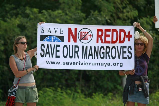
The Semarnat decision provoked the immediate ire of Greenpeace and other environmental campaigners, as well as local residents who fear being displaced from the small village of Cabo Pulmo by a proposed marina.

The value of the Cabo Pulmo National Marine Park

Jacques Costeau, the famous ocean explorer, once described the Sea of Cortés as being the “aquarium of the world.” This area of the Sea has been protected since 1995 and is now designated a National Marine Park. It was declared a “Natural Patrimony of Mankind” by UNESCO in 2005. The protected area, ideal for diving, kayaking and snorkeling, covers 71 sq. km of ocean with its highly complex marine ecosystem. Dive sites include underwater caves and shipwrecks.

The biological productivity of the Marine Park is amazing. Since the National Marine Park was established, the number and size of fish inside the park boundaries have increased rapidly. Studies show that the number of fish has more than quadrupled since 1995, owing to the exceptional productivity of the offshore reef area. The park is an outstanding example of the success of environmental protection efforts.

Cabo Pulmo is on the Tropic of Cancer, about as far north as coral usually grows. The water temperatures vary though the year from about 20 to 30 degrees C (68 to 86 degrees F). The seven fingers of coral off Cabo Pulmo comprise the most northerly living reef in the eastern Pacific. The 25,000-year-old reef is the refuge for more than 220 kinds of fish, including numerous colorful tropical species. Divers and snorkelers regularly report seeing cabrila, grouper, jacks, dorado, wahoo, sergeant majors, angelfish, putterfish and grunts, some of them in large schools.

The tourism megaproject

The project involves an area of 1,248 hectares (3,000 acres). Swathes of land will be cleared for two 18-hole golf courses. Water provision will require the extraction of 4.5 million cubic meters of groundwater a year from the Santiago aquifer, and the construction of 17 kilometers of aqueducts. The planned marina has 490 berths. When complete, the megaproject will offer more than 27,000 tourist rooms, almost as many as Cancún has today, and almost three times as many as currently in nearby Los Cabos. It is estimated that Cabo Cortés will generate 39,000 metric tons of solid wastes a year (about 2 kg/person/day).

Cover of Greenpeace's position paper on Cabo Cortés

Cover of Greenpeace’s position paper on Cabo Cortés

NGOs oppose Cabo Cortés

When challenged about the legality of granting permission for a project which will impact the Marine Park, Semarnat officials have claimed that the ecological criteria in Semarnat regulations are “suggestive” rather than “obligatory”.

Several NGOs have already launched protest campaigns. Alejandro Olivera is spearheading Greenpeace’s opposition to Semarnat’s decision. He has described the decision as “erroneous” and claims that the megaproject is “not congruent with the prevailing ecological regulations for the region, given that the construction of the marina is in direct contravention of the Los Cabos Ecology Plan which covers this region. The plan expressly prohibits any construction on shoreline dunes. Semarnat maintains that its authorization of a marina and elevated walkways will not affect the “structure or functioning of the area’s sand dune system”.

Olivera emphasizes that Greenpeace is not opposed to tourism as a development strategy, but that it believes in sustainable (responsible) tourism that respects the area’s carrying capacity. Meanwhile, a Greenpeace Spain spokesperson claims that the resort development model of Hansa Urbana, is fundamentally flawed and outdated, and that, when implemented in Spain, it resulted in unacceptable social and environmental costs.

Amanda Maxwell of the Natural Resources Defence Council (NRDC) has written a good summary of why the Semarnat decision should be opposed, entitled “Approval of the Cabo Cortés resort complex–next to the healthiest coral reef in the Gulf of California–is a huge step backward for Mexico

The 120 or so local residents who live in Cabo Pulmo village also oppose the plan and have formed an NGO called Cabo Pulmo Vivo. The existing village, which has no street lights, is a haphazard collection of homes and small businesses, including dive shops, stores and restaurants.

Cabo Pulmo Vivo organized on online petition calling for the Semarnat permits to be revoked.

Personal view, written following a visit in 2008

“We arrive in Cabo Pulmo as the sun is setting, relieved to finally find the end of the initially paved, then dirt, access road, which has been bounded by barbed wire ever since we caught our last clear views of the coast near La Ribera. At intervals behind the barbed wire are warning signs making it very clear that the land either side of the road is private.

Over a beer with Kent Ryan, the owner of Baja Bungalows, our base for the next few days, I learn that the newly erected fences mark the beginning of a major development of the coast immediately outside the National Marine Park. When I eventually got a chance to examine the masterplan, I can only say that I’m glad we visited Cabo Pulmo in early 2008 before this coast is changed for ever.” (Tony Burton in MexConnect)

Further information:

For an exceptionally informative series of papers (in Spanish) on all aspects of tourism and sustainability in Cabo Pulmo,  see Tourism and sustainability in Cabo Pulmo, published in 2008.

Another valuable resource (also in Spanish) is Greenpeace Spain’s position paper entitled Cabo Cortés, destruyendo el paraíso (“Cabo Cortés: destroying paradise”) (pdf file)

Dec 062010
 

Cancún is Mexico’s premier tourist destination, attracting more than 3 million visitors a year. A recent Associated Press report by Mark Stevenson highlights the problems faced by the resort due to the erosion of its beaches.

Cancún was developed on formerly uninhabited barrier islands on Mexico’s Caribbean coast. The islands were low-lying sand bars, held together by beach vines and the dense, interlocking roots of coastal mangroves. Hurricanes periodically swept over these small islands blowing loose sand towards the beaches on the mainland. Despite the occasional hurricane, the sandbars survived more or less unscathed until construction of Cancún, Mexico’s first purpose-built tourist resort, began in 1970.

As Cancún has grown, so the damage from hurricanes has become more serious. Category 4 Wilma in 2005 was especially destructive.

Cancún beach erosion

Cancún beach erosion. Photo: Dario Lopez-Mills/AP

Why has hurricane damage increased since 1970? Several factors are thought to play in a part in causing the increased rate of erosion of Cancún’s beaches in recent years:

  • hotels have been built too close to the shore, and too many are high-rise buildings. High-rise hotels deflect some of the wind downwards towards the ground. These wind eddies can stir up any dry surface sand in a process known as deflation.
  • hotels are too heavy. The sheer weight of high-rise hotels compacts the largely unconsolidated sediments beneath them, rendering the sediments less able to store or absorb excess water, and more liable to subsidence and structural problems. Extra weight also increases the load on slopes and leads to a higher incidence of slope failure.
  • coastal mangroves have been destroyed, removing their ability to protect the shoreline during storm events.
  • most beaches have been stripped of their original vegetation. The original beaches were protected by various adventitious vines which were quick to colonize bare sand. They would simultaneously help hold the sand in place, protecting it from wind action, and gradually add to the organic content of beaches to a point where they could support other, larger plants. Native vegetation has been mercilessly eradicated from Cancún’s beaches to create the tourism “ideal” of uninterrupted swathes of white sand.

It also appears that hurricanes and other tropical storms have become more frequent in recent decades, perhaps as a consequence of global climate change. The situation has also been exacerbated by the gradually rising sea level. Sea level on this coast is rising at about 2.2 mm/y.

Why have some of the efforts made to mitigate the beach erosion only made the situation even worse?

Following strong hurricanes (such as Wilma in 2005) Cancún has lost most of its beaches. The first attempt at beach restoration in 2006 cost 19 million dollars. In 2009, an even costlier (70 million dollar) beach restoration was carried out, using sand dredged from offshore. In one sense, the project was a resounding success. A new beach up to 60 meters wide, was created along some 10 km of coastline.

However, this new beach came at a considerable ecological cost. The pumping of sand from offshore disturbed the seafloor and damaged sealife, including populations of octupus and sea cucumbers. Fine sediments raised by the pumping traveled in suspension to nearby coral reefs, where it also had deleterious impacts.

In addition, the new beach is already being eroded away (some estimates are that up to 8% of the new sand has already been washed or blown away), so presumably if Cancún’s beaches are to be maintained in the future, beach restoration will have to become a regular event.

One hotel erected a breakwater or groyne on its beach to retain all the sand being carried along the coast by the process of longshore drift. The Associate Press article ends with a wonderful story of how the beach in front of this particular hotel was cordoned off by marines last year on the grounds that it was stolen property.

Link to 2013 news article: A fortune made of sand: How climate change is destroying Cancun

Tourism is one of Mexico’s major sources of revenue. But tourism, especially high-rise mass tourism such as that characterized by Cancún, comes with a hefty price tag. Policy-makers need to decide whether this price tag, which will only rise further in the future as we continue to damage our natural environment, is really one that is worth the cost.

Chapter 19 of Geo-Mexico: the geography and dynamics of modern Mexico looks in much more detail at Mexico’s purpose-built resorts as well as many other  aspects of tourism, resorts and hotels  in Mexico. Chapter 30 focuses on environmental issues and trends. Buy your copy today!

The 10 states of Mexico which have the longest coastline

 Other, Teaching ideas  Comments Off on The 10 states of Mexico which have the longest coastline
May 132010
 

Here are the ten states of Mexico which have the longest coastlines. Note that these figures are those published by the National Statistics and Geography Information Institute (INEGI). We discussed the impossibility of ever measuring a coastline accurately in a previous post:

How long is Mexico’s coastline?

RankStateLength of coast (km)
1Baja California Sur2,131
2Baja California1,493
3Sonora1,209
4Quintana Roo1,176
5Veracruz720
6Sinaloa622
7Oaxaca568
8Guerrero522
9Tamaulipas433
10Campeche425

Only seven other states have a marine coast. They are Jalisco, Yucatán, Nayarit, Chiapas, Michoacán, Tabasco and Colima.

The remaining 15 states (counting the Federal District as a state) are land-locked.

Q. What are the likely impacts on economic activity of either (a) having a coastline or (b) being landlocked?