Soil science and Mexico’s ancient kitchens

 Other  Comments Off on Soil science and Mexico’s ancient kitchens
Jun 212010
 

In an earlier post, we saw how archaeologists have gradually unraveled the history of the domestication of Mexico’s most important food plants.

Teotihuacan

Teotihuacan

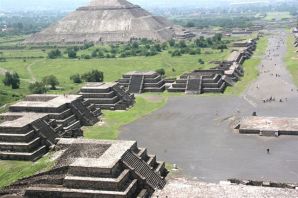
Other archaeologists, working at Teotihuacan, close to Mexico City, have been turning their attention away from how the upper classes lived (and ruled) to focus on the lives of the ordinary residents of suburbia fifteen hundred years ago. At its height (500 AD), Teotihuacan was one of the largest cities in the world, with an estimated population of 200,000. Its elaborate water supply and drainage systems and a precisely aligned grid demonstrate masterful urban planning. The city was so prominent that it became a magnet for craftsmen from other far-away regions like Oaxaca and the Gulf Coast (Veracruz). These migrants would have brought their own food ideas and preferences with them, making Teotihuacan an excellent choice for a cosmopolitan eating experience.

What most visitors to this ancient city today do not appreciate is how the average Teotihuacanos lived, how they cooked, and what they ate. But, between 1985 and 1988, cleverly conceived and executed fieldwork by a team directed by Linda Manzanilla of the National University (UNAM), unearthed a wealth of information about ancient food storage, preparation methods and kitchens. Manzanilla has demonstrated that age-old kitchens in Teotihuacan can be located by a combination of traditional archaeological methods (collecting artifacts, debris, pollen and food remains) alongside the microscopic and chemical analysis of the stucco floors in the multi-room apartment complexes used as residences and workshops.

It was already known that the stucco used on floors can absorb, over time, trace amounts of chemicals that serve as indicators of the predominant activities carried out in the room. Soil samples were taken from each square meter of floor and then analyzed for certain key indicators.

High levels of phosphates revealed areas where organic refuse was abundant. This could be a place where food was consumed, or where refuse was discarded. An elevated level of carbonates was assumed to reflect either a place where stucco was processed, or somewhere where tortillas were prepared. The tortilla-making process today still involves the liberal application of lime. A localized higher alkaline reading from the stucco floor was correlated to the location of heat or fire. The color of the soil samples was also checked for any indication of the limits of a particular activity.

Once an outline of the distribution of particular activities had been sketched out, the presence of sodium and iron was investigated. High levels of iron, for example, probably indicate where agave was processed, or where animals were butchered.

The end result? By correlating the various lines of evidence from this particular sixth century apartment, Manzanilla was able to pinpoint the precise locations of many everyday household functions. For instance, three areas where ceramic stoves once stood were distinguished. Each had a dark red stain on the floor, with relatively low carbonate values, relatively high alkalinity, and some ash. Significantly higher phosphate values in a band around this zone suggested an area used for eating. Higher phosphate levels were also encountered outside the dwelling where any refuse had been swept or accumulated.

And what was cooked on these stoves? We can not be certain, but evidence suggests that the residents of Teotihuacan had a varied diet of plants and animals. They not only prepared corn, beans, squash and chiles, but also ate cacti (prickly pear), hawthorns and cherries. For additional protein, rabbits, deer, duck, dogs, turkeys and fish were all on the menu, at least occasionally.

And, lest you think their likely diet sounds too bland, the locals also had access to potatoes and a plethora of herbs and spices, as well as chocolate, chewing gum and tobacco to satisfy their cravings, and various exotic hallucinogens to stimulate their imaginations!

So, next time you savor Mexican food, pause for a moment and remember that your meal may be startlingly similar to a banquet eaten thousands of years ago in any major Aztec, Toltec or Maya city…

Further reading

Manzanilla, Linda (1996) Soil analyses to identify ancient human activities. Canadian Journal of Soil Science.
The original article on MexConnect

The impact of NAFTA on urban growth in Mexico

 Other  Comments Off on The impact of NAFTA on urban growth in Mexico
Jun 192010
 

The North American Free Trade Agreement (NAFTA), signed in 1994, had a significant impact on the pace and pattern of urbanization in Mexico.

NAFTA removed tariffs on imported corn and beans.  Small Mexican producers could not compete with the cheap imports from the USA. As a result, an estimated 1.3 million agricultural jobs in Mexico were lost. Many of those who lost work in rural areas, moved to Mexican cities or to the USA to search for employment. Most of these drifted into the urban informal sector in cities throughout Mexico.

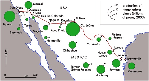
Geo-Mexico, figure 20.2

Geo-Mexico, figure 20.2 All rights reserved.

On the plus side, NAFTA created an estimated 500,000 jobs in Mexican manufacturing, mostly maquiladora assembly plants focused on the US market. These plants and their multiplier impacts generated rapid growth in border cities, particularly Ciudad Juárez, Tijuana, Mexicali, Matamoros, Nuevo Laredo, and Reynosa (see map).

Largely as a result of NAFTA, border cities grew faster during the 1990s than most other Mexican cities, essentially reversing the trend that existed during the 1980s. Though after 2000 many of Mexico’s border maquiladora industries moved to lower cost countries, most border cities continued to grow rapidly.

In conclusion, the overall NAFTA impact has strongly stimulated urban growth while fostering rural decline and out-migration.

Mexico’s first cooks and the origins of Mexican cuisine

 Other  Comments Off on Mexico’s first cooks and the origins of Mexican cuisine
Jun 182010
 

Mexican cuisine has been one of the country’s most successful cultural exports over the past twenty years or so and most large towns in North America and Europe now boast at least one Mexican restaurant, even if the menu is not necessarily “authentic”. For those wanting to experiment, the basic ingredients for Mexican meals can now be bought virtually everywhere. The increasing popularity of Mexican food has been rivaled only by an extraordinary increase in the consumption of Mexican drinks, including Corona beer and tequila.

Ingredients for guacamole. Photo: Chef Daniel Wheeler. All rights reserved.

Archaeologists have also taken much more interest in Mexican food in recent years.

By 1970, studies carried out at various locations, ranging from Tamaulipas in the north of the country to Oaxaca in the south, had gradually led to the conclusion that the earliest plants to be domesticated in Meso-America were corn, beans and squash, and that all three had been domesticated between about 7000 and 10,000 years BP (Before Present, not British Petroleum…).

Further research subsequently led most archaeologists and palaeo-botanists to believe that squash was actually domesticated much earlier than corn. Re-evaluating cave samples, originally collected in the 1950s, using an improved carbon-14 dating technique, anthropologist Bruce Smith found that the squash seeds from one location were between 8,000 and 10,000 years old, while the oldest corn and bean seeds were much younger, less than 6,000 years old.

While Smith’s study does appears to confirm that squash was domesticated first, it does not necessarily mean that this squash was domesticated for its food value. Many experts think that early varieties of squash may have been domesticated primarily for their gourds, which could be used as ready-made drinking vessels and fishing floats.

The domestication of squash may have improved life, but it did not fundamentally change it. On the other hand, the eventual domestication of corn, about 7,000 years BP marked a true watershed in pre-Hispanic life, enabling the abandonment of a nomadic hunter-gathering existence in favor of settlement in semi-permanent villages. How important was this? In the words of renowned archaeologist Michael Coe, “it was the cultivation of maize, beans and squash that made possible all of the higher cultures of Mexico.”

With the passing of time, the ancient peoples of Mexico domesticated and cultivated many other native plants, including tomatoes, chiles, potatoes, avocados, amaranth, chayote (vegetable pear), cotton and tobacco.

The original article on MexConnect

If you enjoyed this post, you might also enjoy Geo-Mexico: the geography and dynamics of modern Mexico.

Jun 172010
 

The nationwide figure for 2004 was 26 / 100,000 inhabitants. By way of comparison, the rates in the USA, Canada, and the UK were about 6, 2 and 2 respectively. The latest figures show that South Africa has a rate of 39 and Colombia 38.

The ten states with the worst murder rate in Mexico are:

RankStateIncidence of murders (/100,000 inhabitants)
1Guerrero36.8
2Oaxaca34.1
3Baja California30.4
4Sinaloa28.3
5Nayarit27.2
6Chihuahua26.6
7Michoacán26.1
8México25.3
9Quintana Roo22.1
10Durango21.9

Mexico’s crime figures are analyzed in chapter 28 of Geo-Mexico: the geography and dynamics of modern Mexico

Evolution of control on the Yucatán Peninsula

 Other  Comments Off on Evolution of control on the Yucatán Peninsula
Jun 122010
 

Throughout history the Yucatán Peninsula has been somewhat separate from the rest of Mexico. The pre-Colombian Maya civilizations were more closely linked to Guatemala and Central America than to central Mexico. It took the Spaniards and Mexicans almost 400 years to gain full control of the Peninsula.

In the 16th century, the Conquistadors needed about 25 years and numerous battles to establish a permanent foothold on the Peninsula, essentially limited to the area around Mérida. It would take another 150 years and tens of thousands of indigenous conscripts before they would gain effective control over the majority of Maya lands. There are a couple main reasons why this took so long.  First, the Yucatán had no gold or silver, so the Spaniards had less incentive to subjugate the Maya peoples. Second, the Maya were separated into numerous distinct political units each with its own army and will to resist.  In contrast, central Mexico was ruled by the Aztecs and once they were defeated it was easier to take control of the peoples under their rule. In the Yucatán, the Spaniards had to defeat and subdue scores of independent, highly motivated armies, which once subdued, were eager to rebel. Finally in 1697 the Spanish gained some measure of control of most Maya lands by defeating the Itza at Tayasal, which is now the town of Flores in the Guatemalan Petén. However, during the 18th century, most Maya communities retained essential autonomy and self rule.

After independence, control of the Peninsula was shared by Mexico, three separate Republics of the Yucatán (see an earlier post on the Republic of the Yucatán), and the Maya peoples. In general the Maya controlled the southeast and Criollos of the republics of Mexico or Yucatán controlled the northwest.

In 1847, the Caste War broke out when the Mayas rebelled against the Hispanic (Criollo) upper class that controlled the Yucatán Republic. The Mayas briefly gained control of virtually the whole Peninsula except for the cities of Merida and Campeche. However, within a year or two, the Criollos retook control of the northeast portion of the Peninsula. Campeche became independent from the State of Yucatán in 1858 and achieved full statehood in 1863.  However, the Mayas maintained control of the southeast portion of the Peninsula.  Skirmishes continued on and off for more than 65 years.

The British even recognized the independence of the Chan Santa Cruz Maya government in the southeast to facilitate trade with British Honduras, (now Belize).   In 1884 a treaty was signed reuniting the southeast with Mexico as the new State of Chan Santa Cruz.  But the treaty was canceled a year later when Chan Santa Cruz experienced a coup d’état.

In 1893the Britain withdrew their recognition of Chan Santa Cruz by signing an agreement recognizing Mexico’s sovereignty over the area.  This facilitated British industrial and railroad investment in President Porfirio Diaz’s Mexico.  However, the Mayas maintained de facto control of the area.

In 1901, the Mexican army took military control of the capital of Chan Santa Cruz, in the current State of Quintana Roo. A year later, the central government carved the territory of Quintana Roo from the State of Yucatán. However the government did not have full control of the area; small skirmishes continued. The official end of hostilities came in 1915 when the new Revolutionary Government of Mexico sent General Salvador Alvarado to the Yucatán to implement reforms that essentially eliminated the reasons for the skirmishes. Quintana Roo continued as a Territory until 1974 when it finally achieved statehood.

See also:

Many Mexican place names were changed following Mexican Independence (1821)

 Other  Comments Off on Many Mexican place names were changed following Mexican Independence (1821)
Jun 102010
 

This is the fourth and final part of our series of guest blogs by Fatimah Araneta.

Fatimah Araneta grew up in Mexico City. After gaining a Masters in City Planning at Berkeley, California, she opted to eschew city life and direct her energy and attention to living in tune with what’s left of Mother Earth before it all gets paved over and criss-crossed with cabled and non-cabled networks. She lives “off the grid” in the shadow of the volcano she prefers to call Chicnautécatl.

Part 4 – Many Mexican place names were changed following Mexican Independence (1821)

Finally, we come to what León-Portilla calls the fourth layer in a place name: the part applied during Mexico’s independent era. The purpose usually was to deliberately erase names that were too Castilian for the newly-born nation’s taste, as in the case of the state of Jalisco, which used to be Nueva Galicia, or Tamaulipas, which was formerly called Nuevo Santander. Both Jalisco and Tamaulipas are prehispanic names.

Sometimes the new place name was to honor a war hero. Today’s Ciudad Hidalgo used to be Tajimaroa; Ciudad Juárez’s old name was El Paso del Norte (today the city to the north of the border from Ciudad Juárez retains part of that name: El Paso, Texas).

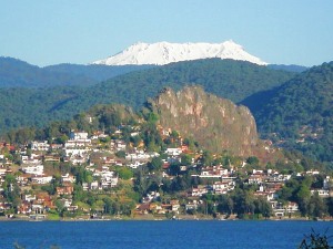
And coming back to the domains of the Nevado/Xinantécatl/Chicnautécatl, there is a small city about an hour’s drive to the west of the volcano with a place name history of its own. Nine hundred years ago it was a densely populated area, the focus of pilgrimages and of commerce, a place where produce, goods, news and ceremonies were exchanged between the people of the altiplano (the higher, cooler plains) and those of tierra caliente (the warmer lowlands). The Nahuatl name for it was Temascaltepec, “Place of the Hot Vapor Baths”.

Valle de Bravo

Valle de Bravo. Photo: Fatimah Araneta. All rights reserved.

Since it was contained in an ample valley, the Spaniards began to call it Valle de Temascaltepec. During the war for independence, the hero Nicolás Bravo and his army passed nearby, on their way from Chilpancingo to what is the state of Morelos today. Admittedly, none of them actually spent not even a night in Valle de Temascaltepec, but the proximity of their famously brave passage was enough for the the town to decide one day to drop the Temascaltepec and change its name to Valle de Bravo[1].

In view of all this one can only conclude that there is a great deal in a name, especially in a place name in Mexico, and that to wholly or partially modify a place name is to risk losing an important part of the memory of its past.

This concludes our mini-series on Mexican place names.

Bibliography

GARCÍA MARTÍNEZ, Bernardo, Los Nombres del Nevado de Toluca, in Arqueología Mexicana, Vol.VIII, no.43, pp.24-26, May-June 2000.

LEÓN-PORTILLA, Miguel, Toponimia e Identidad, in Arqueología Mexicana, Vol.XVII, no.100, pp. 28-33, November-December 2009.

SIERRA CARRILLO, Dora, San Miguel Arcángel en los Rituales Agrícolas, in Arqueología Mexicana, Vol.XII, no.68, pp74-79, July-August 2004.


[1] The dropped name was quickly claimed by a neighboring town, Real de Abajo, “Lower Mine”. It is one of twin towns located in an area of silver and gold mines (reales, in Spanish). The other town is called Real de Arriba, and still conserves that name. Real de Abajo must have felt uncomfortable all its life with its lowlier designation and quickly adopted the more elegant Temascaltepec to make up for its previous existence in the shadow of the “Upper Mine”.


Click on the word “placenames” or the “placenames” tag for more articles about Mexico’s place names.

Jun 092010
 

On January 1, 1846, the Criollo leaders in Merida declared independence as the Republic of the Yucatán for the third time. In 1847, the Caste War broke out when the Mayas rebelled against the Criollo upper class that controlled the Yucatán Republic. They drove most of the Criollos out of the Peninsula except for the those behind the walls surrounding Mérida and Campeche City.

With their back to the wall, the Yucatan Republic offered sovereignty over to Yucatán to either USA or Britain or Spain, whichever was first to effectively end the Maya revolt. In a desperate effort to put down the rebellion, the Yucatán Criollos agreed on 17 August 1848 to re-unite with Mexico if the Mexican army would put down the Maya rebellion. With fresh Mexican troops, they retook control over northwestern portion of the Peninsula. However, Mayas maintained control of the southeast for the rest of the 19th century and beyond. Skirmishes continued on and off for more than 70 years. Maya independent control of some parts of the southeastern Yucatán Peninsula did not end until after the Mexican Revolution.

See also:

The Spanish arrive and change lots of place names

 Other  Comments Off on The Spanish arrive and change lots of place names
Jun 072010
 

This is the third in our series of guest blogs by Fatimah Araneta.

Fatimah Araneta grew up in Mexico City. After gaining a Masters in City Planning at Berkeley, California, she opted to eschew city life and direct her energy and attention to living in tune with what’s left of Mother Earth before it all gets paved over and criss-crossed with cabled and non-cabled networks. She lives “off the grid” in the shadow of the volcano she prefers to call Chicnautécatl.

Part 3 – How the Spanish colonization of Mexico contributed to its place names

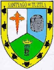
Santiago Tuxtla coat of arms

Santiago Tuxtla coat of arms

The third layer was bestowed by the Spanish colonizers. Some places received the names of cities in Spain, such as León (in the state of Guanajuato) or Córdoba (in the state of Veracruz). Sometimes the original Nahuatl was maintained but mispronounced so much that the name became corrupted, as in Churubusco, which used to be called Huitzilopochco. Some other times the name of a saint was added to the place name, as in Santiago Tuxtla, Santa Teresa Tiloxtoc or San Miguel Chapultepec.

The choice of the saintly counterpart to an already existing place name was hardly ever a frivolous decision. The different religious orders who set out to convert the indigenous populations to Christianity had their preferences. The Franciscans, for example, relied on Saint Michael to be their champion in the battle against the devils of the New World. Luckily for the evangelizing friars, Saint Michael also happened to possess attributes that made it easy for this religious icon to be accepted by the potential converts.

In the Old World, apparitions of Saint Michael had first taken place on mountaintops (high places near heaven from which he had banished Lucifer) and caves (since he was also in charge of assisting departing souls into the netherworld). Later, he would become involved in miraculous apparitions of springs of water, as in Mont Saint Michel in northern France, and was henceforth increasingly associated with the agricultural cycles of sowing and harvest.

At the same time, a very important figure in the prehispanic pantheon was Tláloc, the rain god, venerated too on mountaintops and at the entrances of caves, since it was believed that mountains were the containers of the weather. It was to Tláloc that one turned to ask for abundant rain for the crops, as well as mercy from the snakes of fire, or lightning bolts, that could inflict so much damage. Images of Tláloc depict him holding a bolt of lightning in one hand, not very differently from how images of Saint Michael show him wielding a flaming sword.

Thus, with this third layer of meaning, a place name in Mexico gives many clues to the past. If  “San Miguel” is part of the name it could be telling us that Franciscan friars had been in charge of the place at one time; that there could have been a cult to Tláloc; that the place was and could still be of hydrological importance; and that it could have been and could still be the focus of religious pilgrimages related to agricultural cycles.

The next part will consider how some Mexican places were rechristened during Mexico’s independent era (post 1821).

Click on the word “placenames” or the “placenames” tag for more articles about Mexico’s place names.

The Republic of the Yucatán

 Other  Comments Off on The Republic of the Yucatán
Jun 042010
 

After independence in 1821, the Federated Republic of Yucatán joined the Mexican federation in May 1823.  The new republic comprised the whole Yucatan Peninsula including what is now the states of Campeche and Quintana Roo.  It maintained a degree of autonomy in the Mexican federation.

In the mid 1830s President Santa Anna imposed a centrally controlled dictatorship, which imposed significant control over Yucatán.  This lead to a rebellion in 1838 seeking Yucatán independence. Negotiations with Santa Anna to give Yucatán more autonomy within the Mexican Republic stumbled.

In 1840 the Yucatán declared full independence as the Republic of the Yucatán. At the time, Santa Anna was preoccupied with rebellions in northern Mexico, but he did blockade Yucatán ports. At the time, there were no land routes between the Yucatán and either Mexico or Central America. In 1843 Mexico sent troops to Yucatán to put down the rebellion. They failed, but the blockade was successful. The young Republic had no navy and no way to trade because its ports were successfully blockaded. It agreed in December 1843 to rejoin Mexico when given assurances of self-rule.

But the assurances of self-rule were not upheld and the Yucatán declared independence again on January 1, 1846. When the Mexican–American War broke out later that year, Yucatán declared neutrality. While Mexico had its hands full fighting the USA, the Yucatán had its own problems. In 1847 the Mayas initiated the Caste War by rebelling against the Hispanic (Criollo) (creole) upper class that controlled the Yucatán Republic.

With its back to the wall in early 1848, the Yucatán Republic offered sovereignty over Yucatán to either USA or Britain or Spain, whichever was first to effectively end the Maya revolt. The USA invoked the Monroe Doctrine to keep the other two out and seriously considered the proposal, but in the end did not accept it.

In a desperate effort to put down the rebellion, the Yucatán Criollos agreed on 17 August 1848 to re-unite with Mexico if the Mexican army would put down the Maya rebellion. Thus the on and off  life of the Republic of the Yucatán came to an end. The peninsula remained relatively separate from the rest of Mexico. The first railroad link was established in the 1950s (see earlier post about the first map on a Mexican postage stamp) and the first highway in the 1960s.

See also:

Mexican place names often have their roots in pre-Hispanic languages and have multiple levels of meaning

 Other  Comments Off on Mexican place names often have their roots in pre-Hispanic languages and have multiple levels of meaning
Jun 032010
 

This is the second in our series of guest blogs by Fatimah Araneta.

Fatimah Araneta grew up in Mexico City. After gaining a Masters in City Planning at Berkeley, California, she opted to eschew city life and direct her energy and attention to living in tune with what’s left of Mother Earth before it all gets paved over and criss-crossed with cabled and non-cabled networks. She lives “off the grid” in the shadow of the volcano she prefers to call Chicnautécatl.

Part 2 – Mexican place names often have their roots in pre-Hispanic languages, and have multiple levels of meaning

In the first part, we looked at the possible origins of Chicnautécatl or Xinantécatl, aka El Nevado de Toluca, Mexico’s fourth highest peak. In this part we start to consider Miguel León-Portilla’s view that a single place name in Mexico can have up to four distinct levels of meaning.

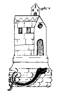
The first layer of meaning is more often than not a geographical description of the place in the language of its original inhabitants. Two examples in Oaxaca are Yodzo Coo, which in Mixtec means “Plain of the Snakes”, and Yacu Dzaa, Mixtec for “Hill of the Bird”.

coixtlahuaca

Coixtlahuaca (place of snakes)

The second layer is generally in Nahuatl, as the expansion of the Aztec empire made this language the lingua franca over an extensive territory over the course of several centuries. The Nahuatl name would almost always be a translation of the first place name. For example, the above mentioned Yodzo Coo was renamed Coixtlahuaca.

On other occasions, the Nahuatl name would be another geographic appreciation of the place, but this time from the viewpoint of the Aztecs. For example, the region occupied by the Purépecha nation was called Mechuaca, which is Nahuatl for “Place of Fish”. That region is roughly what today is the modern state of Michoacán. The Purépecha simply called their territory P’urhépecheo, “Place Where the P’urhé Live”, p’urhé meaning people, referring to themselves.

The next part in this mini-series will look at how a third layer was often bestowed on Mexico’s placenames by the Spanish colonizers who arrived in the early 16th century.

Click on the word “placenames” or the “placenames” tag for more articles about Mexico’s place names.

How Mexico’s fourth highest peak got its name

 Other  Comments Off on How Mexico’s fourth highest peak got its name
Jun 022010
 

We are delighted to publish a series of guest blogs by independent researcher Fatimah Araneta.

Fatimah Araneta grew up in Mexico City. After gaining a Masters in City Planning at Berkeley, California, she opted to eschew city life and direct her energy and attention to living in tune with what’s left of Mother Earth before it all gets paved over and criss-crossed with cabled and non-cabled networks. She lives “off the grid” in the shadow of the volcano she prefers to call Chicnautécatl.

Part 1 How Mexico’s fourth highest peak (Chicnautécatl) got its name

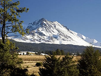
Chicnautécatl

Mexico’s fourth highest peak is an extinct volcano that rises elegantly above the city of Toluca. It is generally referred to as “el Nevado”, which is short for “el Volcán Nevado de Toluca”, Toluca’s Snow-Covered Volcano. Nowadays, however, the name is sadly inaccurate since the volcano is hardly ever covered in snow.

El Nevado is also known as Xinantécatl[1]. This name first appeared in an official registry in the second half of the nineteenth century. It sounds like Nahuatl, the language of the Aztecs, but historians have debated at length about its origin and meaning, questioning its authenticity. The closest place name that bears any etymological resemblance is the town of Zinacantepec, “Hill Where There Are Bats”. However, the volcano does not possess a significant bat population, and Zinacantepec is only one of dozens of small towns that surround it.

It is possible that the original name in Nahuatl had really been Chicnautécatl, “Nine Peaks”. This would dovetail nicely with the Lerma River’s old Nahuatl name of Chicnahuapan, “Nine Rivers”. The River Lerma is the result of the confluence of several streams that spring from the sides of the volcano.

An explanation offered by García Martínez of how “Chicnautécatl” could have become “Xinantécatl” is a not-so-farfetched series of errors, considering the lack of a basic alphabet in Nahuatl. It could all boil down to how the name was pronounced by one person, written down by a second, and later read and copied, or rather miscopied, by a third.

The number nine in nahuatl is “chicnaui” and that is how it is generally written now, but it can be pronounced “shicnaui” as well as “chicnaui”. It is possible that one person informed a second that the volcano was called “Chicnautécatl”, pronouncing it with a “sh” sound, and the one who listened wrote an “X” for the beginning “sh” sound (the Castilian alphabet has no letter for the “sh” sound). So, it may have been registered as “Xinautécatl”. Then, according to this line of thought, a third person misread the name, mistaking the “u” for an “n”, or miscopied it, writing an “n” instead of the “u”, thus giving rise to “Xinantécatl”.

However it may have been, the volcano is still more often referred to as “el Nevado”.

Fortunately, the origins of most place names in Mexico are more straightforward and comprehensible. The next part of this article examines why many Mexican place names have up to four distinct layers of meaning.


[1] In Mexican Spanish, the “x” can be pronounced “s” as in sun, “sh” as in shoe, “h” as in hat, or “x” as in taxi. In the case of “Xinantécatl” it is pronounced “s”.

Click on the word “placenames” or the “placenames” tag for more articles about Mexico’s place names.

How big is Lake Chapala?

 Other  Comments Off on How big is Lake Chapala?
Jun 012010
 

“How big is Lake Chapala?”

There is no single answer to this question.  It all depends on the reference point in time.

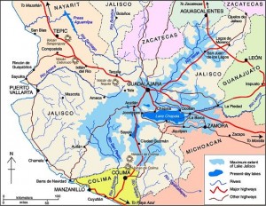
The extent of the former Lake Jalisco (click image to enlarge map)

Some geologists suggest that 40,000 years ago, the Lake’s surface area was seven times its current size and its volume about 200 times greater.  At that time, the Lake towered almost 700 feet above what is now Guadalajara and stretched nearly to Aguascalientes (see map).  The decline of this massive ancient lake resulted from sedimentation, tectonic faulting and the cutting of a fantastic drainage gorge by the Rio Santiago  (see Jack Leyden’s “The geology and geography of Lake Chapala and western Mexico”, on MexConnect.com)

In recent history, the size of the Lake has continued to change dramatically.  In the 19th century, the Lake stretched almost 20 kilometers farther east.  Construction of an 80 kilometer dike and drainage system in 1908 attempted to capture a large portion of the lake for agricultural use.  Through a series of successive floods, partially attributed to the Poncitlán Dam on the Rio Santiago, the lake recaptured the land.  However, the dikes were re-constructed and the land eventually converted to permanent farmland, only occasionally disrupted by flooding.  Environmentalists argue that this has destroyed an important ecological role of this once important marshland.

The size of Lake Chapala has fluctuated significantly in recent decades; from extreme lows in 1954-56, 1992 and 2003 to highs in the 1960-70s and 2005-06.  These dramatic low to high changes can increase the Lake level by 8 meters, its volume by a whopping 800% and its surface area by 100%.   Fortunately, the Lake is at a relatively high level as we approach the 2010 rainy season.

Obviously, answering the question, “How big is Lake Chapala?” is very time sensitive.   In November 2009, Lake Chapala was about 75 by 25 kilometers with a surface area of 1150 square kilometers and a volume of 5.5 billion cubic meters (bcm).

Lake Chapala is sometimes called the largest lake in Mexico, but even this can be questioned.  It is the largest in terms of surface area. But with its shallow depth it is not the largest in terms of volume. The amount of water it holds, even when full to maximum capacity, is only 8.1 bcm.  It trails three reservoirs behind hydroelectric dams: La Angostura (10.7 bcm), Malpaso (9.6 bcm) and Infiernillo (9.3 bcm). But we must remember that the volume of all Mexico’s lakes and reservoirs varies enormously from season to season and year to year.

What about the future?  All lakes are destined to disappear because they all eventually fill completely with sediment.  In the not too distant geologic future, Lake Chapala will be gone.  Speaking of the future, geologic fault systems aligned with Lake Chapala, working with nearby fault systems, will eventually create a large Pacific island from a big chunk of western Mexico containing Puerto Vallarta and Manzanillo.

These topics are discussed in greater detail in previous Geo-Mexico.com posts:

The origin of tequila

 Other  Comments Off on The origin of tequila
May 292010
 

Mexico’s favorite “tipple” has a long and fascinating history. Historians have debated for years precisely when the spirit was first distilled, and precisely where this took place.

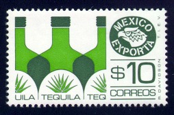
“Mexico Exporta” – tequila

John Pint, writing in MexConnect, has written a great article about the area around the town of Tequila (Jalisco), the heartland of tequila production. He presents a strong case that the nearby town of Amatitan has a longer history of tequila making than Tequila, and explored the backcountry for the remains of what is reputed to be the first place where tequila was distilled by native people, finding ruins of early ovens which may predate the  Spanish conquest. The article includes a fine series of photos.

John Pint’s article on MexConnect.

Tequila gets several mentions in Geo-Mexico: the geography and dynamics of modern Mexico. Tequila volcano is included on the map of Mexico’s major volcanoes in chapter 2, while the importance of tequila (the spirit) and other “agricultural” exports is examined in chapter 20.

Related posts:

The short-lived Republic of the Río Grande

 Other, Updates to Geo-Mexico  Comments Off on The short-lived Republic of the Río Grande
May 272010
 

Leaders in the northern Mexican states of Coahuila, Nuevo León and Tamaulipas met in Laredo on 17 January 1840 and declared independence as the Republic of the Río Grande.  They hoped to gain independence from the central Mexican government as Texas had done in 1836. Unfortunately for the infant republic, the state legislatures in the three states did not support their rebellion.

The new government of the Republic of the Río Grande moved often to avoid being captured by the Mexican federal troops. They started in Laredo, the republic’s initial capital, but in the first few weeks moved to Guerrero, Tamaulipas. Next they moved to Victoria in the new Republic of Texas, where it remained.

The insurgent forces, under General Canales were composed of state militias from the three states and volunteers from the Republic of Texas, which was sympathetic to the cause of the Republic of the Río Grande, but unwilling to jeopardize their new independence by officially recognizing and providing troops to the Republic of the Río Grande.

The insurgents and federal forces battled several times during the middle of 1840.  When the federal forces won the March 24–25 Battle of Morales (Coahuila), the surviving insurgents, under General Canales, retreated to San Antonio, Texas.  In June, a group of insurgents under Colonel Jordan captured Ciudad Victoria, the capital of Tamaulipas, and had ideas of marching on San Luis Potosí.  Instead they marched to Saltillo and in October attacked the federal forces there. From there they retreated back into Texas.

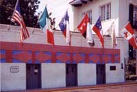
Republic of Río Grande Museum, Laredo

After that battle, it became clear that the insurgent forces could not sustain the rebellion. On November 6, 1840 the Republic of the Río Grande ended when General Canales agreed to end the rebellion in exchange for a brigadier general position in the federal army. The short-lived republic lasted a total 294 days.

Additional information is available at the Republic of the Rio Grande Museum in Laredo (photo).

The evolution of Mexico’s political boundaries is discussed in chapter 12 of Geo-Mexico: the geography and dynamics of modern Mexico.

Listen to Geo-Mexico author on KMEXRadio.fm

 Other  Comments Off on Listen to Geo-Mexico author on KMEXRadio.fm
May 262010
 

KMEXRadio.fm has broadcast an interview with Richard Rhoda, the lead author of Geo-Mexico: the geography and dynamics of modern Mexico. The interview, by Amigo Rodrigo,  first aired at 8:15 AM Central Daylight Time (CDT) on Wednesday May 26, and will air again later today (Wednesday May 26) at 6:15 PM CDT  (that’s 7:15 Eastern, 5:15 Mountain and 4:15 Pacific).

You can hear the interview on http://www.kmexradio.fm/about-kmexradio-for-american-expatriates-living-in-l. Just click the big LISTEN at the top of the page.  The interview will be aired numerous times in the next few weeks.

Links for more information about KMEXRadio.fm

Mexico’s population density compared to other countries. Is Mexico too crowded?

 Other, Teaching ideas  Comments Off on Mexico’s population density compared to other countries. Is Mexico too crowded?
May 192010
 

It is sometimes claimed that Mexico is ‘too crowded’ or ‘overpopulated’. Overpopulation, however, is an elusive concept, since it depends on the complex relationships between total population (and/or population density) and the resources available to support that population. In turn, the value of these resources depends in part on the technologies available to utilize them.

Even accepting that Mexico is not over-populated (since it apparently has sufficient resources to support its population), it is still interesting to compare Mexico’s population density with that of other countries.

CountryPopulation Density (persons per sq. km)
Mexico55
Bangladesh1127
India359
Japan337
UK337
Germany229
Italy200
Nigeria167
China 139
Indonesia121
Colombia40
USA31
Venezuela29
Brazil22
Argentina14
Canada3

As the table shows, Mexico’s overall population density of 55 persons per km2 is low, compared to Asian and European countries: Bangladesh (1127), India (359), Japan (337), UK (255) and Germany (229).

On the other hand, it is easily the highest among large countries in the New World like Colombia (40), USA (31), Venezuela (29) and Brazil (22).

Q. What are the implications for development of a country having a high density of population?

In a future post, we will consider whether or not Mexico’s population is evenly distributed across the country.

Perceptions of Mexico, from popular images to the “real” Mexico

 Other, Teaching ideas  Comments Off on Perceptions of Mexico, from popular images to the “real” Mexico
May 182010
 

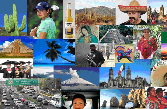
What comes to mind when the word “Mexico” is mentioned?

For most people, it brings to mind a variety of colorful images, such as those below, usually based on television, magazines, travel brochures and personal travels in Mexico. “Mexico” also is associated with verbal or written words or phrases, such as:

  • Drug wars
  • Illegal immigrants
  • Tacos and tamales
  • Tequila / Good beer
  • Fabulous beach resorts
  • Bargain prices
  • Poverty
  • Friendly people
  • Carlos Slim (the World’s richest man)
  • Deserts and cactus
  • Swine flu
  • Pre-Columbian ruins
  • Sombreros
  • Geo-Mexico (well maybe that last one is wishful thinking, but hopefully it will true someday)

Q. How many of these images can you identify?

These images and word phrases hold some truth, but do not begin to capture the full importance and significance of Mexico, something we try to do more thoroughly in Geo-Mexico: the geography and dynamics of modern Mexico.

For example, did you know that Mexico is one of only six countries ranked in the top 15 in the world in geographic size, population, and economic production? Furthermore, Mexico is one of the earth’s most biologically diverse countries. It ranks first in number of reptile, cactus and pine species; second in mammal species; and fourth in amphibian species.

There is lots more to Mexico than meets the eye in magazine and TV adverts – and that’s why you should consider buying your own copy of Geo-Mexico: the geography and dynamics of modern Mexico, rather than relying on your local library or extracts posted on this blog!

Where to find Mexico’s most beautiful señoritas

 Other  Comments Off on Where to find Mexico’s most beautiful señoritas
May 142010
 

The British-born journalist William English Carson (1870-1940) spent four months in Mexico, in 1908-1909, collecting material for his “Mexico, the Wonderland of the South“, never straying far from the railways. Always an enthusiastic traveler, many of his views about Mexicans will strike modern readers as stereotypical. For example, Carson devoted an entire chapter to “The Mexican Woman“. Many of Carson’s pronouncements read today as outrageous over-generalizations. Select quotes from the chapter include:

  • “no foreigner, unless he be associated with diplomacy, is likely to have any chance of studying and judging the Mexican women”
  • “the Mexican girl has but two things in life to occupy her, love and religion”
  • “As a rule, the Mexican women are not beautiful”.

Miss Mexico 2009

After due analysis, the latter claim can be swiftly disposed of! See, for example, this article on MexConnect.

Want to find out which state in Mexico has the most beautiful young señoritas? In chapter 13 of Geo-Mexico: the geography and dynamics of modern Mexico, we use locational quotients to analyze the geography of beauty pageant winners in Mexico

This is an edited version of an article originally published on MexConnect, partly based on chapter 52–“A place of contrasts”–of Lake Chapala Through the Ages, an anthology of travellers’ tales (Sombrero Books, 2008).

The 10 states of Mexico which have the longest coastline

 Other, Teaching ideas  Comments Off on The 10 states of Mexico which have the longest coastline
May 132010
 

Here are the ten states of Mexico which have the longest coastlines. Note that these figures are those published by the National Statistics and Geography Information Institute (INEGI). We discussed the impossibility of ever measuring a coastline accurately in a previous post:

How long is Mexico’s coastline?

RankStateLength of coast (km)
1Baja California Sur2,131
2Baja California1,493
3Sonora1,209
4Quintana Roo1,176
5Veracruz720
6Sinaloa622
7Oaxaca568
8Guerrero522
9Tamaulipas433
10Campeche425

Only seven other states have a marine coast. They are Jalisco, Yucatán, Nayarit, Chiapas, Michoacán, Tabasco and Colima.

The remaining 15 states (counting the Federal District as a state) are land-locked.

Q. What are the likely impacts on economic activity of either (a) having a coastline or (b) being landlocked?

The mud volcanoes known as Los Negritos, in Michoacán, Mexico

 Other  Comments Off on The mud volcanoes known as Los Negritos, in Michoacán, Mexico
May 112010
 

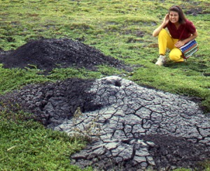
Los Negritos (the Little Black Ones) are a legacy of the volcanic heritage of most of central and western Mexico. They are located a few kilometers east of Jiquilpan in the state of Michoacán.

Two of the “Los Negritos” mud volcanoes. Photo: Tony Burton. All rights reserved.

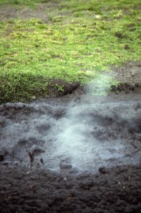
Los Negritos are small mud volcanoes (up to a meter or two across) which burble and gurgle, hiss and splutter, and occasionally erupt, throwing hot mud into the air and emitting sulfurous fumes. They are great fun to watch, but take care! Don̓t get too close or you may be splattered with the hot mud. Worse yet, you could step in the innocuous-looking but highly unstable surrounding mud patches which can rarely hold a person’s weight.

Other vestiges of volcanic action include several geysers, including the one at Ixtlán de los Hervores and the many thermal hot springs, now often utilized for tourist facilities and spas, scattered  throughout Mexico’s Volcanic Axis.

This is an edited extract from Western Mexico, A Traveler’s Treasury (Sombrero Books 2013).

Mexico’s volcanic landscapes are discussed in chapters 2 and 3 of Geo-Mexico: the geography and dynamics of modern Mexico.

Mud volcano puffs into action. Photo: Tony Burton. All rights reserved.

May 072010
 

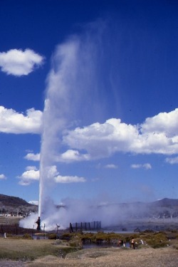
The geysers of Ixtlán de los Hervores have long attracted the attention of travelers. They are located north-west of the city of Zamora in the state of Michoacán. The temperature of the water emerging from underground varies between about 90 and 100 degrees Centigrade.

Here is how English explorer Captain George Lyon described them following his visit in 1826:

Photo: Tony Burton. All rights reserved.

”The plain is interesting, as being in some places covered by an efflorescence of muriate of soda, which forms a considerable article of commerce. The saline earth is collected into large vats, through which water is filtered, and then placed to evaporate in small well-cemented beds of about twelve feet by six. All this, however, interested me but little in comparison with the wells of boiling water, which to the amount of many hundreds are dispersed in a space of one mile and a half by a quarter of a mile in width, east and west along the plain, and sending up at intervals clouds of steam. In fact the whole surface of this place is nothing more than the crust of a volcano; and seven years back an earthquake opened a large rent in the plain,whence issued  fountains of the purest water, and of mud also, both of a boiling heat.

In the evening I rambled amongst the springs, which are of all forms and sizes, from holes not larger than an inch, through which the water is seen and heard boiling beneath, to large spaces of several yards in diameter; some as transparent as though distilled. Others, within a foot of them are turbid, or of boiling mud; and there is one called “El Pozo Verde,” in which, although perfectly clear, the water is of a fine deep green. The springs are in some places constantly tranquil, and varying in temperature  from 110̊ to 130̊; but in far the greater number the water boils up with amazing force and in one well, chosen at random, I cooked a piece of mutton of the size of an egg in four minutes and fifty seconds. All the fountains which have been sufficiently small to admit of it, have been choked up with stones and bushes, to prevent cattle from falling into them; yet a number of poor beasts are frequently thus destroyed.”

Lyon, G.F. 1828 Journal of a residence and tour in the Republic of Mexico in the year 1826, with some account of the mines of that country. London: John Murray.

Mexico’s volcanic landscapes are discussed in chapters 2 and 3 of Geo-Mexico: the geography and dynamics of modern Mexico.

The wettest states in Mexico

 Other  Comments Off on The wettest states in Mexico
May 012010
 

The “top ten” states in Mexico for annual precipitation amounts are:

RankStateAnnual precipitation (mm)
1Tabasco2,406
2Chiapas1,969
3Oaxaca1,519
4Veracruz1,492
5Puebla1,271
6Quintana Roo1,263
7Campeche1,169
8Guerrero1,105
9Yucatán1,091
10Nayarit1,069

No other state normally receives more than 1,000 mm of precipitation, which in Mexico’s case is almost entirely rainfall.

As is evident from this list, the southern half of Mexico receives significantly more precipitation than the northern half. Among other implications, this means that the risk of flooding is greatest in states on this list such as Tabasco that are also low-lying and/or poorly drained.

Apr 302010
 

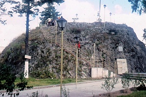
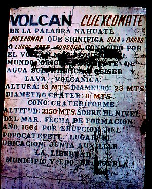
The Cuexcomate volcano, in a suburb of the city of Puebla, is generally considered to be the world’s smallest volcano.

The world's smallest volcano

Weighing in at an estimated 40 metric tons, it stands just 13 meters (43 feet) tall, with a reach (diameter) of 23 meters (75 feet). The name Cuexcomate derives from the Nahuatl Cuexcomac which means bowl or place for keeping things.

Mexico has thousands of volcanoes, and many very interesting ones, but Cuexcomate must surely be the only volcano in the country with a spiral staircase inside it! The volcano formed in 1664, as an offshoot parasitic cone during an eruption of a much larger volcano, Popocatépetl.

Cuexcomate is considered “inactive” and highly unlikely to burst into renewed activity. However,  Popocatépetl itself has been increasingly active over the past few years, leading to several temporary evacuations of the villages around its base. If Popocatépetl were to erupt violently again, some locals believe that perhaps the subterranean link to Cuexcomate might be re-established and the world’s smallest volcano could become somewhat larger…

Let’s hope that never happens. It would bring an end to one of the more unusual tourist attractions in this part of Mexico. Climbing down a spiral staircase into claustrophobic darkness is hardly an everyday experience for a tourist, or indeed for a vulcanologist. The crater is about eight meters across. Inside there is, frankly, not much to see apart from the inevitable lava!

Cuexcomate volcano is located in a residential suburb of the city of Puebla, a city better known for its proximity to archaeological sites, colonial buildings and a massive Volkswagen factory.

Factual note:
The world’s smallest active volcano is probably Mount Taal, located near the city of Tagaytay in the Philippines. It is a positively gargantuan 508 meters (1,660 feet) high, more than thirty-nine times the height of Cuexcomate, its Lilliputian cousin.

This is an edited version of an article first published on MexConnect: Original article

Volcanoes, in all their sizes and shapes are discussed in chapter 2 of Geo-Mexico: the geography and dynamics of modern Mexico

An early scientific account of Lake Chapala, Mexico’s largest natural lake

 Other  Comments Off on An early scientific account of Lake Chapala, Mexico’s largest natural lake
Apr 272010
 

The first detailed scientific account of Lake Chapala was written by Henri Guillaume Galeotti. It was based on a visit to Chapala in February-March 1837, and published in French in 1839.

Galeotti (1814-1858) was born in Paris and  studied natural history at the Establissement Géographique de Brussels, founded in 1830 by Philippe Vandermaelen, a very famous Flemish cartographer. Vandermaelen produced an extraordinary world atlas, published in 1827, with 400 maps in six volumes, covering the entire world at a uniform scale of about 1:1,600,000.

Galeotti arrived in Mexico in December 1835; it turned out to be a visit which lasted several years. Galeotti was primarily a botanist, and was responsible for the first scientific descriptions of scores of plants, including a wide variety of cacti, for which he had a particularly fondness.
In his account of Lake Chapala, Galeotti starts with a detailed description, before providing some personal observations of storms:

“We have observed in the lake the phenomenon of occasional waves (seiches) which are in the habit of lasting plenty of time, with one part of the water remaining calm next to the rough part. This usually occurs at about five in the afternoon. We noted several of these singular effects, on February 27 and 28, and in March of 1837: the weather was calm and the temperature between 18 and 22 degrees Centigrade. The phenomenon is visible on the southern shore and in Tlachichilco and Chapala. The flood water rises from one to four feet (from 33 centimeters to 1.33 meters)…”

“From time to time, very strong whirlwinds or cloudbursts agitate the lake, snatching fish from their hideouts, and hurling them onto the nearby mountains. Some have been found on quite a high mountain near Ixtlahuacan, two leagues from the lake.”

Early map of Lake Chapala (Galeotti, 1837)

Galeotti goes on to provide a rich account of the varied flora and fauna, especially the birdlife, around the lake, including:

“(the) water sheep or pelicans (Pelecanus) which live on the island of Chapala, and fly in flocks of 50 or 60 individuals, at about five in the afternoon, to search for food on the shores, where some little fish called javai are abundant. The pelicans are very fierce and plump, and have white feathers with a yellowish green tint at the tips of their wings.”

“There is a great diversity of fish in the waters of the lake. The whitefish and the bagoc are very well-liked for the table. A great quantity of fish is caught in Easter week. The inhabitants of the vicinity subsist on little else apart from the product of this fishing, for which they prepare by building reed shacks on the shores of the lagoon, and lighting large bonfires between 6 and 7 in the evening to attract the fish.”

All in all, his article is a remarkable achievement for its time, and a true testimony to the powerful pull that Lake Chapala has had on so many foreign visitors.

Source: Galeotti, H. G. 1839 Coup d’oeil sur la Laguna de Chapala au Mexique, avec notes géognostiques. Translations by the author; all rights reserved.
Note:  This is an edited version of an article originally published on MexConnect, based on chapter 21–“The natural history of Lake Chapala”–of  Tony Burton’s Lake Chapala Through the Ages, an anthology of travelers’ tales (Sombrero Books, 2008).

The hydrology of Lake Chapala is discussed in chapters 6 and 7 of Geo-Mexico: the geography and dynamics of modern Mexico. A case study of ‘residential tourism’ in the villages on the northern shore of Lake Chapala is discussed in chapter19 of Geo-Mexico: the geography and dynamics of modern Mexico.

Related posts about Lake Chapala

Los Mochis and Topolobampo are two examples of “new towns” in Mexico

 Other  Comments Off on Los Mochis and Topolobampo are two examples of “new towns” in Mexico
Apr 262010
 

In north-western Mexico, two towns in close proximity—Los Mochis and Topolobampo—are both examples of “new towns”. Many Mexican towns and cities are more than 500 years old; relatively few major settlements in the country are less than 150 years old. How did it come about then that these two “new towns” in the state of Sinaloa were founded so close to one another?

Topolobampo dates back only as far as 1872, when a US engineer, Albert Kimsey Owen (1847-1916) arrived. Owen envisaged the city as a U.S. colony centered on sugar-cane production in this previously unsettled area and as the terminus for a railway across the Sierra Madre Occidental.

Owen had been raised in New Harmony, the city founded by Robert Owen (no relation) and decided to try and found a similar “ideal socialist” city somewhere in Mexico. In 1871-1872 he visited Chihuahua and Sinaloa and decided that the site of present day Topolobampo was ideal for his purposes. Owen founded the Texas, Topolobampo and Pacific Railroad and Telegraph Company (later the American and Mexican Pacific Railroad) and in 1881 was granted the concession for the settlement of a town.

Settlement began in October 1886. Two and a half years later, in April 1889, the first large group of colonists—300-strong—set sail from New York, arriving in Sinaloa in July, only to find a deserted beach and no Owen. Owen had returned to the USA but finally arrived the following year with another 30 colonists. During 1891, 70 more settlers arrived. They founded several additional settlements including Vegatown (Estación Vega), La Logia, El Público and El Platt. They also dug an irrigation canal, 12 kilometers long, to divert water from the Fuerte River across their lands. Despite their heroic efforts, the farming project was eventually abandoned, though the town of Topolobampo struggled on.

The Henry Madden Library of the California State University, Fresno, houses an amazing visual record of those early years, based on photos dating back to 1889-90 taken by Ira Kneeland, one of the first settlers.

Meanwhile, in 1893, another American, Benjamin Francis Johnston (1865-1937) founded the Eagle Sugar Co. (Compañia Azucarera Aguila S.A.) and constructed a factory, church, airport, dam, and the Memory Hill lighthouse. Ten years later, in 1903, Johnston officially founded Los Mochis. Johnston came to own more than 200,000 hectares. He built a veritable palace of a residence, including an indoor pool and even an elevator, one of the first in the country. The mansion’s garden, full of exotic plants, is now the city’s botanical gardens, Parque Sinaloa. The mansion itself was later torn down for a shopping plaza.

Historians and geographers have long questioned the precise motives of both Owen and Johnston, whose efforts have been described as more akin to capitalist expansion and neo-imperialism than any form of socialism. If they had come to fruition, Owen’s projects could have resulted in the annexation of a million square kilometers to a USA which had ambitious ideas of expansion at the time. Owen has been labeled variously a visionary, a madman or a conman and fraudster. Similarly, Johnston has also been regarded by some as a stooge for grandiose US expansionist plans.

Whatever the motives of their founders, both Topolobampo and Los Mochis had their start and have rarely looked back. Los Mochis gained importance as a major commercial center, marketing much of the produce grown on the enormous El Fuerte irrigation scheme. A large proportion of this produce is exported to the U.S. via the famous Copper Canyon railway. Los Mochis is the passenger terminus at the western end of the  line. For freight, the line continues to Topolobampo, “the lion’s watering place” or “tiger’s water”. The port, with its shrimp-packing plant, is at the head of one of Mexico’s finest natural harbors, the head of a drowned river valley or ria, which affords an unusually high degree of security in the event of hurricanes.

This is an edited version of an article originally published on MexConnect. Click here for the original article

Urban settlements in Mexico are discussed in chapters 21 and 22 of Geo-Mexico: the geography and dynamics of modern Mexico, with urban issues being the focus of chapter 23.

Las Tuxtlas Biosphere Reserve in Veracruz, Mexico

 Other  Comments Off on Las Tuxtlas Biosphere Reserve in Veracruz, Mexico
Apr 172010
 

Scenically, the entire Tuxtlas region, in the south-eastern section of the  state of Veracruz, is one of the most fabulously beautiful in all of Mexico. High temperatures combined with lots of rainfall result in luxuriant vegetation and boundless wildlife. Average monthly temperatures range from a pleasant 21 degrees C (70 degrees F) in January to a high of 28 degrees C (82 degrees F) in May, just before the rainy season kicks in. During the rainy season, from June to October, some 2000 mm (79 inches) of rain falls, often in late afternoon tropical deluges.

The jungle masking the lower slopes of the San Martín volcano gradually merges into tropical cloud forest at higher altitudes. Competing with the Silk Cotton (Kapok) and Ficus trees for light and sustenance are ground-hugging ferns. Overhead, the tangle of tree branches provides support for thousands of non-parasitic bromeliads (“air” plants) and orchids. More than 1300 species of flowering plants have been identified in this classic area for Neotropical ecology.

Bird-watchers are likely to spot the spectacular Keel-billed Toucan, or hear a Tody Motmot. Smaller birds include several species of hummingbird; look for the endemic Long-tailed Sabrewing. About half of all the bird species recorded in Mexico have been seen here, but birds are not the only wild animals inhabiting the jungle. Ocelots and tapirs are regularly seen and you may be lucky enough to see spider monkeys playing overhead in the canopy.

Clearance of the land for grazing and cultivation of the slopes to grow tobacco, bananas and sugar cane have reduced the original jungle to a relatively small number of isolated fragments. Fortuitously, this provides more varied habitats than the original vegetation, helping to enrich the area’s wildlife, further enhancing the region’s reputation as an ornithological and botanical paradise.

Fortunately an extensive area of this region was declared a Biosphere Reserve in 1998, ensuring that conservation programs now go hand-in-hand with human activities. The total area forming the Reserva de la Biósfera “Los Tuxtlas” is 155,122 hectares (380,000 acres).

Click here for original article on MexConnect

Mexico’s varied climate zones are discussed in chapter 4 of  Geo-Mexico: the geography and dynamics of modern Mexico, while chapter 5 is devoted to Mexico’s ecosystems and biodiversity, including the nation’s many biosphere reserves.

An overview of Mexico’s indigenous peoples

 Other  Comments Off on An overview of Mexico’s indigenous peoples
Apr 162010
 

How many indigenous people are there?

According to INEGI figures, about six million Mexicans over the age of five speak at least one indigenous language. Another three million Mexicans consider themselves indigenous but no longer speak any indigenous language.

How many indigenous towns or villages exist?

INEGI figures show that, in over 13,000 localities, more than 70% of the population speaks an indigenous language. Most of these localities are small rural settlements with fewer than 500 inhabitants. These settlements are often highly marginalized, with high levels of poverty.

Speaking an Indian language is associated with disadvantage

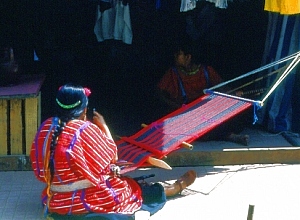
Oaxacan weaver. Photo: Tony Burton. All rights reserved

Speakers of indigenous languages fall way below the Mexican average on almost any socio-economic indicator. For instance, almost 33% of indigenous-speakers are illiterate, compared to a national rate of 9.5%. Females are particularly disadvantaged – indigenous females stay in school a full year less than their male counterparts, and for only half the time that the average non-indigenous female does. Even today, almost 5% of indigenous infants die before reaching their first birthday. A third of indigenous houses lack electricity; more than half do not have piped water.

Where do the indigenous people live?

More than 92% of the indigenous population lives in central and southern Mexico. With the notable exception of the 50,000+ Tarahumara Indians who live in the remote Copper Canyon region of Chihuahua, other indigenous groups in northern Mexico have relatively small populations.

The reason is largely historical. The major pre-Columbian civilizations in Mexico—Maya, Aztec, Zapotec, etc—developed in central or southern Mexico. The north always had fewer indigenous people. The disparity in numbers between north and south was heightened in early colonial times, as Spain expanded its territorial interests in New Spain along two major axes of economic development: the Mexico City-Veracruz corridor (the major trade route linking the capital to the port and Europe) and the Mexico City-Zacatecas corridor (the major route linking the capital to valuable agricultural and mining areas). It is no coincidence that indigenous languages and customs first died out along these corridors, as the indigenous people were forced to become assimilated into the developing dominant culture.

Indigenous peoples and languages did much better in the south. At last count, Oaxaca has over one million indigenous speakers representing more than a third of the state’s population. The state’s largest indigenous linguistic groups are the Zapotec, Mixtec, Mazatec, Chinantec, and Mixe. Oaxaca’s ethnic diversity is celebrated in the annual Guelaguetza festival, normally held in July.

Chiapas has almost as many indigenous speakers as Oaxaca. The largest indigenous groups in Chiapas are the Tzotzil, Tzeltal and Chol. One numerically-small Chiapas group is the Mam. Its recent history is an interesting study in how an indigenous group can re-invent itself in order to survive in the modern world.

The population figures quoted in this post are from INEGI’s Census and II Conteo de Población y Vivienda 2005 (INEGI, Aguascalientes).

Click here for original article on MexConnect

Chapter 10 of Geo-Mexico: the geography and dynamics of modern Mexico is devoted to Mexico’s indigenous peoples. Many other chapters of Geo-Mexico include significant discussion of the characteristics of, and development issues facing, Mexico’s many indigenous peoples.

The geographic center of Mexico

 Other  Comments Off on The geographic center of Mexico
Apr 142010
 

Where is the geographic center of Mexico? Well, believe it or not, Mexico has more than one geographic center. This is why, whenever I’ve been asked this question in the past, I’ve always deliberately fudged my reply.

Several locations lay claim to being the center, but it’s all a question of definition. Does center mean “the point where the minimum distance to the ocean in any direction is as large as possible” or does it mean “the center of mass of the country, located by complicated mathematics or by reproducing its outline on a sheet of cardboard and then balancing it on a pin”? But (I can already hear you cry), that doesn’t take into account where the mountain ranges are!  “Aren’t they heavier than the flat coastal lowlands? Don’t they affect the center of mass?”. In addition, what we’ve said so far fails to take into account the uneven distribution of population in Mexico…

So, there is definitely more than one answer to the original question, “Where’s the center of Mexico?” Let’s take a look at some of the contenders.

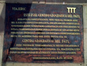
Plaque marking Tequisquiapan's claim to be the center of Mexico

The townsfolk of Tequisquiapan, a spa town in the state of Querétaro, laid early claim to the idea that their town is the center,  erecting a monument to that effect with a plaque that clearly states “this is the geographic center of Mexico”. Hmm… unfortunately, I’ve absolutely no idea why this position could count as the center!

I’ve often been told by well-educated Mexicans that the true center is actually a point in Guanajuato state, very close to (or corresponding precisely with- opinions differ) the Cerro del Cubilete, the prominent steep-sided hill that rises above the interior plains between the cities of Silao and Guanajuato. I’ve never been clear on what basis this point qualifies for the “geographic center sweepstakes”, but the hill certainly does boast a huge religious statue on its top, and is a regular destination for thousands of pilgrims.

Another alternative is offered by the government mapping and statistics organization, INEGI. Maps displayed when the option “Centro geográfico” is selected on one of its web-pages show that a point in Zacatecas is likely to be the center of mass of the country, with the precise location depending on whether only mainland points are used in the calculation, or whether islands are also included. Strictly speaking, the INEGI calculation is based on averaging the furthermost points of Mexico in the four cardinal directions, rather than on a true “center of mass” calculation or demonstration.

The true center of mass has been calculated, according to a brief text by Homero Adame Martínez in Mexico Desconocido (January 2000), to be yet another point in Zacatecas, just south of the village of Cañitas de Felipe Pescador. Most conveniently for all railroad lovers, this point is very close to where the tracks of two major railroads (from Mexico City to Saltillo and Ciudad Juarez respectively) cross.

Readers with a little time on their hands might like to construct their own cardboard cutout of Mexico to determine if the center of mass they determine corresponds with any of these versions. (If you do try this, please post your result in our comments section.) Incidentally, Mr. Adame also relates how the city of Aguascalientes once laid claim to be the center, placing a plaque (sadly no longer there) to that effect on a post in the city’s central plaza…

Well, having explored the issue of “Where’s the geographic center of Mexico?”, let’s end with a related but much simpler to answer question: “What’s on the opposite side of the globe to Mexico?” This is the point where you would eventually emerge if you were able to dig an unbelievably deep hole straight through the center (core) of the earth. If you began digging outside the National Palace in Mexico City, you’d emerge… in the middle of the Indian Ocean, relatively close to the tiny Cocos (Keeling) Islands.

Click here for the original article on MexConnect

Apr 122010
 

Many common garden flowers were developed from samples collected in Mexico by a German botanist financed by Britain’s Horticultural Society.

Karl Theodor Hartweg (1812-1871) came from a long line of gardeners and had gardening in his genes. Born in Karlsruhe, Germany, he worked in Paris, at the Jardin des Plantes, before moving to England to work in the U.K. Horticultural Society’s Chiswick gardens in London. Keen to travel even further afield, he was appointed an official plant hunter and sent to the Americas for the first time in 1836. What was originally intended to be a three-year project eventually became an expedition lasting seven years.

By Hartweg’s time, Europeans already knew that Mexico was a veritable botanical treasure trove, full of exciting new plants. For example, the humble dahlia, a Mexican native since elevated to the status of the nation’s official flower, had already become very prominent in Europe. Mexican cacti were also beginning to acquire popularity in Europe at this time.

The Horticultural Society saw both academic and financial potential in sponsoring Hartweg to explore remote areas of Mexico, and collect plants that might flourish in temperature climes such as north-west Europe.

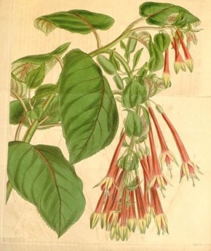
Fuchsia fulgens

Fuchsia fulgens

Hartweg proved to be an especially determined traveler, who covered a vast territory in search of new plants. He collected representative samples and seeds of hundreds and hundreds of species, many of which had not previously been scientifically named or described. Orchids from the Americas were particularly popular in Hartweg’s day. According to Merle Reinkka, the author of A History of the Orchid, Hartweg amassed “the most variable and comprehensive collection of New World Orchids made by a single individual in the first half of the [19th] century”.

Shortly after arriving in Veracruz in 1836, Hartweg met a fellow botanist, Carl Sartorius (1796-1872), of German extraction, who had acquired the nearby hacienda of El Mirador a decade earlier. Sartorius collected plants for the Berlin Botanical Gardens. His hacienda, producing sugar-cane, set in the coastal, tropical lowlands, became the mecca of nineteenth century botanists visiting Mexico.

From 1836 to 1839, Hartweg explored Mexico, criss-crossing the country from Veracruz to León, Lagos de Moreno and Aguascalientes before entering the rugged landscapes around the mining town of Bolaños in early October 1837. In his own words, reaching Bolaños had involved “travelling over a mountain path of which I never saw the like before”, one “which became daily work by the continual heavy rains.” From Bolaños, Hartweg visited Zacatecas, San Luis Potosí (in February 1838) and Guadalajara, where he did not omit to include a detailed description of tequila making. From Guadalajara, he moved on to Morelia, Angangueo [then an important mining town, now the closest town of any size to the Monarch butterfly reserves], Real del Monte, and Mexico City, from where he sent a large consignment of plant material back to England. Hartweg then headed south to Oaxaca and Chiapas en route to Guatemala, Ecuador, Peru and Jamaica. He arrived back in Europe in 1843.

Hartweg visited Mexico again in 1845-46.  After arriving in Veracruz in November 1845, he traversed the country via Mexico City (early December) to Tepic, where he arrived on New Year’s Day 1846, to wait for news of a suitable vessel arriving in the nearby port of San Blas which could take him north to California. In the event he had to wait until May, so he occupied himself in the meantime with numerous botanical explorations in the vicinity, including trips to Ceboruco Volcano. From California, he sent further boxes of specimens back to England, including numerous plants which would subsequently become much prized garden ornamentals. During this trip, he also added several new conifers to the growing list found in Mexico. It is now known that Mexico has more of the world’s 90+ species of pine (Pinus) than any other country on earth. This has led botanists to suppose that it is the original birthplace of the entire genus.

It took several years for the boxes and boxes of material sent back to England by Hartweg to be properly examined, cataloged and described. Many of the samples from his early trip were first described formally by George Bentham in Plantae Hartwegianae, which appeared as a series of publications from 1839 to 1842. Among the exciting discoveries were new species of conifers, such as Pinus hartwegii, Pinus ayacahuite, P. moctezumae, P. patula, Cupressus macrocarpa, and Sequoia sempervirens. Hartweg’s collecting prowess is remembered today in the name given to a spectacular purple-flowering orchid, Hartwegia purpurea, which is native to southern Mexico.

Numerous garden plants derive directly from plants Hartweg sent back to Europe. These included Salvia patens (a blue flowering member of the mint family) which became the ancestor of modern bedding salvias, the red-flowering Fuchsia fulgens, ancestor of a very large number of Fuchsia cultivars, and the red-flowering Zauschneria californica, commonly known as California fuchsia.

Original article on MexConnect

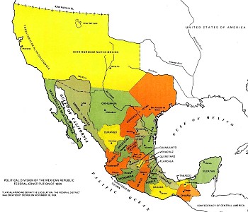
Mexico tried to prevent Americans from migrating to Texas

 Other  Comments Off on Mexico tried to prevent Americans from migrating to Texas
Apr 092010
 

In recent years, considerable attention has focused on the US government’s efforts to stem the flow of Mexicans migrating north of the border in search of jobs. But there was a time in history when the boot was, so to speak, very much on the other foot.

In the early 19th century, shortly after gaining her Independence from Spain (1821), Mexico’s territory extended considerably further north than it does today. It included modern-day Texas, as well as many other parts of what later became US territory.

The first British Chargé d’Affaires in Mexico was Sir Henry George Ward (1797-1860). Ward entered the diplomatic service in 1816, and first visited Mexico in 1823, as a member of a British government commission assessing the desirability of establishing trading relations following Independence. The following year, he married Emily Elizabeth Swinburne, who accompanied him on his return to Mexico in 1825 in his role as Chargé d’Affaires.

Map of Mexico, 1824

Two years later, Ward wrote a detailed description of how he saw Mexico. Mexico in 1827, which contains illustrations by his wife, was an early appraisal of the fledgling Mexican Republic, and was published on his return to the UK. Ward’s book provides numerous details of trade, mining, economic activity and topography, as well as pointing out many errors in Alexander von Humboldt’s earlier classic work Political Essay on the Kingdom of New Spain (1811).

Ward, a skilled diplomat, arrived only a few months before his American counterpart Joel Poinsett. (Poinsett, after whom the poinsettia is named, was the first US minister to Mexico). Ward was not only anti-Spanish, but also decidedly anti-American. His main goal, apparently, was to try to prevent the USA from expanding its territory at the expense of Mexico. The British diplomat believed that the incorporation of Texas into the Anglo-American states was inevitable unless the Mexican government could stem the wave of immigrants flooding southwards into the region. (How times have changed!)

The Mexican government was relatively unstable at this time, with frequent changes of leaders and some inconsistency in policies. Ward summed up the political situation that he encountered as one in which, after 13 years of civil war, the form of government had still not been determined, with great differences of opinion existing with respect to the desired degree of central authority. He found it difficult to conceive of any country less prepared than Mexico for the “transition from despotism to democracy”.

While both men were acting on behalf of their respective countries, Ward acted as a moderate balance to the interventionist politics of Poinsett. He promoted the signing of a UK-Mexico treaty of friendship, trade and migration, but the UK gradually lost influence in Mexico despite Ward’s best efforts. Meanwhile, Poinsett was trying his hardest to purchase Texas. His meddling in Mexican politics antagonized the government of Vicente Guerrero to the point where his recall was demanded in 1829.

The British Chargé d’Affaire’s greatest concern was that the USA might one day gain control over Texas ports. This would put them only three days away by boat from Tampico and Veracruz (Mexico’s main trading port) and mean that Mexico was vulnerable to invasion. Ward’s worst fears in this regard were realized later in the nineteenth century (the Mexican-American War of 1846-1848).

Original article on MexConnect.

The changing political boundaries of Mexico are described in chapter 12 of Geo-Mexico: the geography and dynamics of modern Mexico. Buy your copy today!