Sep 302010
 

Liquefied natural gas (LNG) is natural gas which has been processed to allow for transportation to international markets well beyond the reach of pipelines. The process enables major producers of natural gas such as Australia, Qatar, Indonesia, Malaysia, Brunei, Abu Dhabi and Oman to supply markets almost anywhere in the world.

The stages involved in making and shipping LNG are:

  • 1. Natural gas is extracted from underground deposits.
  • 2. The gas is sent to a processing plant where impurities such as water, oil and carbon dioxide are removed (a process known as  sweetening).
  • 3. The purified gas is cooled to minus 162 degrees C (the temperature of the surface of Saturn). This is accompanied by a dramatic decrease in its volume. The process turns 615 liters of natural gas into a single liter of LNG.
  • 4. The super-cold LNG is kept cold by storage in cryogenic tanks. LNG in this form is not explosive and cannot burn, making it safe to transport.
  • 5. LNG is then transported to markets in special tanks aboard double-hulled tankers. Modern tankers can each transport 50,000 metric tons of LNG.
  • 6. At the market, LNG is put in special tanks where it is allowed to warm up, becoming gaseous again. This gas can then be piped to consumers.

Worldwide, there are currently 17 liquefaction gas terminals preparing LNG for export, and 40 terminals where imported LNG can be reconverted, 35 of them in Japan.

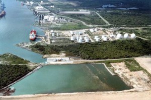
LNG terminal

Altamira LNG terminal. Photo: hydrocarbons-technology.com

Mexico has two existing regasification plants, as well as one currently under construction and several more in the planning stages. Mexico’s first three terminals are in:

  • Altamira, Tamaulipas – this plant opened in 2006 and may be expanded in 2012
  • Ensenada, Baja California – this plant which is 14 miles north of Ensenada opened in 2008
  • Manzanillo, Colima – currently under construction, expected to open in 2011/12

Proposed LNG regasification plants in Mexico are being considered for:

  • Puerto Libertad, Sonora – 60% of the output from this terminal would be piped to the USA, the remainder to cities in northern Mexico
  • Topolobampo, Sinaloa – planned opening date is 2016
  • Offshore of Tamaulipas, in the Gulf of Mexico – this plant would be built 35 nautical miles offshore
  • Lázaro Cárdenas, Michoacán – the proposed LNG terminal would be close to the existing major port
  • Salina Cruz, Oaxaca

LNG means that industries and homes far from Mexico’s own gas fields which are mainly in the north-east of the country can still have access to gas. Supplying them direct from Mexico’s gas fields would require the construction of costly series of pumping stations and pipelines crossing the rugged Western Sierra Madre (Sierra Madre Occidental), where any construction of this kind would be very difficult.
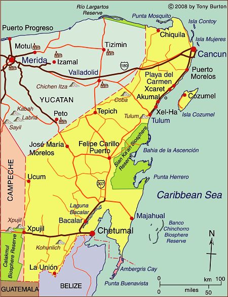
Map of the state of Quintana Roo, with Cancún, Cozumel and Tulum

 Maps  Comments Off on Map of the state of Quintana Roo, with Cancún, Cozumel and Tulum
Sep 272010
 

The state of Quintana Roo (see map below) has an area of 42,360 square kilometers and a population of 1,361,821 (2010 estimate). The state is one of Mexico’s flattest states, with its highest point being only 230 meters above sea level. Its distinctive landscapes include coastal barrier islands (such as the one Cancún’s hotel  zone is built on), magnificent coral reefs and tropical karst (limestone scenery). It also has tropical forests and mangrove swamps. The state’s capital city  is Chetumal (estimated 2010 population: 146,000), an important port and the gateway for overland connections to Guatemala. A short distance north of Chetumal is the beautiful, tranquil Laguna Bacalar.

Map of Quintana Roo. Copyright 2010 Tony Burton. All rights reserved.

Until the mid-20th century, the state was best known for its chicle (used for chewing gum) collectors and its Mayan ruins. Many of these have been restored in the past 50 years or so, and are now important tourist attractions. The best known sites are Tulum perched on a cliff overlooking the azure Caribbean sea (and unfortunately all too accessible for cruise ship passengers) and Cobá, a magnificent city only partially cleared of jungle. Ecotourism is an important sector of tourism in Quintana Roo. Critics notwithstanding, one of the most memorable eco-related sites in the entire country is Xcaret marine park. The biosphere reserve of Sian Ka’an in the middle part of the state also draws large numbers of  ecotourists.

The purpose-built resort of Cancún, begun in 1970, has grown into Mexico’s most important tourist resort. Easily reached by plane from most parts of the USA, Canada and Europe, it is one of the world’s major destinations for package holidays. The area south of Cancún is often referred to as the Mayan Riviera; it is one of Mexico’s most rapidly developing tourist areas.

Previous post related to Quintana Roo

Maps of neighboring states

Geo-Mexico: the geography and dynamics of modern Mexico looks at many aspects of Quintana Roo, including its socio-economic make-up and its development indicators. If you are interested in the geography of Mexico, please recommend this book to your local library or consider buying your own copy, as well as following this site with details of all new posts via  e-mail, Facebook or Twitter.

Homicide rates are declining in many Mexican states

 Updates to Geo-Mexico  Comments Off on Homicide rates are declining in many Mexican states
Sep 252010
 

Data from the Mexican National Public Security System (SNSP) indicate that Mexico’s homicide rate has declined by 23% from 37 (homicides per 100,000 population) in 1997 to 29 in 2009. It declined in 20 of Mexico’s 32 states.

The states with the homicide rates below 20 and their change since 1997 are shown below. All of the states listed except two experienced impressive declines since 1997. The two exceptions, Yucatán and Nuevo León, had the lowest homicide rates in the country in 1997. The homicide rates in the majority of these states even declined from 2007 to 2009 when the national homicide rate increased by 20%.

StateHomicide rate per 100,000 population, 2009Change, 1997-2009 (%)
Yucatán11+11
Campeche13–66
Baja California Sur14–59
Veracruz15–39
Zacatecas16–40
Nuevo León16+79
Hidalgo16–39
Federal District16–25
Querétaro17 –57
Colima18–55
Jalisco19–65
México19–63
San Luis Potosí19–11
ALL MEXICO29–23

Most of these states are not heavily affected by Mexico’s drug war violence. While these states have low homicide rates for Mexico, they are not particularly low from an international perspective.  They are about two times the rate in the USA, but about one quarter of those in Colombia.

Preserving the genetic diversity of corn in Mexico is essential for future world food security

 Mexico's geography in the Press  Comments Off on Preserving the genetic diversity of corn in Mexico is essential for future world food security
Sep 242010
 

Corn (maize) originated in Mexico, and has long been the staple subsistence crop among Mexico’s campesinos, as well as being one of the essential ingredients in Mexico’s varied cuisines, from tortillas to tamales, and pozole to enchiladas.

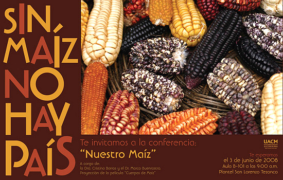
Corn poster

"Without corn there is no nation" (Poster from a 2008 conference at the Autonomous University of Chihuahua)

It was recently announced that Mexico’s federal Agriculture Secretariat is financing a germoplasm bank to preserve the genetic diversity of Mexico’s native varieties of corn. The facility is located in the Antonio Narro Autonomous University of Agriculture (UAAAN) in Saltillo (Coahuila), and will eventually house up to 100,000 samples of 60 distinct varieties of corn supplied by farmers  from all over the country. The first seeds have already been deposited in the germoplasm bank by farmers from the state of Puebla. The University plans to add an interactive museum of corn and a seed-production division at a later stage.

Helping to ensure that corn’s genetic diversity is preserved for future generations is an invaluable contribution towards future global food security.

Mexico’s corn-based cuisine, specifically that of the state of Michoacán, was recently accorded status by UNESCO as a vital part of the country’s Intangible Cultural Heritage.

Further reading:

Classic recipes related to corn (all from MexConnect’s astounding Mexican cuisine pages):

Our grateful acknowledgment to Cristina Potter of MexicoCooks! and MexConnect for bringing much of this material to our attention.

The route taken by Mexico’s first international scientific expedition, 1874-5

 Maps, Other  Comments Off on The route taken by Mexico’s first international scientific expedition, 1874-5
Sep 232010
 

Mexico’s first international scientific expedition in 1874 left Mexico City with only a few months to travel half way around the world to Japan to set up their instruments in time for the transit of Venus on 9 December.

Mexico’s international scientific expedition to observe the 1874 transit of Venus

Looking at a map, the quickest route would appear to be via Acapulco and then by boat across the Pacific. However, in 1874, the “road” to Acapulco was often in appalling condition, especially after the rainy season, and boats crossing the Pacific from Acapulco were few and far between.

The Commission of Mexican Astronomers opted to travel via San Francisco, from where more vessels left regularly for the Far East. Getting from Mexico City to San Francisco in 1874 was nowhere as simple as it is today. For the first part of the trip, the intrepid group was able to take advantage of the Mexico City-Veracruz railway line, inaugurated only the previous year.

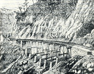
Rail bridge on Mexico City-Veracruz line

Infiernillo Bridge on the Mexicano Railroad (from Viaje de la Comisión Astronómica Mexicana al Japón)

This was an arduous and long trip in those days. Fortunately, the railway from Mexico City to Veracruz had just been completed. The expedition’s memoirs include a charming sketch of the Infiernillo railway bridge (see image).

Boats from Veracruz did not operate on a strict timetable either, and the group decided to wait in Orizaba for news of a suitable vessel rather than risk exposing themselves to the tropical diseases prevalent in the port itself. They had left Mexico City on 18 September and eventually set sail from Veracruz six days later—to Havana, Cuba. This was because vessels were much more frequent to the USA from Cuba than from Mexico.

Landing in Philadelphia on 30 September, the group was placed in temporary quarantine until diplomatic efforts succeeded in getting them released. A few days later, they caught a train to New York, and then the following day, to Chicago and on to San Francisco. Within a week, they had berths on board the Vasco de Gama to Japan.

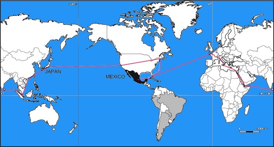
Route taken by Mexico's first international scientific expedition, 1874-5

Route taken by Mexico’s first international scientific expedition, 1874-5. All rights reserved

Their route back home was via Hong Kong, Ceylon (now Sri Lanka), the Suez Canal, Italy and France (see map). By the time they arrived back in Mexico, they had completed a world tour, though it had taken somewhat longer than that of Jules Verne’s fictional tale Around the World in Eighty Days.

Source: Odisea 1874 o el primer viaje internacional de cientificos mexicanos by Marco Arturo Moreno Corral (Fonda de Cultural Economica,  1986)

Build-it-yourself wind and solar power for rural Oaxaca

 Mexico's geography in the Press  Comments Off on Build-it-yourself wind and solar power for rural Oaxaca
Sep 212010
 

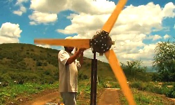
Many remote settlements in the mountains of Oaxaca are still not connected to the national electricity grid. A project based in the municipality of Ejutla (60 km south of Oaxaca City) aims to bring affordable renewable energy to isolated hamlets. The innovative scheme relies on a design for a power-producing wind-vane, complemented by a solar panel for when the wind fails to blow.

Wind power in Oaxaca

Wind power in Oaxaca (still from John Dixie's video)

Constructing the system does not require any specialist materials or equipment, but relies on readily available components. For example, the blades for the wind turbine are made of wood which means they are easy to repair and adjust as needed.

More information?

Mexico’s cultural diversity is discussed in chapters 10 and 13 of Geo-Mexico: the geography and dynamics of modern Mexico. Rural areas are the focus of chapter 24 and development indices of various kinds are discussed in chapters 29 and 30. Ask your local library to purchase a copy today!

Believe it or not, homicide rates in Mexico have actually declined since 1997

 Updates to Geo-Mexico  Comments Off on Believe it or not, homicide rates in Mexico have actually declined since 1997
Sep 202010
 

All the recent media attention to drug war violence suggests that homicide rates in Mexico are increasing rapidly. This is undoubtedly true, but only in certain areas. The available data from the Mexican National Public Security System (SNSP) does not uniformly support the contention that homicide rates are on the rise.

SNSP data show that Mexico’s homicide rate has declined by 23% since 1997. It declined for 20 of Mexico’s 32 states.  According to SNSP, the national homicide rate of 37 per 100,000 population declined by 36% to 24 in 2007, before edging up 20% to 29 in 2009, the most recent year for which data available. However, since 2007 the homicide rate has declined in nine states. Clearly, there are enormous differences in homicide rates among Mexico’s states. A future blog will focus on states with low and declining homicide rates.

The increases in some states since 2007 may well be related to drug war violence. The estimated 28,000 drug war deaths reported in the media is significant compared to the 111,000 homicides in Mexico for the four year period 2006–2009.

The states with homicide rates above 40 in 2009 and which have increased since 2006 are shown in the table. Undoubtedly, drug war violence is an important factor in many of these states, particularly Chihuahua, Durango, Sinaloa, Guerrero and Michoacán.

StateHomicide rate per 100,000 population, 2009Increase, 2006–2009 (%)
Durango89865
Chihuahua86177
Sinaloa7540
Guerrero6355
Morelos6046
Michoacán5755
Quintana Roo52124
ALL MEXICO2920

International comparisons are difficult due to differences in definitions and in data collection methods. For example, the fatal shooting of an intruder, death committed in self-defense, or death caused by  a drunk driver may count as a homicide in some countries and not in others. In rough terms, data appear to show that homicide rates in Mexico are about four times those in the USA, but less than half of the rates in Colombia or South Africa.

Mexico’s international scientific expedition to observe the 1874 transit of Venus

 Other  Comments Off on Mexico’s international scientific expedition to observe the 1874 transit of Venus
Sep 182010
 

In an earlier post, Novelist who loved geography set a story in Mexico, which his publisher labeled South America, we referred to Mexico’s first international scientific expedition in 1874.

This is the expedition that social historian William H. Beezley says was linked by many Mexican writers to Jules Verne’s fictional epic, Around the World in 80 Days, published the year before. (Mexican National Identity: memory, innuendo and popular culture).

Beezley’s account has one significant error; he mistakenly writes that the international expedition was to observe an eclipse of the sun, when in fact its purpose was to make measurements during a transit of Venus across the Sun. Venus only transits the sun infrequently, but then usually does so twice in eight years.

Mexico is not commonly associated with astronomy, despite the fact that archaeologists and archaeoastronomers have worked out that several indigenous groups including the Zapotec, Aztec and Maya all constructed astronomical observatories and were able to predict eclipses and other events in the skies with incredible precision. Perhaps even more remarkably, an international astronomical congress appears to have been held in Xochicalco in the 8th century BC.

We can not be certain how much the ancients knew about astronomy, but by the 18th century, British astronomer Edward Halley had worked out that if only the transit of Venus could be observed from several different places, the differences in timing could be used to calculate the precise distance of the Earth from the Sun, a distance known as the astronomical unit. Unfortunately Halley died in 1742, before he had the chance to observe the next transits of Venus in 1761 and 1769. [The most recent transit of Venus across the Sun occurred on 8 June 2004; the next is expected on 6 June 2012.]

Obtaining an accurate figure for the astronomical constant was one of the greatest challenges for astronomers of the time. In 1760, a French astronomer set out for India (for the 1761 transit) but failed to arrive in time! Undeterred, he remained in India, waiting patiently for 1769. Alas, on that occasion it was too cloudy to make any worthwhile observations.

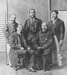
Mexico's first international scientific expedition team

Left to right: Jiménez, Barroso, Díaz Covarrubias, Fernández Leal, Bulnes (Photo reproduced in Odisea 1874)

Mexico’s connection to the astronomical constant began at this time. For the 1769 transit, Spain had granted permission to another French astronomer to join a party of Spanish astronomers setting up a temporary observatory near San José del Cabo on the southern tip of the Baja California peninsula. A short distance away, a creole astronomer Joaquín Velázquez de León had traveled from Mexico City to make independent observations. Only days after the transit, three members of the Franco-Spanish party, including the two principal astronomers, died of yellow fever.

By the time of the next transit in 1874, large scientific teams had been assembled by several countries including France, Russia, Germany and the USA to collect better data for a more accurate calculation of the astronomical constant.

Mexico had a fledgling astronomy community, but decided it must send a team to Yokohama, Japan. The team consisted of:

  • Francisco Díaz Covarrubias (the expedition’s leader) who had written various books and had installed the first post-Independence astronomy observatory in Chapultepec Castle, Mexico City, in 1863.
  • Francisco Jiménez – whose offical qualification was as a “geographic engineer”. He had fought in defense of Chapultepec Castle when the USA invaded in 1847, written about the 1769 transit, and been a key member of the Mexican Border Commission which fixed the definitive Mexico-USA boundary in 1856. He helped coordinate research for the great map of Mexico produced by Antonio García Cubas. Jiménez was the first person to use telegraph signals to determine longitudes in Mexico with precision.
  • Francisco Bulnes was the expedition’s chronicler and the youngest member of the team.
  • Agustín Barroso had wide interests in natural science and engineering, and became an early enthusiast of photogaphy and its applications to astronomy. He was responsible for the outstanding sequence of photos of the transit of Venus taken as part of the Mexican scientific expedition’s work.
  • Manuel Fernández Leal was an expert surveyor and educator who had also participated on the Mexican Border Commission.

The team traveled to Japan and were able to make valuable measurements. Commendably, they published their first results very much more quickly than did the astronomers from all other countries.

Mexico’s scientific community has continued to play an active part in major international research ever since. See for example, our earlier post about Mexicans involved in the work of the Inter Intergovernmental Panel on Climate Change (IPCC). Scientific globalization was under way…

Source: Odisea 1874 o el primer viaje internacional de científicos mexicanos by Marco Arturo Moreno Corral (Fondo de Cultura Económica, 1986)

Happy 200th birthday, Mexico!

 Other  Comments Off on Happy 200th birthday, Mexico!
Sep 162010
 

Mexico is celebrating its bicentennial.

Mexican flag

The long struggle for independence began on this day in 1810; independence was finally “awarded” by Spain in 1821. By happy coincidence, 2010 also marks the centenary of the start of the Mexican Revolution. This has a less clear-cut ending date, with some Mexicans saying that it is still on-going today. It was during the Mexican Revolution that Mexico’s current constitution of 1917 came into effect.

For some geographic trivia associated with the War of Independence:

Events in the War of Independence called for an accurate map of Lake Chapala, Mexico’s largest natural lake. The cartographer for this map was José María Narváez, whose major contributions to Mexican cartography in succeeding decades have largely been forgotten.

Following independence, the rush was on to draw an accurate map of all of Mexico’s territory. Mexico’s boundaries following independence were very different to today. Flows of migrants linking the USA to Mexico at that time were from the USA to Mexico (see link),  the reverse of the direction of more recent flows, which have seen millions of Mexicans migrate north looking for work.

Political events conspired to bring Mexico into direct conflict with the USA in the Mexican-American War of 1846-1848. The 1848 Treaty of Guadalupe Hidalgo, signed after the war, ceded over half of Mexico’s territory to the USA. A few years later, under the 1853 Gadsden Purchase (Treaty of La Mesilla), northern portions of Sonora and Chihuahua were transferred to the USA. This established the current border between the two countries.

Minor modifications have been negotiated since to take account of changes in the meanders of the Río Bravo (Grande).

The first truly national map, compiled in 1857-1858 from a meticulous reconciling of the work of numerous local cartographers, was  drawn by Antonio García Cubas. García Cubas did not graduate from university until a few years after completing this map!

In the latter half of the 19th century, the development of Mexico’s railway network brought immense changes to many parts of the country. See, for instance:

In 1910, then president Porfirio Díaz decided that the centenary of Mexican independence should be celebrated in style. One of the reasons why the “traditional” Grito (“shout) is made on 15 September each year, rather than on the morning of 16 September (when Father Miguel Hidalgo apparently gathered his parishioners in revolt) is because 15 September 1910 happened to be Díaz’s 80th birthday. Why not have one big bash and celebrate both president and country at the same time? Unfortunately for the then president, the Mexican Revolution broke out later in the year and in 1911 Díaz was exiled to Paris.

One of the major events during the centenary of independence celebrations in 1910 was the opening to the public of Teotihuacan, the  archaeological site an hour’s drive north of Mexico City. Months of frantic cleaning and restoration were completed just in time for the official opening. This marked the start of mass tourism based on Mexico’s cultural heritage. The haste with which Teotihuacan was readied for tourists led to some unfortunate errors of reconstruction. For instance, the number of levels now seen on the Pyramid of the Sun does not correspond to its original form. Of course, Mexico’s unbridled pursuit of tourism in the past 80 or so years has led to lots of other serious environmental and cultural issues elsewhere.

Mexico has come a long way in 200 years, but amazingly, to the best of our knowledge, Geo-Mexico: the geography and dynamics of modern Mexico, published earlier this bicentennial year, is the first ever book in English focused exclusively on the nation’s  varied and fascinating geography.

¡Viva Mexico!

Mexican flag

Sep 152010
 

The remote Copper Canyon region in northern Mexico is the home of 50,000 Tarahumara Indians who have preserved much of their distinctive culture (language, dress, customs, beliefs) into this century, partly because of their extreme remoteness. Many live untouched by the trappings of modern civilization, moving between caves just below the canyon rim and warmer, winter shelters at lower altitude near the Urique River.

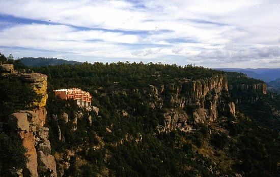
Modern hotels are encroaching on the Copper Canyon

Modern hotels are encroaching on the Copper Canyon, and changing the views in this wilderness region. Photo: Tony Burton; all rights reserved.

Their radically different lifestyle and extreme isolation beg many questions. Their ancestral homelands are already being invaded by marijuana-growers and trampled on by outside developers who have very different notions of property rights and very different customs.

Questions to think about:

  • Are the Tarahumara Indians really in any position to make informed decisions about their future?
  • Should we leave them entirely alone and let them decide entirely for themselves?
  • Should we offer education about what we would consider the benefits of the modern world?
  • Should we improve their access to health services and hospitals?
  • Should we encourage them to acquire computers and internet access?
  • Might these progressive elements destroy their existing lifestyle, break down their social and political structures and ultimately wipe them out?
  • What do YOU think? Now, imagine you were a Tarahumara Indian – would you think the same?
  • Who should decide the future of this region?

Previous Geo-Mexico posts related to the Copper Canyon:

Chapter 10 of Geo-Mexico: the geography and dynamics of modern Mexico is devoted to Mexico’s indigenous peoples, including the Tarahumara Indians. If you have enjoyed this post, please suggest to your local library that they purchase a copy to enhance their collection.

April earthquake leads to Mexico-USA talks over water-sharing

 Mexico's geography in the Press  Comments Off on April earthquake leads to Mexico-USA talks over water-sharing
Sep 142010
 

In April 2010, a large earthquake rattled the Mexicali area, causing significant damage. It was so powerful that it even moved the southern part of California! The magnitude 7.2 earthquake damaged the irrigation infrastructure used by Mexican farmers on land along the lower Colorado River and in the Colorado River delta region.

Mexico and US officials are reported to be discussing the Colorado water-sharing agreement, given the damage done to irrigation facilities following the April earthquake (The OOSKA News Weekly Water Report for Latin America and the Caribbean, 18 August 2010).

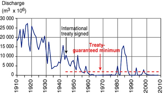
River Colorado discharge entering Mexico, 1910-2010

River Colorado discharge entering Mexico, 1910-2010. Figure 6.5 of Geo-Mexico; all rights reserved

As we noted in an earlier post, a 1944 treaty guaranteed that at least 1750 million cubic meters of water (see graph) would enter Mexico each year along the Colorado River via the Morelos diversionary dam in the Mexicali Valley. The damaged infrastructure means that Mexico is unable to use effectively all of its annual allocation of water from the Colorado. Urgent repairs are underway on pumps, pipelines and irrigation channels, particularly those in the Mexicali region.

Meanwhile, Mexican officials have asked their US counterparts if it is possible to store some of Mexico’s 2010 allocation of water in the Lake Mead reservoir near Las Vegas, until repairs to irrigation systems have been completed.

Earthquakes in Mexico are discussed in detail in chapter 2 of Geo-Mexico: the geography and dynamics of modern Mexico. Mexico’s water resources and water-related issues are the subject of chapters 6 and 7. Ask your library to buy a copy of this handy reference guide to all aspects of Mexico’s geography today! Better yet, order your own copy…

Sep 132010
 

Beer was introduced to New Spain by the Spanish. The first permit to produce beer in New Spain was awarded by Spain’s King Charles V to Alonso Herrera in 1544.

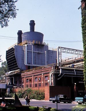
Initially, beer was a pleasure of the upper classes, and a series of local beer shops supplied their needs. During the 17th and 18th centuries, the status of beer changed and it gradually gained popularity among other social classes. Prior to the 20th century, the main breweries were in major urban centers such as Mexico City and Puebla. (Puebla was Mexico’s second largest city until 1870 when it was replaced by Guadalajara).

Cuauhtemoc Moctezuma brewery in Monterrey

Cuauhtemoc Moctezuma brewery in Monterrey. Photo: Tony Burton. All rights reserved.

The relative difficulty of transportation links meant that a single brewery could only serve a limited area. Only after the major railways were built in the last quarter of the 19th century, was it possible for a brewery to ship beer further afield. This same period saw significant foreign investment in breweries, primarily from Germany. Technological improvements enabled the breweries to expand production, industrialize more processes and meet the needs of the ever-growing population. The commercial manufacture and distribution of ice also helped the beer producers. Foreign investment, from the USA and Europe, continued to develop the beer industry until the Mexican Revolution began in 1910.

During the 20th century, two major brewery companies emerged, expanding by a combination of building new breweries and acquiring existing ones to bring more and more of the nation into their market areas. These two brewery groups are Grupo Modelo (main brands: Corona, Modelo Especial, Negra Modelo, Pacífico, Victoria, Estrellita, León) and Femsa (Fomento Mexicano; main brands: Tecate, Carta Blanca, Superior, Sol, Indio, Bohemia, Dos Equis, Noche Buena). Between them the control about 80% of the market.

Grupo Modelo

Grupo Modelo currently has a brewing capacity (7 breweries) of 60 million hectoliters. Its new brewery in Nava (Coahuila) will add another 10 million hectoliters to this figure. Modelo started exporting beer (to the USA) in the 1930s. It now exports to more than 150 countries worldwide. It is the world’s 6th largest brewer, accounting for 63% of the combined export and domestic Mexican market.

The granddaughter of the founder of Grupo Modelo is María Asunción Aramburuzabala, whose net worth of $2 billion makes her the richest woman in Mexico.

Femsa

Femsa is the oldest major beer-maker in Mexico. Its brewery division started life in the northern city of Monterrey in 1890 as the Cuauhtemoc Moctezuma brewery (see photo). Femsa brews about 31 million hectoliters of beer a year, including three of the top 5 beer brands in Mexico’s domestic market. In 2010, the company entered into a joint venture with giant Dutch brewers Heineken to become the leading global brewing concern.

In 1943, one of Femsa’s executives co-founded the Tec. de Monterrey (ITESM), a prestigious university that started in Monterrey and now has 31 campuses in 25 cities across the country.

We will continue our look at the geography of Mexico’s beer industry in a later post.

Mexico’s economic geography is analyzed in chapters 14–20 of Geo-Mexico: the geography and dynamics of modern Mexico. Buy your copy of this invaluable reference guide today!

Is tourism in Mexico expanding?

 Other, Updates to Geo-Mexico  Comments Off on Is tourism in Mexico expanding?
Sep 112010
 

At first sight, this would seem like an easy question to answer but, in fact, it is not exactly clear whether tourism in Mexico in 2010 is increasing, decreasing or holding steady. Flows of tourists are affected not only by any changes in the situation of the destinations (receiving countries) but also by the situation at the point of origin. Most of Mexico’s international visitors come from the USA. This year, many potential tourists have opted to stay at home as a result of the current recession which started in 2008 and worsened in 2009.  On the other hand, the recession may have diverted some tourists to Mexico from more expensive destinations they had originally planned to visit.

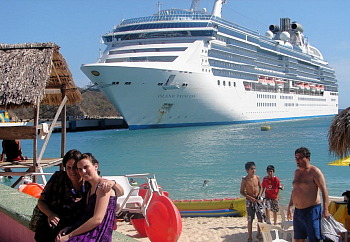
Cruise ship

Events within Mexico have also influenced the number of international tourist arrivals. The threat of H1N1 flu in early 2009 kept many international tourists away. Publicity about the violence associated with Mexico’s “drug wars” has accelerated in 2010 and almost certainly diverted some international tourists to other destinations.  On the other hand, some tourists who planned their 2010 summer vacation on the US Gulf Coast may have opted for Mexico after the massive oil spill off Louisiana.  An additional complicating factor is that international tourists only account for about 20% of Mexico’s total tourism revenue. While international tourism gets most of the attention, about 80% of tourism revenues come from national (Mexican) tourists.

Statistical data on tourism can be very difficult to interpret. The World Tourism Organization (WTO) and Mexican tourism agencies use similar international definitions of  a tourist:

  • A tourist as someone who spends at least one night (and less than one year) away from their usual home.

This definition ignores the precise reasons for travel. Hence, international tourism figures generally include travel for all purposes, including visiting family and friends, and business trips, as well as health and religious travel.  All these factors make assessing trends in Mexican tourism an analytical challenge.

In an August 2010 press conference, Mexico’s Secretary of Tourism Gloria Guevara presented data indicating that 818,278 international travelers visited Mexico in the month of June 2010 compared to only 605,435 in June 2009. This increase of 24% seems impressive, but requires closer scrutiny.  International arrivals in January and February 2010 were 5.2% and 5.8% less respectively than the same months in 2009; revenues for those two months were up 21% in peso terms, but actually fell by 7.5% in dollar terms, because of the falling value of the peso. Arrivals in March 2010 were 2.7% higher than March 2009.

Room occupancy rates (the percentage of available hotel rooms actually occupied) in 70 tourist destinations were up 11% for the first six months of 2010 compared to the same period in 2009.  However, 2009 was a very poor year for tourism in Mexico. Only 21.5 million international travelers visited Mexico in 2009, compared to a record 22.6 million in 2008.

Another major complication to the statistics is that they mask important regional differences. Tourism in some areas of Mexico is increasing steadily while it is simultaneously declining in others.  For example, occupancy rates for the first six months of 2010 were up 30% in Morelia and 15% in Huatulco compared to the previous year. However 14 of the 70 cities monitored showed no gain in occupancy over the low numbers posted in 2009. All these percentage figures ignore any changes in hotel capacity over that time. For instance, if an additional 2000 hotel rooms are opened in a resort, the occupancy rate may decrease slightly, even though more tourists actually visited the resort.

For cruise ships, a similar picture emerges. Though cruise ship visitors to Mexico were up in the first six months of 2010, they remain lower than the 2008 numbers for the equivalent period.

So, is tourism expanding, or not? Overall, tourism in 2010 is certainly improving over the 2009 numbers, which is quite encouraging given the extremely negative publicity resulting from drug war violence.  However, it is too early to say if the total number of visitors and revenues in 2010 will surpass the numbers for 2008.  This will depend not only on publicity related to Mexico’s fight against drugs, but also on the speed and extent of economic recovery in the USA. In addition, the collapse of Mexicana airline means that there are currently far fewer flights into Mexico that there were at this time last year.

See also:

Chapter 19 of Geo-Mexico: the geography and dynamics of modern Mexico focuses on Mexican tourism and development.  Buy your copy today to have a handy reference guide to all major aspects of Mexico’s geography!

Cultural and eco-tourism in the Copper Canyon region of Mexico

 Other, Teaching ideas  Comments Off on Cultural and eco-tourism in the Copper Canyon region of Mexico
Sep 102010
 

The Copper Canyon area is one of Mexico’s most popular destinations for eco-tourism activities. The canyons offer plenty of opportunities for canyoneering (like mountaineering, but starting from the top!), wilderness hikes and adventure trips. Mexico’s two highest waterfalls—Piedra Volada and Baseaseachi— are also in this area. The Basaseachic Falls are about 250 meters (820 ft) in height, beaten only by the virtually inaccessible 453-meter-high Piedra Volada falls, also in the state of Chihuahua. The Basaseachic National Park is easily accessible via paved roads from Chihuahua City.

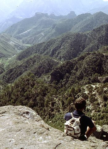
Magnificent scenery attracts hikers from all over the world.

Magnificent scenery attracts hikers from all over the world. Photo: Tony Burton; all rights reserved.

Adding to the allure of the Copper Canyon region is the fact that it is the home of some 50,000 indigenous Tarahumara Indians with their distinctive language, customs and lifestyle. The Tarahumara are one of the most culturally distinct groups in all of Mexico, famous especially for their long distance running ability and communal spirit.

Relatively easy access to this region is possible because of the railway line which runs from Chihuahua City to the lumber town of Creel, close to the canyons, and then skirts the canyon rim before descending to El Fuerte (once the capital of Arizona) and Los Mochis in Sinaloa. This railway is an incredible feat of engineering brilliance, matched by few railway lines anywhere on the planet. The railway is the lifeline of this remote region.

Travel articles:

Tourism in this area is not without its discussion points. Tourists place more pressure on scarce resources such as potable water. As noted in an earlier post, tourism has led to changes in the items made by indigenous Tarahumara women. Some hotel developers have viewed the Tarahumara as a human resource to be exploited as a quaint experience for their clients, though others have quite rightly viewed the Tarahumara as the area’s most important assets, one to admire and appreciate for what they are and how they have adapted to the harsh environment in which they live.

Points to ponder (discussion topics in class):

  • Should tourists encourage a monetary economy by buying Tarahumara souvenirs?
  • Is there a risk of tourists introducing a disease to which the Tarahumara have no resistance?
  • Should tourists be allowed to pick flowers and collect souvenir rock samples in the Copper Canyon area?
  • What are the pros and cons of tourists giving small items such as T-shirts to the Tarahumara?
  • What items, if any, are appropriate for tourists to offer the Tarahumara if they wish to give them something for sharing their ancestral homeland?
  • Is it right to take photos of Tarahumara homes, such as their cave dwellings?

Previous Geo-Mexico posts related to the Copper Canyon:

Chapter 10 of Geo-Mexico: the geography and dynamics of modern Mexico is devoted to Mexico’s indigenous peoples, including the Tarahumara Indians. If you have enjoyed this post, please suggest to your local library that they purchase a copy to enhance their collection.

Sep 092010
 

In two previous posts, we examined the historical connections between Mexico and the Philippines.

A news story (on mb.com.ph) a few months ago alerted us to another, much more recent link between the two countries.

The Philippine Drug Enforcement Agency (PDEA) claims that a Mexican herb poses a significant public health risk. According to the PDEA, Salvia divinorum, which is hallucinogenic when sun-dried leaves are chewed, sniffed or smoked, has been found growing wild in the Teachers Village in Quezon City. The plant is a member of the mint family and has a distinctive square stem. It is not known how or when it was introduced into the Philippines.

It is endemic to the remote region of the Sierra Mazateca in the northern part of the state of Oaxaca, Mexico. The plant grows in the warm, damp tropical evergreen and cloud forests at elevations between 300 and 1800 meters (1000 to 6000 feet). Biologists remain uncertain whether the plant is a truly natural plant or whether it is actually a hybrid (a cross between two or more distinct plant species) or cultigen (a plant that has been deliberately altered or selected by humans). It is commonly known in Mexico as divine sage, and the local Mazatec indigenous group has a long tradition of employing the plant in spiritual healing ceremonies.

The active constituent of Salvia divinorum is known as salvinorin A. Wikipedia’s entry on divine sage claims that “By mass, salvinorin A is the most potent naturally-occurring psychoactive compound known.”

We are not sure why it is in the interests of the PDEA to offer helpful tips for anyone thinking of growing and using this particular plant, but a PDEA spokesperson did just that, describing the plant as being somewhat similar to cannabis (marijuana), but easier to grow, since it can be propagated via stem cuttings. In addition, “The addictive effect of the said plant will last long if the leaves of the plant will be spread on a person’s gums rather than sniffing or puffing it like a cigarette. They say it gives you an uncontrollable laugh trip because the user will see the people as if they were caricatures or cartoons.” At least the final part of that quote appears to be hearsay and probably not admissible if introduced into a courtroom!

Despite its known hallucinogenic qualities, the cultivation and possession of divine sage remain legal in almost every country around the world. In the USA, only certain states have criminalized the plant. Click here for a webpage which provides more details of divine sage’s legal situation in particular countries and US states.

In the Philippines, the PDEA is reported to be collecting further evidence prior to recommending whether or not owning the plant should be made illegal. Sounds like it could be a fun job if you can get it!

Divine sage is the latest link in the 450-year-long history of close connections between Mexico and the Philippines.

Mexico’s links with other countries are discussed in chapter 20 of Geo-Mexico: the geography and dynamics of modern Mexico. Ask your library to buy a copy of this handy reference guide to all aspects of Mexico’s geography today! Better yet, order your own copy…

Sep 072010
 

When complete, this dramatic new highway will have significant economic impact. Drivers using the old road report that it can take from five to nine hours to make the 325 kilometer trip, depending on traffic and one’s willingness to risk passing slow trucks on virtually blind curves. Buses allow 6.5 hours.

When completed, the driving time on the new four lane expressway will be reduced to less than three hours. Durango residents will easily be able to go off to the beach in Mazatlán for the week-end. The driving time from Monterrey or South Texas to Mazatlán will be reduced to less than a day. This could revive Mazatlán as a major tourist destination after a couple of decades of relative stagnation.

The port of Mazatlán

The port of Mazatlán. Photo: Stan Shebs (Wikimedia Commons)

Perhaps the biggest effect of the new highway will be the improved connection between the Pacific Ocean port of Mazatlán and north-central Mexico (population about 12 million) and most of Texas (about 20 million). The impact from increased trade in finished products (especially those which are relatively light and suitable for truck transport) will be significant.

Shrimp from Mazatlán and many, many products destined for northern Mexico/Texas from the Pacific Rim Region (China, South Korea, Taiwan, Japan, Indonesia, Australia, etc.) will be shipped through Mazatlán and trucked from there on the new highway. We expect there will be considerable trucking/shipping in the opposite direction as well. The resulting increased shipping through the port of Mazatlán will stimulate economic growth.  However, to facilitate these shipments, new urban expressways should be built through or around the cities of Durango, Torreón and Saltillo.

We expect the impact on the state of Durango will be less. Most of Durango’s mineral and timber products are rather bulky, not ideally suited to truck transport, and not globally competitive; therefore they will not find their way through Mazatlán to world markets.

Some (including Chris Hawley in USA Today) have argued that the new highway will have an appreciable impact on drug production and trade by improving police access and providing new economic opportunities. We think the impact will be rather slight. The Western Sierra Madre (Sierra Madre Occidental) covers about 200,000 square kilometers and the road affects less than 4% of this area (assuming an area of influence 25 kilometers wide either side of the highway). In our opinion, whatever illegal drugs are currently being cultivated in the Western Sierra Madre will continue to be grown. Yes, some people along the highway will find new employment in roadside commerce, but these jobs will be rather few.

Chapter 3 of Geo-Mexico: the geography and dynamics of modern Mexico discusses how the Sierra Madre Occidental influenced Mexico’s historical development. Chapter 17 analyzes the difficulties of transportation between Mazatlán and Durango. Buy your copy today to have a handy reference guide to all major aspects of Mexico’s geography!

Sep 062010
 

Bike riding is quite a common recreational activity in Mexico, as well as being many people’s chosen means of transport to work.

In recent years, an increasing number of cities have started regular bike festivals or other events. The Festival de Bicicleta in Xalapa, the state capital of Vercaruz, is just one example.

Back in 1972, in Mexico City, famous Belgian cyclist Eddy Merckx, considered by many to be the greatest cyclist in the history of the sport, smashed the world one-hour distance record by pedaling 49.431 km (30.715 miles). He simultaneously established new 10 km (6.2 miles) and 20 km records by covering 10 km in 11 minutes 53.2 secs and 20 km in 24 minutes 6.8 secs. One curiosity of this achievement is that contemporary ads for Windsor bikes purport to claim that he was riding a Windsor bike when he smashed the record, whereas he was actually riding an Italian bike! Merckx’s distance record stood for more than a decade before being broken, also in Mexico City, by Francesco Moser.

Mexico City is catching up with the craze for bike riding, too. It sees bikes as one way to reduce air pollution. About 30 km ( miles) of downtown streets, including the 8-lane Avenida Reforma, are closed to powered vehicles on Sunday mornings, to provide unhindered access for pedal bikes, walkers, and wheelchairs.

Earlier this year, the city began a bike rental system, Ecobici. More than 1,000 bikes were distributed between 85 specially-designed bike stations, spaced around the city center. Users purchase swipe cards which allow them to access a bike. After the trip, the bikes can be returned to any of the stations. City officials anticipate 24,000 riders using the system by the end of the year.

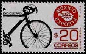
Stamp of Bike exports

As the postage stamp suggests, Mexico exports bikes, mainly to the USA. The export market has declined, however, in the past decade as several manufacturers who used to assemble bikes in Mexico have moved their operations to China. Firms which have relocated their operations away from Mexico include Huffy (formerly in Nuevo Laredo), Windzy (Monterrey), Brunswick (Ojinaga) and SRAM.

The website of the National Association of Bicycle Manufacturers claims that its 14 member companies produce about 3 million bikes a year and employ, between them, 4,000 workers.

The 14 bike manufacturers listed are:

  • Bicicletas Cinelli – Santa Catarina, Nuevo León
  • Nahel – Durango, Durango
  • Goray – Torreón, Coahuila
  • Grupo Veloci – Zapopan, Jalisco
  • Rebimo de Guadalajara – Zapopan, Jalisco
  • Biciclo – San Luis Potosí
  • Bicicletas Mercurio, Mérida, Yucatá and San Luis Potosí (they acquired the famous Acer-Mex Windsor brand in 2001)
  • Bimex – Mexico City
  • BR – Mexico City
  • Magistroni – Mexico City
  • Benotto (primarily a distributor) – Mexico City
  • Grupo Oriental – Mexico City
  • Bicicletas Ozeki – Atizapan de Zaragoza, State of México
  • Bicileyca – Yauhquemehcan, Tlaxcala

Q. Is there any pattern to the distribution of bike manufacturers in Mexico? Try plotting the locations mentioned on a map of Mexico to see if any pattern emerges.

Q. What factors do you think bicycle manufacturers must take into account when deciding where to locate?

Mexico’s manufacturing industry is discussed in chapter 16 of  Geo-Mexico: the geography and dynamics of modern Mexico. Mexico’s transportation system is discussed in chapter 17, and its exports in chapter 20.

Ask your library to buy a copy of this handy reference guide to all aspects of Mexico’s geography today! Better yet, order your own copy…

Sep 032010
 

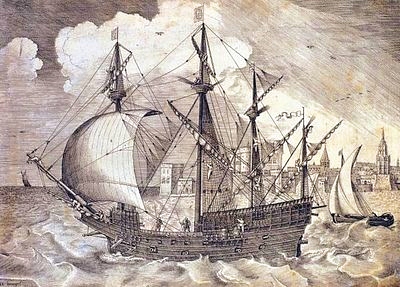
The “China galleons” greatly stimulated spatial interactions between Acapulco and Manila, 15,000 km away. Many Mexicans settled in Manila and scores of Nahuatl words entered Tagalog, the main Filipino language. These included atole, avocado, balsa, cacao, calabaza, camote, chico, chocolate, coyote, nana(y), tata(y), tocayo and zapote.

The Nao de China galleon

The China Galleon

As well as vocabulary, some aspects of Mexican cuisine, customs and dress were also introduced to the Philippines, along with a variety of plants and flowers. In addition, the Filipino currency has the same name as Mexico’s: the peso.

Mexico’s long connection with the Philippines – exploration, seafaring and geopolitics

A large number of Filipinos migrated in the other direction, escaping from their life of servitude aboard a galleon by jumping ashore on the coasts of Colima and Guerrero. One sizable Filipino community settled in Coyuca, on the Costa Grande, 50 km north of Acapulco. Coyuca was apparently known as Filipino Town at one point in its early history.

The Filipinos settling in Mexico introduced mangoes and a game called “cara y cruz” (heads and tails). The settlers were known locally as “Chinese Indians” and brought their expertise in the cultivation and use of palm trees with them. In Tagalog, palm fronds are known as “palapa” and by the end of the 18th century, this name was in use, too, for the palm-roofed shelters which remain a distinctive style of architecture along Mexico’s coasts.The coconut palm’s sap is known locally as tuba. Filipino newcomers fermented the resulting coconut wine into a potent drink. Henry Bruman, a University of California geographer, documented how Filipino seamen on the Manila Galleon also introduced simple stills, for making coconut brandy, to western Mexico during the late 16th century. These techniques were quickly adopted by Mexicans who were then able to turn the hearts of their native agave plants into tequila.

This is an excellent example of how developments in transportation can encourage cultural exchanges, and diminish the social, economic and cultural distance between places.

According to some historians, Mexico’s “China Poblana,” the woman who supposedly arrived from the East as a slave during the early 1600s and subsequently captured the hearts and minds of the people of Puebla, was actually a Filipino noblewoman who had arrived in Mexico aboard one of the Spanish galleons.

Mexico’s independence from Spain (1821) brought an end to the Manila–Acapulco galleons, though the network of shipping links then expanded from Veracruz to New Orleans and New York.

Mexico-Phillipines friendship has continued down the years.

For instance, in the second world war, several Mexican air force pilots, in the elite Escuadrón 201, were sent by the US government to lend their support in the Philippines. The pilots were decorated by the Philippine’s government for their heroism.

Related post

The development of Mexico’s transportation system is discussed in chapter 17 of Geo-Mexico: the geography and dynamics of modern Mexico. Its cultural geography is the subject of chapters 10, 11 and 13. Ask your library to buy a copy of this handy reference guide to all aspects of Mexico’s geography today! Better yet, order your own copy…

Mexico’s Copper Canyon train is one of the world’s great railway trips

 Excerpts from Geo-Mexico, Other  Comments Off on Mexico’s Copper Canyon train is one of the world’s great railway trips
Sep 022010
 

The Copper Canyon region is one of the most remote parts of Mexico. This remoteness helps to explain why the area is the home of about 50,000 Tarahumara Indians, and how they have managed to preserve much of their highly distinctive culture to this day.

The Copper Canyon railroad line, “the most dramatic train ride in the Western Hemisphere” (Reader’s Digest), begins in Ojinaga and continues, via Chihuahua, to Los Mochis and Topolobampo. The railroad was started in the 1870s to enable produce grown in southern Texas to be exported via a Pacific port. Simultaneously, the twin settlements of Los Mochis and its port Topolobampo were developed on the other side of the Western Sierra Madre. The railroad project floundered and successive attempts to complete it all failed. Some innovative engineering finally led to the line being completed in 1961. Total cost? Over $100 million.

The highlights include a 360-degree loop at El Lazo (km 585 from Ojinaga), one of only three comparable examples anywhere in North America), and a 180-degree turn inside a tunnel near Temoris at km 708. The line crosses the Continental Divide three times, reaches a maximum height of 2400 m (at km 583) and skirts the rim of the Copper Canyon. Between Chihuahua and Los Mochis, there are 37 bridges (totaling 3.6 km) and 86 tunnels (totaling 17.2 km). Almost all passenger rail services in Mexico ended in the 1990s but daily services continue along this line, mainly for tourists.

Tarahumara Indians wait for a sale at Divisadero, the station on the rim

Tarahumara Indians wait for a sale at Divisadero, the station on the canyon rim. Photo: Tony Burton; all rights reserved.

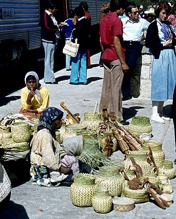
Almost all trains stop for a few minutes at Divisadero, a station set right on the rim of the canyon, with a lookout offering a magnificent panoramic view. Shy Tarahumara women and children sit quietly, weaving pine-needle baskets (see photo) and hoping for a sale. Many of them speak very little Spanish apart from the numbers; on the other hand, how many tourists speak even one word of the Tarahumara language? Thirty years ago, most articles sold by the women were items similar to ones they would use everyday themselves in their daily tasks. Sadly, many of the articles sold today are made specifically for the tourist trade.

Unlike the railway, Los Mochis and Topolobampo both soon flourished. Topolobampo was started by US engineer Albert Kimsey Owen who chose this previously unsettled area for a socialist colony based on sugar-cane production, and as the terminus for the railway. Topolobampo has one of Mexico’s finest natural harbors, a drowned river valley or ria, which affords a safe haven in the event of storms. Los Mochis was officially founded in 1893 by a second American, Benjamin Johnston, who built a sugar factory there.

Los Mochis became especially important in the second half of the twentieth century as a major commercial center, marketing much of the produce grown on the vast El Fuerte irrigation scheme. Much of this produce is still exported to the USA via the famous Copper Canyon railway. Los Mochis and Topolobampo are unusual—there are few other examples of such “new towns”, with no colonial or pre-Hispanic antecedents, anywhere else in Mexico.

Previous Geo-Mexico posts related to the Copper Canyon:

External links of interest:

Chapter 10 of Geo-Mexico: the geography and dynamics of modern Mexico is devoted to Mexico’s indigenous peoples, including the Tarahumara Indians. If you have enjoyed this post, please suggest to your local library that they purchase a copy to enhance their collection.

Sep 012010
 

Several famous writers wrote about Mexico despite having no direct geographic experience of the country. In an earlier post, we looked at the case of Jules Verne. This time, we look at Henry Wadsworth Longfellow.

There is some sound historical geography in the famous poem The Bells of San Blas, yet author Henry Wadsworth Longfellow had never ever visited the town.

The San Blas referred to in the poem is on the Pacific coast, in the state of Nayarit. It is a small town with several good hotels and restaurants, and a birding “hot spot”. The variety of habitats around the town, ranging from sandy beaches and luxuriant mangroves to palm plantations and tropical swamps, have attracted more than 500 different bird species, or about half of all the bird species known in Mexico.

The town’s economy was not always geared to tourism. For more than a century, San Blas, founded in 1768, functioned as an important port and boat-building center. The vessels built in San Blas included those used by Junípero Serra to establish missions in California. To ensure that taxes were paid on imports, an imposing customs house was built on the shore. To guarantee safe passage, a church dedicated to “Our Lady of the Sailor’s Rosary” stands atop the steep-sided Cerro de San Basilio which overlooks the town. In the church hung the famous bronze bells.

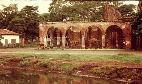
San Blas Customs House

The former Customs House of San Blas in the evening light, 1989. Photo: Tony Burton. All rights reserved.

Time conspired against the port of San Blas. The harbor silted up, the coastline gradually inched its way further west. Over the years, other ports such as Acapulco and Mazatlan became more important. San Blas declined. The customs house and church were abandoned, transformed from bustling buildings into evocative ruins. By the end of the 19th century, the port was very much a “has been”.

In March, 1882, far away from Mexico, in Cambridge, Massachusetts, the American poet Henry Wadsworth Longfellow (best known for Paul Revere’s Ride, The Song of Hiawatha, and Evangeline) lay on his deathbed. Longfellow, born in 1807, was a prolific poet and accomplished linguist. After a long and illustrious career, which included teaching at Harvard College, his life was now drawing to a close, even as the distant port of San Blas was falling into disuse.

By a happy coincidence, the March 1882 issue of Harper’s new monthly magazine (Volume 64, Issue 382) contained an article by William Henry Bishop, entitled “Typical Journeys and Country Life in Mexico”. Bishop’s article described several Pacific coast ports, including San Blas:

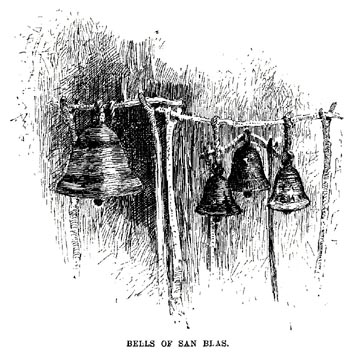
“Acapulco has the most complete and charming harbor, and an old fort dismantled by the French, of the order of Morro Castle. Manzanillo is a small strip of a place on the beach, built of wood, with quite an American look. The volcano of Colima appears inland, with a light cloud of smoke above it. San Blas, larger, but still hardly more than an extensive thatched village, has, on a bluff beside it, the ruins of a once more substantial San Blas. Old bronze bells brought down from it have been mounted in rude frames a few feet high to serve the purpose of the present poor church, which is without a belfry, and this is called in irony ‘the Tower of San Blas.'”

The article was accompanied by an illustration showing four bells swinging from a rickety wooden frame.

The Bells of San Blas, the illustration that sparked Longfellow's poetic imagination.

The article and its accompanying illustration prompted Longfellow to write what would prove to be his last poem, entitled The Bells of San Blas.

Like the port at that time, Longfellow saw the bells as relics from a byegone age:

They are a voice of the Past,
Of an age that is fading fast,
Of a power austere and grand;
When the flag of Spain unfurled
Its folds o’er this western world,
And the Priest was lord of the land.

The chapel that once looked down
On the little seaport town
Has crumbled into the dust;
And on oaken beams below
The bells swing to and fro,
And are green with mould and rust.

Several days later, Longfellow penned the last stanza, with a suggestion of optimism for the future:

O Bells of San Blas, in vain
Ye call back the Past again!
The Past is deaf to your prayer;
Out of the shadows of night
The world rolls into light;
It is daybreak everywhere.

On March 24, Longfellow, who had never had the good fortune to visit San Blas in person, passed away.

Should you visit San Blas today, spare a thought for this genius of a poet who was able to capture so eloquently the declining fortunes of this once-great port.

What further stanzas remain to be written in the story of San Blas, now revived by its important naval base and ornithological tourism?

Original article on MexConnect.

The development of Mexico’s transportation system is discussed in chapter 17 of Geo-Mexico: the geography and dynamics of modern Mexico. Ask your library to buy a copy of this handy reference guide to all aspects of Mexico’s geography today! Better yet, order your own copy…