Dec 062010
 

Cancún is Mexico’s premier tourist destination, attracting more than 3 million visitors a year. A recent Associated Press report by Mark Stevenson highlights the problems faced by the resort due to the erosion of its beaches.

Cancún was developed on formerly uninhabited barrier islands on Mexico’s Caribbean coast. The islands were low-lying sand bars, held together by beach vines and the dense, interlocking roots of coastal mangroves. Hurricanes periodically swept over these small islands blowing loose sand towards the beaches on the mainland. Despite the occasional hurricane, the sandbars survived more or less unscathed until construction of Cancún, Mexico’s first purpose-built tourist resort, began in 1970.

As Cancún has grown, so the damage from hurricanes has become more serious. Category 4 Wilma in 2005 was especially destructive.

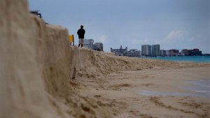
Cancún beach erosion

Cancún beach erosion. Photo: Dario Lopez-Mills/AP

Why has hurricane damage increased since 1970? Several factors are thought to play in a part in causing the increased rate of erosion of Cancún’s beaches in recent years:

  • hotels have been built too close to the shore, and too many are high-rise buildings. High-rise hotels deflect some of the wind downwards towards the ground. These wind eddies can stir up any dry surface sand in a process known as deflation.
  • hotels are too heavy. The sheer weight of high-rise hotels compacts the largely unconsolidated sediments beneath them, rendering the sediments less able to store or absorb excess water, and more liable to subsidence and structural problems. Extra weight also increases the load on slopes and leads to a higher incidence of slope failure.
  • coastal mangroves have been destroyed, removing their ability to protect the shoreline during storm events.
  • most beaches have been stripped of their original vegetation. The original beaches were protected by various adventitious vines which were quick to colonize bare sand. They would simultaneously help hold the sand in place, protecting it from wind action, and gradually add to the organic content of beaches to a point where they could support other, larger plants. Native vegetation has been mercilessly eradicated from Cancún’s beaches to create the tourism “ideal” of uninterrupted swathes of white sand.

It also appears that hurricanes and other tropical storms have become more frequent in recent decades, perhaps as a consequence of global climate change. The situation has also been exacerbated by the gradually rising sea level. Sea level on this coast is rising at about 2.2 mm/y.

Why have some of the efforts made to mitigate the beach erosion only made the situation even worse?

Following strong hurricanes (such as Wilma in 2005) Cancún has lost most of its beaches. The first attempt at beach restoration in 2006 cost 19 million dollars. In 2009, an even costlier (70 million dollar) beach restoration was carried out, using sand dredged from offshore. In one sense, the project was a resounding success. A new beach up to 60 meters wide, was created along some 10 km of coastline.

However, this new beach came at a considerable ecological cost. The pumping of sand from offshore disturbed the seafloor and damaged sealife, including populations of octupus and sea cucumbers. Fine sediments raised by the pumping traveled in suspension to nearby coral reefs, where it also had deleterious impacts.

In addition, the new beach is already being eroded away (some estimates are that up to 8% of the new sand has already been washed or blown away), so presumably if Cancún’s beaches are to be maintained in the future, beach restoration will have to become a regular event.

One hotel erected a breakwater or groyne on its beach to retain all the sand being carried along the coast by the process of longshore drift. The Associate Press article ends with a wonderful story of how the beach in front of this particular hotel was cordoned off by marines last year on the grounds that it was stolen property.

Link to 2013 news article: A fortune made of sand: How climate change is destroying Cancun

Tourism is one of Mexico’s major sources of revenue. But tourism, especially high-rise mass tourism such as that characterized by Cancún, comes with a hefty price tag. Policy-makers need to decide whether this price tag, which will only rise further in the future as we continue to damage our natural environment, is really one that is worth the cost.

Chapter 19 of Geo-Mexico: the geography and dynamics of modern Mexico looks in much more detail at Mexico’s purpose-built resorts as well as many other  aspects of tourism, resorts and hotels  in Mexico. Chapter 30 focuses on environmental issues and trends. Buy your copy today!
Is tourism in Mexico expanding?

 Other, Updates to Geo-Mexico  Comments Off on Is tourism in Mexico expanding?
Sep 112010
 

At first sight, this would seem like an easy question to answer but, in fact, it is not exactly clear whether tourism in Mexico in 2010 is increasing, decreasing or holding steady. Flows of tourists are affected not only by any changes in the situation of the destinations (receiving countries) but also by the situation at the point of origin. Most of Mexico’s international visitors come from the USA. This year, many potential tourists have opted to stay at home as a result of the current recession which started in 2008 and worsened in 2009.  On the other hand, the recession may have diverted some tourists to Mexico from more expensive destinations they had originally planned to visit.

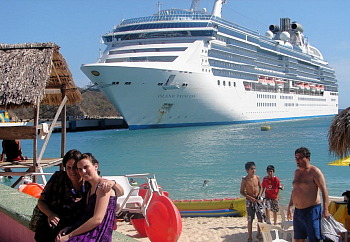
Cruise ship

Events within Mexico have also influenced the number of international tourist arrivals. The threat of H1N1 flu in early 2009 kept many international tourists away. Publicity about the violence associated with Mexico’s “drug wars” has accelerated in 2010 and almost certainly diverted some international tourists to other destinations.  On the other hand, some tourists who planned their 2010 summer vacation on the US Gulf Coast may have opted for Mexico after the massive oil spill off Louisiana.  An additional complicating factor is that international tourists only account for about 20% of Mexico’s total tourism revenue. While international tourism gets most of the attention, about 80% of tourism revenues come from national (Mexican) tourists.

Statistical data on tourism can be very difficult to interpret. The World Tourism Organization (WTO) and Mexican tourism agencies use similar international definitions of  a tourist:

  • A tourist as someone who spends at least one night (and less than one year) away from their usual home.

This definition ignores the precise reasons for travel. Hence, international tourism figures generally include travel for all purposes, including visiting family and friends, and business trips, as well as health and religious travel.  All these factors make assessing trends in Mexican tourism an analytical challenge.

In an August 2010 press conference, Mexico’s Secretary of Tourism Gloria Guevara presented data indicating that 818,278 international travelers visited Mexico in the month of June 2010 compared to only 605,435 in June 2009. This increase of 24% seems impressive, but requires closer scrutiny.  International arrivals in January and February 2010 were 5.2% and 5.8% less respectively than the same months in 2009; revenues for those two months were up 21% in peso terms, but actually fell by 7.5% in dollar terms, because of the falling value of the peso. Arrivals in March 2010 were 2.7% higher than March 2009.

Room occupancy rates (the percentage of available hotel rooms actually occupied) in 70 tourist destinations were up 11% for the first six months of 2010 compared to the same period in 2009.  However, 2009 was a very poor year for tourism in Mexico. Only 21.5 million international travelers visited Mexico in 2009, compared to a record 22.6 million in 2008.

Another major complication to the statistics is that they mask important regional differences. Tourism in some areas of Mexico is increasing steadily while it is simultaneously declining in others.  For example, occupancy rates for the first six months of 2010 were up 30% in Morelia and 15% in Huatulco compared to the previous year. However 14 of the 70 cities monitored showed no gain in occupancy over the low numbers posted in 2009. All these percentage figures ignore any changes in hotel capacity over that time. For instance, if an additional 2000 hotel rooms are opened in a resort, the occupancy rate may decrease slightly, even though more tourists actually visited the resort.

For cruise ships, a similar picture emerges. Though cruise ship visitors to Mexico were up in the first six months of 2010, they remain lower than the 2008 numbers for the equivalent period.

So, is tourism expanding, or not? Overall, tourism in 2010 is certainly improving over the 2009 numbers, which is quite encouraging given the extremely negative publicity resulting from drug war violence.  However, it is too early to say if the total number of visitors and revenues in 2010 will surpass the numbers for 2008.  This will depend not only on publicity related to Mexico’s fight against drugs, but also on the speed and extent of economic recovery in the USA. In addition, the collapse of Mexicana airline means that there are currently far fewer flights into Mexico that there were at this time last year.

See also:

Chapter 19 of Geo-Mexico: the geography and dynamics of modern Mexico focuses on Mexican tourism and development.  Buy your copy today to have a handy reference guide to all major aspects of Mexico’s geography!

Cultural and eco-tourism in the Copper Canyon region of Mexico

 Other, Teaching ideas  Comments Off on Cultural and eco-tourism in the Copper Canyon region of Mexico
Sep 102010
 

The Copper Canyon area is one of Mexico’s most popular destinations for eco-tourism activities. The canyons offer plenty of opportunities for canyoneering (like mountaineering, but starting from the top!), wilderness hikes and adventure trips. Mexico’s two highest waterfalls—Piedra Volada and Baseaseachi— are also in this area. The Basaseachic Falls are about 250 meters (820 ft) in height, beaten only by the virtually inaccessible 453-meter-high Piedra Volada falls, also in the state of Chihuahua. The Basaseachic National Park is easily accessible via paved roads from Chihuahua City.

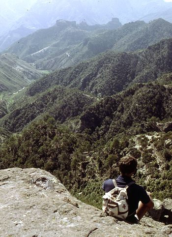
Magnificent scenery attracts hikers from all over the world.

Magnificent scenery attracts hikers from all over the world. Photo: Tony Burton; all rights reserved.

Adding to the allure of the Copper Canyon region is the fact that it is the home of some 50,000 indigenous Tarahumara Indians with their distinctive language, customs and lifestyle. The Tarahumara are one of the most culturally distinct groups in all of Mexico, famous especially for their long distance running ability and communal spirit.

Relatively easy access to this region is possible because of the railway line which runs from Chihuahua City to the lumber town of Creel, close to the canyons, and then skirts the canyon rim before descending to El Fuerte (once the capital of Arizona) and Los Mochis in Sinaloa. This railway is an incredible feat of engineering brilliance, matched by few railway lines anywhere on the planet. The railway is the lifeline of this remote region.

Travel articles:

Tourism in this area is not without its discussion points. Tourists place more pressure on scarce resources such as potable water. As noted in an earlier post, tourism has led to changes in the items made by indigenous Tarahumara women. Some hotel developers have viewed the Tarahumara as a human resource to be exploited as a quaint experience for their clients, though others have quite rightly viewed the Tarahumara as the area’s most important assets, one to admire and appreciate for what they are and how they have adapted to the harsh environment in which they live.

Points to ponder (discussion topics in class):

  • Should tourists encourage a monetary economy by buying Tarahumara souvenirs?
  • Is there a risk of tourists introducing a disease to which the Tarahumara have no resistance?
  • Should tourists be allowed to pick flowers and collect souvenir rock samples in the Copper Canyon area?
  • What are the pros and cons of tourists giving small items such as T-shirts to the Tarahumara?
  • What items, if any, are appropriate for tourists to offer the Tarahumara if they wish to give them something for sharing their ancestral homeland?
  • Is it right to take photos of Tarahumara homes, such as their cave dwellings?

Previous Geo-Mexico posts related to the Copper Canyon:

Chapter 10 of Geo-Mexico: the geography and dynamics of modern Mexico is devoted to Mexico’s indigenous peoples, including the Tarahumara Indians. If you have enjoyed this post, please suggest to your local library that they purchase a copy to enhance their collection.

Mexico’s Copper Canyon train is one of the world’s great railway trips

 Excerpts from Geo-Mexico, Other  Comments Off on Mexico’s Copper Canyon train is one of the world’s great railway trips
Sep 022010
 

The Copper Canyon region is one of the most remote parts of Mexico. This remoteness helps to explain why the area is the home of about 50,000 Tarahumara Indians, and how they have managed to preserve much of their highly distinctive culture to this day.

The Copper Canyon railroad line, “the most dramatic train ride in the Western Hemisphere” (Reader’s Digest), begins in Ojinaga and continues, via Chihuahua, to Los Mochis and Topolobampo. The railroad was started in the 1870s to enable produce grown in southern Texas to be exported via a Pacific port. Simultaneously, the twin settlements of Los Mochis and its port Topolobampo were developed on the other side of the Western Sierra Madre. The railroad project floundered and successive attempts to complete it all failed. Some innovative engineering finally led to the line being completed in 1961. Total cost? Over $100 million.

The highlights include a 360-degree loop at El Lazo (km 585 from Ojinaga), one of only three comparable examples anywhere in North America), and a 180-degree turn inside a tunnel near Temoris at km 708. The line crosses the Continental Divide three times, reaches a maximum height of 2400 m (at km 583) and skirts the rim of the Copper Canyon. Between Chihuahua and Los Mochis, there are 37 bridges (totaling 3.6 km) and 86 tunnels (totaling 17.2 km). Almost all passenger rail services in Mexico ended in the 1990s but daily services continue along this line, mainly for tourists.

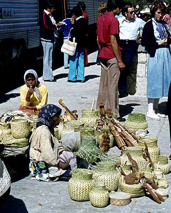
Tarahumara Indians wait for a sale at Divisadero, the station on the rim

Tarahumara Indians wait for a sale at Divisadero, the station on the canyon rim. Photo: Tony Burton; all rights reserved.

Almost all trains stop for a few minutes at Divisadero, a station set right on the rim of the canyon, with a lookout offering a magnificent panoramic view. Shy Tarahumara women and children sit quietly, weaving pine-needle baskets (see photo) and hoping for a sale. Many of them speak very little Spanish apart from the numbers; on the other hand, how many tourists speak even one word of the Tarahumara language? Thirty years ago, most articles sold by the women were items similar to ones they would use everyday themselves in their daily tasks. Sadly, many of the articles sold today are made specifically for the tourist trade.

Unlike the railway, Los Mochis and Topolobampo both soon flourished. Topolobampo was started by US engineer Albert Kimsey Owen who chose this previously unsettled area for a socialist colony based on sugar-cane production, and as the terminus for the railway. Topolobampo has one of Mexico’s finest natural harbors, a drowned river valley or ria, which affords a safe haven in the event of storms. Los Mochis was officially founded in 1893 by a second American, Benjamin Johnston, who built a sugar factory there.

Los Mochis became especially important in the second half of the twentieth century as a major commercial center, marketing much of the produce grown on the vast El Fuerte irrigation scheme. Much of this produce is still exported to the USA via the famous Copper Canyon railway. Los Mochis and Topolobampo are unusual—there are few other examples of such “new towns”, with no colonial or pre-Hispanic antecedents, anywhere else in Mexico.

Previous Geo-Mexico posts related to the Copper Canyon:

External links of interest:

Chapter 10 of Geo-Mexico: the geography and dynamics of modern Mexico is devoted to Mexico’s indigenous peoples, including the Tarahumara Indians. If you have enjoyed this post, please suggest to your local library that they purchase a copy to enhance their collection.

Sep 012010
 

Several famous writers wrote about Mexico despite having no direct geographic experience of the country. In an earlier post, we looked at the case of Jules Verne. This time, we look at Henry Wadsworth Longfellow.

There is some sound historical geography in the famous poem The Bells of San Blas, yet author Henry Wadsworth Longfellow had never ever visited the town.

The San Blas referred to in the poem is on the Pacific coast, in the state of Nayarit. It is a small town with several good hotels and restaurants, and a birding “hot spot”. The variety of habitats around the town, ranging from sandy beaches and luxuriant mangroves to palm plantations and tropical swamps, have attracted more than 500 different bird species, or about half of all the bird species known in Mexico.

The town’s economy was not always geared to tourism. For more than a century, San Blas, founded in 1768, functioned as an important port and boat-building center. The vessels built in San Blas included those used by Junípero Serra to establish missions in California. To ensure that taxes were paid on imports, an imposing customs house was built on the shore. To guarantee safe passage, a church dedicated to “Our Lady of the Sailor’s Rosary” stands atop the steep-sided Cerro de San Basilio which overlooks the town. In the church hung the famous bronze bells.

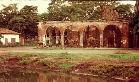
San Blas Customs House

The former Customs House of San Blas in the evening light, 1989. Photo: Tony Burton. All rights reserved.

Time conspired against the port of San Blas. The harbor silted up, the coastline gradually inched its way further west. Over the years, other ports such as Acapulco and Mazatlan became more important. San Blas declined. The customs house and church were abandoned, transformed from bustling buildings into evocative ruins. By the end of the 19th century, the port was very much a “has been”.

In March, 1882, far away from Mexico, in Cambridge, Massachusetts, the American poet Henry Wadsworth Longfellow (best known for Paul Revere’s Ride, The Song of Hiawatha, and Evangeline) lay on his deathbed. Longfellow, born in 1807, was a prolific poet and accomplished linguist. After a long and illustrious career, which included teaching at Harvard College, his life was now drawing to a close, even as the distant port of San Blas was falling into disuse.

By a happy coincidence, the March 1882 issue of Harper’s new monthly magazine (Volume 64, Issue 382) contained an article by William Henry Bishop, entitled “Typical Journeys and Country Life in Mexico”. Bishop’s article described several Pacific coast ports, including San Blas:

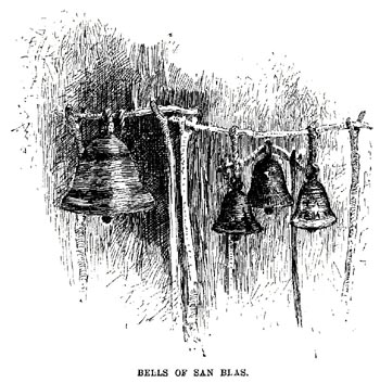
“Acapulco has the most complete and charming harbor, and an old fort dismantled by the French, of the order of Morro Castle. Manzanillo is a small strip of a place on the beach, built of wood, with quite an American look. The volcano of Colima appears inland, with a light cloud of smoke above it. San Blas, larger, but still hardly more than an extensive thatched village, has, on a bluff beside it, the ruins of a once more substantial San Blas. Old bronze bells brought down from it have been mounted in rude frames a few feet high to serve the purpose of the present poor church, which is without a belfry, and this is called in irony ‘the Tower of San Blas.'”

The article was accompanied by an illustration showing four bells swinging from a rickety wooden frame.

The Bells of San Blas, the illustration that sparked Longfellow's poetic imagination.

The article and its accompanying illustration prompted Longfellow to write what would prove to be his last poem, entitled The Bells of San Blas.

Like the port at that time, Longfellow saw the bells as relics from a byegone age:

They are a voice of the Past,
Of an age that is fading fast,
Of a power austere and grand;
When the flag of Spain unfurled
Its folds o’er this western world,
And the Priest was lord of the land.

The chapel that once looked down
On the little seaport town
Has crumbled into the dust;
And on oaken beams below
The bells swing to and fro,
And are green with mould and rust.

Several days later, Longfellow penned the last stanza, with a suggestion of optimism for the future:

O Bells of San Blas, in vain
Ye call back the Past again!
The Past is deaf to your prayer;
Out of the shadows of night
The world rolls into light;
It is daybreak everywhere.

On March 24, Longfellow, who had never had the good fortune to visit San Blas in person, passed away.

Should you visit San Blas today, spare a thought for this genius of a poet who was able to capture so eloquently the declining fortunes of this once-great port.

What further stanzas remain to be written in the story of San Blas, now revived by its important naval base and ornithological tourism?

Original article on MexConnect.

The development of Mexico’s transportation system is discussed in chapter 17 of Geo-Mexico: the geography and dynamics of modern Mexico. Ask your library to buy a copy of this handy reference guide to all aspects of Mexico’s geography today! Better yet, order your own copy…

Mexico’s top 13 natural wonders

 Other  Comments Off on Mexico’s top 13 natural wonders
Aug 242010
 

According to the 1.5 million votes cast in a Televisión Azteca survey in 2007 (published in the always interesting glossy magazine mexicanísimo), the top 13 natural wonders in Mexico are (in no particular order):

  • The Copper Canyon region (Chihuahua)
  • The El Cielo Biosphere Reserve (Sierra Madre Occidental, Tamaulipas)
  • The Sumidero Canyon (Chiapas)
  • Cuatro Ciénegas oasis (Chihuahuan desert)
  • El Arrecifal coral reef ecological park (Veracruz)
  • El Pinacate desert (Sonora)
  • The Monarch Butterfly reserves (Michoacán)
  • The agave landscapes surrounding Tequila (Jalisco)
  • The Centla wetlands (Tabasco)
  • The Peña de Bernal monolith (Querétaro)
  • The Basalt Prisms of San Miguel Regla (Hidalgo)
  • The Sótano de las Golondrinas sinkhole (San Luis Potosí)
  • Xel-Há marine park (Quintana Roo)
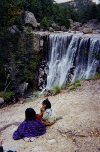
Tarahumar woman and child, by waterfall in the Copper Canyon

Tarahumar woman and child, by waterfall in the Copper Canyon. Photo: Tony Burton. All rights reserved.

Also ranked highly were

  • Cerro de la Silla (Nuevo León)
  • Estero de Palo Verde (Colima)
  • Loltún caverns (Yucatán)
  • Mexcaltitán Island (Nayarit)

We will describe each of these geographical treasures in more detail in future posts.

How many of these places have you visited?

What other places do you think should be on this list?

If you have enjoyed this post, you might also enjoy Geo-Mexico: the geography and dynamics of modern Mexico.

Buy your copy today!

Review of “One Hundred and One Beautiful Small Towns in Mexico”.

 Books and resources  Comments Off on Review of “One Hundred and One Beautiful Small Towns in Mexico”.
Jul 302010
 

In an earlier post, we listed the towns included in One Hundred and One Beautiful Small Towns in Mexico, by Guillermo García Oropeza and Cristóbal García Sánchez (Rizzoli International Publications, 2008; 280 pp.). Here we offer a short review of the book.

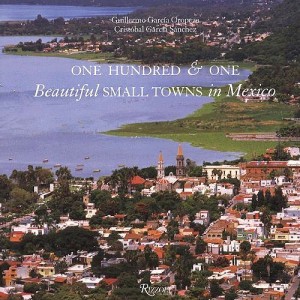
Cover of 101 Beautiful Small Towns in MexicoThis is a large format book, with many magnificent photographs. A fascinating range of places is included, even though the criteria used for their selection are nowhere explained. The selection offers lots of interest for anyone curious about Mexico’s geography.

For example, a stunning aerial view of Mexcaltitán (Nayarit) shows the cross-and-concentric-circle street pattern of “Mexico’s Venice”, surrounded by muddy brown shrimp-bearing swamps.

Curiously, the list of places included in the book on the contents pages adopts the affected style of using no capital letters whatsoever for any of the town names.

Each place is afforded at least a double page spread, and the back of the book has helpful lists of tourist offices, and selected hotels and restaurants.

Despite the title, some of the locations are more to do with the natural environment than with settlement. For instance, the town of Cuatro Ciénegas is a somewhat unprepossessing place whereas the desert oases of Cuatro Ciénegas,on which the book entry focuses, are an amazing natural zoological laboratory of crystalline water and extraordinary biodiversity. Similarly, Cacahuamilpa Caverns hardly qualify as a town!

The San Ignacio entry focuses on difficult to reach cave paintings. The village itself has few claims to fame beyond its colonial mission church.

The Paricutín double-page spread is named after the volcano which devoured several small settlements including Parícutin (for the name of the original village, the accent is on the second syllable; for the volcano it is on the last syllable). The photos included here actually show (as the captions make clear) the towns of Angahuan, and the upper facade of the church of San Juan Parangaricutiro, overwhelmed by the volcano’s lava.

A couple of places are given names that might not be very familiar to their residents. Casas Nuevas (Chihuahua) is actually Nuevo Casas Grandes (the real Casas Nuevas is an entirely different place which had only 13 inhabitants at the time of the 2000 census) and Mineral del Monte (Hidalgo) is more usually known as Real del Monte.

In southern Mexico, Santa María del Tule gets an entry. Santa María would not be worthy of mention, except for the fact that it is home to what is arguably the world’s largest tree, now thankfully restored to good health after decades of neglect.

In the Yucatán, three entries ignore the main thrust of the book, and focus instead on significant routes, one linking henequen (sisal) haciendas, one combining relatively minor archaeological sites which share distinctive Puuc architecture, and one going from one friary (monastery) to another. These are all interesting trips, but are entirely unexpected in a book specifically about towns. Some judicious editing might have removed some of the inaccuracies such as describing hemp (sisal) as “in the agave… or cactus, family”. The family name for agaves is Agavaceae which includes the genus Agave. In any event, agaves are biologically distinct to all members of the Cactaceae family; confusing agaves with cacti is an unexpected blunder.

The chosen towns quite rightly include some long-abandoned sites such as Teotihuacan, “City of the Gods”, which was once a city of 200,000 or so, the fascinating Mayan sites of Palenque and Chichen Itza, and Mitla and Monte Alban, both in Oaxaca.

The cover photo of the town of Chapala in Jalisco, much favored by American and Canadian retirees in recent years, unfortunately dates from a time when the lake level was relatively low. The green areas in the lake are floating masses of the introduced aquatic weed water hyacinth.

Despite being written by a Mexican historian, there are numerous minor historical inaccuracies in the text, though these should not detract from the enjoyment of the average reader.

For instance, in the Chapala entry, illustrated by the same photo used on the cover, it should be Septimus Crowe (not Crow), and the “navigation company with two small steam ships” had nothing to do with Christian Schjetnam. The steamships predated his arrival in Chapala by many years. Schjetnam did however, introduce two small sail yachts to the area, perhaps explaining the confusion. The description of President Díaz’s interest in Chapala appears to imply that he was first acquainted with the lake when he visited “a political crony” in 1904. Actually, Díaz was certainly personally familiar with Lake Chapala from long before this.

The entry for Santa Rosalia repeats the long-held but unproven idea that the main church was designed by Frenchman Gustave Eiffel (of Eiffel Tower fame). The town does have other Eiffel connections, and the church may indeed have been brought lock, stock and barrel from the 1889 Paris World Exhibition. However, research by Angela Gardner strongly suggests that the original designer was probably not Eiffel but was far more likely to have been Brazilian Bibiano Duclos, who graduated from the same Parisian academy as Eiffel. Gardner proved that Duclos took out a patent on prefabricated buildings, whereas she could find no evidence that Eiffel had ever designed a prefabricated building of any kind. Regardless of who designed it, it is certainly a unique design in the context of Mexico, and well worth seeing.

And really, surely this is the main point of this book. It was presumably never intended to be a reliable geographical (or historical) primer, but rather an enticing selection of seductive places, many of which will be unfamiliar to any but the most traveled reader. The variety of places included is breathtaking; few countries on earth can possibly match it. As such, One Hundred and One Beautiful Small Towns in Mexico is a resounding success.

This beautifully illustrated book should certainly tempt readers to venture into new parts of Mexico in search of these and other memorable places. Enjoy your travels!

– – – –

Mexico’s cities and towns are analyzed in chapters 21, 22 and 23 of Geo-Mexico: the geography and dynamics of modern Mexico. Buy your copy today!!

Jul 242010
 

According to the book One Hundred and One Beautiful Small Towns in Mexico, by Guillermo García Oropeza and Cristóbal García Sánchez (Rizzoli International Publications, 2008; 280 pp), these places all merit inclusion in the list of the 101 Beautiful Small Towns in Mexico.

Cover of 101 Beautiful Small Towns in MexicoWe will review the book more formally in a future post, since it offers some insights into Mexico’s geography, but for now take a look at the list below, and see if you agree.

Our own list of the most beautiful small towns would certainly include most of these, though we can think of some equally excellent choices which are not included.

Are there other towns that would be on your list? If so, let’s hear about them!

BAJA CALIFORNIA

  • San Felipe
  • Valle de Guadalupe

BAJA CALIFORNIA SUR

  • Loreto
  • Mulegé
  • San Ignacio
  • San Jóse del Cabo
  • Santa Rosalía
  • Todos Santos

CAMPECHE

  • Campeche
  • Edzná

CHIAPAS

  • Comitlán de Domínguez
  • Chiapa de Corzo
  • Palenque
  • San Cristóbal de las Casas
  • Yaxchilán
  • Bonampak
  • Zinacantán
  • San Juan Chamula

CHIHUAHUA

  • Batopilas
  • Creel
  • Hidalgo del Parral
  • Nuevas Casas [Nuevo Casaas Grandes]
  • Mata Ortíz
  • Cuarenta Casas

COAHUILA

  • Cuatro Ciénegas
  • Parras

COLIMA

  • Cómala

FEDERAL DISTRICT

  • Coyoacán

GUANAJUATO

  • Atotonilco
  • Dolores Hidalgo
  • Guanajuato
  • San Miguel De Allende
  • Yuriria

GUERRERO

  • Cacahuamilpa
  • Taxco

HIDALGO

  • El Chico
  • Huasca
  • Mineral del Monte [Real del Monte]
  • Tula

JALISCO

  • Chapala
  • Ajijic
  • Lagos de Moreno
  • Mazamitla
  • Puerto Vallaría
  • San Sebastián del Oeste
  • Tapalpa
  • Tequila
  • Tlaquepaque

MEXICO STATE

  • Malinalco
  • Teotihuacán
  • Acolman
  • Tepotzotlán
  • Valle De Bravo

MICHOACÁN

  • Angangueo
  • Cuitzeo
  • Paricutín
  • Angahuan
  • Santiago Nurío
  • Paracho
  • Pátzcuaro
  • Santa Clara del Cobre
  • Zirahuén
  • Tlalpujahua
  • Tzintzuntzan

MORELOS

  • Cuernavaca
  • Tepoztlán
  • Tétela del Volcán
  • Xochicalco
  • Yecapixtia

NAYARIT

  • Mexcaltitán

NUEVO LEÓN

  • Bustamante
  • Villa de García

OAXACA

  • Cuilapan
  • Arrasóla
  • Ixtlán De Juárez
  • Mitla
  • Monte Albán
  • Ocotlán
  • San Bartólo Coyotepec
  • Santa María del Tule
  • Tlacochahauya
  • Tlacolula
  • Dianzú
  • Yanhuitlán

PUEBLA

  • Cuetzalan
  • Cholula
  • Huejotzingo
  • Tonantzintia
  • San Francisco Acatepec

QUERÉTARO

  • Bernal
  • Jalpan

QUINTANA ROO

  • Bacalar
  • Cozumel
  • Holbox
  • Isla Mujeres
  • Playa del Carmen
  • Tulum

SAN LUIS POTOSÍ

  • Real de Catorce

SINALOA

  • Cósala

SONORA

  • Alamos
  • Magdalena de Kino

TLAXCALA

  • Tlaxcala

YUCATAN

  • Chichen Itza
  • Izamal
  • Uxmal
  • Valladolid

VERACRUZ

  • Coatepec
  • Los Tuxtlas
  • Papantia
  • Tlacotalpan

ZACATECAS

  • Guadalupe
  • Jerez
  • Sombrerete

Mexico’s cities and towns are analyzed in chapters 21, 22 and 23 of Geo-Mexico: the geography and dynamics of modern Mexico. Buy your copy today!!

The mud volcanoes known as Los Negritos, in Michoacán, Mexico

 Other  Comments Off on The mud volcanoes known as Los Negritos, in Michoacán, Mexico
May 112010
 

Los Negritos (the Little Black Ones) are a legacy of the volcanic heritage of most of central and western Mexico. They are located a few kilometers east of Jiquilpan in the state of Michoacán.

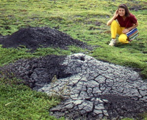
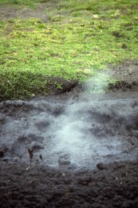
Two of the “Los Negritos” mud volcanoes. Photo: Tony Burton. All rights reserved.

Los Negritos are small mud volcanoes (up to a meter or two across) which burble and gurgle, hiss and splutter, and occasionally erupt, throwing hot mud into the air and emitting sulfurous fumes. They are great fun to watch, but take care! Don̓t get too close or you may be splattered with the hot mud. Worse yet, you could step in the innocuous-looking but highly unstable surrounding mud patches which can rarely hold a person’s weight.

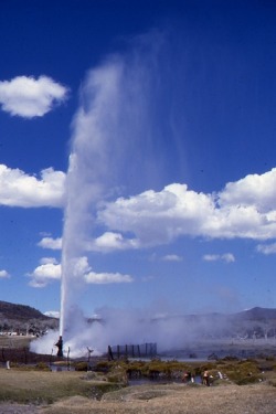
Other vestiges of volcanic action include several geysers, including the one at Ixtlán de los Hervores and the many thermal hot springs, now often utilized for tourist facilities and spas, scattered  throughout Mexico’s Volcanic Axis.

This is an edited extract from Western Mexico, A Traveler’s Treasury (Sombrero Books 2013).

Mexico’s volcanic landscapes are discussed in chapters 2 and 3 of Geo-Mexico: the geography and dynamics of modern Mexico.

Mud volcano puffs into action. Photo: Tony Burton. All rights reserved.

May 072010
 

The geysers of Ixtlán de los Hervores have long attracted the attention of travelers. They are located north-west of the city of Zamora in the state of Michoacán. The temperature of the water emerging from underground varies between about 90 and 100 degrees Centigrade.

Here is how English explorer Captain George Lyon described them following his visit in 1826:

Photo: Tony Burton. All rights reserved.

”The plain is interesting, as being in some places covered by an efflorescence of muriate of soda, which forms a considerable article of commerce. The saline earth is collected into large vats, through which water is filtered, and then placed to evaporate in small well-cemented beds of about twelve feet by six. All this, however, interested me but little in comparison with the wells of boiling water, which to the amount of many hundreds are dispersed in a space of one mile and a half by a quarter of a mile in width, east and west along the plain, and sending up at intervals clouds of steam. In fact the whole surface of this place is nothing more than the crust of a volcano; and seven years back an earthquake opened a large rent in the plain,whence issued  fountains of the purest water, and of mud also, both of a boiling heat.

In the evening I rambled amongst the springs, which are of all forms and sizes, from holes not larger than an inch, through which the water is seen and heard boiling beneath, to large spaces of several yards in diameter; some as transparent as though distilled. Others, within a foot of them are turbid, or of boiling mud; and there is one called “El Pozo Verde,” in which, although perfectly clear, the water is of a fine deep green. The springs are in some places constantly tranquil, and varying in temperature  from 110̊ to 130̊; but in far the greater number the water boils up with amazing force and in one well, chosen at random, I cooked a piece of mutton of the size of an egg in four minutes and fifty seconds. All the fountains which have been sufficiently small to admit of it, have been choked up with stones and bushes, to prevent cattle from falling into them; yet a number of poor beasts are frequently thus destroyed.”

Lyon, G.F. 1828 Journal of a residence and tour in the Republic of Mexico in the year 1826, with some account of the mines of that country. London: John Murray.

Mexico’s volcanic landscapes are discussed in chapters 2 and 3 of Geo-Mexico: the geography and dynamics of modern Mexico.

Medical tourism in Mexico, and where the Maya live

 Mexico's geography in the Press  Comments Off on Medical tourism in Mexico, and where the Maya live
Apr 222010
 

A few months ago, English journalist Rachel Rickard Straus wrote an article entitled “How I swapped a medical trial for a free holiday in Mexico” and published on the telegraph.co.uk website.

This is an interesting variation on the increasingly important field of medical tourism, much studied by geographers over the past decade or so. Several forms of medical tourism have been important in Mexico for a long time, mainly because of the significant price differential either side of the USA-Mexico border for almost all medical and dental procedures. Guadalajara was one of several cities where Americans could afford cosmetic surgery at the hands of (often) American-trained experts at a fraction of the cost back home, and were able to recuperate in relative luxury away from the preying eyes of family and colleagues.

Ms Straus appears to have thoroughly enjoyed her free holiday and apparently suffered no ill effects from the medical trial. Or did she?

Her article describes how she “lapped up the Mexican sunshine, admired the incredible Mayan pyramids and even took a road trip to San Miguel de Allende, a world heritage site.” This is fairly remarkable, since she managed all this without even leaving central Mexico! Presumably she actually meant either Aztec pyramids (if she visited El Templo Mayor in downtown Mexico City) or, much more likely the Teotihuacan pyramids, where Ms Straus had her picture taken. Archaeologists do not know all that much about the people who built the Teotihuacan pyramids, who are usually called simply Teotihuacanos. As any Mexican 5th grader knows, the Maya built their pyramids far to the east, in and around the Yucatán Peninsula, where sites such as Uxmal, Chichen Itza, Palenque, Calakmul and Tulum, among dozens of others, are proof of the Maya’s very considerable architectural skills.

Tourism based on major events in Mexico (“concert tourism”)

 Mexico's geography in the Press, Teaching ideas  Comments Off on Tourism based on major events in Mexico (“concert tourism”)
Apr 042010
 

The recent (2010) Elton John concert at Chichen Itza provides an ideal case-study for discussion in geography classes. Events such as this concert are a great starting point for a debate about the benefits and drawbacks of using world-famous archaeological or cultural sites as the setting for concerts by major modern international music stars.

Benefits:

  • $$$ paid directly by event organizers
  • $$$ paid by visiting concert-goers (“concert tourists”?) for hotels, food and transportation
  • free promotion for the site in world press and media

Drawbacks:

  • shows little respect for indigenous (Mayan) culture; the Maya consider the site a ceremonial center
  • many of the $$$ end up outside Mexico in the main offices of multi-national hotel chains and foreign airlines
  • ticket prices of $80—$800 (dollars), which most local residents are unable to afford, make this an elitist event

After those initial suggestions, it’s over to you… Readers are hereby invited to add their own suggestions of other benefits and drawbacks. Please do this via the comments section below this post.  (Click here if the comments section is not currently visible.)

So, what other factors should be taken into account before reaching an evaluation of whether or not such events are a good idea?

What do YOU think?

The first geography field trip guide in Mexico

 Books and resources, Teaching ideas  Comments Off on The first geography field trip guide in Mexico
Apr 032010
 

Despite the popularity of geography in Mexico’s high schools, students are rarely involved in any geographic fieldwork until they reach university. The major exceptions are those students lucky enough to attend one of the international schools offering courses such as the International Baccalaureate (IB) Diploma Programme. The IB geography syllabus requires all students to have undertaken and written up a report on fieldwork. Most IB fieldwork is hypothesis-based.

It is perhaps not surprising therefore that the number of publications relating to fieldwork in Mexico is very small. There have been a limited number of specialist “field guides” published, relating to geology and geography, and coinciding with international conferences.

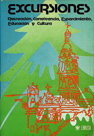
To the best of my knowledge, the first fieldwork guide aimed at high school students, teachers and the general public was written following a meeting of teachers in Mexico City in March 1979. Excursiones was designed to be a guide for “teachers, parents and/or organized groups interested in finding pleasant and educational ways of enjoying our environment and encouraging the spiritual elements inherent in making use of the tourist attractions that form part of Mexico’s heritage.”

The book, published by Editorial Limusa in 1983, has 14 general chapters (clothing, food, first aid, etc), followed by 17 destination specific chapters:

  • Cacahuamilpa
  • Taxco
  • Zempoala
  • Tepoztlán
  • Desierto de los Leones
  • Ruta de la Estrella
  • Valle de Bravo
  • Isla de los Aves-Ocotal
  • El Xinantécatl and its lakes
  • Piedras Encimadas
  • Ruta de los Volcanes
  • Africam Safari
  • El Chico
  • Basalt columns
  • Tolantongo
  • El Xitle and El Ajusco
  • Chapingo-Texcoco

We’ll take a closer look at the opportunities offered for fieldwork in some of these locations in future posts.

Mar 102010
 

As mentioned in a previous post about tourist guidebooks, the introduction of railways into Mexico and the gradual expansion of the railway network encouraged the development of all kinds of social, industrial and tourist activities.

The Mexico City-Puebla line was completed in 1886 and went via the small town of Cuautla in the state of Morelos. Cuautla is about 25 kilometers south-east of Cuernavaca.

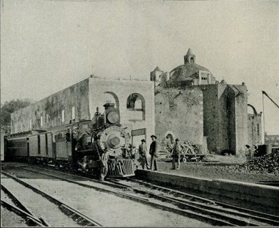
In Cuautla, the builders of the railway found a perfect location for the town’s new station, very close to the center. They station was constructed around the cloisters of an abandoned building, the former Dominican convent of San Diego, which dated back to 1657. Its ecclesiastical life ended some years before parts of it were incorporated into the railway station in 1881.

The 1899 edition of Reau Campbell’s famous Guide provides an idea of what visitors to Cuautla could expect when the train was in its heyday:

The train stops some minutes in Cuautla and there may be time for a walk through the little alameda, just outside of the station, where there are trees and flowers, a hotel where there are good wines, coffee and lunches to be had. As the approach to the station has been through a grove of tropical trees and gardens, so is its departure, and the train continues southward through the cane country to Yautepec…

A decade later, the British-born journalist William English Carson (1870-1940) spent four months in Mexico. Carson also visited Cuautla:

It is a quaint, old-fashioned place, with narrow, cobble-paved streets, and houses of the usual low, flat-roofed type. As I strolled about the town the next morning, I noticed some unusually amusing signs of Americanization. An enterprising barber, for example, displayed a big signboard with the English inscription, “Hygienic, non-cutting barber shop,” as a tempting inducement to tourists, and one or two other establishments displayed in their windows the interesting announcement, “American spoke here.”

The Oldest Railway Station in the World. Cuautla. Inter-Oceanic Railway (from Carson).

Carson also describes the railway station:

Cuautla is also famous for having the oldest railway station in the world, the crumbling, ancient structure which is now used for this purpose having been the Church of San Diego built in 1657. … The day after my arrival I went into the old church, the body of which is now used as a warehouse, while one side of it bordering the railway line provides accommodation for the waiting-room and various offices. A quantity of wine-barrels were piled up at the spot where the high altar had formerly stood, and all kinds of merchandise were stored in other parts of the building. Over the door was an inscription, the first words of which seem appropriate enough to the present condition of the once sacred edifice: “Terribilis est iste hic domus dei et porta coeli ” (How dreadful is this place. This is none other but the house of God and this is the gate of heaven).

In October 1973, the original narrow gauge track from Mexico City to Cuautla was replaced with standard gauge line, bringing a premature end to the lives of several steam engines. These engines were among the very last steam locomotives used in regular service anywhere in North America. Fortunately, the oldest section of narrow gauge in Mexico, built between Amecameca and Cuautla still survives. Originally built in 1881 as the Ferrocarril Morelos (Morelos Railroad), it was partially re-opened, between Cuautla and Yecapiztla, for a tourist steam train service in July 1986, using engine #279 and four restored second class coaches. Engine 279 is a Baldwin locomotive, built in Philadelphia, first brought into service in 1904, and now spends most of its time resting contentedly in the Cuautla museum, the museum that is housed in the oldest building ever used as a railway station anywhere in the world.

Postscript: The rival claims of Red Hall, Bourne, U.K. to be the oldest station building in the world

I am very grateful to Tony Smedley and Ian Jolly, two very alert railway enthusiasts from the U.K., for bringing to my attention the rival claims of a railway station building in Lincolnshire to be the oldest in the world. The original owner of Red Hall, in Bourne, died in 1633. The Hall was later used as the Station Master’s house and Ticket office for the Bourne & Essendine Railway, which began operations in 1860. The last passenger train through Bourne station was apparently in 1959, with freight services ending a few years later. (For more details, click on Red Hall and Bourne Railway Station respectively.

Since the Red Hall (Bourne) station no longer has any rail tracks or trains associated with it, I stand by my claim (for now at least) that Cuautla station (which still does have rail tracks and trains) is the oldest railway station in the world. Apparently, Carson, at the time he was writing, was unaware of the rival claims of Red Hall.

Sources:

Campbell, Reau. Campbell’s New Revised Complete Guide and Descriptive Book of Mexico. Chicago. 1899.

Carson, William English. Mexico: the wonderland of the south. 1909

This is an edited version of an article originally published on MexConnect.
Click here for the complete article

The growth of the railway network and the importance of railways in Mexico are examined in depth in chapter 17 of Geo-Mexico: the geography and dynamics of modern Mexico and tourism in Mexico is the subject of chapter 19.

Mar 042010
 

Mexico is one of the 30 member states of the OECD (Organisation for Economic and Commercial Development).

Of all these countries, Mexico, Spain and Portugal are the three whose economies gain most from tourism. In Spain, 11% of its GDP comes from tourism, in Portugal 10.5% and in Mexico 8.2%.

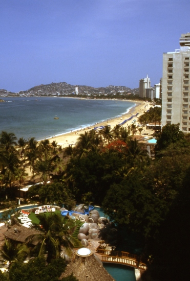
Acapulco, Mexico's first major resort. Photograph by Tony Burton. All rights reserved.

Employment in Mexico is also greatly dependent on tourism. Of the 30 OECD countries, Mexico has the eighth highest figure for the proportion of the workforce in tourism (6.7%), after Spain (13%), Italy (9.7%), New Zealand (9.6%), Hungary (9.2%), Portugal (8.0%), Greece (7.3%) and Japan (6.9%).

Many aspects of tourism are analyzed in detail in chapter 19 of Geo-Mexico: the geography and dynamics of modern Mexico, including:

  • The problems of defining “a tourist”
  • How different kinds of tourism compare in terms of their contribution to Mexico
  • Tourism as a development strategy
  • Spontaneous and purpose-built resorts
  • The concepts of sustainability and ecotourism
  • “Residential tourism”, an unusual category of tourism that is very important in certain specific regions in Mexico.

The development of railways led to tourist guide books

 Other  Comments Off on The development of railways led to tourist guide books
Mar 012010
 

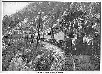
In the golden age of steam, railway lines were built all over Mexico. Rail quickly became THE way to travel. Depending on your status and wealth, you could travel third class, second class or first class. Anyone desiring greater comfort and privacy could add their luxury carriage to a regular train. To avoid mixing with the ordinary folk, the super-rich and the privileged few hired or ran their own special trains.

The railway era ushered in an entire new genre of travel writing, which culminated in the first genuine guidebooks, describing routes and places that other travelers could visit with relative ease. The earliest comprehensive guide to Mexico was Appletons’ Guide to Mexico (1883); it was soon followed by several others including Campbell’s Complete guide and descriptive book of Mexico, first published in 1895.

The 1899 edition of Reau Campbell’s famous Guide provides an idea of what visitors to Cuautla in the state of Morelos, for example, could expect when the train was in its heyday:

Here again the tourist finds another feature of Mexico’s scenery and people, totally different from all the other travels in the Republic. The houses are adobe as to walls and thatched as to roofs; the broad plains have curious trees; bands of Indians troop from one town to another in curious costumes, marching along totally oblivious to the passing locomotive and approaching civilization, and will not give way to the latter any quicker than they will to the engine if they happen to be on the track when it comes along. In fact, it is hard for them to understand that the train cannot “keep to the right” when it meets people in the road, and they claim the right of way from the fact that they were there first.

A decade later, the British-born journalist William English Carson (1870-1940) spent four months in Mexico. Carson also visited Cuautla, on the advice of a doctor as the result of catching influenza.

Upon making inquiries at the railway office about trains to Cuautla, the clerk handed me an illustrated pamphlet with a fine colored picture on the cover representing a Mexican tropical scene. It bore the title, “Cuautla, Mexico’s Carlsbad.” What! I thought, another Carlsbad? In glowing language the booklet described Cuautla as an earthly paradise with a magnificent climate, beautiful scenery, splendidly equipped hotels and a warm sulphur spring whose waters were a certain specific for almost every human ailment. What more could one desire?

Carson continues:

Cuautla is about a hundred miles or so from Puebla, and the speedy trains of the Interoceanic Railway take about ten hours to make the journey. The train which I took left about seven o’clock in the morning ; it was not timed to reach Cuautla until five in the evening; and as there was not any restaurant at any intermediate station, a somewhat terrifying prospect of starvation faced travellers. How were they to get their luncheon? A little pamphlet given away by an American tourist agency and evidently written by an accomplished press-agent gave me the desired information: “At a certain station on the road,” said my traveller’s guide, “your train will stop for some twenty minutes. Here you will be greeted by graceful Indian women,— beauties, many of them, with their olive skins and dark, flashing eyes, bearing themselves with queenly grace in their dainty rebosos and flowing garments, white as the driven snow. They will offer you such dainties as tamales, chili-con-carne and tortillas, piping hot from their little stoves, and prepared with all the scrupulous cleanliness of a Parisian chef. They will bring you dainty refrescos of freshly gathered pineapple or orange to quench your thirst, and pastry such as your mother may have made when her cooking was at its prime.”
Now, what more could any reasonable traveller demand? What need was there for a restaurant when there were all these good things to be enjoyed? I showed my guide to an American friend before I started. He chuckled, gave a knowing wink and remarked, “Great is the faith of man, for after all your experiences you can still believe in a Mexican guide-book.”

Hotels were not always the same standard as those in the USA, but were certainly less expensive:

The attractions of the hotel were hardly up to those of a Carlsbad establishment, for it had neither a writing nor a smoking room; but the terms were rather more attractive than the usual Carlsbad tariff, being about two dollars a day inclusive. It is true there was a good deal of Mexican about the cooking, but the meals were not at all bad and the service very fair…

Railways may have opened up Mexico for tourism, but today, sadly, there are virtually no passenger lines still operating, the main exception being the justly famous Copper Canyon line from Los Mochis to Chihuahua.

Sources:
Campbell, Reau. Campbell’s New Revised Complete Guide and Descriptive Book of Mexico. Chicago. 1899.
Carson, William English. Mexico: the wonderland of the south. 1909

This is an edited version of an article originally published on MexConnect.
Click here for the complete article

The growth of the railway network and the importance of railways in Mexico are examined in depth in chapter 17, and tourism in Mexico is the subject of chapter 19. of  Geo-Mexico: the geography and dynamics of modern Mexico.

Mexico’s top yachtsman wins the first round-the-world yacht race.

 Other  Comments Off on Mexico’s top yachtsman wins the first round-the-world yacht race.
Feb 272010
 

The first Whitbread Round-The-World yacht race was won by a Mexican.

Most people do not associate Mexico and Mexicans with yachting, but it’s a fact that the first Whitbread Round-The-World Yacht Race, in 1973-4, was won by the Mexican ketch Sayula II, skippered by Ramón Carlin, a Mexican businessman who made his money from washing machines.

What makes Carlin’s achievement all the more remarkable is that relatively few of Mexico’s 108 million inhabitants actually reside on the coast, even though the country is sandwiched between the Gulf of Mexico and the Pacific Ocean and actually has a long coastline. Most large Mexican cities are located in the interior. The nation’s capital, Mexico City, is unusual in being one of the very few major cities in the world not situated on the sea.

Not surprisingly, then, when Carlin set out with Sayula II from Portsmouth, England, alongside 16 other yachts, in September 1973, the pundits did not give him any chance of victory. Most of the yachts in the race were European, and Europeans have completely dominated the race ever since. But Carlin, with his crew of 12 (including family, friends and some professional sailors from other countries) sailed off in their production line Swan 65 determined to do their best.

And their best proved very good indeed. The 1973-4 race had four legs. Taking handicap into account, Sayula II came second in the first leg, Portsmouth to Cape Town, and then won the second leg, Cape Town to Sydney. This was a particularly remarkable achievement since this leg proved to be the hardest in the entire race, exposing all the competitors to unbelievably adverse weather in the Southern or Indian Ocean. Violent storms and 40-knot winds battered all the contestants and two yachts were forced to abandon the race. Sayula II capsized. Her cabin was filled with water and most of her crew, fortunately securely tethered, were swept overboard, sustaining numerous minor injuries. But the ketch survived and the crew soon had her under way again.

From Sydney, the race took the yachts across the Pacific and round Cape Horn. Prior to the race, less than 10 private sports yachts had ever rounded Cape Horn successfully. It should also be remembered that Sayula II didn’t have the benefit of the thousands of dollars worth of modern navigational equipment, including GPS systems and transmitters for audio and video satellite communications, now considered standard on racing yachts.

For the Sydney-Rio de Janeiro leg Sayula II came second, on handicap, and then placed fourth (on handicap) for the final leg across the Atlantic to Portsmouth. Carlin sailed the yacht across the finish line on April 9, 1974, and was declared the overall winner. Sayula II had taken 152 days (133 days on corrected time) to sail 32,500 nautical miles (about 60,000 kilometers).

And, how did Carlin celebrate his unexpected victory? Well, in time-honored Mexican tradition, he donned a mariachi’s sombrero and partied, partied, partied!

Source: The main inspiration and source for this article was “Sayula pusó la muestra” published on page 7 of the Guadalajara daily Público on July 26, 2001.

This is an edited version of an article originally published on MexConnect.

Click here for the complete article

Tourism in Mexico, including yachts and marinas, is discussed in chapter19 of Geo-Mexico: the geography and dynamics of modern Mexico.]

Feb 132010
 

Mexico’s mass tourism industry in the past forty years has been dominated by large-scale, purpose-built developments partially funded by federal funds. In 1967, responding to bullish predictions of US demand for beach vacations,  Mexico’s central bank identified the five best places for completely new, purpose-built tourist resorts. Top of the list, as part of a 30-year plan, was the uninhabited barrier island now known as Cancún. The other choice locations were Ixtapa, Los Cabos, Loreto and Huatulco.

The National Fund for Tourism Infrastructure (renamed the National Tourism Development Fund, Fonatur, in 1974) began building Cancún in 1970 and Ixtapa in 1971.

Cancún has become Mexico’s foremost tourist resort. Factors considered in the choice of Cancún included water temperatures, the quality of beaches, varied attractions, sunshine hours and travel distances from the main markets. The stated benefits were thousands of new jobs, increased revenues, the development of a previously peripheral region and the diversification of the national economy.

Public funds were used to purchase land, improve it by fumigation and drainage, and install all necessary basic infrastructure (airport, highways, potable water, electricity, telephone lines, convention center, golf course, harbors). Private sector investors developed hotels, a shopping center and supporting services.

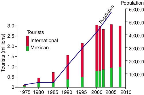
By 1975, Cancún had 1769 rooms in service; by 2008, it boasted about 150 hotels and more than 27,000 rooms. Second only to Mexico City, Cancún airport now handles 200 flights a day. The influx of people to Cancún has been especially dramatic. The city has had to cope with unprecedented growth rates as its population shot up from 30,000 in 1980 to 676,238 in 2010 (preliminary census figure) (see graph).

The number of tourists in Cancún dipped slightly in 2001–2002 due, in part, to the 2001 9/11 tragedy in the USA. Hurricane Wilma (2005) put many hotel rooms temporarily out of commission. Cancún is now only one focus of an extensive tourist corridor along the Quintana Roo coast, stretching as far south as Tulum.

Chapter 19 of Geo-Mexico: the geography and dynamics of modern Mexico, from which this extract is taken, looks in much more detail at Mexico’s purpose-built resorts as well as many other  aspects of tourism, resorts and hotels  in Mexico.