admin

The distribution of retail activities in the city of Zitácuaro, Michoácan, Mexico

 Excerpts from Geo-Mexico  Comments Off on The distribution of retail activities in the city of Zitácuaro, Michoácan, Mexico
Nov 022010
 

The maps below show the distribution in 1980 of three distinct types of commercial establishments in the mid-sized city of Zitácuaro in Michoacán.

Map of retail activities in Zitácuaro, Michoacán

Retail activities in Zitácuaro, Michoacán. Color version of Figure 22.3 of Geo-Mexico: the geography and dynamics of modern Mexico. All rights reserved.

Founded hundreds of years earlier, the city grew spontaneously, almost organically, with little planning; its population by 1980 was 100,000. Cars were not a necessity. The residents of Zitácuaro did not have to walk far to purchase their basic daily shopping needs. Convenience stores (top map) existed in every  neighborhood. Many (145 out of 393) were genuine “corner stores”, strategically located at street intersections. On average, each convenience store served about  250 residents.

More specialist stores (middle map), selling so-called “shopping goods” such as clothes and furniture, had a very different distribution. A few were located in  residential areas, but most were concentrated in the heavily trafficked central area of the city, in the narrow streets close to the main plaza or zócalo, west of the main highway.

By 1980, a bypass had been opened enabling through traffic to avoid the main congested highway through the center of the city. However, the distribution of specialist stores does not appear to show any close connection to either the old highway or the new bypass.

This contrasts with the distribution of stores connected to auto services (gas stations, auto parts, tire repairs, mechanics) where the preferred locations in 1980 were close to the main highway (bottom map). In the succeeding years, this distribution has changed somewhat. Many of these services have now relocated to the by-pass to better serve the passing traffic.

This post is an excerpt from Geo-Mexico: the geography and dynamics of modern Mexico. Chapters 21 and 22 of Geo-Mexico analyze Mexico’s 500-year transition to an urban society and the internal geography of Mexico’s cities. Chapter 23 looks at urban issues, problems and trends. To preview more parts of the book, click here and use amazon.com’s “Look Inside” feature. Buy your copy today!

Which states in Mexico are the most competitive in business terms?

 Books and resources, Teaching ideas  Comments Off on Which states in Mexico are the most competitive in business terms?
Nov 012010
 

A recent report from the Mexican Institute for Competitiveness (Instituto Mexicano para la Competitividad, IMCO) provides some interesting insights into which areas of Mexico are “most competitive” in business terms. The latest report relies on 2008 data. The IMCO Competitiveness figures are usually compiled for a major urban area or a state, and international comparisons are also possible at the country level. For example, IMCO found that Mexico ranks 31st in the world for competitiveness, immediately behind Brazil, but ahead of China (rank 38). Mexico’s basic pattern of competitiveness at the state level is shown in the map.

IMCO defines competitiveness as the capacity to attract and retain investment and talent. This suggests a business environment that maximizes the socio-economic potential of both the business entities and individuals residing in a a specific area. It also suggests that any improved well-being (economic and social) will be maintained (sustained).

Map of competitiveness in Mexico, 2008

Competitiveness in Mexico, 2008. Map: Tony Burton; all rights reserved

The IMCO index of competitiveness is based on 120 key variables, grouped into 10 major factors affecting competitiveness. All the variables must be ones which are regularly updated and easy to interpret, with transparent methods of calculation. The 10 major factors include the reliability and objectivity of the legal system, the sustainable management of the natural environment, the stability of macroeconomic policies, the degree to which society is non-divisive, educated and healthy, and the stability and functioning of the political system.

  • Using the map above, how would you describe the pattern of competitiveness in Mexico? (north/south? coastal/inland?, proximity to the USA?)
  • Does the pattern of competitiveness match the pattern of GDP/capita? In what way is the State of Mexico an anomaly in this regard? Are there other anomalies?

A full analysis of why some states are more competitive than others is beyond the scope of this post. However, given its relevance to geographers, we will examine the specific variables that make up the sustainable management of the natural environment in a future post, when we will also take a look at the trends for that indicator.

Mexico’s economy and workforce are analyzed in chapters 14 to 20 of Geo-Mexico: the geography and dynamics of modern Mexico. Ask your library to buy a copy of this handy reference guide to all aspects of Mexico’s geography today! Better yet, order your own copy…

Resistance to government-sponsored change in Chiapas, Mexico

 Mexico's geography in the Press  Comments Off on Resistance to government-sponsored change in Chiapas, Mexico
Oct 292010
 

Kudos to the the New Mexico-based Grassroots Press, for the enticing title “Weaving Webs of Resistance in Chiapas” on an article by Crystal Massey and Rebecca Wiggins. The article reports on a visit to Chiapas earlier this year by a small group from the Las Cruces-Chiapas Connection (since renamed Weaving for Justice), which helps weaving cooperatives in Chiapas market their products through fair trade.

maya-weavers

One of the groups they visited was Tsobol Antzetik (Women United). They describe how these villagers have to carry fresh water (for cooking, washing, drinking) across the village from near the local school. Despite being in one of the wettest regions of the country, they have no easily accessible potable water source.

Some of the women of Tsobol Antzetik belong to Abejas, a Catholic social justice organization founded in 1992, while others are active supporters of the Zapatistas (EZLN). None of the women accepts handouts from the “corrupt” federal government. This means that they refuse any of the possible benefits from Oportunidades, Mexico’s flagship poverty-fighting program, which helps about 60% of all families in Chiapas. The women believe that Oportunidades “hand outs” are a way for the federal government to control the  rural population, and prefer to avoid being politically compromised.

The article quotes sociologist Molly Talcott, who describes Oportunidades as “…essentially sterilizing women and attempting to contain women’s resistances [sic] by enlisting them in a small cash assistance program, which in these times, is badly needed.” Critics of Oportunidades claim that its health care workers are asked to meet sterilization quotas.

The marketing of woven items from Chiapas is an alternative way for women such as those in Tsobol Antzetik and their families to boost household incomes. This is where the Las Cruces-Chiapas Connection comes in. They help market the items in the USA and hope their help will offer an alternative to migration in search of employment to rapidly-growing cities such as Cancún or even into the USA.

The article goes on to examine another much publicized development project aimed at improving the situation in Chiapas, the Mesoamerica Project (formerly known as Plan Puebla Panamá). A side effect of this project has been to force some indigenous people off their traditional land to clear the way for major high-budget, capitalist construction projects.

One of the many strategies bandied about as part of the Mesoamerica Project is the forced relocation of rural Chiapas Indians into what the government calls “sustainable rural cities”, a phrase which suggests a less-than-clear grasp of geography! These would enable easier provision of modern services such as education and health care. In turn, they would “free up” potentially productive land that could then be used for agro-industrial plantations (flowers, tropical fruits, specialist timber, coffee). The major downside of such a proposal would be the demise of an ancient subsistence lifestyle, and an end to the food security previously enjoyed by thousands of Maya families.

Opposition to the Mesoamerica Project has already led to unrest and violent reprisals. It is still far from clear what the eventual outcome of the Mesoamerica Project will be.

Related news: Up to now, Oportunidades has focused almost entirely on rural areas. However, the Interamerican Development Bank recently approved a loan of 800 million dollars to extend the program to marginalized families in urban areas.

To learn more about the evolution of PPP and the idea of “rural cities”, see the three-part article by Dr. Japhy Wilson, who lectures in international politics at the University of Manchester in the UK:

  • The New Phase of the Plan Puebla Panama in Chiapas, Part One
  • Part Two
  • Part Three

Mexico’s indigenous groups, social geography and development issues are analyzed in various chapters of Geo-Mexico: the geography and dynamics of modern Mexico. Buy your copy today, and learn more about Mexico’s fascinating geography. Additional knowledge will greatly enhance the pleasures you derive during your next trip to Mexico.

The thorny issues of plant and animal trafficking and biopiracy in Mexico

 Excerpts from Geo-Mexico  Comments Off on The thorny issues of plant and animal trafficking and biopiracy in Mexico
Oct 282010
 

In several previous posts we examined the megadiversity of Mexico’s ecosystems which include more than 10% of all the world’s living species.

Mexico’s biodiversity is under pressure from several quarters.

Plant and animal trafficking

Selling wildlife by the roadside in Chihuahua state

Roadside entrepreneurs sell wildlife in Chihuahua state. Photo: Tony Burton; all rights reserved.

Plant and animal trafficking is the country’s third largest criminal activity after illegal drugs and arms smuggling. Favored items include cacti, live birds (some species sell for upwards of $100,000), spider monkeys, sea turtles, snakes and jaguars. Mexico is one of 175 nations that have signed the Convention on International Trade in Endangered Species (CITES) but this has had no discernible effect on the trafficking of flora and fauna.

Biopiracy

Mexico’s megadiversity presents both opportunities, for activities such as ecotourism, as well as challenges such as preventing biopiracy. In its simplest form, biopiracy occurs whenever a bioprospector takes biological material from a place and then acquires a patent or intellectual property rights on it, or one of its constituents, elsewhere. The best documented example of biopiracy in Mexico occurred in 1999 when a US patent was granted to Colorado-based company Pod-ners for the exclusive right to market Enola beans bred from Mexican yellow beans bought only five years previously. Mexico’s bean export business collapsed overnight as shippers were accused of patent infringement. Yellow bean production in Sinaloa fell by 62% in three years.

Mexican growers subsequently proved that the yellow beans they had been breeding for decades are genetically identical to Enola beans but the damage had been done. Subsequently, the patent was challenged by the International Center for Tropical Agriculture. In 2008 the US patent office finally reversed its decision and rejected any patent claims on yellow beans. While this case of biopiracy was thwarted, acts of biopiracy, by their very nature, are usually clandestine and there are certain to be other instances in the future.

This is an excerpt from chapter 30 of Geo-Mexico: the geography and dynamics of modern Mexico. Buy your copy today, and learn more about Mexico’s fascinating geography. The more knowledge you acquire, the more pleasure you will derive from your next trip to Mexico!

President Zedillo’s political reforms brought real democracy in Mexico

 Other  Comments Off on President Zedillo’s political reforms brought real democracy in Mexico
Oct 272010
 

A previous post focused on the economic reforms of President Ernesto Zedillo, 1994-2000. This article discusses his very important political reforms.

1994 was a very important and difficult year for Mexico. It started with the Zapatista rebellion in Chiapas, which the PRI (Partido Revolucionario Insititucional) government brutally put down, infuriating many Mexicans and leading to giant protest demonstrations against the PRI. Liberation theology was gaining strength and blaming PRI for human rights abuses as well as the impoverishment of the Mexican people. Furthermore, the economy was slipping into a severe crisis.

Following tradition, President Salinas personally selected Donaldo Colosio to succeed him as the PRI President of Mexico. While other parties nominated candidates, PRI had held an iron grip on the Presidency and Mexican politics for over 60 years.

In March 1994 the PRI presidential candidate Colosio was assassinated in Tijuana. The PRI was held responsible for all the country’s problems and Salinas was in a very difficult spot. Old PRI hard-liners (“dinosaurs”) pressed Salinas to name one of them as the next president, but Salinas knew he had to select a “clean” candidate that would help the PRI regain some credibility. Salinas selected as the replacement, Colosio’s young campaign manager and technocrat Ernesto Zedillo. Zedillo, the “accidental president”, easily won the relatively fair 1994 election.

Zedillo was dedicated to political reform. He took dramatic steps to counter corruption. Apparently not trusting anyone within his own PRI party, he appointed as his Attorney General, Antonio Lozano Gracia from the opposition PAN party. Lozano aggressively prosecuted and indicted numerous senior PRI officials, including Salinas’ brother, on a variety of corruption charges. In 1995 Zedillo replaced the country’s entire Supreme Court, which then began to rule against PRI dominated government agencies on a regular basis. Zedillo implemented reforms which separated the ruling PRI party from the Government of Mexico, thus terminating the practice of using government agencies and revenues to support PRI political campaigns.

Zedillo initiated multiparty talks on political reform and began transferring some power away from his own office and toward Mexico’s Congress and 31 states. He made the Federal Elections Commission more transparent by increasing the oversight and participation by opposition parties. He reformed the law giving the President the power to appoint the Mayor of Mexico City, who henceforth would be popularly elected.

These reforms brought dramatic change to local, state, and national elections in July 1997. The opposition PDR party candidate for Mexico City mayor, Cuauhtémoc Cárdenas, garnered nearly 50% of the vote and was elected, defeating the PRI candidate by a wide margin. Opposition party candidates also swept several state governorships. Most significantly, the PRI lost control of the lower house of the Mexican Congress for the first time in history. Finally, after almost 70 years of PRI domination, Mexico was becoming a real democracy and the Mexican public rejoiced in their new democratic powers.

Zedillo decided not to personally select his successor in the traditional way. Instead, the PRI would hold a national primary enabling the voters to select the next PRI presidential candidate. He also loosened the PRI government’s grip on the media, opening the door to more objective political reporting. Under Zedillo’s watch, Mexico enjoyed a clean and fair election in the summer of 2000 which, for the first time in over 70 years, elected a non-PRI candidate as President in the person of Vicente Fox of PAN.

The reforms of the Zedillo Administration largely leap-frogged Mexico from an economically-unstable, single party state, to a relatively modern 21st century multiparty democracy. President Ernesto Zedillo is distinguished from his predecessors by his integrity, vision, and for doing what was best for Mexico, not for himself, his cronies, or his political party. Ernesto Zedillo was and is an inspiration to his country and the world. Everyone living in Mexico owes him a great debt of gratitude for modernizing Mexico’s economy and democracy as well as making Mexico a far better place.

Chapter 12 of Geo-Mexico: the geography and dynamics of modern Mexico discusses the political map of Mexico. Buy your copy today to have a handy reference guide to all major aspects of Mexico’s geography!

Dust, snowmelt and the reduced flow of the Colorado River into Mexico

 Other  Comments Off on Dust, snowmelt and the reduced flow of the Colorado River into Mexico
Oct 262010
 

The Colorado River flows almost entirely in the USA, though its extensive delta is in Baja California. The USA and Mexico have negotiated usage rights designed to guarantee a minimum flow reaching Mexico and to safeguard the water available for numerous cities in the USA that depend on water from the Colorado, and for the rapidly-growing urban centers of Mexicali, Tijuana, Tecate and Rosarito in Baja California.

Even so, the amount of water reaching Mexico has declined dramatically as a result of the Hoover and Glen Canyon dams and other diversions of Colorado River water in the USA. The Colorado River delta has been almost totally dry for most of the last decade.

A new study led by a NASA scientist, links increased human activity in the USA over the past 150 years to earlier annual snowmelt in the Rocky Mountains and reduced flow rates in the Colorado River.

According to the study:

  • lake sediments reveal that between 5 and 6 times as much dust now falls on the Rocky Mountains as 150 years ago – an increase attributed to soil disturbances caused by agriculture and grazing
  • dust settling on snow makes the surface darker, enabling it to absorb more incoming solar energy (ie. the dust changes the albedo of the surface)
  • this increased absorption of solar energy causes earlier snowmelt and more evaporation to enter the atmosphere – peak spring runoff now comes three weeks earlier than 150 years ago
  • this earlier snowmelt exposes vegetation, causing plants to lose more water to the atmosphere than previously – this loss is estimated at almost 1 billion cubic meters (35 billion cubic feet) of water each year
  • this loss of water causes river discharges to be lower than previously; the annual runoff averages less than 95% of the levels found prior to extensive human settlement
  • earlier snowmelt leads to earlier peak runoff into rivers. This complicates water management, especially during the summer.

How much is 1 billion cubic meters of water?

  • sufficient to meet the demands of the entire city of Los Angeles for 18 months
  • more than 50% of the amount of water guaranteed to enter Mexico each year via the Colorado by a 1944 USA-Mexico treaty
  • about 14% of the current volume of Lake Chapala, Mexico’s largest natural lake

How can the situation be reversed/ameliorated?

One successful strategy, mentioned in the article, has been the Taylor Grazing Act (1934). This has improved conditions on public grazing lands, decreasing the amount of dustfall in the Rockies by about 25%. Other strategies are needed since climate change may well exacerbate the effects the additional dust has had on river flows.

Related posts:

Rivers, reservoirs and water-related issues are discussed in chapters 6 and 7 of Geo-Mexico: the geography and dynamics of modern Mexico. Ask your library to buy a copy of this handy reference guide to all aspects of Mexico’s geography today! Better yet, order your own copy…

The disposal of solid wastes in Mexico

 Excerpts from Geo-Mexico  Comments Off on The disposal of solid wastes in Mexico
Oct 252010
 

The disposal of solid wastes has become a serious problem almost everywhere in the world. In general the more affluent a society, the more solid waste it generates. Technologically-advanced civilizations tend to produce many wastes that are not biodegradable, further complicating the disposal problem. With each succeeding decade, Mexico faces greater and more complex challenges in managing its solid waste.

Garbage recycling at Oaxaca City dump

Garbage recycling at Oaxaca City dump. Photo: Conrad Fox, World Vision Report

In terms of weight, the vast majority of solid waste is produced by the agricultural sector. Fortunately most of this waste in readily biodegradable and is produced in areas of relatively low population density. However, agricultural wastes in the form of fertilizers and pesticides which are carried into steams and rivers have significant impacts on water quality. Animal wastes from concentrated feed lot operations are another major concern particularly because they are often located relatively close to densely populated areas.

Municipal solid waste includes waste from most commercial establishments and many small industrial operations. Mexico’s urban waste exceeds 36 million tons a year, three times the equivalent figure for Canada. Many municipalities in Mexico have initiated recycling programs, primarily focused on aluminum, glass, certain plastics and paper. However, in 2008 only 3.3% of Mexico’s total urban waste was recycled. Waste from larger towns and cities, about half of the total, is deposited in properly operated sanitary landfills. Waste from smaller communities often ends up in dumps, two thirds of which are uncontrolled.

The management (treatment or recycling) of hazardous wastes has improved greatly in recent years, particularly in the states of Nuevo León, Tamaulipas, Mexico, Tabasco and the Federal District. About half of all hazardous waste originates either in the state of Chihuahua (31% of the total) or in Mexico City (17%).

See also:

This is an excerpt from chapter 30 of Geo-Mexico: the geography and dynamics of modern Mexico. Buy your copy today, and learn more about Mexico’s fascinating geography.

Oct 222010
 

By common consent, the history of blacks in what-is-now Mexico is a long one. The first black slave to set foot in Mexico is thought to have been Juan Cortés. He accompanied the conquistadors in 1519. It has been claimed that some natives thought he must be a god, since they had never seen a black man before.

A few years later, six blacks are believed to have taken part in the successful siege of the Aztec capital Tenochtitlan. Several hundred other blacks formed part of the wandering, fighting forces employed in the name of the Spanish crown to secure other parts of New Spain.[1]

The indigenous population crashed in the first hundred years following the conquest, largely as a result of smallpox and other European diseases. Estimates of the native population prior to the conquest range from 4 to 30 million. A century later, there were just 1.6 million.

afromexico-coverNew Spain had been conquered by a ludicrously small number of Spaniards. To retain control and in order to begin exploiting the potential riches of the virgin territory they had won, a good supply of laborers was essential. There were not enough locals, so imports of slaves became a high priority.

By 1570, almost 35% of all the mine workers in the largest mines of Zacatecas and neighboring locations were African slaves. [2] Large numbers of slaves were also imported for the sugar plantations and factories in areas along the Gulf coast, such as Veracruz. By the mid-seventeenth century, some 8,000-10,000 blacks were Gulf coast residents. After this time, the slave trade to Mexico gradually diminished.

Miguel Hidalgo, the Independence leader, first demanded an end to slavery in 1810 (the same year that Upper Canada freed all slaves). Slavery was abolished by President Vicente Guerrero on September 15, 1829.

During the succeeding 36 years, prior to the abolition of slavery in the U.S. (1865), some U.S. slaves seized their chance and headed south in search of freedom and opportunity. Recognizing the potential, in 1831, one Mexican senator, Sánchez de Tagle, a signatory of the Act of Independence, called for assistance to be given to any blacks wanting to move south on the grounds that this movement would possibly prevent Mexico being invaded by white Americans. [3] Sánchez de Tagle’s point was that black immigrants would be strong supporters of Mexico since they wouldn’t want to be returned to slavery, and would be preferable to white Americans, who might be seeking an opportunity to annex parts of Mexico for their homeland. Sánchez de Tagle’s fears came to pass. One year after the U.S. annexed the slave-holding Republic of Texas in 1845, it invaded Mexico.

Perhaps as many as 4,000 blacks entered Mexico between 1840 and 1860. At the beginning of 1850, several states enacted a series of land concessions for black immigrants, in order that undeveloped areas with agricultural potential might be settled and farmed.

Even after the abolition of slavery in the U.S., small waves of blacks continued to arrive periodically in Mexico. Many came from the Caribbean after 1870 to help build the growing national railway network. In 1882, some 300 Jamaicans arrived to help build the San Luis Potosí-Tampico line; another 300 Jamaicans made the trip in 1905 to take jobs in mines in the state of Durango. [4] Partially as a response to their own independence struggles, thousands of Cubans came after 1895. They favored the tropical coastal lowlands such as Veracruz, Yucatan and parts of Oaxaca, where the climate and landscapes were more familiar to them than the high interior plateaux of central Mexico.

Mexican historians have largely ignored the in-migration of blacks and their gradual intermarriage and assimilation into Mexican society. For a variety of reasons, they chose to focus instead on either the indigenous peoples, or the mestizos who form the majority of Mexicans today. The pendulum is finally beginning to swing back, as researchers like Charles Henry Rowell, Ben Vinson III and Bobby Vaughn re-evaluate the original sources, and examine the life and culture of the communities where many blacks settled.

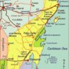
Most work about the influence of blacks on modern-day Mexico has focused on the Veracruz area, in particular on the settlements of Coyolillo, Alvarado, Mandinga and Tlacotalpan. 5 On the opposite coast, Bobby Vaughn has spent more than a decade studying the Costa Chica of Oaxaca and Guerrero. [6]

Analysts of Mexican population history emphasize the poor reliability of early estimates and censuses, as well as the complex mixing of races which occurred with time. While the precise figures and dates may vary, most demographers appear to agree with Bobby Vaughn that the black population, which rose rapidly to around 20,000 shortly after the conquest, continued to exceed the Spanish population in New Spain until around 1810.

It is estimated that more than 110,000 black slaves (perhaps even as many as 200,000) were brought to New Spain during colonial times. Happily, their legacy is still with us, and lives on in the language, customs and culture of all these areas.

Sources / Further Reading

1 Matthew Restall. Seven Myths of the Spanish Conquest. (Oxford University Press) 2003

2 Peter J. Bakewell. Silver Mining and Society in Colonial Mexico: Zacatecas, 1546-1700, cited in Afroméxico.

3 Vinson III, Ben & Vaughn, Bobby. Afroméxico. (in Spanish; translation by Clara García Ayluardo) Mexico: CIDE/CFE. 2004. The main source for this column, divided into three parts. Following a joint introduction, Ben Vinson III, Professor of Latin American History at Penn State University, provides a detailed overview of studies connected to blacks in Mexico. Then Bobby Vaughn, who has a doctorate in anthropology from Stanford University, adopts an ethnographic perspective in writing about the Costa Chica of Oaxaca and Guerrero; his short essay includes discussion of the Black Mexico movement. The work concludes with an extensive bibliography of sources relating to Afroméxico.

4 Vinson III, Ben & Vaughn, Bobby. Afroméxico. Mexico: CIDE/CFE. 2004

5 See, for example, the Winter 2004 and Spring 2006 issues of Callaloo (A Journal of African Diaspora Arts and Letters). The Spring 2006 issue, vol 29, #2, pp 397-543, has a series of articles under the general heading of “Africa in Mexico”, including transcriptions of fascinating interviews with such characters as Rodolfo Figueroa Martinez, who relates the history of how several local towns, including San Lorenzo de los Negros (now Yanga) were founded by blacks, and of how a black identity gradually emerged. Other interviewees discuss how they view their color and Afromestizo identity, lamenting the fact that their history has been distorted or largely forgotten. Local food and festival celebrations are also highlighted.

6 Bobby Vaughn’s Black Mexico Home Page, Afro-Mexicans of the Costa Chica, available via MexConnect, provides links to several of his articles including Blacks in Mexico. A Brief Overview.

Original article on MexConnect

Several chapters of Geo-Mexico: the geography and dynamics of modern Mexico discuss population issues, including population growth, distribution and density. Buy your copy today to have a handy reference guide to all major aspects of Mexico’s geography!

New irrigation areas in Chihuahua, Mexico, are visible from space

 Books and resources  Comments Off on New irrigation areas in Chihuahua, Mexico, are visible from space
Oct 212010
 

A recent article on Wired.com drew my attention to these spectacular Landsat photos of Chihuahua, Mexico.

Landsat images of Chihuahua

  • Link to high resolution Landsat images (clicking on the images in this link reveals amazing detail)

These false-color remote sensing images were taken by the Landsat 5 satellite in August 1992 (left) and August 2010 (right).

  • Red = vegetation (the brighter the red, the healthier the vegetation)
  • Whites, greens, browns = areas with bare soil or only limited vegetation (colors depend on organic matter and moisture content)
  • Blue & Black = water (clear, deep water is darker; sediment-laden water is lighter)
  • Blue-Gray = urban areas

They show some interesting changes have taken place in the 18 years since the first image was captured. In particular, they reveal that more water is now available from a major reservoir, and is being used for irrigation. Particularly noticeable is the development of round irrigation areas in the central part of the images. These circular areas, which show as bright, red circles (see image below) are the result of center-pivot irrigation systems. The water is being used for growing alfalfa and sorghum to feed livestock.

Circular irrigation areas

Circular irrigation areas (enlarged view of center portion of 2010 image)

In addition to the impacts resulting from irrigation, diverting more water from the reservoir has also affected the area’s native vegetation, and reduced the amount of water flowing into the Río Grande River. This may have ameliorated, at least slightly, the serious flooding which occurred earlier this year in the same general area.

President Zedillo’s reforms stabilized the Mexican economy

 Other  Comments Off on President Zedillo’s reforms stabilized the Mexican economy
Oct 202010
 

President Ernesto Zedillo (in office from 1994 to 2000) took unprecedented steps that set the stage for Mexico’s 21st century economy. Before discussing Zedillo’s economic reforms, it is useful to review the recent history of Mexico’s economy.

Following the fifty year “Mexican Miracle” of unprecedented economic growth and low inflation, the economy entered some very tough times in the early 1980s. Assuming high oil prices would continue, Mexico borrowed very heavily and could not pay its debts when oil prices plunged in 1981-82 and interest rates rose dramatically. The government suspended debt payments, devalued the peso by 500%, and nationalized the banks. The “lost decade” of the 1980s was an economic disaster, with inflation rates over 100% and economic growth hovering around 1%.

Economic growth improved a bit the early 1990s but President Salinas was forced to introduce strict price controls in an attempt to curb inflation. With a fixed exchange rate, the peso soon became severely overvalued. Then in January 1994, Zapatistas in Chiapas rebelled against the national government. Two month later, PRI Presidential candidate Donaldo Colosio was assassinated in Tijuana. Salinas selected as his replacement, Colosio’s campaign manager and technocrat Ernesto Zedillo, a Yale PhD Economist who had previously been a university professor, Minister of Planning and Budget as well as Minister of Education. Zedillo easily won the relatively fair 1994 election and was called the “accidental president” because he never sought the presidency and never previously held elected office.

Upon assuming office, Zedillo faced an impending severe economic crisis. As was customary, Salinas in his last year had spent very lavishly, severely aggravating the government deficit. The economic crisis of 1995 was characterized by a deep recession, hyperinflation, widespread bankruptcies, serious unemployment and soaring interest rates. He floated the peso which quickly moved from 4.0 to 7.2 to the US dollar.

President Clinton orchestrated a controversial $48 billion bail-out loan which eased the crisis. Conditions of the loan required very stiff and unpopular austerity measures including a 50% income tax hike, reduced public spending, privatizing some state-owned enterprises, and making the Central Bank of Mexico more independent from politics. Zedillo effectively implemented these reforms, knowing they were the best for Mexico’s future though they seriously hurt his public popularity.

The bailout reforms succeeded, the economy stabilized and began to grow, averaging over 5% between 1996 and 2000. Mexico repaid the bailout loan three years before its due date. During the crisis and throughout his term, Zedillo supported and expanded Mexico’s free trade (globalization) agenda.

The Mexican economy is now far more stable than is was in the years prior to the Zedillo reforms. Mexico appears to be completely beyond the self-inflicted economic crises it experienced in the late 20th century. The 2008-09 recession was serious but was completely beyond the control of Mexico. The Mexican economy appears to be recovering nicely in 2010.

Chapters 14 through 20 of Geo-Mexico: the geography and dynamics of modern Mexico discuss the components and characteristics of Mexico’s economy. Buy your copy today to have a handy reference guide to all major aspects of Mexico’s geography!

The debate over GM corn in Mexico

 Updates to Geo-Mexico  Comments Off on The debate over GM corn in Mexico
Oct 192010
 

Until relatively recently, Mexican authorities have staunchly resisted the introduction of GM corn into the country. Significant improvements in Mexico’s wheat and corn yields have been achieved in the past by long-term programs of selective breeding, such as that which was later dubbed the “Green Revolution“.

In 2009, however, Mexico’s Agriculture and Environment Secretariats approved a project financed by transnational seed firm Monsanto involving 30 hectares of  experimental plots in Sonora, Sinaloa and Tamaulipas planted with transgenic corn. Mexico still does not yet permit the commercialization of genetically-modified corn, but Monsanto has indicated publicly that it hopes that current rules will be relaxed as early as 2011. According to Monsanto, the new seed could boost annual corn production in Mexico by between 6 and 7 million tons, roughly the amount lost each year to disease and pests.

The Monsanto project was been widely condemned by environmental groups. A widely-published article earlier this month by journalist Mica Rosenberg offered an overview of how transgenic (GM) corn is clearly on its way into Mexican mainstream agriculture:

The article is disappointingly superficial in many respects, but does provide a useful starting point for discussions about the relative merits of allowing (or not) commercial imports of transgenic corn seed into Mexico.

As we write in Geo-Mexico, Mexican farmers are well aware of the importance of maintaining genetic diversity:

Mexican farmers share concerns about the on-going loss of genetic diversity, especially in native crops. For example, if all corn farmers planted imported hybrid corn seeds, native diversity would quickly be lost. In Tlaxcala, where about 90% of the corn is grown on non-irrigated land and where two-thirds of farmers grow corn only for their own use, local varieties have been selectively bred by farmers not only for their yields but also because of their color, taste, resistance to pests and ability to withstand strong winds or short-term droughts. Such characteristics are not necessarily important to commercial seed producers.

Events in other countries often have unexpected consequences in Mexico. For example, the price of Mexico’s corn imports from the USA has increased sharply as a result of the high subsidies offered in that country for corn-based biofuel and bio-additives. The rising import price of corn led to an increase in the price of tortillas which adversely affected the poorest sectors of Mexican society.

Furthermore, as we wrote in an earlier post, the Mexican government has shown its support for a major project aimed at ensuring that the genetic diversity of corn is preserved for future generations:

Is the introduction of GM corn into Mexico a good idea? Proponents argue that it will lead to higher yields and reduce losses from pests and diseases. In their view, commercial planting of GM corn in Mexico is inevitable and will help Mexico “catch up” with Brazil and Argentina, where GM crops are already being grown. Opponents argue that it will inevitably reduce the genetic diversity of corn, meaning that corn will have less resilience in future to unexpected (and unpredicted) changes (climate, pests, soil conditions, etc). They also argue that GM corn will make corn growers even more dependent on commercial seed producers.

Greenpeace protest against GM corn

Greenpeace protest against GM corn

At least two studies since 2001 have already found transgenic DNA in fields of native Mexican corn. The first, published in Nature in 2001, reported findings from the state of Oaxaca. One oft-expressed fear is that Monsanto’s fierce protection of its GM corn will lead to the company seeking damages from local farmers who are found to have any GM corn mixed into the native corn growing in their fields, even if this is the result of accidental contamination from neighboring fields where GM crops are being legally cultivated.

Mexico’s agriculture is analyzed in chapter 15 of Geo-Mexico: the geography and dynamics of modern Mexico. and concepts of sustainability are explored in chapters 19 and 30.  Buy your copy today, so you have this handy reference guide to all aspects of Mexico’s geography available whenever you need it.

Oct 162010
 

In an earlier post, we looked briefly at Females, males and gender inequality in Mexico.

Gender inequality is unfortunately still alive and well in Mexico. It is often shown through discrimination and human rights violations.

Several women’s empowerment groups aim to change the status quo. Perhaps the most successful to date has been an organization known as Semillas (= seeds). Founded in 1990, Semillas is the shorthand for the NGO Sociedad Mexicana Pro Derechos de la Mujer, A.C. (Mexican Society Pro-Women’s Rights).

In the words of its homepage, Semillas…

“knows that all the different responsibilities and duties that women have as mothers, caretakers, providers, educators, resource generators, politicians, field workers, business owners, social leaders, scholars, artists, etc… make them the fundamental factors of change in their families, communities, and society at large. Semillas is also aware that strengthening Mexican women’s rights builds a more just society, promotes a new culture of equality between women and men, and improves life conditions for generations to come.”

Semillas group of women

Photo credit:Semillas (Sociedad Mexicana Pro Derechos de la Mujer, A.C)

Semillas aims to break the traditional gender inequalities in Mexico through sponsorship of dozens of local initiatives, covering a wide range of development objectives. Since 1990, Semillas have started 237 sustainable development projects, benefiting 650,000 women. Projects are based on the principle of “women helping women”. Semillas funds and supports projects run by women who are already exhibiting leadership qualities in their communities.

For example, one project supports the work of a victim of psychological violence who has spent the last 15 years of her life designing programs to ensure equality of educational opportunity in her home community. This educational equality is not limited to formal schooling, but extends to the sports activities available after-school and at weekends. When our daughter was growing up in Mexico, we learned first-hand in the early 1990s that many smaller, traditional villages in Mexico tend to offer a reasonable variety of sports, such as soccer, only for boys. Rarely is anything equivalent on offer for girls. While the situation is gradually improving (girls’ soccer is becoming one popular option!), there is still a long way to go in many places.

Semillas does not only fund projects concerned with educational equality; other projects focus on health care, female working conditions and legal aid.

The Semillas website has many short articles, images and videos highlighting its work, if you are interested in finding out more about this noteworthy NGO. (It also has a link for donations).

Stop Press! By coincidence, today the Inter Press Service news agency published Four Years On, No Justice for Atenco Women (by Daniela Pastrana). In 2002, Atenco was proposed as the site for a new Mexico City airport, leading to protests by local residents. Eventually, (in April 2008) 11 women brought a case before the Inter-American Commission on Human Rights, involving allegations of torture, sexual violence and illegal deprivation of freedom, all connected to the protest movement. Their case was supported by many NGOs, as well as several winners of the Nobel Peace Prize. Mexico’s Supreme Court ruled earlier this year that the opposition to the new airport was a “legitimate social protest” and ordered the immediate release of those protesters who were still behind bars.

Chapter 29 of Geo-Mexico: the geography and dynamics of modern Mexico is titled “Variations in Quality of Life within Mexico” and discusses many aspects of poverty, including  Gender Inequality. Buy your copy today, or ask your local library to purchase a copy for their collection.

The diversity of species (plants and animals) in Mexico

 Other  Comments Off on The diversity of species (plants and animals) in Mexico
Oct 152010
 

A previous post noted that Mexico’s very wide range of ecosystems make it one of the six most biodiverse countries on earth. We also looked at the states in Mexico with the greatest biodiversity.

Given its deserts, it is not surprising that Mexico ranks first in the world in cactus species and second in reptile species, behind only Australia. Mexico’s tallest cactus is the Pachycereus pringlei (cardón), a relative of the saguaro. It can grow to a height over 19 meters (60 feet) and 1 meter in diameter (39 inches). The largest reptile is the crocodile which can grow to 5 meters (16 feet) in length and weigh over 400 kilograms (880 pounds).  In recent years, several Mexicans have been killed by crocodile attacks.

Marine biodiversityLargely as a result of Mexico’s diverse tropical and subtropical forests, Mexico ranks fourth in the world with 30,000 different types of flowering plants, compared to only 18,000 in the USA and 12,000 in all of Europe. It also ranks fourth in number of amphibian species, which thrive in Mexico’s tropical rainforests. Mexico is also among the top ten in fern and butterfly species.

The temperate forests also harbor significant biodiversity.  Mexico has more species of pine trees and oak trees than any other country.  However, with deforestation, some of these species may be endangered.

Most people are very surprised to learn that Mexico is among the top three in mammal species, along with Indonesia and Brazil. Some of Mexico’s mammals are majestic like the jaguar, some are rather large like the tapir, but many are small and less impressive like bats, shrews, and rodents. Extinction of endemic Mexican mammals is a serious concern. The International Union for Conservation of Nature (IUCN) has listed 11 endemic Mexican mammals as “critically endangered”; 27 as “endangered”, and 14 as “vulnerable”.

Chapter 5 of Geo-Mexico: the geography and dynamics of modern Mexico focuses on Mexico’s ecosystems and biodiversity.  Chapter 30 analyzes environmental issues and trends including current environmental threats and efforts to protect the environment.  Buy your copy today to have a handy reference guide to all major aspects of Mexico’s geography!

Oct 122010
 

Q. Mexico is one of the six most biologically diverse countries on the planet.  But which states in Mexico have the greatest biodiversity?

A. In general, the southern states (which receive the highest amounts of rainfall) have the greatest biodiversity: Chiapas, Oaxaca, and Veracruz.

The three most biodiverse states in Mexico

The three most biodiverse states in Mexico

To answer this question in more detail, it is useful to look at different types of plants and animals.

Mammal species are fairly well distributed throughout Mexico. Three of the wettest states lead in number of mammal species.  Chiapas has 205 different species followed by Oaxaca (194) and Veracruz (190). Interestingly, the next highest rated states are in central and northern Mexico: Jalisco (173), Michoacán (163), San Luis Potosí (152), Tamaulipas (145), Puebla (144), Durango (141) and Sonora (139). All states have over 70 mammal species, except for the relatively small states of Aguascalientes (40), Tlaxcala (50) and Guanajuato (65). Mexico as a whole has an impressive 901 mammal species; this figure places it ahead of all other countries.

Mexico is a bird watchers paradise. Veracruz and Oaxaca lead with 635 and 634 different bird species. Chiapas is third with 565 bird species followed by Sonora (445), Jalisco (438), San Luis Potosí (438), Tamaulipas (435) and Michoacán (429). Tlaxcala (86) and Aguascalientes (88) have the fewest number of bird species.

Mexico’s 808 different reptile species places it second, behind only Australia. Relative wet states lead in number of reptile species: Oaxaca (258), Chiapas (224), Veracruz (214) and Guerrero (158). However, the more arid states also have relatively large numbers of reptile species: Sonora (137), Chihuahua (118), Baja California (80) and Baja California Sur (68). Aguascalientes has only 17 reptile species.

Amphibians are very abundant in the wet southeastern states. Chiapas leads with117 amphibian species in followed by Veracruz (109), Oaxaca (106) and Hidalgo (66). Not surprisingly, there are very few amphibian species in desert states. Baja California Sur has only five species while Baja California has 12.

Mexico ranks fourth in the world in number of flowering plant species, behind only Brazil, Colombia and China. Veracruz is the clear leader with 4,907 species, followed by Chiapas (3,833), Oaxaca (3,388) and Jalisco (2,752). States with the fewest species are Aguascalientes (467), Tlaxcala (457) and Baja California Sur (484).

Mexico is also among the world leaders in number gymnosperm (nonflowering plants – mostly conifers and other evergreens) species.  Mexico has more species of pine trees than any other country. Veracruz leads with 31 species, followed closely by Nuevo León (30), Durango (29), Oaxaca (28), Hidalgo (27) and Chihuahua (26). Quintana Roo and Campeche have only one species while Colima and Yucatán have only two.

Ferns are also an important part of Mexico’s biodiversity. Chiapas leads with 693 fern species, followed by Oaxaca (669), Veracruz (534), Guerrero (374) and Puebla (297). States on the Yucatán Peninsula have relatively few fern species: Yucatán (25), Campeche (29) and Quintana Roo (39).

Source for the statistics in this post: Semarnat, El ambiente en números 2010, tabla 21: “Riqueza de grupos de species selecionadas, 2008” (CONABIO) (pdf document).

Several of our previous posts have discussed Mexico’s very wide range of climates, ecosystems and species diversity:

Chapter 5 of Geo-Mexico: the geography and dynamics of modern Mexico focuses on Mexico’s ecosystems and biodiversity.  Chapter 30 analyzes environmental issues and trends including current environmental threats and efforts to protect the environment.  Buy your copy today to have a handy reference guide to all major aspects of Mexico’s geography!

Mexico’s mega-biodiversity

 Other  Comments Off on Mexico’s mega-biodiversity
Oct 122010
 

People from elsewhere generally think of Mexico as an arid country with lots of cacti. The general impression is that Mexico has relatively little biodiversity in comparison with equator-hugging tropical countries such as Brazil and Indonesia.

These impressions could not be farther from the truth.  While northern Mexico is indeed arid, many areas in southern Mexico receive over 2,000 mm (80 inches) of annual precipitation, almost entirely in the form of rainfall. The rainiest place in Mexico— Tenango, Oaxaca—receives 5,000 mm (16.4 feet) of rain annually.

Mexico's postage stamps regularly celebrate biodiveristy

Mexico's postage stamps regularly celebrate biodiveristy. Click to enlarge

Straddling the Tropic of Cancer, Mexico is a world leader in terms of climate and ecosystem diversity.  It is one of the only countries on earth with arid deserts, dry scrublands, temperate forests, high altitude alpine areas, subtropical forests, tropical rainforests and extensive coral reefs. The multitude of ecosystems in Mexico supports a very wide range of biodiversity.

  • Mexico’s vegetation zones. The link is to a pdf map (in color) of vegetation zones. The map (all rights reserved) is a color version of Figure 5.1 in Geo-Mexico.

Mexico’s Environmental Ministry (SEMARNAT) indicates that there are over 200,000 different species in Mexico.  This is about 10% – 12% of all the species on the planet. About half of all Mexico’s species are endemic; they exist only in Mexico. An unknown number of endemic species were forced to extinction by the intended and unintended importation of Old World species by the Spaniards.

The U.N. Environment Programme has identified 17 “megadiverse” countries.  The list includes Mexico, the USA, Australia, five South American countries, three African countries, and six Asian counties.  Actually, Mexico is among the upper third of this group along with Brazil, Colombia, China, Indonesia and DRC (Democratic Republic of the Congo). The other countries on the list are: the USA, Venezuela, Ecuador, Peru,  South Africa, Malagasy Republic, India, Malaysia, The Philippines,  Papua New Guinea, and Australia.

Chapter 4 of Geo-Mexico: the geography and dynamics of modern Mexico discusses Mexico’s diverse climates.  Chapter 5 focuses on ecosystems and biodiversity.  Chapter 30 analyzes environmental issues and trends including the impact of Old World species imported by the Spaniards, current environmental threats, and efforts to protect the environment.  Buy your copy today to have a handy reference guide to all major aspects of Mexico’s geography!

How did the world’s deepest water-filled sinkhole form?

 Updates to Geo-Mexico  Comments Off on How did the world’s deepest water-filled sinkhole form?
Oct 112010
 

In an earlier post, we described the El Zacatón sinkhole, the deepest water-filled sinkhole known at present anywhere on the planet. Such a large sinkhole begs some important questions:

How did such a large sinkhole form?

Most major sinkholes form as a result of the collapse of the ceilings of underground cavities which have been formed by the gradual dissolution of limestone due to percolating acidic rainwater. However, according to Marcus Gary, of the Jackson School of Geosciences at the University of Texas at Austin, who has studied this area since the 1990s, the Zacatón pit is not a conventional sinkhole. He believes that this pit began to form in the Pleistocene period as a result of underground volcanic activity. Volcanism increased the acidity of water deep underground which then gradually ate away at the surrounding limestone in a process known as “hypogenic karstification“. As the underground caverns grew larger, the overlying rock would periodically collapse into them, eventually leaving giant pits extending to the surface above.

Is the sinkhole continuing to get deeper?

Equally interestingly, some of the sinkholes appear to be closing over. All the major sinkholes in Tamaulipas contain lakes and in several cases, they appear to be crusting over with travertine, a form of calcium carbonate which, in the right conditions, can be precipitated out of calcium bicarbonate-rich water. According to Marc Airhart, another researcher at the Jackson School of Geosciences, the process is probably an excruciatingly slow one, but at least one sinkhole (Poza Seca) has closed up entirely, sealing off an underwater lake. This travertine skin may also explain why El Zacatón has floating islands. It seems likely that pioneer species may have colonized small rafts of travertine, beginning the series of ecological processes that resulted in the grassy islands that can be seen there today.

Sources / Further reading:

Mexico’s geology and landforms are analyzed in chapters 2 and 3 of Geo-Mexico: the geography and dynamics of modern Mexico.  Buy your copy of this book today!

Oct 082010
 

This year marks the centenary of the start of the Mexican Revolution. One of the fundamental causes of the Mexico Revolution in 1910, though by no means the only one, was the demand by landless campesinos (peasant farmers) for access to the means to control their own supplies of food. Revolutionary leaders called for the expropriation of the large estates or haciendas, which had been the principal means of agricultural production since colonial times, and the redistribution of land among the rural poor. A law governing this radical change in the land tenure system came into force in 1917 and the process has continued, albeit sporadically, into modern times.

About half of all cultivated land in Mexico was converted from large estates into ejidos, a form of collective farming. In most ejidos, each individual ejidatario has the rights to use between 4 and 20 hectares (10-50 acres) of land, depending on soil quality and whether or not it is irrigated. In addition, members of the ejido share collective rights over the use of local pasture and woodland. The system is similar to that in place in Aztec times. The maximum area of land that hacienda owners were allowed to keep varied with its potential use, from 100 hectares in the case of irrigated arable land to 300 hectares for land without irrigation.

By 1970 land redistribution had been more or less completed. Even so, most farming land still remained in the hands of a very small minority of farmers. Only 1% of farms were larger than 5000 hectares (12,355 acres) but between them they shared 47% of all farm land. Meanwhile, 66% of farms were smaller than 10 hectares (25 acres) yet they shared only 2% of all farm land. The ejido system did not produce the anticipated increase in food production or food security. Hacienda owners opted to keep their most productive land, meaning that many ejidos had to work land that was marginal at best. Many ejidatarios saw no need to pursue profits provided their families were well fed.

Entrance to Ejido Modelo Emiliano Zapata, Jalisco. Photo: Tony Burton

Many individual plots were too small for mechanization, and nutrients were rapidly depleted through constant use. Collective ownership of the land meant that individuals could offer no collateral for improvement loans. Many campesinos abandoned their ejidos and sought their futures elsewhere, migrating either to the big cities, for their range of manufacturing and service jobs, or to the USA. A sizable proportion of ejido land is no longer economically productive, but only in the 1990s was any mechanism put in place for ejido lands to be sold and revert back to private status.

The photo shows the entrance to the “model ejido” of Emiliano Zapata, near Tizapán el Alto, Jalisco, on the southern shore of Lake Chapala. (nb. Despite the claims of Google Earth that this ejido is in the state of Michoacán, it is definitely in Jalisco, though relatively close to the state border.) The ejido has a population of about 2500. The Google Earth image clearly shows a dispersed rural settlement pattern, quite unlike the more usual nucleated villages of rural areas in most of Mexico. Each individual ejitario has a small plot of land around his/her house, and also has a share in the communal land beyond the perimeter of the settlement.

Google Earth image of part of Ejido Modelo Emiliano Zapata, Jalisco

This is an excerpt from chapter 15 of Geo-Mexico: the geography and dynamics of modern Mexico. Buy your copy today, and learn more about Mexico’s fascinating geography. Additional knowledge will greatly enhance the pleasures you derive during your next trip to Mexico.

Oct 042010
 

The map shows the coasts of the states of Colima, Jalisco and Nayarit. These states all have some great beaches, and tourism is an important activity in many of the towns shown on the map. Some of the beaches are so exposed that the Pacific Ocean waves arriving to smash into the sand offer outstanding surfing opportunities. Other beaches are more sheltered, with calmer waters perfect for swimming.

Map of Pacific Coast beaches. Copyright 2010 Tony Burton. All rights reserved.

Besides being important for tourism, Manzanillo is one of Mexico’s largest ports. One of the major reasons why the port of Manzanillo has attracted so much investment in recent decades is that it is easy to access via the major divided highway to/from Guadalajara and the interior of Mexico (and indeed, the US border).

Further north, San Blas was once an important port, but declined as silting blocked the shallow access routes. We described the historical geography of San Blas in a previous post:

Barra de Navidad also had great historical importance, as one of the shipbuilding ports where the Spanish built the ships which traversed the Pacific Ocean to the islands of the Philippines.

The coast around the headland of Punta de Mita used to be the site of rustic fishing villages, from where fisherman also took occasional groups of tourists out to sea whale-watching. This headland, and these villages became one of the best recent examples in Mexico of a forced migration:

In recent years tourism developments have caused more forced relocations than dam construction. One example is the Punta de Mita peninsula, 50 km (30 mi) north of Puerto Vallarta, developed in the 1990s. The existing residents, mostly fishermen, were forced from their homes on the coast so that their ejido lands could be converted into a luxury tourist resort and Jack Nicklaus-designed golf course.

The fishermen were moved from their breezy and somewhat ramshackle palapa huts, interspersed with palm trees, into ugly, concrete block houses a short distance inland, in the purpose-built small town of Emiliano Zapata, which adjoins a redeveloped coastal commercial/ restaurant strip called Anclote. Attempts by the developers to build the fishermen a small boat-building workshop and breakwater to protect the beach caused sand to be eroded from one of the only two remaining beaches with public access. During the resort’s construction an influx of workers from other parts of Mexico pushed prices up and led to social problems. (Geo-Mexico: the geography and dynamics of modern Mexico page 191)

More dramatic changes are now underway along part of this coastline. The area north of Sayulita (which has become a favored wintering location for Americans and Canadians) as far as the beach resort of Rincón de Guayabitos (favored by Mexican families) is slowly being transformed into Mexico’s latest purpose-built tourist resort, in the same way that other Mexican mega-resorts such as Cancún, Huatulco and Ixtapa were created.

Only time will tell what eventually happens to the areas that currently remain as genuine wilderness coast. One thing is sure – the more we develop this coastline, the more ecological damage will be done in the name of progress. Ecologically productive mangroves have been stripped out almost all along the coast, giving way to luxury hotels and marinas. Mangroves are now protected by federal law, but enforcement of this law may not be very effective.

Equally, fewer safe places now remain for the various endangered species of marine turtles who first visited these beaches a very long time before even the early Spanish mariners. One good sign is that active turtle protection programs exist at several of the beaches in this area. Ecological education is a good thing; ecological action is even better.

For more information about the geography of Mexico, buy your copy of Geo-Mexico: the geography and dynamics of modern Mexico today!

 Tagged with:

The geography of Mexico’s caves

 Mexico's geography in the Press  Comments Off on The geography of Mexico’s caves
Oct 022010
 

For a fascinating overview of caves and caving in Mexico, see John Pint’s great article and image gallery (link below) on MexConnect. Pint is an accomplished caver and author who has explored caves on several continents. His writing is clear and authoritative, much of it based on his own first-hand experiences and investigations.

Caves have played an important part in Mexico’s history. The Maya on Mexico’s Yucatán Peninsula, which is largely limestone, and now known to be riddled by amazing interconnected sinkholes and subterranean tunnels, viewed caves as entrances to an underworld. They revered some caves in particular, adorning them with lavish offerings.

Cacahuamilpa cave

The sinkholes of the Yucatán Peninsula are beautiful, but are not all that deep. In the state of Tamaulipas, El Zacatón is a sinkhole that is considered the deepest water-filled sinkhole in the world.

In the early days of tourism in Mexico, the Cacahuamilpa Caverns near Taxco (Guerrero) were a popular place to visit. The English traveler Mrs. Alec Tweedie recalls in Mexico as I saw it how she was deep underground in these caves when a telegram arrived bearing the sad news that Queen Victoria had passed away. (If only postal and telegraph services were that efficient today!)

In recent years, scientists have begun to unravel the mysteries of how strange forms of life can thrive deep underground, even in environments that are noxious to humans. The sulfur-loving organisms of the Cueva de la Villa Luz in the state of Tabasco are a much-studied example.

Pint also discusses lava caves, of which Mexico has some fine examples. One of the most visited lava caves in the world must be that which plays home to the La Gruta restaurant, close to the famous archaeological site of Teotihuacan.

And, finally, for one of the most spectacular caves imaginable, how about the Naica crystal caves?

Visit John Pint’s website for a selection of his writing, with many original articles, illustrated with great photographs, about individual caves in Mexico.

Sadly, we did not have room in Geo-Mexico: the geography and dynamics of modern Mexico to delve beneath the surface into the wonders of Mexico’s caves.  Mexico’s landforms are discussed in chapter 3, which may be expanded in future editions, depending on the feedback from readers like you. If you have not yet read a copy, please ask your local library for a copy, or better yet, please consider purchaing your own copy via this website or amazon.com

Feedback from readers about any aspect of Geo-Mexico: the geography and dynamics of modern Mexico is welcomed.

Sep 302010
 

Liquefied natural gas (LNG) is natural gas which has been processed to allow for transportation to international markets well beyond the reach of pipelines. The process enables major producers of natural gas such as Australia, Qatar, Indonesia, Malaysia, Brunei, Abu Dhabi and Oman to supply markets almost anywhere in the world.

The stages involved in making and shipping LNG are:

  • 1. Natural gas is extracted from underground deposits.
  • 2. The gas is sent to a processing plant where impurities such as water, oil and carbon dioxide are removed (a process known as  sweetening).
  • 3. The purified gas is cooled to minus 162 degrees C (the temperature of the surface of Saturn). This is accompanied by a dramatic decrease in its volume. The process turns 615 liters of natural gas into a single liter of LNG.
  • 4. The super-cold LNG is kept cold by storage in cryogenic tanks. LNG in this form is not explosive and cannot burn, making it safe to transport.
  • 5. LNG is then transported to markets in special tanks aboard double-hulled tankers. Modern tankers can each transport 50,000 metric tons of LNG.
  • 6. At the market, LNG is put in special tanks where it is allowed to warm up, becoming gaseous again. This gas can then be piped to consumers.

Worldwide, there are currently 17 liquefaction gas terminals preparing LNG for export, and 40 terminals where imported LNG can be reconverted, 35 of them in Japan.

LNG terminal

Altamira LNG terminal. Photo: hydrocarbons-technology.com

Mexico has two existing regasification plants, as well as one currently under construction and several more in the planning stages. Mexico’s first three terminals are in:

  • Altamira, Tamaulipas – this plant opened in 2006 and may be expanded in 2012
  • Ensenada, Baja California – this plant which is 14 miles north of Ensenada opened in 2008
  • Manzanillo, Colima – currently under construction, expected to open in 2011/12

Proposed LNG regasification plants in Mexico are being considered for:

  • Puerto Libertad, Sonora – 60% of the output from this terminal would be piped to the USA, the remainder to cities in northern Mexico
  • Topolobampo, Sinaloa – planned opening date is 2016
  • Offshore of Tamaulipas, in the Gulf of Mexico – this plant would be built 35 nautical miles offshore
  • Lázaro Cárdenas, Michoacán – the proposed LNG terminal would be close to the existing major port
  • Salina Cruz, Oaxaca

LNG means that industries and homes far from Mexico’s own gas fields which are mainly in the north-east of the country can still have access to gas. Supplying them direct from Mexico’s gas fields would require the construction of costly series of pumping stations and pipelines crossing the rugged Western Sierra Madre (Sierra Madre Occidental), where any construction of this kind would be very difficult.

Map of the state of Quintana Roo, with Cancún, Cozumel and Tulum

 Maps  Comments Off on Map of the state of Quintana Roo, with Cancún, Cozumel and Tulum
Sep 272010
 

The state of Quintana Roo (see map below) has an area of 42,360 square kilometers and a population of 1,361,821 (2010 estimate). The state is one of Mexico’s flattest states, with its highest point being only 230 meters above sea level. Its distinctive landscapes include coastal barrier islands (such as the one Cancún’s hotel  zone is built on), magnificent coral reefs and tropical karst (limestone scenery). It also has tropical forests and mangrove swamps. The state’s capital city  is Chetumal (estimated 2010 population: 146,000), an important port and the gateway for overland connections to Guatemala. A short distance north of Chetumal is the beautiful, tranquil Laguna Bacalar.

Map of Quintana Roo. Copyright 2010 Tony Burton. All rights reserved.

Until the mid-20th century, the state was best known for its chicle (used for chewing gum) collectors and its Mayan ruins. Many of these have been restored in the past 50 years or so, and are now important tourist attractions. The best known sites are Tulum perched on a cliff overlooking the azure Caribbean sea (and unfortunately all too accessible for cruise ship passengers) and Cobá, a magnificent city only partially cleared of jungle. Ecotourism is an important sector of tourism in Quintana Roo. Critics notwithstanding, one of the most memorable eco-related sites in the entire country is Xcaret marine park. The biosphere reserve of Sian Ka’an in the middle part of the state also draws large numbers of  ecotourists.

The purpose-built resort of Cancún, begun in 1970, has grown into Mexico’s most important tourist resort. Easily reached by plane from most parts of the USA, Canada and Europe, it is one of the world’s major destinations for package holidays. The area south of Cancún is often referred to as the Mayan Riviera; it is one of Mexico’s most rapidly developing tourist areas.

Previous post related to Quintana Roo

Maps of neighboring states

Geo-Mexico: the geography and dynamics of modern Mexico looks at many aspects of Quintana Roo, including its socio-economic make-up and its development indicators. If you are interested in the geography of Mexico, please recommend this book to your local library or consider buying your own copy, as well as following this site with details of all new posts via  e-mail, Facebook or Twitter.

Homicide rates are declining in many Mexican states

 Updates to Geo-Mexico  Comments Off on Homicide rates are declining in many Mexican states
Sep 252010
 

Data from the Mexican National Public Security System (SNSP) indicate that Mexico’s homicide rate has declined by 23% from 37 (homicides per 100,000 population) in 1997 to 29 in 2009. It declined in 20 of Mexico’s 32 states.

The states with the homicide rates below 20 and their change since 1997 are shown below. All of the states listed except two experienced impressive declines since 1997. The two exceptions, Yucatán and Nuevo León, had the lowest homicide rates in the country in 1997. The homicide rates in the majority of these states even declined from 2007 to 2009 when the national homicide rate increased by 20%.

StateHomicide rate per 100,000 population, 2009Change, 1997-2009 (%)
Yucatán11+11
Campeche13–66
Baja California Sur14–59
Veracruz15–39
Zacatecas16–40
Nuevo León16+79
Hidalgo16–39
Federal District16–25
Querétaro17 –57
Colima18–55
Jalisco19–65
México19–63
San Luis Potosí19–11
ALL MEXICO29–23

Most of these states are not heavily affected by Mexico’s drug war violence. While these states have low homicide rates for Mexico, they are not particularly low from an international perspective.  They are about two times the rate in the USA, but about one quarter of those in Colombia.

Preserving the genetic diversity of corn in Mexico is essential for future world food security

 Mexico's geography in the Press  Comments Off on Preserving the genetic diversity of corn in Mexico is essential for future world food security
Sep 242010
 

Corn (maize) originated in Mexico, and has long been the staple subsistence crop among Mexico’s campesinos, as well as being one of the essential ingredients in Mexico’s varied cuisines, from tortillas to tamales, and pozole to enchiladas.

Corn poster

"Without corn there is no nation" (Poster from a 2008 conference at the Autonomous University of Chihuahua)

It was recently announced that Mexico’s federal Agriculture Secretariat is financing a germoplasm bank to preserve the genetic diversity of Mexico’s native varieties of corn. The facility is located in the Antonio Narro Autonomous University of Agriculture (UAAAN) in Saltillo (Coahuila), and will eventually house up to 100,000 samples of 60 distinct varieties of corn supplied by farmers  from all over the country. The first seeds have already been deposited in the germoplasm bank by farmers from the state of Puebla. The University plans to add an interactive museum of corn and a seed-production division at a later stage.

Helping to ensure that corn’s genetic diversity is preserved for future generations is an invaluable contribution towards future global food security.

Mexico’s corn-based cuisine, specifically that of the state of Michoacán, was recently accorded status by UNESCO as a vital part of the country’s Intangible Cultural Heritage.

Further reading:

Classic recipes related to corn (all from MexConnect’s astounding Mexican cuisine pages):

Our grateful acknowledgment to Cristina Potter of MexicoCooks! and MexConnect for bringing much of this material to our attention.

The route taken by Mexico’s first international scientific expedition, 1874-5

 Maps, Other  Comments Off on The route taken by Mexico’s first international scientific expedition, 1874-5
Sep 232010
 

Mexico’s first international scientific expedition in 1874 left Mexico City with only a few months to travel half way around the world to Japan to set up their instruments in time for the transit of Venus on 9 December.

Mexico’s international scientific expedition to observe the 1874 transit of Venus

Looking at a map, the quickest route would appear to be via Acapulco and then by boat across the Pacific. However, in 1874, the “road” to Acapulco was often in appalling condition, especially after the rainy season, and boats crossing the Pacific from Acapulco were few and far between.

The Commission of Mexican Astronomers opted to travel via San Francisco, from where more vessels left regularly for the Far East. Getting from Mexico City to San Francisco in 1874 was nowhere as simple as it is today. For the first part of the trip, the intrepid group was able to take advantage of the Mexico City-Veracruz railway line, inaugurated only the previous year.

Rail bridge on Mexico City-Veracruz line

Infiernillo Bridge on the Mexicano Railroad (from Viaje de la Comisión Astronómica Mexicana al Japón)

This was an arduous and long trip in those days. Fortunately, the railway from Mexico City to Veracruz had just been completed. The expedition’s memoirs include a charming sketch of the Infiernillo railway bridge (see image).

Boats from Veracruz did not operate on a strict timetable either, and the group decided to wait in Orizaba for news of a suitable vessel rather than risk exposing themselves to the tropical diseases prevalent in the port itself. They had left Mexico City on 18 September and eventually set sail from Veracruz six days later—to Havana, Cuba. This was because vessels were much more frequent to the USA from Cuba than from Mexico.

Landing in Philadelphia on 30 September, the group was placed in temporary quarantine until diplomatic efforts succeeded in getting them released. A few days later, they caught a train to New York, and then the following day, to Chicago and on to San Francisco. Within a week, they had berths on board the Vasco de Gama to Japan.

Route taken by Mexico's first international scientific expedition, 1874-5

Route taken by Mexico’s first international scientific expedition, 1874-5. All rights reserved

Their route back home was via Hong Kong, Ceylon (now Sri Lanka), the Suez Canal, Italy and France (see map). By the time they arrived back in Mexico, they had completed a world tour, though it had taken somewhat longer than that of Jules Verne’s fictional tale Around the World in Eighty Days.

Source: Odisea 1874 o el primer viaje internacional de cientificos mexicanos by Marco Arturo Moreno Corral (Fonda de Cultural Economica,  1986)

Build-it-yourself wind and solar power for rural Oaxaca

 Mexico's geography in the Press  Comments Off on Build-it-yourself wind and solar power for rural Oaxaca
Sep 212010
 

Many remote settlements in the mountains of Oaxaca are still not connected to the national electricity grid. A project based in the municipality of Ejutla (60 km south of Oaxaca City) aims to bring affordable renewable energy to isolated hamlets. The innovative scheme relies on a design for a power-producing wind-vane, complemented by a solar panel for when the wind fails to blow.

Wind power in Oaxaca

Wind power in Oaxaca (still from John Dixie's video)

Constructing the system does not require any specialist materials or equipment, but relies on readily available components. For example, the blades for the wind turbine are made of wood which means they are easy to repair and adjust as needed.

More information?

Mexico’s cultural diversity is discussed in chapters 10 and 13 of Geo-Mexico: the geography and dynamics of modern Mexico. Rural areas are the focus of chapter 24 and development indices of various kinds are discussed in chapters 29 and 30. Ask your local library to purchase a copy today!

Believe it or not, homicide rates in Mexico have actually declined since 1997

 Updates to Geo-Mexico  Comments Off on Believe it or not, homicide rates in Mexico have actually declined since 1997
Sep 202010
 

All the recent media attention to drug war violence suggests that homicide rates in Mexico are increasing rapidly. This is undoubtedly true, but only in certain areas. The available data from the Mexican National Public Security System (SNSP) does not uniformly support the contention that homicide rates are on the rise.

SNSP data show that Mexico’s homicide rate has declined by 23% since 1997. It declined for 20 of Mexico’s 32 states.  According to SNSP, the national homicide rate of 37 per 100,000 population declined by 36% to 24 in 2007, before edging up 20% to 29 in 2009, the most recent year for which data available. However, since 2007 the homicide rate has declined in nine states. Clearly, there are enormous differences in homicide rates among Mexico’s states. A future blog will focus on states with low and declining homicide rates.

The increases in some states since 2007 may well be related to drug war violence. The estimated 28,000 drug war deaths reported in the media is significant compared to the 111,000 homicides in Mexico for the four year period 2006–2009.

The states with homicide rates above 40 in 2009 and which have increased since 2006 are shown in the table. Undoubtedly, drug war violence is an important factor in many of these states, particularly Chihuahua, Durango, Sinaloa, Guerrero and Michoacán.

StateHomicide rate per 100,000 population, 2009Increase, 2006–2009 (%)
Durango89865
Chihuahua86177
Sinaloa7540
Guerrero6355
Morelos6046
Michoacán5755
Quintana Roo52124
ALL MEXICO2920

International comparisons are difficult due to differences in definitions and in data collection methods. For example, the fatal shooting of an intruder, death committed in self-defense, or death caused by  a drunk driver may count as a homicide in some countries and not in others. In rough terms, data appear to show that homicide rates in Mexico are about four times those in the USA, but less than half of the rates in Colombia or South Africa.

Mexico’s international scientific expedition to observe the 1874 transit of Venus

 Other  Comments Off on Mexico’s international scientific expedition to observe the 1874 transit of Venus
Sep 182010
 

In an earlier post, Novelist who loved geography set a story in Mexico, which his publisher labeled South America, we referred to Mexico’s first international scientific expedition in 1874.

This is the expedition that social historian William H. Beezley says was linked by many Mexican writers to Jules Verne’s fictional epic, Around the World in 80 Days, published the year before. (Mexican National Identity: memory, innuendo and popular culture).

Beezley’s account has one significant error; he mistakenly writes that the international expedition was to observe an eclipse of the sun, when in fact its purpose was to make measurements during a transit of Venus across the Sun. Venus only transits the sun infrequently, but then usually does so twice in eight years.

Mexico is not commonly associated with astronomy, despite the fact that archaeologists and archaeoastronomers have worked out that several indigenous groups including the Zapotec, Aztec and Maya all constructed astronomical observatories and were able to predict eclipses and other events in the skies with incredible precision. Perhaps even more remarkably, an international astronomical congress appears to have been held in Xochicalco in the 8th century BC.

We can not be certain how much the ancients knew about astronomy, but by the 18th century, British astronomer Edward Halley had worked out that if only the transit of Venus could be observed from several different places, the differences in timing could be used to calculate the precise distance of the Earth from the Sun, a distance known as the astronomical unit. Unfortunately Halley died in 1742, before he had the chance to observe the next transits of Venus in 1761 and 1769. [The most recent transit of Venus across the Sun occurred on 8 June 2004; the next is expected on 6 June 2012.]

Obtaining an accurate figure for the astronomical constant was one of the greatest challenges for astronomers of the time. In 1760, a French astronomer set out for India (for the 1761 transit) but failed to arrive in time! Undeterred, he remained in India, waiting patiently for 1769. Alas, on that occasion it was too cloudy to make any worthwhile observations.

Mexico's first international scientific expedition team

Left to right: Jiménez, Barroso, Díaz Covarrubias, Fernández Leal, Bulnes (Photo reproduced in Odisea 1874)

Mexico’s connection to the astronomical constant began at this time. For the 1769 transit, Spain had granted permission to another French astronomer to join a party of Spanish astronomers setting up a temporary observatory near San José del Cabo on the southern tip of the Baja California peninsula. A short distance away, a creole astronomer Joaquín Velázquez de León had traveled from Mexico City to make independent observations. Only days after the transit, three members of the Franco-Spanish party, including the two principal astronomers, died of yellow fever.

By the time of the next transit in 1874, large scientific teams had been assembled by several countries including France, Russia, Germany and the USA to collect better data for a more accurate calculation of the astronomical constant.

Mexico had a fledgling astronomy community, but decided it must send a team to Yokohama, Japan. The team consisted of:

  • Francisco Díaz Covarrubias (the expedition’s leader) who had written various books and had installed the first post-Independence astronomy observatory in Chapultepec Castle, Mexico City, in 1863.
  • Francisco Jiménez – whose offical qualification was as a “geographic engineer”. He had fought in defense of Chapultepec Castle when the USA invaded in 1847, written about the 1769 transit, and been a key member of the Mexican Border Commission which fixed the definitive Mexico-USA boundary in 1856. He helped coordinate research for the great map of Mexico produced by Antonio García Cubas. Jiménez was the first person to use telegraph signals to determine longitudes in Mexico with precision.
  • Francisco Bulnes was the expedition’s chronicler and the youngest member of the team.
  • Agustín Barroso had wide interests in natural science and engineering, and became an early enthusiast of photogaphy and its applications to astronomy. He was responsible for the outstanding sequence of photos of the transit of Venus taken as part of the Mexican scientific expedition’s work.
  • Manuel Fernández Leal was an expert surveyor and educator who had also participated on the Mexican Border Commission.

The team traveled to Japan and were able to make valuable measurements. Commendably, they published their first results very much more quickly than did the astronomers from all other countries.

Mexico’s scientific community has continued to play an active part in major international research ever since. See for example, our earlier post about Mexicans involved in the work of the Inter Intergovernmental Panel on Climate Change (IPCC). Scientific globalization was under way…

Source: Odisea 1874 o el primer viaje internacional de científicos mexicanos by Marco Arturo Moreno Corral (Fondo de Cultura Económica, 1986)

Happy 200th birthday, Mexico!

 Other  Comments Off on Happy 200th birthday, Mexico!
Sep 162010
 

Mexico is celebrating its bicentennial.

Mexican flag

The long struggle for independence began on this day in 1810; independence was finally “awarded” by Spain in 1821. By happy coincidence, 2010 also marks the centenary of the start of the Mexican Revolution. This has a less clear-cut ending date, with some Mexicans saying that it is still on-going today. It was during the Mexican Revolution that Mexico’s current constitution of 1917 came into effect.

For some geographic trivia associated with the War of Independence:

Events in the War of Independence called for an accurate map of Lake Chapala, Mexico’s largest natural lake. The cartographer for this map was José María Narváez, whose major contributions to Mexican cartography in succeeding decades have largely been forgotten.

Following independence, the rush was on to draw an accurate map of all of Mexico’s territory. Mexico’s boundaries following independence were very different to today. Flows of migrants linking the USA to Mexico at that time were from the USA to Mexico (see link),  the reverse of the direction of more recent flows, which have seen millions of Mexicans migrate north looking for work.

Political events conspired to bring Mexico into direct conflict with the USA in the Mexican-American War of 1846-1848. The 1848 Treaty of Guadalupe Hidalgo, signed after the war, ceded over half of Mexico’s territory to the USA. A few years later, under the 1853 Gadsden Purchase (Treaty of La Mesilla), northern portions of Sonora and Chihuahua were transferred to the USA. This established the current border between the two countries.

Minor modifications have been negotiated since to take account of changes in the meanders of the Río Bravo (Grande).

The first truly national map, compiled in 1857-1858 from a meticulous reconciling of the work of numerous local cartographers, was  drawn by Antonio García Cubas. García Cubas did not graduate from university until a few years after completing this map!

In the latter half of the 19th century, the development of Mexico’s railway network brought immense changes to many parts of the country. See, for instance:

In 1910, then president Porfirio Díaz decided that the centenary of Mexican independence should be celebrated in style. One of the reasons why the “traditional” Grito (“shout) is made on 15 September each year, rather than on the morning of 16 September (when Father Miguel Hidalgo apparently gathered his parishioners in revolt) is because 15 September 1910 happened to be Díaz’s 80th birthday. Why not have one big bash and celebrate both president and country at the same time? Unfortunately for the then president, the Mexican Revolution broke out later in the year and in 1911 Díaz was exiled to Paris.

One of the major events during the centenary of independence celebrations in 1910 was the opening to the public of Teotihuacan, the  archaeological site an hour’s drive north of Mexico City. Months of frantic cleaning and restoration were completed just in time for the official opening. This marked the start of mass tourism based on Mexico’s cultural heritage. The haste with which Teotihuacan was readied for tourists led to some unfortunate errors of reconstruction. For instance, the number of levels now seen on the Pyramid of the Sun does not correspond to its original form. Of course, Mexico’s unbridled pursuit of tourism in the past 80 or so years has led to lots of other serious environmental and cultural issues elsewhere.

Mexico has come a long way in 200 years, but amazingly, to the best of our knowledge, Geo-Mexico: the geography and dynamics of modern Mexico, published earlier this bicentennial year, is the first ever book in English focused exclusively on the nation’s  varied and fascinating geography.

¡Viva Mexico!

Mexican flag

Sep 152010
 

The remote Copper Canyon region in northern Mexico is the home of 50,000 Tarahumara Indians who have preserved much of their distinctive culture (language, dress, customs, beliefs) into this century, partly because of their extreme remoteness. Many live untouched by the trappings of modern civilization, moving between caves just below the canyon rim and warmer, winter shelters at lower altitude near the Urique River.

Modern hotels are encroaching on the Copper Canyon

Modern hotels are encroaching on the Copper Canyon, and changing the views in this wilderness region. Photo: Tony Burton; all rights reserved.

Their radically different lifestyle and extreme isolation beg many questions. Their ancestral homelands are already being invaded by marijuana-growers and trampled on by outside developers who have very different notions of property rights and very different customs.

Questions to think about:

  • Are the Tarahumara Indians really in any position to make informed decisions about their future?
  • Should we leave them entirely alone and let them decide entirely for themselves?
  • Should we offer education about what we would consider the benefits of the modern world?
  • Should we improve their access to health services and hospitals?
  • Should we encourage them to acquire computers and internet access?
  • Might these progressive elements destroy their existing lifestyle, break down their social and political structures and ultimately wipe them out?
  • What do YOU think? Now, imagine you were a Tarahumara Indian – would you think the same?
  • Who should decide the future of this region?

Previous Geo-Mexico posts related to the Copper Canyon:

Chapter 10 of Geo-Mexico: the geography and dynamics of modern Mexico is devoted to Mexico’s indigenous peoples, including the Tarahumara Indians. If you have enjoyed this post, please suggest to your local library that they purchase a copy to enhance their collection.

April earthquake leads to Mexico-USA talks over water-sharing

 Mexico's geography in the Press  Comments Off on April earthquake leads to Mexico-USA talks over water-sharing
Sep 142010
 

In April 2010, a large earthquake rattled the Mexicali area, causing significant damage. It was so powerful that it even moved the southern part of California! The magnitude 7.2 earthquake damaged the irrigation infrastructure used by Mexican farmers on land along the lower Colorado River and in the Colorado River delta region.

Mexico and US officials are reported to be discussing the Colorado water-sharing agreement, given the damage done to irrigation facilities following the April earthquake (The OOSKA News Weekly Water Report for Latin America and the Caribbean, 18 August 2010).

River Colorado discharge entering Mexico, 1910-2010

River Colorado discharge entering Mexico, 1910-2010. Figure 6.5 of Geo-Mexico; all rights reserved

As we noted in an earlier post, a 1944 treaty guaranteed that at least 1750 million cubic meters of water (see graph) would enter Mexico each year along the Colorado River via the Morelos diversionary dam in the Mexicali Valley. The damaged infrastructure means that Mexico is unable to use effectively all of its annual allocation of water from the Colorado. Urgent repairs are underway on pumps, pipelines and irrigation channels, particularly those in the Mexicali region.

Meanwhile, Mexican officials have asked their US counterparts if it is possible to store some of Mexico’s 2010 allocation of water in the Lake Mead reservoir near Las Vegas, until repairs to irrigation systems have been completed.

Earthquakes in Mexico are discussed in detail in chapter 2 of Geo-Mexico: the geography and dynamics of modern Mexico. Mexico’s water resources and water-related issues are the subject of chapters 6 and 7. Ask your library to buy a copy of this handy reference guide to all aspects of Mexico’s geography today! Better yet, order your own copy…