Review of “One Hundred and One Beautiful Small Towns in Mexico”.

 Books and resources  Comments Off on Review of “One Hundred and One Beautiful Small Towns in Mexico”.
Jul 302010
 

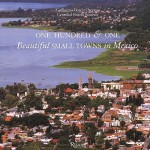
In an earlier post, we listed the towns included in One Hundred and One Beautiful Small Towns in Mexico, by Guillermo García Oropeza and Cristóbal García Sánchez (Rizzoli International Publications, 2008; 280 pp.). Here we offer a short review of the book.
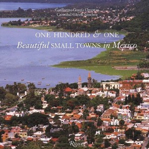
Cover of 101 Beautiful Small Towns in MexicoThis is a large format book, with many magnificent photographs. A fascinating range of places is included, even though the criteria used for their selection are nowhere explained. The selection offers lots of interest for anyone curious about Mexico’s geography.

For example, a stunning aerial view of Mexcaltitán (Nayarit) shows the cross-and-concentric-circle street pattern of “Mexico’s Venice”, surrounded by muddy brown shrimp-bearing swamps.

Curiously, the list of places included in the book on the contents pages adopts the affected style of using no capital letters whatsoever for any of the town names.

Each place is afforded at least a double page spread, and the back of the book has helpful lists of tourist offices, and selected hotels and restaurants.

Despite the title, some of the locations are more to do with the natural environment than with settlement. For instance, the town of Cuatro Ciénegas is a somewhat unprepossessing place whereas the desert oases of Cuatro Ciénegas,on which the book entry focuses, are an amazing natural zoological laboratory of crystalline water and extraordinary biodiversity. Similarly, Cacahuamilpa Caverns hardly qualify as a town!

The San Ignacio entry focuses on difficult to reach cave paintings. The village itself has few claims to fame beyond its colonial mission church.

The Paricutín double-page spread is named after the volcano which devoured several small settlements including Parícutin (for the name of the original village, the accent is on the second syllable; for the volcano it is on the last syllable). The photos included here actually show (as the captions make clear) the towns of Angahuan, and the upper facade of the church of San Juan Parangaricutiro, overwhelmed by the volcano’s lava.

A couple of places are given names that might not be very familiar to their residents. Casas Nuevas (Chihuahua) is actually Nuevo Casas Grandes (the real Casas Nuevas is an entirely different place which had only 13 inhabitants at the time of the 2000 census) and Mineral del Monte (Hidalgo) is more usually known as Real del Monte.

In southern Mexico, Santa María del Tule gets an entry. Santa María would not be worthy of mention, except for the fact that it is home to what is arguably the world’s largest tree, now thankfully restored to good health after decades of neglect.

In the Yucatán, three entries ignore the main thrust of the book, and focus instead on significant routes, one linking henequen (sisal) haciendas, one combining relatively minor archaeological sites which share distinctive Puuc architecture, and one going from one friary (monastery) to another. These are all interesting trips, but are entirely unexpected in a book specifically about towns. Some judicious editing might have removed some of the inaccuracies such as describing hemp (sisal) as “in the agave… or cactus, family”. The family name for agaves is Agavaceae which includes the genus Agave. In any event, agaves are biologically distinct to all members of the Cactaceae family; confusing agaves with cacti is an unexpected blunder.

The chosen towns quite rightly include some long-abandoned sites such as Teotihuacan, “City of the Gods”, which was once a city of 200,000 or so, the fascinating Mayan sites of Palenque and Chichen Itza, and Mitla and Monte Alban, both in Oaxaca.

The cover photo of the town of Chapala in Jalisco, much favored by American and Canadian retirees in recent years, unfortunately dates from a time when the lake level was relatively low. The green areas in the lake are floating masses of the introduced aquatic weed water hyacinth.

Despite being written by a Mexican historian, there are numerous minor historical inaccuracies in the text, though these should not detract from the enjoyment of the average reader.

For instance, in the Chapala entry, illustrated by the same photo used on the cover, it should be Septimus Crowe (not Crow), and the “navigation company with two small steam ships” had nothing to do with Christian Schjetnam. The steamships predated his arrival in Chapala by many years. Schjetnam did however, introduce two small sail yachts to the area, perhaps explaining the confusion. The description of President Díaz’s interest in Chapala appears to imply that he was first acquainted with the lake when he visited “a political crony” in 1904. Actually, Díaz was certainly personally familiar with Lake Chapala from long before this.

The entry for Santa Rosalia repeats the long-held but unproven idea that the main church was designed by Frenchman Gustave Eiffel (of Eiffel Tower fame). The town does have other Eiffel connections, and the church may indeed have been brought lock, stock and barrel from the 1889 Paris World Exhibition. However, research by Angela Gardner strongly suggests that the original designer was probably not Eiffel but was far more likely to have been Brazilian Bibiano Duclos, who graduated from the same Parisian academy as Eiffel. Gardner proved that Duclos took out a patent on prefabricated buildings, whereas she could find no evidence that Eiffel had ever designed a prefabricated building of any kind. Regardless of who designed it, it is certainly a unique design in the context of Mexico, and well worth seeing.

And really, surely this is the main point of this book. It was presumably never intended to be a reliable geographical (or historical) primer, but rather an enticing selection of seductive places, many of which will be unfamiliar to any but the most traveled reader. The variety of places included is breathtaking; few countries on earth can possibly match it. As such, One Hundred and One Beautiful Small Towns in Mexico is a resounding success.

This beautifully illustrated book should certainly tempt readers to venture into new parts of Mexico in search of these and other memorable places. Enjoy your travels!

– – – –

Mexico’s cities and towns are analyzed in chapters 21, 22 and 23 of Geo-Mexico: the geography and dynamics of modern Mexico. Buy your copy today!!
The 10 warmest states in Mexico

 Maps, Teaching ideas  Comments Off on The 10 warmest states in Mexico
Jul 292010
 

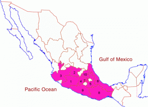
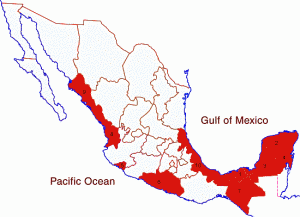
The table shows the ten warmest states in Mexico, defined by their average annual temperature.

RankStateAverage annual temperature (degrees C)
1Tabasco26.4
2Yucatán25.9
3=Campeche25.8
3=Quintana Roo25.8
5Colima25.3
6Guerrero24.9
7=Chiapas24.1
7=Nayarit24.1
9Sinaloa24.0
10Veracruz23.7
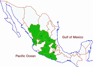
Map of the warmest states in Mexico

The warmest states in Mexico. Click to enlarge. All rights reserved.

In both Canada and the USA, average temperatures tend to depend largely on latitude, ie. they increase towards the south of the country. This is clearly only partially the case in Mexico.

(a) What factors apart from latitude influence the average temperatures in Mexico’s states? Try to find evidence that either supports (or refutes) your ideas.

(b) Is there any connection between average temperature and precipitation amounts? Compare this map of states which are relatively warm with the states which have

(c) If you do not already know, can you guess where the coolest states in Mexico will be? Check here to find out if you are right!

Mexico’s diverse climates are the subject of chapter 4 of Geo-Mexico: the geography and dynamics of modern Mexico. Climate-related hazards are analyzed in chapters 6 and 7. Buy your copy today!

Maternal health in southern Mexico

 Mexico's geography in the Press  Comments Off on Maternal health in southern Mexico
Jul 282010
 

A short piece in The Economist entitled “Maternal Health in Mexico: A perilous journey” (26 June 2010) highlights some of the reasons why maternal mortality has remained stubbornly high in southern Mexico, despite a marked improvement in recent years. Since 1990, maternal mortality (death related to childbearing) has fallen by 36% in Mexico as a whole.

Maternal mortality remains alarmingly high

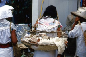
Carrying the future; maternal mortality remains alarmingly high. Photo: Tony Burton. All rights reserved. Click to enlarge.

Any average figure for the whole country disguises enormous regional differences. Rates for the richer inhabitants in the more developed regions in Mexico are comparable to rate in the USA or Canada. However, rates in the impoverished southern states such as Chiapas, Oaxaca and Guerrero are up to 70% higher than the national average.

In the words of the Research for Development blog “In 2005 the maternal mortality rate was 63.4 deaths per 100,000 live births. In the state of Guerrero the rate rose to 128 deaths per 100, 000 live births. Both figures are a long way from Mexico’s commitment under the Millennium Development Goals (MDGs) of 22.3.” Click here to see how well Mexico is doing in meeting other MDGs.

One study found that in the year 2000, only 44.8% of women in Chiapas gave birth with a doctor present; 49.4% did so with midwives, and the remaining 5.8% were attended by family members or give birth alone.

As The Economist article emphasizes, indigenous women are only one-third as likely to survive giving birth as non-indigenous women.

Why is this? What are the key factors preventing lower maternal mortality rates?

The Economist singles out:

  • means of transport – lack of a car means a total reliance on public transport. Public transport is poor in many remote areas
  • poor roads – many rural roads are unpaved, and the terrain in much of Mexico means than travel times are often much longer than might be expected
  • the expense of the hospital tests and medical supplies which can save a mother’s life
  • errors in delivery care or hospital procedures – according to The Economist, “40% of urban maternal deaths are caused by using the wrong medicine, by botched surgery or by other forms of malpractice.”
  • reluctance to see a male doctor (for social or cultural reasons)
  • language issues – many indigenous women do not speak Spanish at all well, if at all, and very few doctors have any knowledge of indigenous languages, so communication is often poor

What is needed to reduce maternal mortality rates? Understandably, The Economist focuses its attention on financial or economic solutions. More money is needed, it argues, for “midwifes and contraceptives.” It reports that increased funds are coming from a variety of sources, including the Spanish government, Carlos Slim (the Mexican entrepreneur who is the world’s richest man) and from the Bill and Melinda Gates Foundation. Between them, they have announced plans to spend 150 million dollars “on health care for the poor in Central America and southern Mexico”.

In addition, the article calls for investment in “infrastructure, health and education”, making the claim that investment in these areas would help the south catch up with the rest of the country.

We consider this analysis of possible remedies for the problem to be incomplete. The political will to continue making investments in health care installations and personnel over the long-term requires, in our opinion, a significant shift in attitudes among the wealthier and more influential sectors of Mexican society.

At present most members of the wealthy elite regard indigenous Mexicans as second class citizens.

At the time of the Chiapas uprising in 1994, for example, a subset of well-educated Mexicans called on the government to resolve the problems the nation faced in southern Mexico once and for all by using maximum force to re-establish complete military control over the area. Fortunately, the government of the day did not follow their advice but opted for alternative approaches such as dialogue.

Mexico’s indigenous peoples are rarely shown on TV or in advertisements. Instead, most firms prefer to picture blond, blue-eyed mestizos. Alongside increased financial investment in the south, a massive shift in public perception is required. For everyone’s sake, let us hope that this can be achieved with a minimum of turmoil.

Mexico’s government has to make tough choices about how far the national budget can stretch, and which things should be prioritized. Decisions are often based on political expediency as much as on the nation’s pressing development needs. Indigenous peoples are not well represented in federal government.

At present, the best-trained physicians and nurses aspire to work in the world class medical facilities in Mexico’s major cities. Health care workers in Mexico’s remote areas are often there only to fulfill the social service requirements for their professional qualification; they perform valuable work, but certainly have no long-term commitment to these regions. In the words of a MacArthur Foundation researcher (quoted in “Evaluation of The MacArthur Foundation’s Work in Mexico to Reduce Maternal Mortality, 2002-2008”) , qualified doctors (residents) “see their work as a big favor they do for the community, rather than understanding that indigenous populations in our country also have a right to health.”

We believe that a change in how society perceives indigenous peoples is a fundamental prerequisite for genuine long-term change, particularly in states such as Chiapas and Oaxaca.

Mexico’s indigenous populations, and the disparities in wealth and opportunity they face, are analyzed in chapters 10 and 29 of Geo-Mexico: the geography and dynamics of modern Mexico. Ask your local or university library to buy a copy today!!

Jul 272010
 

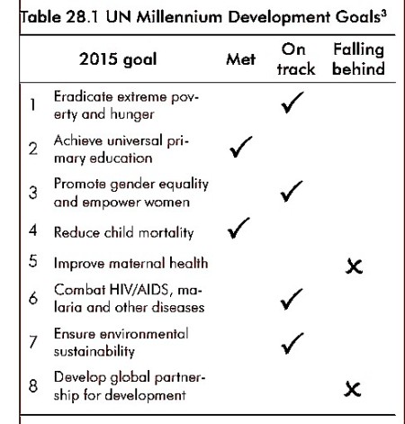
More than 190 countries signed up to the UN Millennium Development Goals (MDGs), agreed in 2000. Mexico is well on its way to meeting most of the eight goals (see table below).

UN Millennium Development Goals

Please refer to “Geo-Mexico: the geography and dynamics of modern Mexico” if you copy this resource

Each goal has numerous specific targets. Mexico met one of the key targets — a 50% reduction in the proportion of children suffering from hunger (under-nutrition) between 1990 and 2015 — with several years to spare. It has also met its child mortality target.

Specific targets that Mexico has not yet reached include:

  • an increase in the proportion of GDP that corresponds to the poorest 20% of the population (part of goal 1)
  • an increase in the number of women in government (goal 3)
  • a further decrease in maternal mortality (goal 5);
  • an increase in forested area (goal 7)
  • an improved employment rate for young people aged 15–24 (goal 8)

In future posts, we will take a look at some of these specific goals and examine Mexico’s progress towards meeting them in more detail.

Geo-Mexico: the geography and dynamics of modern Mexico is an outstanding new resource for courses in geography, economics, sociology and development studies, designed to be relevant to both general and academic readers. It provides an up-to-date account of Mexico suitable for students taking initial university or college courses related to geography, economics and Mexican or Latin American studies.  Buy your copy today!

Education professionals are invited to contact us if they would like to request a review copy. In addition, the entire book is searchable via the “Look Inside” feature of amazon.com

The 10 coolest states in Mexico

 Maps, Teaching ideas  Comments Off on The 10 coolest states in Mexico
Jul 262010
 

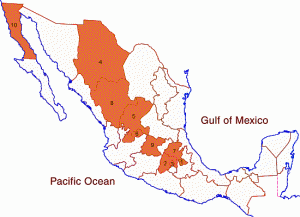
The table shows the ten coolest states in Mexico, defined by their average annual temperature.

RankStateAverage annual temperature (degrees C)
1Tlaxcala14.1
2=Estado de México15.2
2=Federal District15.2
4Chihuahua16.6
5=Zacatecas17.2
5=Aguascalientes17.2
7Hidalgo17.4
8Durango17.7
9Guanajuato17.9
10Baja California18.5
Map of the coolest states in Mexico

The coolest states in Mexico. Click to enlarge. All rights reserved.

In both Canada and the USA, average temperatures tend to depend largely on latitude, ie. they decrease towards the north of the country. This is clearly not the case in Mexico.

(a) What factors apart from latitude influence the average temperatures in Mexico’s states? Try to find evidence that either supports (or refutes) your ideas.

(b) Is there any connection between average temperature and precipitation amounts? Compare this map of states which are relatively cool with the states which have

(c) Can you guess where the warmest states in Mexico will be? To find out if you are right, you can find an atlas or on-line map showing average temperatures in Mexico, or keep reading the Geo-Mexico blog each day until we include our own map showing the warmest states!

Mexico’s diverse climates are the subject of chapter 4 of Geo-Mexico: the geography and dynamics of modern Mexico. Climate-related hazards are analyzed in chapters 6 and 7. Buy your copy today!

Jul 242010
 

According to the book One Hundred and One Beautiful Small Towns in Mexico, by Guillermo García Oropeza and Cristóbal García Sánchez (Rizzoli International Publications, 2008; 280 pp), these places all merit inclusion in the list of the 101 Beautiful Small Towns in Mexico.

Cover of 101 Beautiful Small Towns in MexicoWe will review the book more formally in a future post, since it offers some insights into Mexico’s geography, but for now take a look at the list below, and see if you agree.

Our own list of the most beautiful small towns would certainly include most of these, though we can think of some equally excellent choices which are not included.

Are there other towns that would be on your list? If so, let’s hear about them!

BAJA CALIFORNIA

  • San Felipe
  • Valle de Guadalupe

BAJA CALIFORNIA SUR

  • Loreto
  • Mulegé
  • San Ignacio
  • San Jóse del Cabo
  • Santa Rosalía
  • Todos Santos

CAMPECHE

  • Campeche
  • Edzná

CHIAPAS

  • Comitlán de Domínguez
  • Chiapa de Corzo
  • Palenque
  • San Cristóbal de las Casas
  • Yaxchilán
  • Bonampak
  • Zinacantán
  • San Juan Chamula

CHIHUAHUA

  • Batopilas
  • Creel
  • Hidalgo del Parral
  • Nuevas Casas [Nuevo Casaas Grandes]
  • Mata Ortíz
  • Cuarenta Casas

COAHUILA

  • Cuatro Ciénegas
  • Parras

COLIMA

  • Cómala

FEDERAL DISTRICT

  • Coyoacán

GUANAJUATO

  • Atotonilco
  • Dolores Hidalgo
  • Guanajuato
  • San Miguel De Allende
  • Yuriria

GUERRERO

  • Cacahuamilpa
  • Taxco

HIDALGO

  • El Chico
  • Huasca
  • Mineral del Monte [Real del Monte]
  • Tula

JALISCO

  • Chapala
  • Ajijic
  • Lagos de Moreno
  • Mazamitla
  • Puerto Vallaría
  • San Sebastián del Oeste
  • Tapalpa
  • Tequila
  • Tlaquepaque

MEXICO STATE

  • Malinalco
  • Teotihuacán
  • Acolman
  • Tepotzotlán
  • Valle De Bravo

MICHOACÁN

  • Angangueo
  • Cuitzeo
  • Paricutín
  • Angahuan
  • Santiago Nurío
  • Paracho
  • Pátzcuaro
  • Santa Clara del Cobre
  • Zirahuén
  • Tlalpujahua
  • Tzintzuntzan

MORELOS

  • Cuernavaca
  • Tepoztlán
  • Tétela del Volcán
  • Xochicalco
  • Yecapixtia

NAYARIT

  • Mexcaltitán

NUEVO LEÓN

  • Bustamante
  • Villa de García

OAXACA

  • Cuilapan
  • Arrasóla
  • Ixtlán De Juárez
  • Mitla
  • Monte Albán
  • Ocotlán
  • San Bartólo Coyotepec
  • Santa María del Tule
  • Tlacochahauya
  • Tlacolula
  • Dianzú
  • Yanhuitlán

PUEBLA

  • Cuetzalan
  • Cholula
  • Huejotzingo
  • Tonantzintia
  • San Francisco Acatepec

QUERÉTARO

  • Bernal
  • Jalpan

QUINTANA ROO

  • Bacalar
  • Cozumel
  • Holbox
  • Isla Mujeres
  • Playa del Carmen
  • Tulum

SAN LUIS POTOSÍ

  • Real de Catorce

SINALOA

  • Cósala

SONORA

  • Alamos
  • Magdalena de Kino

TLAXCALA

  • Tlaxcala

YUCATAN

  • Chichen Itza
  • Izamal
  • Uxmal
  • Valladolid

VERACRUZ

  • Coatepec
  • Los Tuxtlas
  • Papantia
  • Tlacotalpan

ZACATECAS

  • Guadalupe
  • Jerez
  • Sombrerete

Mexico’s cities and towns are analyzed in chapters 21, 22 and 23 of Geo-Mexico: the geography and dynamics of modern Mexico. Buy your copy today!!
Jul 232010
 

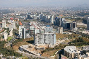
Santa Fe, in upscale western Mexico City is one example of the many new developments being built on the urban periphery in Mexico.

Santa Fe, a subsidiary CBD in Mexico City

Santa Fe has become a subsidiary CBD in Mexico City. Photo: Oscar Ruiz

The plan for the Santa Fe complex called for private sector financed office towers, a gigantic retail mall, high income housing, park areas, as well as schools and universities. Construction was halted briefly by the 1994–95 economic crises, but soon resumed at full speed. Today Santa Fe has numerous skyscraping office towers, over one eighth of the Federal District’s total office space, about 70,000 employees, four universities with 13,500 students, over 4300 residents, and one of the largest retail malls in Latin America.

Santa Fe is essentially an island that is only accessible by private car; public transport is relatively limited.

Unfortunately, it has not fully lived up to expectations. The preponderance of cars, mostly with a driver and no passengers, has led to severe traffic jams. Perhaps related to this, the vacancy rate of office space is about 25%. Furthermore, even with eight million visitors a year, the gigantic Santa Fe shopping mall is not as heavily utilized as competing malls in the area.

How many of the shoppers in Santa Fe mall or students attending classes realize that they are on top of what was once one of the biggest garbage dumps in Mexico City? Prior to its development into high-end real estate, much of this area had been quarried for sand, and the resulting holes  used as a landfill site for household and industrial waste. Some of the structural problems reported in buildings in Santa Fe may well be due to the settling of these less than savory foundations.

(Our sincere thanks to Fatimah Araneta for improving this account)

If you have enjoyed this brief excerpt from chapter 23  of Geo-Mexico: the geography and dynamics of modern Mexico please consider purchasing your own copy of the book. Chapters 21 and 22 analyze Mexico’s 500-year transition to an urban society and the internal geography of Mexico’s cities. Chapter 23 looks at urban issues, problems and trends. To preview more parts of the book, click here and use amazon’s “Look Inside” feature.

Meandering river leads to border dispute

 Excerpts from Geo-Mexico  Comments Off on Meandering river leads to border dispute
Jul 222010
 

The 1848 Treaty of Guadalupe Hidalgo, signed after the Mexican-American War, ceded over half of Mexico’s territory to the USA. A few years later, under the 1853 Gadsden Purchase (Treaty of La Mesilla), northern portions of Sonora and Chihuahua were transferred to the USA. This established the current border between the two countries.

The end to a border dispute caused by a meandering river

The end to a border dispute caused by a meandering river

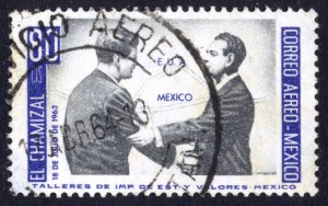
Minor disputes have occurred since due to the migrating meanders of the Río Bravo (Río Grande) which forms much of the border between Mexico and the USA. Flooding during the early 1860s moved the Río Bravo channel south, shifting an area of about 2.6 square kilometers (1 square mile) from Ciudad Juárez in Mexico to El Paso in the USA. Both countries claimed the area, giving rise to the El Chamizal dispute.

This dispute went to international arbitration in 1911 and was only finally resolved in 1963 with the ratification of the Chamizal Treaty. In 1963, President Adolfo López Mateos met his US counterpart John F. Kennedy on the border formalizing the end of the Chamizal dispute.

The USA and Mexico shared the costs of rechanelling the river in an effort to prevent further migrating of its meanders. The concrete channel is about 50 meters (170 feet) wide and almost 5 meters (15 feet) deep. As we saw in July 2010, with the flooding following Hurricane Alex, even this size of channel is sometimes unable to contain the full flow of the river.

A similar dispute, the Ojinaga Cut, was resolved in 1970.

In El Paso, the Chamizal National Memorial was established in 1966 as a permanent memorial to commemorate the two nations’ laudable  international cooperation, diplomacy and respect for cultural values in arriving at a mutually acceptable resolution to the conflict.

The changing political frontiers of Mexico are the subject of chapter 12 of Geo-Mexico: the geography and dynamics of modern Mexico. If you have enjoyed this post, please consider purchasing a copy of Geo-Mexico so that you have your own handy reference guide to all aspects of Mexico’s geography.

The 10 states in Mexico with the highest percentage of homes receiving remittances

 Maps, Teaching ideas  Comments Off on The 10 states in Mexico with the highest percentage of homes receiving remittances
Jul 212010
 

The table and map show the ten states which have the highest percentage of homes receiving remittances. (Data for 2005)

RankState% of homes that receive remittances, 2005
1Zacatecas12.2
2Michoacán10.4
3Guanajuato9.6
4Morelos7.5
5San Luis Potosí7.4
6Durango7.3
7Hidalgo7.1
8=Guerrero6.8
8=Nuevo León6.8
10Aguascalientes6.7
States where a high % of households receive remittances

States where a high % of households receive remittances. Click to enlarge. All rights reserved.

These data portray where remittances are most critical in terms of maintaining household finances. If a high percentage of homes in a state receive remittances, that suggests that people living in the state are likely to be quite dependent on remittances.

The local economy in many towns and villages in these states may be significantly boosted by incoming remittances. These places are likely to suffer most in times of economic down-turn when the US economy is suffering, employment is harder to find, and when fewer remittance payments are sent back home.

(a) What do the 10 states where a high percentage of homes receive remittances have in common?

(b) What factors might help explain why lots of households in some states receive remittances, but only very few households in other states?

(c) Explain what is meant in geography or economics by a “multiplier effect”.

(d) Suggest which sectors of the economy would be most likely to benefit from incoming remittance payments. Try to find evidence to support (or refute) your ideas.

“Migration to the USA” is the title of chapter 26 of Geo-Mexico: the geography and dynamics of modern Mexico. This chapter provides a good introduction to the geography, history and impacts of migration and remittances. Buy your copy today!

Mexico’s major dams and reservoirs

 Excerpts from Geo-Mexico  Comments Off on Mexico’s major dams and reservoirs
Jul 192010
 

The functions of dams and reservoirs

Mexico’s dams and reservoirs serve many valuable functions. The first is as a source of hydroelectric power. The amount of power that can be generated is a function of the amount of water streaming through the generators and its pressure, which is related to the height of the dam. Just over half of hydroelectric power is generated by dams on rivers which start in southern mountain ranges and flow into the southern portion of the Gulf of Mexico. Most of the rest comes from dams on rivers along the Pacific coast from the Balsas basin all the way north to Sonora.

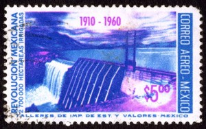
Postage stamp depicting dam and reservoir

The 50th anniversary of the Mexican Revolution: dam, reservoir and water power.

Hydroelectric power has been important since the early part of the twentieth century. Currently about 22% of the electricity  generating capacity is from hydroelectric plants. The largest hydroelectric plants are on the Grijalva River in Chiapas. Other rivers providing significant hydropower are the Balsas, Santiago, Fuerte, Papaloapan and Moctezuma.

Virtually all Mexican dams, except those in the rainiest southern areas, provide water for irrigated agriculture. This is particularly true in arid northern Mexico. Mexico ranks sixth in the world with about 63,000 cubic kilometers of irrigated agriculture. It is well behind India (558,000), China (546,000), the USA (224,000), Pakistan (182,000) and Iran (76,500). About 23% of Mexico’s cultivated area is irrigated, compared to 99.9% in Egypt, 82% in Pakistan, 47% in China and only 12% in the USA.

Dams also protect against floods, especially in the drier northern areas which are very susceptible to floods from rare but torrential downpours.

In addition, dams provide a source of water for urban populations, especially in the largest metropolitan areas.

Finally, the reservoirs behind dams throughout Mexico are an important recreational resource.

On the other hand, the construction of dams can also have negative effects, including habitat loss, the need to relocate existing residents away from the reservoir site, adverse changes in river flows downstream of the dam and sediment accumulation behind the dam which reduces the reservoir’s capacity.

Chapter 6 of Geo-Mexico: the geography and dynamics of modern Mexico is about water availability, rivers and aquifers; it includes several maps including one showing the relative sizes of the main reservoirs.

The connection between a Veracruz sugar plantation, San Francisco earthquake, Mexico tourist guide, and Mutiny on the Bounty

 Other  Comments Off on The connection between a Veracruz sugar plantation, San Francisco earthquake, Mexico tourist guide, and Mutiny on the Bounty
Jul 172010
 

At first sight, it would seem unlikely that a Veracruz sugar plantation could be linked, even indirectly, to Mutiny on the Bounty. The connection, which also takes in the San Francisco earthquake and one of Mexico’s most famous tourist guide books, is made via Charles Bernard Nordhoff, born in London, England in 1887, to well-to-do American parents.

When Charles was very young, the family moved to Berlin, where his mother wrote in the family diary that, “Charlie undoubtedly began his study of water fowl, as his daily outing in a small pram or push cart led him first to the bakeries for a supply of stale buns and back to the lake to feed the ducks.” The family also lived on a ranch near Todos Santos in Baja California, where as a young child, Nordhoff learnt to hunt, sail and fish.

Later, the family moved to California. Following in the footsteps of his grandfather, a journalist and  author, Charles Nordhoff wrote his first article at age 15 for an ornithological journal. He studied briefly at Stanford University, but left in the aftermath of the serious earthquake and fire of 1906.

After completing a B.A. at Harvard University, he moved back to Mexico in 1909 to work as a supervisor on a sugar plantation in Veracruz, where he was besotted with the owner’s attractive daughter. Unable to win the heart of the beautiful young lady, and with the Mexican Revolution breaking out around him, Nordhoff left Mexico in 1911; he never  returned.

But Nordoff’s adventures were far from over, In 1917, he joined the French Foreign Legion as a pilot, eventually winning the Croix de Guerre for his efforts. After the war, he wrote a history of the Lafayette Flying Corps. with James Norman Hall. Hall later landed the job of updating Terry’s Guide to Mexico, by far the most famous guidebook to Mexico of its era.

Nordhoff and Hall later moved to Tahiti to write travel articles for Harper’s, where Nordhoff married a Polynesian woman, Pepe Teara; they had six children. While Nordhoff wrote several books of his own, including several novels, he is best known for his collaboration with Hall on the Mutiny on the Bounty trilogy about the famous 1789 mutiny in the South Seas. The novel was the basis for three movie versions, the first of which, released in 1935, won an Oscar for Best Picture.

Tragically, following a severe depression and heavy drinking, Nordhoff took his own life on 10 April 1947.

This is an edited excerpt of a biography that first appeared in Tony Burton’s Lake Chapala Through the Ages, an anthology of travellers’ tales (Sombrero Books, 2008). All rights reserved.

Narco-related killings in Mexico, 2006-2010

 Mexico's geography in the Press, Updates to Geo-Mexico  Comments Off on Narco-related killings in Mexico, 2006-2010
Jul 162010
 

The alarming situation in Mexico with regard to drug-related violence has led the Wall Street Journal to prepare an interesting interactive graphic.

The graphic shows narco-related killings from 2006 to 2010. The slider allows you to see the pattern for each year. Hovering over the proportional circles used to represent the deaths in each state brings up the exact number.

While drug-related violence is not new, it is clearly intensifying and now affecting areas of the country where it was traditionally very rare.

Chapter 20 of Geo-Mexico: the geography and dynamics of modern Mexico includes a brief section about the geography of drug trafficking. It focuses mainly on the spatial changes in supply systems. Buy your copy today, so you have this handy reference guide to all aspects of Mexico’s geography available whenever you need it.

The 10 states in Mexico receiving the most remittances in total

 Maps, Teaching ideas  Comments Off on The 10 states in Mexico receiving the most remittances in total
Jul 162010
 

The table shows the 10 states which receive the highest total remittances.

RankStateRemittances ($ millions), 2005
1Michoacán2,595
2Guanajuato1,715
3Jalisco1,693
4State of México1,675
5Puebla1,174
6Veracruz1,155
7Federal District1,452
8Oaxaca1,002
9Guerrero957
10Hidalgo718
States receiving the most remittances (highest value)

States receiving the most remittances (highest value). Click to enlarge. All rights reserved.

The data show very clearly that all the states receiving high total amounts of remittances are in the southern half of Mexico.

(a) What factors might explain this pattern?

(b) Compare this map with a map of the states with highest per person remittances. Why are some states only shown on one of the maps, and not on the other?

(c) Find a table showing the total population of each state in Mexico. To what extent do the total population figures for each state help to explain whether or not they are in the top 10 states for receiving remittances?

“Migration to the USA” is the title of chapter 26 of Geo-Mexico: the geography and dynamics of modern Mexico. This chapter provides a good introduction to the geography, history and impacts of migration and remittances. Buy your copy today!

Absolute distance, relative distance and the vagaries of air travel within Mexico

 Excerpts from Geo-Mexico  Comments Off on Absolute distance, relative distance and the vagaries of air travel within Mexico
Jul 152010
 

In an earlier post we looked at the importance of Mexico City airport in the national network of airports. In this post, we focus our attention more on the network, and much less on any individual airport.

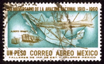
Alberto Braniff's biplane, modern jet and Mexico's airport network in 1960

Air travel greatly distorts the map of Mexico and the world. In terms of travel time on public transport, Mexico City’s airport is closer to Guadalajara, in the state of Jalisco, than to some areas in the Mexico City Metropolitan Area!

Similarly, Guadalajara is closer to Hong Hong by air—21 hours for the 13,000 km—than to some communities only 200 km away in northern Jalisco which require a trek of over 24 hours by bus, taxi and foot.

Business executives fly 2300 km from Tijuana to Mexico City, work for six hours in the city, and fly back the same day. Commuting to the same office takes longer for some Metro area residents who live only 50 km away, but have to contend with traffic congestion.

Air travel, coupled with  familiarity, significantly influences our perceptions of distance. A Guadalajara traveling executive perceives Mexico City as being closer to his home than slum areas within 20 km of his house. Downtown Mexico City seems much closer to a person who commutes there daily from 40 km away than to a neighbor who works locally and only goes downtown once a year.

Transportation systems greatly affect our perception of distance. Depending on connections, air travel is not always the quickest means of transport.

The straight line distance from Mazatlán to Durango is 245 km. The fastest air connection goes through Mexico City and involves flying over 1500 km. It takes seven hours, longer than the inter-city bus! A direct flight would take about 45 minutes. When an expressway connects the two cities, the drive will take less than three hours. Though the straight line distance between them is about the same as that between Querétero and Mexico City, the travel and perceived distance is far greater. This example demonstrates how existing transportation systems affect our perceptions of distance.

“Distance” can also be looked at in terms of costs. In Geo-Mexico, we look at the distinction between absolute distance measured in kilometers and relative distance in terms of cost. We include a graph plotting distance against the price of one-way economy-class direct flights from Mexico City to 28 cities for a random mid-week day in April 2009. The graph shows that there is very little connection between flying distance (or flight times) and ticket price (For statistically inclined readers, rs = 0.14).  Rather than discussing this further here, we suggest you consider purchasing a copy of the book for a more in-depth analysis!

This is an excerpt from chapter 17 of Geo-Mexico: the geography and dynamics of modern Mexico. which discusses transportation systems, including air travel and the national network of airports.

In which months are hurricanes most likely to strike Mexico?

 Other  Comments Off on In which months are hurricanes most likely to strike Mexico?
Jul 142010
 

The following verse provides a way to remember how likely hurricanes are in different months of the year. It applies specifically to Atlantic (Gulf of Mexico) and Caribbean hurricanes.

June, too soon
July, stand by
August, come it must
September, remember
October, all over.

This verse matches the historical records of Atlantic and Caribbean hurricanes fairly closely. Even so, to keep everyone on their toes, hurricanes sometimes, very occasionally, develop in other months of the year.

Previous hurricane-related posts:

Hurricane Alex, 30 June – 1 July 2010

Hurricanes and other climatological phenomena are analyzed in chapters 4 and 7 of Geo-Mexico: the geography and dynamics of modern Mexico. Buy your copy today, so you have a handy reference guide available whenever you need it.

A case study of low-income housing on the urban periphery

 Excerpts from Geo-Mexico  Comments Off on A case study of low-income housing on the urban periphery
Jul 132010
 

A shortage of affordable housing is a persistent problem in large Mexican cities. In response, new, subsidized lower income housing developments are being built on the periphery of Mexico City, Guadalajara, Monterrey, and other metropolitan areas.

Sprawling Mexico City - "El Monstruo"

Sprawling Mexico City - "El Monstruo"

Though most working families can afford the down payment and monthly payments for these subsidized housing units, these expenses leave little extra for food, clothing, utility bills, commuting, and health care. Even these subsidized housing units provide a car parking place because virtually all Mexican families aspire to own their own automobile. The case study which follows, of the Hernández family, illustrates the situation.

Carlos Hernández, his spouse, mother-in-law, and two daughters are happy with their house in a new housing development in Zumpango, about 40 km (25 mi) north of the Mexico City Zócalo. The government-backed mortgage on the tiny (30 square meters – 323 square feet, about the size of a two-car garage), 15,700-dollar, one-bedroom house, is 100 dollars a month. Hernández must spend another $110 a month for his daily five hour commute by colectivo (mini bus), bus, and metro (subway) to his $350 a month maintenance job in the capital. This leaves only $140 a month for all other expenses such as food, utilities, installment payments on furniture and appliances, health care, clothing, schooling, etc. To help make ends meet, his spouse, Edith, runs an informal convenience store out of the front of the house.

The house is very crowded; the kitchen table is brought inside only at mealtimes. Carlos and Edith sleep on a foldout couch in the living room. Edith’s mother, Lucía, has the bedroom and the two daughters take turns sleeping with their parents or grandmother. Hernandez is glad he finally owns a house and no longer has to pay rent. His story is repeated tens of thousands of times as hundreds and hundreds of low-income housing developments are being built on the urban periphery.

If you have enjoyed this brief excerpt from chapter 23  of Geo-Mexico: the geography and dynamics of modern Mexico please consider purchasing your own copy of the book. Chapters 21 and 22 analyze Mexico’s 500-year transition to an urban society and the internal geography of Mexico’s cities. Chapter 23 looks at urban issues, problems and trends. To preview more parts of the book, click here and use amazon’s “Look Inside” feature.

Mexico has 32 states, divided into 2,456 municipalities

 Excerpts from Geo-Mexico, Updates to Geo-Mexico  Comments Off on Mexico has 32 states, divided into 2,456 municipalities
Jul 102010
 

Mexico’s 32 states are divided into municipios (municipalities). There are 2456 municipalities which vary greatly in size and population. For example, the average population of Oaxaca’s 570 municipalities is about 6000 while the average population of Baja California’s five  municipalities is over 500,000. Each municipality elects a new president and local council every three years (except for Coahuila where four-year terms now apply).

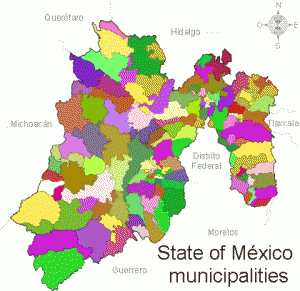
State of Mexico municipalitiesMunicipal governments have taxing authority but rely very heavily on financial support from state and federal sources.

Municipalities are responsible for a variety of public services, including water and sewerage; street lighting and maintenance, trash collection and disposal, public safety and traffic, supervision of slaughterhouses, and maintenance of parks, gardens and cemeteries.

Municipalities are also free to assist state and federal governments in the provision of elementary education, emergency fire and medical services, environmental protection and the maintenance of historical landmarks.

Municipalities are therefore akin to  counties in the USA.

Here are a selection of other facts about Mexico’s municipalities:

  • The state with the most municipalities is Oaxaca:  570; at the other extreme, the states of Baja California and Baja California Sur each have only 5 municipalities.
  • Excluding the equivalent territorial divisions of the Federal District (known as delegaciones), the largest municipalities in terms of population are Ecatepec de Morelos (in Mexico State) and Guadalajara (Jalisco). Each is home to about 1.7 million people.
  • The least populated municipality is Santa Magdalena Jicotlán (Oaxaca) which has just 102 inhabitants.
  • Only about 450 municipalities have fewer men than women. The most male-dominated municipality is Aquiles Serdán (Chihuahua) which has 1.6 men for every woman.
  • The most female-dominated municipality is San Miguel Tulancingo (Oaxaca) with 1.5 women for every man.
  • The municipality of Tulum (Quintana Roo) is one of the youngest in the country; its first council was elected in 2009.
  • The most crowded municipality in terms of people per dwelling is San Simón Zahuatlán (Oaxaca):  9.1 persons per household. The national average is 4.2. The least crowded municipality is  Santiago Nejapilla (Oaxaca) where the average occupancy is 2.7 per home.
  • The largest municipality in area is Ensenada (Baja California), 53,304 square kilometers; the smallest used to be San Lorenzo Axocomanitla (Tlaxcala), 4.34 square kilometers, but is now Santa Cruz Amilpas (Oaxaca) which is only 1 square kilometer in area.

The 2010 census, carried out in June, will necessitate revising some of these numbers when the results are released in due course.

Jul 092010
 

The 4th Assessment Report (2007) of the IPCC (Intergovernmental Panel on Climate Change) involved the contributions of 2,500 scientists from 130 countries. The number of Mexican scientists participating was higher than the number from many richer countries including Spain and France. Sixteen Mexican scientists were involved in writing the 4th IPCC report. Ten of the sixteen hold positions at UNAM (the National University in Mexico City), making UNAM one of the institutions in the world with the highest rate of participation.

The 16 Mexican contributors were:
IPCC 4th Report

A further 8 Mexican scientists helped edit the documents:

Many of the same scientists have now been confirmed as members of the international team developing the 5th Assessment Report of the IPCC. In addition, the following newcomers have also been appointed:

  • Salvador Lluch-Cota, Centro de Investigaciones Biológicas del Noroeste, S.C. (Lead author, Ocean systems)
  • Fernando Aragon, El Colegio de la Frontera Sur (Urban areas)
  • Ursula Oswald-Spring, Centro Regional de Investigaciones Multidiscipinarias, UNAM    (Human security)
  • Roberto A. Sanchez Rodriguez, University of California, Riverside  (Adaptation planning and implementation)
  • Edgar Ortiz (Integrated Risk and Uncertainty Assessment of Climate Change Response Policies)
  • Martha Micheline Cariño Olvera (Social, Economic and Ethical Concepts and Methods)
  • Mauricio de María Campos (Sustainable development and equity)
  • Angel de la Vega     (Energy systems)
  • Xochitl Cruz-Nuñez (Transport)
  • Omar Masera (Agriculture, Forestry and other land uses)
  • Gian Carlo Delgado (Human Settlements, Infrastructure and Spatial Planning)
  • Alba Eritrea Gámez Vázquez (Regional Development and Cooperation)
  • Manuel Angeles (National and Sub-National Policies and Institutions)
  • Tomás Hernández-Tejeda, National Institute of Research in Forestry, Agriculture and Livestock (INIFAP)/SAGARPA (Synthesis Report)

Mexico’s diverse climates are the subject of chapter 4 of Geo-Mexico: the geography and dynamics of modern Mexico. Water availability, rivers, aquifers, water issues and hazards are analyzed in chapters 6 and 7. Buy your copy today!

Jul 082010
 

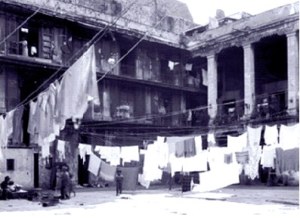
Mexico City’s inner city slums date from the regime of Porfirio Díaz (1877–1910) which stimulated rapid railroad expansion and industrialization north and northwest of the city center. The industrial zone expanded out along the rail lines into the areas now known as Azcapotzalco and Gustavo A. Madero.

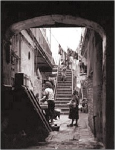
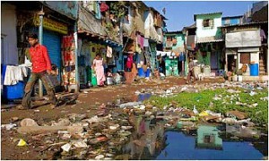
Typical vecindad, Mexico CityWith this expansion, the upper classes sold or abandoned their inner city colonial mansions and moved further west, deliberately avoiding noisy and polluted industrial areas. Their abandoned multi-storied mansions were converted into vecindades, cheap tenements with individual rooms rented to families.

Vecindades, with a shared central court, kitchen and latrines, became Mexico City’s first slums. They encircled the center on the north, east and south; the west side remained upscale. As these eventually became overcrowded, incoming migrants moved into cheap, undesirable housing in the industrial zone or on the urban periphery.

Vecindad, Mexico CityRapid industrialization after World War II brought another massive wave of poor immigrants. They initially headed for the low rent vecindades which had expanded as developers built new tenements using the old vecindades as a model.

Following government-mandated rent control, many investors abandoned the vecindades, depleting an already poor housing stock. Affordable housing emerged as a paramount concern of low-income residents; most were forced into colonias populares either on very steep hillsides or the urban periphery, such as Nezahualcoyotl.

While vecindades are most closely associated with Mexico City, they also emerged in Mexico’s other large cities. About ten percent of Mexico City’s current residents live in vecindades.

Mexico’s cities and towns are analyzed in chapters 21, 22 and 23 of Geo-Mexico: the geography and dynamics of modern Mexico. Buy your copy today!!
Mexico City’s wholesale food market, Central de Abasto

 Books and resources, Other  Comments Off on Mexico City’s wholesale food market, Central de Abasto
Jul 072010
 

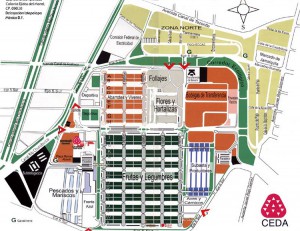
Have you ever wondered how food supplies are organized in a metropolitan area the size of Mexico City (population 20 million) so that all its inhabitants have regular access to fresh produce? Like most major world cities, Mexico City has a specialized wholesale market for food, Central de Abasto. It is located in Iztapalapa, south-east of the city center.

Nicola Twilley, a freelance writer currently based in Montreal, has written a wonderfully informative description of what a visit to the Central de Abasto is like on her fascinating blog edible geography

Map of Central de Abasto, Mexico City

Map of Central de Abasto, Mexico City. Click to enlarge.

The map is the “official” map of the Central de Abasto in all its glory. While I often organized market surveys for school groups in Mexico, I have to admit that I never dared take on the challenge of surveying the Central de Abasto. This map, and Twilley’s fun account of the market reminds me why I never had the courage!

Mexican markets, in all their guises, from the massive Central de Abasto down to a humble tianguis (street market) in a small village, are a fascinating aspect of Mexico’s geography, and well worth a book in their own right.

Enjoy!

Notes:

Geo-Mexico author made two presentations at the University of Guanajuato

 Other  Comments Off on Geo-Mexico author made two presentations at the University of Guanajuato
Jul 052010
 

Richard Rhoda, joint author with Tony Burton of “Geo-Mexico: the geography and dynamics of modern Mexico”, visited the University of Guanajuato on 2 July 2010 to present two lectures (based on the book) to an eager group of about 30 US students.   The lectures were titled:

  • “Mexico: More Important than We Think” and
  • “Mexico: Current Trends and Issues.”

The students, all from the Big Ten universities and the University of Chicago, are participating in a Committee on Institutional Cooperation (CIC) eight week summer program in Guanajuato.

We sincerely hope that all the students will take fond memories of Mexico back with them at the end of the summer, and that many of them will decide to undertake further studies and research related to Mexico in the future.

The introduction of sheep caused widespread environmental damage in Mexico

 Books and resources, Excerpts from Geo-Mexico  Comments Off on The introduction of sheep caused widespread environmental damage in Mexico
Jul 032010
 

After the conquest, Spanish settlers introduced numerous Old World species into the New World. The most pernicious introductions were human-borne diseases, which led to the rapid and tragic decimation of the indigenous population. However, most of the introductions were deliberate, made with the intention of increasing the diversity of available food and resources. Among the non-native (exotic) plants and animals introduced were sheep, pigs, chickens, goats, cattle, wheat, barley, figs, grapevines, olives, peaches, quinces, pomegranates, cabbages, lettuces and radishes, as well as many flowers.

The environmental impact of all these introductions was enormous. The introduction of sheep to Mexico is a case in point.

In the Old World, wool had been a major item of trade in Spain for several centuries before the New World was settled. The first conquistadors were quick to recognize the potential that the new territories held for large-scale sheep farming.

Cover of A Plague of SheepThe development of sheep farming and its consequences in one area of central Mexico (the Valle de Mezquital in Hidalgo) was analyzed  by Elinor Melville in A Plague of Sheep. Environmental Consequences of the Conquest of Mexico.

Melville divides the development of sheep farming in the Valle of Mezquital into several distinct phases. Sheep farming took off during Phase I (Expansion; 1530-1565). During this phase, the growth in numbers of sheep in the region was so rapid that it caused the enlightened Viceroy, Luis de Velasco, to became concerned that sheep might threaten Indian land rights and food production. Among the regulations introduced to control sheep farming was a ban on grazing animals within close proximity of any Indian village. At first the Indians did not own any grazing animals, and consequently did not fence their fields, which inadvertently encouraged the Spaniards to treat the landscape as common land.

During Phase II (Consolidation of Pastoralism; 1565-1580), the area used for sheep grazing remained fairly stable, but the numbers of sheep (and therefore grazing density) continued to increase. By the mid-1570s, sheep dominated the regional landscape and the Indians also had flocks. One of the consequences of this was environmental deterioration to the point where by the late 1570s, some farmers did not have adequate year-round access to pastures and introduced the practice of seasonal grazing in which they moved their flocks (often numbering tens of thousands of sheep) from their home farm in central Mexico to seasonal pastures near Lake Chapala.

This practice of grazing on harvested fields or temporary pastures was known as agostadero. This term originally applied to summer (agosto=August) grazing in Spain but was adopted in New Spain for “dry season” grazing, between December and March. So important was this annual movement of sheep that provision was made in 1574 for the opening of special sheep lanes or cañadas along the route, notwithstanding the considerable environmental damage done by the large migrating flocks. As flock sizes peaked, more than 200,000 sheep made the annual migration by 1579.

In the words of historian Francois Chevalier:

By 1579, and doubtless before, more than 200,000 sheep from the Querétaro region covered every September the 300 or 400 kilometers to the green meadows of Lake Chapala and the western part of Michoacán; the following May, they would return to their estancias.

The prime dry season pastures were those bordering the flat, marshy swampland at the eastern end of Lake Chapala. The Jiquilpan district alone supported more than 80,000 sheep each year, as the Geographic Account of Xiquilpan and District (1579) makes clear:

More than eighty thousand sheep come from other parts to pasture seasonally on the edge of this village each year; it is very good land for them and they put on weight very well, since there are some saltpeter deposits around the marsh.

By the end of Phase III (The Final Takeover; 1580-1600), most land had been incorporated into the Spanish land tenure system, the Indian population had declined (mainly due to disease) and the sheep population had also dropped dramatically. Contemporary Spanish accounts reveal that this collapse was attributed to a combination of the killing of too many animals for just their hides by Spaniards, an excessive consumption by Indians of lamb and mutton, and by the depletion of sheep flocks by thieves and wild dogs. Melville’s research, however, suggests that the main reason for the decline was actually environmental degradation, brought on by the excessive numbers of sheep at an earlier time.

The entire process is, in Melville’s view, an excellent example of an “ungulate irruption, compounded by human activity.” The introduction of sheep had placed great pressure on the land. Their numbers had risen rapidly, but then crashed as the carrying capacity of the land was exceeded. The carrying capacity had been reduced as (over)grazing permanently changed the local environmental conditions.

By the 1620s, the serious collapse in sheep numbers in the Valle de Mezquital was over; sheep farming never fully recovered. The landscape had been changed for ever.

Sources / Further reading:

  • Acuña, R. (ed) Relaciones geográficas del siglo XVI: Michoacán. Edición de René Acuña. Volume 9 of Relaciones geográficas del siglo XVI. Mexico City: Universidad Nacional Autónoma de México. 1987
  • Chevalier, F. Land and Society in Colonial Mexico. University of California Press. 1963.
  • Melville, Elinor G. K. A plague of Sheep. Environmental consequences of the conquest of Mexico. Cambridge University Press. 1994.

Click here for the original article on MexConnect.

Mexico’s ecosystems and biodiversity are discussed in chapter 5 of Geo-Mexico: the geography and dynamics of modern Mexico. The concept of carrying capacity is analyzed in chapter 19. Buy your copy today, as a useful reference book!

Nezahualcoyotl, an irregular settlement which grew into a monster

 Excerpts from Geo-Mexico, Updates to Geo-Mexico  Comments Off on Nezahualcoyotl, an irregular settlement which grew into a monster
Jul 022010
 

Rapid industrialization north of Mexico City after World War II brought a giant wave of immigrants aggravating a serious shortage of low income housing. With the vecindades (inner city slums) severely overcrowded, the only alternative was “irregular housing” or “colonias populares.” These were developed wherever there was vacant land, mostly in the west and north of the city on the dry former lakebed or on very steep slopes. They all followed a development pattern roughly similar to that of Nezahualcoyotl, the largest and best known colonia popular.

The densely packed housing of Nezahaulcoyotl in all its glory

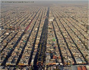
The densely packed housing of Nezahaulcoyotl in all its glory. Image: imagenesaereasdemexico.com. Follow link at end of post for more Mexico City photos

In the late 1950s, a group of speculators gained de facto possession of roughly 78 square kilometers  (30 square miles) of former lakebed in Nezahualcoyotl just east of the Mexico City airport. They sold nearly 200,000 plots cheaply and on credit, a few dollars down, and a few dollars a month, for 10-20 yrs.

Families bought plots and immediately started to erect shacks. Aside from electricity, which was provided by the national utility, the plots initially lacked basic services such as potable water, sewerage, flood drainage, pavement, schools, etc. Without services, Nezahualcoyotl was illegal under State of Mexico law; but the government tolerated this situation.

The community became an immediate boom town. By 1970, the population was over 600,000, but still over half the area was without paved streets, water supply and drainage. Summer brought floods while the rest of the year it was an arid dust bowl.

Residents became frustrated with the broken promises of the developers, demanded that they be jailed for fraud, and stopped their monthly payments. The feud lasted for years and some developers were actually jailed. Eventually most of the area was “regularized”, meaning that residents got legal deeds and basic services. They continued to improve their houses and communities.

Nezahualcoyotl, the city of dreams

Nezahualcoyotl, the city of dreams

By 1980, the population reached about 1.3 million, making it one of the largest and most densely populated municipalities in the country.

By 2000, Nezahualcoyotl had essentially joined the mainstream. Nearly all residents had electricity and TVs, over 80% had refrigerators, 60% had telephones, nearly one in three had access to an automobile, and almost one in five had a computer. While Nezahualcoyotl has slums, gangs and crime, it also has tree-lined boulevards, parks, a zoo, banks, shopping centers, offices, libraries, hospitals, universities, cinemas, and apartment buildings. It even has a cathedral (since 2000) and an Olympic sports stadium, which hosted some 1986 FIFA World Cup matches. Currently, it is a vital part of metropolitan Mexico City and provides jobs for almost 250,000.

From irregular settlement to massive urban monster; Cd. Nezahualcoyotl has certainly come a long way!

Mexico’s cities and towns are analyzed in chapters 21, 22 and 23 of Geo-Mexico: the geography and dynamics of modern Mexico. Buy your copy today!!
How many hurricanes are likely in the 2010 Atlantic hurricane season?

 Mexico's geography in the Press, Updates to Geo-Mexico  Comments Off on How many hurricanes are likely in the 2010 Atlantic hurricane season?
Jul 012010
 

Philip Klotzbach and William Gray, of Colorado State University, have analyzed the atmospheric and oceanic conditions in the Atlantic immediately prior to the 2010 hurricane season. They conclude that this season’s hurricane activity in the Atlantic is likely to be stronger than has been the norm during the past 50 years. They predict that the Atlantic season will see 18 named storms, of which 8 will be classed as tropical storms, 5 as moderate hurricanes (1 or 2 on the Saffir-Simpson scale), and 5 as severe hurricanes (3, 4 or 5 on the Saffir-Simpson scale).

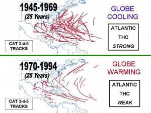
The popular press regularly warns us that on-going global warming will increase the frequency of hurricanes, and their intensity, allegedly due to warmer sea-surface temperatures in the mid-ocean hurricane-spawning areas. Klotzbach and Gray do not believe this. They studied the paths of all severe hurricanes (category 3, 4 or 5) for the fifty years from 1945-1994, dividing this time frame into two 25-year periods (see image).

Tracks of severe Atlantic hurricanes, 1945-1994

Tracks of severe Atlantic hurricanes, 1945-1994. Source: Klotzbach and Gray, 2010. Link to original article at end of this post. Click image to enlarge.

From 1945-1969 was a period of weak global cooling. There were 80 severe hurricanes in this period, some of them taking very erratic paths, with correspondingly dramatic impacts when they struck areas wholly unprepared.

Between 1970 and 1994, the Earth’s temperatures underwent a modest rise (global warming). However, in stark contrast to popular belief, far fewer severe hurricanes occurred during this period (38 in total), and they tended to follow entirely predictable paths.

Clearly the science behind hurricane formation is more complicated than some journalists would have us believe!

Klotzbach and Gray demonstrate the importance of the Thermohaline Circulation (THC) in the Atlantic. The THC is a large-scale circulation in the Atlantic Ocean that is driven by fluctuations in salinity and temperature. The 1945-1969 period coincided with a strong THC, whereas the 1970-1994 period was a time when the THC was weak.

What has happened since 1994? In the fifteen years from 1995-2009 inclusive, the THC was strong, and there were 56 severe Atlantic hurricanes. By comparison, in the preceding fifteen years from 1980-1994, when the THC was weak, only 22 severe hurricanes formed. So it appears that hurricane frequency is not linked to global warming or carbon dioxide (CO2) levels in the atmosphere, but to cyclical changes in the THC.

How accurate are the predictions for the 2010 hurricane season? Only time will tell…

Click here for Klotzbach and Gray’s original article (pdf).

Hurricane warnings in Mexico are the responsibility of the National Meteorological Service (NMS). The NMS also provides an archive of information about past hurricanes.

Hurricanes and other climatological phenomena are analyzed in chapters 4 and 7 of Geo-Mexico: the geography and dynamics of modern Mexico. Buy your copy today, so you have a handy reference guide available whenever you need it.