Oct 062016
 

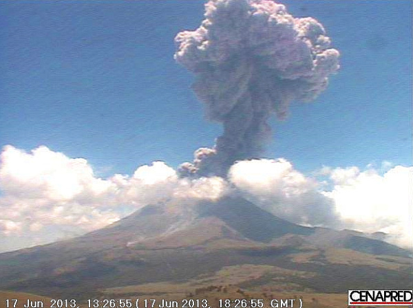
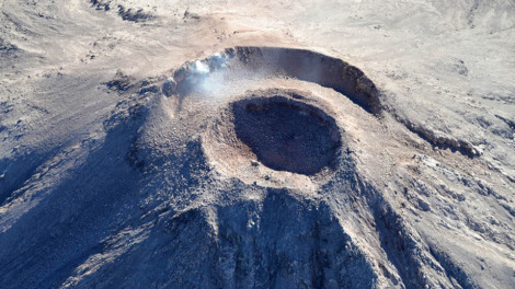
El Pico de Orizaba, or Citlaltépetl (= “star”), is Mexico’s highest peak, rising to a summit 5,610 meters (18,406 feet) above sea level. The third highest peak in North America, it is also that region’s highest volcano, responsible for major eruptions in 1569, 1613 and 1687. The mountain was first explored by scientists as long ago as 1838.

Located east of Mexico City, some 30 kilometers (20 miles) northwest of the city of Orizaba, it is regularly climbed today by well-equipped groups, especially during the dry season, from December to April. Its classical cone shape masks an impressively large crater, which is more than 300 meters (1,000 feet) deep. The volcano and surrounding area were declared a national park by President Lázaro Cárdenas in 1936; the decree took effect the following January.

Among the first recorded ascents is that in August 1838 by a group of several European botanists: Henri Galeotti, Nicolas Funck, Auguste Ghiesbreght and Jean-Jules Linden.  The group spent eleven days on the volcano and their subsequent accounts of the expedition show that they definitely reached the summit. Afterwards, they went on to have distinguished careers in their specialist fields.

By the time of the climb, Henri Guillaume Galeotti (1814-1858) had already written a landmark article about Lake Chapala, and made numerous botanical discoveries in Mexico. He went on to become Director of the Royal Botanical Gardens in Brussels, Belgium.

Less is known about the achievements of Nicolas Funck (1816-1896), who continued traveling in Mexico until 1842. He subsequently became director of Brussels Zoo (1861) and then Cologne Zoo.

After the climb, Auguste Ghiesbreght (1810-1893) set up his own business in Mexico, making a living by supplying plants and natural history specimens to European collectors and his botanist business partners. Who knows? Perhaps the plans for a cacti-exporting business (Galeotti) and large-scale orchid cultivation (Linden) were hatched while the group of young friends were battling their way towards the peak of Orizaba.

Jean Jules Linden (1817-1898), born in Luxembourg, collected for the Belgian government in Brazil, Mexico and Guatemala, before becoming one of the world’s most celebrated importers of plants. He set up nurseries for exotic plants in Brussels and Ghent in Belgium, as well as on the French Mediterranean coast. He also directed Brussels Zoo. He is credited with introducing and popularizing numerous plants, including begonias, palm trees and orchids. His superb publications on orchids and his marketing skills won him world-wide respect.

The nineteenth century craze for orchids in Belgium had numerous parallels with the craze three hundred years earlier for tulips in the Netherlands. The nouveau-riche industrialists satisfied their passion for expensive and unusual orchids by buying them from Linden who was propagating and growing them in massive, industrial-scale glasshouses. Even the Russian czar bought orchids from Linden!

El Pico de Orizaba (from Oswald’s Summerland Sketches, 1880)

The explorations of Galeotti and his friends resulted in the volcano becoming much better known. A decade later, Carl Sartorius, an artist of German extraction who collected plants for the Berlin Botanical Gardens, and who owned the El Mirador hacienda close to the volcano, organized an expedition to reach the summit. When they reached the top, they found a simple plaque there already, left by two US soldiers, F. Maynard and G. Reynolds, who had served as troopers in Winfield Scott’s army during the 1846-1848 Mexican-American war.

Not surprisingly, the upper reaches of El Pico de Orizaba (above about 4,000 meters) are snow-capped all year. Though someone had probably skied down the mountain previously, the first recorded descent on skis was made by W. Furlinger in 1974. Schemes to open a skiing resort on its slopes have been suggested several times. Before any budding entrepreneurs get carried away with the possibilities, it should be pointed out that setting up permanent ski runs on the slopes of El Citlaltépetl may not be too smart an idea, given the likely impact of global warming.

This is an edited and updated version of an article originally published on MexConnect.

Acknowledgment

My thanks to Dr. Winston Crausaz. the author of Pico de Orizaba or Citlaltepetl (Geopress International, 1993), whose valuable comment on the original post (see below) has now been incorporated into the updated version above.

Mexico’s volcanoes, mountains and relief features are examined  in chapters 2 and 3 of Geo-Mexico: the geography and dynamics of modern Mexico.

Recent eruptions of Colima Volcano, el Volcán de Colima

 Mexico's geography in the Press  Comments Off on Recent eruptions of Colima Volcano, el Volcán de Colima
Jul 122015
 

Colima Volcano (aka el Volcán de Colima or el Volcán de Fuego) continues to erupt, displaying its fiery temper by throwing massive plumes of ash and smoke several kilometers into the air. One recent eruption caused a plume of ash seven kilometers high.


Following the eruptions of 10 and 11 July 2015 (see video clip from Webcams de México), a state of emergency has been declared by the state of Colima in 5 municipalities: Colima, Comala, Coquimatlán, Cuauhtémoc and Villa de Álvarez. This enables rapid access to state and federal funds in preparing to cope with any potential disaster.

A precautionary evacuation has been ordered of all communities within a 12-kilometer radius of the volcano’s crater. The 50-60 residents of the closest community to the volcano, La Yerbabuena, live barely eight kilometers (five miles) away from the crater. Five centimeters (two inches) of ash fell on La Yerbabuena in the past few days.

Authorities are concerned that heavy summer rains could generate dangerous and very fast-moving lahars. Lahars are mudflows of volcanic ash, pumice and rocks; they can travel at velocities of up to 100 km/h and move huge boulders and objects as large as houses.

Where is Colima Volcano (Volcán de Colima)?

Location of Colima Volcano

Location of Colima Volcano (Volcán de Colima). Credit: Tony Burton / Geo-Mexico

The volcano is one of the westernmost volcanoes in Mexico’s Volcanic Axis, which straddles the country from west to east. Colima Volcano’s summit is only 8 km (5 miles) from the inactive Nevado of Colima volcano, Mexico’s sixth-highest peak, which rises 4260 m (13,976 ft) above sea level. (Lovers of geographical trivia should note that, despite their names, the summits of both volcanoes are actually located in the state of Jalisco, not in the state of Colima.)

Colima Volcano is considered one of Mexico’s most dangerous volcanoes. Numerous villages in its shadow keep a wary eye on its level of activity, and emergency evacuations have become a regular event over the past fifty years.

How high is Colima Volcano?

The elevation of Colima Volcano is officially given as 3820 m (12,533 ft) above sea level. In the past 400 years, it has been the most active volcano in Mexico, having erupted at least 30 times since 1576. Recent activity means that this exact height may no longer be correct.

The eruption of Colima Volcano on 21 January 2015, shown in this short video, is typical of recent activity.

How often does it erupt?

Historically, the eruptions of the volcano have fallen into a definite cyclical pattern with periods of activity, each lasting about 50 years, interspersed with periods of dormancy. The first cycle of activity (after the Spanish arrived in Mexico) was between 1576 and 1611. Major eruptions occurred in 1680 and 1690, and further complete cycles occurred between 1749 and 1818, and from 1869 to 1913.

The current eruption cycle

Most geologists agree that current activity is part of the fifth cycle, which began in 1961. Judging by past performance, we should be nearing the end of this cycle, though volcanoes can be extremely unpredictable, so don’t bet your house on this happening within the next decade.

Activity has intensified in the past couple of years. In early 2013, we reported that Colima Volcano had erupted, destroying a lava dome first created in 2007 and later that year we looked at how Popocatapetl Volcano and Colima Volcano continued to erupt. At that time, experts monitoring the volcano were reporting up to 200 eruptive events a day, with numerous minor emissions of lava. Colima Volcano has been exhibiting four distinct types of volcanic activity in recent years:

  • lava dome growth
  • explosive eruptions
  • flank collapse
  • lava flows.

In early 2015, activity began to intensify, with several spectacular eruptions, sending ash and dust up to 8 or 9 kilometers (5-6 miles) into the air. Ash fell on towns up to 25 kilometers (15 miles) away from the volcano, in locations including Tuxpan, Zapotiltic and Ciudad Guzmán, but with no loss of life, or significant property damage.

The volcano can be viewed via this permanent fixed webcam operated by Webcams de Mexico. Below the main image on that site are links to 1-minute time-condensed videos showing the past 24 hours of activity.

Three maps (PDF format, Spanish-language keys and text) showing the areas likely to be affected by the volcanic hazards associated with Colima Volcanocan be found via this webpage of Mexico’s National Center for Disaster Prevention (Centro Nacional de Prevención de Desastres, CENAPRED). :

The area around the Colima Volcano is described in more detail in chapter 15 of my Western Mexico, a Traveler’s Treasury (4th edition; Sombrero Books, 2013).

Related posts:

Mexico’s webcams

 Books and resources  Comments Off on Mexico’s webcams
Jun 292015
 

There are thousands of webcams operating in Mexico offering armchair geographers the opportunity to see up-to-date images of active volcanoes, megacities, archaeological sties, small towns and tourist resorts.

Many of the major webcams are listed at Webcams de México, which has several great features once you’ve chosen a particular webcam, including access to prior images for any date and time, or the ability to compile an instant time-lapse video covering any period of time.

Links to webcams listed at Webcams de México:

Explore Mexico via its webcams! Enjoy!

Related posts:

The art of Mexican volcanoes

 Other  Comments Off on The art of Mexican volcanoes
Apr 162015
 

An art exhibition entitled “Mexican Volcanoes” is opening in Mexico City next week. The show opens on Tuesday 21 April, at noon, at the offices of the Mexican Society for Geography and Statistics (Sociedad Mexicana de Geografía y Estadística) at Justo Sierra #19, in the Historic Center of the city. The Society is one of the world’s oldest geographic societies, having been founded 18 April 1833. (The Royal Geographical Society in the U.K. was founded in 1830; the National Geographic Society in the USA was founded in 1888).

Invitacion frente

This exhibition, which will close on 29 April, is being arranged by Lewinson Art, a Mexican art firm that specializes in promoting artists via a virtual gallery and exhibitions. Artists were invited to submit works (paintings, drawings, engravings, photographs) relating to the subject “Mexican Volcanoes”.

Detail of lithograph by Casimiro Castro of Railway near Orizaba, Veracruz

Detail of lithograph by Casimiro Castro of Railway near Orizaba, Veracruz, with Pico de Orizaba in the background

Historically, Mexico’s volcanoes have been especially fertile ground for Mexican artists, from the great landscapes of José María Velasco to Casimiro Castro and the colorful and energetic “aerial landscapes” of Dr. Atl (Gerardo Murillo).

dr-atl-paricutin

Dr. Atl (Gerardo Murillo): Paricutin Volcano

Artists represented in this interesting exhibition include:

Agustín Aldama, Mercedes Arellano, José Luis Briseño, Rosi Calderón, Argelia Castañeda, Becky Esquenazi, Gabriela Estrada, Tere Galván, Gabriela Horta, Ana Gabriela Iñiguez, Débora Lewinson, Manuel Martinez Moreno, Nadine Markova, Ausberto Morales, Francoise Noé, Merle Reivich, Fernando Reyes Varela, Homero Santamaría, Arcelia Urbieta, Ariel Valencia , Primo Vega and Lucille Wong.

The volcanoes depicted in the show include Popocatepetl, Iztaccihuatl, Cofre de Perote and the Nevado de Toluca (Xinantecatl).

Related posts:

Popocatepetl Volcano continues its very active phase

 Mexico's geography in the Press, Other, Updates to Geo-Mexico  Comments Off on Popocatepetl Volcano continues its very active phase
Aug 092014
 

Popocatepetl Volcano, near Mexico City continues to be very active, with smoke and ashes belching up to 1000 meters above the crater rim. Mexico’s National Disaster Prevention Agency Cenapred, reports that the volcano had 82 “low intensity” exhalations on 7 August 2014, four of which contained “explosive material”.

Popocatapetl, 8 August 2014. Credit: Cenapred.

Popocatapetl, 8 August 2014. Credit: Cenapred.

The agency also reported that many mionr tremors hd been recorded, including one harmonic tremor lasting 56 minutes. Geologists believe that the volcano is currently destroying dome number 50 even as dome number 51 begins to form. Dome #51 is currently about 70 meters in diameter. Renewed explosions, together with some ash fall is predicted for the coming days.

The Volcanic Traffic Light remains at Yellow Phase 2.

For a series of images dated 8 August 2014, see Images of 8 of ago of 2014

Related posts:

The landforms of the El Pinacate and Gran Desierto de Altar Biosphere Reserve

 Other  Comments Off on The landforms of the El Pinacate and Gran Desierto de Altar Biosphere Reserve
Nov 092013
 

The breathtaking scenery of the El Pinacate and Gran Desierto de Altar Biosphere Reserve in the northern state of Sonora affords visitors a dramatic combination of two very distinct landscape types: volcanic landscapes (El Pinacate) in the east, and sand dunes (Gran Desierto de Altar) towards the west and south.

pinacate-map-googleVolcanic scenery (El Pinacate)

The eastern section of the Biosphere Reserve, El Pinacate, is a dormant volcanic area of around 200,000 ha (2000 sq. km), centered on the El Pinacate Shield (or Sierra Pinacate) which has 3 main peaks: Pinacate, Carnegie and Medio. The El Pinacate Shield is a composite structure, comprised of extensive, successive black and red lava flows, some more than 20 km long, seperated by desert pavement. The El Pinacate Shield boasts a wide array of volcanic phenomena and geological formations. Most of the lava is basaltic (alkaline) in composition, making it relatively fluid when molten; it is mainly of the aa (blocky) type, though some pahoehoe (ropy) lava is also found. The total volume of lava is estimated at between 150 and 180 km3.

Elegante Crater, El Pinacate

Elegante Crater, El Pinacate (example of a maar) Credit: IUCN Tilman Jaeger

Besides the lave flows, the Pinacate area has more than 400 cinder cones (formed 1.2 million years ago) and several lava tubes. The lava flows and cinder cones are only a prelude to the most visually striking features in the reserve: 10 enormous, deep, and almost perfectly circular maars (steam explosion craters). Maars are believed to originate from a combination of explosion caused by groundwater coming into contact with hot lava or magma and subsequent collapse. The maars of El Pinacate are rivalled only by similar formations in Africa. The largest single maar is El Elegante, formed 32,000 years ago, which is 1,400 meters (4,600 feet) from rim to rim and 140 meters (460 feet) deep. It takes visitors a two to three-hour hike to reach its rim and be rewarded by a spectacular view.

The volcanic forms of El Pinacate are relatively recent in geological terms, most having been formed during the Quaternary Period, which began some 2.8 million years ago. The most recent volcanic activity in this area was only about 11,000 years ago. Some volcanologists believe that some of these craters could become active again in the future, with the potential to form volcanoes up to a few hundred meters in height.

Ron Mader, the founder of Planeta.com and a foremost authority on responsible tourism in Mexico, has marveled at the “bizarre and mind-boggling scenery” of El Pinacate., which so resemble the lunar landscape that between 1865 and 1970 it was used by NASA as a training ground for astronauts preparing for the moon landings. The lava field is so vast and sharply defined that it later turned out that the astronauts could easily recognize it from space!

Sand dunes (Gran Desierto de Altar)

The western and southern parts of the El Pinacate and Gran Desierto de Altar Biosphere Reserve have entirely different scenery. The Gran Desierto de Altar is North America’s largest field of active sand dunes (erg). Several types of dunes are represented here, the tallest reaching 200 meters in height.

The sand needed to form and maintain these dunes comes from the fluvial and deltaic sediments of the Colorado River delta (to the west), the beaches of the Sea of Cortés/Gulf of California (to the south), the River Sonoyta (to the east) and the smaller river and stream fans formed in those parts of the reserve where there are volcanic and granitic mountains.

Sand dunes of Gran Desierto de Altar

Sand dunes of Gran Desierto de Altar

Prior to the opening of the Sea of Cortés (Gulf of California), vast amounts of sediment accumulated in this region brought by rivers of which little trace remains today. The creation of the Sea of Cortés, 5.3 million years ago, shortened the rivers and increased their average gradient (rejuvenation), causing them to cut into the pre-existing landscape leaving behind river terraces, remnants of the former higher level floodplains.

The fields of sand dunes of the Gran Desierto de Altar cover more than 550,000 hectares (5700 sq.km.) Several different kinds of sand dunes are found here–linear, crescent-shaped (barchans) and star-shaped–and they can be simple, compound or complex, depending on seasonal changes in the direction and strength of the wind.

Although linear dunes dominate (70%), crescent-shaped complex dunes and star-shaped dunes are of more interest because they exist in only a few locations in the world. Spectacular and very large star-shaped dunes, up to 200 meters high, occur both singly and in long ridges up to 48km in length. Star-shaped dunes possibly evolved from crescent dunes which changed their direction of movement becoming “reversing dunes”. Side winds may account for the multiple arms of some star-shaped dunes.

Other features – Granite massifs

In addition, there are several granite massifs (inselbergs), such as the Sierra del Rosario, emerging like islands from the sandy desert flats and dunes. They range in elevation from 300 to 650 meters above sea level. They represent another remarkable landscape feature harboring distinct plant and wildlife communities.

Main source:

Related posts:

Oct 242013
 

Mexico’s latest UNESCO World Heritage Site is the El Pinacate and Gran Desierto de Altar Biosphere Reserve in Sonora, added to the UNESCO list in June 2013. Mexico now has 32 World Heritage Sites.

The El Pinacate and Gran Desierto de Altar Biosphere Reserve is part of the Sonoran desert, which extends from Sonora into the northern part of Baja California, and across the U.S. border into Arizona and California. The reserve covers 714,566 hectares with an additional 354,871 hectares of buffer zone. It is a relatively undisturbed portion of the Sonoran desert, and offers visitors a dramatic combination of two very distinct landscape types: volcanic landscapes (El Pinacate) and sand dunes (Gran Desierto de Altar).

pinacate-map-googleThe biosphere reserve is immediately south of the U.S. border, west of the Lukeville (Arizona) – Sonoyta (Sonora) border crossing, and 50 km (30 miles) north of the fishing and tourist town of Puerto Peñasco. The San Luis Río Colorado–Sonoyta section of Mexican federal highway 2 (which runs from Mexicali to Caborca) skirts the northern section of the reserve. Puerto Peñasco is connected to Sonoyta by highway 8. There are entrances to the park from highway 2, 50 km west of Sonoyta, and from highway 8, mid-way between Sonoyta and Puerto Peñasco.

Despite being a desert area, most parts of the biosphere reserve do receive occasional rainfall, which gives this area more biodiversity than is true for most deserts.

El Pinacate and Gran Desierto de Altar Biosphere ReserveVaried scenery

The eastern section of the biosphere reserve, El Pinacate, is a dormant volcanic area of around 200,000 ha (2000 sq. km), centered on the El Pinacate Shield (or Sierra Pinacate) which has lava flows, cinder cones, lava tubes and circular maars (steam explosion craters). Ron Mader, the founder of Planeta.com and a foremost authority on responsible tourism in Mexico, has marveled at the “bizarre and mind-boggling scenery” of El Pinacate. The geology and landforms of this area so resemble the lunar landscape that between 1865 and 1970 NASA used it as a training ground for astronauts preparing for the moon landings. The lava field is so vast and sharply defined that it later turned out that the astronauts could easily recognize it from space!

The western and southern parts of the El Pinacate and Gran Desierto de Altar Biosphere Reserve are entirely different. The Gran Desierto de Altar is North America’s largest field of active sand dunes (erg), more than 550,000 hectares (5700 sq.km.) in area. Several types of dunes are represented here, the tallest reaching 200 meters in height, including linear, crescent-shaped (barchans) and star-shaped dunes.

Flora and Fauna

The highly diverse mosaic of habitats in the biosphere reserve is home to complex communities and a surprisingly high species diversity. More than 540 species of vascular plants, 44 mammals, more than 200 birds and over 40 reptiles inhabit this seemingly inhospitable desert. All feature sophisticated physiological and behavioural adaptations to the extreme environmental conditions. Insect diversity is high, though not fully documented. Several endemic species of plants and animals exist, including two freshwater fish species.

The flora in Sierra Pinacate includes the sculptural elephant tree (Bursera microphylla). The name “Pinacate” derives from pinacatl, the Nahuatl word for the endemic desert stink beetle. The biosphere reserve has large caves inhabited by the migratory lesser long-nosed bat (Leptonycteris curasoae yerbabuenae), which is an important pollinator and seed dispersal vector, and the endangered fish-eating bat (Myotis vivesi); both species are endemic.

Other noteworthy species in the reserve include the threatened Sonoran pronghorn (Antilocapra americana sonorensis), an endemic subspecies of restricted habitat and the fastest land mammal in North America; bighorn sheep (Ovis canadensis mexicana), the mule deer (Odocoileus hemionus) and gray fox (Urocyon cinereoargenteus), the Gila monster (Heloderma suspectum) and desert tortoise (Gopherus agassizii).

Human occupation and use

El Pinacate and Gran Desierto de Altar contains numerous archaeological remains, some dating back more than 20,000 years. It is an important cultural site for the indigenous Tohono O’odham people who consider El Pinacate peak, where they still perform sacred ceremonies, as the place where  creation occurred.

Management issues

The El Pinacate section of the biosphere reserve was first designated a “protected area” in 1979. In 1993, it was a declared a Biosphere Reserve, along with the Gran Desierto de Altar, by then president Carlos Salinas de Gortari. The biosphere reserve is managed by Mexico’s National Commission of Natural Protected Areas (Conanp), in collaboration with the Sonora state government and the Tohono O’odham people.

The number of people visiting the reserve has risen rapidly from fewer than 6,000 in 2000 to more than 17,500 in 2010. The two major challenges that management needs to take into account are how to ensure that indigenous views about the reserve’s use are respected, and how to limit negative impacts on the reserve from nearby tourism developments.

The potential negative impacts include:

  • increased vehicle traffic, resulting in ecological disturbance, littering and wildlife road kills.
  • pressure to extend the limited existing road infrastructure by adding new roads, though this might lead to more exotic (alien) invasive species.
  • increased habitat damage from the growing use of off-road vehicles

UNESCO considers that, “The most critical long term management issue is to address potential problems derived from tourism-related water consumption.”

Given that this reserve is on the Mexico-U.S. border, transboundary cooperation is essential, and UNESCO actually recommends that the best way forward is to establish a Transboundary Protected Area, extending into Arizona.

The combination of a volcanic shield with spectacular craters and lava flows, almost entirely surrounded by an immense sea of dunes, makes this an area of great scientific interest, and an ideal laboratory for researchers interested in geology and geomorphology.

[Note: This post makes extensive use of UNESCO’s description of the biosphere reserve, with additional information from a variety of other sources.]

Want to read more?

Related posts:

Popocatepetl Volcano puts on an explosive show

 Mexico's geography in the Press  Comments Off on Popocatepetl Volcano puts on an explosive show
Jul 102013
 

This 30-second video update on the eruption of Popocatepetl Volcano speaks for itself. Webcams have made the life of armchair geologists (even those of us who quite like exploring volcanic craters, provided the volcano in question is extinct or at least dormant) a whole lot easier!

The alert level remains at Yellow Phase 3, the highest stage before the two “Alarm” stages of Red 1 and Red 2.

Travel tips:

Several international flights into and out of Mexico City over the past week have been either diverted to other airports or cancelled. If you are flying into Mexico City in the next few days, check with your airline.

Ash has fallen (in varying amounts) over many parts of the city during this time. To avoid getting any ash into your lungs (not good!), consider wearing a damp face mask wherever/whenever the air is not clear.

Related posts:

The volcanic calderas of Mexico’s Volcanic Axis

 Maps, Other  Comments Off on The volcanic calderas of Mexico’s Volcanic Axis
Jul 082013
 

There is still lots of work needed to fully unravel the geological secrets of Mexico’s Volcanic Axis which crosses the country between latitudes 19̊ and 21̊ North. Unlike most volcanic belts elsewhere in the world, this one does not appear at first sight to correspond to any plate boundary. Another of the mysteries of this volcanic region, where igneous upheavals have shaped the landscape for several million years, is the relative dearth of calderas, the “super craters” formed either by collapse or by giant explosions.

While the toponym La Caldera is used fairly commonly in Mexico’s volcanic regions for a volcano or volcanic crater, geologists restrict the term to the much larger landform that results from the collapse or super-explosion of a volcano. Even so, there is still some debate among specialists as to the precise definition of the term caldera.

Geologists have proposed a threefold division of the Volcanic Axis, based on differences in the volcanic landforms, in terms of their type, structure, age, morphology and chemistry.

volcanic-axis

The western sector (see map below) extends from the western coast of Mexico to Lake Chapala (including the lake basin). The central sector covers the area between Lake Chapala and the twin volcanoes of Popocatepetl and Ixtaccihuatl, close to Mexico City. The eastern sector includes these twin volcanoes and extends as far as Mexico’s Gulf Coast.

Mexico's Volcanic Axis (Fig 2.2 of Geo-Mexico, the geography and dynamics of modern Mexico. All rights reserved.

Mexico’s Volcanic Axis (Fig 2.2 of Geo-Mexico, the geography and dynamics of modern Mexico). All rights reserved.

The only caldera recognized in the western section is that of La Primavera, the forested area west of Guadalajara, whose formation we considered in

In the central and eastern sections of the Volcanic Axis, several other calderas have been recognized. They include (from west to east):

  • Los Azufres
  • Amealco
  • Mazahua
  • Huichapan
  • Los Humeros
  • Las Cumbres

Los Azufres

The precise origin of the Los Azufres caldera, in Michoacán, is still debated. The caldera is the site of an important geothermal power station with an installed capacity of 188 MW. (Mexico is the world’s fourth largest producer of geothermal energy, after USA, the Philippines and Indonesia.) The geothermal heat in this area is also used to heat the cabins in a local campground, and to dry wood and process fruit.

Amealco

The Amealco caldera is in the central part of the Mexican Volcanic Axis, midway between the towns of San Juan del Río and Maravatio. It dates from Pliocene times and has been heavily eroded since. It is about 11 km wide and 400 m deep and was the origin of great sheets of pyroclastic flow deposits (ignimbrites) with a total volume of around 500 cubic km.

Mazahua

Mazahua is a collapse caldera, 8 km in width, near the village of San Felipe del Progreso in the western part of the State of Mexico.

Huichapan

The Donguinyó-Huichapan caldera complex is 10 km in diameter and in the central sector of the Volcanic Axis. It appears to be two overlapping calderas, dating from around 5 million and 4.2 million years ago respectively. The rocks from the older caldera are intermediate to basic in composition, while those from the more recent caldera are acidic (high silica) rhyolites.

Los Humeros

The Los Humeros caldera is in the state of Puebla, close to its border with Veracruz. It is 55 km west-north-west of the city of Xalapa (Veracruz), relatively close to Teziutlán (Puebla). The main caldera (summit elevation 3150 m) is about 400 m deep and roughly oval in shape, with a diameter which varies from 15 to 21 km. It was formed about 460,000 years ago by the collapse of the underground magma chamber. Prior to collapse, lava emitted from this vent had covered 3500 square km with ignimbrite. Later, two smaller calderas formed nearby, with ages of about 100,000 years (Los Potreros caldera) and 30,000 years (El Xalapazco) respectively. Volcanic activity in this area has been utilized to produce generate geothermal power (installed capacity: 40 megawatts).

Las Cumbres

The easternmost caldera in Mexico is Las Cumbres, 15 km north of Pico de Orizaba, Mexico’s highest volcano, and close to the state boundary between Puebla and Veracruz. The Las Cumbres caldera was originally believed to be an explosion super-crater, but geologists now think that it was created due to the partial collapse of the eastern flank of the original volcano, between 40,000 and 350,000 years ago. The collapse of the side of Las Cumbres produced a huge debris avalanche (total volume estimated at 80 cubic km, which extended up to 120 km in the direction of the Gulf of Mexico.

Lake Alchichica

According to Dra. Esperanza Yarza de la Torre in Volcanes de México (UNAM; 1984), Lake Alchichica in the Oriental Basin near Puebla occupies another caldera. The basin has several shallow lakes, known locally as axalpazcos (“sandy basin with water” in the indigenous Nahuatl language). These occupy shallow craters (or in one case a caldera) and are largely sustained by ground water. The largest of the lakes, in a caldera, is Lake Alchichica, which has a diameter of 1888 meters, an area of 1.81 square km, and lies at an elevation of 2320 meters above sea level. The rim of the caldera rises 100 m above the lake level. The lake is used for irrigation. This lake is claimed to be Mexico’s deepest natural lake with a maximum depth of 64 meters, and a mean depth of 38.6 meters.

Main sources:

  • Gerardo J. Aguirre-Díaz & Fred W. McDowell. 1999. Volcanic evolution of the Amealco caldera, central Mexico. United States Geological Society. Special Paper 334.
  • Esperanza Yarza de la Torre. 1984. Volcanes de México. UNAM.

Want to read more?

  • Use the site’s tag system (left hand side of the page) to find lots more posts about Mexico’s volcanoes, geology and landforms.
Jul 062013
 

Popocatepetl Volcano (“Don Goyo” to the people living in its shadow) continues to erupt. On 4 July, several airlines, including American Airlines, US Airways, Delta Airlines and Alaska Airlines suspended operations to and from Mexico City for several hours, resulting in numerous cancelled flights.

Mexico’s National Disaster Center (Cenapred) provides daily updates (in both English and Spanish) on the volcano’s activity. The Volcanic Alert Level was raised today (6 July) to Yellow Phase 3. This includes:

  1. Access is restricted within a radius of 12 km from the volcano’s crater. Permanence in this area is not allowed.
  2. The road between Santiago Xalitzintla (Puebla) and San Pedro Nexapa (Mexico State), including Paso de Cortes, is open only to authorized traffic.
  3. Civil Protection authorities maintain preventive procedures, according to operative plans.
  4. People are advised to follow guidelines provided by official information bulletins.

There are only two higher levels (both described as “Alarm” rather than “Alert”): Red Phase 1 and Red Phase 2.

Since our last update in March, several spectacular images of the volcano have been released.  Activity increases every two or three weeks, as the following brief reports, based on the Cenapred daily updates, reveal:

8 May – Ash rose 3000 m above the volcano before falling on several municipalities in the states of Puebla and Tlaxcala. Residents were advised to sweep it up without using any water to prevent the ash from sticking together and blocking drains. Mexico City’s international airport was closed to flights for a short time.

14 May – Eruptions continued, accompanied by an increase in seismic activity. The Alert Level was raised to Yellow Phase 3 for several days, with evacuation plans about to be implemented. A dome of lava, about 350 m across and 50 m thick, had formed in the crater, prior to being destroyed in an eruption which formed a 3000 m high ash cloud and sent incandescent fragments (“volcanic bombs”) up to 1000 m from the crater. The volcano’s activity subsided within days and the alert level was reduced to Yellow Phase 2.

17 June – A month later, another explosion (see photos) sent ash more than 4000 m into the air, and threw volcanic bombs up to 2000 m from the crater, starting a series of minor wild fires. Winds blowing towards the northwest carried ash towards the south-eastern section of Mexico City. A week later (24 June), minor amounts of ash fell in eight municipalities in the state of Mexico: Amecameca, Tlalmanalco, Temamatla, Cocotitlán, Ozumba, Atlautla, Ecatzingo and Chalco. The local authorities reported no damage, but reminded residents, among other things, to avoid wearing contact lenses if at all possible. The next day (25 June), ash fell on some southern and eastern parts of Mexico City. Three international flights scheduled to land in Mexico City airport were diverted to Querétaro airport.

The typical sequence of activity is shown in the photos. First, pressure from molten rock underground (magma) leads to the formation of a dome of lava in the summit crater (photo below).

Lava dome building in crater of Popocatapetl Volcano

Lava dome building in crater of Popocatapetl Volcano

These domes eventually either collapse or are destroyed by explosions (photos below) that lessen the pressure beneath the surface.

NasaPopocatapetl Volcano erupts, 17 June 2013

Popocatapetl Volcano erupts, 17 June 2013

Following the explosion (shown by the satellite image below), a new dome begins to form, and the cycle of eruptive activity continues.

Geophysicists from the National University (UNAM) who monitor the volcano and analyze its gaseous emissions say that between 1994 and 2008 the volcano emitted 30 megatons (30 million tons) of gases and that it looks set to continue erupting for several years. Popocatepetl is one of the top five volcanoes in the world for emissions of sulfur dioxide. The volcano has added between 6000 and 8000 tons/day to the atmosphere in recent months. Lead researcher Hugo Delgado Granados has been quoted in press reports as saying that the continued gaseous emissions are good news, since the constant releases of pressure should preclude a more explosive eruption.

A YouTube compilation of webcam videos of the volcano provides a time-condensed view of the eruption of 17 June 2013. The 30-second video represented a period of 20-30 minutes, during which the volcano exploded into action, sending a cloud of gases, ash and volcanic fragments high into the air.

Related posts:

Popocatapetl Volcano and Colima Volcano continue to erupt

 Mexico's geography in the Press, Updates to Geo-Mexico  Comments Off on Popocatapetl Volcano and Colima Volcano continue to erupt
Mar 302013
 

In our series of brief updates on topics featured in previous Geo-Mexico posts, we look this week at the continuing eruption of two major volcanoes: Popocatapetl Volcano (between Mexico City and Puebla) and Colima Volcano (on the Jalisco-Colima state border in western Mexico).

Popocatepetl, 30 July 2012

Popocatepetl, 30 July 2012

Since our previous post, about a year ago, entitled Alert level rises as Popocatepetl volcano starts to erupt, Popocatapetl Volcano (photo) has continued to be active, with up to 250 activity events a day. The alert level has been reduced slightly to Yellow Phase 2, the fourth highest level. This level indicates intermediate scale explosive activity and possible expulsion of lava, explosions of increasing intensity and wind-blown ash falling on nearby villages. The volcano is monitored daily, and updates from CENAPRED  (in Spanish and English) are issued every 24 hours.

The report issued on 27 March is typical of recent months. In the previous 24 hours, there were 83 low intensity events with emissions of gas, water vapor and ash. The two largest events sent material rising 1000 meters and 600 meters into the atmosphere respectively, before the wind blew the material north eastwards (away from Mexico City).

Colima Volcano

In January 2013, we reported how Colima Volcano erupts, destroying lava dome first created in 2007. The volcano has continued to erupt in the ten weeks since then. The experts monitoring the volcano have reported up to 200 eruptive events a day, with numerous minor emissions of lava. Local villagers have been asked to remain on alert, though the experts are not yet calling for any villages to be evacuated.

The image below (source: Nasa Earth Observatory) shows Colima Volcano in 2010, part way into its current eruptive phase which is expected to last several years. The image shows the evidence at that time of four different types of volcanic activity:

  • lava dome growth
  • explosive eruptions
  • flank collapse
  • lava flows.

(Note that the 2013 eruptions have significantly altered the top of the volcano since this image was taken).

Nasa Earth Observatory)

Colima Volcano in 2010 (Nasa Earth Observatory)

Related posts:

Paricutin Volcano in Mexico celebrates its 70th birthday

 Other  Comments Off on Paricutin Volcano in Mexico celebrates its 70th birthday
Feb 202013
 

Today (20 February 2013) marks the 70th anniversary of the first eruption of Paricutín Volcano in the state of Michoacán in western Mexico.

The landscape around the volcano, which suddenly started erupting in the middle of a farmer’s field in 1943 and which stopped equally abruptly in 1952, is some of the finest, most easily accessible volcanic scenery in the world. A short distance northwest of Uruapan, this is a geographic “must see”, even if you can only spare a few hours.

Paricutín Volcano, 16 July 1943

Paricutín Volcano, 16 July 1943

What makes Paricutín so special is that in all of recorded history, scientists have had the opportunity to study very few completely new volcanoes in continental areas (whereas new oceanic island volcanoes are comparatively common). The first two new volcanoes formed in the Americas in historic times are just one hundred kilometers apart. The first was Jorullo, which erupted in 1759, and the second is Paricutín.

Dominating the valley where Paricutín now exists is the peak of Tancítaro, the highest point in the state of Michoacán at 3845 meters (12,615 feet), and sometimes snow-capped in winter. In 1943, the local Purépechan Indians inhabited a series of small villages and towns spread across the valley floor. The villages included Angahuan, which still exists today, Paricutín, where all 500 people lost their homes, and San Juan Parangaricutiro. The latter was once famous for hand-woven bedspreads and quilts and consequently known as San Juan de las Colchas (bedspreads). Its church, begun in 1555, had never been finished and only ever had a single tower.

On 20 February 1943, a local campesino named Dionisio Pulido was tending his crops with his wife Paula, their son and a friend. At about 4:00pm, they noticed a small crack and felt the ground shaking under their feet. While they watched, the ground rose more than 2 meters and smoke rose into the air, accompanied by whistling noises and the smell of sulfur. Sparks set fire to a nearby pine tree. Not surprisingly, they fled!

Legend has it that Dionisio first tried to smother the emerging volcano with loose rocks and afterwards was of the opinion that the volcano would never have erupted if he hadn’t plowed his field, but such reports are almost certainly pure fiction.

The volcano grew rapidly, providing onlookers, visiting vulcanologists and residents alike, with spectacular fireworks displays. The month of March was a particularly noisy time in Paricutín’s history—explosions were heard as far away as Guanajuato and ash and sand were blown as far as Mexico City and Guadalajara.

After one week, the volcano was 140 meters high, and after six weeks 165 meters.

In April 1943 there were major lava flows, originating from about 10 kilometers underground. These lavas were basaltic; their chemistry suggested temperatures inside the volcano of between 960o and 1020oC. More than 30 million metric tons of lava flowed from the volcano between April and June 1943, raising the volcano’s height to more than 400 meters before its first birthday.

In early 1944, another lava flow streamed in a gigantic arc reaching the outskirts of the town of San Juan Parangaricutiro. Fortunately, the town had already been abandoned following many earthquakes, some of which rang church bells as far away as Morelia! The lava flowed about 30 meters a day and went right through the church but, miraculously, left the main altar standing. The parts of the church which survived in “old” San Juan, including its altar, can still be visited today, though reaching them involves clambering over jagged blocks of lava.

The villagers who had abandoned the town were escorted to Uruapan for safety. Some of them later founded a new town called San Juan Nuevo. Other villagers moved away to live in Los Reyes, Uruapan, Angahuan, Morelia and Guadalajara.

Yet another lava flow buried the village of Paricutin which fortunately had also been evacuated in time. Nothing remains of this village, covered by lava which is more than 200 meters thick in places! A small cross atop the lava marks its approximate position. Besides lava, ashes and dust were also thrown out by the volcano. The ash was 1 millimeter thick in Guadalajara, 25 centimeters thick in Angahuan, and 12 meters thick near the cone. The volcano rose 410 meters above the original ground surface.

Suddenly, in February 1952, nine years after the volcano first erupted, the lava stopped flowing. In many places, plumes of hot steam still rise as fumaroles from the ground, ground that is still most distinctly warm to the touch.

Enjoying a full day at Paricutín has been made much easier since the construction of rustic tourist cabins on the edge of Angahuan village. The restaurant, which serves tasty local specialties, gives clients a panoramic view encompassing the lava and the half-buried church. A small permanent exhibition of maps, charts and photographs in one of the cabins, describing the volcano’s history and the surrounding area, was inaugurated in February 1993 to commemorate the 50th anniversary of the volcano.

Horses can be hired for a trip to the church or to the more distant cone of the volcano. The latter requires an early start since the last part involves clambering up the loose ashes and cinders which comprise the cone and scrambling onto the narrow rim of the truly magnificent crater. A marvelous view can be enjoyed from atop the crater rim and only then can the full extent of the area devastated by the volcano be fully appreciated. Nothing can quite have prepared you for this startling lunar-like landscape.

Note:

This post is a lightly edited extract from my “Western Mexico: A Traveler’s Treasury” (Sombrero Books, 2013). Chapter 35 describes Paricutín Volcano and its surrounding area, including the fascinating indigenous village of Angahuan, in much more detail. “Western Mexico: A Traveler’s Treasury” is also available as either a Kindle edition or Kobo ebook.

Related posts:

Colima Volcano erupts, destroying lava dome first created in 2007

 Mexico's geography in the Press  Comments Off on Colima Volcano erupts, destroying lava dome first created in 2007
Jan 142013
 

Colima Volcano (aka the Volcán de Fuego) is one of the westernmost volcanoes in Mexico’s Volcanic Axis, which straddles the country from west to east. The Volcano’s summit is only 8 km (5 miles) from the inactive Nevado of Colima volcano, Mexico’s sixth-highest peak, which rises 4260 m (13,976 ft) above sea level. (Curiously, despite their names, the summits of both volcanoes are actually located in the state of Jalisco and not the state of Colima.)

The elevation of Colima Volcano is officially given as 3820 m (12,533 ft) above sea level. In the past 400 years, it has been the most active volcano in Mexico, having erupted at least 30 times since 1576.

It is also considered to be one of the country’s most dangerous volcanoes. Numerous villages in its shadow keep a wary eye on its level of activity, and emergency evacuations have become a regular event in the past fifty years.

Colima Volcano, 11 Jan 2013. Photo: Protección Civil.

Colima Volcano forms new crater, 11 Jan 2013. Photo: Edo de Jalisco Protección Civil.

On a geological time-scale, the volcano first erupted about five million years ago in the Pliocene period, long after activity ceased at the nearby, and higher, Nevado de Colima. It quickly developed into a large volcano which partially blew apart or collapsed during Pleistocene times to form a caldera, five kilometers across. A new cone developed inside the caldera. This is the Volcán de Fuego we see today.

The cone is built mainly of pyroclastic materials (ashes and volcanic bombs) of andesitic composition together with some basaltic lava, making it a classic example of a composite volcanic cone.

Historically, the eruptions of the volcano have fallen into a definite cyclical pattern with periods of activity, each lasting about 50 years, interspersed with periods of dormancy. The first cycle of activity (after the Spanish arrived in Mexico) was between 1576 and 1611. Major eruptions occurred in 1680 and 1690, and further complete cycles occurred between 1749 and 1818, and from 1869 to 1913. Most geologists agree that current activity is part of the fifth cycle, which began in 1961.

A three year sequence of prior activity (2003 to 2005) is shown on this series of NASA satellite images.

Hazard Map of Colima Volcano (2003) Credit: Universidad de Colima, Observatorio Vulcanológico

Hazard Map of Colima Volcano (2003) Credit: Universidad de Colima, Observatorio Vulcanológico. Click for full-size image (large file size)

In each major cycle, the first results of renewed activity force new lava into the existing crater, forming a dome. Once the crater has filled up, any additional lava is ejected from the crater and flows down the volcano’s flanks. If the lava is unable to escape (relieving the underground pressure), the dome is liable to explode, which is exactly what happened a few days ago:

As on several previous occasions, once the subterranean pressure that caused the activity has been relieved, activity should cease, and the volcano will enter another less dangerous dormant phase. Even during this phase, a plume of hot gas often billows out from the volcano.

The dome that was destroyed in January 2013 began to build in 2007. The explosive activity on 6 January and 10 January 2013 left behind a new crater 220 meters (720 ft) across and about 50 m (165 ft) deep. According to the Jalisco-Colima Scientific Committee (which oversees the hazard analysis posed by the volcano), the events of 6 and 10 January emitted an estimated  1.5 million cubic meters of material, which formerly formed the dome. The 10 January explosion, which occurred at 21:40 hrs local time, sent incandescent material down the west flank of the volcano. An ash column rose about 3000 meters into the air before traveling north-eastwards on the wind towards the city of Ciudad Guzmán.

Thermal imaging shortly after the 10 January explosion showed that the temperatures in the crater are below 200 degrees Centigrade, which indicates relatively little gaseous build up and limited risk of further major explosions. Even so, a prudent 7.5 km exclusion zone is being maintained around the volcano.

Update (29 Jan 2013):

Another explosion at 3:58 am on 29 January 2013 created a plume of ash and cinders that rose more than 3000 meters above the volcano. The ash fell of nearby villages, including Los Mazos, Ejido Atenquique, Tuxpan and Huescalapa.

The area around the volcanoes is described in more detail in chapter 15 of “Western Mexico, a Traveler’s Treasury” (4th edition; Sombrero Books, 2013).

Related posts:

Update on the activity of Popocatepetl Volcano

 Mexico's geography in the Press  Comments Off on Update on the activity of Popocatepetl Volcano
May 102012
 

In the past few days, Popocatepetl Volcano has continued to emit gas, steam and ashes, periodically shooting ash-laden clouds high into the sky. The columns of ash have risen up to 2500 meters above the volcano before drifting downwind. Depending on the wind direction at the time, light falls of ash have been reported from Mexico City (especially the Milpa Alta and Iztapalapa districts) and the city of Puebla.

Ash cloud rises above Popocatepetl

Ash cloud rises above Popocatepetl Volcano

The National University’s Atmospheric Sciences Institute has developed atmospheric models taking account of the volcanic emissions and is releasing regular forecasts of where ash is likely to fall.

Ramón Espinasa Pereña, who heads the Geological Risks department in the National Disaster Prevention Centre (Centro Nacional de Prevención de Desastres, Cenapred) expressed concern recently that Popocatepetl Volcano could be headed towards much more significant activity in coming weeks.

In an interview with Mexico City daily Excelsior, Espinasa started by saying that that the current level of activity is less than that experienced in 2000 when the volcano’s heat caused the melting of the glacier then found on the northwest side of the mountain. However, he added, the situation today is quite different. The dome of lava inside the crater of Popocatepetl Volcano has been growing, increasing the risks of a significant and possibly explosive eruption. In 1994, prior to the 2000 eruption, the crater of the volcano was about 800 meters long, 600 meters wide and 100 meters deep. The activity in 2000 raised successive domes of lava in the crater to within 20 or 30 meters of the crater rim. So far this year, the depth of the crater has remained about the same, but only because almost all the new material being added to the existing domes is being blown into the air.

Experts are concerned that the high density of the magma beneath the volcano may lead to the existing vents being blocked. If this happens, pressure will build up underground and greatly increase the possibility of a violent eruption.

Evacuation plans have been in place since 1994, and they have been modified and updated regularly since. There are ten major evacuation routes (see map). The villages most at risk (inside the 12-kilometer radius “high risk” zone) include several in the states of Puebla (San Nicolás de los Ranchos, Santiago Xalitzintla, San Pedro Benito Juárez, San Baltazar Atlimeyaya and Tochimilco), Morelos (Ocuituco, Tetela del Volcán, Yecapixtla, Zacualpan de Amilpas and Temoac) and the State of México (Tepetlixpa, Ozumba, Atlautla, Ecatzingo and Amecameca).

Popocatepetl Volcano: the planned evacuation routes

Popocatepetl Volcano: the planned evacuation routes

Last week, the evacuation system (that will only be put into effect if the risk level rises) was tested with a large-scale practice evacuation in which the Mexican Army assisted municipal and state officials and emergency response crews. The practice has enabled authorities to improve the forecasts of precisely how long it will take to evacuate all villagers from the likely danger zone, in the event that the risk level is raised.

Evacuation will not be easy. Some local inhabitants argue that the volcano has never caused them any harm, because, on the contrary, it is their “protector and guide”. They are unlikely to move voluntarily even if an eruption is imminent. They hold a festival each year on 12 March thanking the volcano for its rich soil, abundant rainfall and “to keep the volcano calm and happy.” The ceremonies include the placing of offerings part-way up the volcano, accompanied by folk dancing.

Related posts:


Mexico’s highest volcanoes

 Excerpts from Geo-Mexico  Comments Off on Mexico’s highest volcanoes
Apr 302012
 

In a previous post, we saw how most of Mexico’s volcanoes are located in a broad band that crosses central Mexico known as the Volcanic Axis (Eje neovolcánico). In this post, we provide brief descriptions of some of the major volcanoes in Mexico.

Starting in the west, the first active volcanoes are Everman and Barcenas in the Revillagigedo Islands. Two of the westernmost volcanoes on the mainland are near Colima. At 4260 m (13,976 ft), the inactive Nevado of Colima, Mexico’s sixth-highest peak, is as tall as the highest mountains in the contiguous USA. Its younger brother, Colima Volcano (or Volcán de Fuego) is lower (3820 m) but highly active and considered potentially very dangerous. It has erupted in cycles for several hundred years, and is capped by a dacitic plug characteristic of a silica-rich Pelean volcano. Such volcanoes have the potential to erupt suddenly, not emitting vast quantities of molten lava, but shooting out less spectacular, but far more devastating, clouds of red‑hot asphyxiating gasses.

Tequila Volcano, overlooking the town where the beverage is distilled, is also in Jalisco. In neighboring Michoacán state, the most noteworthy volcanoes are Jorullo (which last erupted in 1759) and Paricutín, which began life in a farmer’s field in 1943 and ceased activity in 1952, but only after its lava had overwhelmed several small villages.

Closer to Mexico City, the Nevado of Toluca (4680 m) has a drive-in crater and is a favored destination for Mexico City families in winter to take their children to play in the snow. It is Mexico’s fourth highest peak (see table below).

VolcanoStatesHeight (meters)Height (feet)
Pico de OrizabaVeracruz; Puebla5 61018 406
PopocatapetlMéxico; Morelos; Puebla5 50018 045
IztaccihuatlMéxico; Puebla5 22017 126
Nevado of Toluca México 4 68015 354
MalincheTlaxcala; Puebla4 42014 501
Nevado of Colima Jalisco4 26013 976
Cofre de PeroteVeracruz 4 20013 780
TacanáChiapas 4 08013 386
TelapónMéxico 4 06013 320
El AjuscoFederal District3 93012 894
Colima VolcanoJalisco; Colima3 82012 533

Continuing eastwards, we reach several other volcanoes that are among Mexico’s highest volcanic peaks (and are also included in the table).

The most famous volcano in the Volcanic Axis is the still active Popocatepetl (“Popo”), which rises to 5500 meters (18,045 feet). Alongside Popocatepetl is the dormant volcanic peak of Iztaccihuatl (5220 m or 17,126 ft). On a smog-free day, both are clearly visible from Mexico City. The southern suburbs of Mexico City are overshadowed by a smaller active volcano, Ajusco, which reaches 3930 m (12,894 ft).

The Nevado de Toluca volcano

The Pico de Orizaba, a dormant volcano on the border between states of Veracruz and Puebla, is Mexico’s highest mountain. At 5610 m (18,406 ft) it is the third highest peak in North America. By way of contrast, not very far away, in the outskirts of the city of Puebla, is the world’s smallest volcano!

Only a few volcanoes appear to be located outside the Volcanic Axis and therefore in an anomalous location to the general pattern. They include two volcanoes in Chiapas which lie south of the Volcanic Axis: El Chichón (which erupted in 1982) and Tacaná (4080 m).

Related posts:


Apr 222012
 

Popocatepetl is Mexico’s second largest volcano, after El Pico de Orizaba. Popocatepetl rises to a height of 5500 meters (18,045 feet) and is located approximately mid-way between Mexico City, about 80 kilometers (50 miles) to the northwest, and the city of Puebla, a similar distance to the east.

In the past week, Popocatepetl (aka “Popo” or “Don Goyo”) has sprung back into life, blowing off steam and ash in a series of minor eruptions, accompanied by minor earth tremors, many of which registered between 3 and 4 on the Richter scale. Incandescent rocks (“volcanic bombs”) have been thrown up to 1000 meters (3000 feet) from the crater down the slopes of volcano, and water vapor, gasses and ash have formed towering clouds, up to 2000 meters high, rising above the iconic volcano.

Popocatapetl lets off steam. Credit: Victor Hugo Rojas (Universal)

Popocatepetl lets off steam. Credit: Victor Hugo Rojas (Universal)

The latest eruptions of Popocatepetl come from an estimated sixty different vents that are connected to a magma chamber 10 km (6 miles) beneath the volcano that is thought to hold upwards of 1,000,000 cubic meters (36,000,000 cubic feet) of magma. On the one hand, the small eruptions are good news, since they relieve the pressure building up underground, at least temporarily. On the other hand, they may presage a much more serious and major eruption.

Thousands of families live in the farming villages on the lower slopes of the volcano; some 25 million people live within a 100 kilometer (60 mile) radius. In the event of a major eruption, and depending on wind directions, airborne ash could fall on Mexico City, interrupting normal activities and Mexico City’s busy international airport, or on the Metropolitan area of Puebla (population 2.7 million), an important industrial center, where Volkswagen has its main vehicle factory.

Even though geophysicists are unable to say whether or when a major eruption will actually occur, authorities have raised the threat level and taken steps to ensure that local residents can be safely evacuated, if necessary, to emergency shelters in nearby public buildings such as schools. Almost 200 temporary shelters have been prepared in nearby villages to house any people that are forced to leave their homes.

Mexico’s National Disaster Prevention Centre (El Centro Nacional de Prevención de Desastres, Cenapred) has raised the alert level to “yellow stage three” – the third highest level. This level indicates that a magma expulsion is possible and that the intensity of explosions is likely to increase.

  • Access to latest CENAPRED report (in Spanish and English) English link is under “Reportes”

In the event that the alert is raised still further, into the red zone, villages within a 12-km zone will be immediately evacuated, and the exclusion zone may be extended still further if this is deemed a prudent safety measure. During the last major evacuation, in 2000, nearly 50,000 residents in three states were moved into temporary shelters.

As in the case of previous volcanic eruptions in Mexico, such as Paricutín in the 1940s, the Mexican Army would take charge of ensuring that local residents are taken to safety.

Roads are being kept open, and emergency repaving is underway, in case an evacuation is required. Local villages are arranging to have sufficient buses standing by to ensure that their residents can be evacuated rapidly should the alert level be raised. Even so, it is unlikely that everyone would choose to leave, and it is thought that up to half the population might attempt to remain in their homes even if the alert level is raised.

Images of the volcano:

Health authorities have already distributed free face masks and bottles of water to families in the area. The cloth face masks are intended to filter out the fine ash released by the volcano, and reduce the likely increase in respiratory problems. Falling ash is also expected to lead to an increased incidence of allergic conjunctivitis.

Authorities in the city of Puebla have temporarily suspended open air activities until further notice since much of the city has received a thin layer of ash. Ash falls of about one centimeter have been reported in some districts of the city. Ash has also fallen over the nearby town of Cholula and as far away as Atlixco and Huejotzingo.

Puebla hoteliers, restauranteurs and merchants will be hoping that the city’s restriction on open air activities ends quickly, since the city is gearing up for the annual festivities associated with the 5 de Mayo (5 May) festival for which the city is famous. (The festival commemorates Mexico’s victory over French forces at the Battle of Puebla on 5 May 1862).

Related links:

Mexico’s Volcanic Axis

 Excerpts from Geo-Mexico  Comments Off on Mexico’s Volcanic Axis
Apr 192012
 

Mexico’s active seismic zones have created numerous volcanoes, many of which are still active. Virtually all the country’s active and recently dormant volcanoes are located in a broad belt of high relief which crosses Mexico from west to east: the Volcanic Axis (see map).

volcanic-axisAltitudes in this region vary from a few hundred to several thousand meters. The principal peaks are shown on the map. They include many of Mexico’s most famous mountains, such as Popocatepetl and Iztaccihuatl, near Mexico City; Pico de Orizaba, Mexico’s highest peak; Paricutín, the only completely new volcano in the Americas in recent times; and Colima, considered the most active at present. Many of the volcanoes are surprisingly young. For instance, a study using Carbon‑14 dating on the palaeosols (ancient soils) under 12 volcanoes in the Toluca area yielded ages ranging from 38,600 to 8400 years before present.

It is unclear precisely why this broad belt of Mexico should be so active. Elsewhere in the world all major tectonically active areas have been linked in terms of their location to the margins or meeting‑zones of tectonic plates. Some Mexican geologists believe that Mexico’s Volcanic Axis is a rare example of activity associated with a gently dipping plate margin, one where the edge of the Cocos plate is subsumed, but at only moderate gradient, beneath the North American plate.

Almost all the volcanic activity in this zone has taken place in the last 25 million years, from the upper Oligocene period, through the Miocene and Pliocene and up to Recent. Two distinct periods of activity are recognized by some geologists. The first, in the late Oligocene and early Miocene, produced volcanic rocks often found today tightly folded by later earth movements. The second, responsible for all the major composite cones as well as dozens of ash and cinder cones, started in the Pliocene and continues today.

Erosion has had relatively little time to work on these “new” volcanic peaks, some of which are still developing. As a result, this region includes Mexico’s highest mountains, reaching over 5500 m or 18,000 ft.

Thick, lava-rich volcanic soils make this one of the most fertile areas in North America. Though the relief is very rugged, this area has supported relatively high population densities for hundreds of years, including the current large metropolitan areas of Mexico City, Guadalajara and Puebla. Legacies of previous volcanic activity are found in craters, mud‑volcanoes, geothermal activity, and the numerous hot springs (and spa towns) scattered throughout the Volcanic Axis.

Related posts:

How has the movement of tectonic plates affected Mexico?

 Excerpts from Geo-Mexico  Comments Off on How has the movement of tectonic plates affected Mexico?
Apr 122012
 

In a previous post, we identified the tectonic plates that affect Mexico. In this piece, we look at some of the major impacts of Mexico lying on or close to so many different plates.

To the east of Mexico, in the last 100 million years, outward expansion from the Mid-Atlantic Ridge (a divergent boundary) first pushed South America ever further apart from Africa, and then (slightly more recently) forced the North American plate (and Mexico) away from Eurasia. The Atlantic Ocean continues to widen, expanding the separation between the New World and the Old World, by about 2.5 cm (1 in) each year.

Mexico's position in relation to tectonic plates

Mexico's position in relation to tectonic plates.Map: Geo-Mexico.com; all rights reserved

Meanwhile, to the west of Mexico, an analogous situation is occurring in the Pacific Ocean, where the Cocos plate is being forced eastwards away from the massive Pacific plate, again as a result of mid-ocean activity. The Cocos plate is effectively caught in a gigantic vice, its western edge being forced ever further eastwards while its leading eastern edge smacks into the North American plate.

The junction between the Cocos and North American plates is a classic example of a convergent plate boundary. The collision zone is marked by a deep ocean trench, variously known as the Middle America trench or the Acapulco trench. Off the coast of Chiapas, this trench is a staggering 6662 m (21,857 ft) deep. The trench is formed where the Cocos plate is forced to dive beneath the North American plate.

As the Cocos plate is subducted, its leading edge fractures, breaks and is partly re-melted into the surrounding mantle. Any cracks in the overlying North American plate are exploited by the molten magma, which is under immense pressure, and as the magma is forced to the surface, volcanoes form. The movement of the plates also gives rise to earthquakes. The depth of these earthquakes will vary with distance from the deep ocean trench. Those close to the trench will be relatively shallow, whereas those occurring further away from the trench (where the subducting plate is deeper) will have deeper points of origin.

As the plates move together, sediments, washed by erosion from the continent, collect in the continental shallows before being crushed upwards into fold mountains as the plates continue to come together. A line of fold mountains stretches almost continuously along the west coast of the Americas from the Rocky Mountains in Canada past the Western and Southern Sierra Madres in Mexico to the Andes in South America. Almost all Mexico’s major mountain ranges—including the Western Sierra Madre, the Eastern Sierra Madre and the Southern Sierra Madre—formed as a result of these processes during the Mesozoic Era, from 245 to 65 million years ago.

However, no sooner had they formed than another momentous event shook Mexico. About 65 million years ago, a giant iridium-rich asteroid slammed into the Gulf of Mexico, close to the Yucatán Peninsula, causing the Chicxulub Crater, and probably hastening the demise of the dinosaurs. An estimated 200,000 cubic km of crust was pulverized; most of it was thrown into the air. The resulting dust cloud is thought to have contributed to the extinction of up to 50% of all the species then on Earth. Not only did this event have an enormous impact on all life forms on Earth, it also left a legacy in the Yucatán. The impact crater is about 200 km (125 mi) across. Its outer edge is marked by a ring of sinkholes (locally known as cenotes) and springs where the fractured crust provided easy access to ground water. These locations include the ria (drowned river valley) of Celestún (now a UNESCO Biosphere Reserve), where fresh water springs mingle with salt water to create an especially rich habitat for birdlife.

In the 65 million years since the asteroid impact (the Cenozoic period), the remainder of Mexico has been formed, including many of the plateaus and plains, and the noteworthy Volcanic Axis, which owes its origin to still-on-going tectonic activity at the junction of the North American and Cocos plates.

Related posts:

Which tectonic plates affect Mexico?

 Excerpts from Geo-Mexico  Comments Off on Which tectonic plates affect Mexico?
Apr 022012
 

The theory of plate tectonics suggests that the earth’s crust or lithosphere is from 5 to 65 km (3 to 40 mi) thick and divided into about a dozen large tectonic plates, tabular blocks that drift across the Earth in different directions and at various speeds (up to a few centimeters or inches per year), probably as a result of thermal convection currents in the Earth’s molten mantle. Most plates consist of a combination of both ocean floor and continent, though some are entirely ocean floor.

Each tectonic plate is moving relative to other plates. The movements are not independent because the plates smash into and scrape against one another. Areas in the center of tectonic plates, far from the boundaries, have relatively little seismic activity, but the boundaries between plates are seismically very active, creating earthquakes and volcanoes. The level of seismic activity depends on the relative speed and direction of the plates at the boundary.

There are three distinct kinds of boundaries between plates. At divergent boundaries, along mid-ocean ridges, plates are being steadily pushed apart, with new crust being added by volcanic activity to the rear of each plate as it moves. At convergent boundaries, plates collide and parts of the plates either buckle or fracture or are subducted back down into the molten mantle. The third kind of boundary is where plates are neither created nor destroyed but are moving side by side. The resulting friction as they rub against each other can produce large earthquakes.

Almost all of Mexico sits atop the south-west corner of the massive North American plate (see map). Immediately to the south is the much smaller Caribbean plate. The North American plate extends westwards from the Mid-Atlantic Ridge, which runs through Iceland and down the middle of the Atlantic Ocean, to the western edge of North America. In a north-south direction, it extends from close to the North Pole as far south as the Caribbean.

Mexico's position in relation to tectonic plates

Mexico's position in relation to tectonic plates.Map: Geo-Mexico.com; all rights reserved

While most of Mexico rests on the North American plate, it is also influenced by several other plates.

The Baja California Peninsula is on the gigantic Pacific plate, which is moving northwest and under the North American plate. The intersection of these plates under the Gulf of California causes parallel faults which are part of the famous San Andreas Fault system. Thus, the Gulf of California is an area of heavy seismic activity.

The small Rivera plate, between Puerto Vallarta and the southern tip of Baja California, is moving in a southeasterly direction and rubbing against the Pacific plate; it, too, is moving under the North American plate.

The Cocos plate and tiny Orozco plate are ocean crust plates located off the south coast of Mexico. The collision of the Cocos plate and the North American plate has had several far-reaching consequences, including both the disastrous 1985 earthquakes that caused such severe loss of life and damage in Mexico City and the much more recent 2012 earthquake that, fortunately, was far less destructive.

Related posts:

The eruption of El Chichón volcano in 1982

 Excerpts from Geo-Mexico  Comments Off on The eruption of El Chichón volcano in 1982
Mar 282012
 

Not all volcanoes give any warning of impending activity. Exactly thirty years ago, just before midnight 28/29 March 1982, the El Chichón volcano in Chiapas erupted completely without warning and with unexpected fury.  Two further eruptions followed in early April. The lack of warning caused heavy loss of life among local villagers who had been unable to evacuate their villages. About 2,000 people lost their lives as a result of the eruption.

Palenque covered in ash following the eruption of El Chichón

Palenque covered in ash following the eruption of El Chichón. Photo: Tony Burton; all rights reserved.

Ash from El Chichón fell over a wide area of southern Mexico. The nearby Mayan archaeological site of Palenque (set on the edge of what is normally a luxuriant, tropical-green jungle) was covered in ash (see photo above).

Concerned about the potential for the ash to combine with rainfall and form an acidic solution that might erase delicate and intricately carved stones, workers at the site engaged in a major clean up, even before all the ash had stopped falling. The second photo (below) shows a worker on top of one of Palenque’s distinctive roof combs sweeping the recently-fallen ash off the structure.

Sweeping ash off Palenque following the eruption of El Chichón

Sweeping ash off Palenque following the eruption of El Chichón. Photo: Tony Burton; all rights reserved.

Vulcanologists later worked out that the last previous eruption of El Chichón had been 1200 years earlier. The eruption “left behind a brooding, sulfuric, acidic lake that formed when the dome collapsed into a crater and filled with water.”

Aztec glyph for a “hill that smokes”

El Chichón forced more than 7 million tons of sulfur dioxide and 20 million tons of particulate material into the stratosphere. The resultant cloud of volcanic gases circled the Earth in three weeks and was still dissipating three years later. It was expected that the additional particulates in the atmosphere would reduce the solar radiation reaching the earth and cause the following summer to be cooler than usual. However, in an unlikely coincidence, an El Niño event began that same year, negating any significant cooling effect from the volcano’s particulates.

The El Chichón eruption was one of the largest volcanic eruptions of the 20th century, exceeded only by the 1991 Mt. Pinatubo eruption in the Philippines in terms of the amount of volcanic gases and particulates entering the stratosphere. Ash fell over a wide area, from Campeche to San Cristóbal de las Casas in Chiapas.

By the time the eruption was over, the volcano, whose summit had been 1260 m (4134 ft) prior to the eruption, had lost 200 m in height. The Chiapanecan Volcanic Arc, which includes El Chichón, falls outside Mexico’s Volcanic Axis (the location of almost all Mexico’s volcanoes) and is thought to be related to the subduction of the edge of the Cocos Plate underneath the North American plate.

Related posts:

Oct 062011
 

The small town of Tequila, the center of production of Mexico’s national drink, lies in the shadow of an imposing 2700-meter (8860-ft) volcano. Most visitors to the town visit the National Tequila Museum, take a distillery tour, and then sample one or two of the many world-famous brands of tequila made in the area.

The spine of Tequila Volcano

The spine of Tequila Volcano. Drawing by Mark Eager (Western Mexico, A Traveler’s Treasury); all rights reserved.

Tequila Volcano, which overlooks the rolling fields of blue agaves required to make the liquor, is the home of one of Mexico’s most distinctive geomorphosites. From the rim of its crater, the most arresting thing about the view is not the green, tree-covered crater itself but the giant monolith with almost vertical sides rising perpendicularly from the middle of the crater floor.

This well-preserved central spine, known locally as la tetilla (“the nipple”) is quite unusual. It represents the hardened lava which cooled in the central vent of the volcano and which, solid and unyielding, was later pushed upwards by tremendous subterranean pressure.

Few such good examples exist anywhere in the world. The example most often quoted in geography texts is the spine that was pushed up by Mont Pelée on the island of Martinique in the West Indies in October 1902, immediately prior to that volcano’s disastrous eruption which cost 32,000 lives.

How to get there

A cobblestone road begins near the railway station in the town of Tequila and winds up Tequila Volcano towards the short-wave communications tower on its rim. It is about 20 kilometers from the town to the rim. The hike or drive up to the rim affords glorious views over the surrounding countryside. As you gain altitude, so the vegetation changes, becoming luxuriant pine-oak forest well before you reach the rim. Looking across the crater, on a day when clouds slowly drift across and partially obscure the view, is like watching a silent movie of ancient Chinese landscape drawings.

Want to read more?

For a fuller description of a visit to Tequila Volcano and a climb up the volcanic spine, see John and Susy Pint’s Outdoors in Western Mexico (2nd edition 2011).

For a description of Tequila Volcano and the varied villages and sights in its vicinity, see chapters 9 and 10 of my “Western Mexico: A Traveler’s Treasury” (Sombrero Books, 2013), also available in a Kindle edition.

Dec 182010
 

One of Mexico’s best kept travel secrets for people driving their own vehicle is the multitude of road signs all beginning with the word “microondas” (literally “microwaves”). Even visitors with good Spanish and a bilingual dictionary in their glove compartment may puzzle over the meaning of this frequently occurring sign, which invariably seems to lead onto a cobblestone track going, so far as one can tell, absolutely nowhere! There is no distant church tower, no sign of habitation, just a radio mast on the distant skyline. And that (rather than microwave ovens) is precisely what the sign refers to: a short-wave communications post!

One of the numerous benefits for the geographer is that virtually any microondas station offers a short, usually interesting side-trip, ideal for a brief respite from the demands of high speed highway driving. The well maintained, cobblestone tracks that provide access to the communications towers serve not only engineers, but also enterprising tourists. The access roads may follow devious routes but they eventually reach the gates of a fenced enclosure, invariably situated on the highest point for several miles in any direction. While there is no guarantee of an uninterrupted view, most microondas stations afford tremendous vistas over the surrounding countryside.

Microondas at top of Cerro de los Caballos. Photo: Gabriel Chaparro Tre….

View from the Microondas atop Cerro de los Caballos. Photo: Gabriel Chaparro Tre….

Very few vehicles use these excellent side roads, so they are usually safe and convenient places to stop, take a rest, stretch your legs and enjoy a picnic. As the tracks wind upwards, they often traverse successive vegetation zones, going from oak woodland up into pine forest if the mountain is high enough, for instance. This provides botanists and birders a range of habitats and transition zones worth exploring. Of course, some microondas sit on top of small mounds surrounded by a seemingly limitless flat and monotonous plain, home only to an infinite number of cacti. But others, the jewels of their kind, are in the midst of tropical rainforest looking out over canyons where spider monkeys can be seen leaping from branch to branch.

In the volcanic central areas of Mexico, microondas stations are commonly perched on crater rims, making many volcanoes fall in the “drive-in” category, including the Volcán Nevado de Toluca (Xinantécatl).  Full descriptions of the scenic wonders to be encountered on drives up, for example, Ceboruco volcano or Tequila volcano (the former in Nayarit state, the latter in Jalisco) merit a book unto themselves. To anyone who has never seen the legacies of past vulcanicity at close quarters, what more awesome and eye-opening introduction could there possibly be?

Needless to say, though you’re never far from the highway, you mustn’t expect to find any tourist amenities at microondas, not even “microwaved” fast-food. But don’t let that put you off visiting Mexican-style microwaves.

So, next time you spy “microondas” on a road sign (or, if you’re reading this in the depths of northern winter, the next time you press a button on your microwave!), remember – a short detour along one of Mexico’s best-kept travel secrets might well lead you to discover your own favorite stopping place. Someday, somewhere, someone should produce a comprehensive guide to the microondas of Mexico…

Mexico’s volcanic landscapes are discussed in chapters 2 and 3 of Geo-Mexico: the geography and dynamics of modern Mexico. Buy a copy as a seasonal gift today!

The story of Paricutín volcano in Michoacán

 Other  Comments Off on The story of Paricutín volcano in Michoacán
Jun 252010
 

Paricutín first erupted, completely unexpectedly, in the middle of a farmer’s field, on February 20, 1943.

Paricutin depicted on postage stamp

Paricutín Volcano depicted on stamp

A remarkable account of its early days is given by Simón Lázaro Jiménez, who recounts in his book, Paricutín: 50 Years After Its Birth , his adventures as a young boy as he fled with his parents for safety as their small village of Angahuan was bombarded with red-hot rocks and ash. Don Simón’s account, which I was delighted to translate into English, may possibly be exaggerated in places, but remains the only first-hand account of any substance written by a native P’urépecha speaker.

The book is illustrated with some magnificent photos by German photographer Walter Reuter. One of Reuter’s photos shows Dionisio Pulido (the farmer whose field was blown apart by the volcano) trying to sell the resulting conical hill to an “eccentric American”. I have since learned that the “eccentric American” is none other than Robert Ripley of “Believe it or not” fame.

The volcano finally stopped erupting in 1952, but only after completely destroying the village of Parícutin (note that the position of the accent has changed over the years) and the town of viejo (old) San Juan Parangaricutiro. All that is left of the latter today are a few broken-down walls and parts of the huge, old church that did a brave job of withstanding the compelling force of the lava as it overran the rest of the town.

Geographic tongue-twister related to Paricutín Volcano.

The landscape around Paricutín is world-class in terms of its eco-tourism potential. Visitors have the opportunity to explore some of the finest, easily accessible volcanic scenery anywhere in the world. What makes Paricutín so special is that scientists have rarely had the opportunity to study a completely new land-based volcano, whereas new oceanic island volcanoes are comparatively common. In fact, the first two new volcanoes formed in the Americas in historic times are just one hundred kilometers apart. The first is Jorullo, which first erupted on September 29, 1759, and was studied by Alexander von Humboldt; the second is Paricutín.

Mexico’s Volcanic Axis is discussed in chapter 2 of Geo-Mexico: the geography and dynamics of modern Mexico. The sustainable forestry project of San Juan Parangaricutiro is examined in chapter 15 and the 2004 UN Equator prize won by the village is described here.

Copies of Paricutín: 50 Years After Its Birth are available from Sombrero Books

How Mexico’s fourth highest peak got its name

 Other  Comments Off on How Mexico’s fourth highest peak got its name
Jun 022010
 

We are delighted to publish a series of guest blogs by independent researcher Fatimah Araneta.

Fatimah Araneta grew up in Mexico City. After gaining a Masters in City Planning at Berkeley, California, she opted to eschew city life and direct her energy and attention to living in tune with what’s left of Mother Earth before it all gets paved over and criss-crossed with cabled and non-cabled networks. She lives “off the grid” in the shadow of the volcano she prefers to call Chicnautécatl.

Part 1 How Mexico’s fourth highest peak (Chicnautécatl) got its name

Chicnautécatl

Mexico’s fourth highest peak is an extinct volcano that rises elegantly above the city of Toluca. It is generally referred to as “el Nevado”, which is short for “el Volcán Nevado de Toluca”, Toluca’s Snow-Covered Volcano. Nowadays, however, the name is sadly inaccurate since the volcano is hardly ever covered in snow.

El Nevado is also known as Xinantécatl[1]. This name first appeared in an official registry in the second half of the nineteenth century. It sounds like Nahuatl, the language of the Aztecs, but historians have debated at length about its origin and meaning, questioning its authenticity. The closest place name that bears any etymological resemblance is the town of Zinacantepec, “Hill Where There Are Bats”. However, the volcano does not possess a significant bat population, and Zinacantepec is only one of dozens of small towns that surround it.

It is possible that the original name in Nahuatl had really been Chicnautécatl, “Nine Peaks”. This would dovetail nicely with the Lerma River’s old Nahuatl name of Chicnahuapan, “Nine Rivers”. The River Lerma is the result of the confluence of several streams that spring from the sides of the volcano.

An explanation offered by García Martínez of how “Chicnautécatl” could have become “Xinantécatl” is a not-so-farfetched series of errors, considering the lack of a basic alphabet in Nahuatl. It could all boil down to how the name was pronounced by one person, written down by a second, and later read and copied, or rather miscopied, by a third.

The number nine in nahuatl is “chicnaui” and that is how it is generally written now, but it can be pronounced “shicnaui” as well as “chicnaui”. It is possible that one person informed a second that the volcano was called “Chicnautécatl”, pronouncing it with a “sh” sound, and the one who listened wrote an “X” for the beginning “sh” sound (the Castilian alphabet has no letter for the “sh” sound). So, it may have been registered as “Xinautécatl”. Then, according to this line of thought, a third person misread the name, mistaking the “u” for an “n”, or miscopied it, writing an “n” instead of the “u”, thus giving rise to “Xinantécatl”.

However it may have been, the volcano is still more often referred to as “el Nevado”.

Fortunately, the origins of most place names in Mexico are more straightforward and comprehensible. The next part of this article examines why many Mexican place names have up to four distinct layers of meaning.


[1] In Mexican Spanish, the “x” can be pronounced “s” as in sun, “sh” as in shoe, “h” as in hat, or “x” as in taxi. In the case of “Xinantécatl” it is pronounced “s”.

Click on the word “placenames” or the “placenames” tag for more articles about Mexico’s place names.

The mud volcanoes known as Los Negritos, in Michoacán, Mexico

 Other  Comments Off on The mud volcanoes known as Los Negritos, in Michoacán, Mexico
May 112010
 

Los Negritos (the Little Black Ones) are a legacy of the volcanic heritage of most of central and western Mexico. They are located a few kilometers east of Jiquilpan in the state of Michoacán.

Two of the “Los Negritos” mud volcanoes. Photo: Tony Burton. All rights reserved.

Los Negritos are small mud volcanoes (up to a meter or two across) which burble and gurgle, hiss and splutter, and occasionally erupt, throwing hot mud into the air and emitting sulfurous fumes. They are great fun to watch, but take care! Don̓t get too close or you may be splattered with the hot mud. Worse yet, you could step in the innocuous-looking but highly unstable surrounding mud patches which can rarely hold a person’s weight.

Other vestiges of volcanic action include several geysers, including the one at Ixtlán de los Hervores and the many thermal hot springs, now often utilized for tourist facilities and spas, scattered  throughout Mexico’s Volcanic Axis.

This is an edited extract from Western Mexico, A Traveler’s Treasury (Sombrero Books 2013).

Mexico’s volcanic landscapes are discussed in chapters 2 and 3 of Geo-Mexico: the geography and dynamics of modern Mexico.

Mud volcano puffs into action. Photo: Tony Burton. All rights reserved.

Book describing Paricutín volcano in the state of Michoacán, Mexico

 Books and resources  Comments Off on Book describing Paricutín volcano in the state of Michoacán, Mexico
May 052010
 

On February 20, 1943, Paricutín Volcano erupted in a farmer’s cornfield in Michoacán. Simón Lázaro Jiménez, now a carpenter by trade, was just a young boy. Here, for the first time, an indigenous P’urepecha Indian relives, in vivid and entertaining prose, his first-hand experiences on that fateful day and during the months that followed.

This 51-page softcover booklet includes simple maps and 16 previously unpublished photos, including several by acclaimed German photographer Walter Reuter.

Geo-Mexico is reader-supported. Purchases made via links on our site may, at no cost to you, earn us an affiliate commission. Learn more.

Paricutín, 50 years after its birth was written by Simón Lázaro Jiménez, and translated by Tony Burton. The booklet was published by Editorial Agata in 1994.

“Early that morning when we reached the town all the houses were completely deserted, with their doors open but nobody inside. We went round the town three times and found five men reciting the Holy Rosary…” (p 14)

“The first flows of lava oozed out of the volcano’s mouth and formed a hard initial slope but this didn’t work as Nature intended. It only resulted in reinforcing the side, enabling the volcano to increase its height, which is just what happened.” (p 23)

“The greatest number of tourists always arrived at night because this was the best time to appreciate, in all its splendor, in all its magnitude, this marvel of Nature, and the volcano, as if showing off its immense pride, threw its fiery stones as high as possible. These same stones would then totally cover everything…” (p 27)

The author tells a compelling tale, and one which might never have seen the light of day had it not been for the generosity of Editorial Agata in arranging its translation and publication.

Apr 302010
 

The Cuexcomate volcano, in a suburb of the city of Puebla, is generally considered to be the world’s smallest volcano.

The world's smallest volcano

Weighing in at an estimated 40 metric tons, it stands just 13 meters (43 feet) tall, with a reach (diameter) of 23 meters (75 feet). The name Cuexcomate derives from the Nahuatl Cuexcomac which means bowl or place for keeping things.

Mexico has thousands of volcanoes, and many very interesting ones, but Cuexcomate must surely be the only volcano in the country with a spiral staircase inside it! The volcano formed in 1664, as an offshoot parasitic cone during an eruption of a much larger volcano, Popocatépetl.

Cuexcomate is considered “inactive” and highly unlikely to burst into renewed activity. However,  Popocatépetl itself has been increasingly active over the past few years, leading to several temporary evacuations of the villages around its base. If Popocatépetl were to erupt violently again, some locals believe that perhaps the subterranean link to Cuexcomate might be re-established and the world’s smallest volcano could become somewhat larger…

Let’s hope that never happens. It would bring an end to one of the more unusual tourist attractions in this part of Mexico. Climbing down a spiral staircase into claustrophobic darkness is hardly an everyday experience for a tourist, or indeed for a vulcanologist. The crater is about eight meters across. Inside there is, frankly, not much to see apart from the inevitable lava!

Cuexcomate volcano is located in a residential suburb of the city of Puebla, a city better known for its proximity to archaeological sites, colonial buildings and a massive Volkswagen factory.

Factual note:
The world’s smallest active volcano is probably Mount Taal, located near the city of Tagaytay in the Philippines. It is a positively gargantuan 508 meters (1,660 feet) high, more than thirty-nine times the height of Cuexcomate, its Lilliputian cousin.

This is an edited version of an article first published on MexConnect: Original article

Volcanoes, in all their sizes and shapes are discussed in chapter 2 of Geo-Mexico: the geography and dynamics of modern Mexico

Earliest landscapes on Mexican postage stamps

 Other  Comments Off on Earliest landscapes on Mexican postage stamps
Mar 192010
 

The earliest landscapes to be depicted on Mexican postage stamps were in 1899. The set included these magnificent images of The Juanacatlán Falls, popularly known as the “Niagara of Mexico”, on the 50 cent stamp, and of Popocatapetl volcano on the 1 peso stamp.

The Juanacatlán Falls are on the River Santiago, shortly after it leaves Lake Chapala on its way to carve the deep Oblatos Canyon on the northern edge of Mexico’s second city, Guadalajara. In 1899, these falls were considered to be the second largest waterfall in North America (in terms of volume of flow) after Niagara Falls. A bridge with 24 arches spans the falls and joins the villages of Juanacatlán and El Salto (The Waterfall).

There are two major volcanoes near Mexico City. The first is the still active Popocatepetl (“Popo”), which rises to 5500 meters (18,045 feet) and is shown on the 1899 1 peso stamp. Alongside it, the dormant volcanic peak of Iztaccihuatl is 5220 m (17,126 ft) high. Both are clearly visible from Mexico City on a smog-free day. The southern suburbs of Mexico City are overshadowed by a third, smaller volcano, Ajusco, which reaches 3930 m (12,894 ft).

These beautiful 1899 stamps, designed and printed in the UK, are considered to be among the gems of Mexican philately.

Mexico’s many volcanoes are discussed in chapter 2 of Geo-Mexico: the geography and dynamics of modern Mexico.  Water issues are examined in chapter 7, and environmental trends and issues are the subject of chapter 30.