Dust, snowmelt and the reduced flow of the Colorado River into Mexico

 Other  Comments Off on Dust, snowmelt and the reduced flow of the Colorado River into Mexico
Oct 262010
 

The Colorado River flows almost entirely in the USA, though its extensive delta is in Baja California. The USA and Mexico have negotiated usage rights designed to guarantee a minimum flow reaching Mexico and to safeguard the water available for numerous cities in the USA that depend on water from the Colorado, and for the rapidly-growing urban centers of Mexicali, Tijuana, Tecate and Rosarito in Baja California.

Even so, the amount of water reaching Mexico has declined dramatically as a result of the Hoover and Glen Canyon dams and other diversions of Colorado River water in the USA. The Colorado River delta has been almost totally dry for most of the last decade.

A new study led by a NASA scientist, links increased human activity in the USA over the past 150 years to earlier annual snowmelt in the Rocky Mountains and reduced flow rates in the Colorado River.

According to the study:

  • lake sediments reveal that between 5 and 6 times as much dust now falls on the Rocky Mountains as 150 years ago – an increase attributed to soil disturbances caused by agriculture and grazing
  • dust settling on snow makes the surface darker, enabling it to absorb more incoming solar energy (ie. the dust changes the albedo of the surface)
  • this increased absorption of solar energy causes earlier snowmelt and more evaporation to enter the atmosphere – peak spring runoff now comes three weeks earlier than 150 years ago
  • this earlier snowmelt exposes vegetation, causing plants to lose more water to the atmosphere than previously – this loss is estimated at almost 1 billion cubic meters (35 billion cubic feet) of water each year
  • this loss of water causes river discharges to be lower than previously; the annual runoff averages less than 95% of the levels found prior to extensive human settlement
  • earlier snowmelt leads to earlier peak runoff into rivers. This complicates water management, especially during the summer.

How much is 1 billion cubic meters of water?

  • sufficient to meet the demands of the entire city of Los Angeles for 18 months
  • more than 50% of the amount of water guaranteed to enter Mexico each year via the Colorado by a 1944 USA-Mexico treaty
  • about 14% of the current volume of Lake Chapala, Mexico’s largest natural lake

How can the situation be reversed/ameliorated?

One successful strategy, mentioned in the article, has been the Taylor Grazing Act (1934). This has improved conditions on public grazing lands, decreasing the amount of dustfall in the Rockies by about 25%. Other strategies are needed since climate change may well exacerbate the effects the additional dust has had on river flows.

Related posts:

Rivers, reservoirs and water-related issues are discussed in chapters 6 and 7 of Geo-Mexico: the geography and dynamics of modern Mexico. Ask your library to buy a copy of this handy reference guide to all aspects of Mexico’s geography today! Better yet, order your own copy…

Oct 222010
 

By common consent, the history of blacks in what-is-now Mexico is a long one. The first black slave to set foot in Mexico is thought to have been Juan Cortés. He accompanied the conquistadors in 1519. It has been claimed that some natives thought he must be a god, since they had never seen a black man before.

A few years later, six blacks are believed to have taken part in the successful siege of the Aztec capital Tenochtitlan. Several hundred other blacks formed part of the wandering, fighting forces employed in the name of the Spanish crown to secure other parts of New Spain.[1]

The indigenous population crashed in the first hundred years following the conquest, largely as a result of smallpox and other European diseases. Estimates of the native population prior to the conquest range from 4 to 30 million. A century later, there were just 1.6 million.
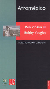
afromexico-coverNew Spain had been conquered by a ludicrously small number of Spaniards. To retain control and in order to begin exploiting the potential riches of the virgin territory they had won, a good supply of laborers was essential. There were not enough locals, so imports of slaves became a high priority.

By 1570, almost 35% of all the mine workers in the largest mines of Zacatecas and neighboring locations were African slaves. [2] Large numbers of slaves were also imported for the sugar plantations and factories in areas along the Gulf coast, such as Veracruz. By the mid-seventeenth century, some 8,000-10,000 blacks were Gulf coast residents. After this time, the slave trade to Mexico gradually diminished.

Miguel Hidalgo, the Independence leader, first demanded an end to slavery in 1810 (the same year that Upper Canada freed all slaves). Slavery was abolished by President Vicente Guerrero on September 15, 1829.

During the succeeding 36 years, prior to the abolition of slavery in the U.S. (1865), some U.S. slaves seized their chance and headed south in search of freedom and opportunity. Recognizing the potential, in 1831, one Mexican senator, Sánchez de Tagle, a signatory of the Act of Independence, called for assistance to be given to any blacks wanting to move south on the grounds that this movement would possibly prevent Mexico being invaded by white Americans. [3] Sánchez de Tagle’s point was that black immigrants would be strong supporters of Mexico since they wouldn’t want to be returned to slavery, and would be preferable to white Americans, who might be seeking an opportunity to annex parts of Mexico for their homeland. Sánchez de Tagle’s fears came to pass. One year after the U.S. annexed the slave-holding Republic of Texas in 1845, it invaded Mexico.

Perhaps as many as 4,000 blacks entered Mexico between 1840 and 1860. At the beginning of 1850, several states enacted a series of land concessions for black immigrants, in order that undeveloped areas with agricultural potential might be settled and farmed.

Even after the abolition of slavery in the U.S., small waves of blacks continued to arrive periodically in Mexico. Many came from the Caribbean after 1870 to help build the growing national railway network. In 1882, some 300 Jamaicans arrived to help build the San Luis Potosí-Tampico line; another 300 Jamaicans made the trip in 1905 to take jobs in mines in the state of Durango. [4] Partially as a response to their own independence struggles, thousands of Cubans came after 1895. They favored the tropical coastal lowlands such as Veracruz, Yucatan and parts of Oaxaca, where the climate and landscapes were more familiar to them than the high interior plateaux of central Mexico.

Mexican historians have largely ignored the in-migration of blacks and their gradual intermarriage and assimilation into Mexican society. For a variety of reasons, they chose to focus instead on either the indigenous peoples, or the mestizos who form the majority of Mexicans today. The pendulum is finally beginning to swing back, as researchers like Charles Henry Rowell, Ben Vinson III and Bobby Vaughn re-evaluate the original sources, and examine the life and culture of the communities where many blacks settled.

Most work about the influence of blacks on modern-day Mexico has focused on the Veracruz area, in particular on the settlements of Coyolillo, Alvarado, Mandinga and Tlacotalpan. 5 On the opposite coast, Bobby Vaughn has spent more than a decade studying the Costa Chica of Oaxaca and Guerrero. [6]

Analysts of Mexican population history emphasize the poor reliability of early estimates and censuses, as well as the complex mixing of races which occurred with time. While the precise figures and dates may vary, most demographers appear to agree with Bobby Vaughn that the black population, which rose rapidly to around 20,000 shortly after the conquest, continued to exceed the Spanish population in New Spain until around 1810.

It is estimated that more than 110,000 black slaves (perhaps even as many as 200,000) were brought to New Spain during colonial times. Happily, their legacy is still with us, and lives on in the language, customs and culture of all these areas.

Sources / Further Reading

1 Matthew Restall. Seven Myths of the Spanish Conquest. (Oxford University Press) 2003

2 Peter J. Bakewell. Silver Mining and Society in Colonial Mexico: Zacatecas, 1546-1700, cited in Afroméxico.

3 Vinson III, Ben & Vaughn, Bobby. Afroméxico. (in Spanish; translation by Clara García Ayluardo) Mexico: CIDE/CFE. 2004. The main source for this column, divided into three parts. Following a joint introduction, Ben Vinson III, Professor of Latin American History at Penn State University, provides a detailed overview of studies connected to blacks in Mexico. Then Bobby Vaughn, who has a doctorate in anthropology from Stanford University, adopts an ethnographic perspective in writing about the Costa Chica of Oaxaca and Guerrero; his short essay includes discussion of the Black Mexico movement. The work concludes with an extensive bibliography of sources relating to Afroméxico.

4 Vinson III, Ben & Vaughn, Bobby. Afroméxico. Mexico: CIDE/CFE. 2004

5 See, for example, the Winter 2004 and Spring 2006 issues of Callaloo (A Journal of African Diaspora Arts and Letters). The Spring 2006 issue, vol 29, #2, pp 397-543, has a series of articles under the general heading of “Africa in Mexico”, including transcriptions of fascinating interviews with such characters as Rodolfo Figueroa Martinez, who relates the history of how several local towns, including San Lorenzo de los Negros (now Yanga) were founded by blacks, and of how a black identity gradually emerged. Other interviewees discuss how they view their color and Afromestizo identity, lamenting the fact that their history has been distorted or largely forgotten. Local food and festival celebrations are also highlighted.

6 Bobby Vaughn’s Black Mexico Home Page, Afro-Mexicans of the Costa Chica, available via MexConnect, provides links to several of his articles including Blacks in Mexico. A Brief Overview.

Original article on MexConnect

Several chapters of Geo-Mexico: the geography and dynamics of modern Mexico discuss population issues, including population growth, distribution and density. Buy your copy today to have a handy reference guide to all major aspects of Mexico’s geography!

President Zedillo’s reforms stabilized the Mexican economy

 Other  Comments Off on President Zedillo’s reforms stabilized the Mexican economy
Oct 202010
 

President Ernesto Zedillo (in office from 1994 to 2000) took unprecedented steps that set the stage for Mexico’s 21st century economy. Before discussing Zedillo’s economic reforms, it is useful to review the recent history of Mexico’s economy.

Following the fifty year “Mexican Miracle” of unprecedented economic growth and low inflation, the economy entered some very tough times in the early 1980s. Assuming high oil prices would continue, Mexico borrowed very heavily and could not pay its debts when oil prices plunged in 1981-82 and interest rates rose dramatically. The government suspended debt payments, devalued the peso by 500%, and nationalized the banks. The “lost decade” of the 1980s was an economic disaster, with inflation rates over 100% and economic growth hovering around 1%.

Economic growth improved a bit the early 1990s but President Salinas was forced to introduce strict price controls in an attempt to curb inflation. With a fixed exchange rate, the peso soon became severely overvalued. Then in January 1994, Zapatistas in Chiapas rebelled against the national government. Two month later, PRI Presidential candidate Donaldo Colosio was assassinated in Tijuana. Salinas selected as his replacement, Colosio’s campaign manager and technocrat Ernesto Zedillo, a Yale PhD Economist who had previously been a university professor, Minister of Planning and Budget as well as Minister of Education. Zedillo easily won the relatively fair 1994 election and was called the “accidental president” because he never sought the presidency and never previously held elected office.

Upon assuming office, Zedillo faced an impending severe economic crisis. As was customary, Salinas in his last year had spent very lavishly, severely aggravating the government deficit. The economic crisis of 1995 was characterized by a deep recession, hyperinflation, widespread bankruptcies, serious unemployment and soaring interest rates. He floated the peso which quickly moved from 4.0 to 7.2 to the US dollar.

President Clinton orchestrated a controversial $48 billion bail-out loan which eased the crisis. Conditions of the loan required very stiff and unpopular austerity measures including a 50% income tax hike, reduced public spending, privatizing some state-owned enterprises, and making the Central Bank of Mexico more independent from politics. Zedillo effectively implemented these reforms, knowing they were the best for Mexico’s future though they seriously hurt his public popularity.

The bailout reforms succeeded, the economy stabilized and began to grow, averaging over 5% between 1996 and 2000. Mexico repaid the bailout loan three years before its due date. During the crisis and throughout his term, Zedillo supported and expanded Mexico’s free trade (globalization) agenda.

The Mexican economy is now far more stable than is was in the years prior to the Zedillo reforms. Mexico appears to be completely beyond the self-inflicted economic crises it experienced in the late 20th century. The 2008-09 recession was serious but was completely beyond the control of Mexico. The Mexican economy appears to be recovering nicely in 2010.

Chapters 14 through 20 of Geo-Mexico: the geography and dynamics of modern Mexico discuss the components and characteristics of Mexico’s economy. Buy your copy today to have a handy reference guide to all major aspects of Mexico’s geography!

Oct 162010
 

In an earlier post, we looked briefly at Females, males and gender inequality in Mexico.

Gender inequality is unfortunately still alive and well in Mexico. It is often shown through discrimination and human rights violations.

Several women’s empowerment groups aim to change the status quo. Perhaps the most successful to date has been an organization known as Semillas (= seeds). Founded in 1990, Semillas is the shorthand for the NGO Sociedad Mexicana Pro Derechos de la Mujer, A.C. (Mexican Society Pro-Women’s Rights).

In the words of its homepage, Semillas…

“knows that all the different responsibilities and duties that women have as mothers, caretakers, providers, educators, resource generators, politicians, field workers, business owners, social leaders, scholars, artists, etc… make them the fundamental factors of change in their families, communities, and society at large. Semillas is also aware that strengthening Mexican women’s rights builds a more just society, promotes a new culture of equality between women and men, and improves life conditions for generations to come.”

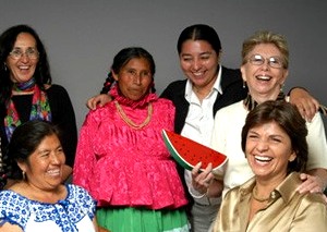
Semillas group of women

Photo credit:Semillas (Sociedad Mexicana Pro Derechos de la Mujer, A.C)

Semillas aims to break the traditional gender inequalities in Mexico through sponsorship of dozens of local initiatives, covering a wide range of development objectives. Since 1990, Semillas have started 237 sustainable development projects, benefiting 650,000 women. Projects are based on the principle of “women helping women”. Semillas funds and supports projects run by women who are already exhibiting leadership qualities in their communities.

For example, one project supports the work of a victim of psychological violence who has spent the last 15 years of her life designing programs to ensure equality of educational opportunity in her home community. This educational equality is not limited to formal schooling, but extends to the sports activities available after-school and at weekends. When our daughter was growing up in Mexico, we learned first-hand in the early 1990s that many smaller, traditional villages in Mexico tend to offer a reasonable variety of sports, such as soccer, only for boys. Rarely is anything equivalent on offer for girls. While the situation is gradually improving (girls’ soccer is becoming one popular option!), there is still a long way to go in many places.

Semillas does not only fund projects concerned with educational equality; other projects focus on health care, female working conditions and legal aid.

The Semillas website has many short articles, images and videos highlighting its work, if you are interested in finding out more about this noteworthy NGO. (It also has a link for donations).

Stop Press! By coincidence, today the Inter Press Service news agency published Four Years On, No Justice for Atenco Women (by Daniela Pastrana). In 2002, Atenco was proposed as the site for a new Mexico City airport, leading to protests by local residents. Eventually, (in April 2008) 11 women brought a case before the Inter-American Commission on Human Rights, involving allegations of torture, sexual violence and illegal deprivation of freedom, all connected to the protest movement. Their case was supported by many NGOs, as well as several winners of the Nobel Peace Prize. Mexico’s Supreme Court ruled earlier this year that the opposition to the new airport was a “legitimate social protest” and ordered the immediate release of those protesters who were still behind bars.

Chapter 29 of Geo-Mexico: the geography and dynamics of modern Mexico is titled “Variations in Quality of Life within Mexico” and discusses many aspects of poverty, including  Gender Inequality. Buy your copy today, or ask your local library to purchase a copy for their collection.

The diversity of species (plants and animals) in Mexico

 Other  Comments Off on The diversity of species (plants and animals) in Mexico
Oct 152010
 

A previous post noted that Mexico’s very wide range of ecosystems make it one of the six most biodiverse countries on earth. We also looked at the states in Mexico with the greatest biodiversity.

Given its deserts, it is not surprising that Mexico ranks first in the world in cactus species and second in reptile species, behind only Australia. Mexico’s tallest cactus is the Pachycereus pringlei (cardón), a relative of the saguaro. It can grow to a height over 19 meters (60 feet) and 1 meter in diameter (39 inches). The largest reptile is the crocodile which can grow to 5 meters (16 feet) in length and weigh over 400 kilograms (880 pounds).  In recent years, several Mexicans have been killed by crocodile attacks.

Marine biodiversityLargely as a result of Mexico’s diverse tropical and subtropical forests, Mexico ranks fourth in the world with 30,000 different types of flowering plants, compared to only 18,000 in the USA and 12,000 in all of Europe. It also ranks fourth in number of amphibian species, which thrive in Mexico’s tropical rainforests. Mexico is also among the top ten in fern and butterfly species.

The temperate forests also harbor significant biodiversity.  Mexico has more species of pine trees and oak trees than any other country.  However, with deforestation, some of these species may be endangered.

Most people are very surprised to learn that Mexico is among the top three in mammal species, along with Indonesia and Brazil. Some of Mexico’s mammals are majestic like the jaguar, some are rather large like the tapir, but many are small and less impressive like bats, shrews, and rodents. Extinction of endemic Mexican mammals is a serious concern. The International Union for Conservation of Nature (IUCN) has listed 11 endemic Mexican mammals as “critically endangered”; 27 as “endangered”, and 14 as “vulnerable”.

Chapter 5 of Geo-Mexico: the geography and dynamics of modern Mexico focuses on Mexico’s ecosystems and biodiversity.  Chapter 30 analyzes environmental issues and trends including current environmental threats and efforts to protect the environment.  Buy your copy today to have a handy reference guide to all major aspects of Mexico’s geography!

Oct 122010
 

Q. Mexico is one of the six most biologically diverse countries on the planet.  But which states in Mexico have the greatest biodiversity?

A. In general, the southern states (which receive the highest amounts of rainfall) have the greatest biodiversity: Chiapas, Oaxaca, and Veracruz.

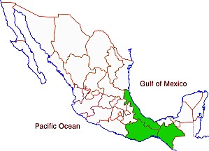
The three most biodiverse states in Mexico

The three most biodiverse states in Mexico

To answer this question in more detail, it is useful to look at different types of plants and animals.

Mammal species are fairly well distributed throughout Mexico. Three of the wettest states lead in number of mammal species.  Chiapas has 205 different species followed by Oaxaca (194) and Veracruz (190). Interestingly, the next highest rated states are in central and northern Mexico: Jalisco (173), Michoacán (163), San Luis Potosí (152), Tamaulipas (145), Puebla (144), Durango (141) and Sonora (139). All states have over 70 mammal species, except for the relatively small states of Aguascalientes (40), Tlaxcala (50) and Guanajuato (65). Mexico as a whole has an impressive 901 mammal species; this figure places it ahead of all other countries.

Mexico is a bird watchers paradise. Veracruz and Oaxaca lead with 635 and 634 different bird species. Chiapas is third with 565 bird species followed by Sonora (445), Jalisco (438), San Luis Potosí (438), Tamaulipas (435) and Michoacán (429). Tlaxcala (86) and Aguascalientes (88) have the fewest number of bird species.

Mexico’s 808 different reptile species places it second, behind only Australia. Relative wet states lead in number of reptile species: Oaxaca (258), Chiapas (224), Veracruz (214) and Guerrero (158). However, the more arid states also have relatively large numbers of reptile species: Sonora (137), Chihuahua (118), Baja California (80) and Baja California Sur (68). Aguascalientes has only 17 reptile species.

Amphibians are very abundant in the wet southeastern states. Chiapas leads with117 amphibian species in followed by Veracruz (109), Oaxaca (106) and Hidalgo (66). Not surprisingly, there are very few amphibian species in desert states. Baja California Sur has only five species while Baja California has 12.

Mexico ranks fourth in the world in number of flowering plant species, behind only Brazil, Colombia and China. Veracruz is the clear leader with 4,907 species, followed by Chiapas (3,833), Oaxaca (3,388) and Jalisco (2,752). States with the fewest species are Aguascalientes (467), Tlaxcala (457) and Baja California Sur (484).

Mexico is also among the world leaders in number gymnosperm (nonflowering plants – mostly conifers and other evergreens) species.  Mexico has more species of pine trees than any other country. Veracruz leads with 31 species, followed closely by Nuevo León (30), Durango (29), Oaxaca (28), Hidalgo (27) and Chihuahua (26). Quintana Roo and Campeche have only one species while Colima and Yucatán have only two.

Ferns are also an important part of Mexico’s biodiversity. Chiapas leads with 693 fern species, followed by Oaxaca (669), Veracruz (534), Guerrero (374) and Puebla (297). States on the Yucatán Peninsula have relatively few fern species: Yucatán (25), Campeche (29) and Quintana Roo (39).

Source for the statistics in this post: Semarnat, El ambiente en números 2010, tabla 21: “Riqueza de grupos de species selecionadas, 2008” (CONABIO) (pdf document).

Several of our previous posts have discussed Mexico’s very wide range of climates, ecosystems and species diversity:

Chapter 5 of Geo-Mexico: the geography and dynamics of modern Mexico focuses on Mexico’s ecosystems and biodiversity.  Chapter 30 analyzes environmental issues and trends including current environmental threats and efforts to protect the environment.  Buy your copy today to have a handy reference guide to all major aspects of Mexico’s geography!

Mexico’s mega-biodiversity

 Other  Comments Off on Mexico’s mega-biodiversity
Oct 122010
 

People from elsewhere generally think of Mexico as an arid country with lots of cacti. The general impression is that Mexico has relatively little biodiversity in comparison with equator-hugging tropical countries such as Brazil and Indonesia.

These impressions could not be farther from the truth.  While northern Mexico is indeed arid, many areas in southern Mexico receive over 2,000 mm (80 inches) of annual precipitation, almost entirely in the form of rainfall. The rainiest place in Mexico— Tenango, Oaxaca—receives 5,000 mm (16.4 feet) of rain annually.

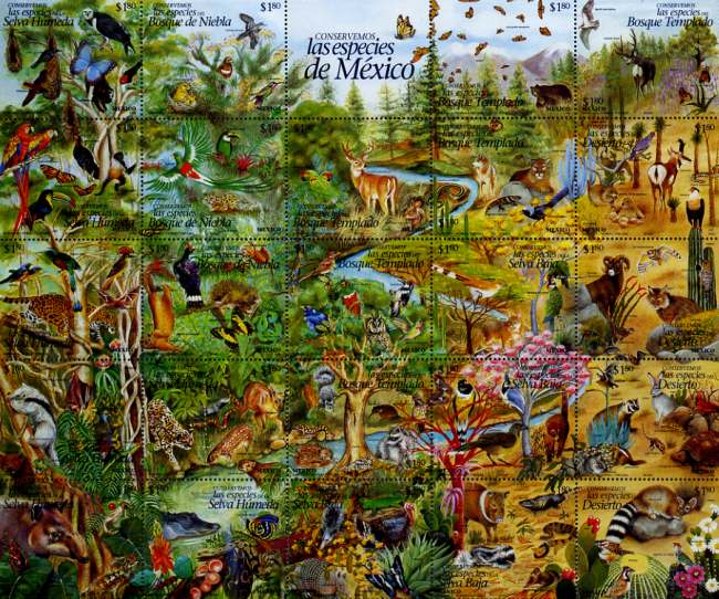
Mexico's postage stamps regularly celebrate biodiveristy

Mexico's postage stamps regularly celebrate biodiveristy. Click to enlarge

Straddling the Tropic of Cancer, Mexico is a world leader in terms of climate and ecosystem diversity.  It is one of the only countries on earth with arid deserts, dry scrublands, temperate forests, high altitude alpine areas, subtropical forests, tropical rainforests and extensive coral reefs. The multitude of ecosystems in Mexico supports a very wide range of biodiversity.

  • Mexico’s vegetation zones. The link is to a pdf map (in color) of vegetation zones. The map (all rights reserved) is a color version of Figure 5.1 in Geo-Mexico.

Mexico’s Environmental Ministry (SEMARNAT) indicates that there are over 200,000 different species in Mexico.  This is about 10% – 12% of all the species on the planet. About half of all Mexico’s species are endemic; they exist only in Mexico. An unknown number of endemic species were forced to extinction by the intended and unintended importation of Old World species by the Spaniards.

The U.N. Environment Programme has identified 17 “megadiverse” countries.  The list includes Mexico, the USA, Australia, five South American countries, three African countries, and six Asian counties.  Actually, Mexico is among the upper third of this group along with Brazil, Colombia, China, Indonesia and DRC (Democratic Republic of the Congo). The other countries on the list are: the USA, Venezuela, Ecuador, Peru,  South Africa, Malagasy Republic, India, Malaysia, The Philippines,  Papua New Guinea, and Australia.

Chapter 4 of Geo-Mexico: the geography and dynamics of modern Mexico discusses Mexico’s diverse climates.  Chapter 5 focuses on ecosystems and biodiversity.  Chapter 30 analyzes environmental issues and trends including the impact of Old World species imported by the Spaniards, current environmental threats, and efforts to protect the environment.  Buy your copy today to have a handy reference guide to all major aspects of Mexico’s geography!

The route taken by Mexico’s first international scientific expedition, 1874-5

 Maps, Other  Comments Off on The route taken by Mexico’s first international scientific expedition, 1874-5
Sep 232010
 

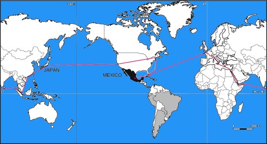
Mexico’s first international scientific expedition in 1874 left Mexico City with only a few months to travel half way around the world to Japan to set up their instruments in time for the transit of Venus on 9 December.

Mexico’s international scientific expedition to observe the 1874 transit of Venus

Looking at a map, the quickest route would appear to be via Acapulco and then by boat across the Pacific. However, in 1874, the “road” to Acapulco was often in appalling condition, especially after the rainy season, and boats crossing the Pacific from Acapulco were few and far between.

The Commission of Mexican Astronomers opted to travel via San Francisco, from where more vessels left regularly for the Far East. Getting from Mexico City to San Francisco in 1874 was nowhere as simple as it is today. For the first part of the trip, the intrepid group was able to take advantage of the Mexico City-Veracruz railway line, inaugurated only the previous year.

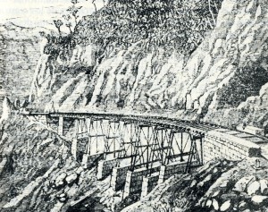
Rail bridge on Mexico City-Veracruz line

Infiernillo Bridge on the Mexicano Railroad (from Viaje de la Comisión Astronómica Mexicana al Japón)

This was an arduous and long trip in those days. Fortunately, the railway from Mexico City to Veracruz had just been completed. The expedition’s memoirs include a charming sketch of the Infiernillo railway bridge (see image).

Boats from Veracruz did not operate on a strict timetable either, and the group decided to wait in Orizaba for news of a suitable vessel rather than risk exposing themselves to the tropical diseases prevalent in the port itself. They had left Mexico City on 18 September and eventually set sail from Veracruz six days later—to Havana, Cuba. This was because vessels were much more frequent to the USA from Cuba than from Mexico.

Landing in Philadelphia on 30 September, the group was placed in temporary quarantine until diplomatic efforts succeeded in getting them released. A few days later, they caught a train to New York, and then the following day, to Chicago and on to San Francisco. Within a week, they had berths on board the Vasco de Gama to Japan.

Route taken by Mexico's first international scientific expedition, 1874-5

Route taken by Mexico’s first international scientific expedition, 1874-5. All rights reserved

Their route back home was via Hong Kong, Ceylon (now Sri Lanka), the Suez Canal, Italy and France (see map). By the time they arrived back in Mexico, they had completed a world tour, though it had taken somewhat longer than that of Jules Verne’s fictional tale Around the World in Eighty Days.

Source: Odisea 1874 o el primer viaje internacional de cientificos mexicanos by Marco Arturo Moreno Corral (Fonda de Cultural Economica,  1986)

Mexico’s international scientific expedition to observe the 1874 transit of Venus

 Other  Comments Off on Mexico’s international scientific expedition to observe the 1874 transit of Venus
Sep 182010
 

In an earlier post, Novelist who loved geography set a story in Mexico, which his publisher labeled South America, we referred to Mexico’s first international scientific expedition in 1874.

This is the expedition that social historian William H. Beezley says was linked by many Mexican writers to Jules Verne’s fictional epic, Around the World in 80 Days, published the year before. (Mexican National Identity: memory, innuendo and popular culture).

Beezley’s account has one significant error; he mistakenly writes that the international expedition was to observe an eclipse of the sun, when in fact its purpose was to make measurements during a transit of Venus across the Sun. Venus only transits the sun infrequently, but then usually does so twice in eight years.

Mexico is not commonly associated with astronomy, despite the fact that archaeologists and archaeoastronomers have worked out that several indigenous groups including the Zapotec, Aztec and Maya all constructed astronomical observatories and were able to predict eclipses and other events in the skies with incredible precision. Perhaps even more remarkably, an international astronomical congress appears to have been held in Xochicalco in the 8th century BC.

We can not be certain how much the ancients knew about astronomy, but by the 18th century, British astronomer Edward Halley had worked out that if only the transit of Venus could be observed from several different places, the differences in timing could be used to calculate the precise distance of the Earth from the Sun, a distance known as the astronomical unit. Unfortunately Halley died in 1742, before he had the chance to observe the next transits of Venus in 1761 and 1769. [The most recent transit of Venus across the Sun occurred on 8 June 2004; the next is expected on 6 June 2012.]

Obtaining an accurate figure for the astronomical constant was one of the greatest challenges for astronomers of the time. In 1760, a French astronomer set out for India (for the 1761 transit) but failed to arrive in time! Undeterred, he remained in India, waiting patiently for 1769. Alas, on that occasion it was too cloudy to make any worthwhile observations.

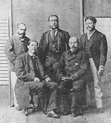
Mexico's first international scientific expedition team

Left to right: Jiménez, Barroso, Díaz Covarrubias, Fernández Leal, Bulnes (Photo reproduced in Odisea 1874)

Mexico’s connection to the astronomical constant began at this time. For the 1769 transit, Spain had granted permission to another French astronomer to join a party of Spanish astronomers setting up a temporary observatory near San José del Cabo on the southern tip of the Baja California peninsula. A short distance away, a creole astronomer Joaquín Velázquez de León had traveled from Mexico City to make independent observations. Only days after the transit, three members of the Franco-Spanish party, including the two principal astronomers, died of yellow fever.

By the time of the next transit in 1874, large scientific teams had been assembled by several countries including France, Russia, Germany and the USA to collect better data for a more accurate calculation of the astronomical constant.

Mexico had a fledgling astronomy community, but decided it must send a team to Yokohama, Japan. The team consisted of:

  • Francisco Díaz Covarrubias (the expedition’s leader) who had written various books and had installed the first post-Independence astronomy observatory in Chapultepec Castle, Mexico City, in 1863.
  • Francisco Jiménez – whose offical qualification was as a “geographic engineer”. He had fought in defense of Chapultepec Castle when the USA invaded in 1847, written about the 1769 transit, and been a key member of the Mexican Border Commission which fixed the definitive Mexico-USA boundary in 1856. He helped coordinate research for the great map of Mexico produced by Antonio García Cubas. Jiménez was the first person to use telegraph signals to determine longitudes in Mexico with precision.
  • Francisco Bulnes was the expedition’s chronicler and the youngest member of the team.
  • Agustín Barroso had wide interests in natural science and engineering, and became an early enthusiast of photogaphy and its applications to astronomy. He was responsible for the outstanding sequence of photos of the transit of Venus taken as part of the Mexican scientific expedition’s work.
  • Manuel Fernández Leal was an expert surveyor and educator who had also participated on the Mexican Border Commission.

The team traveled to Japan and were able to make valuable measurements. Commendably, they published their first results very much more quickly than did the astronomers from all other countries.

Mexico’s scientific community has continued to play an active part in major international research ever since. See for example, our earlier post about Mexicans involved in the work of the Inter Intergovernmental Panel on Climate Change (IPCC). Scientific globalization was under way…

Source: Odisea 1874 o el primer viaje internacional de científicos mexicanos by Marco Arturo Moreno Corral (Fondo de Cultura Económica, 1986)

Happy 200th birthday, Mexico!

 Other  Comments Off on Happy 200th birthday, Mexico!
Sep 162010
 

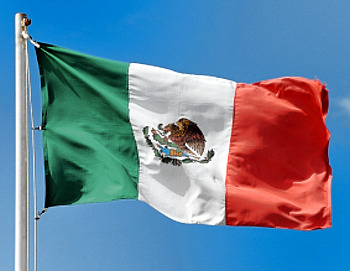
Mexico is celebrating its bicentennial.

Mexican flag

The long struggle for independence began on this day in 1810; independence was finally “awarded” by Spain in 1821. By happy coincidence, 2010 also marks the centenary of the start of the Mexican Revolution. This has a less clear-cut ending date, with some Mexicans saying that it is still on-going today. It was during the Mexican Revolution that Mexico’s current constitution of 1917 came into effect.

For some geographic trivia associated with the War of Independence:

Events in the War of Independence called for an accurate map of Lake Chapala, Mexico’s largest natural lake. The cartographer for this map was José María Narváez, whose major contributions to Mexican cartography in succeeding decades have largely been forgotten.

Following independence, the rush was on to draw an accurate map of all of Mexico’s territory. Mexico’s boundaries following independence were very different to today. Flows of migrants linking the USA to Mexico at that time were from the USA to Mexico (see link),  the reverse of the direction of more recent flows, which have seen millions of Mexicans migrate north looking for work.

Political events conspired to bring Mexico into direct conflict with the USA in the Mexican-American War of 1846-1848. The 1848 Treaty of Guadalupe Hidalgo, signed after the war, ceded over half of Mexico’s territory to the USA. A few years later, under the 1853 Gadsden Purchase (Treaty of La Mesilla), northern portions of Sonora and Chihuahua were transferred to the USA. This established the current border between the two countries.

Minor modifications have been negotiated since to take account of changes in the meanders of the Río Bravo (Grande).

The first truly national map, compiled in 1857-1858 from a meticulous reconciling of the work of numerous local cartographers, was  drawn by Antonio García Cubas. García Cubas did not graduate from university until a few years after completing this map!

In the latter half of the 19th century, the development of Mexico’s railway network brought immense changes to many parts of the country. See, for instance:

In 1910, then president Porfirio Díaz decided that the centenary of Mexican independence should be celebrated in style. One of the reasons why the “traditional” Grito (“shout) is made on 15 September each year, rather than on the morning of 16 September (when Father Miguel Hidalgo apparently gathered his parishioners in revolt) is because 15 September 1910 happened to be Díaz’s 80th birthday. Why not have one big bash and celebrate both president and country at the same time? Unfortunately for the then president, the Mexican Revolution broke out later in the year and in 1911 Díaz was exiled to Paris.

One of the major events during the centenary of independence celebrations in 1910 was the opening to the public of Teotihuacan, the  archaeological site an hour’s drive north of Mexico City. Months of frantic cleaning and restoration were completed just in time for the official opening. This marked the start of mass tourism based on Mexico’s cultural heritage. The haste with which Teotihuacan was readied for tourists led to some unfortunate errors of reconstruction. For instance, the number of levels now seen on the Pyramid of the Sun does not correspond to its original form. Of course, Mexico’s unbridled pursuit of tourism in the past 80 or so years has led to lots of other serious environmental and cultural issues elsewhere.

Mexico has come a long way in 200 years, but amazingly, to the best of our knowledge, Geo-Mexico: the geography and dynamics of modern Mexico, published earlier this bicentennial year, is the first ever book in English focused exclusively on the nation’s  varied and fascinating geography.

¡Viva Mexico!

Mexican flag

Sep 132010
 

Beer was introduced to New Spain by the Spanish. The first permit to produce beer in New Spain was awarded by Spain’s King Charles V to Alonso Herrera in 1544.

Initially, beer was a pleasure of the upper classes, and a series of local beer shops supplied their needs. During the 17th and 18th centuries, the status of beer changed and it gradually gained popularity among other social classes. Prior to the 20th century, the main breweries were in major urban centers such as Mexico City and Puebla. (Puebla was Mexico’s second largest city until 1870 when it was replaced by Guadalajara).

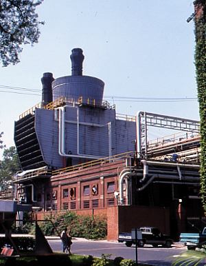
Cuauhtemoc Moctezuma brewery in Monterrey

Cuauhtemoc Moctezuma brewery in Monterrey. Photo: Tony Burton. All rights reserved.

The relative difficulty of transportation links meant that a single brewery could only serve a limited area. Only after the major railways were built in the last quarter of the 19th century, was it possible for a brewery to ship beer further afield. This same period saw significant foreign investment in breweries, primarily from Germany. Technological improvements enabled the breweries to expand production, industrialize more processes and meet the needs of the ever-growing population. The commercial manufacture and distribution of ice also helped the beer producers. Foreign investment, from the USA and Europe, continued to develop the beer industry until the Mexican Revolution began in 1910.

During the 20th century, two major brewery companies emerged, expanding by a combination of building new breweries and acquiring existing ones to bring more and more of the nation into their market areas. These two brewery groups are Grupo Modelo (main brands: Corona, Modelo Especial, Negra Modelo, Pacífico, Victoria, Estrellita, León) and Femsa (Fomento Mexicano; main brands: Tecate, Carta Blanca, Superior, Sol, Indio, Bohemia, Dos Equis, Noche Buena). Between them the control about 80% of the market.

Grupo Modelo

Grupo Modelo currently has a brewing capacity (7 breweries) of 60 million hectoliters. Its new brewery in Nava (Coahuila) will add another 10 million hectoliters to this figure. Modelo started exporting beer (to the USA) in the 1930s. It now exports to more than 150 countries worldwide. It is the world’s 6th largest brewer, accounting for 63% of the combined export and domestic Mexican market.

The granddaughter of the founder of Grupo Modelo is María Asunción Aramburuzabala, whose net worth of $2 billion makes her the richest woman in Mexico.

Femsa

Femsa is the oldest major beer-maker in Mexico. Its brewery division started life in the northern city of Monterrey in 1890 as the Cuauhtemoc Moctezuma brewery (see photo). Femsa brews about 31 million hectoliters of beer a year, including three of the top 5 beer brands in Mexico’s domestic market. In 2010, the company entered into a joint venture with giant Dutch brewers Heineken to become the leading global brewing concern.

In 1943, one of Femsa’s executives co-founded the Tec. de Monterrey (ITESM), a prestigious university that started in Monterrey and now has 31 campuses in 25 cities across the country.

We will continue our look at the geography of Mexico’s beer industry in a later post.

Mexico’s economic geography is analyzed in chapters 14–20 of Geo-Mexico: the geography and dynamics of modern Mexico. Buy your copy of this invaluable reference guide today!

Is tourism in Mexico expanding?

 Other, Updates to Geo-Mexico  Comments Off on Is tourism in Mexico expanding?
Sep 112010
 

At first sight, this would seem like an easy question to answer but, in fact, it is not exactly clear whether tourism in Mexico in 2010 is increasing, decreasing or holding steady. Flows of tourists are affected not only by any changes in the situation of the destinations (receiving countries) but also by the situation at the point of origin. Most of Mexico’s international visitors come from the USA. This year, many potential tourists have opted to stay at home as a result of the current recession which started in 2008 and worsened in 2009.  On the other hand, the recession may have diverted some tourists to Mexico from more expensive destinations they had originally planned to visit.

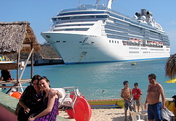
Cruise ship

Events within Mexico have also influenced the number of international tourist arrivals. The threat of H1N1 flu in early 2009 kept many international tourists away. Publicity about the violence associated with Mexico’s “drug wars” has accelerated in 2010 and almost certainly diverted some international tourists to other destinations.  On the other hand, some tourists who planned their 2010 summer vacation on the US Gulf Coast may have opted for Mexico after the massive oil spill off Louisiana.  An additional complicating factor is that international tourists only account for about 20% of Mexico’s total tourism revenue. While international tourism gets most of the attention, about 80% of tourism revenues come from national (Mexican) tourists.

Statistical data on tourism can be very difficult to interpret. The World Tourism Organization (WTO) and Mexican tourism agencies use similar international definitions of  a tourist:

  • A tourist as someone who spends at least one night (and less than one year) away from their usual home.

This definition ignores the precise reasons for travel. Hence, international tourism figures generally include travel for all purposes, including visiting family and friends, and business trips, as well as health and religious travel.  All these factors make assessing trends in Mexican tourism an analytical challenge.

In an August 2010 press conference, Mexico’s Secretary of Tourism Gloria Guevara presented data indicating that 818,278 international travelers visited Mexico in the month of June 2010 compared to only 605,435 in June 2009. This increase of 24% seems impressive, but requires closer scrutiny.  International arrivals in January and February 2010 were 5.2% and 5.8% less respectively than the same months in 2009; revenues for those two months were up 21% in peso terms, but actually fell by 7.5% in dollar terms, because of the falling value of the peso. Arrivals in March 2010 were 2.7% higher than March 2009.

Room occupancy rates (the percentage of available hotel rooms actually occupied) in 70 tourist destinations were up 11% for the first six months of 2010 compared to the same period in 2009.  However, 2009 was a very poor year for tourism in Mexico. Only 21.5 million international travelers visited Mexico in 2009, compared to a record 22.6 million in 2008.

Another major complication to the statistics is that they mask important regional differences. Tourism in some areas of Mexico is increasing steadily while it is simultaneously declining in others.  For example, occupancy rates for the first six months of 2010 were up 30% in Morelia and 15% in Huatulco compared to the previous year. However 14 of the 70 cities monitored showed no gain in occupancy over the low numbers posted in 2009. All these percentage figures ignore any changes in hotel capacity over that time. For instance, if an additional 2000 hotel rooms are opened in a resort, the occupancy rate may decrease slightly, even though more tourists actually visited the resort.

For cruise ships, a similar picture emerges. Though cruise ship visitors to Mexico were up in the first six months of 2010, they remain lower than the 2008 numbers for the equivalent period.

So, is tourism expanding, or not? Overall, tourism in 2010 is certainly improving over the 2009 numbers, which is quite encouraging given the extremely negative publicity resulting from drug war violence.  However, it is too early to say if the total number of visitors and revenues in 2010 will surpass the numbers for 2008.  This will depend not only on publicity related to Mexico’s fight against drugs, but also on the speed and extent of economic recovery in the USA. In addition, the collapse of Mexicana airline means that there are currently far fewer flights into Mexico that there were at this time last year.

See also:

Chapter 19 of Geo-Mexico: the geography and dynamics of modern Mexico focuses on Mexican tourism and development.  Buy your copy today to have a handy reference guide to all major aspects of Mexico’s geography!

Cultural and eco-tourism in the Copper Canyon region of Mexico

 Other, Teaching ideas  Comments Off on Cultural and eco-tourism in the Copper Canyon region of Mexico
Sep 102010
 

The Copper Canyon area is one of Mexico’s most popular destinations for eco-tourism activities. The canyons offer plenty of opportunities for canyoneering (like mountaineering, but starting from the top!), wilderness hikes and adventure trips. Mexico’s two highest waterfalls—Piedra Volada and Baseaseachi— are also in this area. The Basaseachic Falls are about 250 meters (820 ft) in height, beaten only by the virtually inaccessible 453-meter-high Piedra Volada falls, also in the state of Chihuahua. The Basaseachic National Park is easily accessible via paved roads from Chihuahua City.

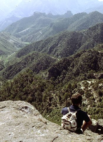
Magnificent scenery attracts hikers from all over the world.

Magnificent scenery attracts hikers from all over the world. Photo: Tony Burton; all rights reserved.

Adding to the allure of the Copper Canyon region is the fact that it is the home of some 50,000 indigenous Tarahumara Indians with their distinctive language, customs and lifestyle. The Tarahumara are one of the most culturally distinct groups in all of Mexico, famous especially for their long distance running ability and communal spirit.

Relatively easy access to this region is possible because of the railway line which runs from Chihuahua City to the lumber town of Creel, close to the canyons, and then skirts the canyon rim before descending to El Fuerte (once the capital of Arizona) and Los Mochis in Sinaloa. This railway is an incredible feat of engineering brilliance, matched by few railway lines anywhere on the planet. The railway is the lifeline of this remote region.

Travel articles:

Tourism in this area is not without its discussion points. Tourists place more pressure on scarce resources such as potable water. As noted in an earlier post, tourism has led to changes in the items made by indigenous Tarahumara women. Some hotel developers have viewed the Tarahumara as a human resource to be exploited as a quaint experience for their clients, though others have quite rightly viewed the Tarahumara as the area’s most important assets, one to admire and appreciate for what they are and how they have adapted to the harsh environment in which they live.

Points to ponder (discussion topics in class):

  • Should tourists encourage a monetary economy by buying Tarahumara souvenirs?
  • Is there a risk of tourists introducing a disease to which the Tarahumara have no resistance?
  • Should tourists be allowed to pick flowers and collect souvenir rock samples in the Copper Canyon area?
  • What are the pros and cons of tourists giving small items such as T-shirts to the Tarahumara?
  • What items, if any, are appropriate for tourists to offer the Tarahumara if they wish to give them something for sharing their ancestral homeland?
  • Is it right to take photos of Tarahumara homes, such as their cave dwellings?

Previous Geo-Mexico posts related to the Copper Canyon:

Chapter 10 of Geo-Mexico: the geography and dynamics of modern Mexico is devoted to Mexico’s indigenous peoples, including the Tarahumara Indians. If you have enjoyed this post, please suggest to your local library that they purchase a copy to enhance their collection.

Sep 062010
 

Bike riding is quite a common recreational activity in Mexico, as well as being many people’s chosen means of transport to work.

In recent years, an increasing number of cities have started regular bike festivals or other events. The Festival de Bicicleta in Xalapa, the state capital of Vercaruz, is just one example.

Back in 1972, in Mexico City, famous Belgian cyclist Eddy Merckx, considered by many to be the greatest cyclist in the history of the sport, smashed the world one-hour distance record by pedaling 49.431 km (30.715 miles). He simultaneously established new 10 km (6.2 miles) and 20 km records by covering 10 km in 11 minutes 53.2 secs and 20 km in 24 minutes 6.8 secs. One curiosity of this achievement is that contemporary ads for Windsor bikes purport to claim that he was riding a Windsor bike when he smashed the record, whereas he was actually riding an Italian bike! Merckx’s distance record stood for more than a decade before being broken, also in Mexico City, by Francesco Moser.

Mexico City is catching up with the craze for bike riding, too. It sees bikes as one way to reduce air pollution. About 30 km ( miles) of downtown streets, including the 8-lane Avenida Reforma, are closed to powered vehicles on Sunday mornings, to provide unhindered access for pedal bikes, walkers, and wheelchairs.

Earlier this year, the city began a bike rental system, Ecobici. More than 1,000 bikes were distributed between 85 specially-designed bike stations, spaced around the city center. Users purchase swipe cards which allow them to access a bike. After the trip, the bikes can be returned to any of the stations. City officials anticipate 24,000 riders using the system by the end of the year.

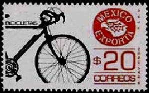
Stamp of Bike exports

As the postage stamp suggests, Mexico exports bikes, mainly to the USA. The export market has declined, however, in the past decade as several manufacturers who used to assemble bikes in Mexico have moved their operations to China. Firms which have relocated their operations away from Mexico include Huffy (formerly in Nuevo Laredo), Windzy (Monterrey), Brunswick (Ojinaga) and SRAM.

The website of the National Association of Bicycle Manufacturers claims that its 14 member companies produce about 3 million bikes a year and employ, between them, 4,000 workers.

The 14 bike manufacturers listed are:

  • Bicicletas Cinelli – Santa Catarina, Nuevo León
  • Nahel – Durango, Durango
  • Goray – Torreón, Coahuila
  • Grupo Veloci – Zapopan, Jalisco
  • Rebimo de Guadalajara – Zapopan, Jalisco
  • Biciclo – San Luis Potosí
  • Bicicletas Mercurio, Mérida, Yucatá and San Luis Potosí (they acquired the famous Acer-Mex Windsor brand in 2001)
  • Bimex – Mexico City
  • BR – Mexico City
  • Magistroni – Mexico City
  • Benotto (primarily a distributor) – Mexico City
  • Grupo Oriental – Mexico City
  • Bicicletas Ozeki – Atizapan de Zaragoza, State of México
  • Bicileyca – Yauhquemehcan, Tlaxcala

Q. Is there any pattern to the distribution of bike manufacturers in Mexico? Try plotting the locations mentioned on a map of Mexico to see if any pattern emerges.

Q. What factors do you think bicycle manufacturers must take into account when deciding where to locate?

Mexico’s manufacturing industry is discussed in chapter 16 of  Geo-Mexico: the geography and dynamics of modern Mexico. Mexico’s transportation system is discussed in chapter 17, and its exports in chapter 20.

Ask your library to buy a copy of this handy reference guide to all aspects of Mexico’s geography today! Better yet, order your own copy…

Sep 032010
 

The “China galleons” greatly stimulated spatial interactions between Acapulco and Manila, 15,000 km away. Many Mexicans settled in Manila and scores of Nahuatl words entered Tagalog, the main Filipino language. These included atole, avocado, balsa, cacao, calabaza, camote, chico, chocolate, coyote, nana(y), tata(y), tocayo and zapote.

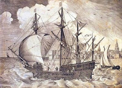
The Nao de China galleon

The China Galleon

As well as vocabulary, some aspects of Mexican cuisine, customs and dress were also introduced to the Philippines, along with a variety of plants and flowers. In addition, the Filipino currency has the same name as Mexico’s: the peso.

Mexico’s long connection with the Philippines – exploration, seafaring and geopolitics

A large number of Filipinos migrated in the other direction, escaping from their life of servitude aboard a galleon by jumping ashore on the coasts of Colima and Guerrero. One sizable Filipino community settled in Coyuca, on the Costa Grande, 50 km north of Acapulco. Coyuca was apparently known as Filipino Town at one point in its early history.

The Filipinos settling in Mexico introduced mangoes and a game called “cara y cruz” (heads and tails). The settlers were known locally as “Chinese Indians” and brought their expertise in the cultivation and use of palm trees with them. In Tagalog, palm fronds are known as “palapa” and by the end of the 18th century, this name was in use, too, for the palm-roofed shelters which remain a distinctive style of architecture along Mexico’s coasts.The coconut palm’s sap is known locally as tuba. Filipino newcomers fermented the resulting coconut wine into a potent drink. Henry Bruman, a University of California geographer, documented how Filipino seamen on the Manila Galleon also introduced simple stills, for making coconut brandy, to western Mexico during the late 16th century. These techniques were quickly adopted by Mexicans who were then able to turn the hearts of their native agave plants into tequila.

This is an excellent example of how developments in transportation can encourage cultural exchanges, and diminish the social, economic and cultural distance between places.

According to some historians, Mexico’s “China Poblana,” the woman who supposedly arrived from the East as a slave during the early 1600s and subsequently captured the hearts and minds of the people of Puebla, was actually a Filipino noblewoman who had arrived in Mexico aboard one of the Spanish galleons.

Mexico’s independence from Spain (1821) brought an end to the Manila–Acapulco galleons, though the network of shipping links then expanded from Veracruz to New Orleans and New York.

Mexico-Phillipines friendship has continued down the years.

For instance, in the second world war, several Mexican air force pilots, in the elite Escuadrón 201, were sent by the US government to lend their support in the Philippines. The pilots were decorated by the Philippine’s government for their heroism.

Related post

The development of Mexico’s transportation system is discussed in chapter 17 of Geo-Mexico: the geography and dynamics of modern Mexico. Its cultural geography is the subject of chapters 10, 11 and 13. Ask your library to buy a copy of this handy reference guide to all aspects of Mexico’s geography today! Better yet, order your own copy…

Mexico’s Copper Canyon train is one of the world’s great railway trips

 Excerpts from Geo-Mexico, Other  Comments Off on Mexico’s Copper Canyon train is one of the world’s great railway trips
Sep 022010
 

The Copper Canyon region is one of the most remote parts of Mexico. This remoteness helps to explain why the area is the home of about 50,000 Tarahumara Indians, and how they have managed to preserve much of their highly distinctive culture to this day.

The Copper Canyon railroad line, “the most dramatic train ride in the Western Hemisphere” (Reader’s Digest), begins in Ojinaga and continues, via Chihuahua, to Los Mochis and Topolobampo. The railroad was started in the 1870s to enable produce grown in southern Texas to be exported via a Pacific port. Simultaneously, the twin settlements of Los Mochis and its port Topolobampo were developed on the other side of the Western Sierra Madre. The railroad project floundered and successive attempts to complete it all failed. Some innovative engineering finally led to the line being completed in 1961. Total cost? Over $100 million.

The highlights include a 360-degree loop at El Lazo (km 585 from Ojinaga), one of only three comparable examples anywhere in North America), and a 180-degree turn inside a tunnel near Temoris at km 708. The line crosses the Continental Divide three times, reaches a maximum height of 2400 m (at km 583) and skirts the rim of the Copper Canyon. Between Chihuahua and Los Mochis, there are 37 bridges (totaling 3.6 km) and 86 tunnels (totaling 17.2 km). Almost all passenger rail services in Mexico ended in the 1990s but daily services continue along this line, mainly for tourists.

Tarahumara Indians wait for a sale at Divisadero, the station on the rim

Tarahumara Indians wait for a sale at Divisadero, the station on the canyon rim. Photo: Tony Burton; all rights reserved.

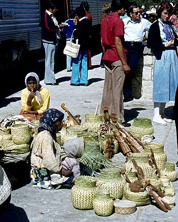
Almost all trains stop for a few minutes at Divisadero, a station set right on the rim of the canyon, with a lookout offering a magnificent panoramic view. Shy Tarahumara women and children sit quietly, weaving pine-needle baskets (see photo) and hoping for a sale. Many of them speak very little Spanish apart from the numbers; on the other hand, how many tourists speak even one word of the Tarahumara language? Thirty years ago, most articles sold by the women were items similar to ones they would use everyday themselves in their daily tasks. Sadly, many of the articles sold today are made specifically for the tourist trade.

Unlike the railway, Los Mochis and Topolobampo both soon flourished. Topolobampo was started by US engineer Albert Kimsey Owen who chose this previously unsettled area for a socialist colony based on sugar-cane production, and as the terminus for the railway. Topolobampo has one of Mexico’s finest natural harbors, a drowned river valley or ria, which affords a safe haven in the event of storms. Los Mochis was officially founded in 1893 by a second American, Benjamin Johnston, who built a sugar factory there.

Los Mochis became especially important in the second half of the twentieth century as a major commercial center, marketing much of the produce grown on the vast El Fuerte irrigation scheme. Much of this produce is still exported to the USA via the famous Copper Canyon railway. Los Mochis and Topolobampo are unusual—there are few other examples of such “new towns”, with no colonial or pre-Hispanic antecedents, anywhere else in Mexico.

Previous Geo-Mexico posts related to the Copper Canyon:

External links of interest:

Chapter 10 of Geo-Mexico: the geography and dynamics of modern Mexico is devoted to Mexico’s indigenous peoples, including the Tarahumara Indians. If you have enjoyed this post, please suggest to your local library that they purchase a copy to enhance their collection.

Sep 012010
 

Several famous writers wrote about Mexico despite having no direct geographic experience of the country. In an earlier post, we looked at the case of Jules Verne. This time, we look at Henry Wadsworth Longfellow.

There is some sound historical geography in the famous poem The Bells of San Blas, yet author Henry Wadsworth Longfellow had never ever visited the town.

The San Blas referred to in the poem is on the Pacific coast, in the state of Nayarit. It is a small town with several good hotels and restaurants, and a birding “hot spot”. The variety of habitats around the town, ranging from sandy beaches and luxuriant mangroves to palm plantations and tropical swamps, have attracted more than 500 different bird species, or about half of all the bird species known in Mexico.

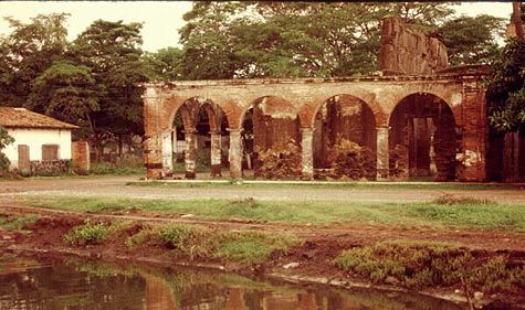
The town’s economy was not always geared to tourism. For more than a century, San Blas, founded in 1768, functioned as an important port and boat-building center. The vessels built in San Blas included those used by Junípero Serra to establish missions in California. To ensure that taxes were paid on imports, an imposing customs house was built on the shore. To guarantee safe passage, a church dedicated to “Our Lady of the Sailor’s Rosary” stands atop the steep-sided Cerro de San Basilio which overlooks the town. In the church hung the famous bronze bells.

San Blas Customs House

The former Customs House of San Blas in the evening light, 1989. Photo: Tony Burton. All rights reserved.

Time conspired against the port of San Blas. The harbor silted up, the coastline gradually inched its way further west. Over the years, other ports such as Acapulco and Mazatlan became more important. San Blas declined. The customs house and church were abandoned, transformed from bustling buildings into evocative ruins. By the end of the 19th century, the port was very much a “has been”.

In March, 1882, far away from Mexico, in Cambridge, Massachusetts, the American poet Henry Wadsworth Longfellow (best known for Paul Revere’s Ride, The Song of Hiawatha, and Evangeline) lay on his deathbed. Longfellow, born in 1807, was a prolific poet and accomplished linguist. After a long and illustrious career, which included teaching at Harvard College, his life was now drawing to a close, even as the distant port of San Blas was falling into disuse.

By a happy coincidence, the March 1882 issue of Harper’s new monthly magazine (Volume 64, Issue 382) contained an article by William Henry Bishop, entitled “Typical Journeys and Country Life in Mexico”. Bishop’s article described several Pacific coast ports, including San Blas:

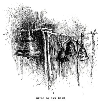
“Acapulco has the most complete and charming harbor, and an old fort dismantled by the French, of the order of Morro Castle. Manzanillo is a small strip of a place on the beach, built of wood, with quite an American look. The volcano of Colima appears inland, with a light cloud of smoke above it. San Blas, larger, but still hardly more than an extensive thatched village, has, on a bluff beside it, the ruins of a once more substantial San Blas. Old bronze bells brought down from it have been mounted in rude frames a few feet high to serve the purpose of the present poor church, which is without a belfry, and this is called in irony ‘the Tower of San Blas.'”

The article was accompanied by an illustration showing four bells swinging from a rickety wooden frame.

The Bells of San Blas, the illustration that sparked Longfellow's poetic imagination.

The article and its accompanying illustration prompted Longfellow to write what would prove to be his last poem, entitled The Bells of San Blas.

Like the port at that time, Longfellow saw the bells as relics from a byegone age:

They are a voice of the Past,
Of an age that is fading fast,
Of a power austere and grand;
When the flag of Spain unfurled
Its folds o’er this western world,
And the Priest was lord of the land.

The chapel that once looked down
On the little seaport town
Has crumbled into the dust;
And on oaken beams below
The bells swing to and fro,
And are green with mould and rust.

Several days later, Longfellow penned the last stanza, with a suggestion of optimism for the future:

O Bells of San Blas, in vain
Ye call back the Past again!
The Past is deaf to your prayer;
Out of the shadows of night
The world rolls into light;
It is daybreak everywhere.

On March 24, Longfellow, who had never had the good fortune to visit San Blas in person, passed away.

Should you visit San Blas today, spare a thought for this genius of a poet who was able to capture so eloquently the declining fortunes of this once-great port.

What further stanzas remain to be written in the story of San Blas, now revived by its important naval base and ornithological tourism?

Original article on MexConnect.

The development of Mexico’s transportation system is discussed in chapter 17 of Geo-Mexico: the geography and dynamics of modern Mexico. Ask your library to buy a copy of this handy reference guide to all aspects of Mexico’s geography today! Better yet, order your own copy…

The energy efficiency of farming in Mexico and elsewhere

 Other, Teaching ideas  Comments Off on The energy efficiency of farming in Mexico and elsewhere
Aug 302010
 

Corn is one of the world’s major cereal crops and has long been a vitally-important crop to Mexico.

However, is it more efficient in energy terms to be a slash-and-burn farmer of corn in the jungle or a technologically-sophisticated corn farmer on the US or Canadian prairies?

David and Marcia Pimentel have compiled data from a variety of sources and analyzed this question and similar questions in some detail.

In Mexico, they calculated that about 1144 hours of human labor are required to produce 1 hectare (ha) of corn using only hand labor, and no animals or machinery. On the other hand, using machinery, cultivating a hectare of corn requires only 10 hours of labor in the USA.

The total energy required to cultivate a single hectare of corn by hand is 589,160 kcal for the 1144 hours of hand labor, plus 16,570  kcal for making the axe and hoe used by the farmer (this figure assumes a certain lifespan and maintenance needs for such tools), plus 36,608 kcal for the 10.4 kg of seed required. The grand total for energy inputs into the system is 642,336 kcal. [One kcal (kilocalorie) = 4184 joules.]

An average yield for corn in such a non-mechanized system is 1,944 kg/ha, equivalent to 6,901,200 kcal. The ratio between the energy output and the energy expended of this system is almost 11:1.

By way of comparison, the energy inputs (labor, machinery, gasoline, seeds, irrigation, herbicides, etc) in a typical, highly mechanized US or Canadian cornfield total 10,535,000 kcal/ha. The yield of corn is about 7,500 kg/ha, equivalent to 26,625,000 kcal. The energy ratio for this farming system is 2.5:1

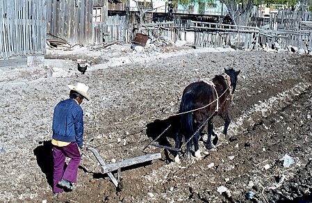
Horse-drawn plough, Creel, Chihuahua, 1980

More efficient than a tractor?

Which system is more efficient? This is where it becomes essential to define what is meant by efficiency. In terms of output per hour of labor, the US farm is far more efficient. In terms of yield per hectare, the US farm is more efficient. However, in terms of energy ratios, the Mexican farm is four times more efficient than its US counterpart.

Looking at energy ratios makes it possible to make various generalizations about farming. In general, hand cultivation methods are the most energy efficient, followed by systems where animals are used, followed by systems based largely on machinery. The precise numbers for any type of farming will vary from one country to another, since the labor required and crop yields do depend to some extent on such geographic factors as soil types, terrain and the weather during the growing season.

It is also possible to look at what the additional energy inputs in a highly mechanized system actually achieve. For instance, in the USA, machinery and fuel account for about 20% of all the fossil energy employed; in other words, about 20% of the energy input reduces, or replaces, human and animal labor. The remaining 80% of fossil fuel inputs is employed in increasing corn yields by means of fertilizers, insecticides, herbicides and irrigation.

The table shows the energy ratios which have been calculated for a selection of crops in various countries.

Type of farmingLocationEnergy ratio (output/input)
CassavaTanzania23.0
Corn (human power)Mexico10.7
Corn (human power)Guatemala4,8
Corn (oxen power)Guatemala3.1
Corn (oxen power)Mexico4.3
Corn (animal power)Philippines5.1
Corn (mechanized)USA2.5
Wheat (bullock power)Uttar Pradesh, India1.0
WheatUSA2.0
Rice (human power)Borneo7.0
Rice (mechanized)Japan3.0
RiceCalifornia2.0
Sorghum (human power)Sudan14.0
SorghumUSA2.0
SoybeansUSA4.0
OrangesFlorida, USA2.0
ApplesEastern USA1.0
PotatoesNew York state, USA1.2
PotatoesUK1.5
TomatoesCalifornia0.6
SpinachUSA0.2
Eggs, batteryUK0.15
CatfishLouisiana, USA0.03
ShrimpThailand0.01
OystersHawaii0.01
Winter lettuce (glasshouse)UK0.0023
All agriculture, 1952UK0.47
All agriculture, 1968UK0.35

An energy ratio below 1.0 for a particular item means that the inputs of energy exceed the output, or in other words more energy is expended on cultivation than is returned via the crop.

As Tim Bayliss-Smith concludes in the The ecology of agricultural systems, the evidence is that, “Only in fully industrialized societies does the use of energy become so profligate that very little more energy is gained from agriculture than is expended in its production.”

Why are energy ratios important?

Energy ratios shed some light on the sustainability of farming. Cultivation relying only on human power, is clearly sustainable virtually indefinitely, provided that land degradation is avoided and yields do not decline. Farming using a mix of animal and human power is also likely to be fully sustainable. However, the same is not true for cultivation relying on power derived from fossil fuels. For mechanized farming, sustainability requires machinery to be powered by renewable sources of energy, such as solar or wind power. Such sources of energy may be impossible to harness in some climatic zones.

Of course, farm systems are not only about energy flows and ratios. As Tim Bayliss-Smith points out, farms ”also provide jobs, incomes and a way of life for agrarian societies, whose social and ideological characteristics cannot be ignored.”

Sources / further reading:

  • Pimentel, David and Pimentel, Marcia H. Food, energy and society (3rd edition) CRC Press, 2008
  • Bayliss-Smith, T.P. The ecology of agricultural systems. Cambridge University Press, 1982.
  • Simmons, I.G. “Ecological-Functional Approaches to Agriculture in Geographical Contexts”, in Geography, 65: 305-316 (Nov. 1980)

Agriculture is analyzed in chapter 15 of Geo-Mexico: the geography and dynamics of modern Mexico. and concepts of sustainability are explored in chapters 19 and 30.  Buy your copy today, so you have this handy reference guide to all aspects of Mexico’s geography available whenever you need it.

Mexico’s top 13 natural wonders

 Other  Comments Off on Mexico’s top 13 natural wonders
Aug 242010
 

According to the 1.5 million votes cast in a Televisión Azteca survey in 2007 (published in the always interesting glossy magazine mexicanísimo), the top 13 natural wonders in Mexico are (in no particular order):

  • The Copper Canyon region (Chihuahua)
  • The El Cielo Biosphere Reserve (Sierra Madre Occidental, Tamaulipas)
  • The Sumidero Canyon (Chiapas)
  • Cuatro Ciénegas oasis (Chihuahuan desert)
  • El Arrecifal coral reef ecological park (Veracruz)
  • El Pinacate desert (Sonora)
  • The Monarch Butterfly reserves (Michoacán)
  • The agave landscapes surrounding Tequila (Jalisco)
  • The Centla wetlands (Tabasco)
  • The Peña de Bernal monolith (Querétaro)
  • The Basalt Prisms of San Miguel Regla (Hidalgo)
  • The Sótano de las Golondrinas sinkhole (San Luis Potosí)
  • Xel-Há marine park (Quintana Roo)
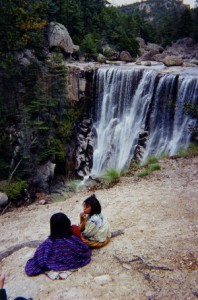
Tarahumar woman and child, by waterfall in the Copper Canyon

Tarahumar woman and child, by waterfall in the Copper Canyon. Photo: Tony Burton. All rights reserved.

Also ranked highly were

  • Cerro de la Silla (Nuevo León)
  • Estero de Palo Verde (Colima)
  • Loltún caverns (Yucatán)
  • Mexcaltitán Island (Nayarit)

We will describe each of these geographical treasures in more detail in future posts.

How many of these places have you visited?

What other places do you think should be on this list?

If you have enjoyed this post, you might also enjoy Geo-Mexico: the geography and dynamics of modern Mexico.

Buy your copy today!

Mexico’s long connection with the Philippines – exploration, seafaring and geopolitics

 Other  Comments Off on Mexico’s long connection with the Philippines – exploration, seafaring and geopolitics
Aug 232010
 

In 1559, King Philip II of Spain ordered a fleet to be prepared to sail west from New Spain (Mexico) to the Philippines. Barra de Navidad, on the shores of Jalisco, was one of the centers of New Spain’s maritime activity at the time. It offered a sandy beach in a well-protected bay; with tall forests inland to provide the necessary timber. Barra de Navidad echoed to the sounds of hammering and sawing, as the Spanish fleet was readied.

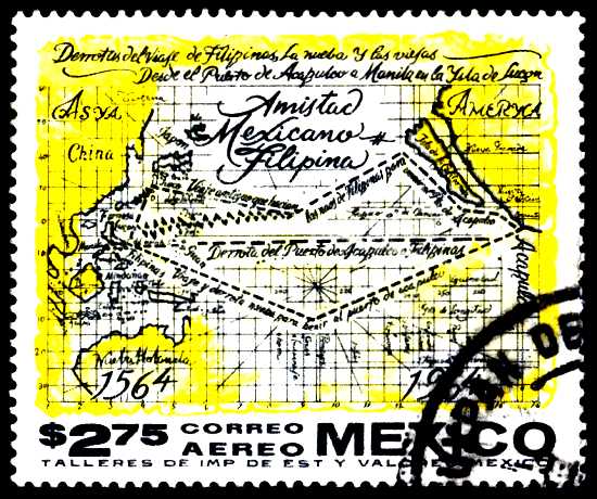
Mexican postage stamp commemorates 400 years of Mexico-Philippines friendship

Mexican postage stamp commemorating 400 years of Mexico-Philippines friendship

All western Mexico was mobilized to support the venture. Roads were built to ferry supplies from the city of Guadalajara to the Barra de Navidad boatyards. To this day, the main Guadalajara-Barra de Navidad road is known as The Philippines Way. Food, planks, sails and rigging – all had to be acquired and transported to the port. Every village had to support the effort, which was not without its dangers. For example, the Indians from Ameca complained of “many killed in the transport of rigging to Puerto de la Navidad where they are building boats to go to China.”

The expedition finally set sail at 3:00am on 21 November 1564, marking the start of more than 400 years of friendly contact between Mexico and the Philippines.

The expedition’s commander, López de Legazpi, fearing a mutiny, did not reveal their true destination to his sailors until the boats were well under way; no previous expedition had ever managed to find its way back across the Pacific Ocean. The expedition landed in the Philippines in March 1565. López de Legazpi remained there, putting his 17-year-old grandson in charge of finding the way back. In one of the most amazing feats of sailing of all time, his grandson was successful, but when the expedition reached Acapulco in October the crew was too exhausted to drop anchor. The return voyage had cost more than 350,000 gold pesos, and is commemorated today by a simple monument in Barra de Navidad’s small plaza.

The map on the stamp issued in 1964 to celebrate 400 years of friendship between Mexico and Philippines shows the expedition’s routes across the Pacific. The southern line marks the outward route, the northern line the route home.

The Spanish authorities quickly decided that bringing Asian goods from their colony in the Philippines back to Spain by crossing the Pacific, transshipping the cargo across Mexico and then sailing from Veracruz to Spain was preferable (more secure) to any alternative. Barra de Navidad soon became a regular port-of-call for Spanish sailors plying the so-called China route between Acapulco and Manila. To enable easier communication between Mexico City and Acapulco, a Camino Real (Royal Road) for pack mules was built between Mexico City and Acapulco. (A road suitable for wheeled vehicles between these cities was not completed until well into the 20th century.)

Demonstrating strong complementarity, for 250 years Spanish galleons carried Mexican silver to Manila and returned with spices, silk, porcelain, lacquer ware and other exotic goods from the Orient. These “China galleons” displaced 2000 tons and were the largest seafaring vessels of their time in the world.

But the lure of easy treasure drew pirates such as Englishman Francis Drake. In 1579, Drake sacked the small port of Huatulco, now a premier multi-million dollar tourist resort in the state of Oaxaca, and attacked the Manila galleon off the coast of California, exposing the vulnerability of Spanish sea traffic. For the next forty years, all the west coast ports, including Barra de Navidad, saw more pirates and corsairs than was good for them. Then, slowly but surely, the center of colonial operations moved further north into Sinaloa and Baja California.

Related Post

The development and characteristics of Mexico’s transportation network are analyzed in chapter 17 of Geo-Mexico: the geography and dynamics of modern Mexico. Buy your copy of this invaluable reference guide today!

Aug 212010
 

Mexico is the world leader for avocado growing, accounting for almost 35% of global production. Other important avocado producers include the USA and Indonesia (each with 7% of the world total), Colombia (6%), Brazil (5%) and Peru (4%).

In Mexico, avocado production is heavily concentrated in the state of Michoacán. The main areas of avocado orchards are near the cities of Uruapan and Tacámbaro. The annual harvest of avocados is now worth about 800 million dollars, and has increased extremely rapidly in the past decade. The total annual production of Mexico’s 21,000 avocado growers has risen to 1.2 million tons.

Avocado-growing states

Avocado-growing states. All rights reserved. Click to enlarge.

The map shows the four main avocado-growing states. Michoacán accounts for 92% (by value) of all the avocados produced each year, followed by Morelos (2.5%), the State of México (1.3%) and Nayarit (0.7%).

The Hass variety grown in Mexico fruits twice each year. The main harvest periods are January to April, and July to September. The average yield in Mexico is about 10.6 tons/ha. This compares with yields of 14 tons/ha on the Caribbean island of Guadalupe, 13.4 tons/has in the Dominican Republic, 13.1 tons/ha in Israel, 10 tons/ha in Cuba, 11.1 tons/ha in Colombia and 9.2 tons/ha in the USA.

Area of avocado cultivation

Area of avocado cultivation in Mexico (thousands of hectares). The green line is area under cultivation; the yellow line is area harvested.

Currently, Michoacan has more than 120,000 hectares dedicated to avocado production, compared to only 90,000 hectares seven years ago. About half the area is irrigated. US trade restrictions limiting avocado imports from Mexico were lifted in 2005, and exports have climbed to more than 300,000 tons a year.

This extraordinarily rapid increase in land area devoted to avocados, known locally as “green gold”, has come at the expense of natural forest. The rate of deforestation has prompted environmentalists to demand that state and federal environmental authorities regulate further land clearance. Environmental agencies have now agreed that is essential to regulate deforestation for avocado production in order to avoid further environmental damage.

Farming in Mexico, including avocado growing, is analyzed in chapter 15 of Geo-Mexico: the geography and dynamics of modern Mexico. Ask your library to buy a copy of this handy reference guide to all aspects of Mexico’s geography today! Better yet, order your own copy…

Air quality improving in Mexico City but not in Monterrey

 Mexico's geography in the Press, Other  Comments Off on Air quality improving in Mexico City but not in Monterrey
Aug 102010
 

A recent short piece in The Economist, “A breath of fresh air” (31 July 2010) echoes Geo-Mexico’s contention that air quality has been improving in Mexico City in recent years, but declining in other large cities, especially Monterrey.

The improving air quality in Mexico City is attributed to:

  • relocation of heavy industry away from the city
  • closure of the Azcapotzalco oil refinery (1991); part of this area is now a public park
  • vehicle emissions standards, and enforcement
  • “Día sin coche” (Day without a car) policy for all but the newest vehicles
  • improvements to public transport, such as introducing Metrobus; starting in 2011, taxi owners have incentives to use hybrid or electric vehicles
  • on-going, effective monitoring of air quality since the mid 1980s
The IMECA scale for urban air quality

The IMECA scale for urban air quality

Air quality still exceeds environmental norms in Mexico City many days each year, but far fewer than during the late 1980s and early 1990s when air pollution was at its peak. Even low-level ozone measurements are showing improvement. Ironically, ozone in the lower atmosphere rose immediately after the introduction of a new unleaded gasoline, designed to  ensure that the major source of brain-damaging lead pollution was removed. The new gasoline, it emerged, simply traded one serious pollutant for another.

Latest pollution values for Mexico City.

Mexico’s other big cities still face enormous challenges with regards to air pollution. Monterrey’s air regularly has very high concentrations of microparticulates (PM10); the levels now exceed Mexico City’s peak readings from twenty years ago.  The air in Guadalajara is improving, but not as rapidly as in Mexico City.

Geo-Mexico: the geography and dynamics of modern Mexico examines the trends in air quality (ozone, microparticulates and carbon monoxide) for Mexico’s three largest cities and also asks whether the air pollution from maquiladora plants in Ciudad Juárez raises public health issues.

Ask your library to buy a copy of this handy reference guide to all aspects of Mexico’s geography today! Better yet, order your own copy…

Previous post on this topic: Mexico City air quality continues to improve

Aug 072010
 

The copper industry in Mexico embraces two extremes: from a major Mexican multinational, Grupo México, to hundreds of dedicated, but poorly remunerated coppersmiths living in a small town in Michoacán.

Large-scale copper mining in Mexico

Grupo México is the largest mining corporation in Mexico, and the world’s third largest copper producer. The company has faced a series of financial and labor issues over the years, which have sometimes restricted its output. It operates two major mines in Mexico, both in the northern part of the state of Sonora:

  • Cananea – this mine, which dates back to 1899, produced 163,804 tons of copper in 2006. It has some of the largest reserves in the world.
  • La Caridad – proven reserves of 600 million metric tons.

Grupo Peñoles started extracting copper from the Milpillas copper deposit, also in Sonora, in 2006. Copper miens in Sonora account for 83% of national output. Other states where copper is mined include:

  • Zacatecas (6%), where copper is one of several metals obtained from Industrial Minera México’s mine at Sombrerete
  • Chihuahua (4%), where copper is mined at Santa Bárbara and Naica.
  • San Luis Potosí (6%), where copper comes from the polymetallic mine of Charcas (also Industrial Minera México)
  • minor amounts are also obtained in Durango, Hidalgo, Michoacán, the State of México and Sinaloa.

335,000 tons of copper were mined in 2007

Mexico Exporta - CopperSanta Clara del Cobre

The artisans of Santa Clara del Cobre are justly world-famous for their coppersmithing skills.

A great time to visit the town, one of Mexico’s Magical Towns, is during the annual Copper Fair. The XLV National Copper Fair and LXV Hammered Copper Competition run from 7-17 August 2010. The competition offers 89 prizes with a total prize fund of 414,000 pesos (33,000 dollars).

How did Santa Clara, in Michoacán, come to be associated with copper working?

In pre-colonial times, local Indians mined for copper in various regions of Mexico including the state of Michoacan in Central Mexico, where the local P’urhepecha Indian group produced magnificent copper, gold and silver jewelry. They also made copper handaxes, used as currency throughout MesoAmerica.

In 1538, the Spanish missionary, Vasco de Quiroga, the first Bishop of Michoacan, helped develop local crafts. To avoid competition between villages, he encouraged each village to specialize in a particular craft. Coppersmithing was the craft allocated to Santa Clara (now Santa Clara del Cobre).

Santa Clara became the most prominent copper-producing town in colonial New Spain. During the 17th century, the town was the main source for hand-hammered copper kettles.In the 20th century, when demand for these collapsed, the townspeople, supported by government programs, started making a variety of other objects.

A National Copper Fair was started, and state-sponsored coppersmithing competitions began. Santa Clara de Cobre has a museum dedicated to copper working, where many of the prize-winning entries from previous years are displayed.

Further artistic and commercial impetus to Santa Clara copper came in the 1970s from American James Metcalf and his Mexican wife Ana Pellicer. Metcalf created the Olympic torch for the 1968 Mexico City Olympic Games.

While most copper pieces are designed to be utilitarian, the number of decorative items has increased in recent decades, with many items incorporating other metals, stone and ceramics. Many of the workshops continue to employ traditional techniques; a single hand-crafted piece may take an entire month to make.

The economy of coppersmithing

About 82% of households in Santa Clara depend on copper working for their livelihood. The town has more than 300 workshops. Between them, they transform 450 tons of copper a year. In an average year, sales of copper items reach about 4 million dollars.

Smelting the copper in colonial times required large quantities of charcoal. Charcoal production contributed greatly to the region’s deforestation.

The industry depends on recycled copper wire and cable, which in some years includes imports from the USA. One of the great ironies of this is that American tourists now visit Santa Clara to buy back (admittedly at a much higher price and in a more artistic form) the same copper they once threw away.

When electricity was first brought to Santa Clara, it is said that the electric company had a hard time keeping the lines functioning as they were often stolen to be hammered into copper posts and pans for the next market day.

Curiosity

Perhaps Santa Clara’s most famous son is J. Jesús Pérez Gaona, better known as “Pito Pérez”. Born in 1867, he began studying to be a priest, but never completed his studies. He then became a clerk, a drunkard and—mainly—a wonderful dreamer. He was immortalized in Rubén Romero’s great work, “La vida inútil de Pito Pérez” (The useless life of Pito Pérez), later turned into a movie.

Mexico’s mining sector is analyzed in chapter15 of Geo-Mexico: the geography and dynamics of modern Mexico. Buy your copy of this invaluable reference guide today!

The connection between a Veracruz sugar plantation, San Francisco earthquake, Mexico tourist guide, and Mutiny on the Bounty

 Other  Comments Off on The connection between a Veracruz sugar plantation, San Francisco earthquake, Mexico tourist guide, and Mutiny on the Bounty
Jul 172010
 

At first sight, it would seem unlikely that a Veracruz sugar plantation could be linked, even indirectly, to Mutiny on the Bounty. The connection, which also takes in the San Francisco earthquake and one of Mexico’s most famous tourist guide books, is made via Charles Bernard Nordhoff, born in London, England in 1887, to well-to-do American parents.

When Charles was very young, the family moved to Berlin, where his mother wrote in the family diary that, “Charlie undoubtedly began his study of water fowl, as his daily outing in a small pram or push cart led him first to the bakeries for a supply of stale buns and back to the lake to feed the ducks.” The family also lived on a ranch near Todos Santos in Baja California, where as a young child, Nordhoff learnt to hunt, sail and fish.

Later, the family moved to California. Following in the footsteps of his grandfather, a journalist and  author, Charles Nordhoff wrote his first article at age 15 for an ornithological journal. He studied briefly at Stanford University, but left in the aftermath of the serious earthquake and fire of 1906.

After completing a B.A. at Harvard University, he moved back to Mexico in 1909 to work as a supervisor on a sugar plantation in Veracruz, where he was besotted with the owner’s attractive daughter. Unable to win the heart of the beautiful young lady, and with the Mexican Revolution breaking out around him, Nordhoff left Mexico in 1911; he never  returned.

But Nordoff’s adventures were far from over, In 1917, he joined the French Foreign Legion as a pilot, eventually winning the Croix de Guerre for his efforts. After the war, he wrote a history of the Lafayette Flying Corps. with James Norman Hall. Hall later landed the job of updating Terry’s Guide to Mexico, by far the most famous guidebook to Mexico of its era.

Nordhoff and Hall later moved to Tahiti to write travel articles for Harper’s, where Nordhoff married a Polynesian woman, Pepe Teara; they had six children. While Nordhoff wrote several books of his own, including several novels, he is best known for his collaboration with Hall on the Mutiny on the Bounty trilogy about the famous 1789 mutiny in the South Seas. The novel was the basis for three movie versions, the first of which, released in 1935, won an Oscar for Best Picture.

Tragically, following a severe depression and heavy drinking, Nordhoff took his own life on 10 April 1947.

This is an edited excerpt of a biography that first appeared in Tony Burton’s Lake Chapala Through the Ages, an anthology of travellers’ tales (Sombrero Books, 2008). All rights reserved.

In which months are hurricanes most likely to strike Mexico?

 Other  Comments Off on In which months are hurricanes most likely to strike Mexico?
Jul 142010
 

The following verse provides a way to remember how likely hurricanes are in different months of the year. It applies specifically to Atlantic (Gulf of Mexico) and Caribbean hurricanes.

June, too soon
July, stand by
August, come it must
September, remember
October, all over.

This verse matches the historical records of Atlantic and Caribbean hurricanes fairly closely. Even so, to keep everyone on their toes, hurricanes sometimes, very occasionally, develop in other months of the year.

Previous hurricane-related posts:

Hurricane Alex, 30 June – 1 July 2010

Hurricanes and other climatological phenomena are analyzed in chapters 4 and 7 of Geo-Mexico: the geography and dynamics of modern Mexico. Buy your copy today, so you have a handy reference guide available whenever you need it.

Jul 092010
 

The 4th Assessment Report (2007) of the IPCC (Intergovernmental Panel on Climate Change) involved the contributions of 2,500 scientists from 130 countries. The number of Mexican scientists participating was higher than the number from many richer countries including Spain and France. Sixteen Mexican scientists were involved in writing the 4th IPCC report. Ten of the sixteen hold positions at UNAM (the National University in Mexico City), making UNAM one of the institutions in the world with the highest rate of participation.

The 16 Mexican contributors were:
IPCC 4th Report

A further 8 Mexican scientists helped edit the documents:

Many of the same scientists have now been confirmed as members of the international team developing the 5th Assessment Report of the IPCC. In addition, the following newcomers have also been appointed:

  • Salvador Lluch-Cota, Centro de Investigaciones Biológicas del Noroeste, S.C. (Lead author, Ocean systems)
  • Fernando Aragon, El Colegio de la Frontera Sur (Urban areas)
  • Ursula Oswald-Spring, Centro Regional de Investigaciones Multidiscipinarias, UNAM    (Human security)
  • Roberto A. Sanchez Rodriguez, University of California, Riverside  (Adaptation planning and implementation)
  • Edgar Ortiz (Integrated Risk and Uncertainty Assessment of Climate Change Response Policies)
  • Martha Micheline Cariño Olvera (Social, Economic and Ethical Concepts and Methods)
  • Mauricio de María Campos (Sustainable development and equity)
  • Angel de la Vega     (Energy systems)
  • Xochitl Cruz-Nuñez (Transport)
  • Omar Masera (Agriculture, Forestry and other land uses)
  • Gian Carlo Delgado (Human Settlements, Infrastructure and Spatial Planning)
  • Alba Eritrea Gámez Vázquez (Regional Development and Cooperation)
  • Manuel Angeles (National and Sub-National Policies and Institutions)
  • Tomás Hernández-Tejeda, National Institute of Research in Forestry, Agriculture and Livestock (INIFAP)/SAGARPA (Synthesis Report)

Mexico’s diverse climates are the subject of chapter 4 of Geo-Mexico: the geography and dynamics of modern Mexico. Water availability, rivers, aquifers, water issues and hazards are analyzed in chapters 6 and 7. Buy your copy today!

Mexico City’s wholesale food market, Central de Abasto

 Books and resources, Other  Comments Off on Mexico City’s wholesale food market, Central de Abasto
Jul 072010
 

Have you ever wondered how food supplies are organized in a metropolitan area the size of Mexico City (population 20 million) so that all its inhabitants have regular access to fresh produce? Like most major world cities, Mexico City has a specialized wholesale market for food, Central de Abasto. It is located in Iztapalapa, south-east of the city center.

Nicola Twilley, a freelance writer currently based in Montreal, has written a wonderfully informative description of what a visit to the Central de Abasto is like on her fascinating blog edible geography

Map of Central de Abasto, Mexico City

Map of Central de Abasto, Mexico City. Click to enlarge.

The map is the “official” map of the Central de Abasto in all its glory. While I often organized market surveys for school groups in Mexico, I have to admit that I never dared take on the challenge of surveying the Central de Abasto. This map, and Twilley’s fun account of the market reminds me why I never had the courage!

Mexican markets, in all their guises, from the massive Central de Abasto down to a humble tianguis (street market) in a small village, are a fascinating aspect of Mexico’s geography, and well worth a book in their own right.

Enjoy!

Notes:

Geo-Mexico author made two presentations at the University of Guanajuato

 Other  Comments Off on Geo-Mexico author made two presentations at the University of Guanajuato
Jul 052010
 

Richard Rhoda, joint author with Tony Burton of “Geo-Mexico: the geography and dynamics of modern Mexico”, visited the University of Guanajuato on 2 July 2010 to present two lectures (based on the book) to an eager group of about 30 US students.   The lectures were titled:

  • “Mexico: More Important than We Think” and
  • “Mexico: Current Trends and Issues.”

The students, all from the Big Ten universities and the University of Chicago, are participating in a Committee on Institutional Cooperation (CIC) eight week summer program in Guanajuato.

We sincerely hope that all the students will take fond memories of Mexico back with them at the end of the summer, and that many of them will decide to undertake further studies and research related to Mexico in the future.

Our ten favorite phrases “googled” by readers en route to Geo-Mexico.com

 Other  Comments Off on Our ten favorite phrases “googled” by readers en route to Geo-Mexico.com
Jun 302010
 

Reviewing Geo-Mexico blog statistics, we have found some curious search phrases. In each case, when these phrases were entered into a famous leading search engine, a Geo-Mexico page appeared in the results, and someone, somewhere, followed that link to reach our humble site. Here are our current favorite “top ten”:

  • 10. gender basis in mexico [is there an expectation that there is something distinctive in this regard in Mexico?]
  • 9. www.indonesian coffee exporter.com [an interesting mix of web search and url search]
  • 8. ancient mariners map north arrow design [we like our north arrow design, thank you, and don’t mind being called “mariners”, but do not consider ourselves “ancient”, at least not yet]
  • 7. the local economy [what one expects from this search, we’re not sure, but we’re delighted they found us!]
  • 6. any irish people in Toluca Mexico [presumably looking for the links, which genuinely do exist, between Toluca, the Irish and the potato famine]
  • 5. what changed in mexico [lack of temporal or spatial qualifiers makes this a tough question to answer]
  • 4. why is shopping quality improves geography [we really do believe that our blog can improve geography, but we’re not so sure about shopping quality]
  • 3. total 2010 birth rate for mexico [given that we’re only in June, maybe the last six months of this year will be birth-free?]
  • 2. how long is mexico [another interesting question – this is actually the commonest query in our current “top ten”]
  • 1. full size map of mexico [sadly, we don’t yet have one of these on our site…]

While Geo-Mexico: the geography and dynamics of modern Mexico can’t answer all of those search inquiries, it does have loads of fascinating information about Mexico, some of it guaranteed to be very useful in trivia competitions. Buy your copy today!!

The story of Paricutín volcano in Michoacán

 Other  Comments Off on The story of Paricutín volcano in Michoacán
Jun 252010
 

Paricutín first erupted, completely unexpectedly, in the middle of a farmer’s field, on February 20, 1943.

Paricutin depicted on postage stamp

Paricutín Volcano depicted on stamp

A remarkable account of its early days is given by Simón Lázaro Jiménez, who recounts in his book, Paricutín: 50 Years After Its Birth , his adventures as a young boy as he fled with his parents for safety as their small village of Angahuan was bombarded with red-hot rocks and ash. Don Simón’s account, which I was delighted to translate into English, may possibly be exaggerated in places, but remains the only first-hand account of any substance written by a native P’urépecha speaker.

The book is illustrated with some magnificent photos by German photographer Walter Reuter. One of Reuter’s photos shows Dionisio Pulido (the farmer whose field was blown apart by the volcano) trying to sell the resulting conical hill to an “eccentric American”. I have since learned that the “eccentric American” is none other than Robert Ripley of “Believe it or not” fame.

The volcano finally stopped erupting in 1952, but only after completely destroying the village of Parícutin (note that the position of the accent has changed over the years) and the town of viejo (old) San Juan Parangaricutiro. All that is left of the latter today are a few broken-down walls and parts of the huge, old church that did a brave job of withstanding the compelling force of the lava as it overran the rest of the town.

Geographic tongue-twister related to Paricutín Volcano.

The landscape around Paricutín is world-class in terms of its eco-tourism potential. Visitors have the opportunity to explore some of the finest, easily accessible volcanic scenery anywhere in the world. What makes Paricutín so special is that scientists have rarely had the opportunity to study a completely new land-based volcano, whereas new oceanic island volcanoes are comparatively common. In fact, the first two new volcanoes formed in the Americas in historic times are just one hundred kilometers apart. The first is Jorullo, which first erupted on September 29, 1759, and was studied by Alexander von Humboldt; the second is Paricutín.

Mexico’s Volcanic Axis is discussed in chapter 2 of Geo-Mexico: the geography and dynamics of modern Mexico. The sustainable forestry project of San Juan Parangaricutiro is examined in chapter 15 and the 2004 UN Equator prize won by the village is described here.

Copies of Paricutín: 50 Years After Its Birth are available from Sombrero Books