Air quality improving in Mexico City but not in Monterrey

 Mexico's geography in the Press, Other  Comments Off on Air quality improving in Mexico City but not in Monterrey
Aug 102010
 

A recent short piece in The Economist, “A breath of fresh air” (31 July 2010) echoes Geo-Mexico’s contention that air quality has been improving in Mexico City in recent years, but declining in other large cities, especially Monterrey.

The improving air quality in Mexico City is attributed to:

  • relocation of heavy industry away from the city
  • closure of the Azcapotzalco oil refinery (1991); part of this area is now a public park
  • vehicle emissions standards, and enforcement
  • “Día sin coche” (Day without a car) policy for all but the newest vehicles
  • improvements to public transport, such as introducing Metrobus; starting in 2011, taxi owners have incentives to use hybrid or electric vehicles
  • on-going, effective monitoring of air quality since the mid 1980s
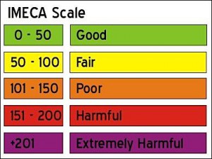
The IMECA scale for urban air quality

The IMECA scale for urban air quality

Air quality still exceeds environmental norms in Mexico City many days each year, but far fewer than during the late 1980s and early 1990s when air pollution was at its peak. Even low-level ozone measurements are showing improvement. Ironically, ozone in the lower atmosphere rose immediately after the introduction of a new unleaded gasoline, designed to  ensure that the major source of brain-damaging lead pollution was removed. The new gasoline, it emerged, simply traded one serious pollutant for another.

Latest pollution values for Mexico City.

Mexico’s other big cities still face enormous challenges with regards to air pollution. Monterrey’s air regularly has very high concentrations of microparticulates (PM10); the levels now exceed Mexico City’s peak readings from twenty years ago.  The air in Guadalajara is improving, but not as rapidly as in Mexico City.

Geo-Mexico: the geography and dynamics of modern Mexico examines the trends in air quality (ozone, microparticulates and carbon monoxide) for Mexico’s three largest cities and also asks whether the air pollution from maquiladora plants in Ciudad Juárez raises public health issues.

Ask your library to buy a copy of this handy reference guide to all aspects of Mexico’s geography today! Better yet, order your own copy…

Previous post on this topic: Mexico City air quality continues to improve

Maternal health in southern Mexico

 Mexico's geography in the Press  Comments Off on Maternal health in southern Mexico
Jul 282010
 

A short piece in The Economist entitled “Maternal Health in Mexico: A perilous journey” (26 June 2010) highlights some of the reasons why maternal mortality has remained stubbornly high in southern Mexico, despite a marked improvement in recent years. Since 1990, maternal mortality (death related to childbearing) has fallen by 36% in Mexico as a whole.
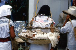
Maternal mortality remains alarmingly high

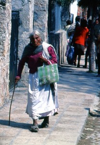
Carrying the future; maternal mortality remains alarmingly high. Photo: Tony Burton. All rights reserved. Click to enlarge.

Any average figure for the whole country disguises enormous regional differences. Rates for the richer inhabitants in the more developed regions in Mexico are comparable to rate in the USA or Canada. However, rates in the impoverished southern states such as Chiapas, Oaxaca and Guerrero are up to 70% higher than the national average.

In the words of the Research for Development blog “In 2005 the maternal mortality rate was 63.4 deaths per 100,000 live births. In the state of Guerrero the rate rose to 128 deaths per 100, 000 live births. Both figures are a long way from Mexico’s commitment under the Millennium Development Goals (MDGs) of 22.3.” Click here to see how well Mexico is doing in meeting other MDGs.

One study found that in the year 2000, only 44.8% of women in Chiapas gave birth with a doctor present; 49.4% did so with midwives, and the remaining 5.8% were attended by family members or give birth alone.

As The Economist article emphasizes, indigenous women are only one-third as likely to survive giving birth as non-indigenous women.

Why is this? What are the key factors preventing lower maternal mortality rates?

The Economist singles out:

  • means of transport – lack of a car means a total reliance on public transport. Public transport is poor in many remote areas
  • poor roads – many rural roads are unpaved, and the terrain in much of Mexico means than travel times are often much longer than might be expected
  • the expense of the hospital tests and medical supplies which can save a mother’s life
  • errors in delivery care or hospital procedures – according to The Economist, “40% of urban maternal deaths are caused by using the wrong medicine, by botched surgery or by other forms of malpractice.”
  • reluctance to see a male doctor (for social or cultural reasons)
  • language issues – many indigenous women do not speak Spanish at all well, if at all, and very few doctors have any knowledge of indigenous languages, so communication is often poor

What is needed to reduce maternal mortality rates? Understandably, The Economist focuses its attention on financial or economic solutions. More money is needed, it argues, for “midwifes and contraceptives.” It reports that increased funds are coming from a variety of sources, including the Spanish government, Carlos Slim (the Mexican entrepreneur who is the world’s richest man) and from the Bill and Melinda Gates Foundation. Between them, they have announced plans to spend 150 million dollars “on health care for the poor in Central America and southern Mexico”.

In addition, the article calls for investment in “infrastructure, health and education”, making the claim that investment in these areas would help the south catch up with the rest of the country.

We consider this analysis of possible remedies for the problem to be incomplete. The political will to continue making investments in health care installations and personnel over the long-term requires, in our opinion, a significant shift in attitudes among the wealthier and more influential sectors of Mexican society.

At present most members of the wealthy elite regard indigenous Mexicans as second class citizens.

At the time of the Chiapas uprising in 1994, for example, a subset of well-educated Mexicans called on the government to resolve the problems the nation faced in southern Mexico once and for all by using maximum force to re-establish complete military control over the area. Fortunately, the government of the day did not follow their advice but opted for alternative approaches such as dialogue.

Mexico’s indigenous peoples are rarely shown on TV or in advertisements. Instead, most firms prefer to picture blond, blue-eyed mestizos. Alongside increased financial investment in the south, a massive shift in public perception is required. For everyone’s sake, let us hope that this can be achieved with a minimum of turmoil.

Mexico’s government has to make tough choices about how far the national budget can stretch, and which things should be prioritized. Decisions are often based on political expediency as much as on the nation’s pressing development needs. Indigenous peoples are not well represented in federal government.

At present, the best-trained physicians and nurses aspire to work in the world class medical facilities in Mexico’s major cities. Health care workers in Mexico’s remote areas are often there only to fulfill the social service requirements for their professional qualification; they perform valuable work, but certainly have no long-term commitment to these regions. In the words of a MacArthur Foundation researcher (quoted in “Evaluation of The MacArthur Foundation’s Work in Mexico to Reduce Maternal Mortality, 2002-2008”) , qualified doctors (residents) “see their work as a big favor they do for the community, rather than understanding that indigenous populations in our country also have a right to health.”

We believe that a change in how society perceives indigenous peoples is a fundamental prerequisite for genuine long-term change, particularly in states such as Chiapas and Oaxaca.

Mexico’s indigenous populations, and the disparities in wealth and opportunity they face, are analyzed in chapters 10 and 29 of Geo-Mexico: the geography and dynamics of modern Mexico. Ask your local or university library to buy a copy today!!
Narco-related killings in Mexico, 2006-2010

 Mexico's geography in the Press, Updates to Geo-Mexico  Comments Off on Narco-related killings in Mexico, 2006-2010
Jul 162010
 

The alarming situation in Mexico with regard to drug-related violence has led the Wall Street Journal to prepare an interesting interactive graphic.

The graphic shows narco-related killings from 2006 to 2010. The slider allows you to see the pattern for each year. Hovering over the proportional circles used to represent the deaths in each state brings up the exact number.

While drug-related violence is not new, it is clearly intensifying and now affecting areas of the country where it was traditionally very rare.

Chapter 20 of Geo-Mexico: the geography and dynamics of modern Mexico includes a brief section about the geography of drug trafficking. It focuses mainly on the spatial changes in supply systems. Buy your copy today, so you have this handy reference guide to all aspects of Mexico’s geography available whenever you need it.

How many hurricanes are likely in the 2010 Atlantic hurricane season?

 Mexico's geography in the Press, Updates to Geo-Mexico  Comments Off on How many hurricanes are likely in the 2010 Atlantic hurricane season?
Jul 012010
 

Philip Klotzbach and William Gray, of Colorado State University, have analyzed the atmospheric and oceanic conditions in the Atlantic immediately prior to the 2010 hurricane season. They conclude that this season’s hurricane activity in the Atlantic is likely to be stronger than has been the norm during the past 50 years. They predict that the Atlantic season will see 18 named storms, of which 8 will be classed as tropical storms, 5 as moderate hurricanes (1 or 2 on the Saffir-Simpson scale), and 5 as severe hurricanes (3, 4 or 5 on the Saffir-Simpson scale).

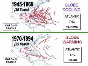
The popular press regularly warns us that on-going global warming will increase the frequency of hurricanes, and their intensity, allegedly due to warmer sea-surface temperatures in the mid-ocean hurricane-spawning areas. Klotzbach and Gray do not believe this. They studied the paths of all severe hurricanes (category 3, 4 or 5) for the fifty years from 1945-1994, dividing this time frame into two 25-year periods (see image).

Tracks of severe Atlantic hurricanes, 1945-1994

Tracks of severe Atlantic hurricanes, 1945-1994. Source: Klotzbach and Gray, 2010. Link to original article at end of this post. Click image to enlarge.

From 1945-1969 was a period of weak global cooling. There were 80 severe hurricanes in this period, some of them taking very erratic paths, with correspondingly dramatic impacts when they struck areas wholly unprepared.

Between 1970 and 1994, the Earth’s temperatures underwent a modest rise (global warming). However, in stark contrast to popular belief, far fewer severe hurricanes occurred during this period (38 in total), and they tended to follow entirely predictable paths.

Clearly the science behind hurricane formation is more complicated than some journalists would have us believe!

Klotzbach and Gray demonstrate the importance of the Thermohaline Circulation (THC) in the Atlantic. The THC is a large-scale circulation in the Atlantic Ocean that is driven by fluctuations in salinity and temperature. The 1945-1969 period coincided with a strong THC, whereas the 1970-1994 period was a time when the THC was weak.

What has happened since 1994? In the fifteen years from 1995-2009 inclusive, the THC was strong, and there were 56 severe Atlantic hurricanes. By comparison, in the preceding fifteen years from 1980-1994, when the THC was weak, only 22 severe hurricanes formed. So it appears that hurricane frequency is not linked to global warming or carbon dioxide (CO2) levels in the atmosphere, but to cyclical changes in the THC.

How accurate are the predictions for the 2010 hurricane season? Only time will tell…

Click here for Klotzbach and Gray’s original article (pdf).

Hurricane warnings in Mexico are the responsibility of the National Meteorological Service (NMS). The NMS also provides an archive of information about past hurricanes.

Hurricanes and other climatological phenomena are analyzed in chapters 4 and 7 of Geo-Mexico: the geography and dynamics of modern Mexico. Buy your copy today, so you have a handy reference guide available whenever you need it.

Baja earthquake moved part of California

 Maps, Mexico's geography in the Press  Comments Off on Baja earthquake moved part of California
Jun 242010
 

The 4/4/2010 (Easter Sunday) earthquake centered in Baja California really did not only shake the earth but also move it. What is even more amazing is that this may be one of the best documented examples of an earthquake in one country moving parts of a neighboring country.

UAVSAR interferogram of Calexico region

UAVSAR interferogram of Calexico region. Credit: NASA/JPL

NASA has released data showing that the 4/4/2010 earthquake in Baja California moved the border city of Calexico in California. According to NASA’s analysis of radar data from research flights, the April earthquake moved the Calexico region as much as 0.8 meters (2.5 feet) towards the south.

Further south, in Baja California, some parts of the ground moved up to 3 meters (10 feet).

For a full explanation of the image, which shows an area about 20km east-west, by 15 km north-south, please refer to the original article.

Earlier post on 4/4/2010 earthquake: 7.2 magnitude earthquake strikes Baja California (4 April 2010)

Other cities have also been moved by earthquakes. For instance, in the magnitude-8.8 Chilean earthquake of 27 February 2010 , the city of Concepción in Chile was displaced a whopping 3 meters (10 feet) west of its original position.

Jun 162010
 

Thousands of dinosaur bones have been found in northern Mexico.

Bones literally litter the ground. Here’s a femur; there’s a tibia; vertebrae, ribs, skulls…

Dozens of dinosaurs have been unearthed in a broad belt across northern Mexico, from Baja California and Sonora in the west, through Chihuahua, and Coahuila to Nuevo León and Tamaulipas in the east. Dinosaurs lived from around 230 to 65 millions years ago. Most of the dinosaurs dug up in northern states date back about 70 million years, though those found in the Huizachal canyon in Tamaulipas include the oldest known dinosaur bones in Mexico, from the Jurassic period 180 million years ago.

Earlier this year, the discovery of a new species of dinosaur, Coahuilaceratops magnacuerna, was reported from Coahuila. It is 6.7 meters long, 1.8 meters tall, and weighed 4.5 tonnes, with two 1.2-meter-long horns, longer than any other dinosaur.

Dinosaur area in Coahuila

There are two prime locations for dinosaurs in the state of Coahuila in northern Mexico. It is hard to imagine today, but millions of years ago the southern part of the state was a vast river delta bordering the ocean. It appears that literally hundreds of dinosaurs floundered in the mud while trying to forage for food. Conditions changed and fossilization preserved the remains of these beasts for prosperity.

Coahuila’s most famous dinosaur was discovered at Presa San Antonio, some seventy kilometers west of the state capital Saltillo. Between 1988 and 1992, excavations on ejido land, led by Dr. René Hernández of the National University (UNAM), succeeded in recovering more than 70% of the bones of a herbivorous Kritosaurus.

The world’s cheapest dinosaur

When reassembled, the creature was 7 meters (23 feet) long and stood 3.8 meters (12.5 feet) tall. It also became the cheapest dinosaur in the world. Excluding Dr. Hernandez’s salary, its excavation cost just 15,000 pesos, equivalent at the time to 5,000 dollars. Making a replica for the Institute of Geology Museum in Mexico City cost a whopping 40,000 pesos. The replica (218 bones) is named “Isauria”, apparently because one of the first high school students to view it was overheard to say that it looked just like Isaura, one of their fellow students!

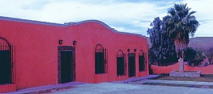
The second location is even closer to Saltillo. The Rincón Colorado ejido is 43.5 kilometers west of the state capital along federal highway 40, the road to Torreón. Here, a small village, located three kilometers north of the road, boasts Mexico’s only “on-site” paleontology museum, complete with lots of dinosaur bones and imprints.

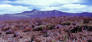
The displays in the Rincón Colorado museum reveal the wide diversity of fauna that once thrived in this area, including fish, turtles, crocodiles, sharks, bivalves, gastropods, ammonites as well as a considerable variety of flora, as shown by tell-tale signs of at least nine different kinds of fruit. Today’s vegetation is much less varied, consisting primarily of plants like agaves, prickly pear cacti, creosote bushes and acacias that can survive in the harsh semi-arid conditions.

Dinosaur museum in Coahuila

Visitors to the museum can also obtain permission to visit the dinosaur dig, located a short distance away on arid, red-tinted, scrub-covered hillsides, one of which, formerly called Cerro de la Virgen, is now known as Cerro de los Dinosaurios. Bones litter the ground, and more than 20 dinosaurs, dating from the Late Cretaceous period, have so far been found in an area of 25 square kilometers. They include specimens of duck-billed hadrosaurs, one of which still sports its toenails, horned ceratopids (three rhinoceros-like horns on the head), carnivorous tyrannosaurids and dromaeosaurids. One triceratopid still had some skin attached to its bones, making it a very rare find. Hadrosaurs are particularly common and may have been amphibious.

See also:

  • Dinosaur Bones in Mexico on MexConnect.
  • Fosiles de Dinosaurios en Coahuila. Gobierno de Coahuila (SEPC) (no date)
  • Hernández H., René Dinosaurios. Gobierno de Coahuila (SEPC) (no date)

Is the BP Deepwater Horizon accident the biggest Gulf of Mexico oil spill in history?

 Mexico's geography in the Press  Comments Off on Is the BP Deepwater Horizon accident the biggest Gulf of Mexico oil spill in history?
Jun 042010
 

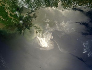
Judging from the recent coverage in the US and world media, most people would immediately respond “Yes!”, citing the current BP spill resulting from the April 20 explosion of the Deepwater Horizon offshore rig.

Ixtoc-1 blow out

However, at present this would not be the correct answer.  The largest oil spill in the Gulf of Mexico followed the June 3, 1979 blowout from the PEMEX Ixtoc I exploratory well in the southern part of the Gulf of Mexico 100 kilometers from the Campeche Coast. Though the well was in only 160 feet of water, the leak was very difficult to plug.  The flow started at an estimated 30,000 barrels a day (b/d); but was reduced in July by pumping mud into the well.  In August PEMEX pushed steel, iron and lead balls into the well to further reduce the flow.  Though PEMEX drilled two relief wells to reduce the pressure, the leak continued for 295 days until March 23, 1980.  An estimated total of 140 million gallons oil escaped making the Ixtoc I the largest oceanic accidental oil spill in history.

The next largest accidental oceanic spill was that same year when in July, 1979 the two tankers, the Atlantic Empress and the Aegean Capitan, collided off Trinidad and spilled about 90 million gallons.  The largest oil spill ever was during the Gulf War Gulf when the Iraqi Army intentionally sabotaged the oil fields in 1991 spilling about 525 million gallons.  The second largest was the Lakeview Gusher which occurred on land near Bakersfield, California in 1909 and spilled an estimated 370 million gallons.

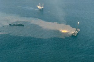
BP oil spill approaches the US coast

The current BP leak south of Louisiana spilled an estimated 19 to 39 million gallons during its first six weeks.  At this rate, it could surpass the Ixtoc I spill between by September or October.  Everyone hopes that the leak is stopped long before then…

Update (16 July 2010). BP has capped the well, and no more oil is leaking into the ocean. The total volume of oil that has already spilled from the BP well is estimated at between 90 and 180 million gallons, comparable to, and possibly even exceeding, the Ixtoc I spill.

Update (16 August 2010). A team of US scientists now estimates that BP’s Macondo oil well, which exploded on 20  April 2010 spewed 170 million gallons of crude into the Gulf of Mexico during the 87 days before 15 July, when it was  finally capped. A further 34 million gallons of oil were captured by BP during efforts to cap the well. This makes the BP disaster the world’s largest accidental offshore oil spill ever.

More details? Wikipedia’s extensive account of the Deepwater Horizon oil spill.

A summary of population trends in Mexico

 Mexico's geography in the Press  Comments Off on A summary of population trends in Mexico
May 262010
 

The Economist issue of April 24-30 had an interesting article entitled “Mexico’s population, when the niños run out. A falling birth rate and what it means.” Here are some of the figures quoted in that article:

Mexico's population is aging rapidly

Children per woman of child-bearing age.

  • 1960s: almost 7
  • today: just over 2 (about the same as the USA)

Average age

  • 1980: 17 years
  • 2010: 28 years (1 in 10 of the total population is aged 60 or older)

As the article emphasizes, in Mexico the trend towards an aging population “which took a century in Europe, has happened in three decades”. This trend has many implications for the provision of health care, social security and pensions. Such a rapid change towards an older population may also have a considerable impact on the rates of migration between Mexico and the USA.

The geography of Mexico’s population is analyzed in chapters 8 and 9 of Geo-Mexico: the geographyand dynamics of modern Mexico. Buy your copy today!

The pros and cons of bottled water

 Mexico's geography in the Press  Comments Off on The pros and cons of bottled water
May 252010
 

Mexico has overtaken Italy to become the world’s largest consumer of bottled water and now accounts for 13% of all the bottled water sold worldwide.

The latest report of the Beverage Marketing Corporation puts the per person consumption of bottled water in Mexico at 234 liters a year. The equivalent figures for Italy, Spain and the USA are 191 liters, 119 liters and 110 liters respectively.

Aided by massive advertising campaigns and concerns about drinking water quality, the consumption of bottled water in Mexico has risen 8.1 % a year since 2004.

The Environment Secretariat insists that 85% of public water supplies exceed the minimum standards for drinking water, but sales of bottled water now top 26.032 million liters a year, 70% in large bottles (known as garrafones) and 30% in individual plastic bottles.

This has dire consequences for household budgets and for the environment. In 2009, 21.3 million PET (hard plastic) bottles were discarded daily; only 20% of them are recycled.

The two major bottlers of water are Coca-Cola and Pepsi, whose combined concessions for water top 37 million cubic meters a year, equivalent to the combined capacity of Mexico’s four largest man-made reservoirs, or to more than four times the capacity of Lake Chapala, Mexico’s largest natural lake.

Water and water-related issues are discussed in chapters 6 and 7 of Geo-Mexico: the geography and dynamics of modern Mexico.

Mexico’s national interests in the fight against drugs

 Mexico's geography in the Press  Comments Off on Mexico’s national interests in the fight against drugs
May 062010
 

The following paragraphs come from a Stratfor Geopolitical Intelligence Report about Mexico’s fight against the drug cartels, Mexico and the Failed State Revisited, by George Friedman, published on 6 April 2010. The link above is to the full text of the report.

The Drug War and Mexican National Interests

From Mexico’s point of view, interrupting the flow of drugs to the United States is not clearly in the national interest or in that of the economic elite. Observers often dwell on the warfare between smuggling organizations in the northern borderland but rarely on the flow of American money into Mexico. Certainly, that money could corrupt the Mexican state, but it also behaves as money does. It is accumulated and invested, where it generates wealth and jobs.

For the Mexican government to become willing to shut off this flow of money, the violence would have to become far more geographically widespread. And given the difficulty of ending the traffic anyway — and that many in the state security and military apparatus benefit from it — an obvious conclusion can be drawn: Namely, it is difficult to foresee scenarios in which the Mexican government could or would stop the drug trade. Instead, Mexico will accept both the pain and the benefits of the drug trade.

Mexico’s policy is consistent: It makes every effort to appear to be stopping the drug trade so that it will not be accused of supporting it. The government does not object to disrupting one or more of the smuggling groups, so long as the aggregate inflow of cash does not materially decline. It demonstrates to the United States efforts (albeit inadequate) to tackle the trade, while pointing out very real problems with its military and security apparatus and with its officials in Mexico City. It simultaneously points to the United States as the cause of the problem, given Washington’s failure to control demand or to reduce prices by legalization. And if massive amounts of money pour into Mexico as a result of this U.S. failure, Mexico is not going to refuse it.

The problem with the Mexican military or police is not lack of training or equipment. It is not a lack of leadership. These may be problems, but they are only problems if they interfere with implementing Mexican national policy. The problem is that these forces are personally unmotivated to take the risks needed to be effective because they benefit more from being ineffective. This isn’t incompetence but a rational national policy.

Moreover, Mexico has deep historic grievances toward the United States dating back to the Mexican-American War. These have been exacerbated by U.S. immigration policy that the Mexicans see both as insulting and as a threat to their policy of exporting surplus labor north. There is thus no desire to solve the Americans’ problem. Certainly, there are individuals in the Mexican government who wish to stop the smuggling and the inflow of billions of dollars. They will try. But they will not succeed, as too much is at stake. One must ignore public statements and earnest private assurances and instead observe the facts on the ground to understand what’s really going on.

“This report is republished with permission of STRATFOR” © Copyright 2010 STRATFOR.

An overview of the geography of drug trafficking in Mexico forms part of chapter 20 of Geo-Mexico: the geography and dynamics of modern Mexico. Buy your copy today!

Related articles in this mini-series:

The economic benefits to Mexico of the drugs trade

 Mexico's geography in the Press  Comments Off on The economic benefits to Mexico of the drugs trade
May 032010
 

The economics of the drug trade

The amount of money pouring into Mexico annually is stunning. It is estimated to be about $35 billion to $40 billion each year. The massive profit margins involved make these sums even more significant. Assume that the manufacturing sector produces revenues of $40 billion a year through exports. Assuming a generous 10 percent profit margin, actual profits would be $4 billion a year. In the case of narcotics, however, profit margins are conservatively estimated to stand at around 80 percent. The net from $40 billion would be $32 billion; to produce equivalent income in manufacturing, exports would have to total $320 billion.

In estimating the impact of drug money on Mexico, it must therefore be borne in mind that drugs cannot be compared to any conventional export. The drug trade’s tremendously high profit margins mean its total impact on Mexico vastly outstrips even the estimated total sales, even if the margins shifted substantially.

On the whole, Mexico is a tremendous beneficiary of the drug trade. Even if some of the profits are invested overseas, the pool of remaining money flowing into Mexico creates tremendous liquidity in the Mexican economy at a time of global recession. It is difficult to trace where the drug money is going, which follows from its illegality. Certainly, drug dealers would want their money in a jurisdiction where it could not be easily seized even if tracked. U.S. asset seizure laws for drug trafficking make the United States an unlikely haven. Though money clearly flows out of Mexico, the ability of the smugglers to influence the behavior of the Mexican government by investing some of it makes Mexico a likely destination for a substantial portion of such funds.

The money does not, however, flow back into the hands of the gunmen shooting it out on the border; even their bosses couldn’t manage funds of that magnitude. And while money can be — and often is — baled up and hidden, the value of money is in its use. As with illegal money everywhere, the goal is to wash it and invest it in legitimate enterprises where it can produce more money. That means it has to enter the economy through legitimate institutions — banks and other financial entities — and then be redeployed into the economy. This is no different from the American Mafia’s practice during and after Prohibition.

The paragraphs above are taken from a Stratfor Geopolitical Intelligence Report about Mexico’s fight against the drug cartels, Mexico and the Failed State Revisited, by George Friedman, published on 6 April 2010.

“This report is republished with permission of STRATFOR” © Copyright 2010 STRATFOR.

An overview of the geography of drug trafficking in Mexico forms part of chapter 20 of Geo-Mexico: the geography and dynamics of modern Mexico. Buy your copy today!

Related articles in this mini-series:

Mexico’s export trade in drugs

 Mexico's geography in the Press  Comments Off on Mexico’s export trade in drugs
Apr 282010
 

These paragraphs come from a Stratfor Global Security and Intelligence Report by Fred Burton and Ben West, When the Mexican Drug Trade Hits the Border, published 15 April 2009 (republished with permission of STRATFOR).

Though the drug trade as a whole is highly complex, the underlying concept is as simple as getting narcotics from South America to the consuming markets — chief among them the United States, which is the world’s largest drug market. Traffickers use Central America and Mexico as a pipeline to move their goods north. The objective of the Latin American smuggler is to get as much tonnage as possible from Colombia, Peru and Bolivia to the lucrative American market and avoid interdictions by authorities along the way.

However, as narcotic shipments near the U.S.-Mexican border, wholesale trafficking turns into the more micro process of retail distribution. In southern Mexico, drug traffickers move product north in bulk, but as shipments cross the U.S. border, wholesale shipments are broken down into smaller parcels in order to hedge against interdiction and prepare the product for the end user. One way to think about the difference in tactics between trafficking drugs in Central America and Mexico and distributing drugs in the United States is to imagine a company like UPS or FedEx. Shipping air cargo from, say, New York to Los Angeles requires different resources than delivering packages to individual homes in southern California. Several tons of freight from the New York area can be quickly flown to the Los Angeles area. But as the cargo gets closer to its final destination, it is broken up into smaller loads that are shipped via tractor trailer to distribution centers around the region, and finally divided further into discrete packages carried in parcel trucks to individual homes.

As products move through the supply chain, they require more specific handling and detailed knowledge of an area, which requires more manpower. The same, more or less, can be said for drug shipments. This can be seen in interdiction reports. When narcotics are intercepted traversing South America into Mexico, they can be measured in tons; as they cross the border into the United States, seizures are reported in kilograms; and by the time products are picked up on the streets of U.S. cities, the narcotics have been divided into packages measured in grams. To reflect this difference, we will refer to the movement of drugs south of the border as trafficking and the movement of drugs north of the border as distributing.

As narcotics approach the border, law enforcement scrutiny and the risk of interdiction also increase, so drug traffickers have to be creative when it comes to moving their products. The constant game of cat-and-mouse makes drug trafficking a very dynamic business, with tactics and specific routes constantly changing to take advantage of any angle that presents itself.

The only certainties are that drugs and people will move from south to north, and that money and weapons will move from north to south. But the specific nature and corridors of those movements are constantly in flux as traffickers innovate in their attempts to stay ahead of the police in a very Darwinian environment. The traffickers employ all forms of movement imaginable, including:

  • Tunneling under border fences into safe houses on the U.S. side.
  • Traversing the desert on foot with 50-pound packs of narcotics. (Dirt bikes, ATVs and pack mules are also used.)
  • Driving across the border by fording the Rio Grande, using ramps to get over fences, cutting through fences or driving through open areas.
  • Using densely vegetated portions of the riverbank as dead drops.
  • Floating narcotics across isolated stretches of the river.
  • Flying small aircraft near the ground to avoid radar.
  • Concealing narcotics in private vehicles, personal possessions and in or on the bodies of persons who are crossing legally at ports of entry.
  • Bribing border officials in order to pass through checkpoints.
  • Hiding narcotics on cross-border trains.
  • Hiding narcotics in tractor trailers carrying otherwise legitimate loads.
  • Using boats along the Gulf coast.
  • Using human “mules” to smuggle narcotics aboard commercial aircraft in their luggage or bodies.
  • Shipping narcotics via mail or parcel service.

These methods are not mutually exclusive, and organizations may use any combination at the same time. New ways to move the product are constantly emerging.

“This report is republished with permission of STRATFOR” © Copyright 2010 STRATFOR.

An overview of the geography of drug trafficking in Mexico forms part of chapter 20 of Geo-Mexico: the geography and dynamics of modern Mexico. Buy your copy today!

Related articles in this mini-series:

The geography of drug trafficking in Mexico

 Maps, Mexico's geography in the Press  Comments Off on The geography of drug trafficking in Mexico
Apr 242010
 

This article dates back to 2010. For updates, see:

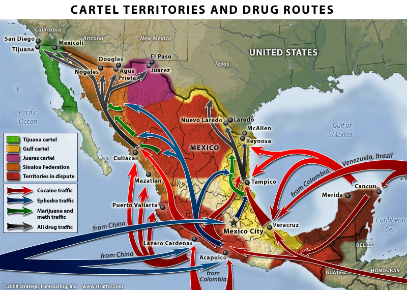
This map of drug cartel territories and drug trafficking and export routes comes from a Stratfor Global Security and Intelligence Report by Fred Burton and Ben West, When the Mexican Drug Trade Hits the Border, published 15 April 2009.

Map of Cartel Territories. Copyright Stratfor. Click map for enlarged version.

Click here to see map in its original context. Map © Copyright 2008 Strategic Forecasting Inc, STRATFOR www.stratfor.com. This map is republished with permission of STRATFOR.

The map shows the major routes for Mexico’s imports, transport and exports of drugs.  The boundaries between cartel territories are in a constant state of flux as rival cartels fight to enlarge their territories.

Perhaps the single biggest shift in the geography of drug trafficking in Mexico in recent decades has been that involving drugs originating in Colombia. Prior to the 1980s, Colombian drugs reached the US and Canada either direct or via the Caribbean. During the 1980s, as US pressure mounted on these routes, Colombian cartels shifted their supply routes to Mexico, where they needed the help of Mexican gangs. These gangs rapidly became better organized and have become the powerful Mexican cartels operating today.

Mexico’s on-going “war” against drugs cartels has had most success so far against the Gulf cartel and the Zetas, who started life as the enforcing arm of the Gulf cartel. On the other hand, the influence of the Sinaloa cartel appears to be spreading. For an analysis of the Gulf cartel, including the effects of globalization on its operations, see Stephanie Brophy’s “Mexico Cartels, corruption and cocaine: A profile of the Gulf cartel” (Global Crime, vol. 9, #3, August 2008, pp 248-261)

This article dates back to 2010. For updates, see:

An overview of the geography of drug trafficking in Mexico forms part of chapter 20 of Geo-Mexico: the geography and dynamics of modern Mexico. Buy your copy today!

Related articles in this mini-series:

Medical tourism in Mexico, and where the Maya live

 Mexico's geography in the Press  Comments Off on Medical tourism in Mexico, and where the Maya live
Apr 222010
 

A few months ago, English journalist Rachel Rickard Straus wrote an article entitled “How I swapped a medical trial for a free holiday in Mexico” and published on the telegraph.co.uk website.

This is an interesting variation on the increasingly important field of medical tourism, much studied by geographers over the past decade or so. Several forms of medical tourism have been important in Mexico for a long time, mainly because of the significant price differential either side of the USA-Mexico border for almost all medical and dental procedures. Guadalajara was one of several cities where Americans could afford cosmetic surgery at the hands of (often) American-trained experts at a fraction of the cost back home, and were able to recuperate in relative luxury away from the preying eyes of family and colleagues.

Ms Straus appears to have thoroughly enjoyed her free holiday and apparently suffered no ill effects from the medical trial. Or did she?

Her article describes how she “lapped up the Mexican sunshine, admired the incredible Mayan pyramids and even took a road trip to San Miguel de Allende, a world heritage site.” This is fairly remarkable, since she managed all this without even leaving central Mexico! Presumably she actually meant either Aztec pyramids (if she visited El Templo Mayor in downtown Mexico City) or, much more likely the Teotihuacan pyramids, where Ms Straus had her picture taken. Archaeologists do not know all that much about the people who built the Teotihuacan pyramids, who are usually called simply Teotihuacanos. As any Mexican 5th grader knows, the Maya built their pyramids far to the east, in and around the Yucatán Peninsula, where sites such as Uxmal, Chichen Itza, Palenque, Calakmul and Tulum, among dozens of others, are proof of the Maya’s very considerable architectural skills.

The background to Mexico’s fight against the drug cartels

 Mexico's geography in the Press  Comments Off on The background to Mexico’s fight against the drug cartels
Apr 202010
 

The following paragraphs come from a Stratfor Geopolitical Intelligence Report about Mexico’s fight against the drug cartels, Mexico and the Failed State Revisited, by George Friedman, published on 6 April 2010. The link above is to the full text of the report.

Mexico’s Core Problem

Let’s begin by understanding the core problem. The United States consumes vast amounts of narcotics, which, while illegal there, make their way in abundance. Narcotics derive from low-cost agricultural products that become consumable with minimal processing. With its long, shared border with the United States, Mexico has become a major grower, processor and exporter of narcotics. Because the drugs are illegal and thus outside normal market processes, their price is determined by their illegality rather than by the cost of production. This means extraordinary profits can be made by moving narcotics from the Mexican side of the border to markets on the other side.

Whoever controls the supply chain from the fields to the processing facilities and, above all, across the border, will make enormous amounts of money. Various Mexican organizations — labeled cartels, although they do not truly function as such, since real cartels involve at least a degree of cooperation among producers, not open warfare — vie for this business. These are competing businesses, each with its own competing supply chain.

Typically, competition among businesses involves lowering prices and increasing quality. This would produce small, incremental shifts in profits on the whole while dramatically reducing prices. An increased market share would compensate for lower prices. Similarly, lawsuits are the normal solution to unfair competition. But neither is the case with regard to illegal goods.

The surest way to increase smuggling profits is not through market mechanisms but by taking over competitors’ supply chains. Given the profit margins involved, persons wanting to control drug supply chains would be irrational to buy, since the lower-cost solution would be to take control of these supply chains by force. Thus, each smuggling organization has an attached paramilitary organization designed to protect its own supply chain and to seize its competitors’ supply chains.

The result is ongoing warfare between competing organizations. Given the amount of money being made in delivering their product to American cities, these paramilitary organizations are well-armed, well-led and well-motivated. Membership in such paramilitary groups offers impoverished young men extraordinary opportunities for making money, far greater than would be available to them in legitimate activities.

The raging war in Mexico derives logically from the existence of markets for narcotics in the United States; the low cost of the materials and processes required to produce these products; and the extraordinarily favorable economics of moving narcotics across the border. This warfare is concentrated on the Mexican side of the border. But from the Mexican point of view, this warfare does not fundamentally threaten Mexico’s interests.

(to be continued) “This report is republished with permission of STRATFOR” © Copyright 2010 STRATFOR.

An overview of the geography of drug trafficking in Mexico forms part of chapter 20 of Geo-Mexico: the geography and dynamics of modern Mexico. Buy your copy today!

The least cost business location

 Mexico's geography in the Press  Comments Off on The least cost business location
Apr 152010
 

This table shows the cost of doing business in 10 countries, according to the latest (2010) KPMG guide “Competitive Alternatives” which compares business costs for more than 100 cities. The study uses a compound index of business costs, which includes 26 significant cost components, as well as a variety of non-cost factors such as labor availability and skills, economic conditions and markets, innovation, infrastructure and regulatory environment. It also incorporates personal cost of living and quality of life. The baseline for the scores is the USA which is given an arbitrary score of 100.0.

CountryCost of doing business
(USA = 100)
Mexico81.8
Canada95.0
Netherlands96.5
Australia97.8
UK98.2
France98.3
Italy100.0
USA100.0
Germany102.6
Japan107.6

Mexico clearly offers the lowest cost for business of the 10 countries studied by KMPG with a business cost advantage over the USA of 18.2%.

In fact, in terms of the individual cities studied, Monterrey placed 1st as the most cost-efficient business location (18.5% less expensive than the average of the four largest USA cities—New York, Los Angeles, Chicago and Dallas-Fort Worth), while Mexico City placed 2nd (17.9% less expensive). 3rd place on the list was taken by the Canadian city of Montreal, 4th by Manchester (UK). Vancouver and Toronto occupied 5th and 6th, followed by the least expensive US location for business, Tampa.

Click here for the full report

Mexico, Manchester United, and a new soccer stadium in Guadalajara

 Mexico's geography in the Press  Comments Off on Mexico, Manchester United, and a new soccer stadium in Guadalajara
Apr 082010
 

The British soccer (fútbol) giants Manchester United have signed their first ever player from Mexico. Javier Hernández—”El Chicharito” (the Little Pea)—is a 21-year-old striker who has already scored four goals for Mexico in just four games, and is expected to play an important part in Mexico’s World Cup bid in South Africa in the summer. So far this season playing for Guadalajara-based Club Deportivo Guadalajara (better known as Chivas) in Mexico’s Primera División, Hernández has scored 10 goals in 11 matches, an outstanding strike rate, making him joint third in the goal-scoring charts.

And the origin of his nickname “El Chicharito”? Apparently, it comes from his father who was also a Chivas and Mexico soccer player, and whose nickname was “El Chicharo” (‘The Pea). Hernández’s grandfather also played for Chivas.

The deal between Manchester United and Chivas is worth about 9 million dollars. It includes an agreement for Manchester United to play Chivas in Guadalajara in July this year in a friendly game to mark the official opening of Chivas’ new 45,000-seat stadium prior to the start of the 2010/11 season. The new stadium is on the western edge of Mexico’s second city, and was designed by French firm Studio Massaud Pouzet and built by HOK (Mexico-USA).

The geography of soccer is increasingly tied to the forces of globalization. We’ll take a more in-depth look at the geography of soccer in Mexico in future posts.

Cuisine has changed as Mexico has experienced a nutrition transition

 Excerpts from Geo-Mexico, Mexico's geography in the Press  Comments Off on Cuisine has changed as Mexico has experienced a nutrition transition
Apr 072010
 

Mexico has passed rapidly through a “nutrition transition”.

Ingredients for guacamole. Photo: Chef Daniel Wheeler. All rights reserved.

The traditional Mexican diet was based on corn and beans, supplemented by fruits and vegetables with relatively little meat and dairy products. Over a 15-year period the average Mexican ate 29% less fruits and vegetables and 6% more carbohydrates while consuming 37% more soft drinks. In fact Mexicans now enjoy the dubious distinction of being the world’s greatest consumers of soft drinks, downing 160 liters a year on average.

White bread is replacing tortillas, fast food is replacing home cooking.

This nutrition transition, together with a more sedentary lifestyle, fueled a “disease transition”, characterized by a shift from high mortality due to infectious diseases to high mortality from non-communicable chronic diseases.

To see how Mexico compares with other countries—USA, Spain, France,  Japan, Russia, Brazil, South Africa, China and India— in terms of eating habits, see this recent graphical comparison:  New York Times Business section article of April 3, 2010, entitled “Factory Food” Mexico’s per person consumption of vegetables is lower than any other country on the chart except South Africa. Mexico’s consumption of “processed, frozen, dried and chilled food, and read-to-eat meals” is lower than any country except China and India, but Mexicans make up for this with a consumption of “bakery goods” that is more than double that of any other country on the chart.

This post includes edited excerpts from chapter 28 of of Geo-Mexico: the geography and dynamics of modern Mexico. Buy your copy today!

Apr 042010
 

Initial reports of the earthquake, which struck at at 15:40 Pacific time, are that the epicenter was about 160 kilometers south-east of Tijuana and that the earthquake occurred at a depth of about 10 kilometers. The shaking was felt in downtown Los Angeles.

Press  reports confirm two fatalities and 100 people injured, as well as considerable damage to some buildings in Mexicali. More than 5000 homes in the rural areas south of Mexicali have been badly damaged. About 25,000 people have received emergency shelter and food and other assistance.

Press reports (latest at the top):

Millions in California, Arizona feel 7.2 quake (AP)

Telegraph.co.uk article about the earthquake

Damage reported from Mexicali – LA Times blog

USGS data on earthquake

USGS – Community earthquake intensity map

Tourism based on major events in Mexico (“concert tourism”)

 Mexico's geography in the Press, Teaching ideas  Comments Off on Tourism based on major events in Mexico (“concert tourism”)
Apr 042010
 

The recent (2010) Elton John concert at Chichen Itza provides an ideal case-study for discussion in geography classes. Events such as this concert are a great starting point for a debate about the benefits and drawbacks of using world-famous archaeological or cultural sites as the setting for concerts by major modern international music stars.

Benefits:

  • $$$ paid directly by event organizers
  • $$$ paid by visiting concert-goers (“concert tourists”?) for hotels, food and transportation
  • free promotion for the site in world press and media

Drawbacks:

  • shows little respect for indigenous (Mayan) culture; the Maya consider the site a ceremonial center
  • many of the $$$ end up outside Mexico in the main offices of multi-national hotel chains and foreign airlines
  • ticket prices of $80—$800 (dollars), which most local residents are unable to afford, make this an elitist event

After those initial suggestions, it’s over to you… Readers are hereby invited to add their own suggestions of other benefits and drawbacks. Please do this via the comments section below this post.  (Click here if the comments section is not currently visible.)

So, what other factors should be taken into account before reaching an evaluation of whether or not such events are a good idea?

What do YOU think?

“La Curva de la Gringa”, the American woman’s curve, a place name in Michoacán, Mexico

 Maps, Mexico's geography in the Press, Other  Comments Off on “La Curva de la Gringa”, the American woman’s curve, a place name in Michoacán, Mexico
Mar 302010
 

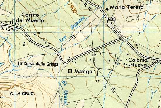
Another interesting example of an unusual place name (following on from an earlier post about unusual place names) is the name “La Curva de la Gringa”, the American woman’s curve.

La Curva de la Gringa is the name of a 90-degree bend near Jungapeo, west of Zitácuaro in the state of Michoacán. Literally translated as “the American woman’s curve”, how did this name come about? The first thing to remember is that all names on maps have to come from somewhere. Detailed maps of Mexico, including the 1:50,000 series, relied initially on aerial (later satellite) imagery, followed by some checking on the ground. Given the expense, ground checking was often relatively limited. However, the on-the-ground surveyors were responsible for adding names to the maps.

La Curva de la Gringa, Michoacán (on Mexico’s 1:50,000 topographic map)

In this case, local informants were apparently unanimous in calling this bend La Curva de la Gringa. Further research shows that this had nothing to do with any purported similarity to the sensuous curve of a gringa‘s breast, but derived from when the road was first paved in the 1950s. Apparently, shortly after the road was finished, an American lady driving her oversized gas-guzzler down to the luxury spa of San José Purua completely missed this bend, and plowed into a cornfield. The locals have long memories!

In 2010, this road is being widened, and sidewalks and street lights installed, all the way from Federal Highway 15 (see map), past La Curva de la Gringa, and as far as the money allocated (currently about 7 million pesos) allows. The first section was due to be inaugurated 21 March 2010. If anyone has an update, please leave a comment. Here’s hoping that no more accidents ever occur along this stretch of road, and that no future place names ever reflect such unfortunate incidents.

Oil in the Gulf of Mexico (Canwest headline writers take note).

 Mexico's geography in the Press  Comments Off on Oil in the Gulf of Mexico (Canwest headline writers take note).
Mar 262010
 

Inaccuracies involving Mexico occur all too frequently in the press. This is the first of an occasional series recording such Mexico-related imprecisions.

Canwest News Service claims to be “the best source in Canada for editorial content because we have more journalists than any other organization.” Maybe its journalists are better than its headline writers.

The evidence? Canwest’s report (20 March 2010) about a recent oil discovery by Shell in the Gulf of Mexico, headlined Mexican oil find ‘significant’. Apparently, Canwest’s headline writers do not realize that much of the Gulf of Mexico is not actually Mexican. A more accurate title for the Canwest story would have been US oil find ‘significant‘.

The USA and Mexico share the Gulf, with periodic arguments about the precise offshore limits of each country’s jurisdiction. A few years ago, it was alleged, probably without foundation, that the USA was already  “sucking the oil” out from joint oil fields that straddled the divide.

What is certain is that the USA has encouraged the development of oil fields in relatively deep water (more than 500 meters deep or 1,640 feet) in the Gulf, which require advanced deep-water drilling techniques, and the expertise of Shell and other multinational oil firms.

However, in Mexico, all oil exploration in managed by state-owned oil giant Petroleos Mexicanos (Pemex). Mexican experts believe that up to 29.5 billion barrels of oil might reside in Mexico’s share of the Gulf, but Pemex has little to show for 7 years of deep water drilling apart from some relatively minor gas finds.

Only a few days before the Canwest story, though, Pemex did announce two  important new finds in shallow waters in the Gulf of Mexico. Ayatzil-Tekel, found in 2008, holds a total of one billion barrels of proven, probable and potential (3P) reserves of super-heavy crude. Tsimin-Xux, found last year, has a similar amount of super-light crude.

Mexico’s total 3P reserves now stand at about 46 billion barrels, which would last more than 40 years at current rates of extraction.

Mar 242010
 

Update: New Durango-Mazatlán highway officially open (Oct 2013)

Update [October 2012]: Despite earlier claims that the Durango-Mazatlán highway would be completed before the end of 2012, government officials have now confirmed that the highway will not be finished, and will not open, until sometime in 2013.

Update [5 January 2012]:

Original post:

A truly amazing feat of engineering brilliance will force the authors of Geo-Mexico to revise one of their many original maps, when preparing the book’s next edition!

Figure 17.4 of Geo-Mexico is a map using isolines to show the average driving times by road from the city of Durango to everywhere else in Mexico. The map shows that it currently takes about five hours to drive the 312 km from Durango to the Pacific coast resort of Mazatlán, whereas driving south-east for five hours can take you as far as Encarnación de Díaz, 460 km away. The reason for this difference is that the rugged mountains of the Western Sierra Madre separate Durango from Mazatlán, whereas no significant relief obstacles lie between Durango and Encarnación de Díaz.

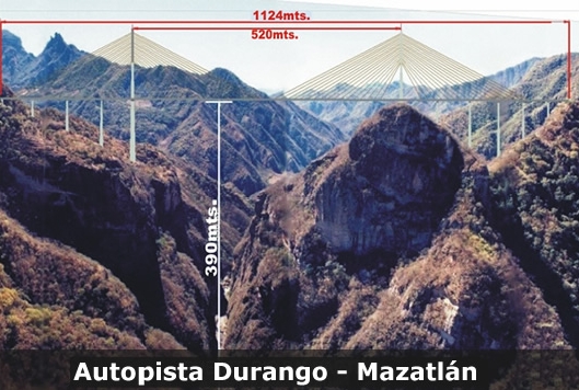
However, this pattern will change significantly once a new 1.2-billion-dollar highway between Durango and Mazatlán is complete. The four-lane, 230-kilometer-long highway is already well advanced; it will greatly reduce the travel time between the two cities. The major ‘missing piece’ remaining to be finished is the Puente Baluarte Bicentenario (Baluarte Bicentennial Bridge).

Puente Baluarte Bicentenario. Photo: TRADECO

This will be the biggest cable-stayed bridge ever built in Latin America. It is 1.124 km long and 4 lanes wide. Its central span extends 520 meters. At its highest point, it is a gravity-defying 390 metres (1280 feet) above the River Baluarte from which it takes its name. The bridge’s largest supporting pillar is 153 meters high, with a base measuring 18 meters by 30 meters.

Construction, by Mexican firm TRADECO, has required 103,000 tons of cement and almost 17,000 tons of steel. The bridge joins the states of Durango and Sinaloa and removes the need for drivers to negotiate a very dangerous stretch of highway known as the Devil’s Backbone.

Meanwhile, the authors of Geo-Mexico are busy preparing a map to show the next best example in Mexico where extreme differences of terrain influence travel times between major cities! Hopefully, the government won’t immediately use the new map in the next edition of Geo-Mexico to decide where to build their next major highway!

Mexico’s North-South economic divide weakens slightly in 2009

 Mexico's geography in the Press, Updates to Geo-Mexico  Comments Off on Mexico’s North-South economic divide weakens slightly in 2009
Mar 222010
 

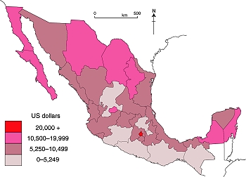
The rapid rates of economic growth in recent decades in the north of Mexico has led to a pronounced economic north-south divide, mapped and analyzed in some detail in chapter 14 of Geo-Mexico: the geography and dynamics of modern Mexico.

GDP/person in Mexico, 2007 (Color version of Fig. 14-3 of Geo-Mexico). All rights reserved.

In 2009, this divide weakened slightly. However, this was not so much a case of the south catching up but more a case of the north stumbling in its progress, due to its heavy reliance on economic ties to the USA.

Northern border states, where manufacturing is important, saw their GDP fall by more than 10% on average during 2009, according to Banamex’s Regional Economic Activity Indicators (Indicadores Regionales de Actividad Económica), published in mid-March. This decline in GDP was accompanied by a fall in employment and also by a significant fall in remittances sent home from Mexican migrant workers in the USA. It should be remembered, however, that these states all experienced marked rises in their GDP in the years immediately prior to the worldwide economic downturn.

No fewer than 29 of Mexico’s 32 states (counting the Federal District as a state for simplicity) saw their GDP decline in 2009. Only 3 states—Zacatecas, Chiapas and Oaxaca—bucked the trend and saw a rise in their GDP in 2009. In the state of Zacatecas GDP grew 1.6% (helped by a resilient construction sector), in Chiapas 1.1% and in Oaxaca 0.8%. It is noteworthy that none of these three states is particularly well integrated into the global economy. As a result, what was happening outside Mexico’s boundaries had little effect on their economic progress.

The list below gives the % change in GDP during 2009 for a sample of states, alongside the national average for comparison:

Zacatecas           + 1/6%
Chiapas               + 1.1%
Oaxaca                + 0.8%

State of México       – 5.6%
Jalisco                     – 6.0%
Federal District       – 6.4%
Querétaro               – 6.3%

National average    – 6.7%

Tamaulipas            – 7.8%
Nuevo León           – 9.3%
Baja California        -10.5%
Chihuahua              -13.6%
Coahuila                -14.4%

Reducing pollution from the making of corn tortillas

 Mexico's geography in the Press  Comments Off on Reducing pollution from the making of corn tortillas
Mar 202010
 

The traditional way of turning corn (maize) into tortillas pollutes large volumes of water and uses copious amounts of energy. Researchers at the biotechnology department of the Autonomous Metropolitan University of Mexico (UAM) are developing a greatly improved “greener” way of  making tortillas.

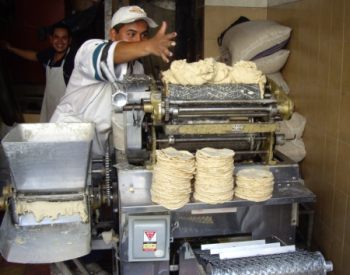
Tortilla-making. Photo: krebsmaus07 (Flickr)

Tortillas cost less than a dollar a kilo in Mexico, but price rises for corn (and therefore tortillas) in recent years have caused the consumption of tortillas to fall to about 80 kg per person each year. According to the National Institute of Nutrition, tortillas account for about 45% of all the  calories consumed in Mexico.

Conventional tortilla mills cook the corn in a solution of calcium hydroxide (limewater) and then ground it into a dough. The process, known as nixtamalization, was originally developed in pre-Hispanic times. A ball of dough is then flattened into a round which is cooked on both sides on a hot comal to produce a tortilla. Residue from the nixtamalization proces contains starches, cellulose and calcium and is discarded into local drains.

About 54% of all the tortillas consumed in the country are made this way. The remainder come from a ground corn-flour mix to which water must be added to form a dough, marketed by giant commercial producers such as Maseca and Minsa.

Processing a single kilogram of corn for tortillas the conventional way requires two liters of water. There are 20,000 corn mills in Mexico; each one can pollute more than 1,000 liters of water every day. The UAM researchers were able to reduce pollution by conventional mills by 80% simply by introducing a more efficient filtering system for the cooked mass, allowing more dough to be extracted.

The researchers have now turned their attention to energy usage. Using solar energy to help heat the water should reduce the amount of natural gas required by as much as 40%. This could save mills a considerable amount of money. Each mid-sized mill (supplying dough to an average of 10 tortilla factories) spends about 2,300 dollars a month on energy.

Mar 172010
 

Geo-Mexico looks in some detail at air quality issues in several Mexican cities, focusing on trends in carbon monoxide, ozone and microparticulates (PM10) from 1995-2008. Among other things, it concludes that,

“As a result of aggressive government efforts, the quality of air in Mexico City has improved significantly. Since 1990 the number of hours that air pollution exceeded the city’s quality standard has declined by about two-thirds. Ozone continues to be a problem as do minute particulates under 10 microns (PM10), both of which can have serious health consequences.”

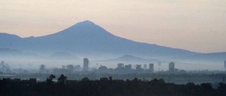
Mexico City air quality in 1980. Credit: Tony Burton

In the two years since 2008, the trend towards improvement of the air quality in Mexico City has continued according to this article which has appeared in numerous newspapers including the online version of The Independent, a UK daily.

That is very good news indeed. Hopefully air quality in all Mexico’s major cities will improve over the coming decade. When last we looked, Monterrey’s air pollution statistics were still headed in the wrong direction.

Mexico’s richest individuals in 2010

 Mexico's geography in the Press, Updates to Geo-Mexico  Comments Off on Mexico’s richest individuals in 2010
Mar 122010
 

The Forbes magazine list of the world’s richest individuals in 2010 consists of 1011 individuals, each with a wealth of one billion dollars or more. Nine Mexicans (all men this year) made the list. The nine richest Mexicans are:

World rank / Name / Estimated wealth according to Forbes / Main business interests

#1 Carlos Slim Helú, 53.5 billion dollars, making him the richest man in the world. Fixed line telephone provider Telmex, cell phone provider América Móvil, Grupo Carso, Inbursa

#63 Ricardo Salinas Pliego, 10.1 billion dollars. Television company Televisón Azteca, domestic appliance store Elektra, bank Banco Azteca,
and cell phone company Iusacell

#72 Germán Larrea, 9.7 billion dollars. Grupo México – mining for copper and other minerals

#82 Alberto Bailleres, 8.3 billion dollars. Mining giant Peñoles, department store El Palacio de Hierro and Grupo Profuturo

#212 Jerónimo Arango, 4 billion dollars. Founder of Aurrerá supermarket chain and Grupo Cifra which controlled VIPS and El Portón restaurant chains, Suburbia department stores and tourist developments in Baja California Peninsula and Acapulco

#655 Emilio Azcárraga, 1.5 billion dollars. Television and media conglomerate Televisa,and Nextel cell phones

#828 Roberto Hernández, 1.2 billion dollars. Banker, one of main shareholders of Citigroup, and tourist developments in the Yucatán Peninsula

#937 (equal) Alfredo Harp Helú, 1 billion dollars. Shareholder in Citibank, telecommunications firm Avantel

#937 (equal) Joaquín Guzmán Loera (aka “El Chapo”), 1 billion dollars. Mexico’s most wanted man, head of the Sinaloa drugs cartel, the main supplier of cocaine to the US market

The combined total wealth of these 9 individuals is a staggering 90.3 billion dollars, equivalent to almost 6% of Mexico’s GDP.

The average earnings of Mexican workers registered in IMSS (Mexico’s Social Security Institute) is about 220 pesos a day or $6,300 (dollars) a year. The combined wealth of Mexico’s nine richest individuals is therefore equivalent to the total annual salaries of 14.3 million Mexicans earning this average salary!

Clearly, there are a handful of extremely wealthy individuals living in Mexico, alongside millions of Mexicans who are living at or below the poverty line. These income disparities have existed for a very long time, and are examined in detail in chapter 14 of Geo-Mexico: the geography and dynamics of modern Mexico. That chapter also analyzes the spatial patterns of wealth in Mexico, and discusses whether the gap between rich and poor has widened or narrowed in recent years.

Chapter 29 discusses Gender inequities in Mexico and  Oportunidades, a poverty reduction program (both links are to excerpts from that chapter).

Mexico’s most valuable brands

 Mexico's geography in the Press, Other  Comments Off on Mexico’s most valuable brands
Mar 092010
 

Consultancy firm Brand Finance recently published its fifth annual survey (2010) of the world’s 500 most valuable brands. The Mexican firms in the list are:

  1. Corona (# 184) – principal product – beer
  2. Banorte (#189) – finance and banking
  3. Claro (#262) – cell phone service
  4. Telcel (#290) – cell phone service
  5. Bimbo (#369) – bread and pastry products
  6. Telmex (#420) – fixed line telephone and internet service
  7. Televisa (#490) – film and television

One noteworthy fact is that three of these—Claro, Telcel and Telmex— are owned or controlled by a single individual:  Carlos Slim, Mexico’s richest businessman.

The top ten in the world (in order) are Wal-Mart, Google, Coca Cola, IBM, Microsoft, GE, Vodafone, HSBC, HP and Toyota.

Note that these firms are not necessarily the largest firms in Mexico in terms of sales. Table 16.2 of chapter 19 of Geo-Mexico: the geography and dynamics of modern Mexico lists the ten largest Mexican private enterprises in 2008. Important aspects of several of these major firms are discussed in the chapters about manufacturing, construction and services, transportation, communications, etc.

Mar 042010
 

Mexico is one of the 30 member states of the OECD (Organisation for Economic and Commercial Development).

Of all these countries, Mexico, Spain and Portugal are the three whose economies gain most from tourism. In Spain, 11% of its GDP comes from tourism, in Portugal 10.5% and in Mexico 8.2%.

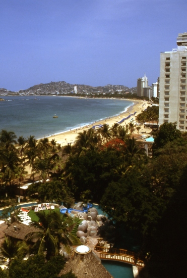
Acapulco, Mexico's first major resort. Photograph by Tony Burton. All rights reserved.

Employment in Mexico is also greatly dependent on tourism. Of the 30 OECD countries, Mexico has the eighth highest figure for the proportion of the workforce in tourism (6.7%), after Spain (13%), Italy (9.7%), New Zealand (9.6%), Hungary (9.2%), Portugal (8.0%), Greece (7.3%) and Japan (6.9%).

Many aspects of tourism are analyzed in detail in chapter 19 of Geo-Mexico: the geography and dynamics of modern Mexico, including:

  • The problems of defining “a tourist”
  • How different kinds of tourism compare in terms of their contribution to Mexico
  • Tourism as a development strategy
  • Spontaneous and purpose-built resorts
  • The concepts of sustainability and ecotourism
  • “Residential tourism”, an unusual category of tourism that is very important in certain specific regions in Mexico.

Flagship social development program – Oportunidades

 Mexico's geography in the Press  Comments Off on Flagship social development program – Oportunidades
Jan 022010
 

Mexico’s flagship social development program featured in a recent (29 Dec 2009) PBS Newshour segment.

Maybe they read an advance copy of Geo-Mexico (chapter 29)?

Oportunidades (Opportunities) is a government social assistance program to help families overcome poverty. Begun in 2002, it is an extension of Progresa, a program which started in 1997. Oportunidades provides conditional cash transfers every two months to families which meet specific geographic and economic criteria of poverty. The transfers only continue if family members meet a series of goals including children’s regular attendance at school and family visits to the nearest clinic for regular nutrition and health advice. Additional economic incentives are offered for the completion of each grade of school with special emphasis on ensuring that girls complete high school. The payment recipients are usually mothers, who make most child and family health decisions.
In 2008, Oportunidades managed a budget of $3.6 billion. This budget is managed very efficiently with only 4% going towards administrative expenses and on-going research. It helps 5 million families, about one-quarter of all families in Mexico. These families tend to live in the most marginal communities. Oportunidades operates in 93,000 different localities throughout the country, 86% of which are in rural areas. In Chiapas the program helps 61% of all families. The corresponding figures for two other poor states—Oaxaca and Guerrero—are 53% and 52% respectively.

Geo-Mexico goes on to evaluate the success of the program, before concluding that,

Oportunidades is one of the most-studied social programs on the planet. It has been very positively received by international agencies and is a model for similar conditioned payment programs in some 30 other countries. A pilot program called Opportunity NYC is being evaluated in New York City.