Our ten favorite phrases “googled” by readers en route to Geo-Mexico.com

 Other  Comments Off on Our ten favorite phrases “googled” by readers en route to Geo-Mexico.com
Jun 302010
 

Reviewing Geo-Mexico blog statistics, we have found some curious search phrases. In each case, when these phrases were entered into a famous leading search engine, a Geo-Mexico page appeared in the results, and someone, somewhere, followed that link to reach our humble site. Here are our current favorite “top ten”:

  • 10. gender basis in mexico [is there an expectation that there is something distinctive in this regard in Mexico?]
  • 9. www.indonesian coffee exporter.com [an interesting mix of web search and url search]
  • 8. ancient mariners map north arrow design [we like our north arrow design, thank you, and don’t mind being called “mariners”, but do not consider ourselves “ancient”, at least not yet]
  • 7. the local economy [what one expects from this search, we’re not sure, but we’re delighted they found us!]
  • 6. any irish people in Toluca Mexico [presumably looking for the links, which genuinely do exist, between Toluca, the Irish and the potato famine]
  • 5. what changed in mexico [lack of temporal or spatial qualifiers makes this a tough question to answer]
  • 4. why is shopping quality improves geography [we really do believe that our blog can improve geography, but we’re not so sure about shopping quality]
  • 3. total 2010 birth rate for mexico [given that we’re only in June, maybe the last six months of this year will be birth-free?]
  • 2. how long is mexico [another interesting question – this is actually the commonest query in our current “top ten”]
  • 1. full size map of mexico [sadly, we don’t yet have one of these on our site…]

While Geo-Mexico: the geography and dynamics of modern Mexico can’t answer all of those search inquiries, it does have loads of fascinating information about Mexico, some of it guaranteed to be very useful in trivia competitions. Buy your copy today!!

Jun 292010
 

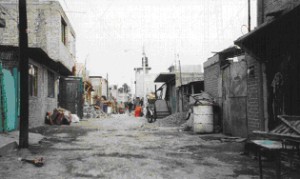
With very rapid growth in the mid-20th century, inner city urban slums could not absorb all the new low income immigrants. The only viable option was so-called “irregular” housing or colonias populares. Irregular housing schemes were initiated by developers who gained ownership of large tracts of contiguous land on the urban periphery. Some of these tracts were illegally obtained ejido properties. Whether ejido or not, the tracts usually consisted of marginal lands, either prone to seasonal flooding or on very steep hillsides.

A colonia popular in Mexico

One of Mexico's many "colonias populares"

The land was subdivided into numerous small lots and sold on an installment plan to low-income families, who would construct low cost one room shacks which they called “home.” These neighborhoods were called “irregular” because many residents lacked legal deeds to their lots, their houses did not meet building codes, and they usually lacked important urban services.

Investors could not legally sell building lots without services such as water, drainage, paved streets, electricity and other basic infrastructure. However often investors did little more than mark the services on the property maps and provide “paper” services. Lots with actual services were considerably more expensive and beyond the reach of most of the urban poor. In general, local government tolerated these unserviced and illegal developments, because they helped relieve the low income housing crisis.

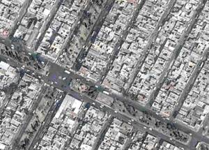
Street plan of a "colonia popular"

Street plan of a "colonia popular"

Developers could make fortunes with these housing schemes. In a one square kilometer piece of land they could sell up to 10,000 lots (each averaging 100 square meters, or 1076 square feet). At $200 a lot, this brought them $2 million. Developers often reneged on their promises to provide services, though their plans did at least provided vacant strips of land between lots, which became known as “paper streets”.

In the beginning, many “irregular” communities lacked running water, sewers, drainage, electricity, and public transport. However, eventually the needed services were provided and the residents upgraded their houses. After a decade or two, most of these communities became completely “regularized” with water, sewers, drainage, electricity, telephones, cable TV, retail stores, schools, bus routes, medical clinics, offices, and even movie theaters, shopping centers, and office buildings. In most large Mexican cities, roughly half of all current housing started as “colonias populares”.

Mexico’s urban geography is analyzed in chapters 21, 22 and 23 of Geo-Mexico: the geography and dynamics of modern Mexico. Buy your copy today, and read more about the fascinating history and structure of Mexico’s cities.

Jun 282010
 

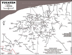
About 1900 one of the densest railroad networks on earth was operating in the Yucatán Peninsula. Between 1870 and 1920 the area experienced an economic boom based on the production of twine from sisal (oro verde or green gold). The numerous plantations in the area needed a way to move the sisal from the fields to processing centers and from there to ports for export. The plantation owners built a very extensive (4500 km) system of narrow gauge railroad system to move sisal as well as sugar and corn.

Map of Yucatan's railways

Map of Yucatan's railways. Copyright Allen Morrison. Reproduced by kind permission (see link to original map near end of this post). Click map for larger version.

The tracks stretched up to 100 km in all directions from Yucatán’s capital, Mérida. Rolling stock and complete sections of track with steel ties were imported mostly from Europe but also from the USA. The small trains were powered by mules, steam engines, electric batteries, and later by gasoline motors. There was no standard design. Several different gauges were in use ranging from 400 to 930 mm (15.7 to 36.6 in).

Foreign competition, the Mexican Revolution, and synthetic fibers brought an end to the sisal boom. Many of the plantations closed in 1930s. Soon small entrepreneurs were providing rail passenger services between the scores of towns in the area. Many families used the small sisal hauling cars as personal transport, powered by a horse or mule. This was far more efficient than animal drawn carts on the rough dirt roads, but required occasional de-railing to allow those going in the opposite direction to pass. Some of the Yucatán’s narrow gauge lines have survived into the 21st century, and some of the former sisal haciendas have reopened as luxury hotels for tourists.

Acknowledgments: Grateful thanks to Allen Morrison, who generously allowed us permission to reproduce his excellent map of Yucatán railways.

Mexico’s transportation systems are the subject of chapter 17 of Geo-Mexico: the geography and dynamics of modern Mexico. Buy your copy today!

Yucatán’s main line railway was not linked to the rest of Mexico until about 1950.

The story of Paricutín volcano in Michoacán

 Other  Comments Off on The story of Paricutín volcano in Michoacán
Jun 252010
 

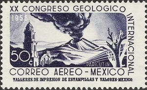
Paricutín first erupted, completely unexpectedly, in the middle of a farmer’s field, on February 20, 1943.

Paricutin depicted on postage stamp

Paricutín Volcano depicted on stamp

A remarkable account of its early days is given by Simón Lázaro Jiménez, who recounts in his book, Paricutín: 50 Years After Its Birth , his adventures as a young boy as he fled with his parents for safety as their small village of Angahuan was bombarded with red-hot rocks and ash. Don Simón’s account, which I was delighted to translate into English, may possibly be exaggerated in places, but remains the only first-hand account of any substance written by a native P’urépecha speaker.

The book is illustrated with some magnificent photos by German photographer Walter Reuter. One of Reuter’s photos shows Dionisio Pulido (the farmer whose field was blown apart by the volcano) trying to sell the resulting conical hill to an “eccentric American”. I have since learned that the “eccentric American” is none other than Robert Ripley of “Believe it or not” fame.

The volcano finally stopped erupting in 1952, but only after completely destroying the village of Parícutin (note that the position of the accent has changed over the years) and the town of viejo (old) San Juan Parangaricutiro. All that is left of the latter today are a few broken-down walls and parts of the huge, old church that did a brave job of withstanding the compelling force of the lava as it overran the rest of the town.

Geographic tongue-twister related to Paricutín Volcano.

The landscape around Paricutín is world-class in terms of its eco-tourism potential. Visitors have the opportunity to explore some of the finest, easily accessible volcanic scenery anywhere in the world. What makes Paricutín so special is that scientists have rarely had the opportunity to study a completely new land-based volcano, whereas new oceanic island volcanoes are comparatively common. In fact, the first two new volcanoes formed in the Americas in historic times are just one hundred kilometers apart. The first is Jorullo, which first erupted on September 29, 1759, and was studied by Alexander von Humboldt; the second is Paricutín.

Mexico’s Volcanic Axis is discussed in chapter 2 of Geo-Mexico: the geography and dynamics of modern Mexico. The sustainable forestry project of San Juan Parangaricutiro is examined in chapter 15 and the 2004 UN Equator prize won by the village is described here.

Copies of Paricutín: 50 Years After Its Birth are available from Sombrero Books

Baja earthquake moved part of California

 Maps, Mexico's geography in the Press  Comments Off on Baja earthquake moved part of California
Jun 242010
 

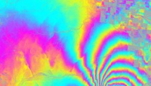
The 4/4/2010 (Easter Sunday) earthquake centered in Baja California really did not only shake the earth but also move it. What is even more amazing is that this may be one of the best documented examples of an earthquake in one country moving parts of a neighboring country.

UAVSAR interferogram of Calexico region

UAVSAR interferogram of Calexico region. Credit: NASA/JPL

NASA has released data showing that the 4/4/2010 earthquake in Baja California moved the border city of Calexico in California. According to NASA’s analysis of radar data from research flights, the April earthquake moved the Calexico region as much as 0.8 meters (2.5 feet) towards the south.

Further south, in Baja California, some parts of the ground moved up to 3 meters (10 feet).

For a full explanation of the image, which shows an area about 20km east-west, by 15 km north-south, please refer to the original article.

Earlier post on 4/4/2010 earthquake: 7.2 magnitude earthquake strikes Baja California (4 April 2010)

Other cities have also been moved by earthquakes. For instance, in the magnitude-8.8 Chilean earthquake of 27 February 2010 , the city of Concepción in Chile was displaced a whopping 3 meters (10 feet) west of its original position.

Unemployment rates in Mexico

 Updates to Geo-Mexico  Comments Off on Unemployment rates in Mexico
Jun 232010
 

The OECD (Organisation for Economic Co-operation and Development) has recently published unemployment rates for its member countries. Mexico fares quite well; its rate of “open unemployment”  so far this year has hovered around 5.5%. This is quite encouraging, since the average for the 31 OECD countries is around 8.7%. Note that these figures do not include “underemployment”.

The OECD members with the highest unemployment rates are Spain (19.7%), Slovakia (14.1%), Ireland (13.2%), Portugal (10.8%), Hungary (10.4%) and France (10.1%).

The lowest rates are in South Korea (3.7%), Netherlands (4.1%), Austria (4.9%), Japan (5.1%), Luxembourg (5.4%) and Australia (5.4%).

Mexico’s unemployment rate is more favorable than that of its NAFTA partners. Open unemployment is currently 8.1% in Canada and 9.7% in the USA.

Soil science and Mexico’s ancient kitchens

 Other  Comments Off on Soil science and Mexico’s ancient kitchens
Jun 212010
 

In an earlier post, we saw how archaeologists have gradually unraveled the history of the domestication of Mexico’s most important food plants.

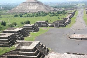
Teotihuacan

Teotihuacan

Other archaeologists, working at Teotihuacan, close to Mexico City, have been turning their attention away from how the upper classes lived (and ruled) to focus on the lives of the ordinary residents of suburbia fifteen hundred years ago. At its height (500 AD), Teotihuacan was one of the largest cities in the world, with an estimated population of 200,000. Its elaborate water supply and drainage systems and a precisely aligned grid demonstrate masterful urban planning. The city was so prominent that it became a magnet for craftsmen from other far-away regions like Oaxaca and the Gulf Coast (Veracruz). These migrants would have brought their own food ideas and preferences with them, making Teotihuacan an excellent choice for a cosmopolitan eating experience.

What most visitors to this ancient city today do not appreciate is how the average Teotihuacanos lived, how they cooked, and what they ate. But, between 1985 and 1988, cleverly conceived and executed fieldwork by a team directed by Linda Manzanilla of the National University (UNAM), unearthed a wealth of information about ancient food storage, preparation methods and kitchens. Manzanilla has demonstrated that age-old kitchens in Teotihuacan can be located by a combination of traditional archaeological methods (collecting artifacts, debris, pollen and food remains) alongside the microscopic and chemical analysis of the stucco floors in the multi-room apartment complexes used as residences and workshops.

It was already known that the stucco used on floors can absorb, over time, trace amounts of chemicals that serve as indicators of the predominant activities carried out in the room. Soil samples were taken from each square meter of floor and then analyzed for certain key indicators.

High levels of phosphates revealed areas where organic refuse was abundant. This could be a place where food was consumed, or where refuse was discarded. An elevated level of carbonates was assumed to reflect either a place where stucco was processed, or somewhere where tortillas were prepared. The tortilla-making process today still involves the liberal application of lime. A localized higher alkaline reading from the stucco floor was correlated to the location of heat or fire. The color of the soil samples was also checked for any indication of the limits of a particular activity.

Once an outline of the distribution of particular activities had been sketched out, the presence of sodium and iron was investigated. High levels of iron, for example, probably indicate where agave was processed, or where animals were butchered.

The end result? By correlating the various lines of evidence from this particular sixth century apartment, Manzanilla was able to pinpoint the precise locations of many everyday household functions. For instance, three areas where ceramic stoves once stood were distinguished. Each had a dark red stain on the floor, with relatively low carbonate values, relatively high alkalinity, and some ash. Significantly higher phosphate values in a band around this zone suggested an area used for eating. Higher phosphate levels were also encountered outside the dwelling where any refuse had been swept or accumulated.

And what was cooked on these stoves? We can not be certain, but evidence suggests that the residents of Teotihuacan had a varied diet of plants and animals. They not only prepared corn, beans, squash and chiles, but also ate cacti (prickly pear), hawthorns and cherries. For additional protein, rabbits, deer, duck, dogs, turkeys and fish were all on the menu, at least occasionally.

And, lest you think their likely diet sounds too bland, the locals also had access to potatoes and a plethora of herbs and spices, as well as chocolate, chewing gum and tobacco to satisfy their cravings, and various exotic hallucinogens to stimulate their imaginations!

So, next time you savor Mexican food, pause for a moment and remember that your meal may be startlingly similar to a banquet eaten thousands of years ago in any major Aztec, Toltec or Maya city…

Further reading

Manzanilla, Linda (1996) Soil analyses to identify ancient human activities. Canadian Journal of Soil Science.

The original article on MexConnect

The impact of NAFTA on urban growth in Mexico

 Other  Comments Off on The impact of NAFTA on urban growth in Mexico
Jun 192010
 

The North American Free Trade Agreement (NAFTA), signed in 1994, had a significant impact on the pace and pattern of urbanization in Mexico.

NAFTA removed tariffs on imported corn and beans.  Small Mexican producers could not compete with the cheap imports from the USA. As a result, an estimated 1.3 million agricultural jobs in Mexico were lost. Many of those who lost work in rural areas, moved to Mexican cities or to the USA to search for employment. Most of these drifted into the urban informal sector in cities throughout Mexico.

Geo-Mexico, figure 20.2

Geo-Mexico, figure 20.2 All rights reserved.

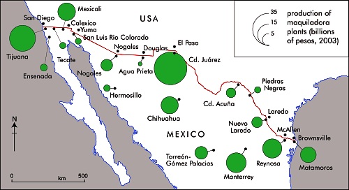
On the plus side, NAFTA created an estimated 500,000 jobs in Mexican manufacturing, mostly maquiladora assembly plants focused on the US market. These plants and their multiplier impacts generated rapid growth in border cities, particularly Ciudad Juárez, Tijuana, Mexicali, Matamoros, Nuevo Laredo, and Reynosa (see map).

Largely as a result of NAFTA, border cities grew faster during the 1990s than most other Mexican cities, essentially reversing the trend that existed during the 1980s. Though after 2000 many of Mexico’s border maquiladora industries moved to lower cost countries, most border cities continued to grow rapidly.

In conclusion, the overall NAFTA impact has strongly stimulated urban growth while fostering rural decline and out-migration.

Mexico’s first cooks and the origins of Mexican cuisine

 Other  Comments Off on Mexico’s first cooks and the origins of Mexican cuisine
Jun 182010
 

Mexican cuisine has been one of the country’s most successful cultural exports over the past twenty years or so and most large towns in North America and Europe now boast at least one Mexican restaurant, even if the menu is not necessarily “authentic”. For those wanting to experiment, the basic ingredients for Mexican meals can now be bought virtually everywhere. The increasing popularity of Mexican food has been rivaled only by an extraordinary increase in the consumption of Mexican drinks, including Corona beer and tequila.

Ingredients for guacamole. Photo: Chef Daniel Wheeler. All rights reserved.

Archaeologists have also taken much more interest in Mexican food in recent years.

By 1970, studies carried out at various locations, ranging from Tamaulipas in the north of the country to Oaxaca in the south, had gradually led to the conclusion that the earliest plants to be domesticated in Meso-America were corn, beans and squash, and that all three had been domesticated between about 7000 and 10,000 years BP (Before Present, not British Petroleum…).

Further research subsequently led most archaeologists and palaeo-botanists to believe that squash was actually domesticated much earlier than corn. Re-evaluating cave samples, originally collected in the 1950s, using an improved carbon-14 dating technique, anthropologist Bruce Smith found that the squash seeds from one location were between 8,000 and 10,000 years old, while the oldest corn and bean seeds were much younger, less than 6,000 years old.

While Smith’s study does appears to confirm that squash was domesticated first, it does not necessarily mean that this squash was domesticated for its food value. Many experts think that early varieties of squash may have been domesticated primarily for their gourds, which could be used as ready-made drinking vessels and fishing floats.

The domestication of squash may have improved life, but it did not fundamentally change it. On the other hand, the eventual domestication of corn, about 7,000 years BP marked a true watershed in pre-Hispanic life, enabling the abandonment of a nomadic hunter-gathering existence in favor of settlement in semi-permanent villages. How important was this? In the words of renowned archaeologist Michael Coe, “it was the cultivation of maize, beans and squash that made possible all of the higher cultures of Mexico.”

With the passing of time, the ancient peoples of Mexico domesticated and cultivated many other native plants, including tomatoes, chiles, potatoes, avocados, amaranth, chayote (vegetable pear), cotton and tobacco.

The original article on MexConnect

If you enjoyed this post, you might also enjoy Geo-Mexico: the geography and dynamics of modern Mexico.

Jun 172010
 

The nationwide figure for 2004 was 26 / 100,000 inhabitants. By way of comparison, the rates in the USA, Canada, and the UK were about 6, 2 and 2 respectively. The latest figures show that South Africa has a rate of 39 and Colombia 38.

The ten states with the worst murder rate in Mexico are:

RankStateIncidence of murders (/100,000 inhabitants)
1Guerrero36.8
2Oaxaca34.1
3Baja California30.4
4Sinaloa28.3
5Nayarit27.2
6Chihuahua26.6
7Michoacán26.1
8México25.3
9Quintana Roo22.1
10Durango21.9

Mexico’s crime figures are analyzed in chapter 28 of Geo-Mexico: the geography and dynamics of modern Mexico

Jun 162010
 

Thousands of dinosaur bones have been found in northern Mexico.

Bones literally litter the ground. Here’s a femur; there’s a tibia; vertebrae, ribs, skulls…

Dozens of dinosaurs have been unearthed in a broad belt across northern Mexico, from Baja California and Sonora in the west, through Chihuahua, and Coahuila to Nuevo León and Tamaulipas in the east. Dinosaurs lived from around 230 to 65 millions years ago. Most of the dinosaurs dug up in northern states date back about 70 million years, though those found in the Huizachal canyon in Tamaulipas include the oldest known dinosaur bones in Mexico, from the Jurassic period 180 million years ago.

Earlier this year, the discovery of a new species of dinosaur, Coahuilaceratops magnacuerna, was reported from Coahuila. It is 6.7 meters long, 1.8 meters tall, and weighed 4.5 tonnes, with two 1.2-meter-long horns, longer than any other dinosaur.

Dinosaur area in Coahuila

There are two prime locations for dinosaurs in the state of Coahuila in northern Mexico. It is hard to imagine today, but millions of years ago the southern part of the state was a vast river delta bordering the ocean. It appears that literally hundreds of dinosaurs floundered in the mud while trying to forage for food. Conditions changed and fossilization preserved the remains of these beasts for prosperity.

Coahuila’s most famous dinosaur was discovered at Presa San Antonio, some seventy kilometers west of the state capital Saltillo. Between 1988 and 1992, excavations on ejido land, led by Dr. René Hernández of the National University (UNAM), succeeded in recovering more than 70% of the bones of a herbivorous Kritosaurus.

The world’s cheapest dinosaur

When reassembled, the creature was 7 meters (23 feet) long and stood 3.8 meters (12.5 feet) tall. It also became the cheapest dinosaur in the world. Excluding Dr. Hernandez’s salary, its excavation cost just 15,000 pesos, equivalent at the time to 5,000 dollars. Making a replica for the Institute of Geology Museum in Mexico City cost a whopping 40,000 pesos. The replica (218 bones) is named “Isauria”, apparently because one of the first high school students to view it was overheard to say that it looked just like Isaura, one of their fellow students!

The second location is even closer to Saltillo. The Rincón Colorado ejido is 43.5 kilometers west of the state capital along federal highway 40, the road to Torreón. Here, a small village, located three kilometers north of the road, boasts Mexico’s only “on-site” paleontology museum, complete with lots of dinosaur bones and imprints.

The displays in the Rincón Colorado museum reveal the wide diversity of fauna that once thrived in this area, including fish, turtles, crocodiles, sharks, bivalves, gastropods, ammonites as well as a considerable variety of flora, as shown by tell-tale signs of at least nine different kinds of fruit. Today’s vegetation is much less varied, consisting primarily of plants like agaves, prickly pear cacti, creosote bushes and acacias that can survive in the harsh semi-arid conditions.

Dinosaur museum in Coahuila

Visitors to the museum can also obtain permission to visit the dinosaur dig, located a short distance away on arid, red-tinted, scrub-covered hillsides, one of which, formerly called Cerro de la Virgen, is now known as Cerro de los Dinosaurios. Bones litter the ground, and more than 20 dinosaurs, dating from the Late Cretaceous period, have so far been found in an area of 25 square kilometers. They include specimens of duck-billed hadrosaurs, one of which still sports its toenails, horned ceratopids (three rhinoceros-like horns on the head), carnivorous tyrannosaurids and dromaeosaurids. One triceratopid still had some skin attached to its bones, making it a very rare find. Hadrosaurs are particularly common and may have been amphibious.

See also:

  • Dinosaur Bones in Mexico on MexConnect.
  • Fosiles de Dinosaurios en Coahuila. Gobierno de Coahuila (SEPC) (no date)
  • Hernández H., René Dinosaurios. Gobierno de Coahuila (SEPC) (no date)
Jun 152010
 

Want to show off your Spanish language skills? Try learning this Spanish-language tongue-twister related to San Juan Parangaricutiro, a town that was destroyed by Paricutín Volcano:

El arzobispo de Parangaricutirimícuaro
se quiere desarzobispoparangaricutirimicuarizar
¡el que lo desarzobispoparangaricutirimicuarizare,
un buen desarzobispoparangaricutirimicuarizador será!

The inhabitants of San Juan Parangaricutiro won a UN Development Prize.

For a more detailed account of the history of the volcano, and of the considerable architectural attractions of the village of Angahuan, including its superb church, read chapter 35 of Western Mexico: A Traveler’s Treasury (Sombrero Books 2013).

Original article, as published on MexConnect

Paricutín Volcano is discussed in chapter 2 of Geo-Mexico: the geography and dynamics of modern Mexico; a local sustainable forestry project (at San Juan Parangaricutiro) is examined in chapter 15.

A small village in Mexico won a 2004 UN Development Prize

 Excerpts from Geo-Mexico  Comments Off on A small village in Mexico won a 2004 UN Development Prize
Jun 142010
 

Every two years, the United Nations Development Programme (UNDP) awards the Equator prize (worth 30,000 dollars) to communities that have shown “outstanding achievement in the reduction of poverty through the conservation and sustainable use of biodiversity.”

One of the winners of the 2004 Equator prize was the indigenous community of Nuevo San Juan Parangaricutiro, in the state of Michoacán. More than 340 communities, from 65 countries, were nominated for consideration by the Equator Prize jury. The seven winning communities were honored at a prize-giving ceremony held in conjunction with an international Biological Diversity Conference in Kuala Lumpur, in Malaysia.

The success of Nuevo San Juan Parangaricutiro (hereafter referred to simply as Nuevo SJP) is all the more remarkable since their community did not even exist prior to 1944.

That is the year when all the founding residents of Nuevo (New) SJP fled their homes in “viejo” (Old) SJP as the sizeable town was overwhelmed by the lava erupting from Paricutín volcano. Paricutín first erupted, completely unexpectedly, in the middle of a farmer’s field, on February 20, 1943. It is a sobering thought that only 61 years to the day before the prize-giving, the volcano literally did not exist.
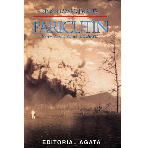
A remarkable account of those early days is given by Simón Lázaro Jiménez, who recounts in his book, Paricutín: 50 Years After Its Birth, his adventures as a young boy as he fled with his parents for safety as their small village of Angahuan was bombarded with red-hot rocks and ash. Don Simón’s is the only first-hand account of any substance written by a native P’urépecha speaker.

The volcano finally stopped erupting in 1952, but only after completely destroying the village of Parícutin (note that the position of the accent has changed over the years) and the town of viejo SJP. All that is left of the latter today are a few broken-down walls and parts of the huge, old church that did a brave job of withstanding the compelling force of the lava as it overran the rest of the town.

The people who fled the volcano (many initially refused to leave, but were escorted to safety by armed soldiers) stayed with friends and relatives and in makeshift camps before finding permanent accommodation, but later in 1944, founded Nuevo SJP after a presidential decree gave them land formerly belonging to the hacienda of Los Conejos.

The new town had to be completely planned from scratch. A gigantic church was built to commemorate the miraculous survival of part of the Old San Juan church which formed a partial barrier to the lava flow. Little by little a new community evolved, fostered in part by the high degree of cooperation required for building a new town and working virgin land.

In 1977, motivated by the abuse of local forest lands by private concession holders, the campesinos of Nuevo SJP organized their own union for farming and forestry workers. In 1981, they began their own forestry industry, and now collectively own and manage more than 11,000 hectares of pine, oak and fir forest. Over the years, their business activities have diversified to include a saw mill, a furniture factory (which has won export orders from Belgium and Ireland), a plant making wooden moldings for export to the USA, avocado and peach orchards, a packing plant which makes its own cases, a Christmas tree plantation, eco-tourism cabins and a resin distillation plant, as well as a store for the bulk purchase and resale of fertilizers. A water bottling plant, to bottle spring water, is one of the community’s latest proposals.

The community’s website gives details of all these activities and includes a link to a furniture catalog for those interested in buying direct. All the wood used is certified as “Smart Wood” (coming from well-managed forests) by the Forest Stewardship Council.

Community decisions in Nuevo SJP are made on behalf of the 8,000 or so residents by a General Assembly of the 1,300 Comuneros (community representatives), which has met at least once a month since 1983.

The Equator Prize was awarded because the forest policies adopted by the community “have provided a boost to local incomes while ensuring that the resource base upon which the community depends is sustained for future generations.” In addition, “the community’s successes have spread well beyond their origins as these novel conservation and business practices have been widely adopted by other indigenous communities in Mexico.”

Nuevo SJP may not be very old, or very large, but it certainly has a really big heart!

For a more detailed account of the history of the volcano, and of the considerable architectural attractions of the village of Angahuan, including its superb church, read chapter 35 of Western Mexico: A Traveler’s Treasury (Sombrero Books 2013).

Original article, as published on MexConnect

Mexico’s Volcanic Axis is discussed in chapter 2 of Geo-Mexico: the geography and dynamics of modern Mexico. The sustainable forestry project of San Juan Parangaricutiro is examined in chapter 15.
Evolution of control on the Yucatán Peninsula

 Other  Comments Off on Evolution of control on the Yucatán Peninsula
Jun 122010
 

Throughout history the Yucatán Peninsula has been somewhat separate from the rest of Mexico. The pre-Colombian Maya civilizations were more closely linked to Guatemala and Central America than to central Mexico. It took the Spaniards and Mexicans almost 400 years to gain full control of the Peninsula.

In the 16th century, the Conquistadors needed about 25 years and numerous battles to establish a permanent foothold on the Peninsula, essentially limited to the area around Mérida. It would take another 150 years and tens of thousands of indigenous conscripts before they would gain effective control over the majority of Maya lands. There are a couple main reasons why this took so long.  First, the Yucatán had no gold or silver, so the Spaniards had less incentive to subjugate the Maya peoples. Second, the Maya were separated into numerous distinct political units each with its own army and will to resist.  In contrast, central Mexico was ruled by the Aztecs and once they were defeated it was easier to take control of the peoples under their rule. In the Yucatán, the Spaniards had to defeat and subdue scores of independent, highly motivated armies, which once subdued, were eager to rebel. Finally in 1697 the Spanish gained some measure of control of most Maya lands by defeating the Itza at Tayasal, which is now the town of Flores in the Guatemalan Petén. However, during the 18th century, most Maya communities retained essential autonomy and self rule.

After independence, control of the Peninsula was shared by Mexico, three separate Republics of the Yucatán (see an earlier post on the Republic of the Yucatán), and the Maya peoples. In general the Maya controlled the southeast and Criollos of the republics of Mexico or Yucatán controlled the northwest.

In 1847, the Caste War broke out when the Mayas rebelled against the Hispanic (Criollo) upper class that controlled the Yucatán Republic. The Mayas briefly gained control of virtually the whole Peninsula except for the cities of Merida and Campeche. However, within a year or two, the Criollos retook control of the northeast portion of the Peninsula. Campeche became independent from the State of Yucatán in 1858 and achieved full statehood in 1863.  However, the Mayas maintained control of the southeast portion of the Peninsula.  Skirmishes continued on and off for more than 65 years.

The British even recognized the independence of the Chan Santa Cruz Maya government in the southeast to facilitate trade with British Honduras, (now Belize).   In 1884 a treaty was signed reuniting the southeast with Mexico as the new State of Chan Santa Cruz.  But the treaty was canceled a year later when Chan Santa Cruz experienced a coup d’état.

In 1893the Britain withdrew their recognition of Chan Santa Cruz by signing an agreement recognizing Mexico’s sovereignty over the area.  This facilitated British industrial and railroad investment in President Porfirio Diaz’s Mexico.  However, the Mayas maintained de facto control of the area.

In 1901, the Mexican army took military control of the capital of Chan Santa Cruz, in the current State of Quintana Roo. A year later, the central government carved the territory of Quintana Roo from the State of Yucatán. However the government did not have full control of the area; small skirmishes continued. The official end of hostilities came in 1915 when the new Revolutionary Government of Mexico sent General Salvador Alvarado to the Yucatán to implement reforms that essentially eliminated the reasons for the skirmishes. Quintana Roo continued as a Territory until 1974 when it finally achieved statehood.

See also:

Jun 112010
 

Compared to its very large and loud northern neighbor the USA, Mexico often seems like a rather minor country. But let’s take a closer look at Mexico’s major characteristics.

Mexico is among the world leaders in land size, population and economic production. These three criteria are a rational way of determining the world’s major countries. Mexico is the world’s 14th largest country in area, just behind the Congo and Saudi Arabia, but ahead of Indonesia and Libya. Mexico’s population in 2009 was about 109 million ranking it 11th in the world.  Russia (140 million) and Japan (127 million) were slightly ahead of Mexico. Trailing Mexico were the Philippines (92 million) and Vietnam (87 million).

The Gross Domestic Product (GDP) of Mexico in 2009 was about $1.5 trillion, behind Brazil ($2.0 trillion) and Italy ($1.7 trillion), but ahead of South Korea (S1.4 trillion), Spain ($1.4 trillion) and Canada ($1.3 trillion). These GDP figures are based on “Purchasing Power Parity” which illuminates distortions based on exchange rates. For example, if a hair cut of equal quality costs $20 in the USA, $5 in Mexico and $2 in China, the haircut is counted as a $20 contribution the GDP of each country.

Mexico is one of only six countries that are in the top 15 in all three categories. The other five countries in this select group are China, India, the USA, Brazil and Russia.

That Mexico is in this very select group makes a very strong case that it is indeed a major country on the world stage.

For more information about these and many other aspects of Mexico, consider buying Geo-Mexico: the geography and dynamics of modern Mexico and adding it to your library.

Many Mexican place names were changed following Mexican Independence (1821)

 Other  Comments Off on Many Mexican place names were changed following Mexican Independence (1821)
Jun 102010
 

This is the fourth and final part of our series of guest blogs by Fatimah Araneta.

Fatimah Araneta grew up in Mexico City. After gaining a Masters in City Planning at Berkeley, California, she opted to eschew city life and direct her energy and attention to living in tune with what’s left of Mother Earth before it all gets paved over and criss-crossed with cabled and non-cabled networks. She lives “off the grid” in the shadow of the volcano she prefers to call Chicnautécatl.

Part 4 – Many Mexican place names were changed following Mexican Independence (1821)

Finally, we come to what León-Portilla calls the fourth layer in a place name: the part applied during Mexico’s independent era. The purpose usually was to deliberately erase names that were too Castilian for the newly-born nation’s taste, as in the case of the state of Jalisco, which used to be Nueva Galicia, or Tamaulipas, which was formerly called Nuevo Santander. Both Jalisco and Tamaulipas are prehispanic names.

Sometimes the new place name was to honor a war hero. Today’s Ciudad Hidalgo used to be Tajimaroa; Ciudad Juárez’s old name was El Paso del Norte (today the city to the north of the border from Ciudad Juárez retains part of that name: El Paso, Texas).

And coming back to the domains of the Nevado/Xinantécatl/Chicnautécatl, there is a small city about an hour’s drive to the west of the volcano with a place name history of its own. Nine hundred years ago it was a densely populated area, the focus of pilgrimages and of commerce, a place where produce, goods, news and ceremonies were exchanged between the people of the altiplano (the higher, cooler plains) and those of tierra caliente (the warmer lowlands). The Nahuatl name for it was Temascaltepec, “Place of the Hot Vapor Baths”.

Valle de Bravo

Valle de Bravo. Photo: Fatimah Araneta. All rights reserved.

Since it was contained in an ample valley, the Spaniards began to call it Valle de Temascaltepec. During the war for independence, the hero Nicolás Bravo and his army passed nearby, on their way from Chilpancingo to what is the state of Morelos today. Admittedly, none of them actually spent not even a night in Valle de Temascaltepec, but the proximity of their famously brave passage was enough for the the town to decide one day to drop the Temascaltepec and change its name to Valle de Bravo[1].

In view of all this one can only conclude that there is a great deal in a name, especially in a place name in Mexico, and that to wholly or partially modify a place name is to risk losing an important part of the memory of its past.

This concludes our mini-series on Mexican place names.

Bibliography

GARCÍA MARTÍNEZ, Bernardo, Los Nombres del Nevado de Toluca, in Arqueología Mexicana, Vol.VIII, no.43, pp.24-26, May-June 2000.

LEÓN-PORTILLA, Miguel, Toponimia e Identidad, in Arqueología Mexicana, Vol.XVII, no.100, pp. 28-33, November-December 2009.

SIERRA CARRILLO, Dora, San Miguel Arcángel en los Rituales Agrícolas, in Arqueología Mexicana, Vol.XII, no.68, pp74-79, July-August 2004.


[1] The dropped name was quickly claimed by a neighboring town, Real de Abajo, “Lower Mine”. It is one of twin towns located in an area of silver and gold mines (reales, in Spanish). The other town is called Real de Arriba, and still conserves that name. Real de Abajo must have felt uncomfortable all its life with its lowlier designation and quickly adopted the more elegant Temascaltepec to make up for its previous existence in the shadow of the “Upper Mine”.


Click on the word “placenames” or the “placenames” tag for more articles about Mexico’s place names.

Jun 092010
 

On January 1, 1846, the Criollo leaders in Merida declared independence as the Republic of the Yucatán for the third time. In 1847, the Caste War broke out when the Mayas rebelled against the Criollo upper class that controlled the Yucatán Republic. They drove most of the Criollos out of the Peninsula except for the those behind the walls surrounding Mérida and Campeche City.

With their back to the wall, the Yucatan Republic offered sovereignty over to Yucatán to either USA or Britain or Spain, whichever was first to effectively end the Maya revolt. In a desperate effort to put down the rebellion, the Yucatán Criollos agreed on 17 August 1848 to re-unite with Mexico if the Mexican army would put down the Maya rebellion. With fresh Mexican troops, they retook control over northwestern portion of the Peninsula. However, Mayas maintained control of the southeast for the rest of the 19th century and beyond. Skirmishes continued on and off for more than 70 years. Maya independent control of some parts of the southeastern Yucatán Peninsula did not end until after the Mexican Revolution.

See also:

The cultural geography of Mennonite enclaves in Mexico

 Excerpts from Geo-Mexico  Comments Off on The cultural geography of Mennonite enclaves in Mexico
Jun 082010
 

Among the first Mennonite settlers were a group of more than 1300 families (about 9300 individuals) of German-Russian descent who arrived from Canada in 1922. They had been guaranteed tax concessions, freedom of worship and exemption from military service by President Obregón. At the time the Mexican government wanted to encourage more settlement in northern Mexico which had unrealized agricultural potential. After the Mexican Revolution, the large landowners in northern Mexico wanted to sell part or all of their vast holdings before the federal government forced the break up of their estates.

Mennonites bought 100,000 hectares for 600,000 pesos (8.25 dollars per acre) and started a colony near Ciudad Cuauhtemoc, west of Chihuahua city.  The group’s spartan lifestyle is reflected in their conservative dress habits and the fact that their villages (campos) are numbered, rather than named.  The people are taller than the average Mexican, speak German, and have northern European physical features. Today, about 50,000 Mennonites live in the Ciudad Cuauhtemoc area. They also founded colonies at Patos, in northern Durango state, and near Saltillo in Coahuila. Today, there are also several Mennonite villages far to the south, in Campeche.

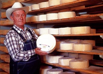
Mennonite cheese

Mennonite cheese (queso menonita)

The landscapes of Mennonite areas in northern Mexico are very distinctive. They transformed desolate areas of semi-arid scrubland into prosperous farms.

Houses built of adobe on wood frames line the main street of each campo. These elongated street villages (about sixty in number) are totally different to the compact, nucleated villages found elsewhere in Mexico.  Surrounding the villages are large relatively flat fields divided into blocks by wide roads.

The Mennonite farming areas look more like parts of the US Midwest than Mexico. The farms are neatly kept and dotted with wind pumps used to raise water for irrigation. Tractors are common though horse-drawn buggies are also used. The main crops are wheat, oats, beans, corn and in some areas apples. The Mennonites are experienced dairy farmers and their most famous contribution to Mexican cuisine is the production and marketing of Chihuahuan cheese (queso menonita). It is a common sight to see Mennonite men selling their delicious cheese at major intersections in several of Mexico’s major cities.

See also:

The geography of Mexico’s religions is discussed in chapter 11 of Geo-Mexico: the geography and dynamics of modern Mexico.

The Spanish arrive and change lots of place names

 Other  Comments Off on The Spanish arrive and change lots of place names
Jun 072010
 

This is the third in our series of guest blogs by Fatimah Araneta.

Fatimah Araneta grew up in Mexico City. After gaining a Masters in City Planning at Berkeley, California, she opted to eschew city life and direct her energy and attention to living in tune with what’s left of Mother Earth before it all gets paved over and criss-crossed with cabled and non-cabled networks. She lives “off the grid” in the shadow of the volcano she prefers to call Chicnautécatl.

Part 3 – How the Spanish colonization of Mexico contributed to its place names

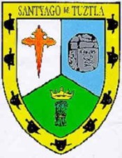
Santiago Tuxtla coat of arms

Santiago Tuxtla coat of arms

The third layer was bestowed by the Spanish colonizers. Some places received the names of cities in Spain, such as León (in the state of Guanajuato) or Córdoba (in the state of Veracruz). Sometimes the original Nahuatl was maintained but mispronounced so much that the name became corrupted, as in Churubusco, which used to be called Huitzilopochco. Some other times the name of a saint was added to the place name, as in Santiago Tuxtla, Santa Teresa Tiloxtoc or San Miguel Chapultepec.

The choice of the saintly counterpart to an already existing place name was hardly ever a frivolous decision. The different religious orders who set out to convert the indigenous populations to Christianity had their preferences. The Franciscans, for example, relied on Saint Michael to be their champion in the battle against the devils of the New World. Luckily for the evangelizing friars, Saint Michael also happened to possess attributes that made it easy for this religious icon to be accepted by the potential converts.

In the Old World, apparitions of Saint Michael had first taken place on mountaintops (high places near heaven from which he had banished Lucifer) and caves (since he was also in charge of assisting departing souls into the netherworld). Later, he would become involved in miraculous apparitions of springs of water, as in Mont Saint Michel in northern France, and was henceforth increasingly associated with the agricultural cycles of sowing and harvest.

At the same time, a very important figure in the prehispanic pantheon was Tláloc, the rain god, venerated too on mountaintops and at the entrances of caves, since it was believed that mountains were the containers of the weather. It was to Tláloc that one turned to ask for abundant rain for the crops, as well as mercy from the snakes of fire, or lightning bolts, that could inflict so much damage. Images of Tláloc depict him holding a bolt of lightning in one hand, not very differently from how images of Saint Michael show him wielding a flaming sword.

Thus, with this third layer of meaning, a place name in Mexico gives many clues to the past. If  “San Miguel” is part of the name it could be telling us that Franciscan friars had been in charge of the place at one time; that there could have been a cult to Tláloc; that the place was and could still be of hydrological importance; and that it could have been and could still be the focus of religious pilgrimages related to agricultural cycles.

The next part will consider how some Mexican places were rechristened during Mexico’s independent era (post 1821).

Click on the word “placenames” or the “placenames” tag for more articles about Mexico’s place names.

Mexico’s population will peak before 2050 but migration is harder to predict

 Updates to Geo-Mexico  Comments Off on Mexico’s population will peak before 2050 but migration is harder to predict
Jun 052010
 

Past data and current trends indicate that Mexico is adhering to the demographic transition model (see post of 15 May 2010).

Mexico's population is aging rapidly

Death rates first dropped precipitously and now birth rates are declining rapidly. By the middle of the 21st century, these will be roughly equal and natural population growth will drop to zero. Then birth rates will drop below death rates and the population will begin to decline. This is already happening in Russia, Italy, Germany and Japan.
Mexico is expected to reach this situation before 2050 when its population will be between 120 and 130 million. This is a rather wide spread for a demographic forecast because predicting the rates of Mexican immigration to the USA is very tricky. Net immigration was over 550,000 in 2006, but dropped to about 200,000 in 2009 because the employment situation in the USA was so bad. When the recession ends and jobs are again plentiful in the USA, immigration will jump back up, but how far and for how many years?

As Mexico’s population growth rates continue to decline and become negative, the new challenge will be coping with a rapidly aging population. Fortunately, Mexico will be able to learn from Europe and Japan who are already facing this challenge.

Mexico’s population dynamics are discussed in chapters 8 and 9 of Geo-Mexico: the geography and dynamics of modern Mexico.

Is the BP Deepwater Horizon accident the biggest Gulf of Mexico oil spill in history?

 Mexico's geography in the Press  Comments Off on Is the BP Deepwater Horizon accident the biggest Gulf of Mexico oil spill in history?
Jun 042010
 

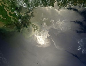
Judging from the recent coverage in the US and world media, most people would immediately respond “Yes!”, citing the current BP spill resulting from the April 20 explosion of the Deepwater Horizon offshore rig.

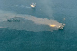
Ixtoc-1 blow out

However, at present this would not be the correct answer.  The largest oil spill in the Gulf of Mexico followed the June 3, 1979 blowout from the PEMEX Ixtoc I exploratory well in the southern part of the Gulf of Mexico 100 kilometers from the Campeche Coast. Though the well was in only 160 feet of water, the leak was very difficult to plug.  The flow started at an estimated 30,000 barrels a day (b/d); but was reduced in July by pumping mud into the well.  In August PEMEX pushed steel, iron and lead balls into the well to further reduce the flow.  Though PEMEX drilled two relief wells to reduce the pressure, the leak continued for 295 days until March 23, 1980.  An estimated total of 140 million gallons oil escaped making the Ixtoc I the largest oceanic accidental oil spill in history.

The next largest accidental oceanic spill was that same year when in July, 1979 the two tankers, the Atlantic Empress and the Aegean Capitan, collided off Trinidad and spilled about 90 million gallons.  The largest oil spill ever was during the Gulf War Gulf when the Iraqi Army intentionally sabotaged the oil fields in 1991 spilling about 525 million gallons.  The second largest was the Lakeview Gusher which occurred on land near Bakersfield, California in 1909 and spilled an estimated 370 million gallons.

BP oil spill approaches the US coast

The current BP leak south of Louisiana spilled an estimated 19 to 39 million gallons during its first six weeks.  At this rate, it could surpass the Ixtoc I spill between by September or October.  Everyone hopes that the leak is stopped long before then…

Update (16 July 2010). BP has capped the well, and no more oil is leaking into the ocean. The total volume of oil that has already spilled from the BP well is estimated at between 90 and 180 million gallons, comparable to, and possibly even exceeding, the Ixtoc I spill.

Update (16 August 2010). A team of US scientists now estimates that BP’s Macondo oil well, which exploded on 20  April 2010 spewed 170 million gallons of crude into the Gulf of Mexico during the 87 days before 15 July, when it was  finally capped. A further 34 million gallons of oil were captured by BP during efforts to cap the well. This makes the BP disaster the world’s largest accidental offshore oil spill ever.

More details? Wikipedia’s extensive account of the Deepwater Horizon oil spill.

The Republic of the Yucatán

 Other  Comments Off on The Republic of the Yucatán
Jun 042010
 

After independence in 1821, the Federated Republic of Yucatán joined the Mexican federation in May 1823.  The new republic comprised the whole Yucatan Peninsula including what is now the states of Campeche and Quintana Roo.  It maintained a degree of autonomy in the Mexican federation.

In the mid 1830s President Santa Anna imposed a centrally controlled dictatorship, which imposed significant control over Yucatán.  This lead to a rebellion in 1838 seeking Yucatán independence. Negotiations with Santa Anna to give Yucatán more autonomy within the Mexican Republic stumbled.

In 1840 the Yucatán declared full independence as the Republic of the Yucatán. At the time, Santa Anna was preoccupied with rebellions in northern Mexico, but he did blockade Yucatán ports. At the time, there were no land routes between the Yucatán and either Mexico or Central America. In 1843 Mexico sent troops to Yucatán to put down the rebellion. They failed, but the blockade was successful. The young Republic had no navy and no way to trade because its ports were successfully blockaded. It agreed in December 1843 to rejoin Mexico when given assurances of self-rule.

But the assurances of self-rule were not upheld and the Yucatán declared independence again on January 1, 1846. When the Mexican–American War broke out later that year, Yucatán declared neutrality. While Mexico had its hands full fighting the USA, the Yucatán had its own problems. In 1847 the Mayas initiated the Caste War by rebelling against the Hispanic (Criollo) (creole) upper class that controlled the Yucatán Republic.

With its back to the wall in early 1848, the Yucatán Republic offered sovereignty over Yucatán to either USA or Britain or Spain, whichever was first to effectively end the Maya revolt. The USA invoked the Monroe Doctrine to keep the other two out and seriously considered the proposal, but in the end did not accept it.

In a desperate effort to put down the rebellion, the Yucatán Criollos agreed on 17 August 1848 to re-unite with Mexico if the Mexican army would put down the Maya rebellion. Thus the on and off  life of the Republic of the Yucatán came to an end. The peninsula remained relatively separate from the rest of Mexico. The first railroad link was established in the 1950s (see earlier post about the first map on a Mexican postage stamp) and the first highway in the 1960s.

See also:

Mexican place names often have their roots in pre-Hispanic languages and have multiple levels of meaning

 Other  Comments Off on Mexican place names often have their roots in pre-Hispanic languages and have multiple levels of meaning
Jun 032010
 

This is the second in our series of guest blogs by Fatimah Araneta.

Fatimah Araneta grew up in Mexico City. After gaining a Masters in City Planning at Berkeley, California, she opted to eschew city life and direct her energy and attention to living in tune with what’s left of Mother Earth before it all gets paved over and criss-crossed with cabled and non-cabled networks. She lives “off the grid” in the shadow of the volcano she prefers to call Chicnautécatl.

Part 2 – Mexican place names often have their roots in pre-Hispanic languages, and have multiple levels of meaning

In the first part, we looked at the possible origins of Chicnautécatl or Xinantécatl, aka El Nevado de Toluca, Mexico’s fourth highest peak. In this part we start to consider Miguel León-Portilla’s view that a single place name in Mexico can have up to four distinct levels of meaning.

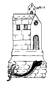
The first layer of meaning is more often than not a geographical description of the place in the language of its original inhabitants. Two examples in Oaxaca are Yodzo Coo, which in Mixtec means “Plain of the Snakes”, and Yacu Dzaa, Mixtec for “Hill of the Bird”.

coixtlahuaca

Coixtlahuaca (place of snakes)

The second layer is generally in Nahuatl, as the expansion of the Aztec empire made this language the lingua franca over an extensive territory over the course of several centuries. The Nahuatl name would almost always be a translation of the first place name. For example, the above mentioned Yodzo Coo was renamed Coixtlahuaca.

On other occasions, the Nahuatl name would be another geographic appreciation of the place, but this time from the viewpoint of the Aztecs. For example, the region occupied by the Purépecha nation was called Mechuaca, which is Nahuatl for “Place of Fish”. That region is roughly what today is the modern state of Michoacán. The Purépecha simply called their territory P’urhépecheo, “Place Where the P’urhé Live”, p’urhé meaning people, referring to themselves.

The next part in this mini-series will look at how a third layer was often bestowed on Mexico’s placenames by the Spanish colonizers who arrived in the early 16th century.

Click on the word “placenames” or the “placenames” tag for more articles about Mexico’s place names.

How Mexico’s fourth highest peak got its name

 Other  Comments Off on How Mexico’s fourth highest peak got its name
Jun 022010
 

We are delighted to publish a series of guest blogs by independent researcher Fatimah Araneta.

Fatimah Araneta grew up in Mexico City. After gaining a Masters in City Planning at Berkeley, California, she opted to eschew city life and direct her energy and attention to living in tune with what’s left of Mother Earth before it all gets paved over and criss-crossed with cabled and non-cabled networks. She lives “off the grid” in the shadow of the volcano she prefers to call Chicnautécatl.

Part 1 How Mexico’s fourth highest peak (Chicnautécatl) got its name

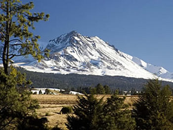
Chicnautécatl

Mexico’s fourth highest peak is an extinct volcano that rises elegantly above the city of Toluca. It is generally referred to as “el Nevado”, which is short for “el Volcán Nevado de Toluca”, Toluca’s Snow-Covered Volcano. Nowadays, however, the name is sadly inaccurate since the volcano is hardly ever covered in snow.

El Nevado is also known as Xinantécatl[1]. This name first appeared in an official registry in the second half of the nineteenth century. It sounds like Nahuatl, the language of the Aztecs, but historians have debated at length about its origin and meaning, questioning its authenticity. The closest place name that bears any etymological resemblance is the town of Zinacantepec, “Hill Where There Are Bats”. However, the volcano does not possess a significant bat population, and Zinacantepec is only one of dozens of small towns that surround it.

It is possible that the original name in Nahuatl had really been Chicnautécatl, “Nine Peaks”. This would dovetail nicely with the Lerma River’s old Nahuatl name of Chicnahuapan, “Nine Rivers”. The River Lerma is the result of the confluence of several streams that spring from the sides of the volcano.

An explanation offered by García Martínez of how “Chicnautécatl” could have become “Xinantécatl” is a not-so-farfetched series of errors, considering the lack of a basic alphabet in Nahuatl. It could all boil down to how the name was pronounced by one person, written down by a second, and later read and copied, or rather miscopied, by a third.

The number nine in nahuatl is “chicnaui” and that is how it is generally written now, but it can be pronounced “shicnaui” as well as “chicnaui”. It is possible that one person informed a second that the volcano was called “Chicnautécatl”, pronouncing it with a “sh” sound, and the one who listened wrote an “X” for the beginning “sh” sound (the Castilian alphabet has no letter for the “sh” sound). So, it may have been registered as “Xinautécatl”. Then, according to this line of thought, a third person misread the name, mistaking the “u” for an “n”, or miscopied it, writing an “n” instead of the “u”, thus giving rise to “Xinantécatl”.

However it may have been, the volcano is still more often referred to as “el Nevado”.

Fortunately, the origins of most place names in Mexico are more straightforward and comprehensible. The next part of this article examines why many Mexican place names have up to four distinct layers of meaning.


[1] In Mexican Spanish, the “x” can be pronounced “s” as in sun, “sh” as in shoe, “h” as in hat, or “x” as in taxi. In the case of “Xinantécatl” it is pronounced “s”.

Click on the word “placenames” or the “placenames” tag for more articles about Mexico’s place names.

How big is Lake Chapala?

 Other  Comments Off on How big is Lake Chapala?
Jun 012010
 

“How big is Lake Chapala?”

There is no single answer to this question.  It all depends on the reference point in time.

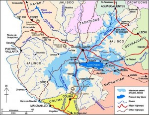
The extent of the former Lake Jalisco (click image to enlarge map)

Some geologists suggest that 40,000 years ago, the Lake’s surface area was seven times its current size and its volume about 200 times greater.  At that time, the Lake towered almost 700 feet above what is now Guadalajara and stretched nearly to Aguascalientes (see map).  The decline of this massive ancient lake resulted from sedimentation, tectonic faulting and the cutting of a fantastic drainage gorge by the Rio Santiago  (see Jack Leyden’s “The geology and geography of Lake Chapala and western Mexico”, on MexConnect.com)

In recent history, the size of the Lake has continued to change dramatically.  In the 19th century, the Lake stretched almost 20 kilometers farther east.  Construction of an 80 kilometer dike and drainage system in 1908 attempted to capture a large portion of the lake for agricultural use.  Through a series of successive floods, partially attributed to the Poncitlán Dam on the Rio Santiago, the lake recaptured the land.  However, the dikes were re-constructed and the land eventually converted to permanent farmland, only occasionally disrupted by flooding.  Environmentalists argue that this has destroyed an important ecological role of this once important marshland.

The size of Lake Chapala has fluctuated significantly in recent decades; from extreme lows in 1954-56, 1992 and 2003 to highs in the 1960-70s and 2005-06.  These dramatic low to high changes can increase the Lake level by 8 meters, its volume by a whopping 800% and its surface area by 100%.   Fortunately, the Lake is at a relatively high level as we approach the 2010 rainy season.

Obviously, answering the question, “How big is Lake Chapala?” is very time sensitive.   In November 2009, Lake Chapala was about 75 by 25 kilometers with a surface area of 1150 square kilometers and a volume of 5.5 billion cubic meters (bcm).

Lake Chapala is sometimes called the largest lake in Mexico, but even this can be questioned.  It is the largest in terms of surface area. But with its shallow depth it is not the largest in terms of volume. The amount of water it holds, even when full to maximum capacity, is only 8.1 bcm.  It trails three reservoirs behind hydroelectric dams: La Angostura (10.7 bcm), Malpaso (9.6 bcm) and Infiernillo (9.3 bcm). But we must remember that the volume of all Mexico’s lakes and reservoirs varies enormously from season to season and year to year.

What about the future?  All lakes are destined to disappear because they all eventually fill completely with sediment.  In the not too distant geologic future, Lake Chapala will be gone.  Speaking of the future, geologic fault systems aligned with Lake Chapala, working with nearby fault systems, will eventually create a large Pacific island from a big chunk of western Mexico containing Puerto Vallarta and Manzanillo.

These topics are discussed in greater detail in previous Geo-Mexico.com posts: