admin

Mexico City wins 2013 Sustainable Transport Award

 Mexico's geography in the Press  Comments Off on Mexico City wins 2013 Sustainable Transport Award
Jan 192013
 

The Institute for Transportation and Development Policy (ITDP), together with an international committee of transportation and development experts, has awarded Mexico City the 2013 Sustainable Transport Award.

The Institute for Transportation and Development Policy works with cities worldwide to bring about sustainable transport solutions that cut greenhouse gas emissions, reduce poverty, increase urban mobility and improve the quality of urban life.

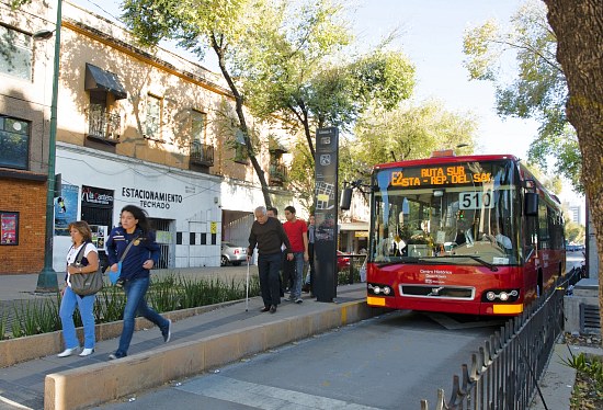
The 2013 Sustainable Transport Award recognizes Mexico City’s Bus Rapid Transit (BRT) system, cycling and walking infrastructure, parking program, and revitalization of public space. Established in 2005, the Sustainable Transport Award recognizes leadership and visionary achievements in sustainable transportation and urban livability, and is presented to a city each January for achievements in the preceding year.

Mexico City Metrobus

The Sustainable Transport Award was presented to Mexico City on January 15, 2013 at an awards ceremony during the annual meeting of the Transportation Research Board, one of six major divisions of the U.S. National Research Council. ITDP board president and former Mayor of Bogotá Enrique Peñalosa presented Mexico’s Minister of Transport, Rufino León, and Minister of Environment, Tanya Muller with the award. The former Mayor of Mexico City, Marcelo Ebrard, who oversaw much of Mexico City’s sustainable transport projects, made closing remarks at the ceremony. Janette Sadik-Khan, Commissioner of the New York City Department of Transportation, delivered the keynote address.

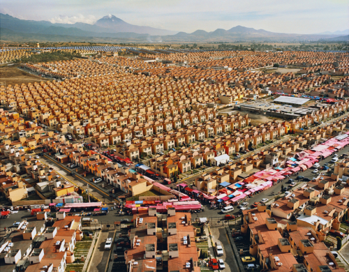
Mexico City has implemented many projects in 2012 that have improved livability, mobility, and quality of life for its citizens, making the Mexican Capital a best practice for Latin America.

  • The city expanded its Bus Rapid Transit system, Metrobús, with Line 4, running along a corridor from the historic center of the city to the airport.
  • The city piloted a comprehensive on-street metered parking program, EcoParq.
  • The city opened line 12 of its Metro system (Sistema de Transporte Colectivo Metro).
  • The city expanded its successful public bike system Ecobici, and added new bike routes (ciclovías).
  • The city revitalized public spaces including the Alameda Central and Plaza Tlaxcoaque.

The finalists and winner were chosen by a Committee that includes the most respected experts and organizations working internationally on sustainable transportation. The Committee includes the Institute for Transportation and Development Policy, The World Resources Institute Center for Sustainable Transport,  GIZ (Deutsche Gesellschaft für Internationale Zusammenarbeit), Clean Air Asia, Clean Air Institute, United Nations Centre for Regional Development (UNCRD), Transport Research Laboratory, EcoMobility, Local Governments for Sustainability (ICLEI) and the Transport Research Board’s Transportation in the Developing Countries Committee.

“Mexico City was like a patient sick with heart disease, its streets were some of the most congested in the world”, says Walter Hook, CEO of ITDP, “In the last year, Mexico City extended its great Metrobus BRT system straight through the narrow congested streets of its spectacular historical core, rebuilt public parks and plazas, expanded bike sharing and bike lanes, and pedestrianized streets.  With the blood flowing again, Mexico City’s urban core has been transformed from a forgotten, crime ridden neighborhood into a vital part of Mexico City’s future.”

“We congratulate the Federal District of Mexico for their leadership in advancing sustainable transport. Celebrating success is a way to highlight best practices; many cities will find inspiration in your great achievements.”

“Sustainable transport systems go hand in hand with low emissions development and livable cities. Mexico City’s success has proven that developing cities can achieve this, and we expect many Asian cities to follow suit,” says Sophie Punte, Executive Director of Clear Air Asia.

Past winners of the Sustainable Transport Award include:  Medellín, Colombia and San Francisco, United States (2012); Guangzhou, China (2011);  Ahmedabad, India (2010); New York City, USA (2009); London, UK (2008); Paris, France (2008); Guayaquil, Ecuador (2007); Seoul, South Korea (2006), and Bogotá, Colombia (2005).

[Note: This post is based on the text of a press release from the The Institute for Transportation and Development Policy (ITDP)]

Related posts:

Why Is Mexico in the OECD?

 Other  Comments Off on Why Is Mexico in the OECD?
Jan 172013
 

The Organisation for Economic Co-operation and Development (OECD) was founded in 1961 to promote economic growth. Its current 34 members include 25 European countries along with Canada, the USA, Australia, New Zealand, Japan, South Korea, Mexico, Chile and Israel. Mexico joined the group in 1994. Four new members were admitted in 2010: Chile, Slovenia, Estonia and Israel. Russia is not yet a member but is moving toward that goal. The current Secretary General of the OECD is Mexico’s  José Ángel Gurría Treviño, first appointed in 2006; his current term in this position extends to 2016.

oecd_logo

OECD member countries are among the most highly developed and wealthiest countries on the planet. Though OECD members represent only 18% of the world’s population, they account for 55% of global Gross Domestic Product (GDP), measured on a Purchasing Power Parity (PPP) basis. Among OECD members, Mexico has the lowest per capita GDP, slightly behind Chile and Turkey. In terms of the UN Human Development Index (HDI) Mexico trails all the others except Turkey. How did Mexico become a member of this very elite set of countries?

There are three main criteria for OECD membership:

  1. Democracy and respect for human rights
  2. Open market economy
  3. GDP per capita (PPP) at least as high as the poorest OECD member

When Mexico became a member in 1994, it was a democracy albeit a one party democracy. It was very clearly an open market economy and its per capita GDP was slightly higher than Turkey’s. Consequently, it met the criteria and was admitted by other OECD members. (See Elżbieta Czarny et al., The Gravity Model and the Classification of Countriesin Argumenta Oeconomica, 2 (25) 2010.)

What are the benefits of OECD membership?

As a member, Mexico fully participates in OECD discussions concerning economic, social and environmental situations, issues, experiences, policies, and best practices. OECD collects and analyzes a very wide range of data which enables Mexico to monitor its position and progress on numerous important dimensions. OECD also has numerous world class experts and committees that can assist countries on specific issues and policies.

Certainly being a member of this elite group provides Mexico with an amount of international prestige. On the other hand, most development analyses and comparative OECD reports show Mexico near the bottom on most measures and rankings.

Related posts:

Colima Volcano erupts, destroying lava dome first created in 2007

 Mexico's geography in the Press  Comments Off on Colima Volcano erupts, destroying lava dome first created in 2007
Jan 142013
 

Colima Volcano (aka the Volcán de Fuego) is one of the westernmost volcanoes in Mexico’s Volcanic Axis, which straddles the country from west to east. The Volcano’s summit is only 8 km (5 miles) from the inactive Nevado of Colima volcano, Mexico’s sixth-highest peak, which rises 4260 m (13,976 ft) above sea level. (Curiously, despite their names, the summits of both volcanoes are actually located in the state of Jalisco and not the state of Colima.)

The elevation of Colima Volcano is officially given as 3820 m (12,533 ft) above sea level. In the past 400 years, it has been the most active volcano in Mexico, having erupted at least 30 times since 1576.

It is also considered to be one of the country’s most dangerous volcanoes. Numerous villages in its shadow keep a wary eye on its level of activity, and emergency evacuations have become a regular event in the past fifty years.

Colima Volcano, 11 Jan 2013. Photo: Protección Civil.

Colima Volcano forms new crater, 11 Jan 2013. Photo: Edo de Jalisco Protección Civil.

On a geological time-scale, the volcano first erupted about five million years ago in the Pliocene period, long after activity ceased at the nearby, and higher, Nevado de Colima. It quickly developed into a large volcano which partially blew apart or collapsed during Pleistocene times to form a caldera, five kilometers across. A new cone developed inside the caldera. This is the Volcán de Fuego we see today.

The cone is built mainly of pyroclastic materials (ashes and volcanic bombs) of andesitic composition together with some basaltic lava, making it a classic example of a composite volcanic cone.

Historically, the eruptions of the volcano have fallen into a definite cyclical pattern with periods of activity, each lasting about 50 years, interspersed with periods of dormancy. The first cycle of activity (after the Spanish arrived in Mexico) was between 1576 and 1611. Major eruptions occurred in 1680 and 1690, and further complete cycles occurred between 1749 and 1818, and from 1869 to 1913. Most geologists agree that current activity is part of the fifth cycle, which began in 1961.

A three year sequence of prior activity (2003 to 2005) is shown on this series of NASA satellite images.

Hazard Map of Colima Volcano (2003) Credit: Universidad de Colima, Observatorio Vulcanológico

Hazard Map of Colima Volcano (2003) Credit: Universidad de Colima, Observatorio Vulcanológico. Click for full-size image (large file size)

In each major cycle, the first results of renewed activity force new lava into the existing crater, forming a dome. Once the crater has filled up, any additional lava is ejected from the crater and flows down the volcano’s flanks. If the lava is unable to escape (relieving the underground pressure), the dome is liable to explode, which is exactly what happened a few days ago:

As on several previous occasions, once the subterranean pressure that caused the activity has been relieved, activity should cease, and the volcano will enter another less dangerous dormant phase. Even during this phase, a plume of hot gas often billows out from the volcano.

The dome that was destroyed in January 2013 began to build in 2007. The explosive activity on 6 January and 10 January 2013 left behind a new crater 220 meters (720 ft) across and about 50 m (165 ft) deep. According to the Jalisco-Colima Scientific Committee (which oversees the hazard analysis posed by the volcano), the events of 6 and 10 January emitted an estimated  1.5 million cubic meters of material, which formerly formed the dome. The 10 January explosion, which occurred at 21:40 hrs local time, sent incandescent material down the west flank of the volcano. An ash column rose about 3000 meters into the air before traveling north-eastwards on the wind towards the city of Ciudad Guzmán.

Thermal imaging shortly after the 10 January explosion showed that the temperatures in the crater are below 200 degrees Centigrade, which indicates relatively little gaseous build up and limited risk of further major explosions. Even so, a prudent 7.5 km exclusion zone is being maintained around the volcano.

Update (29 Jan 2013):

Another explosion at 3:58 am on 29 January 2013 created a plume of ash and cinders that rose more than 3000 meters above the volcano. The ash fell of nearby villages, including Los Mazos, Ejido Atenquique, Tuxpan and Huescalapa.

The area around the volcanoes is described in more detail in chapter 15 of “Western Mexico, a Traveler’s Treasury” (4th edition; Sombrero Books, 2013).

Related posts:

Street patterns in Mexico City

 Books and resources  Comments Off on Street patterns in Mexico City
Jan 102013
 

A recent post on Polis, “a collaborative blog about cities across the world”, focuses on the street patterns in Mexico City.

The post uses Google Earth images of different parts of the city to illustrate how street patterns vary between neighborhoods with different levels of wealth. This approach has long been used in urban geography, but the examples provided are a useful reminder of the value of “old-school” map interpretation skills, some of which are rapidly being lost in the age of online maps.

Mexico City Metropolitan Area: Fuentes de Aragón

Mexico City Metropolitan Area: Fuentes de Aragón

A simple exercise for students would be to ask them to choose two similar-sized cities, one in the USA and one in Mexico, and then use Google Maps and Google Earth images to compare their urban morphology (street patterns). It is worth comparing areas of different land uses (such as industrial, commercial, residential). The analysis should include some annotated images highlighting the key similarities and differences.

Mexico City Metropolitan Area (Geo-Mexico Fig 22.2; all rights reserved)

Spatial growth of Mexico City Metropolitan Area (Geo-Mexico Fig 22.2; all rights reserved)

The striking rectilinear lines usually found in poorer neighborhoods are in stark contrast to the curvilinear street patterns common in wealthier suburbs. In a city with a long history, like Mexico City, it is easy to locate and identify residential areas of very different age. (In general, the older residential areas are closer to the city center than newer residential areas.)

Mexico City: Pedregal San Angel

Mexico City: Pedregal San Angel

In the case of both Mexico City and Guadalajara (Mexico’s second largest city), a transect across the city from the wealthy west to the much poorer east will reveal remarkable differences in street patterns, corresponding closely to the patterns of wealth.

Related posts:


Globalization: Mexico exports almost all motor vehicles it produces, but imports new cars

 Updates to Geo-Mexico  Comments Off on Globalization: Mexico exports almost all motor vehicles it produces, but imports new cars
Jan 082013
 

Which company exports the most motor vehicles in Mexico? In term of units exported, Ford was the leader with 449,925 units. Ford exported over 97% of the vehicles it made in Mexico in 2011. Though Ford sold many new cars in Mexico, virtually all were imports, mainly from the USA or Canada. GM was a relatively close second with 443,237 vehicles exported, 81% of the total produced.

VW was next with 439,925 units exported, 84% of their total. Nissan was fourth with 411,660 vehicles exported which was a significantly lower percentage (68%) of its total production. Nissan sells about a third of its Mexican produced vehicles in Mexico, by far the highest percentage among auto manufacturers in Mexico.

Chrysler/Fiat exported 266,117 vehicles, 79% of their total production. Toyota was next with 49,549 vehicles exported for an amazing 99.9% of the total manufactured. Surprisingly only 47 of the almost 50,000 Toyotas made in Mexico in 2011 were sold in Mexico; all of the rest were exported to the USA or Canada. Virtually all of the thousands of new Toyotas sold in Mexico are imported. This is a very extreme case of globalization at work under NAFTA. Honda exported 36,429 units in 2011 for 80% of its total production.

Data are not yet available to determine which companies will lead in exports in 2012 and the percentage of total production that is exported. Overall production is expected to rise by over 20% in 2012 and perhaps even faster in future years judging by the amount auto companies are currently investing in Mexico. Obviously, production levels in 2013 and beyond will be closely tied to demand in the USA and Canada.

Related posts:

Mexico’s changing urban landscape: the rapid rise of low-income subdivisions

 Books and resources  Comments Off on Mexico’s changing urban landscape: the rapid rise of low-income subdivisions
Jan 052013
 

Between 2000 and 2006, more than 2.3 million new low-income INFONAVIT homes were built in Mexico, a staggering rate of 2,500 new homes each and every day. The achievement was documented by photographer Livia Corona, who divides her time between New York and Mexico City, in a four-year project entitled “Two Million Homes for Mexico”. The project focuses on the “surge of mass-scale neighborhood developments in Mexico, exploring their role in the ongoing transformation of the ecological, social and cultural landscape of the nation and its citizens.”

47,547 Homes. xtapaluca, Mexico.Credit: Livia Corona.

47,547 Homes. Ixtapaluca, Mexico.Credit: Livia Corona.

As Corona’s photos reveal, while most of the “cookie-cutter” housing developments lack public amenities (schools, clinics) and public spaces (parks), and have few commercial establishments, the people moving into these homes proved remarkably adaptable and creative.

In the photographer’s own words, “Through images, films, and interviews, I look for the space between promises and their fulfillment. In my photographs of multiple developments throughout the country, I consider the rapid redefinition of Mexican “small town” life and the sudden transformation of the Mexican ecological and social landscape. These urban developments mark a profound evolution in our way of inhabiting the world.”

Credit: Livia Corona.

Credit: Livia Corona.

As she explained in an interview with Nina Corvallo for the  now-retired Nymphoto blog:

“In my current role as a visual artist, I am often familiarizing with new geographies, both for research and for commissioned assignments. My work is drawn by the underlying structures affecting quotidian survival, and my photographs expand on how these manifest on a broader level.”

“In my current work, Two Million Homes for Mexico, my drive comes from the riddle of what living in these neighborhoods can do to the development of a social and creative expression. What are the manifestations of this experience on the young minds growing up in these insular and remote landscapes, as they draw from a singular cultural and socio-economic backdrop?”

“Developers provided infinite rows of identical 100 to 200 square feet homes. Dwellers are now faced with the task of turning the rows into streets and developments into cities. I am inspired by the inventiveness of people in these neighborhoods, who are adapting with a very hands-on approach—despite a limited infrastructure—to procure a more appropriate living environment. Mexicans, as other Latin Americans, are notoriously gifted in appropriating the built environment. My project both celebrates these small individual triumphs as it frames the challenges and abuses made in providing housing for an ever-expanding population.”

The powerful images of Livia Corona are a worthy resource for urban geography classes.

Related posts:

Education quality: How do Mexican students compare to those in other countries?

 Other  Comments Off on Education quality: How do Mexican students compare to those in other countries?
Jan 032013
 

Mexico’s future is largely dependent on the quality of future citizens and consequently on the quality of its current education system. The Mexican economy has done quite well in recent years because it has a productive work force that is willing to work for relatively reasonable wages. While China previously had a workforce productivity advantage over Mexico, that advantage has essentially vanished. Therefore, many companies are moving their manufacturing operations from China to Mexico.

The Programme for International Student Assessment (PISA), coordinated by the OECD, evaluates national education systems every three years by testing 15-year-olds in reading, mathematics and science. The most recent assessment in 2009 investigated students in 65 countries, including the mostly high income 34 OECD countries.  (The 2012 results will be released in December 2013).

In 2009, the following countries ranked in the top ten in all three categories (reading, mathematics and science):

  • China: Shanghai (PISA divides China into several sub-national regions)
  • South Korea
  • Finland
  • Hong Kong
  • Singapore
  • Canada
  • Japan

How do Mexican 15-year-olds stack up against students from these other countries?

Within this group, the Mexican students ranked 48th in reading with a score 425. This placed Mexico behind the USA (17th, 500), Turkey (41st, 464), Russia (43rd, 459) and Chile (44th, 449); but ahead of Colombia (52nd, 413), Brazil (53rd, 412), Indonesia (57th, 402), Argentina (58th, 398) and Peru (63rd, 370). We mention the ranking and score of the USA because there has been considerable information published recently about the mediocre quality of its education system. While Mexico’s ranking and score is way behind that of the USA and closer to the bottom of this 65 country sample, it is not really so bad. It is better than that of most other Latin American countries. On the other hand it could and should be better.

The Mexican students did not do quite as well in mathematics. They ranked 50th with a score of 419. This placed them significantly behind the USA (31st, 487) and Russia (38th, 468). Mexico was also below Turkey (43rd, 445) and just behind Chile (49th, 421). As with reading they were ahead of Argentina (55th, 388), Brazil (57th, 386), Colombia (58th, 381), Indonesia (61st, 371) and Peru (64th, 360). Only one country was below Peru, namely Kyrgyzstan (65th, 331). It is important to remember that this sample includes mostly European countries, only one African country, Tunisia; no South Asian Countries, and only two Middle Eastern countries, Israel and Dubai. Mexico would look considerably better if it were compared with all countries in the world.

Mexico did about as well in science as they did in mathematics. They ranked 50th with a score 416. This placed them far behind the USA (23rd, 502) and Russia (39th, 478) and a ways below Turkey (43rd, 454) Chile (44th, 447). As with reading they were ahead of Brazil (53rdh, 405), Colombia (54th, 402), Argentina (56th, 401), Indonesia (60st, 383) and Peru (64th, 369). The data suggest that the scores for each country on reading, mathematics and science are pretty much the same within each country. In other words, the scores on any one of these disciplines tend to be a rather good measure of the overall quality of the education system.

If Mexico is going to compete in the globalized world economy, it must continue to improve its education system. Recent efforts have accomplished a great deal, raising the average amount of schooling of its citizens to 8.6 years. Future efforts should focus as much attention on improving the quality of education.

Related posts:


The important role of telenovelas and historietas as forms of communication in Mexico

 Excerpts from Geo-Mexico  Comments Off on The important role of telenovelas and historietas as forms of communication in Mexico
Dec 312012
 

The highest rating programs on TV are televised novels, telenovelas. A telenovela is a limited‑run television serial melodrama, somewhat like a soap opera but normally lasting less than a year, and where the eventual ending has already been scripted.

image of los ricos tambien lloranThe first global telenovela was Los ricos también lloran (“The rich cry too”), originally shown in 1979. Telenovelas are now a $200 million market. Some critics claim they are effective promoters of social change, others deride them as being nothing more than mass escapism. Whichever view is more accurate, their portrayals reflect society’s values and institutions.

Advocates of telenovelas point to their role in challenging some traditional Mexican media taboos by including story lines about urban violence, racism, homosexuality, birth control, physical handicaps, political corruption, immigration and drug smuggling. Early telenovelas tended to be shallow romantic tales. The form subsequently evolved to include social commentaries and historical romances, some applauded for their attention to historical detail. Some were used for attempts at social engineering. An early government-sponsored telenovela promoted adult literacy programs. Several others openly advocated family planning and have been credited with contributing to Mexico’s dramatic decline in fertility rate. Other telenovelas have targeted younger audiences, focusing on issues connected to pop music, sex and drugs.

Rius historieta: The failure of education in Mexico

Rius historieta: The failure of education in Mexico

Besides the shallowness of the plot lines in most telenovelas, the other common criticism is that their stars are almost always white-skinned, blue-eyed blondes. Sadly, all too often, actors with indigenous looks are relegated to roles portraying menial workers such as home help or janitors.

Telenovelas have been extraordinarily successful commercially. They have become immensely popular not only in Latin America and among the US Hispanic population but also in more than 100 other countries, mainly in Eastern Europe and Asia.

In print media, a similar role to the telenovela has been played by historietas (comic books), the best of which have tackled all manner of social, political and environmental issues well before such topics made the main-stream press. Historietas helped educate millions of Mexicans and were also a commercial success. Their circulation peaked in the 1980s but has since declined due to competition from television and, more recently, the internet. The most influential creator of historietas is the cartoonist and writer Eduardo del Río (Rius) whose work earned him a 1991 United Nations Environment Programme prize.

Related posts:

Which company produces the most motor vehicles in Mexico?

 Updates to Geo-Mexico  Comments Off on Which company produces the most motor vehicles in Mexico?
Dec 292012
 

Back in 2006, General Motors (GM) was the clear leader in production with 493,841 units (just over 25% of the national total). Nissan was second with 411,236 units (21%). These were followed by Volkswagen (VW) – 339,183; Ford – 329,993 and Chrysler – 307,344. The newcomers, Toyota and Honda trailed way behind with 33,835 and 24,297 units, respectively.

By 2011 the picture had changed considerably. All the manufacturers suffered major losses in 2009 as a result of the Great Recession, but all have recovered, some better than others. Between 2006 and 2011, Nissan increased total production by 48%. In 2011, Nissan led all producers with 607,087 units for almost 24% of the national total.

Nissan easily surpassed GM which increased 2006 to 2011 by only 10% for a total of 544,202 units. VW increased by an impressive 50% to 510,041 units. Ford nearly kept pace with an increase of 40% to 462,462 units. Chrysler with merged with Fiat matched GM with an increase of only 10% up to 338,772 vehicles. Toyota upped production by a very significant 47% to 49,596 units. Honda did even better, increasing its production by a whopping 87% to 45,390 units.

Final data are not yet available to determine which companies led production in 2012. Overall production was expected to rise by over 20% in 2012 and perhaps even faster in future years judging by the amount auto companies are currently investing in Mexico. Obviously, production levels in 2013 and beyond will be closely tied to demand which is linked to overall economic growth. Judging from the investment amounts announced so far, it appears that Nissan will retain its lead in total production, with VW and Ford perhaps challenging GM for second place.

Related posts:

Mexico’s sixteenth century Geographic Accounts: the example of Jiquilpan, Michoacán

 Books and resources  Comments Off on Mexico’s sixteenth century Geographic Accounts: the example of Jiquilpan, Michoacán
Dec 272012
 

In a previous post, we introduced the Geographic Accounts, a rich source of information about Mexico’s sixteenth century geography. The style and substance of a typical Geographic Account can be judged by extracts from the response (dated 1579) relating to Jiquilpan (then written as Xiquilpan), in what is today the western part of the state of Michoacán in western Mexico. In the following (translated) extracts, square brackets enclose editorial comments, not found in the original.

Xiquilpan is in temperate land… A river, which never dries up, passes the village; it carries very little water in summer. In winter, it often rises so much that it can not be crossed. Less than one league from this village towards the north is a lake called Chapala, which is forty leagues around. A lot of white fish and catfish, and another kind of small fish, are caught in it. A large, very full, river, called Chicnahuatengo, enters this lake. [One league is about the distance that could be walked in an hour, from 4.18 kilometers to 6.687 kilometers, depending on the terrain.]

The village is settled on flat and very level ground, without hills…. It is very fertile land. It produces a lot of corn, chile, beans and other seeds that the natives sow. The native fruits are guamúchiles, avocados and guavas. There are lots of figs, pomegranates, quince trees and grapes. It is land where anything that is sown grows….

Xilquilpan has very few Indians: there could be in it about one hundred tributary Indians. They say that before the land was won, there were one thousand two hundred people. After the lands had been won, their number has been diminishing as a result of the many diseases that have occurred. In particular, in [15]76, there was a great plague in this village, common throughout New Spain, from which a large number of people died….

There is a wild plant in this village which cures those who are crippled. It has leaves like a lettuce and is so hot that the part where the root is put burns naturally, like a fire. There is another [plant], which has a root similar to camote: it is a preventative for everything. They cure with these herbs and with others that the natives know….

This village was subject, when it was heathen, to Cazonzi, king of Mechuacan, who ruled over and was in charge of it; on his behalf, he put an Indian chief called Noxti in this village in order to govern and look after them. At that time, they gave corn and chile as tribute to the said Cazonci, which was received by Noxti and sent to Pátzcuaro. At that time, they idolized the Devil, so that he would help them when they went to fight other Indians from neighboring villages. They say that when they caught an Indian, they carried him to a hill next to the village, and there they sacrificed him and offered him to the Devil, and they cut him open and removed his heart and those who had made the sacrifice ate it…

They wore some shawls of joined together sisal, like jackets, without anything else, and cotton breeches, different to what they now wear. Their food was tortillas, tamales, beans, and other wild herbs that they called quiletes [meaning edible herbs or greens in general] and they drank white maguey wine called tlachiquil [unfermented pulque]. They say that they used to live longer than now, and that the reason for this could not be ascertained…

In this village and its surrounding areas, grow pears, figs, pomegranates, grapes, peaches, quinces, nuts, apples, all Castillian [Spanish] fruits. Native [plants] are avocados, sweet canes, guavas, capulines (which are local cherries), squash, chile, tomatoes and a lot of corn. It is land where it does not snow, formerly or now. They raise many birds, both native and from Spain. They grow cabbages, lettuce, onions, radishes, blites, and every kind of vegetable from Spain. Wheat and barley grow in this village.

The animals that there are in the village are wolves, which breed in the swamps that surround some reed beds, a quarter of a league from the village. More than eighty thousand sheep come from other parts to pasture seasonally on the edge of this village each year; it is very good land for them and they fatten very well, since there are some saltpeter deposits in the marsh.

There are no salt beds in this village; the natives supply themselves with salt from Colima, twenty leagues from this village, and from the province called Avalos fifteen leagues away…

Xiquilpan has a monastery of monks of the Order of San Francisco; it has two clerics, one is the guardian. The founder was Brother Juan de San Miguel, and it was founded about forty years ago for all the clerics that were in this province of Mechuacan. The village has a hospital, where the sick are treated, which was begun thirty years ago and founded by a cleric called Brother Alonso de Pineda of the Order of San Francisco. It receives no rents: it is sustained only by the poor, from the alms they beg from the natives.

As can be seen, the Geographic Accounts are of immense value in reconstructing the past history of Mexico. The detail in them is often quite astonishing. However, as René Acuña emphasizes, while the Accounts provide invaluable information about local cultures, including that of the indigenous peoples, they should never be considered completely reliable. They were not eye-witness accounts and often relied on hearsay and on the possibly dubious interpretations made by a relatively limited number of respondents.

Source:

Several transcriptions of the Relaciones geográficas have been published in Spanish. The version used in preparing this article (translations by the author) is Acuña, R (ed) 1987 Relaciones geográficas del siglo XVI: Michoacán. Edición de René Acuña. Volume 9 of Relaciones geográficas del siglo XVI. Mexico City: Universidad Nacional Autónoma de México.

Note: This post is based on an article first published on MexConnect.com

Related posts:

Two examples of bird re-introduction programs in Mexico

 Mexico's geography in the Press  Comments Off on Two examples of bird re-introduction programs in Mexico
Dec 222012
 

Assuming that the world did not come to an end yesterday, Geo-Mexico would like to convey best wishes to everyone for the entire duration of the next Long Count Maya calendar cycle, which runs until sometime in 2406. This may allow sufficient time for some real progress to be made in environmental stewardship.

Today’s post looks at two ornithological conservation projects that have made significant advances in 2012. The first is in Maya territory in south-east Mexico, where biologists are trying to stave off the extinction of the colorful Scarlet Macaw, and extend its current range. Researchers believe that between 250 and 400 of the birds now remain in the wild, almost all of them in the area straddling the borders between Mexico, Guatemala and Belize.

Birds raised in the Xcaret Center for the breeding of macaws, located in the state of Quintana Roo, are being gradually prepared for being set free in Aluxes Park, an ecological reserve on the edge of the natural forest in Palenque, in the state of Chiapas. The plan is to release as many as 250 birds over the next five years. The natural range of the Scarlet Macaw, prior to deforestation, habitat loss and wildlife trafficking, once extended all the way along Mexico’s Gulf coast, from Tamaulipas to Campeche.

At the other end of the country, a decade-old multi-institutional project (government, academic and NGO) aims to reintroduce the California Condor into Baja California state. There are believed to be about 30 California Condors now flying free in the Sierra de San Pedro Martir, following the release of six condors there earlier this year.

California Condor

California Condor in flight. Credit: Friends of the California Condors

Specialists say the project has almost reached the point at which the birds are likely to reproduce successfully in the wild. Since 2008, 10 nesting sites have been located. Condors nest in caves making it difficult and time-consuming to locate nests, even when the birds are tagged with transmitting devices. Among the threats to the success of the program is the incidence of lead poisoning in condors resulting from them swallowing bullets left in animal carcasses killed, and then abandoned, by hunters.

Related posts:

The “Geographic Accounts”: Mexico’s sixteenth century “Domesday Book”

 Books and resources  Comments Off on The “Geographic Accounts”: Mexico’s sixteenth century “Domesday Book”
Dec 132012
 

Mexico’s equivalent of the Domesday Book was compiled in the sixteenth century.

Conquerors often have very little idea of precisely what they have acquired until their victory is assured. In many cases, one of their first post-conquest steps, therefore, is to undertake a comprehensive survey of everything of value, or potential value.

For instance, in 1086, William the Conqueror ordered a survey of his newly acquired England, the results of which were compiled into the Domesday Book. The decision to send out his assessors to every corner of the land was made at his Christmas Court in 1085. As a belated Christmas present to himself, William wanted to know “what or how much each landholder had, in land or livestock, and how much money it was worth”, so that he could tax it accordingly.

Though less comprehensive, a pictorial record of the wealth of Mexico already existed prior to the Spanish conquest. The Mexica people had gradually established an empire (the Aztec Empire) stretching from the Gulf coast to the Pacific. In order to administer the tributes due from each part of the empire, they recorded the requisite payments of feathers, animals, minerals and food, on bark paper codices. Some of these documents still survive, though most were destroyed by the Spanish. The image below is taken from the Codex Mendoza, which was created shortly after the conquest as a record of Aztec life, including the tributes payable by various villages and towns.

Tribute page from the Codex Mendoza

Tribute page from the Codex Mendoza

In this case, the tribute includes:

  • 2 strings of beads of jadeite, a green semi-precious stone
  • a total of 4000 handfuls of colored feathers
  • 160 skins of the bird with a blue plumage
  • 2 labrets (lip piercings) of amber encased in gold
  • 40 skins of jaguar
  • 200 loads of cacao beans, the main ingredient of chocolate
  • 800 tecomates (cups for drinking chocolate)
  • 2 slabs of clear amber, each approximately the size of a brick

Such tribute lists were of little interest to the Spanish when they arrived. Some of the items held in high esteem by the Aztecs were deemed worthless by the conquerors. Other items, such as silver, of little or no consequence to the Aztecs, were highly prized by the Spaniards.

Back in Spain, the Spanish Court was determined to acquire accurate information about everything being encountered in New Spain. This led to a series of censuses and accounts, including the Relaciones geográficas (Geographic Accounts), the earliest version of which dates back to the late sixteenth century.

In 1569, shortly after Juan de Ovando y Godoy was named Visitor of the Council of the Indies, he sent a questionnaire containing 37 questions to the New World. Another questionnaire, with about 200 questions, was sent in 1570. A few years later, perhaps in an effort to elicit more responses from the provinces, Ovando y Godoy’s former secretary and successor Juan López de Velasco reduced the number of questions to 50. These 50 questions, sent to New Spain in 1577, became the basis for the Geographic Accounts.

The authorities in each administrative center were instructed to call a meeting of the “Spaniards and other natives in the district”, to find out everything they could about the area’s geography, people and history.

Of the 191 known responses to the 1577 questionnaire, 167 have survived in archives to the present day. Most of the original responses are housed in Spain, in either the Archivo General de las Indias (Seville) or the Real Academia de la Historia (Madrid). A further 43 of them form part of the Benson Latin American Collection in the University of Texas library in Austin. The library’s webpage about the Relaciones geográficas has several links to images of sample pages and maps.

A future post will look at the content of a typical example of a “Geographic Account”.

Source:

Several transcriptions of the Relaciones geográficas have been published in Spanish. The version used in preparing this article is Acuña, R (ed) 1987 Relaciones geográficas del siglo XVI: Michoacán. Edición de René Acuña. Volume 9 of Relaciones geográficas del siglo XVI. Mexico City: Universidad Nacional Autónoma de México.

Note: This post is based on an article first published on MexConnect.com

Related posts:

Dec 102012
 

Geographic Travels, one of my very favorite Geography blogs, recently posted a photo of a Mexican Christmas Tree, accompanied by a short history claiming that the Christmas tree was first introduced into northern Mexico by German industrialists and others.

That may be a popular notion, but the true history of Christmas trees in Mexico is far more interesting!

According to Historia del árbol de Navidad en México by Hector de Mauleón, prior to 1870, no writers describe the use of Christmas trees in Mexico. By 1890, however, Mexican author Manuel Gutiérrez Nájera (1859-1895) includes the Christmas tree in an inventory of Christmas customs writing that, “¡Tristes aquellos que no tienen un árbol de Noel!” (“Sad are those who do not have a Christmas Tree!”). At that time, small candles were apparently used to illuminate the tree.

Historians, including Teresa E. Rohde (1933-1992), generally agree that the Christmas tree was first brought to Mexico during the French Intervention by none other than Emperor Maximilian, whose execution in 1867 brought an end to this unfortunate episode in Mexico’s nineteenth century history. At some point during their three years in Mexico, Maximilian and his wife Carlota imported a Christmas tree from Europe and installed it in Chapultepec Castle, their palatial home. The tree impressed at least some of Mexico’s wealthy families, who began to install their own trees at Christmas time.

Artificial Christmas Tree with Coca-Cola decorations in Querétaro.

Artificial Christmas Tree with Coca-Cola decorations in Querétaro. Photo: http://burrohall.blogspot.ca/

Within a few years, the Christmas tree had become a tradition in many homes and had begun to replace the elaborate traditional nativity scenes (nacimientos).

In 1878, General Miguel Negrete, who had fought against the French Intervention, decided to have a Christmas tree in his home. According to some sources, he may have brought the idea back from the USA, independently of the earlier European introduction. His tree garnered considerable press attention. It was decorated with 250 toys. As each of his guests arrived at the house, they were given a number, and later took turns to select a gift from the tree, according to one journalist’s contemporary press account.

Despite the popularity of Christmas trees in Mexico, some nationalists continue to decry the practice, considering them a cultural invasion that continues to threaten the much older tradition of nacimientos.

Modern Mexican Nacimiento. Photo: Ariaski (Flickr);

Modern Mexican Nacimiento. Photo: Ariaski (Flickr); creative commons license

Christmas trees are a good historical example of cultural invasion, but at what point (as Hector de Mauleón asks) does a new custom become a tradition? After 150 years, can we now agree that Christmas trees have been assimilated into Mexican culture? Or do we need to wait another 150 years?

Wherever you may be, and real tree or not, warmest Mexican seasonal greetings to all!

In an interesting follow-up post, Geographic Travels considers the possible “Layers of Geopolitical Myths” behind the introduction of Christmas trees into Mexico: The Christmas Tree in Mexico: Layers of Geopolitical Myths?

Related posts:

Durango gets its first Magic Town: Mapimí, along with the Ojuela suspension bridge

 Mexico's geography in the Press  Comments Off on Durango gets its first Magic Town: Mapimí, along with the Ojuela suspension bridge
Dec 082012
 

The state of Durango state finally has its first Magic Town. The small and historic town of Mapimí served various local mines, including San Vicente, Socavón, Sta. Rita, Sta. María, El Carmen, La Soledad, and the presumably traitorous Judas.

The indigenous Tepehuan Indians called this place “the rock on the hill” and repeatedly thwarted the attempts of Jesuit missionaries to found a town here, but the thirst for gold won in the end. It is rumored that gold was even found under the town’s streets. A small museum houses mementos and photos from the old days showing just how prosperous this mining town once was. One handbook to gem collecting in Mexico describes Mapimí as the “mineral collector’s capital of Mexico”. This is the place for the geologist in the group to find plenty of inexpensive agates, selenite crystals, calcite and other minerals.

Like seemingly every town in this region of Mexico, Mapimí boasts that both Miguel Hidalgo, the Father of Mexican Independence, and Benito Juárez, the President of Indian blood, passed by in the nineteenth century. Juárez even stayed overnight.

Ojuela Suspension Bridge

Ojuela Suspension Bridge. Photo: Tony Burton; all rights reserved

Access to one of the local mining areas, about 10 km outside the town is via the Ojuela suspension bridge, a masterpiece of engineering. Ruined stone houses on the hillsides tell of Ojuela’s former wealth. Ore was first discovered here in 1598. By 1777, seven haciendas de beneficio (enrichment plants) served thirteen different mines. In 1848, the Spanish mine owners gave up their struggle to make the mines pay and a Mexican company took over. In 1892 they decided to attack the hillside opposite Ojuela. To shortcut the approach, engineer Santiago Minguin spanned the gorge with a 315-meter-long suspension bridge, said by some to be the third longest in Latin America.

The mine’s production peaked just after the Mexican Revolution. Between 1922 and 1925, 687 kilograms of gold and 99,820 kilos of silver were extracted, alongside more than 51 million kilos of lead and a million kilos of copper. At that time, some 3000 miners celebrated every evening in the bars of Ojuela, now completely abandoned to the elements.

The bridge, restored for its centenary, is a worthy contribution to tourism in Durango state. One and a half meters wide, it sways and bounces in the breeze, probably scaring mums and dads into silent concentration faster than their excited children! But the local miners and their mineral-laden donkeys rattle across the planks as if it were a highway. Once across the bridge, old timers will take you on a one kilometer walk along mine galleries (unlit except for hand-held miners’ lamps) which completely traverse the mountain to emerge into daylight on the far side.

Not far from Mapimí is the internationally-famous “Zone of Silence”, the Mapimí Biosphere Reserve, the claimed merits of which are much discussed.

Mapimí is a very worthy addition to the Magic Towns list. In a future post, we will look at the merits of  six more towns added to the list in the last days of the previous federal administration.

Related posts:

The spatial distribution of Mexico’s GDP

 Other  Comments Off on The spatial distribution of Mexico’s GDP
Dec 062012
 

Mexico’s National Statistics Agency recently released a breakdown of GDP by state for 2011. The data allow for an analysis of the spatial distribution of Mexico’s GDP. The graph below shows each state’s contribution to GDP (blue bars) and their share of Mexico’s total population (red bars):

Population & GDP by state, 2011

Population & GDP by state, 2011. Data: INEGI. Credit: Tony Burton / Geo-Mexico; all rights reserved

In general, Mexico’s larger states (in terms of population) contribute more towards national GDP than its smaller states. Equally, even after population is taken into account, it is clear that some states contribute far more than others to Mexico’s GDP. The states of Campeche and  Tabasco both stand out as contributing far more than their fair share towards national GDP; this is on account of their oil and gas reserves. The Federal District, Nuevo León, Quintana Roo and Querétaro also outperform in terms of economic output. On the other hand, Michoacán, Chiapas, Oaxaca and Guerrero all stand out for contributing less to Mexico’s GDP than the size of their population would suggest.

The economic disparities revealed by the data are closely matched by other indicators of economic disparity such as differences in poverty rates and the distribution of the wealthiest households. For more about these topics, start with the related posts listed below.

Related posts:

Pemex boosts reserves and reduces its emissions

 Mexico's geography in the Press, Updates to Geo-Mexico  Comments Off on Pemex boosts reserves and reduces its emissions
Dec 032012
 

It may come as something of a surprise to many observers, but during 2012, Mexico’s state-owned oil company Pemex (Petróleos Mexicanos) has received several well-deserved plaudits for its efforts to slash the emissions associated with oil and gas exploration, reserves and production.

For the fifth consecutive year, the Global Reporting Initiative awarded Pemex the highest possible rating for social responsibility. The company also received excellent ratings for sustainable asset management. During 2011, Pemex’s proven reserves increased 1.1%, while the petro-giant cut total emissions by 17.3% compared to the previous year. Crude oil output averaged 2.55 million barrels a day in 2011. Carbon dioxide emissions were down 8.8% in 2011, while sulfur oxides have now fallen more than 50% since 2007.

Meanwhile, the production division of Pemex has been praised by World Bank experts for having reduced burn-off from its giant Cantarell gas field from 31% in 2008 to 3% in July 2011. Pemex has invested more than 1.6 billion dollars in the Cantarell field over the last six years in order to improve efficiency, with the installation of compressors, flow separation devices and re-injection technology. In the past three years, it has reduced total emissions, including greenhouse gases, from 13.6 billion cubic meters a year to 2.1 billion. Pemex is well on track to beat its target of 99% efficiency in gas recovery by 2014.

Crude oil production has risen steadily in 2012. For example, in August 2012, Pemex produced 2.56 million barrels of oil a day (b/d), its highest output since May 2011. The Chicontepec field in Veracruz is doing especially well. Its single best-performing well, named Presidente Alemán 1565, uses innovative technology, including three dimensional seismic mapping and horizontal drilling, to yield as much as the combined output of 28 other wells in the region.

Mexico’s current 3P (proven, probable, possible) reserves are also on the rise, and currently total 43 billion barrels of crude oil equivalent. After years of depletion, Pemex is now adding more oil and gas each year to its reserves than it is extracting. The oil giant recently announced a huge deep water, light crude discovery in the Gulf of Mexico, off the coast of Tamaulipas, its first major find in the Perdido Fold Belt, where the total 3P reserves could be as high as 10 billion barrels. The Trión-1 well, drilled to a total depth of 4,500 meters (14,800 feet), is 40 km (25 miles) inside Mexico’s territorial waters and is expected to yield up to 400 million barrels of high quality crude.

Pemex also recently reported the largest land-based discovery of oil for about a decade. The Navegante-1 well, drilled in the South-East Basins 20 km from Villahermosa (Tabasco) found light crude oil with an APR gravity of 45 degrees, at a depth of 6800 meters. The field is 87 square kilometers in area and has estimated 3P reserves of about 300 million barrels of crude oil equivalent.

Related posts:


Decision about GM corn in Mexico postponed until 2013

 Mexico's geography in the Press  Comments Off on Decision about GM corn in Mexico postponed until 2013
Dec 012012
 

Mexico’s new president Enrique Peña Nieto took office earlier today. His single, six-year term will end in 2018. The change of government means that a final decision about the commercial planting of genetically modified (GM) corn in Mexico has been postponed until sometime early next year.

As we have seen in several previous posts, GM corn is a hotly disputed topic in Mexico.

Corn poster

“Without corn there is no nation” (Conference poster, Autonomous University of Chihuahua)

Proponents argue that GM corn will lead to higher yields and reduce losses from pests and diseases. In their view, the commercial planting of GM corn in Mexico is inevitable and will help Mexico “catch up” with Brazil and Argentina, where GM crops are already being grown.  Opponents argue that GM corn will inevitably reduce the genetic diversity of corn, meaning that corn will have less resilience in future to unexpected (and unpredicted) changes (climate, pests, soil conditions, etc). They also argue that GM corn will make corn growers even more dependent on commercial seed producers.

US farmers have found that GM corn lives up to its advertised higher yields and disease resistance. Farmers organizations in northern Mexico have come out in public support of this view, though many farmers in the center and south of the country remain vehemently opposed to GM corn on the basis that cross-contamination would deplete the plants’ gene pool, and possibly lead to the eventual extinction of traditional corn varieties.

Mexico was the world’s 6th largest grain producer in 2010, but fell to 8th spot in 2011. In just 20 years, Mexico has gone from a nation that needed to import less than 400,000 metric tons of corn a year in order to satisfy its domestic market to one where, in the 2012-12 season, it will need to import about 11,000,000 tons. Mexico’s corn imports, mainly of yellow corn for animal feed, are expected to rise to 15,000,000 tons by 2020. Corn prices are also likely to rise since an increasing portion of the annual US corn crop is  destined for biofuel production rather than human consumption.

Mexico currently produces about 22 million metric tons of corn (mainly white corn for human consumption) from 7.2 million hectares nationwide. According to press reports, there are five applications for planting GM corn on a commercial scale. The total area involved is 2.5 million hectares (6.2 million acres).

  • The transnational seed firm Monsanto has two proposals, each for 700,000 hectares, in Sinaloa, Mexico’s leading corn-producing state
  • Pioneer Hi-Bred International (currently owned by DuPont) has submitted three applications, each for around 350,000 hectares, in Tamaulipas
  • Dow Agrosciences (a unit of Dow Chemical) has applied to grow GM corn on 40,000 hectares, also in Tamaulipas.

It is widely believed that the new government will approve the large-scale trials of GM corn that the companies are requesting. It is likely, however, that GM corn will be confined to certain areas of Mexico only, with other areas designated “centers of origin” for corn where cultivation of GM seeds would not be permitted.

Among the most vocal opponents to the plans for GM corn is the ETC (Action Group on Erosion, Technology and Concentration) group. They set out their views in a multi-page news release. Verónica Villa, of ETC’s Mexico Office, says that,

“If Mexico’s government allows this crime of historic significance to happen, GMOs will soon be in the food of the entire Mexican population, and genetic contamination of Mexican peasant varieties will be inevitable. We are talking about damaging more than 7,000 years of indigenous and peasant work that created maize – one of the world’s three most widely eaten crops.”

Geo-Mexico will continue to report on this issue as it develops in coming months.

Want to learn more? This short open letter from the Unión de Científicos Comprometidos con la Sociedad (Union of Socially-Committed Scientists)  ~ Call to action vs the planting of GMO corn in open field situations in Mexico ~ has an extensive bibliography.

Related posts:

Using Google to map areas influenced by drug cartel activity

 Mexico's geography in the Press  Comments Off on Using Google to map areas influenced by drug cartel activity
Nov 282012
 

The area of influence of each individual drug cartel in Mexico is far from fixed. As cartels fight each other (and government forces) to control their markets, the cartels’ areas of influence expand and contract. This inevitably means that conventional maps of drug cartel “territories” are only a snapshot, each valid only for a limited time. Territories change so rapidly that it is seemingly impossible to keep up.

Two Harvard graduate students have now shown how Google can be used to derive maps of cartel influence. In How and where do criminals operate? Using Google to track Mexican drug trafficking organizations, Viridiana Ríos and Michele Coscia use an algorithm called MOGO (Making Order Using Google As an Oracle) and show how Google data can be processed into maps and graphs.

The method is a much faster, and lower-cost alternative to the sophisticated intelligence and research techniques employed by private security consultants and research institutes.The new approach suggests that different drug groups operate in quite different ways.

Coscia & Ríos, Figure 8: Changing pattern of Juárez cartel

Coscia & Ríos, Figure 8: Changing pattern of Juárez cartel

The spatial patterns related to the activity of each cartel show distinctive peculiarities. For instance, the longer-established cartels, including the Juárez cartel (see graphic) and Sinaloa cartel, “have a tendency towards being not competitive, being most of the time the first to operate in a particular territory. They operate in a large number of municipalities but also have a high turn over.”

Coscia & Ríos, Figure 9: Changing pattern of Zetas

Coscia & Ríos, Figure 9: Changing pattern of Zetas

On the other hand, newer groups such as the Zetas  (see maps) are “Expansionary competitive”, being both highly competitive and very willing to explore new territories.”In other words, they not only try to invade others’ territories but also are the first to colonize new markets and to operate in areas where drug tracking organizations had never been present before.” By mid-2012, the Zetas operated in 324 municipalities. They were adding “an average of 38.87 new municipalities every year”. However, they also “abandon an average of 22 municipalities per year, lasting an average of only 2.86 years in each one of them.”

These findings appear to lend support to the view that, even in the worst-hit areas, the violence related to cartel activities does not last indefinitely. Indeed, the latest homicide figures from Ciudad Juárez and many other northern border areas show a significant improvement from a year or two ago. Hopefully, the new administration will continue to make progress in tackling the violence. According to press reports, Enrique Peña Nieto, whose six year term as President starts 1 December, will focus his public security policies on reducing Mexico’s homicide rate, as well as reducing the rates of kidnapping and extortion.

Related posts:

The geography of music and dance in Mexico

 Excerpts from Geo-Mexico, Maps  Comments Off on The geography of music and dance in Mexico
Nov 272012
 

Numerous different regional music styles are found in Mexico (see map), some strongly influenced by indigenous instruments but most relying on the string and brass instruments brought by early Spanish settlers. Curiously, mariachi music, which is often considered Mexico’s national musical style, is believed to owe its origin to French immigrants and refer to wedding (mariage) music. Other popular music types include rancheras (country style songs), corridos (songs telling stories, often about heroes), norteño (northern), rock and pop.

Music and dance in Mexico.

Music and dance in Mexico. Fig 13.3 of Geo-Mexico, the geography and dynamics of modern Mexico. All rights reserved.

Musical instruments vary regionally as well. For instance, the marimba, a kind of wooden xylophone, is most often heard in Chiapas whereas the harp is more characteristic of Veracruz.

Regional dance styles have provided the stimulus for Mexico’s numerous baile folklórico (folkloric ballet) groups, many of which tour internationally. Some examples of regional dances are shown on the map.

Dance of the Quetzals, Cuetzalan, Puebla.

Dance of the Quetzals, Cuetzalan, Puebla. Photo: Tony Burton; all rights reserved.

Some of these dances are very localized. For example, the Quetzal Dance, with its elaborate headdresses (see photo)  is performed almost exclusively in the village of Cuetzalan in the state of Puebla.

In addition to these cultural manifestations there are significant spatial variations among many other facets of culture, including sport, dress, architectural styles and handicrafts. Regional differences are also found in some forms of literature.

Related posts:

Magic Town #66: Lagos de Moreno, “the Athens of Jalisco”

 Mexico's geography in the Press  Comments Off on Magic Town #66: Lagos de Moreno, “the Athens of Jalisco”
Nov 242012
 

Lagos de Moreno, just designated Mexico’s Magic Town #66, is a town with a charming ambiance. A succession of small squares with old trees and gardens, connected by shaded streets, gives it a cultured university air. At every turn there are beautifully kept old buildings to be enjoyed and it is absolutely fitting that the town, in its entirety, should have been declared a national monument.

Lagos de Moreno is Jalisco’s fifth Magic Town. Boasting more than 380 cultural and historic sites, its peak coincided with the governments of President Porfirio Díaz in the late 1800s when local haciendas produced both an aristocratic elite and plenty of money enabling them to enjoy what they considered were the better things in life.

La Rinconada restaurant, Lagos de Moreno

La Rinconada restaurant, Lagos de Moreno. Credit: Mark Eager / Sombrero Books

Lagos was founded as Santa María de los Lagos in 1563 on the west bank of the broad Lagos River. It assumed its modern name in 1827. In early colonial times, its inhabitants had to withstand repeated attacks from the Chichimecas. When silver was discovered in large quantities near Zacatecas, further north, the town became a natural staging-post on the mule route to Mexico City, where all colonial silver was taken for assaying. At the same time, the main contraband route across Mexico, between Tampico, on the Atlantic, and San Blas, on the Pacific, passed through the town. As a result of this strategic location, the city was fortified with walls, some of which still remain. There are few examples in Mexico of colonial walled cities. Lagos is one of the best preserved.

The width of the river necessitated the construction of a bridge, at least for more modern traffic, and in the eighteenth century Lagos Bridge was built on the northern edge of the town. This bridge is the subject of one of the charming tales in El Alcalde de Lagos (The Mayor of Lagos), a delightful collection of witty short stories compiled by Alfonso de Alba. The stories capture the provincial nature of the town perfectly, complete with the very different perceptions of the local intelligentsia and their rural campesino counterparts as the town grew to maturity.

The imposing ultrabaroque parish church of the Assumption is also eighteenth century and looks onto the principal plaza. Two blocks away, the former Capuchinas convent has been converted into the Casa de la Cultura, with a concert hall, spaces for art exhibits, library and music classes. Few Casas de la Cultura anywhere in the country are housed in quite such an historic or magnificent building. Walk into the patio and see for yourself. The mural inside depicts Pedro Moreno, hero of the Independence movement, who was born near the town, and after whom the town is named. Another building in the Capuchinas square houses the Agustín Rivera Museum with its displays of archaeological and historical items.

Behind the parish church is the Rosas Moreno theater, one of the few provincial theaters to have survived with its interior spaces and decorations unchanged from the end of the nineteenth century. This building, designed by Primitivo Serrano, was begun in 1887, and inaugurated in 1907. It is named in honor of locally-born José Rosas Moreno, the Children’s Poet, a renowned writer of fables. Serrano built many other fine buildings in Lagos de Moreno, and his influence is everywhere in the lovely Hacienda Las Cajas, now a small hotel.

The central area of Lagos de Moreno, with its romantic corners and shaded walks, is a place to wander through slowly, savoring the sights and sounds of an unashamedly provincial town, one proud of its history and still retaining a dignified air. An overnight stay allows visitors to savor the unique atmosphere of this lovely town in the early morning or late evening when lower-angled sunlight shows the colors and details in the stonework to best effect.

[Lightly edited extract from Tony Burton’s Western Mexico: A Traveler’s Treasury.]

Related posts:

Women’s Migration Networks in Mexico and Beyond (review)

 Other  Comments Off on Women’s Migration Networks in Mexico and Beyond (review)
Nov 172012
 

As long ago as 1885, Ernst Georg Ravenstein, a German-English cartographer, proposed seven “laws of migration” that arose from his studies of migration in the U.K.

The original seven laws, as expressed by Ravenstein, were:

  • 1) Most migrants only proceed a short distance, and toward centers of absorption.
  • 2) As migrants move toward absorption centers, they leave “gaps” that are filled up by migrants from more remote districts, creating migration flows that reach to “the most remote corner of the kingdom.”
  • 3) The process of dispersion is inverse to that of absorption.
  • 4) Each main current of migration produces a compensating counter-current.
  • 5) Migrants proceeding long distances generally go by preference to one of the great centers of commerce or industry.
  • 6) The natives of towns are less migratory than those of the rural parts of the country.
  • 7) Females are more migratory than males.

These laws, though certainly not accepted uncritically, have provided a basic framework for many later studies of migration. Surprisingly, despite the wording of law 7, there has been remarkably little focus on female migration in the literature, with far more attention being paid in most studies to the migration of men.

Wilson-Tamar-Diana-coverRecognizing this, anthropologist Tamar Wilson provides a detailed account of several important aspects of female migration in her Women’s Migration Networks in Mexico and Beyond (University of New Mexico Press, 2009).

Wilson’s book focuses on the experiences and thoughts of doña Consuelo [all names are pseudonyms], a woman she met while researching in Colonia Popular, a Mexicali squatter settlement, in 1988, and her daughters Anamaria and Irma.

Over a period of several years, and in small part due to marrying a man from Colonia Popular, the author was able to become an insider, invited to all family functions, helping pay for expenses of other family members for such things as tuition, gaining a unique perspective that extends far beyond that usually available to researchers. Yet, at the same time, she remained an observer, recording conversations and impressions and arranging interviews as she felt necessary in order to tease out the details relating to the migration network involved.

The book is solidly grounded in migration theory and the early chapters call heavily on secondary sources. The first chapter (Herstories) provides a useful summary of the history of Mexican migration to the USA since the mid-nineteenth century, and of the increasing participation of women in international migration from Mexico.

Chapter 2 summarizes the history of female employment in Mexico over the same time period, and changes in gender relations in recent decades, while Chapter 3 provides the theoretical background, emphasizing the key concepts of migration networks, social capital and the peculiarities of transnational migration.

Wilson summarizes the findings of previous studies as suggesting that, “Women migrants within Mexico tend to be disproportionately single and either separated, abandoned, or widowed, and single mothers tend to accompany parents. Young, single women seem to be attracted to the border by the possibilities of finding work in the maquiladoras, underscoring women’s generally ignored status as labor migrants. ” However, based on her fieldwork between 1988 and 1992, she found that  “None of the women in Colonia Popular had migrated to Mexicali in order to work in the maquiladoras, but some of their teenage daughters were employed in those assembly plants”.

Six chapters then focus on the personal experiences of doña Consuelo and her family and friends. Extensive quotations (translated into English) from interviews are linked with a clear narrative. These chapters are full of interest as the reader is drawn into the lives of the women and family members involved.

In the final chapter, Wilson draws nine general conclusions from her research:

  1. Poor women in Mexico engage in a variety of income-producing activities in both the formal and informal economies that may involve migration.
  2. Many if not most women accept the system of male domination but may opt out of an unhappy marriage if men do not live up to certain standards they consider fair. This is especially true in urban areas where women can find work.
  3. Although many women migrate under the auspices of husbands or fathers, women’s migration in Mexico can take [place independently of males.
  4. Extended family migration to a given city often also involves migration to a specific colonia or neighborhood within that city.
  5. The social capital provided by networks exists on individual, familial and community levels
  6. Strong ties can be either reinforced or weakened over time and the family life cycle, and weak tie can be converted into strong ties or abandoned. Transnational migration networks multiply in urban centers when siblings or offspring marry.
  7. Transnational migration networks can be anchored in a multiplicity of locales, including place of origin, place of anterior (internal or transnational) migration, or place of one’s current residence or that of one’s parents, spouse’s parents or other kin
  8. Adaptation networks for urban-origin migrants at destination may be, to a great extent, composed of work-site acquaintances converted into friends or ritual kin, and both friends and ritual kin may introduce migrants to future friends and ritual kin.
  9. Transnationalism involves individuals embedded in households, families and networks who, through their ability to cross borders, provide connecting links between kin in Mexico and kin in the United States.

Related posts:

Nov 152012
 

In a previous post, we quoted a press release from the Pew Hispanic Center suggesting that the net migration flow from Mexico to the USA had slowed down to a trickle, and possibly even gone into reverse (ie with more migrants moving from USA to Mexico than in the opposite direction):

We also looked at data related to the vexed question of which Mexicans, if any, may still want to move to the USA:

There are some slight signs now that the net migration flow northwards is on the increase again. According to this press article, the National Statistics Institute (INEGI) has reported that out-migration from Mexico started to rise again in the second quarter of this year.

During the second quarter, international immigration into Mexico was estimated (based on survey evidence) at 14.3 / 10,000 total population, and emigration from Mexico to another country at 41.9 / 10,000, meaning a net migration outflow from Mexico of 27.6 / 10,000.

It seems like the average age of migrants is also slowly rising. For instance, INEGI data suggest that 31% of emigrants were between 30 and 49 years of age during the period from 2006 to 2008, compared to 35% for the 2009-2011 period.

It is still far too early to say whether or not the flow of migrants from Mexico to the USA will become as strong, and involve as many people, as in the 1990s and 2000s, but watch this space.

Related posts:

The geography of cement production in Mexico

 Other  Comments Off on The geography of cement production in Mexico
Nov 102012
 

In a recent post we saw how Mexico is one of the world’s leading cement manufacturing countries:

The map shows the location of the 34 cement plants currently operating in Mexico. They include 15 belonging to Cemex, 7 to Holcim Apasco, 4 to Cruz Azul, 3 to Cementos Chihuahua, 3 to Cementos Moctezuma and 2 to Lafarge. A new company, Cementos Fortaleza (part-owned by Carlos Slim, the world’s richest man), is due to open in the state of Hidalgo early next year.

Cement plants in Mexico, 2011

Cement plants in Mexico, 2011. Credit: Tony Burton / Geo-Mexico; all rights reserved. Click to enlarge.

According to the Center for Clean Air Policy’s “Sector-based Approaches Case Study: Mexico”,

“The northern region of the country has traditionally been the largest consumer of cement, accounting for 48% of sales mainly for use in infrastructure construction projects, housing and office complexes, and other construction activities. Central Mexico is also a relatively strong market for domestic producers. However, the primary use differs somewhat in that the main source of demand is from construction of new buildings such as hotels and office complexes. The relatively slower pace of economic growth in southern Mexico accounts for the lower share (17%) of domestic cement sales in the south.”

The paucity of cement plants in southern Mexico is particularly well reflected by the map.

The main raw material for cement is limestone. The distribution of cement plants in Mexico tends to follow the distribution of “limestones and clastic rocks” (rocks made of particles of other rocks) on the map of Mexico’s surface geology.

Mexico's surface geology

Mexico’s surface geology. Click map to enlarge.

Related post:

Life expectancy and infant mortality: how does Mexico compare to other countries?

 Excerpts from Geo-Mexico  Comments Off on Life expectancy and infant mortality: how does Mexico compare to other countries?
Nov 032012
 

How long do Mexicans live? The 20th century brought dramatic increases in longevity. From under 30 years at the beginning of the century it rose to 38 by 1930. From there it went up to 50 by 1950 and reached 62 by 1970. By 2000 it was 72, almost double the 1930 value. Women live longer than men. Life expectancy for Mexican women is about 78; that for men is roughly 73 years. In the future Mexican longevity is expected to increase at about 2.5 years per decade. This is not as rapid as in the past but still significant.

Infant mortality and life expectancy for a range of countries and regions.

Infant mortality and life expectancy for a range of countries and regions, 2010. Fig 28.2 of Geo-Mexico; all rights reserved.

It is not easy to find an accurate and reliable indicator of health. One common indicator is infant mortality, the percentage of children who die before their first birthday. This usually provides a reasonable measure of the general quality of health in a society. Mexico has made impressive progress; its infant mortality rate dropped from 7.5% in 1970 to 1.7% by 2005. More improvements are expected in the years ahead.

Mexicans clearly are living longer and healthier lives than they did in past decades. How does Mexico compare to other major countries? Though Mexico trails Canada, the USA and Argentina (see graph), it is slightly ahead of Brazil, China and the weighted average for Latin America. Mexico is significantly ahead of Indonesia, the world average and its southern neighbor Guatemala.

Related posts:

Cement production in Mexico

 Other  Comments Off on Cement production in Mexico
Nov 032012
 

In 2011, Mexico produced 35.4 million tons of cement, 3% more than a year earlier. The first cement-making plant was built in Mexico in 1906, a few years after cement was first officially approved for use in the construction sector. Cement demand grew only slowly prior to a spate of public infrastructure projects in the mid 1940s.

Cement production in Mexico, 1999-2011

Cement production in Mexico, 1999-2011. Source: Camara Nacional de Cemento

There are currently six major cement makers in Mexico. About 20% of production is sold in bulk to large construction companies. The remaining 80% of production is sold in 50-kg bags, used either by formal residential construction firms (50% of the total) or in informal (do-it-yourself) projects (32% of all purchases).

Cemex holds a 49% share of the domestic market, followed by Holcim Apasco (21%), Cruz Azul (16%), Cementos Moctezuma (10%). The remaining 4% is split between Cementos Chihuahua and Lafarge Cementos. A seventh company, Cementos Fortaleza (part-owned by Carlos Slim, the world’s richest man), is due to open early next year.

Cemex, based in Monterrey, is one of Mexico’s most important multinational companies. It is the world’s third largest cement producer and distributor, with operations in fifty countries worldwide. In 2004 Cemex received the Wharton Infosys Business Transformation Award for its creative and efficient use of information technology. Before Cemex, who had ever heard of cement mixers, armed with GPS devices, satellite links and computer systems hooked up via satellite links to the parent company’s HQ, cruising cities? The strategy allowed the company to achieve enviable levels of operating efficiency while meeting demanding delivery deadlines even in congested urban areas such as Mexico City.

China leads the world in terms of the volume of cement production, making around 2,000 million metric tons (mmt) a year, followed by India (710 mmt), Iran (72), USA (68), Turkey (64), Brazil (63) and Russia (52). Mexico (35.4) places 15th on the list, behind Japan, South Korea, Egypt and Thailand, but ahead of Germany, Indonesia, France, Canada, the UK and Spain.

On a per person basis, annual cement consumption in Mexico is about 300 kg/person, well below the levels recorded in the USA (1100 kg) and elsewhere. (The extreme cement consumer in recent years has been Dubai, with the staggering figure of 8000 kg/person!) Cement production may be a good indicator of how much construction is taking place, but is not very good news for the environment and climate change, since high quantities of carbon dioxide are released into the atmosphere during the production process. Globally, cement making is responsible for up to 10% of people’s total carbon dioxide emissions each year.

The carbon dioxide comes from three distinct sources:

  • During the conversion of raw materials into clinker
  • From the combustion of fuels needed in the cement kilns
  • Indirectly, from producing the energy required to power production machinery such as grinders and electric motors.

However, according to the Center for Clean Air Policy’s Sector-based Approaches Case Study: Mexico,

“Mexico’s cement industry is among the most modern and efficient in the world today. All the 50-plus kilns operating in the country’s 34 cement plants are dry-process. Mexico’s cement manufacturers are also using energy efficiency enhancing technologies such as preheaters and precalciners in many of their facilities. Moreover, a number of plants make use of some forms of low carbon alternative fuels.”

“Between 1992 and 2003, emissions of CO2 by the cement industry in Mexico increased roughly 25%. This compares with a nearly 108% increase in cement sector emissions from all developing countries during that same time frame and a 34% increase in U.S. cement industry emissions. The relatively slow growth of emissions from Mexico’s cement sector is an indication of the high overall efficiency of the sector.”

A future post will look at the location of cement plants in Mexico.

The Day of the Dead – a Mexican celebration with regional variations

 Other  Comments Off on The Day of the Dead – a Mexican celebration with regional variations
Oct 292012
 

The indigenous Mexican peoples held many strong beliefs connected with death; for example that the dead needed the same things as the living, hence their bodies should be buried with their personal possessions, sandals and other objects.

With the arrival of the Spanish, the Indians’ pagan ideas and customs were gradually assimilated into the official Catholic calendar. Dead children are remembered on November 1st, All Saints’ Day, while deceased adults are honored on November 2nd, All Souls’ Day. On either day, most of the activity takes place in the local cemetery.

Children's graves on Day of the Dead in Santa Rosa Xochiac, Mexico D.F. Photo: Tony Burton; all rights reserved.

Children’s graves on Day of the Dead in Santa Rosa Xochiac, Mexico D.F. Photo: Tony Burton; all rights reserved.

Children’s graves have toys placed upon them and are decorated with colorful streamers and balloons. Adult graves are more elaborately decorated with offerings of the departed’s favorite foods and drinks, candles, flowers, and even personal items. Brightly colored Mexican marigolds, or zempasuchitl as the Indians call them, are the traditional flowers used to guide the spirits home. Unusual art forms which appear only at this time of year include richly decorated pan de muerto (bread of death), skull-shaped sugar-sweets, and papier-mâché skeletons.

Finishing touches being put to a Day of the Dead altar, Oaxaca City. Photo: Tony Burton; all rights reserved.

Finishing touches being put to a Day of the Dead altar, Oaxaca City. Photo: Tony Burton; all rights reserved.

The graves and altars for the Day of the Dead are prepared by the entire family who then stand vigil throughout the night to ensure that their dearly departed recognize close friends or relatives when they come to partake of the feast offered them. The following day, the spirits presumably having had their fill, family, friends and neighbors consume what is left. The village of Janitzio in Lake Pátzcuaro, is perhaps the single most famous place for witnessing Day of the Dead celebrations, but equally interesting observances of the Day of the Dead are held in many small villages elsewhere in Michoacán, off the usual tourist trail. In most of these places, the local Indians are uninfluenced and unaffected by outside contacts.

There are also significant regional variations in the observance of Day of the Dead. The link below is an index to more than forty original MexConnect articles relating to Day of the Dead:

The magic of the traditional decorated altars can also be appreciated by visiting one of the replicas constructed in local museums or cultural centers. You will be looking into the dim and distant pre-Columbian past of Mexico and the Mexican people.

[This is a lightly edited extract from Tony Burton’s Western Mexico: A Traveler’s Treasury (Sombrero Books 2013). Also available as a Kindle e-book.]

Related posts:

Magic Towns #58-62: Chiapa de Corzo, Comitán de Domínguez, Huichapan, Tequisquiapan, Batopilas

 Mexico's geography in the Press  Comments Off on Magic Towns #58-62: Chiapa de Corzo, Comitán de Domínguez, Huichapan, Tequisquiapan, Batopilas
Oct 252012
 

Well… the spate of Magic Town nominations shows no sign of slowing down. The federal Tourism Secretariat has announced that it hopes to have 70 towns in the program before the new administration takes office in December. The latest five additions to the list of Magic Towns are:

#58 Chiapa de Corzo, Chiapas

Chiapa de Corzo is a small city (2010 population:  45,000), founded in 1528, located where the PanAmerican Highway (Highway 190) from Oaxaca to San Cristobál de las Casas crosses the River Grijalva, 15 km east of Tuxtla Gutiérrez, in the state of Chiapas. It is the site of the earliest known Mesoamerican tomb burial and has considerable archaeological significance. The massive La Pila fountain, dating from 1562, is one of the most distinctive structures anywhere in Mexico. The town has more than its share of historical interest, including the well-preserved 16th century Santo Domingo church/monastery and a museum dedicated to traditional lacquer work (a local craft). It is best known to tourists as the main starting point for boat trips along the Grijalva River into the Sumidero Canyon National Park.

Sumidero Canyon National Park

Sumidero Canyon National Park

#59 Comitán de Domínguez, Chiapas

Comitán is a town of about 85,000 people, south-east of San Cristobál de las Casas, and close to the border with Guatemala. The town attracts mainly Mexican tourists on their way to the Lagunas de Montebello National Park and several remote Mayan archaeological sites in the border zone.

Lagunas de Montebello National Park

Lagunas de Montebello National Park

#60 Huichapan, Hidalgo

Huichapan has some interesting history and architecture, but relatively little to interest the general tourist. (Even Wikipedia has little to say about this town!)

#61 Tequisquiapan, Querétaro

This very pretty town has already been described in several previous posts on geo-mexico.com, including:

Tequisquiapan

Tequisquiapan

#62 Batopilas, Chihuahua

Designated in mid-October 2012. This small town, situated at an elevation of 501 meters above sea level, on the floor of the picturesque Batopilas Canyon, in Mexico’s Copper Canyon region, was once an important silver-mining center. The great German explorer, Alexander von Humboldt called Batopilas the “metallic marvel of the world”. Some of the old buildings in Batopilas have been restored in recent years. Still in ruins is the former dwelling of Alexander Robert Shepherd, one-time Governor of the District of Colombia, USA.

Ruins of former Shepherd mansion, Batopilas

Ruins of former Shepherd mansion, Batopilas

In 1880, Shepherd moved here, complete with family, friends, workers, dogs and grand-piano. His son, Grant Shepherd, describes in his book, The Silver Magnet, how this piano, the first ever seen in this part of Mexico, was carried overland more than 300 km in three weeks by teams of men, each paid the princely sum of US$1.00 a day for his efforts! Shepherd lived here for thirty years, running a silver mine and entertaining stray foreigners who passed through. He employed English servants. When the Mexican Revolution began, he abandoned Batopilas and the mansion fell into ruins. Shepherd is said to have mined more than US$22 million worth of silver here; he was behind the amalgamation of all the mines into a single company, the Consolidated Batopilas Mining Co. in 1887.

Related posts:


The origins of street markets (tianguis) in Oaxaca, Mexico

 Other  Comments Off on The origins of street markets (tianguis) in Oaxaca, Mexico
Oct 152012
 

In an earlier post, we looked at the benefits brought by Mexico’s street markets (tianguis) to both vendors and consumers, and mentioned their long history.

But where, when and why did the first street markets emerge in Mexico?

While there is ample evidence of long-distance trade at least as far back as the Olmec (1500 BC to 200 BC), and we know that there was regular long-distance trade during Aztec times, this trade did not necessarily involve market places and market activity.

Richard Blanton and his co-authors in Ancient Mesoamerica: a comparison of change in three regions offer some insights into how markets may have developed in the Oaxaca region of Mexico.

They point out that relatively little archaeological work has been done on finding the origins of market systems. The major reason for this is because of the paucity of direct archaeological evidence of market activities. Finding “exotic” items (those originating from outside the area) is a clear indication of barter or trade, but does not prove that there was a regular market.There is little or no evidence of the former market stalls and activities for archaeologists to work with.

Ceramic items in a Oaxaca street market. Photo: Tony Burton

Ceramic items in a Oaxaca street market. Photo: Tony Burton

However, several million ceramic pieces found in the Oaxaca area have been collected, and systematically cataloged by complexity of form, and hence, difficulty of manufacture and likely “value”. Blanton and his colleagues explore the idea that the distribution of these ceramics can be used to map ceramic production sites and provide a “faint image of the structure of the region’s marketing system”.

In their words, “Presumably, producers would have  distributed themselves in such a way as to maximize their access to potential customers, and to minimize costs. As the clays needed for ceramic making were available virtually everywhere, potters should have therefore tended to locate themselves close to the marketplace or marketplaces where their goods would be sold, to minimize their costs of moving the pottery.” [p 37]

Echoing central place theory, they write that, “A market system and its specialized producers can’t be supported if the producers can’t make a living. They have to be able to supply a sufficiently large number of households that are willing and able to consume a sufficiently large quantity of their goods.” The “demand threshold” is the minimum demand sufficient for a particular product to be worth producing. People will travel further to purchase a higher cost or rarer item (which has a higher demand threshold), which will be produced in only a single or very small number of locations.

According to Blanton and his colleagues, the data for ceramic types in the Valley of Oaxaca confirm that as early as 500 B.C., only one site contained evidence for the most costly (intricate; many steps involved in production) form of ceramics. This site was located in the center of the valley. On the other hand, a larger number of production sites for less costly ceramics were found, scattered around the valley, each site apparently supplying a small local area. While this is not conclusive proof of regular markets, it is certainly strongly suggestive that this is how markets originated in this region.

More than two thousand years later, the Oaxaca Valley still has some of the most colorful and vibrant markets in Mexico. The map shows the market day for major markets in the area around the city of Oaxaca. For more details, see Markets in and near the city of Oaxaca.

Source:

Blanton, Richard E., Stephen A. Kowalewski, Gary Feinmann and Jill Appel. Ancient Mesoamerica: a comparison of change in three regions. Cambridge University Press, 1981.

Related posts:

Oct 132012
 

Several of the 62 indigenous languages currently spoken in Mexico are considered “endangered”, spoken by so few people that they will die out in the next few years. The most extreme example is Ayapaneco, a language believed to be spoken today by only two individuals.

Ayapaneco (also known as Ayapa Zoque, Tabasco Zoque and Zoque-Ayapaneco) is one of several Zoque languages and dialects. The only remaining native speakers live in Ayapa, a village 10 kilometers (6 miles) east of Comalcalco, in the state of Tabasco. The native name for the language is Nuumte Oote (True Voice).

The language fell into disuse in the middle of the 20th century. Among the factors involved were the introduction of compulsory schooling in Spanish and the migration of many native speakers to towns and cities where the language was not spoken.

Manuel Segovia (77), one of the last native speakers of Ayapaneco (Credit: Cuartoscuro).

Manuel Segovia (77), one of the last native speakers of Ayapaneco (Credit: Cuartoscuro).

The last two known native speakers of the language are Isidro Velazquez (aged 70) and Manuel Segovia (77). The bad news is that they are apparently reluctant to talk to each other! They also disagree about some of the language’s details. The only one of their relatives attempting to learn the language is Manuel’s son (also named Manuel) who, for the past five years, has studied several hours a day in an attempt to become sufficiently fluent to teach it and keep it alive.

There is some good news. Daniel Suslak, a linguistic anthropologist at Indiana University, is trying to complete the first ever dictionary of the language, and two young Mexican film-makers plan to shoot a documentary entitled “Lengua Muerta” (Dead Language) starring the last two native speakers. The film’s director, Denisse Quintero (28), hopes to create an audiovisual memory that will serve future generations, while at the same time increasing awareness among the present generation of the need to preserve the remaining indigenous languages, together with the cultures that they represent. For more about their project (in Spanish), see the documentary-makers’ plea for funding and this Youtube video.

Some estimates put the number of different Indian languages in the 16th century in what became “New Spain” as high as 170. This number had dwindled to about 100 by 1900, and has continued to decline to the present day. The latest estimates are that at least 62 distinct languages (and 100 dialects) are still spoken somewhere in the country. The precise numbers are often debated by linguists, given that the distinction between a dialect and a language is not universally agreed.

Language is an essential part of culture, and every time a native language is lost, Mexico’s rich cultural tapestry loses a few more strands.

Want to learn more?

Related posts:

The geography of the Maya: does central place theory apply to ancient Maya settlements?

 Other  Comments Off on The geography of the Maya: does central place theory apply to ancient Maya settlements?
Oct 112012
 

An interesting historical example of central place theory is described in Ancient Mesoamerica: a comparison of change in three regions. Central place theory suggests that places of similar size (or occupying a similar level in a region’s urban hierarchy) should form a distinctive spatial pattern. They will be roughly equidistant from one another.The pattern is conceptualized as a series of hexagons, with a settlement at each apex. Such a pattern permits an equidistant spacing in all directions, and has no “gaps” where any territory falls outside (beyond) the “sphere of influence” of one or other of the settlements.

Several archaeologists interested in the Maya have suggested that central place theory offers a way to help explain the pattern of Maya sites in the Yucatán Peninsula and further south into Guatemala. They have postulated that Maya settlements may indeed form a hierarchy in terms of size and importance, with a relatively small number of major regional centers overseeing a larger number of smaller centers. Furthermore, where such a pattern exists, it suggests a high degree of political organization.

This particular example comes from the south-east corner of Campeche, near the Guatemala border.


The major regional center in this case is Calakmul (a World Heritage site since 2002). Calakmul is surrounded by six smaller centers, which are close to equidistant from each other, as well as from Calakmul. In turn, Uxul has several smaller subordinate settlements around it.

Settlement order around Calakmul in Classic Period (Blanton et al, 1981)

Settlement order around Calakmul in Classic Period (from Blanton et al, 1981; figure 4.11)

In this example, the average distance between settlements is about 33 kilometers (20.5 miles), which is approximately one day’s walk and/or canoe trip in this region. So, an individual could leave somewhere like Altamira in the morning and reach Calakmul before nightfall, and vice versa.

Not all Maya archaeologists believe that central place theory is helpful in explaining the distribution of settlements in the region. Some argue that the daily travel distance is the key, and that patterns such as that found around Calakmul are as much due to coincidence as any kind of overriding pattern.

The original theory, as proposed by German geographer Walter Christaller in 1933, was based on various assumptions. In particular, the region was assumed to be an unbounded isotropic (flat) plain, homogeneous in all significant physical aspects (soil, access to water, vegetation, etc), and population was assumed to be evenly distributed. The Yucatán Peninsula is certainly an area of low relief, but access to water and vegetation vary significantly from one area to another, so Christaller’s basic assumptions are not met in the region. On the other hand, there is no denying that a highly structured society might decide (even without having studied  AP Human Geography or A-level Geography) that regularly-spaced settlements are an ideal solution to issues of transportation, administration and control.

For a more academic discussion of the merits of central place theory in Maya research, see Brown and Witschey’s The Geographic Analysis of Ancient Maya Settlement and Polity [pdf file], a paper presented in 2001 at the Electronic Cultural Atlas Initiative, City University, Hong Kong.

Source:

Blanton, Richard E., Stephen A. Kowalewski, Gary Feinmann and Jill Appel. Ancient Mesoamerica: a comparison of change in three regions. Cambridge University Press, 1981.

Related posts: