The race is on to expand 4G-LTE services in Mexico

 Mexico's geography in the Press  Comments Off on The race is on to expand 4G-LTE services in Mexico
May 092016
 

AT&T and Telcel are competing for the concession of 80 megahertz (MHz) of spectrum for the provision of 4G-LTE mobile broadband service in Mexico. The winner is expected to have to pay somewhere in the region of 700 million dollars to the government in order to acquire the rights.

Movistar coverage, 2G, 3G, 4G - 2016

Movistar coverage, 2G, 3G, 4G – 2016

The three major competitors currently in the 4G-LTE market in Mexico are Movistar (Telefonica), Telcel (America Movil), and AT&T.

Telcel is the dominant player and reaches 65 million users nationwide. Movistar serves about 50 cities (see map). AT&T’s 4G-LTE network currently reaches 40 million people in 36 cities, but the firm is investing aggressively, with plans to reach 75 million people by the end of 2016 and 100 million by 2018. Under construction is AT&T’s new 300-million-dollar operations center in Guadalajara, which will benefit from that city’s well-qualified workforce and enhance its importance as Mexico’s tech sector hub.

Related posts:

Female Mexican diplomat to head U.N. climate framework

 Mexico's geography in the Press  Comments Off on Female Mexican diplomat to head U.N. climate framework
May 052016
 

United Nations Secretary-General Ban Ki-moon has started the process of consultation with the Conference of Parties through its Bureau, and announced his intention to appoint Patricia Espinosa Cantellano of Mexico as Executive Secretary of the United Nations Framework Convention on Climate Change (UNFCCC).

Espinosa

Espinosa. Credit: UN Photo: Devra Berkowitz

Ms. Espinosa Cantellano has more than 30 years of experience at highest levels in international relations, specializing in climate change, global governance, sustainable development and protection of human rights.

Since 2012, she has been serving as Ambassador of Mexico to Germany, a position she also held from 2001 to 2002. She previously served as Minister of Foreign Affairs of Mexico from 2006 to 2012.

[Text of UN press release, 3 May 2016]

Apr 282016
 

Like most geographers, I collect maps and information wherever I travel; you never know what surprises await. Tourism publications are especially interesting since they are specifically designed (one assumes) to show the best side of the places described.

My collection of tourist brochures associated with Jalisco and the Lake Chapala area dates back more than thirty years. Many early versions had stylized maps, drawn by graphic designers, not cartographers, with sound (if uninspiring) text in Spanish. English translations were often unintelligible. In the 1980s, several bilingual members of the now-defunct Association of Travel Reporters, based in Guadalajara, offered to help the Jalisco State Tourism Department improve its translations, but the offer was politely declined.

chapala-brochure-2016

As this latest brochure relating to Lake Chapala shows, translation standards have not improved significantly since then, and remain a long way off “native speaker” level. This is particularly unfortunate, given that this area of Mexico has the largest concentration of English-speakers in the country.

Here, for example, is the English translation of the attractions of San Juan Cosalá:

One has to closely experience San Juan Cosalá in order to feel and enjoy it to the most, so come and discover a place you will never want to leave, for every happy moment can be lived here, as just by visiting you feel enveloped in an affluent of joy and vitality.

In getting to know it, just stroll across its Pier, or admire the harmonious architecture in San Juan Evangelista Church, or enjoy the exquisite aromas of seafood, bouncing from restaurants enlivened with fine music while walking over the Piedra Barrenada (Drilled Stone); or the rest;  freshness and fun offered in thermal waterparks and world level spas.

Undated tourism brochure, collected April 2016

Undated tourism brochure, collected April 2016

The cartography (above) also leaves a lot to be desired. A key (not shown in this post) is provided but the Jalisco Tourism department clearly needs to hire a geographer if they want to publish useful and meaningful maps. Details worth noting include:

  • No symbol in the key for the “gas station” signs shown on the map. The map shows only four gas stations in this area (and none in Chapala or Ajijic); there are dozens of others not shown on the map, including several in Chapala and Ajijic.
  • The map has no scale.
  • The Isla de los Alacranes, a short boat-ride from Chapala, is shown a long way south of its true position, and a lot further from Chapala than it really is.
  • The dark blue area is, according to the key, the Chapala Lakeshore. I have absolutely no idea what it really represents! Lake Chapala’s catchment area is a completely different shape to the dark blue area. The “Chapala Lakeshore” should, obviously, also include the south-east section of the lake around Las Palmas and Cojumatlán. Much of the area colored dark blue is out of view of the lake, and drains towards the Santiago River, not the lake.
  • Placing the word “CHAPALA” in the north-east section of the dark blue area is totally misleading. The area where the word is written is NOT in the lake basin, not in view of the lake, and is not even in the municipality of Chapala. Again, I have no idea why the artist responsible for this map chose to ignore geography.

It is 2016, and Jalisco State tourism officials still need to improve the quality of their brochures and maps. Come on guys! Time to up your game!

Trends in Mexico’s avocado-growing industry

 Mexico's geography in the Press, Updates to Geo-Mexico  Comments Off on Trends in Mexico’s avocado-growing industry
Apr 212016
 

Mexico is by far the world’s largest producer, consumer and exporter of avocados. Production topped 1.3 million metric tons last year, well ahead of the USA (240,000 tons) and Chile (205,000 tons). Mexico’s avocado exports have risen by a staggering 414% over the past eight years to more than 600,000 metric tons in 2015, worth close to US$2 billion.

logo_brands_avocados-from-mexicoThe state of Michoacán is by far the most important single state in Mexico for avocado farms and accounts for 8 out of very 10 avocados sold in the USA, according to the Association of Avocado Producers, Packers and Exporters of Michoacán (APEAM). APEAM says that more than 50% of all the avocados consumed in the world come from Michoacán. In the town of Tancítaro, one of the main centers for avocado-growing, APEAM estimates that nine out of every 10 pesos can be traced back to avocado production. Mexico’s avocado industry employs more than 300,000 people in total, 100,000 directly and over 200,000 indirectly.

Many avocado farms are quite small. Mexico has more than 12,000 avocado producers with individual farms under five hectares in size. As noted in this previous post, the clearance of land for avocado cultivation can barely keep up with the ever-increasing demand.

Problems with drug cartel activity continue. As we noted a few years ago, narcos insist on their cut of the profitable avocado business and have made life difficult for growers, traders and truck drivers. The Wall Street Journal has reported that this makes Michoacán avocados the equivalent of African blood diamonds. Avocado producers reportedly have to pay cartels up to 1,000 pesos (US$60) a hectare to avoid problems.

Cartels aside, export success looks set to continue for a while longer, since China and South Korea have now opened their markets to receive Michoacán avocados.

Related posts

Apr 182016
 

Only weeks after the suspension of hotel construction work in the Malecón Tajamar area of Cancún due to the wanton destruction of mangroves, work on another major hotel project in Cancón has also been stopped.

This time, it is the building of Riu Hotel’s 95-million-dollar, 530-room, Hotel Riviera Cancún, with two 70-story towers, that has been halted. The project is in the Punta Nizuc area of Cancún’s Hotel Zone, off Boulevard Kukulcán. A judge has now ordered that the project be permanently suspended because it infringes a federally-protected zone that extends 100 meters from nearby mangroves in the Nichupté protected area.

Cancún by Arthur Gonoretzky (Flickr)

Cancún by Arthur Gonoretzky (Flickr)

The judge also ruled that Fonatur (the National Tourism Development Fund) had illegally sold a beach access road to benefit the Riu development. In addition, the municipal government of Cancún had approved a change of land use category (zoning) for the area in order for the hotel construction to begin. The original zoning limited construction to a height of only three stories.

According to press reports, Luis Riu, the president of the Riu hotel chain, claims the issue has nothing to do with mangroves but is about political influence, and because the wealthy owner of a neighboring hotel had been upset at not acquiring the land himself.

Despite these local successes, it is unlikely that this latest setback to hotel construction on the coast really signals a sea-change in Mexico’s attitude to unbridled development of its shoreline. There are still numerous other projects underway in other parts of the country that endanger local habitats, as well as many more major projects on the drawing board. Even so, it is encouraging that the judicial process is showing signs of siding with environmentalists and those seeking to ensure that Mexico’s magnificent coastline and scenery survive its grandiose tourism development plans.

Related posts:

Apr 142016
 

Mexico is the world’s ninth largest coffee producer and second largest producer of organic coffee. However, coffee production in Mexico in recent years has been affected by adverse weather conditions (untimely rainfall, frosts, excess humidity) which have been ideal for the expansion of coffee rust disease (roya del café) in many production areas. The 2015/16 coffee production forecast is for 3.3 million 60/kg bags (sacks), the same as the 2014-15 total production, and much lower than historical production outputs of around 5 million bags.

About 35% of Mexico’s coffee production area is located at elevations of 900 meters or higher above sea level; another 43.5% grows between 600 and 900 meters. Coffee grown at the higher elevations is generally higher quality than that grown at lower elevations.

Mexico's exports: coffee

Coffee, one of Mexico’s most important agricultural exports

Mexico has about 500,000 coffee farmers, looking after 600,000 hectares of coffee trees in twelve states. Plantations in the states of Chiapas, Veracruz, Guerrero, Oaxaca, and Puebla account for about 93% of total production. Almost all coffee-growing areas have been affected by outbreaks of coffee rust. The most affected states are Veracruz, with about 70% of the area affected, and Chiapas with about 60% of the area affected. About 40% of the coffee planted area nationwide has been affected somewhat by coffee rust.

Coffee rust is a fungal disease that can cause plant defoliation. In moderate cases, leaf defoliation reduces plants’ ability to produce fruit (the seeds of which are the actual coffee bean). In serious cases, the trees will die. The rust has spread northward from Central America, and reached Chiapas 4-5 years ago.

coffee

The Agriculture Secretariat (SAGARPA) has responded by installing about 35 nurseries in states most affected, growing coffee plant varieties resistant to rust. But these trees will need about 4 years to come into production so government officials do not expect coffee production to rebound until 2019. Sagarpa’s objective is to renew at least 250,000 hectares before the end of this administration’s term in 2018.

The SAGARPA program, aiming to increase coffee production and productivity, includes US$83 per producer as incentive, technical assistance packages of up to $140 dollars per hectare, and 500 coffee plants to renovate coffee plantations, as 80% of plants are old and less productive and often rust-prone.

However, coffee organizations complain that resources are not reaching the affected areas fast enough and that program implementation has been too localized instead of having a nation-wide strategy.

Some state governments and international companies are offering support for various types of price-enhancing certifications such as organic, Fair Trade etc. Some indigenous communities are planting their coffee trees among other trees like lime and avocado to diversify production and provide shade that helps coffee quality and enhances eligibility for value-added certifications like Rainforest Alliance and Shade Grown.

As production techniques continue to evolve, some producers have increased plant density from 2600 plants per hectare to 5000 plants per hectare.
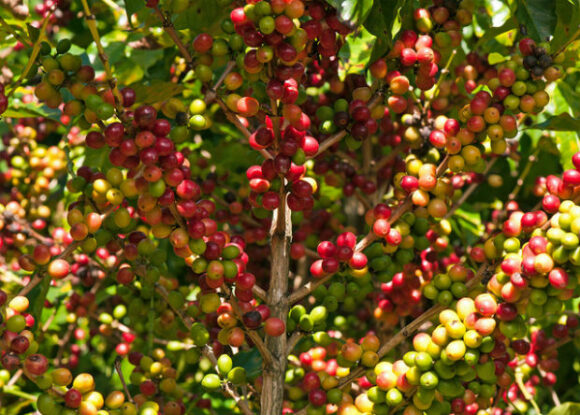
Shade grown coffee

Shade grown coffee

Recent figures suggest that about 96% of Mexico’s coffee is of the Arabica variety. The remaining 3-4% is the Robusta variety, used in the production of instant coffee. Mexico is importing large quantities of Robusta variety coffee beans as the large Nestle plant in the city of Toluca has been increasing its output of instant (soluble) coffee. However, Nestle has also increased the use of Arabica coffee in its products. SAGARPA is now supporting the planting of Robusta coffee to decrease coffee bean imports and to support Mexico’s goal of becoming a major producer of soluble coffee.

Mexico is also producing excellent organic coffee, a trend which is increasing among producers. However,  coffee rust has hit areas of organic coffee more than conventional plantings. According to SAGARPA, about 7 to 8% of growers are cultivating organic coffee, mainly for export.

About 40% of Mexican coffee production is marketed for local consumption, according to AMECAFE, and the remaining 60% is for export. The USA continues to be the main international market for Mexican green coffee beans.

Domestic consumption

Coffee consumption in Mexico has been increasing, with estimates of up to 2.6 million 60 kg. bags total usage this year, and consumption (of roasted and soluble coffee) at between 1.3 and 1.5 kg/person.

The importation of coffee is expected to rise in 2016, in order to meet domestic demand.

Increased consumption has been driven by government and retail advertising and by the growing number of specialty coffee shops in Mexico. (Starbucks alone has opened 500 coffee shops in Mexico). Soluble coffee still makes up about 68% of domestic consumption but ground coffee consumption is increasing among the middle class, whilst high-income consumers often want fashionable value-added imported coffee.

Related posts

Apr 112016
 

According to ECOCE, a non-profit environmental grouping of 24 food and beverage firms, representing more than 80 brands such as Peñafiel, Bonafont, Herdez, Jumex and Coca-Cola, Mexico is the world’s leading recycler of hard plastic PET (polyethylene terephthalate) bottles and containers.

Mexico has 14 PET recycling plants, the construction of which represents total investments of around US$314 million.

Ever wondered what thousands and thousands of crushed plastic bottles look like? Try this short video showing the processes involved in a PetStar PET-recycling plant:

In 2015, Mexico produced 722,000 metric tons of PET, of which 364,000 tons (50.4%) were recovered for recycling. This rate of recycling is well ahead of Canada (40%), Brazil (42%), the U.S. (31%) and the European Union (21%). Recycled PET, worth about $250 a ton, is reused to make bottles, containers, and various textile products.

60% of Mexico’s recycled PET is destined for the national market, the remaining 40% is exported to China, the U.S. and elsewhere.

Source:

  • Press release of ECOCE, 16 March 2016

Related posts:

Gender disparities and the value of women’s work in the home

 Mexico's geography in the Press, Updates to Geo-Mexico  Comments Off on Gender disparities and the value of women’s work in the home
Apr 072016
 

In August 2012, in The value in Mexico of unpaid work in the home, we saw that a study by the National Statistics Institute (INEGI) based on 2010 data had calculated that routine work done in the home (almost 80% of the time-value involved comes from women) was worth about 2.9 trillion pesos to the Mexican economy each year, equivalent to more than 20% of Mexico’s GDP. The INEGI calculations included the costs in time/labor needed to meet the demands of the home, and the net salary that would be paid for someone undertaking similar tasks.

INEGI has just published updated statistics on this topic.  In 2014, unpaid work by women in the home was equivalent to 18% of GDP. This figure means that female contributions in the home continue to make a greater contribution to national GDP than manufacturing (16.7%), commerce (15.5%) or education (4.1%).

The latest INEGI figures show that for every 10 hours that women work (paid or unpaid), men work only 8.3 hours. According to INEGI, the average value of unpaid work by women in the home in rural areas amounted to  51,808 pesos a year (about US$4300 at the then rate of exchange). The value for women married or living with a partner was 61,456 pesos, compared to 26,082 pesos for single women. The average in households which included children under 6 years of age was 60,628 pesos.

Of 29 million Mexicans in employment (in 5.7 million economic units), women account for 43.8% (graph):

% of women in different sectors of the workforce

% of women in different sectors of the workforce, 2014

The figures do reveal a slight decrease in gender inequality since the employment of women is rising slightly faster than that of men, by about 2.0%/year compared to the overall figure of 1.4%/year. In 2014, about 50% of service workers, 34.5% of manufacturing workers, and 11.0% of construction workers were female.

Related posts:

Mar 312016
 

The River Atoyac, a river more than 120 kilometers (75 miles) long, in the state of Veracruz, has suddenly dried up. The dramatic disappearance of the river is believed to be due to the collapse of the roof of a cavern in the underlying limestone. This caused the formation of a narrow sinkhole, 30 meters (100 feet) long, that now swallows the river and diverts its water underground.

rio_atoyac-mapa-el-universal

Drainage basin of the Río Atoyac. Credit: El Universal

The collapse happened on Sunday 28 February; residents of the small ranch town of San Fermín heard a thunderous noise at the time. Within 48 hours, the river had disappeared.

The River Atoyac rises on the slopes of the Pico de Orizaba, Mexico’s highest peak. Unfortunately, the cavern collapse occurred only 3 kilometers from the river’s source, leaving almost all of its course dry, with potentially serious consequences for up to 10,000 people living in the river basin who have now lost their usual water supply.

The disappearance of the river will also have adverse impacts on fauna and flora, and jeopardize sugar-cane farming and other activities downstream. The fauna of the river included fresh-water crayfish (langostinos) which were an important local food source.

The municipalities affected are Amatlán de los Reyes, Atoyac, Yanga, Cuitláhuac, Felipe Carrillo Puerto, Cotaxtla, Medellìn and Boca del Río.

The course of the river approximately follows that of federal highway 150D, the main toll highway between the cities of Orizaba and Veracruz.

Related posts

Mar 282016
 

In 2014 there were 285 tortillerias in Chilpancingo, the capital of the state of Guerrero, when the troubles with the drug cartels really started. Now only 185 remain open as a result of drug gangs attacking the tortilla shops and workers, kidnapping owners and forcing others out of business out of fear of the violence.

Chilpancingo, with a population of over 280,000, is situated in the mountains 105 km north-east of Acapulco. As elsewhere, the tortilla shops are concentrated in the poorer barrios where local criminal gangs also tend to be located. Tortillas are sold from small shops with a view to the street, or are delivered door-to-door by young men on motor cycles.

The drug cartels in Chilpancingo, such as Los Rojos and Guerreros Unidos, realized that by controlling the business owners and the employees of tortillerias, they would have a wide-spread and well-placed network of drug distribution points, lookouts and street dealers, operating under the guise of these many small legitimate businesses.

tortilleria

The take-over began in 2014 with the kidnapping of shop owners and workers, often involving a week’s captivity in a secure house, and demands for ransom ranging from 30,000 pesos (US$2100), up to 2 million pesos (US$140,000 for owners of multiple tortillerias.) After release, the victims were forced to co-operate with the cartel’s drug distribution and look-out system, under threat of business closure. The leader of the Chilpancingo tortilla sellers, Abdon Abel Hernandez has been threatened numerous times, kidnapped once, and his family had to borrow a million pesos to secure his release. He says about 35% of the local tortilla industry has shut down since 2014 out of fear.

The regional president of Corpamex (Mexican Confederation of Business Owners) Adrian Alarcon says he also lives with the fear of death for trying to defend his threatened union membership. “Today the tortilla industry is kidnapped by them (criminal groups) just like what happened with public transport when they forced taxi drivers and bus drivers to become the hands and eyes of the narco. The industry is completely infiltrated. The money that comes from the tortillas is used to buy weapons. We are financing them”.

January 2016 march by owners of tortillerias asking for state government help

January 2016 march by owners of tortillerias asking for state government help

He also stated that 36 businessmen were kidnapped and tortured in the central region of Guerrero in the first two months of 2016, with most of the victims being associated with the tortilla industry. “It wasn’t a coincidence”, he said, “that a national survey named Chilpancingo as the country’s worst city to live in. Crime has put an end to everything: investments, jobs, and the desire to make a family here. But if you think the situation here is in a critical state, you should go to Acapulco. Here, the tortilleros are kidnapped, but there they are being killed.” According to Arcadio Castro, leader of the Tortilla Association of Guerrero, 20 tortilla workers lost their lives in 2015 in clashes with organized crime.

The previous chief of police of Acapulco was dismissed after he failed to pass control examinations, known as trust tests, designed to identify those with possible links to organized crime. His replacement expects some 700 of his current force of 1901 municipal police will also fail their next control exams. Given his current budget, he has no hope of renovating his police force with younger, healthier, law-abiding officers. The assault on the tortilla industry is generally not felt in the tourist areas of the city.

In 2010 UNESCO included the traditional Mexican cuisine of Michoacán in its list of the Intangible Cultural Heritage of Humanity, in large part based on the multiple uses and cultural centrality of corn in Mexican traditional cooking. This decision was very publicly celebrated by the tortilla industry. Unhappily, today, the tortillerias of Guerrero are struggling to survive the extortion rackets of the local drug cartels.

Main source:

Oscar Balderas. Drug Cartels Are Taking Over the Tortilla Business in Mexico. VICE News, , 16 March 2016; article re-published in Business Insider.

Related posts:

Mar 212016
 

Cancún International Airport (CUN) has opened a new terminal, Terminal 3. The airport is the nation’s busiest for international traffic and second only to Mexico City for national traffic. The airport served a total of more than 19 million passengers in 2015, 11% more than the previous year.

The new 60-million-dollar, state-of-the-art Terminal 3 is exclusively for international passengers, and increases operating capacity by 4 million passenger movements a year. An additional terminal, Terminal 4, is scheduled to open in 2017.

New terminal at Cancun airport

New terminal at Cancun airport

According to federal officials, airport investments in the first three years of the current administration have exceeded 1.8 billion dollars. This has triggered the addition of 260 national and 186 international air routes. Passenger movements in the past three years have risen 33% (to 73 million), while air freight has grown 17%.

Related posts:

Mexico’s berry exports now exceed a billion dollars a year

 Mexico's geography in the Press  Comments Off on Mexico’s berry exports now exceed a billion dollars a year
Mar 152016
 

Berry production is one of the most dynamic segments of Mexico’s buoyant agricultural sector, and exports of berries (strawberries, raspberries, blackberries and blueberries) in 2015 totaled 1.1 billion dollars, according to preliminary figures.

Last year, 99.6% of all U.S. imports of fresh strawberries came from Mexico and 27% of all imported raspberries, blackberries and blueberries. Berry-growing, concentrated in Baja California, Jalisco, Michoacán, Guanajuato and Puebla, occupies around 25,000 hectares of farmland nationwide and provides 120,000 permanent jobs.

Postage stamp, strawberry exports

Postage stamp, strawberry exports

Strawberries were introduced from the USA to Mexico in the 1850s. Major commercialization of strawberries began after the second world war, following the construction of Mexico’s first freezing plant for berries. The two major strawberry-growing states today are Guanajuato (around Irapuato, “Mexico’s strawberry capital”) and Michoacán, where the cultivation of strawberries is concentrated around the city of Zamora.

Mexico has also begun exporting berries to China, a market with massive potential for future growth.

Berry farming has significantly changed the agricultural landscape of some areas. For example, sugarcane fields around Los Reyes, Michoacán, have been converted to blackberries over the past 15 years, and now supply 96% of Mexico’s total production of that fruit.

Related posts

Geo-Mexico has many other agriculture-related posts (easily found via our tag system). They include posts about the geography of growing/producing Christmas trees, cacao, honey, sugarcane, coffee, chiles, floriculture, tomatoes, tequila, horticultural crops and oranges.

We also have an index page dedicated to agriculture:

Mar 072016
 

Tourism accounts for about 9% of Mexico’s GNI and provides almost 4 million direct jobs. In 2015, Mexico welcomed a record 32.1 million international tourists, making it the 10th most popular international destination in the world. They spent a combined $17.5 billion in the country. Almost 50% of these overseas visitors arrived by air; they accounted for 80% of total foreign tourist expenditures.

Mexico_Tourism

This year, tourism officials are predicting that 35 million international foreign visitors will holiday in Mexico, with total spending of 19 billion dollars. Officials believe, probably optimistically, that Mexico can attract 40 million tourists in 2018 and 50 million by 2030. They stress the need for policies that will result in more hotels, additional air routes, new attractions, and packages designed for niche markets including health, religion, and seniors-based tourism.

Related posts:

Mexico City chosen over Curitiba (Brazil) as World Design Capital 2018

 Mexico's geography in the Press  Comments Off on Mexico City chosen over Curitiba (Brazil) as World Design Capital 2018
Feb 152016
 

At its 29th General Assembly in Gwangju, South Korea, a few months ago, the International Council of Societies of Industrial Design (ICSID) announced that Mexico City has been designated World Design Capital (WDC) 2018. Mexico City is the first city from the Americas to hold the designation.

Alameda Park, Mexico City, with Palacio de Bellas Artes in foreground

Alameda Park, Mexico City, with Palacio de Bellas Artes in foreground

ICSID President Professor Mugendi M’Rithaa stated, “Mexico City will serve as a model for other megacities around the world grappling with the challenges of urbanization and using design thinking to ensure a safer, more livable city.”

The WDC is awarded every second year to cities that are committed to using design as an effective tool for economic, social, and cultural development. Previous designated cities include Torino (Italy) in 2008, Seoul (South Korea) in 2010, Helsinki (Finland) in 2012, Cape Town (South Africa) in 2014, and Taipei this year, 2016.

The bid was led by Design Week Mexico, a non-profit organization that promotes design as an engine of social change. Design Week Mexico intends to focus its actions on the borough of Miguel Hidalgo, introducing new health, communications and security programs, a bike sharing program, urban gardens, parks and playgrounds. Emilio Cabrera, Director General of Design Week Mexico said, “Our goal is to build a platform for collaboration not only between design disciplines, but also between countries. As WDC, we seek to create a hub of global creative industries that have an impact on their societies.”

The Mexico City bid was preferred over a rival bid from Curitiba (Brazil), well known for its innovative approach to urban sustainability.

For access to more than sixty articles about all aspects of the geography of Mexico City, see The geography of Mexico City: index page.

Related posts:

New era for Federal Electricity Commission as it is split into four divisions

 Mexico's geography in the Press, Updates to Geo-Mexico  Comments Off on New era for Federal Electricity Commission as it is split into four divisions
Feb 112016
 

Mexico’s state-owned Federal Electricity Commission (Comisión Federal de Electricidad, CFE) has remained the dominant electric utility in Mexico for almost eighty years, even though most Latin American countries ended state monopolies in the 1990s. Now, Mexico’s on-going energy reforms are revamping the CFE behemoth by splitting it into four distinct entities focusing, respectively, on electricity generation, transmission, distribution and commercialization.cfe-619x348

  • Generation: CFE’s total installed capacity is 55,118 MW, coming from 628 generating units in 185 power stations.
  • Transmission: Mexico has 115,400 km of high voltage transmission line.
  • Distribution: CFE currently has 820,602 km of mid- and low-voltage lines, 1910 substations and 1.38 million distribution transformers. Distribution to domestic users is organized via 16 regional units: Baja California, Bajío, Centro Occidente, Centro Oriente, Centro Sur, Centro Norte, Golfo Norte, Jalisco, Noroeste, Norte, Oriente, Peninsular, Sureste, Valle de México Sur, Valle de México Centro and Valle de México Norte.
  • Commercialization: Includes the sales and billing to more than 38 million end-users, as well as the operations of two CFE subsidiaries (CFE Internacional and CFE Energía) involved in international trading.

In related news, Mexico’s energy regulatory body, the Centro Nacional de Control de Energía (CENACE) is introducing a market framework. Long-term energy and capacity Power Purchasing Agreements (PPAs) can now extend 15 years, with guaranteed commercialization of all power produced by each generation unit. This should provide a welcome boost to many renewable energy projects.

Mexico is committed to generating 35% of its energy from renewable sources by 2024. Hydro-electric and geothermal power plants have been important for a long time, and significant solar and wind-energy plants have been added in recent decades. A market system involving tradable Clean Energy Certificates (Certificados de Energías Limpias, CELs) is an integral part of the reforms.

Related posts:

Feb 042016
 

Remittances sent home by Mexican migrants (almost all of them residing in the USA) rose to $24.8 billion last year, up 4.75% compared to 2014.

The average remittance sent to Mexico in 2015 was $292.00, a slight decline. Almost all remittances (97%) are now sent via electronic transfer.

Figure 1 of Pew Report

Figure 1 of Pew Report. Shaded area is period of recession.

Low oil prices have led to a sharp decline in the value of Mexico’s oil exports. Oil revenues last year totaled $23.4 billion, which means that remittances now exceed oil revenues as a source of foreign exchange. Before the implementation of NAFTA in 1994, oil revenues accounted for around 80% of all Mexico’s foreign exchange. In 2015, that figure was less than 20%, showing the degree of economic diversification that has been achieved post-NAFTA.

The value of oil exports in 2015 was also significantly lower than the value of manufactured goods exports, or the value of agricultural exports.

Want to learn more about remittances?

Federal District is renamed Mexico City

 Mexico's geography in the Press  Comments Off on Federal District is renamed Mexico City
Feb 012016
 

The name “Distrito Federal” (Federal District) has been replaced by “Ciudad de México” (Mexico City). This is bad news for cartographers who need to relabel all those maps that say “Mexico D.F.”! The abbreviated form for the city’s name in Spanish will be CDMX.

The constitution for the new administrative entity, which will eventually enjoy full status as a state, will be drawn up by a group of 100 citizens (to be elected in June), expected to include some members of the federal Chamber of Deputies.

Among other advantages, the change of status means that Mexico City will no longer need federal approval when selecting its police chief and attorney general. Administration of Mexico City’s 16 delegaciones (boroughs) will change from borough chiefs and regidores to mayors and councils.

Mexico City will remain Mexico’s capital city and the seat of the federal administration. No changes are planned for the neighboring Estado de México (State of Mexico). The Mexico City Metropolitan Area (MCMA) includes Mexico City, but also extends well into adjacent areas of the State of Mexico.

Want to learn more?

For access to more than sixty articles about all aspects of the geography of Mexico City, see The geography of Mexico City: index page.

New highway in Acapulco

 Mexico's geography in the Press  Comments Off on New highway in Acapulco
Jan 252016
 

A new highway linking Mozimba and Pie de la Cuesta has been formally inaugurated in Acapulco. According to the SCT (Communications and Transportation Secretariat), the $37 million highway will benefit 860,000 people living in Acapulco and Coyuca de Benítez.

PRY-Mozimba-002

On average, 18,000 vehicles are expected to use the highway each day. The highway reduces travel times from about 30 minutes to 10 minutes.

Acapulco (Google Earth)

Acapulco (Google Earth)

Related posts:

Jan 112016
 

On 9 January 2016, the Google search pages in some countries (including the USA and Mexico but, curiously, not Canada) featured a Google Doodle about the amazing Monarch Butterflies. That day was exactly 41 years from when Ken Brugger and his partner Cathy Trail finally located the exact site of a major overwintering group of Monarch Butterflies in Mexico.

Their effort was part of the research led by Canadian zoologist Fred Urquhart to try to determine what happened to Canadian Monarch Butterflies during the winter. Urquhart knew they fluttered south, but just where did they all go? Urquhart and his team of helpers tagged thousands of butterflies, and gradually homed in on an area of western Mexico straddling the border between the state of México and the state of Michoacán.

Based on original map design created by Paul Mirocha (paulmirocha.com) for Monarch Watch.

Based on original map design created by Paul Mirocha (paulmirocha.com) for Monarch Watch.

It eventually emerged that there were several overwintering sites of Monarch Butterflies in that general area, and much of the zone is now formally protected, with strict conditions for visitors and restrictions on tree cutting and forest thinning.

The Monarch Butterfly overwintering sites are a fitting topic of a Google Doodle. Sadly, the paragraph explaining the Monarch Butterfly Google Doodle repeats a common error about Mexico’s geography, and one we have featured previously on this blog.

It places the Monarch Butterfly overwintering sites in “Mexico’s easternmost Sierra Madre Mountains”. Unfortunately, this phrase, even if oft-repeated on ill-informed websites, is far from true.

Location of Volcanic Axis and Monarch Butterfly reserves

Location of Volcanic Axis and Monarch Butterfly reserves. Basemap: Figure 3.1 of Geo-Mexico; all rights reserved.

Mexico has three major Sierra Madre ranges: The Western Sierra Madre, Eastern Sierra Madre and Southern Sierra Madre (see map). Mexico’s “easternmost Sierra Madre Mountains” would actually be the Southern Sierra Madre! The Monarch Butterfly reserves are not located in any of these three Sierra Madres; they are happily ensconced in the Volcanic Axis.

Given that Google is reported to be introducing some form of reliability factor into its search algorithms, lending more credence to sites that are “factually accurate” and supported by other sites, this begs the question as to whether the majority is necessarily always right. In this case, while there are numerous web references to the Monarch Butterflies hanging out in “Mexico’s Sierra Madre” mountains, they are all guilty of misrepresenting Mexico’s physical geography.

Geo-Mexico congratulates Google for choosing to feature the Monarch Butterfly and loves the title “Mountain of the Butterflies” but does hope that Google Doodle writers will check their information more carefully next time.

Related posts:

Is the Mexico-USA tuna war finally over?

 Mexico's geography in the Press  Comments Off on Is the Mexico-USA tuna war finally over?
Jan 042016
 

The World Trade Organization (WTO) issued a final ruling at the end of 2015 favoring Mexico in its long-running trade dispute with the U.S. over the labeling of tuna products. The acrimonious dispute began, more than 20 years ago, because the USA refused to allow Mexican fishermen to use the coveted “dolphin‑safe” label.  The “dolphin safe” labels certify that tuna fishing is in compliance with the International Dolphin Protection Program.

The USA is the world’s largest importer of tuna, imported tuna worth more than one billion dollars in 2014, only 2.1% of which (about 20,000 metric tons) came from Mexico.

Dolphin-safe-logoWhen the dispute began, there is no doubt that Mexican fishermen were catching many dolphins as by-catch. Part of the conflict revolved around the very different methods of fishing employed in the two countries. USA tuna fishermen use long‑line fishing in which every species hooked is killed. Mexican tuna fishermen, on the other hand, use the encirclement method which involves locating tuna by tracking the dolphins that swim with the tuna schools. Large nets are then employed. Any dolphins trapped in the nets are released by hand and returned (alive) to the ocean.

Mexico has introduced far more stringent restrictions on tuna fishing methods since the dispute began, including professional observers on every ship to record each tuna catch; conservation measures over the past two decades have reduced dolphin by-catch by 99%. Mexican fishing methods are now recognized as fully sustainable by the U.N. Food and Agriculture Organization.

Mexico is one of the world’s ten leading tuna producers. Mexico’s tuna catch (mainly yellowfin tuna) rose to 166,000 metric tons in 2013. Domestic demand exceeds 190,000 metric tons a year, so Mexico currently has to import some tuna.

Mexico’s leading producer of canned tuna for the domestic market, worth close to a billion dollars a year, is Pinsa Comercial. Its three main brands – Dolores, El Dorado and Mazatún – account for more than half of the local market. Consumption of tuna has been rising steadily in Mexico, and Pinsa has introduced various new presentations of canned tuna in order to boost it still further from its current level of around eight cans/person/year. Pinsa is a vertically-integrated firm with its own fleet of tuna boats and freezing plants. (The firm also has Mexico’s largest fishing fleet for sardines, used to make fish flour, sold to agricultural and pharmaceutical industries.)

Mexico’s tuna fishing quota, set by the Inter-American Tropical Tuna Fishing Commission, is about 35% higher than its current annual catch. Modernizing the tuna fleet is one way to raise catches and reduce tuna imports.

About 20,000 families in Mexico depend on tuna fishing for their livelihood. This figure includes not only fishermen but also those working in associated processing and packing plants. Mexico’s 130-vessel tuna fleet is the largest in Latin America.

The WTO ruling means that Mexico may now seek compensation for its trade losses.

Related posts:

Mexico continues to be the world’s leading exporter of beer

 Mexico's geography in the Press  Comments Off on Mexico continues to be the world’s leading exporter of beer
Jan 012016
 

For the fifth year in a row, Mexico was the world’s leading exporter of beer in 2014. The final tally shows that Mexico exported 1,700 million liters of beer in 2014, worth 1.6 billion dollars. (Export figures for 2015 are not yet available but will show that Mexico remains well in the lead over Belgium and the Netherlands)

Cuauhtemoc Moctezuma brewery in Monterrey

Cuauhtemoc Moctezuma brewery in Monterrey. Photo: Tony Burton.

Mexico is the world’s sixth largest producer of beer and is predicted to leapfrog Germany and Russia this year (2016) into fourth place, behind only China, the U.S. and Brazil. Significant investments during 2015 have raised national production capacity 39% to 125 million hectoliters.

The two largest beer producers are Grupo Modelo and Cuauhtémoc Moctezuma (formerly Femsa). Grupo Modelo is building a new 310-milion-dollar brewery in the state of Yucatán and also expanding its breweries in Zacatecas and Coahuila. Cuauhtémoc Moctezuma is building a new 450-million-dollar facility in Chihuahua. A third brewer, Constellation Brands, is undertaking a 500-million-dollar expansion to its Piedras Negras plant in Coahuila, which will triple its annual production to 30 million hectoliters by 2017.

Related Posts:

Dec 212015
 

The National Statistics Institute (INEGI) has released the results of its inter-census study carried out in March 2015 which involved visits to more than 7 million households across the country.

Children in Zitácuaro, Michoacán. Photo: Tony Burton. All rights reserved.

Children in Zitácuaro, Michoacán. Photo: Tony Burton. All rights reserved.

As of March 2015, Mexico’s total population was 119,530,753 (48.6% male, 51.4% female), up from 111,954,660 million in 2010, a growth rate averaging 1.4% a year. This is the first time for 45 years that the rate of growth has not fallen. Analysts had expected a 1.2% growth rate over the period, but attribute the 1.4% figure to a slightly higher fertility rate than anticipated, together with an unexpected fall in the number of young people emigrating from Mexico. [Note that the total population figure is slightly lower than the figure released in July from Mexico’s National Population Council (Conapo) of 121,783,280.]

Since 2010 the proportion of seniors (over age 65) has risen from 6.2% to 7.2% of the total, and the proportion of households headed by a female is up from 25% to 29%. The median age in Mexico is now 27 years. The youngest median age is in Chiapas (23), the oldest in the Federal District (33). Overall, Mexico’s dependency ratio is falling, continuing a period of “demographic dividend“.

INEGI found that the number of households in Mexico is rising 2.4% a year and now totals about 32 million, giving an average number of 3.7 occupants/household. 98.7% of homes have electricity, 74.1% have piped water inside the building, a further 20.4% outside the building but on the property; 75.6% connected to drainage.

Mexico’s most populated states remain the State of Mexico, the Federal District (Mexico City) and Veracruz, while the smallest states in terms of population are Baja California, Campeche and Colima. The most populated municipality is Iztapalapa (1.8 million), followed by Ecatepec (1.7 million) and Tijuana (1.6 million). The most rapidly growing municipality in the entire country is Pesquería, in Nuevo León, which has grown a startling 35.2% a year since 2010, mainly because of the new Kia vehicle factory opening there.

The item of inter-census news that attracted most press attention was INEGI’s so-called discovery that there were 1.4 million black Mexicans. This was hardly news to most demographers, but the inter-census survey was the first time INEGI had included a question aimed at identifying Afro-Mexicans, as a pilot question for the full 2020 census: “Based on your culture, history and traditions, do you consider yourself black, meaning Afro-Mexican or Afro-descendant?”

INEGI did indeed find that about 1.4 million citizens (1.2% of the population) self-identified as “Afro-Mexican” or “Afro-descendant”, with significantly more women opting for the category than men (755,000 women; 677,000 men).

It was no surprise to find that most Afro-Mexicans live in the states of Guerrero, Oaxaca and Veracruz. The survey showed that Mexico’s self-identified black population is not currently disadvantaged in terms of access to education and health services or work opportunities, putting it well ahead of Mexico’s indigenous population in that regard.

Afro-Mexican activists welcomed the inter-census question and results, but called for Mexico’s history books to reflect their contribution. Benigno Gallardo, an Afro-Mexican activist in Guerrero, pointed out that, “In school they teach our children about Europeans and indigenous natives, but the history books practically don’t recognize our history.”

Certainly more awareness of the long history of Afro-Mexicans is badly needed. For example, how many people realize that Blacks outnumbered Spaniards in Mexico until after 1810 or that Vasconcelas’ “Cosmic Race” (La “Raza Cósmica”) excluded Mexico’s African heritage?

Want to learn more? A good place to start is Bobby Vaughn’s website Afro-Mexico or his Black Mexico Home Page, Afro-Mexicans of the Costa Chica, on MexConnect, which provide links to several of his articles including Blacks in Mexico. A Brief Overview.

Related posts:

Dec 072015
 

The 2015 hurricane season in Mexico for Pacific coast storms started on 15 May and ended on 30 November. For Atlantic storms, the hurricane season extended from 1 June to 30 November. Hurricanes are also known as typhoons or tropical cyclones.

saffir-simpson-scale

This year, predictions for hurricane activity in the Atlantic were fairly close to reality, but the Pacific Coast forecast fell well short of predicting the number and severity of hurricane activity.

Atlantic and Caribbean hurricanes

The early season (May) prediction for 2015 for hurricane activity in the Atlantic was that it would be below the 1981-2012 average, with 7 named storms forming in the Atlantic: 4 tropical storms, 2 moderate hurricanes (1 or 2 on the Saffir-Simpson scale), and 1 severe hurricane (3, 4 or 5 on the Saffir-Simpson scale).

In reality, the 2015 Atlantic season did turn out to be slightly less active than the long-term average, but still saw the Caribbean and Gulf coasts affected by 11 named storms: 7 tropical storms, 2 moderate hurricanes and 2 severe hurricanes.

Eastern Pacific hurricanes

For the Pacific coast, Mexico’s National Meteorological Service (Servicio Meteorológico Nacional, SMN) was anticipating 19 named storms in 2015: 8 tropical storms, 7 moderate hurricanes, and 4 severe hurricanes. The 2015 season actually turned out to be the second most active Pacific hurricane season ever, with a total of 26 named storms: 10 tropical storms, 5 moderate hurricanes, and 11 severe hurricanes.

The number of hurricanes (16) in the eastern Pacific tied the all-time record, and the number of severe hurricanes (11) broke all previous records. The activity included Hurricane Patricia, the most powerful hurricane ever. Fortunately for most of Mexico, this storm lost power very rapidly once it came onshore.

Nov 192015
 

Proficiency in English is widely seen as an ever-more-essential skill in our increasingly-internationalized and business-oriented world. Many Mexicans have acquired excellent English, whether from education, family connections or residence abroad. It therefore comes as something of a shock to study the latest English Proficiency Index, put out by the Toronto-based organization,  Education First (EF).

Education First modestly describes itself as “The World Leader in International Education”. (This claim is rather grandiose, given that the International Baccalaureate, for one, is far larger and much better known in educational circles worldwide).

The 2015 edition of EF’s English Proficiency Index (EPI) “ranks 70 countries and territories based on test data from more than 910,000 adults who took our online English tests in 2014. This edition continues to track the evolution of English proficiency, looking back over the past eight years of EF EPI data.”

EF categorizes the level of English proficiency in different places as “very high”, “high”, “moderate”, “low” or “very low”.

English proficiency in Mexico

English proficiency in Mexico (grey = moderate; yellow = low; orange = very low). Credit: EF EPI, 2015

Strangely, Mexico does not do well on this index. According to EF, no state or city in Mexico performs beyond the “moderate” level (colored grey on the map). From the map, it appears that there is, in this context as in many others, something of a north-south divide in Mexico, with southern states under-performing in comparison with northern states.

The highest-scoring cities for English proficiency are Monterrey (53.59) and Mexico City (53.03), both classed as “moderate”, followed by Hermosillo (52.36), Tijuana (51.27), Guadalajara (50.52), Ciudad Juárez (49.35), and Mexicali (48.51), all classed as “low”. At the bottom end of proficiency, Puebla (47.84), Cancún (47.14), and Oaxaca (44.61) are all in the “very low” category.

EF recognizes that the people taking its tests are “self-selected and not guaranteed to be representative of the country as a whole. Only those people either wanting to learn English or curious about their English skills will participate in one of these tests. This could skew scores lower or higher than those of the general population.” On the other hand, it also claims that, “The EF English Proficiency Index is increasingly cited as an authoritative data source by journalists, educators, elected officials, and business leaders.”

That may be so, but given the EPI methodology and EF’s overblown claims of being “The World Leader in International Education”, perhaps we should take these results with a grain of salt ~ of which Mexico has lots!

Related posts:

The Aqueduct of Padre Tembleque is Mexico’s 33rd UNESCO World Heritage Site

 Mexico's geography in the Press  Comments Off on The Aqueduct of Padre Tembleque is Mexico’s 33rd UNESCO World Heritage Site
Nov 102015
 

Earlier this year, UNESCO added a 16th century aqueduct in Mexico to its list of world heritage sites, bringing the total number of such sites in Mexico to 33.

The Aqueduct of Padre Tembleque was constructed between 1554 and 1571. It is named for the Franciscan friar, Francisco de Tembleque, who began the 48-kilometer-long aqueduct, which was built to transport water from what is now Zempoala, Hidalgo, to Otumba in the State of México. The aqueduct connects to an engineered water catchment area, springs, canals and distribution tanks.

Location of Aqueduct of Padre Tembleque

Location of Aqueduct of Padre Tembleque (Source: Google Maps)

The aqueduct was built with support from the local indigenous communities: “This hydraulic system is an example of the exchange of influences between the European tradition of Roman hydraulics and traditional Mesoamerican construction techniques, including the use of adobe.” (UNESCO)

Aqueduct of Padre Tembleque

Aqueduct of Padre Tembleque (Credit: Xinhua/INAH/NOTIMEX)

While much of the aqueduct is at ground level or underground, it crosses over the Papalote River near Santiago Tepeyahualco supported by a graceful series of high arches called the Main Arcade, 67 arches in total, and at one point 39 meters above the river (the highest single-level arcade ever built in an aqueduct “from Roman times until the middle of the 16th century.”)

The Aqueduct of Padre Tembleque is the largest single hydraulic engineering project completed in the Americas during Spanish colonial times and is a worthy addition to the World Heritage list.

For more information:

Related posts


The West Rail Bypass International Bridge, a new USA-Mexico rail link

 Mexico's geography in the Press  Comments Off on The West Rail Bypass International Bridge, a new USA-Mexico rail link
Nov 032015
 

The flow of bilateral Mexico-USA trade has increased six-fold in value in the past 20 years to nearly 1.5 billion dollars a day; 80% of it moves by truck or rail. A new rail bridge, the West Rail Bypass International Bridge (WBR), opened in late August, capable of carrying up to 24 million metric tons of freight a year, which should help reduce delays in trans-border trade.

West Rail Bypass International Bridge.

West Rail Bypass International Bridge. Credit: Cameron County

The WBR links Matamoros (Tamaulipas) to Brownsville (Texas). It took four years to build and is the first new rail link between Mexico and the USA for more than a century. The bridge can be used by 14 trains a day and replaces a rail line that previously wound its way, with frequent delays, through a heavily congested urban area.

In an unrelated effort to speed up trans-border shipments, Mexican and U.S. officials are testing a single, joint customs inspection procedure that could cut border-crossing times for freight by up to 80%.

The program is being tested at three locations:

  • Laredo international airport in Texas (for vehicle, electronic and aerospace components being flown to eight cities in Mexico),
  • Mesa de Otay in Baja California (for Mexican farm products entering the U.S.) and
  • San Jerónimo in Chihuahua (for computers and other electronic exports from Mexico).

Assuming the six month pilot project is successful, costly border delays for some trans-border shipments could soon be a thing of the past. The project has been warmly welcomed by AmCham, the American Chamber of Commerce in Mexico, which represents more than 1,400 companies.

Related posts:

Hurricane Patricia, a Category 5 hurricane, about to hit the Pacific coast

 Mexico's geography in the Press  Comments Off on Hurricane Patricia, a Category 5 hurricane, about to hit the Pacific coast
Oct 232015
 

Follow-up, 28 October 2015: In the event, Hurricane Patricia did not cause anywhere near the catastrophic damage that it might have. This was partly because it was narrower than most hurricanes of its size and happened to continue on a path that missed the major resorts of Puerto Vallarta and Manzanillo, and partly because it then rapidly lost strength as it smashed into the Western Sierra Madre (Sierra Madre Occidental), though it did bring torrential rain to many areas. This post-hurricane report in the Mexico Daily News summarizes the impacts.

Post-hurricane photos and video:

Original post:

As of Friday morning (23 October), Hurricane Patricia is a Category 5 hurricane, the highest rating possible, and “now the strongest ever hurricane to hit the eastern north Pacific region”, according to World Meteorological Organization spokeswoman Clare Nullis, citing an update from the US National Hurricane Center (NHC).

Hurricane Patricia’s central pressure of 880mb is the lowest for any tropical cyclone globally for over 30 years.

The maximum sustained winds associated with Hurricane Patricia are up to 325 km/hr (200 mi/hr), “enough to get a plane in the air and keep it flying”.

hurricane-patricia-2

Hurricane Patricia is heading towards land at 16 km/hr (10 mi/hr), and is currently predicted to make landfall somewhere close to Manzanillo in the state of Colima, later today (Friday 23 October).

Map of Pacific Coast beaches. Copyright 2010 Tony Burton. All rights reserved.

Map of Pacific Coast beaches. Copyright 2010 Tony Burton. All rights reserved.

Hurricane warnings are in effect for several towns along the Pacific coast, including the major resort of Puerto Vallarta. Puerto Vallarta has established 18 shelter locations to house evacuees.

People living in the coastal areas of the states of Nayarit, Jalisco, Colima and Michoacán are all likely to experience severe impacts from this hurricane. The hurricane could cause a significant storm surge up to 2 meters high along much of the coast, and potentially up to 6 meters high in some bays such as Barra de Navidad-Melaque, and neighboring Cuestacomate.

hurricane-patricia

Officials are warning residents to prepare for torrential rain (in excess of 300 mm is expected in some areas), exceptionally-strong winds and power outages, and are readying emergency shelters. Air traffic is already being affected, with delays reported for various domestic flights.

Mexico’s national water commission, CONAGUA, reports that the government has 1,782 temporary shelters available in the states of Michoacán, Colima, and Jalisco with a combined capacity of more than 258,000 people. Around 50,000 people should have been evacuated before the hurricane hits land, according to Mexican Civil Protection agencies.

Once it makes landfall, the hurricane is expected to weaken quickly, though inland areas, such as Guadalajara and the Lake Chapala area, will receive heavy rain.

Related posts:

Oct 152015
 

Since we first reported on Bicycle manufacturing in Mexico in 2010, a number of things have changed.

At that time, the website of the National Association of Bicycle Manufacturers claimed that its 14 member companies produced about 3 million bikes a year and employed, between them, 4,000 workers. Today, the group has fewer members – 12 – who make “over 2 million” bikes a year and provide 3,000 jobs.

Stamp of Bike exports

The Mexican bicycle manufacturing industry looks like it has to overcome a tough problem. Recent press reports suggest that the total number of bicycles produced nationally fell to around 1.8 million in 2014. Manufacturers are blaming the uncontrolled imports of less expensive bikes made in China. Gunter Maerker, a representative of the National Association of Bicycle Manufacturers, argues that manufacturers need greater protection from Chinese imports, which have an average cost of about 7 dollars a unit, compared to a unit cost of production that is closer to 20 dollars to make a bicycle in Mexico.

Domestic manufacturers sold 1.5 million bikes in the national market in 2014. Mexican manufacturers believe that sales of imported bikes equaled or exceeded that number. The fall in national bicycle manufacturing has already had impacts on suppliers of components since national bikes are made largely of domestically-manufactured parts (along with some items sourced in China or Taiwan).

Mexican bicycle manufacturers are also worried about the implementation of the Trans-Pacific Partnership (TPP), agreed in principle earlier this month, but still needing formal approval in all signatory countries. The 12 countries involved are Mexico, the U.S., Canada, Chile, Peru, Australia, Japan, Brunei, Malaysia, New Zealand, Singapore and Vietnam.

China has had no part in TPP discussions, but it is feared that Chinese manufacturers may triangulate their products into Mexico via signatory countries such as Malaysia or Vietnam.

In 2015, the National Association of Bicycle Manufacturers lists 12 bike manufacturers:

  • Bicicletas Cinelli – Santa Catarina, Nuevo León
  • Nahel – Durango, Durango
  • Goray – Torreón, Coahuila
  • Grupo Veloci – Zapopan, Jalisco
  • Rebimo de Guadalajara – Zapopan, Jalisco
  • Bicicletas Mercurio, Mérida and San Luis Potosí (they acquired the famous Acer-Mex Windsor brand in 2001)
  • Bimex – Mexico City
  • Magistroni – Mexico City
  • Benotto (primarily a distributor) – Mexico City
  • Grupo Oriental – Mexico City
  • Corporativo La Bici – Mexico City
  • Bicileyca – Yauhquemehcan, Tlaxcala

Related posts:

More water meters for Mexico City

 Mexico's geography in the Press, Updates to Geo-Mexico  Comments Off on More water meters for Mexico City
Oct 122015
 

A recent OOSKAnews report says that Mexico City’s water authority (Sacmex) is seeking to purchase 27,835 more water meters that it plans to install in coming months. Sacmex supplies water to around 2 million separate addresses, of which 1.4 million are already metered. The latest purchase is part of Sacmex’s plan to ensure that 100% of connections to the water system are metered. Sacmex’s current budget includes $3.5 million for an additional 40,000 meters.

sacmex

At present, users without a meter pay a fixed bi-monthly tariff based on the building category, and intended type of water use (domestic/industrial/commercial).

Funding for the meters will be part of a $200 million World Bank-supported “Program to Improve the Efficiency of Operating Organizations” (PROME) which has already financed various projects across the country for urban areas with populations over 20,000. Projects already funded by the Progam include more efficient pumps, the updating of user databases with geo-referencing technology, and studies to gauge the robustness of indicators such as water pressure, water quality and leak detection.

Sacmex is also working on other distribution issues. Earlier this year – see Water in Mexico: a human right that is currently subsidized and wasted – Sacmex CEO Ramón Aguirre Diaz said that the agency required $430 million to combat leakages in the system (currently estimated at around 40% of supply), and claimed that a long-term program to fix the problem would be introduced next year.

Related posts:

Oct 082015
 

Which are the most livable cities in Mexico? In an attempt to find out, each year the consultancy Gabinete de Comunicación Estratégica (GCE) publishes its National Quality of Life Index. For the 2015 version of this index, GCE polled more than 30,000 people in 55 cities about their housing, education, transport, cleanliness, recreational opportunities, security, natural beauty and local attractions.

Cities mentioned in this post

Cities mentioned in this post

Which city came top? The top-ranking city was Mérida, which scored 83.3 out of a possible 100 points, followed by Saltillo (79.6), and Aguascalientes and Mazatlán (tied at 78.8).

Which cities came bottom? The five cities rated least desirable were Tuxtla Gutiérrez, Ecatepec, Acapulco, Ciudad del Carmen and Chilpancingo.

Which cities rose most in the rankings? The cities which rose most in the rankings from last year were Saltillo, which rose five places; Tijuana, which jumped 21 places to #25, and Tlalnepantla, which improved 13 places to #36.

  • Link to full study (pdf file in Spanish)- Ciudades mas habitables, 2015

Related posts: