geomorphos | Geo-Mexico, the geography of Mexico

Mexico’s geomorphosites: Peñas Cargadas, Mineral del Monte, Hidalgo

 Other  Comments Off on Mexico’s geomorphosites: Peñas Cargadas, Mineral del Monte, Hidalgo
Apr 232015
 

This short Postandfly video of an area known as Peñas Cargardas (“Loaded Rocks”) in the state of Hidalgo is the perfect excuse to add to our posts about Mexico’s geomorphosites – sites where landforms have provided amazing scenery for our enjoyment. This area of Mexico is definitely one of my favorites, partly because it is crammed with interesting sights for geographers, including the Basalt Prisms of San Miguel Regla, only a few kilometers away from the Piedras Cargadas, and an equally-stunning geomorphosite.

A few minutes east of the city of Pachuca, the Peñas Cargadas (sometimes called the Piedras Cargadas) are located in a valley in the surrounding pine-fir forest. The rocks comprising the Peñas Cargadas have capricious shapes; some appear to be balanced on top of others. Their formation may well be due to the same processes that formed the Piedras Encimadas in Puebla, which are actually not all that far away as the crow flies.

The nearest town, Mineral del Monte (aka Real del Monte) has lots of interest for cultural tourists. Among many other claims to fame, it was where the first soccer and tennis matches in Mexico were played ~ in the nineteenth century, when the surrounding hills echoed to the sounds of Cornish miners, brought here from the U.K. to work the silver mines.

The miners introduced the Cornish Pasty, chile-enriched variations of which are still sold in the town as pastes. Real del Monte also has an English Cemetery, testament not only to the many tragic accidents that befell miners when mining here was at its peak, but also to the long-standing allegiance that led many in-comers to remain here to raise their families long after mining was in near-terminal decline. The town has typical nineteenth century mining architecture. The larger buildings retain many signs of their former wealth the glory.

pachuca-map

The following Spanish language video has some ground-level views, as well as more information about the scenery and the area’s flora:

How to get there

The Peñas Cargadas are about ten kilometers east of Pachuca (see map). From Pachuca, follow signs for Mineral del Monte, and then drive past the “Panteón Inglés” (English Cemetery) in that town on the road to Tezoantla. The Peñas Cargadas are about 3.5 kilometers beyond Tezoantla. This is a great place for a day trip from Mexico City.

Related posts:

Mexico’s geomorphosites: Ceboruco Volcano

 Other  Comments Off on Mexico’s geomorphosites: Ceboruco Volcano
Apr 072014
 

A short distance west of the crater lake of Santa María del Oro, in the west Mexico state of Nayarit, is Ceboruco volcano which has a cobblestone road to the top. The road starts from the old and picturesque village of Jala, eight kilometers off the main highway (Highway 15). The cornfields around Jala yield some of the largest ears of corn in the world, more than 30 centimeters (one foot) in length, a cause for celebration in the village’s annual August festival. Jala was declared a Magic Town in 2012.

The road up Ceboruco is a geologist’s or biologist’s dream come true, a slowly unfolding series of volcanic forms and different types of vegetation with abundant surprises even for the scientifically expert. Small wonder, then, that the great German botanist Karl Theodor Hartweg was so impressed with Ceboruco when he collected plants here in the nineteenth century. To read more about his discoveries, see The geography of garden flowers, many of which originated in Mexico.

ceborucoNear the top are several short but interesting walks, some in shady, thickly vegetated valleys hidden between towering walls of blocky lava, some along the many overlapping rims of the various old craters of which this complex peak is comprised. Wherever you choose to walk, a multicolored profusion of flowers and butterflies will greet your eyes.

On the south side of an attractive grassy valley at kilometer sixteen, fumaroles send hot gases and steam high into the air reminding us that this volcano is not yet irrevocably extinct. A massive Plinian eruption in about the year 1000 sent ash plumes into the air and devastated a wide area around the volcano. The huge blocks of lava near the summit date from a prolonged series of eruptions in the early 1870s.

Highway 15 cuts through Ceboruco’s lava field a few kilometers after the Jala junction. For those not wishing to brave the cobblestone road up to the volcano, this is a good place to stretch the legs and marvel at the inhospitable, black lava blocks which were spewed out more than a hundred years ago.

This is a lightly edited extract from my “Western Mexico: A Traveler’s Treasury” (link is to Amazon’s “Look Inside” feature), also available as either a Kindle edition or Kobo ebook.

Want to read more about Mexico’s geomorphosites? The link uses Geo-Mexico’s “Site Search” feature.

Related posts:

Mexico’s geomorphosites: the Primavera Forest, Guadalajara, Jalisco

 Other  Comments Off on Mexico’s geomorphosites: the Primavera Forest, Guadalajara, Jalisco
Jun 012013
 

The Primavera Forest (aka Bosque de la Primavera, Sierra de la Primavera) is a volcanic region located immediately west of Mexico’s second-largest city, Guadalajara. The Primavera Forest occupies an ancient volcanic caldera, where the last eruptions are thought to have been about 30,000 years ago. The Primavera is a wilderness area of pine and oak woodland, with hot-water rivers, nature-trails and thermal spas. The park, which is about 30 km (19 mi) across (see map), serves as the lungs of Guadalajara and is popular, especially on weekends, for activities such as picnics, birdwatching, hiking, climbing, mountain biking and motocross.

The Primavera Forest. Credit: Semarnat, 2003

Basic map of the Primavera Forest. The distance between Tala and Guadalajara is about 35 km (22 miles). Credit: Semarnat, 2003

The main geographic and geological attractions of the Primavera Forest include:

Scenery, views, flora and fauna

The average elevation of the Primavera Forest is about 2200 m above sea level, rising to 2270 m (7447 ft) towards the eastern edge of the forest which overlooks the city of Guadalajara. The three main summits are El Pedernal, San Miguel and Las Planillas. There is easy access to the 30,000 ha of protected natural area from various points, including the town of Tala and from Highway 15 (the main Guadalajara-Tepic highway) which skirts the northern edge of the Primavera. Agriculture and settlement have made incursions into the edges of the park, with land cleared for subdivisions or for fields of sugarcane and agave (for tequila). A major wildfire raged through parts of the forest in 2012.

The park is home to about 1000 different plant species as well as 137 different birds and at least 106 terrestrial animals, including deer, puma, opossums (tlacuaches), armadillos and rabbits.

Hot springs

Thermal springs are common throughout the Volcanic Axis of Mexico, and the hot river and many hot springs in the Primavera Forest are a legacy of its volcanic history. Río Caliente, the main developed spa in the Primavera Forest, famous for several decades as one of the country’s top vegetarian and health spas, closed in 2011, following some years of uncertainty regarding its land tenure status and increasing security concerns because of its relatively remote location.

The hot springs in the park have been subject to numerous exploratory studies by the Federal Electricity Commission (CFE) which considers the park a potential source of geothermal power. The CFE drilled a dozen wells in the 1980s, finding that six of them offered sufficient flow for power production. The CFE believes the park could support at least three 25 megawatt geothermal plants. Drilling was suspended between 1989 and 1994 when the Jalisco state government ordered the CFE to carry out environmental restoration to areas damaged by drilling activities, and the plants have not yet been approved.

Pumice deposits

As veteran explorer-author John Pint points out in “A geopark in my back yard?”, the Primavera Forest is well known to geologists for its giant blocks of pumice, up to several meters across, which are among the largest found anywhere in the world. One of the best locations for seeing these is in the 50-meter-high walls of the Río Seco arroyo on the northern edge of the park, on the outskirts of the small community of Pinar de la Venta. The cliff face has a thick band of pumice overlying numerous thin layers of lake sediments. The pumice blocks are highly vesicular (full of holes) and therefore surprisingly light for their size.

Obsidian deposits

The Primavera Forest is also well known to geologists (and archaeologists) because it has significant amounts of obsidian, a hard, glassy, usually black rock. Obsidian is easy to find (often in big chunks) in several parts of the park. The obsidian formed when blocks of hot lava, still molten, rained into the cold waters of a lake, cooling instantaneously. When fractured, pieces of obsidian acquire very, very sharp edges. Even today, some surgeons still prefer obsidian scalpel blades, recognizing that they are far sharper than those made from even the best steel.

Obsidian was in great demand in precolonial times for use as mirrors, arrowheads and knives, as well as jewelry:

“Among the people to prize obsidian were the residents of Iztépete (often spelt Ixtépete), “hill of obsidian or knife blades”, located just outside the eastern edge of La Primavera. This small, largely forgotten, and poorly-signed archaeological site in a southern suburb of Guadalajara is within a stone’s throw of the city’s periférico (ring-road).”

“Large, angular chunks of obsidian litter the slopes of Cerro Colli, the hill rising behind the 6-meter-high pyramid, which conceals at least five earlier pyramids, each superimposed over the one before. Ceramics found here suggest that occupation stretches back at least to the fifth century, but little is known about the people who built this site.”  [Quotes are from the recently published 4th edition of the author’s “Western Mexico, A Traveler’s Treasury”]

Obsidian is found throughout this region, and while usually black in color, it can also be found in a range of hues, including red and even rainbow patterns. Not far from the western edge of Primavera, at the foot of a steep-sided knoll called El Picacho is El Pedernal, reputed to be the largest obsidian deposit in the world, covering 4 square kilometers, from which an astonishing 40,000 cubic meters of rock have been extracted over the centuries. Sophisticated chemical techniques have shown that El Pedernal obsidian was widely used in Mesoamerica, finding its way as far north as California and as far south as Oaxaca!

The pre-Columbian obsidian jewelry from this region, consisting of very thin wafers of rock, is unique to this area, and clearly the work of highly skilled specialist craftsmen. One particularly fine example (now in the museum in Tala) is a necklace fashioned out of wafer-thin obsidian carvings of human figures, each pierced by a tiny hole. In the absence of metal tools, the patience and dexterity required to have made these is truly amazing.

The art of obsidian carving has not been lost. Skilled artisans in Navajas, another nearby village, continue to this day to chip and shape chunks of obsidian into spheres, chess boards and beautiful works of art, often representing animals.

In future posts we will consider the formation of the La Primavera Forest in more detail, and also look at the extent to which the pressures resulting from its proximity to the city of Guadalajara threaten the park’s long-term health.

Want to read more?

John Pint is one of those spearheading the proposal of seeking UNESCO designation for La Primavera as a GeoPark.

U.S. Peace Corps Volunteer and geologist Barbara Dye has written a beautifully-illustrated  72-page guide (in Spanish) to the geology of the Primavera Forest: “La Apasionante Geología del Área de Protección de Flora y Fauna La Primavera”.

Related posts:

Mexico’s geomorphosites: El Sótano de las Golondrinas (Cave of the Swallows)

 Other  Comments Off on Mexico’s geomorphosites: El Sótano de las Golondrinas (Cave of the Swallows)
Apr 112013
 

El Sótano de las Golondrinas, in the municipality of Aquismón in the state of San Luis Potosí, is a massive limestone sinkhole (pit cave), one of the largest known in the world. In terms of depth, it is thought to be the second deepest sinkhole in Mexico and is probably in the world’s top 20.

The depth of sinkholes can be difficult to determine. For example, in the case of El Sótano de las Golondrinas, its surface opening is about 50 meters by 60 meters (160 by 200 ft) in size, but is on a slope. The depth on the high side is about 376 meters (1220 ft); the depth on the low side is about 330 meters (1090 ft).

sotano-de-las-golon

Below the surface (see profile) the sinkhole is roughly bottle-shaped. The floor of the sinkhole is about 300 x 135 meters (990 by 440 ft) in area. However, the sinkhole is believed to have formed from the collapse of the roof of an underground cave. As a result, the floor of the sinkhole is not solid rock but rubble that presumably came from the walls and former roof. A shaft on one side extends down at least another 100 m, suggesting that the true floor of the original cave lies at least that far beneath the current rubble-strewn floor.

US photographer Amy Hinkle shot some spectacular images earlier this year in this cave.  The accompanying article highlights the “secret garden” that “nestles 300 meters beneath the surface of the earth”.

The cave’s name (literally “basement of the swallows”) derives from the thousands of white-collared swifts that inhabit the overhanging walls of its interior. They spiral out of the cave every morning over a period of 25-30 minutes and return to their cave homes close to sunset. Large numbers of green parakeets also live in the cave.

The floor of the sinkhole is home to a rich plant life, as well as a diverse selection of  fungi, millipedes, insects, snakes, and scorpions.

The original cave is thought to have been formed by a lengthy period of water erosion along a major fault line in the lower Cretaceous limestone in the Sierra Huasteca (part of Mexico’s Eastern Sierra Madre). Over time, the cave became larger as a consequence of both the water erosion and due to mass movements (landslides, rockfalls) on its walls. Eventually, the size of the cave was so large that its walls could no longer support its roof which then collapsed into the cave, leaving the open air sinkhole seen today. Following heavy rain, short-lived waterfalls cascade down the sides of the sinkhole.

The first documented exploration of El Sótano de las Golondrinas was apparently in 1966. Since that time, the cave has become a popular destination for various adventure sports including rappelling, abseiling and base jumping (no longer allowed).

There are several other very deep sinkholes in the same general area, including Hoya de las Guasguas (with a 202 m deep entrance shaft) and Sótano del Barro (402 m in depth).

Some ornithological studies have found that the bird population of El Sótano de las Golondrinas is decreasing, perhaps due to the disturbance caused by the increasing number of human visitors. To limit disturbance, access and activities are more tightly controlled. For instance, descents into the cave are now strictly limited to daylight hours when the birds are absent, and a no-fly zone has been established around the cave, primarily to avoid helicopter disturbance.

El Sótano de las Golondrinas is yet another outstanding example of a geomorphosite in Mexico. Mexico has literally thousands of geomorphosites. Among those described in previous Geo-Mexico posts are:

References:

Related article:

Jun 072012
 

The Peña de Bernal, in the central state of Querétaro, is one of Mexico’s most distinctive geomorphosites. Geomorphosites are “landforms that have acquired a scientific, cultural/historical, aesthetic and/or social/economic value due to human perception or exploitation” (Panizza M., 2001). See Geotourism and geomorphosites in Mexico for a brief introduction to the topic.

The Peña de Bernal is a dramatic sight, which only gets more imposing the closer you get. How high is the Peña de Bernal? We are unable to give you a definitive answer (it depends where you start measuring from) but claims of 350 meters (1150 feet) sound about right, assuming we start from the town.

Peña de Bernal. Photo: Tony Burton; all rights reserved

The Peña de Bernal. Photo: Tony Burton; all rights reserved.

According to its Wikipedia entry, this is the “third tallest monolith in the world”, apparently only exceeded by the Rock of Gibralter and Sugarloaf Mountain in Rio de Janeiro. Others, including Melville King, have described it as the “third largest rock in the world”. These claims may (or may not) be exaggerated, but in reality it is definitely a very steep and tiring climb, even to reach the small chapel that has been built half-way up! The photo below is taken from this chapel, looking out over Bernal and the local farmland and vineyards.

View from the Peña Bernal, with the town of Bernal in the foreground.

View from the Peña de Bernal over the small town of Bernal. Photo: Tony Burton; all rights reserved.

How was the Peña de Bernal formed?

The most likely explanation is that this monolith represents the hardened magma (molten rock) from the central vent of a former volcano. This rock was much more resistant to erosion that the layers of ash and/or lava that formed the volcano’s flanks. Centuries of erosion removed the sides, leaving the resistant core of the volcano exposed as a volcanic neck. We will examine this idea in slightly more detail in a future post.

The town of Bernal

The town of San Sebastián Bernal is also well worth visiting. Having become a magnet for New Age types, it now boasts several decent restaurants, good stores and a range of hotels including high quality “boutique” hotels. Bernal was designated one of Mexico’s “Magic Towns” in 2005. To learn more about the town of Bernal and see some fine photos, we highly recommend Jane Ammeson’s article “The magic of Bernal, Querétaro: wine, opals and historic charm.

At the Spring Equinox (March 21), the town is invaded by visitors “dressed in long, white robes or gowns, and red neckerchiefs” who come seeking “wisdom, unity, energy and new beginnings”. (Loretta Scott Miller writing in El Ojo del Lago, July 1997).

How to get there:

From Mexico City, take the Querétaro highway (Hwy 57D) north-west to San Juan del Río. Then take Highway 120 past Tequisquiapan as far as the small cross-roads town of Ezequiel Montes. Turn left for about 11 kilometers, then right… and you’re there! Taking this route gives you glimpses of the Peña de Bernal from afar. Allow 2.0 to 2.5 hours for the drive.

Other geomorphosites worth visiting:

Mexico has literally thousands of geomorphosites. Among those described in previous posts are:


Oct 062011
 

The small town of Tequila, the center of production of Mexico’s national drink, lies in the shadow of an imposing 2700-meter (8860-ft) volcano. Most visitors to the town visit the National Tequila Museum, take a distillery tour, and then sample one or two of the many world-famous brands of tequila made in the area.

The spine of Tequila Volcano

The spine of Tequila Volcano. Drawing by Mark Eager (Western Mexico, A Traveler’s Treasury); all rights reserved.

Tequila Volcano, which overlooks the rolling fields of blue agaves required to make the liquor, is the home of one of Mexico’s most distinctive geomorphosites. From the rim of its crater, the most arresting thing about the view is not the green, tree-covered crater itself but the giant monolith with almost vertical sides rising perpendicularly from the middle of the crater floor.

This well-preserved central spine, known locally as la tetilla (“the nipple”) is quite unusual. It represents the hardened lava which cooled in the central vent of the volcano and which, solid and unyielding, was later pushed upwards by tremendous subterranean pressure.

Few such good examples exist anywhere in the world. The example most often quoted in geography texts is the spine that was pushed up by Mont Pelée on the island of Martinique in the West Indies in October 1902, immediately prior to that volcano’s disastrous eruption which cost 32,000 lives.

How to get there

A cobblestone road begins near the railway station in the town of Tequila and winds up Tequila Volcano towards the short-wave communications tower on its rim. It is about 20 kilometers from the town to the rim. The hike or drive up to the rim affords glorious views over the surrounding countryside. As you gain altitude, so the vegetation changes, becoming luxuriant pine-oak forest well before you reach the rim. Looking across the crater, on a day when clouds slowly drift across and partially obscure the view, is like watching a silent movie of ancient Chinese landscape drawings.

Want to read more?

For a fuller description of a visit to Tequila Volcano and a climb up the volcanic spine, see John and Susy Pint’s Outdoors in Western Mexico (2nd edition 2011).

For a description of Tequila Volcano and the varied villages and sights in its vicinity, see chapters 9 and 10 of my “Western Mexico: A Traveler’s Treasury” (Sombrero Books, 2013), also available in a Kindle edition.

Mexico’s geomorphosites: The Piedras Bola (Stone Balls) of the Sierra de Ameca, Jalisco

 Other  Comments Off on Mexico’s geomorphosites: The Piedras Bola (Stone Balls) of the Sierra de Ameca, Jalisco
Sep 272011
 

The Sierra de Ameca is a range of hills a short distance west of Guadalajara. The area was important in colonial times for gold and silver mining. One of the mines is called Piedra Bola (Stone Ball). The landscape immediately around this mine is so distinctive and unusual that it featured on the cover of the August 1969 edition of National Geographic.

In the middle of the forest surrounding the Piedra Bola mine are about a hundred strange stone balls. They are almost perfectly spherical and range in diameter from about sixty centimeters to more than ten meters. These symmetrical boulders are unusually large. Nothing quite like them exists elsewhere in Mexico and few similar examples are known anywhere in the world.

Piedras Bola

Piedras Bola

Some are buried, others partly or fully exposed. In some places, erosion of the surrounding rocks has left a sphere perched precariously atop narrow columns of softer rock, seemingly ready to topple in the next strong wind. These “hoodoos” or earth pillars have been formed as a result of water erosion and they may survive for centuries until the processes of sub-aerial weathering and erosion finally cause them to fall.

Piedra Bola atop an earth pillar

Piedra Bola atop an earth pillar

How were the Piedras Bola formed?

This summary of the most likely explanation of the origin of the stone spheres is based on that offered by Dr. Robert Smith of the U.S. Geological Survey in the original National Geographic article.

During the Tertiary geological era, 10-12 million years ago, a local volcano erupted, causing a deluge of glassy fragments of molten lava and ash, together with large quantities of volcanic gas trapped in the mixture. The mixture was very hot, probably between 550 and 800̊C. The deluge of material partially filled an existing valley, burying the former surface.

As the mixture cooled down, the existing glassy fragments formed nuclei around which much of the remainder of the material crystallized. Spherical balls began to form, their size depending on how long the crystallization process continued uninterrupted. The longer the time, the bigger the ball…. The most perfect balls were formed near the previous ground level, inside the hot mass of ashes, where the cooling would have occurred more evenly than in the bulk of the matrix material. The crystallized material is a kind of rhyolite which has an identical chemical composition to the fragments of glassy obsidian also found in the area.

The remainder of the ashes cooled down and became a consolidated accumulation of ashes and glassy fragments or tuff, without clearly defined spheres. This tuff is weaker, and has a lower density than the stone balls within it. During succeeding millenia, the combined processes of physical and chemical weathering weakened the surrounding tuff, and water (rain and rivulets) then eroded away this loose material, exposing some of the rhyolitic boulders completely and others partially.  As these processes continue, so more of the boulders will be exhumed from beneath their cover of tuff, and be revealed to us.

Protected?

The Jalisco State government has developed a small park around the Piedras Bola, including decent trails, some signposts and an amphitheater. There are even (reportedly) two ziplines, though I haven’t yet had the dubious pleasure of seeing them for myself. Increasing the number of visitors to  geomorphosites is not a bad idea, but some basic education and protection is needed if these and other geomorphological sites are going to be preserved intact for future generations. In the case of the Piedras Bola, graffiti now mar many of the exposed stone spheres and some of the spheres have been dynamited, apparently in the mistaken belief that the center of the sphere contained gold.

picture of piedras bolaHow to get there:

The entrance road to the Piedras Bola (formerly only a hiking trail) begins from km. 13 of the paved road that crosses the mountains from Ahualulco to Ameca. For anyone who does not have time for the hike, but still wants to see what these extraordinary stone spheres look like, the locals have thoughtfully rolled one down the mountain and onto Ahualulco’s main plaza.

Want to read more?

For more images and details, see John Pint’s article, Las Piedras Bola: the great stone balls of Ahualulco, on MexConnect, together with his outstanding gallery of photos.

Sep 082011
 

Geotourism is geography tourism (as opposed to tourism geography!). It applies to any recreational (tourism) activity where one of the primary objectives is to visit some phenomenon of geographic importance. This could be a coral reef, mangrove swamp, volcano, mountain peak, cave or canyon, but it could just as easily be a sinkhole, waterfall, new town or sugar mill. Ideally, geotourism should be sustainable, ecologically-aware and culturally-sensitive.

Geotourism often involves visiting landforms that hold special value: geomorphosites. Mexico has an amazing diversity of geomorphosites, quite possibly the richest collection of any country in the world.

What exactly are geomorphosites?

Geomorphosites were first defined in 1993 by Mario Panniza. Essentially, they are landforms that have acquired, over time, a certain value. Once noticed and made accessible to people, the landforms acquire scientific, cultural, historical, aesthetic, and socio-economic value. [1]

Panniza subsequently defined geomorphosites as,”landforms that have acquired a scientific, cultural/historical, aesthetic and/or social/economic value due to human perception or exploitation.” [2]

Reynard and Panniza state that geomorphosites can vary in scale from a single geomorphological object (eg a sink hole) to a wider landscape (eg a mountain range) and that geomorphosites “may be modified, damaged, and even destroyed by the impacts of human activities.” [3]

The marine arch at Cabo San Lucas, an example of a geomorphosite

The marine arch at Cabo San Lucas, an example of a geomorphosite

The dominant additional value may be economic, ecological, aesthetic or cultural, and this provides a starting point for assessing whether or not a particular landform is a geomorphosite or not.

The science study (see first comment below!) of geomorphosites is still in its infancy. Several competing classifications have been proposed, and no definitive consensus has yet been reached on the best way to quantify the value of a particular example.

One set of criteria for assessing geomorphosites includes:

A. Economic value:

  • accessibility,
  • number of visitors,
  • inclusion in promotional literature

B. Scientific/ecological value:

  • palaeogeographical interest,
  • singularity,
  • integrity (state of conservation)
  • ecological interest

C. Aesthetic value:

  • the number and spacing of belvedere points (high points from which a view is possible over the surrounding landscape)
  • shape
  • altitude
  • color

D. Cultural value:

  • cultural legacy (writing, art etc),
  • historical and archaeological significance,
  • religious relevance,
  • artistic and cultural events

Mexico has literally thousands of geomorphosites. We have already described some of them, including:

and we plan to highlight many more in future posts, including:

  • Piedras Bola (Stone Balls) in Jalisco
  • Peña de Bernal, a monolith in Querétaro
  • Sumidero Canyon in Chiapas
  • the iconic marine-eroded arch at Cabo San Lucas (see photo)

The scientific study of geomorphosites should enable researchers to suggest ways to approach their management. Unlimited access to some geomorphosites may generate a healthy flow of admission fees but could also easily increase erosion and hasten the destruction of the very thing that the tourists are paying to see.

On your next trip to Mexico, make sure to visit one or more of the country’s super-numerous geomorphosites!

References:

[1] Comanescu and Nedelea, Area (2010) 42:4, 406-416.

[2] Panizza M. (2001) Geomorphosites : concepts, methods and example of geomorphological survey. Chinese Science Bulletin, 46: 4-6

[3] Reynard, E and Panizza, M. (2005 ) Geomorphosites: definition, assessment and mapping, Géomorphologie : relief, processus, environnement , 3/2005

Tourism index page

 Index page  Comments Off on Tourism index page
May 232017
 

This Tourism index page lists the most relevant posts on Geo-Mexico related to tourism, including history of tourism in Mexico, types of tourism, major resorts, and current trends. It is updated periodically.

Importance of tourism:

History of tourism in Mexico, hotels, publicity campaigns:

Magic Towns:

Cancún and the Riviera Maya (Maya Riviera), Quintana Roo:

Huatulco and Oaxaca:

Acapulco:

Geotourism and ecotourism in Mexico:

Cruise ships:

Lake Chapala, Ajijic, Chapala and the Lerma-Chapala basin:

Megaproject proposals and conflicts over tourism:

Specialized forms of tourism (tourism niche markets):

Other (miscellaneous):

Other Geo-Mexico index pages:

The geography of tequila: where is tequila made?

 Other  Comments Off on The geography of tequila: where is tequila made?
Nov 142016
 

The production of (genuine) tequila is tightly regulated because tequila has denomination of origin status. This status (sometimes called appellation of origin) sets specific standards for producers in terms of how a product is grown or produced, processed and presented. Equally importantly, it defines the geographic indication, the specific places or regions where the product has to be made. Other items having denomination of origin status include champagne, asiago cheese and Melton Mowbray pork pies.

Geographic indications are “indications which identify a good as originating in the territory of a Member, or a region or locality in that territory, where a given quality, reputation or other characteristic of the good is essentially attributable to its geographic origin.” (World Trade Organization)

Mexico’s denomination of origin area for genuine tequila includes includes 180 municipalities in five states, a total area of about 11 million hectares (27 million acres).

Tequila producing areas of Jalisco and neighboring states.

Tequila producing areas of Jalisco and neighboring states. Credit: Tony Burton; all rights reserved. Click to enlarge

The main area (see map above) is the state of Jalisco (all 124 municipalities), with extensions into three neighboring states:

  • Nayarit (8 municipalities): Ahuacatlán, Amatlán de Cañas, Ixtlán del Río, Jala, Xalisco, San Pedro Lagunillas, Santa María del Oro and Tepic.
  • Guanajuato (7 municipalities): Abasolo, Cd. Manuel Doblado, Cuerámaro, Huanimaro, Pénjamo, Purísima del Rincón and Romita.
  • Michoacán (30 municipalities): Briseñas de Matamoros, Chavinda, Chilchota, Churintzio, Cotija, Ecuandureo, Jacona, Jiquilpan, Maravatío, Marcos Castellanos, Nuevo Parangaricutiro, Numarán, Pajacuarán, Peribán, La Piedad, Régules, Los Reyes, Sahuayo, Tancítaro, Tangamandapio, Tangancicuaro, Tanhuato, Tinguindín, Tocumbo, Venustiano Carranza, Villa Mar, Vista Hermosa, Yurécuaro, Zamora, and Zináparo.
Tequila growing area in Tamaulipas.

Tequila growing area in Tamaulipas. Credit: Tony Burton; all rights reserved. Click to enlarge.

About 80% of all blue agave is grown in Jalisco, and almost all tequila distilleries are located in the state.

The municipality of Maravatío in the eastern section of Michoacán is a tequila outlier, some distance away from the main producing area centered on Jalisco.

The other major outlier is a group of 11 municipalities in the northern border state of Tamaulipas (see second map) where 11 municipalities (Aldama, Altamira, Antiguo Morelos, Gómez Farías, González, Llera, Mante, Nuevo Morelos, Ocampo, Tula and Xicotencatl) are included in the denomination of origin for tequila.

The first denomination of origin for tequila was registered with the World Intellectual Property Organization in 1978. Since that time every trade agreement signed by Mexico has contained a clause to ensure that tequila’s special status is fully protected by the other signatories. Mexico has signed free trade agreements with more countries than any other country in the world.

For example, the relevant NAFTA clause states that:

“Canada and the United States shall recognize Tequila and Mezcal as distinctive products of Mexico. Accordingly, Canada and the United States shall not permit the sale of any product as Tequila or Mezcal, unless it has been manufactured in Mexico in accordance with the laws and regulations of Mexico governing the manufacture of Tequila and Mezcal.”

In 1996, Mexico succeeded in getting the World Trade Organization to recognize tequila, and also mezcal, as denomination of origin products.

The following year, Mexico signed an agreement with the European Union whereby Mexico recognized 175 European spirits, including champagne, cognac, grappa and scotch, as having denomination of origin protection, in exchange for E.U. protection for tequila and mezcal. At that time, Mexico’s Tequila Regulatory Council (CRT) estimated that some 3.5 million liters of “pseudo-tequilas” were sold annually in Europe under such names as “Blue Tarantula” in Italy and “Hot Tequila” in Finland (In search of the blue agave: Tequla’s denomination of origin).

Related posts:

Hidden Beach, aka Beach of Love, reopens

 Mexico's geography in the Press  Comments Off on Hidden Beach, aka Beach of Love, reopens
Sep 012016
 

Mexico’s famed Hidden Beach (Playa Escondida), aka as the Beach of Love (Playa del Amor), has reopened for limited tourism following a three month closure  for cleaning and restoration work.

The beach is on one of the small, uninhabited Marieta Islands, in the Marieta Islands National Park, off the west coast of Mexico, and relatively close to the resort of Puerto Vallarta. It is one of Mexico’s most beautiful small beaches, looking from the air (image) like an “eye to the sky”.

Playa Escondida. Source: Google Earth. Scale: The beach is about 30 m (100 ft) long.

Playa Escondida. Source: Google Earth. Scale: The beach is about 30 m (100 ft) long.

In earlier posts, we considered how Playa Escondida (“Hidden Beach”) was formed and also looked at the not inconsiderable downside to publicizing one of Mexico’s most beautiful beaches.

After a study by University of Guadalajara researchers found that local coral was dying and argued that the beach could support no more than 625 visitors a day (compared to the estimated 2500 who visit it on vacation days), federal authorities closed the beach and prohibited access while they considered how best to regulate future visits.

Mexico’s National Protected Areas Commission (Conanp) has now announced new regulations governing visits to the island and to the beach. It is limiting visitors to 116/day, well below the University of Guadalajara figure for carrying capacity of 625/day/.

In addition, no single group may have more than 15 members. No diving is allowed. Fins, face masks and snorkels are all prohibited. Visits have a strict time limit of 30 minutes. The beach, visted by more than 125,000 in 2015, will be completely closed two days each week for maintenance and monitoring.

Only time will tell if these measures will be sufficient to ensure that this particular gem of Mexico’s hundreds of amazing geosites will still be there for future generations to admire and appreciate.

Related posts

How was Playa Escondida (“Hidden Beach”) formed?

 Other  Comments Off on How was Playa Escondida (“Hidden Beach”) formed?
Jun 022016
 

Following on from our look at the potentially disastrous environmental consequences of publicizing Playa Escondida (“Hidden Beach”), one of Mexico’s most beautiful small beaches, we take a look at how this extraordinary beach was formed.

Playa Escondida. Source: Google Earth. Scale: The beach is about 30 m (100 ft) long.

Playa Escondida. Source: Google Earth. Scale: The beach is about 30 m (100 ft) long.

Playa Escondida is on one of the small, uninhabited Marieta Islands, in the Marieta Islands National Park, off the west coast of Mexico, and relatively close to Puerto Vallarta.

playa-escondida

The beach is an “eye to the sky” and is aptly described by travel writer Brandon Presser, as follows:

At the center of Isla Redonda [is] a quirk of nature seen only on the pages of a fantasy novel—a sandy beach carved into the rounded core of the island like the hole of donut. Although completely invisible from the shoreline, a bird’s eye view reveals lapping crystal waters and an empty dune like dazzling colors at the end of kaleidoscope’s funnel.”

The Marieta Islands are formed of volcanic rocks and are an extension of Mexico’s Volcanic Axis.

Just how was this beach formed? Prosser describes two alternative suggestions. The first is that the volcanic rocks were not uniform in composition and hardness but had differences in resistance to subaerial weathering and erosion. According to this theory, the weaker, less consolidated rocks were eroded more quickly than the surrounding rocks to leave a giant chasm in the ground. This chasm was then breached on one side by marine action.

The alternative theory mentioned by Prosser, and the only one mentioned (though without citation) by wikipedia, is that the chasm was formed by human activity, specifically by the Mexican military who undertook bombing practice in and around the islands prior to when the area was given National Park status.

Coastal geomorphologists might argue the case for considering a third theory, involving the formation, first, of the cove on the outer coast of the island, followed by a combination of marine and subaerial action to exploit a line of weakness in the volcanic rocks to create a landform known as a geo (a narrow, deep, cleft extending inland from the coast). This geo may have gradually lengthened over time, by continued cave formation at the head of the geo, with marine erosion at the back of the cave opening up a blowhole, a small opening to the sky. A sequence of collapses and blowhole formation, over time, may have created Playa Escondida, where the interior beach is the base of a former blowhole, where the roof has collapsed and the material subsequently removed by marine action or pounded into beach sand.

Whatever the explanation, this particular geomorphosite is one of Mexico’s many natural treasures, and one well worth preserving for future generations.

Related posts

The downside to publicizing one of Mexico’s most beautiful beaches

 Mexico's geography in the Press, Other  Comments Off on The downside to publicizing one of Mexico’s most beautiful beaches
May 232016
 

In the past couple of years, Mexico’s federal tourism department has included a truly magnificent beach on some of its publicity posters. It is one of those advertising posters that really catches the eye. I first saw a poster featuring Playa Escondida (“Hidden Beach”) in a departure lounge at Vancouver’s International Airport and spent the next hour watching people’s reactions as they passed it. Several people paused and studied the photo, demonstrating its success in capturing people’s attention.

playa-escondida-tourism-poster-2The beach concerned, also known as the “Beach of Love”) is on one of the small, uninhabited Marieta Islands, in the Marieta Islands National Park, off the west coast of Mexico, and relatively close to Puerto Vallarta.

The posters, and resulting publicity, have led to so many tourists wanting to experience the beach for themselves – more than 2500 visitors a day during Easter Week this year – that Mexico’s National Protected Areas Commission (Conanp) has ordered the beach closed for at least three months due to concerns about environmental damage. Conanp has indicated that the local coral reef has already been adversely impacted by tourism.

Conanp’s decision follows a study by scientists at the University of Guadalajara which concluded that tourism has led to the death of coral, accumulation of garbage, and to pollution from hydrocarbons. The study estimated the beach’s environmental carrying capacity (the number of people that could visit the beach without causing lasting environmental damage) to be 625 visitors a day. Given the secluded nature of this beach, its perceptual carrying capacity (the maximum number of visitors that other visitors can tolerate, based on such impacts as noise) may be even lower.

To assuage some of the economic concerns of tour operators, Conanp is making plans to open a different beach on another of the Marieta Islands for tourism at some point in the near future.

During Easter week, there were numerous press reports that boats ferrying people to the Marieta Islands from El Anclote, Nayarit, were often overcrowded and carrying more passengers than their permits allowed. Boat owners, not surprisingly, deny this, and claim that this is yet another attempt to dislodge them from their remaining toehold on Punta de Mita, where a major upscale tourism development forced many fishermen out of their homes about thirty years ago. For details, see the text accompanying our Map of the Beaches of Jalisco.

islas-marietas-playa-excondida

The number of tourists traveling to Playa Escondida increased from 27,500 in 2012 to 127,372 in 2015. While the federal tourism poster was not the only publicity given the beach, it certainly appears to have played a part in increasing public awareness of this scenic geotourism location, ultimately resulting in the need to make it off limits for tourism, at least for now.

Related posts

We discuss the consequences of tourism, good, bad and neutral, at length, in chapter 19 of Geo-Mexico: the geography and dynamics of modern Mexico. Buy your copy (Print or ebook) today!

Mar 312016
 

The River Atoyac, a river more than 120 kilometers (75 miles) long, in the state of Veracruz, has suddenly dried up. The dramatic disappearance of the river is believed to be due to the collapse of the roof of a cavern in the underlying limestone. This caused the formation of a narrow sinkhole, 30 meters (100 feet) long, that now swallows the river and diverts its water underground.

rio_atoyac-mapa-el-universal

Drainage basin of the Río Atoyac. Credit: El Universal

The collapse happened on Sunday 28 February; residents of the small ranch town of San Fermín heard a thunderous noise at the time. Within 48 hours, the river had disappeared.

The River Atoyac rises on the slopes of the Pico de Orizaba, Mexico’s highest peak. Unfortunately, the cavern collapse occurred only 3 kilometers from the river’s source, leaving almost all of its course dry, with potentially serious consequences for up to 10,000 people living in the river basin who have now lost their usual water supply.

The disappearance of the river will also have adverse impacts on fauna and flora, and jeopardize sugar-cane farming and other activities downstream. The fauna of the river included fresh-water crayfish (langostinos) which were an important local food source.

The municipalities affected are Amatlán de los Reyes, Atoyac, Yanga, Cuitláhuac, Felipe Carrillo Puerto, Cotaxtla, Medellìn and Boca del Río.

The course of the river approximately follows that of federal highway 150D, the main toll highway between the cities of Orizaba and Veracruz.

Related posts

Jul 092015
 

The Jalisco state government has released an informative 5-minute video highlighting some of the reasons why Jalisco is one of the best locations in Mexico for farming, business and tourism.

The video can be viewed on Facebook: Esto es Jalisco. This is Jalisco.

Following opening shots showing some of the diverse landscapes of the state, including the Piedrotas at Tapalpa, the majestic Volcán de Colima (whose summit is actually in Jalisco, not Colima) and the Horseshoe Falls near the Dr. Atl park on the northern edge of Guadalajara, the video’s subtitles (in English) turn to techno0logy and innovation. Jalisco is the first state in Mexico to have a Ministry of Innovation, Science and Technology. The state capitol Guadalajara is the center for MIND (Mexican Innovation and Design Center) and was chosen by MIT for the establishment of a Creative Digital City.

Map of Jalisco state

Map of Jalisco. Copyright 2010 Tony Burton. All rights reserved.

The city also has major cultural and sporting attractions, from libraries to golf courses to hosting international events in the Expo Guadalajara to concerts and its own international film festival. It also hosts the world’s second largest book fair (after Hamburg). Its industrial activity ranges from agro-processing (including tequila) to pharmaceuticals, information technology, automotive and aerospace firms to renewable energy enterprises.

Foreign investment in Jalisco has risen by an average of 17% a year for the past decade, with foreign firms finding the state’s geographic position advantageous for serving central Mexico and with excellent trade links to Asia and the U.S.

The state’s leading coastal resort is Puerto Vallarta, but tourism is also important in the state’s interior. Jalisco has five places with Magic Town status: Lagos de Moreno, San  Sebastian del Oeste, Tapalpa, Mazamitla and Tequila.

Jalisco currently accounts for 6.6% of national GDP and the state government clearly expects this contribution to grow in coming years. This professionally-produced video is an excellent visual introduction to one of Mexico’s most important states.

Related posts:

30 top geotourism sites in Mexico (Geo-Mexico special)

 Index page  Comments Off on 30 top geotourism sites in Mexico (Geo-Mexico special)
May 142015
 

Mexico has literally thousands of geotourism sites (locations where the primary recreational attraction is some phenomenon of geographic importance, such as a coral reef, mangrove swamp, volcano, mountain peak, cave or canyon. Many of Mexico’s geotourism sites are geomorphosites, where the primary attraction is one or more ”landforms that have acquired a scientific, cultural/historical, aesthetic and/or social/economic value due to human perception or exploitation.” (Panniza, 2001)

Here is a partial index (by state) to the geotourism sites described on Geo-mexico.com to date:

Baja California Sur

Chiapas

Chihuahua

Colima

Hidalgo

Jalisco

México (State of)

Michoacán

Morelos

Nayarit

Nuevo León

Oaxaca

Puebla

Querétaro

Quintana Roo

San Luis Potosí

Sonora

Tamaulipas

Veracruz

Reference:

  • Panizza M. (2001) Geomorphosites : concepts, methods and example of geomorphological survey. Chinese Science Bulletin, 46: 4-6

The art of Mexican volcanoes

 Other  Comments Off on The art of Mexican volcanoes
Apr 162015
 

An art exhibition entitled “Mexican Volcanoes” is opening in Mexico City next week. The show opens on Tuesday 21 April, at noon, at the offices of the Mexican Society for Geography and Statistics (Sociedad Mexicana de Geografía y Estadística) at Justo Sierra #19, in the Historic Center of the city. The Society is one of the world’s oldest geographic societies, having been founded 18 April 1833. (The Royal Geographical Society in the U.K. was founded in 1830; the National Geographic Society in the USA was founded in 1888).

Invitacion frente

This exhibition, which will close on 29 April, is being arranged by Lewinson Art, a Mexican art firm that specializes in promoting artists via a virtual gallery and exhibitions. Artists were invited to submit works (paintings, drawings, engravings, photographs) relating to the subject “Mexican Volcanoes”.

Detail of lithograph by Casimiro Castro of Railway near Orizaba, Veracruz

Detail of lithograph by Casimiro Castro of Railway near Orizaba, Veracruz, with Pico de Orizaba in the background

Historically, Mexico’s volcanoes have been especially fertile ground for Mexican artists, from the great landscapes of José María Velasco to Casimiro Castro and the colorful and energetic “aerial landscapes” of Dr. Atl (Gerardo Murillo).

dr-atl-paricutin

Dr. Atl (Gerardo Murillo): Paricutin Volcano

Artists represented in this interesting exhibition include:

Agustín Aldama, Mercedes Arellano, José Luis Briseño, Rosi Calderón, Argelia Castañeda, Becky Esquenazi, Gabriela Estrada, Tere Galván, Gabriela Horta, Ana Gabriela Iñiguez, Débora Lewinson, Manuel Martinez Moreno, Nadine Markova, Ausberto Morales, Francoise Noé, Merle Reivich, Fernando Reyes Varela, Homero Santamaría, Arcelia Urbieta, Ariel Valencia , Primo Vega and Lucille Wong.

The volcanoes depicted in the show include Popocatepetl, Iztaccihuatl, Cofre de Perote and the Nevado de Toluca (Xinantecatl).

Related posts:

Cueva Cheve, Oaxaca, is one of the world’s deepest cave systems

 Other  Comments Off on Cueva Cheve, Oaxaca, is one of the world’s deepest cave systems
Apr 062015
 

Even though most people have never heard of it, Cueva Chevé is one of the deepest cave systems in the world. In 2003, a team led by American speleologist Bill Stone, explored Cueva Chevé, located in the mountainous, pine-clad Sierra de Juárez region of Oaxaca, to a depth of 1484 m (4869 ft). The Cueva Chevé system is thought to have some tunnels (as yet unexplored) that extend even further, to depths beyond 2000 m (6500 ft). By way of comparison, at present the world’s deepest known cave is the Krubera Cave, in the Republic of Georgia, which has a maximum explored depth of 2197 m (7208 ft).

Profile of Cueva Cheve

Profile of Cueva Cheve

How deep might the Cueva Chevé be?

In 1990, colored dye trace experiments showed that there was a hydrological connection between the Chevé Cave and a distant spring (resurgence). This shows that the Cueva Chevé system (including parts not yet explored) has a total vertical fall of 2525 m (8284 ft) over a distance of (north to south) of almost 19 km (11.8 mi).

Because the major risks in exploring any cave system include the possibility of sudden rises in water level, or unexpected water flows through the caves, expeditions to this region are limited to the middle of the dry season (ie February-April). When an expedition gets underway, staging camps are set up underground at intervals, but only in locations believed to be well above flood stage water levels.

Cueva Chevé (see cross section) is shaped like a giant L. The vertical shaft is about 910 m (3000 ft) deep and roughly 3.2 km (2.0 mi) of passages are required to get to the bottom. The remainder is a long, gradually sloping passage that goes on for another 3.2 km and drops roughly 605 m (2000 ft). The cave’s deepest known point is about 11 km (7 mi) from the entrance, where explorers have so far failed to get past a terminal sump.

The air in the cave is relatively warm, with temperatures ranging from 47-52̊ F (8-11̊ C).

Chambers so far explored have been given prosaic names such as “Cuarto de las Canastas” (the Basket Room), “Cuarto del Elefante Negro” (the Black Elephant Room), and “Cañon Fresco” (Fresh Canyon), while named cave formations include the “Taller de Santa Claus” (Santa Claus Workshop). Several parts of the cave system have been found to contain human artifacts, the earliest dating back at least several hundred years.

How to get there

Cueva Chevé is about 140 km (86 mi) north of Oaxaca City via highways 190 and 131.

Related posts

Nov 132014
 

Mexico’s varied geography has made it a premier destination for all kinds of adventure tourism, from caving and canyoneering to jungle treks, white-water rafting and rock climbing.

This 6-minute video shows mountaineer Alex Honnold climbing the 460-meter (1500-feet) high rock face known as El Sendero Luminoso near Monterrey in northern Mexico. What makes this climb special (and slightly scary to watch) is that Honnold climbs solo and without any safety measures such as ropes.

Interviewed for National Geographic Adventure before he had seen the video, Honnold said, “I’m not sure what the video shows, but my true solo was all alone with no photogs [photographers] or helis [helicopters]. We then went back and filmed on big portions of it. In my mind there’s a clear difference between personal climbing—the actual solo—and work days—the filming afterward.”

"The Spires" in El Potrero Chico climbing area (Wikipedia photo)

“The Spires” in El Potrero Chico climbing area (Wikipedia photo)

The El Sendero Luminoso rockface is in an area known as El Potrero Chico, a short distance from Monterrey, near the town of Hidalgo.

The Wikipedia entry for El Potrero Chico describes it as having “a large range of different climbs, most of them in the 5.8 to 5.13 grade. The type of climbing can range from steep overhanging face to easy slab. The rock is usually quite sharp. The climbs are mostly situated in a canyon at the entrance of the park, while the interior offers undeveloped mountain terrain with many mountain biking routes, ranging from very easy to expert options.”

According to Wikipedia, El Potrero is “considered one of the top 10 locations to sport climb in the world. In addition to well over 500 routes, the area boasts the second longest sport route in North America, Timewave Zero, with 23 pitches and over 2,000 feet (610 m).”

Related posts:

World’s longest underground river flows deep beneath the Yucatán Peninsula

 Other  Comments Off on World’s longest underground river flows deep beneath the Yucatán Peninsula
Feb 102014
 

In January 2007, the world’s longest underground river was reported from Mexico’s Yucatán Peninsula. [Prior to that date, the honor was held by the Puerto Princesa Subterranean River in the Philippines]

The Sac Actun (“White Cave”) river system in the Yucatán Peninsula wanders for 153 km (95 miles) through a maze of underground limestone caves. It took British diver Stephen Bogaerts and his German colleague Robbie Schmittner four years to explore the caverns using underwater scooters and specially rigged gas cylinders, before they finally discovered a connection between the Yucatán region’s then second- and third-longest cave systems, known respectively as Sac Actun and Nohoch Nah Chich (“Giant Birdcage”). Following the discovery of a link, the entire system is now known as Sac Actun. The system has a total surveyed length (including dry caves) of 319 kilometers (198 mi), making it the longest cave system in Mexico, and the second longest worldwide. [The longest is the dry Mammoth Cave System, Kentucky, USA, which measures 643.7 km (400 mi) in length].

Sac-Actun cave system

Sac-Actun cave system

Vying with Sac Actun for the title of longest surveyed underwater cave system is the nearby Sistema Ox Bel Ha (“Three Paths of Water”), also in the Tulum municipality of Quintana Roo. As of August 2013, surveys had measured 256.7 kilometers (159.5 mi) of underwater passages.

The underground passages and caverns of the Yucatán Peninsula have been a favored site for cave explorers for decades. Formal mapping of the systems has taken more than 20 years of painstaking work. Access to the systems is via the hundreds of sinkholes (cenotes) that litter the surface of the Peninsula. The Sac Actun system alone includes more than 150 cenotes.

Water management was critical to the Maya as they developed their advanced civilization in this area, a region with very limited surface freshwater. Many of the cenotes in the Yucatán Peninsula have archaeological importance and were utilized by the Maya for ceremonies. Perhaps the best-known (and most visited) cenote is the Sacred Cenote (cenote sagrado) at the archaeological site of Chichen Itza.

The caverns of the Yucatán Peninsula were formed as a result of the slow solution of limestone over thousands of years by percolating, slightly acidic, rainwater. In some cases, cave formations, such as stalactites and stalagmites, have later grown in the caves, formed drip-by-drip from the slow deposition of calcium carbonate from calcium-saturated ground water.

Because the average elevation of the Yucatán Peninsula is only a few meters above sea level, the water in many of the caves is “layered”, with a lens of freshwater overlying a layer of salt water. Rainwater that soaks into the ground becomes ground water, which then moves slowly along the watertable to eventually reach the ocean.

Cave researchers are worried that tourist developments in the Yucatán Peninsula will have adverse impacts on underground water systems, both in terms of water quantity (because of the amounts of fresh water extracted for domestic and tourist use) and in terms of water quality, because even point sources of water pollution (such as excess fertilizers from a golf course) could contaminate underground water supplies over a wide area.

Want to read more?

Related posts

Nov 162013
 

In an alliance with the Sonoran Institute, the National Geographic Center for Sustainable Destinations helped the region’s communities create the first transborder Geotourism MapGuide, covering northern Sonora and southern Arizona. The mapguide was published in 2007:

The maps  have vignettes of information about history, culture, geology and many other aspects of the region, making it a useful guide for geo-tourists. While some might argue about the choice of locations and attractions described on the maps, this is a useful addition to the background reading for anyone thinking of traveling to this region with some time on their hands to explore.

Surprisingly, the map has only a very brief and somewhat dismissive mention of the El Pinacate and Gran Desierto de  Altar Biosphere Reserve:

“Stand at the rim of this mile-wide volcanic crater and you may feel as if you’re on the moon. This land of ancient lava, sand, and cinder cones is sacred to the O’Odham people. Today, those on the Sonora side of the border call themselves “Pápago.”

Related posts:

Geotourism in Mexico: García Caves (Grutas de García) in Nuevo León

 Other  Comments Off on Geotourism in Mexico: García Caves (Grutas de García) in Nuevo León
Oct 032013
 

The Garcia Caves (Grutas de García) are located in the Cumbres de Monterrey National Park, 9 km from the small town of Villa de García, and about 30 km from the city of Monterrey (state capital of Nuevo León). The highest point in the park is Copete de las Águilas which rises to 2260 m (7,410 ft) above sea level, but its best known peak is Saddle Hill (Cerro de la Silla), the distinctive saddle-shaped hill that overlooks the city.

Much of the park, including the mountains, are composed of sedimentary rocks that were originally laid down as marine sediments and then subsequently folded, uplifted and exposed to erosion. The extensive areas of limestone in the park, which date from the Cretaceous period, have been subject to karstification over 50 to 60 million years, which has resulted in typical karst landforms such as sinkholes, caves, cave formations and underground streams.

The Garcia Caves, one of the largest cave systems in Mexico, are deep inside the imposing Cerro del Fraile, a mountain whose summit rises to an elevation of 1080 meters above sea level, more than 700 meters above the main access road. The entrance to the caves is usually accessed via a short ride on a 625-meter cable car that was built to replace a funicular railway.

The cave system was first reported in 1843 by the Marmolejo family who informed their local prist Juan Antonio Sobrevilla that they had stumbled across it while looking for firewood.

Grutas de García. Credit: María de Lourdes Alonso

Grutas de García. Credit: María de Lourdes Alonso

Guided tours of the cave system show visitors some of its 27 separate chambers along a 2.5-kilometer (1.6 mile) route. The full system extends more than a kilometer further into the mountain reaching depths of more than 100 meters (340 feet) beneath the surface. The limestone of the cave walls contains lots of marine fossils. The caves have extensive and impressive formations of dripstone, including stalactities, stalagmites and other forms.

Unlike the suffocating heat of the Naica Crystal Caves in Chihuahua, the cave temperature here remains about 18̊C (65̊F) all year.

The chambers and formations have been given whimsical and imaginative names such as

  • “El salón de la luz” (The Light Chamber) where the natural translucence of the ceiling rock allows light from the outside to filter through.
  • “La octava maravilla” (The Eighth Wonder), a natural column formed where a stalagmite growing from the floor joined a stalactite, growing from the ceiling
  • “El mirador de la mano”, a stalagmite shaped like a human hand.
  • “El Nacimiento” (The Nativity),
  • “La Fuente Congelada” (The Frozen Fountain),
  • “La Torre China” (The Chinese Tower),
  • “El teatro” (The Theatre), and
  • “El Árbol de Navidad” (The Christmas Tree).

Want to read more about caves in Mexico?

Visit John Pint’s website for a selection of his writing, with many original articles, illustrated with great photographs, about many individual caves in Mexico.

Related posts

Watch La Primavera’s geological history unfold via a short video animation

 Books and resources  Comments Off on Watch La Primavera’s geological history unfold via a short video animation
Jun 292013
 

Only days after we published our third post about the Primavera Forest, near Guadalajara, we were alerted to an excellent 9 minute video animation of how the area was formed. This short video about “The Exciting Geology of Bosque La Primavera” was produced by geologist Barbara Dye during her stint as a Peace Corps volunteer in Mexico.

The video can also be viewed in Spanish:

Dye has also written a beautifully-illustrated 72-page guide (in Spanish) to the geology of the Primavera Forest, entitled “La Apasionante Geología del Área de Protección de Flora y Fauna La Primavera.

Previous posts about La Primavera:

What are the 10 main pressures threatening the Primavera Forest in Jalisco?

 Other  Comments Off on What are the 10 main pressures threatening the Primavera Forest in Jalisco?
Jun 222013
 

A 1988 Management plan for the Primavera Forest (Plan de Manejo Bosque La Primavera), published by the University of Guadalajara, included a detailed list of the then-existing pressures on the forest.

Sadly, not much has changed since then, and almost all the sources of pressure mentioned in that study still apply today.

The Primavera Forest. Credit: Semarnat, 2003

The Primavera Forest. Credit: Semarnat, 2003

The management plan argues that the key areas (see map) where careful management is essential include:

  • Cerro San Miguel and Cerro Las Planillas, the highest elevations in the area
  • The environs of the tourist spa of Río Caliente (this spa is now closed)
  • Mesa de Nejahuete, in the center of the volcanic caldera, and
  • Mesa del León, considered an important habitat, primarily for fauna

The plan identifies the following sources of concern (note that this list is in no particular order, and certainly not in order of highest pressure to lowest):

1. Tourism. Poorly planned recreation areas, such as autodromes and spas. Issues resulting from this source of concern include pollution, waste disposal, soil erosion, landscape degradation, habitat change, reduced fauna and, switching to a human focus, delinquency. Motorcycles and trail bikes are a particular problem because of the associated noise pollution, annoyance and risk to other visitors, habitat destruction, the displacement of fauna and often lead to accelerated soil erosion.

2. Ejidos. Any expansion of neighboring ejidos means more homes, deforestation and landscape alteration.

3. Quarrying. The quarrying of local rocks such as pumice or river deposits, as well as a number of abandoned quarries can result in habitat destruction, erosion, forest degradation, accelerated mass movements (landslides, rockfalls), posing a risk to infrastructure, access routes and the potential pollution of ground water.

4. Hunting. Hunters leave spent cartridges that can pollute the soil, as well as wounded and abandoned animals. Larger fauna have become progressively more scarce. In addition, the presence of individuals carrying firearms poses a security threat.

5. Cultivation and Overgrazing. Increased cultivation (primarily for sugar cane, corn and beans) has gradually nibbled away at the edges of the forest, with the clearance method of slash and burn being a particular problem since it greatly raises the risk of wildfires, soil degradation and deforestation. As the number of access routes increases, it is easier for local farmers to graze livestock in the forest, reducing the health of the  grassland, and leading to a relative abundance of unwanted plants and weeds, accelerated soil erosion and the possible contamination of water sources.

6. Deforestation. Deforestation is also a pressure on the forest, in which the cutting of woodland for fuel (including bonfires) and for firebreaks, leads to changes in habitat and soil use, with the secondary effects of increased erosion, reduced ground water recharge and varying degrees of secondary forest succession.

7. Geothermal Power. The potential development of some areas for geothermal power by the Federal Electricity Commission (CFE) has already involved the opening of access routes and would lead to noise contamination (with adverse effects on fauna) and possible pollution of ground water, air and soil, as well as deforested hillsides. The loss of vegetation cover would trigger accelerated erosion, and habitat destruction, further reducing water quality. Access routes attract other “users” such as those seeking to quarry local rocks or clear land for farming.

8. Settlements. Settlements and subdivisions have also encroached on the forest. Some are irregular/illegal settlements, but others are private homes and clubs. Regardless of economic level, these settlements result in a decrease in vegetation and the elimination of the soil’s litter layer, leading to soil compaction, lowered infiltration rates, and nutrient-depleted soils, as well as increased pollution and the gradual elimination of native fauna

9 Wildfires. Wildfires, such as that in 2012, destroy vegetation and cause a general degradation of the woodland. They can result in the accelerated degradation of soil, water and vegetation, leading to significant changes to soil structure, as well as increased runoff and reduced groundwater recharge.

10. Inadequate regulations. The problems faced by the Primavera Forest are compounded because the relevant local authorities have shown little interest in ensuring adequate regulations, supervision and enforcement.

Many of these ten major pressures are closely interrelated. Despite the good intentions back in 1988, it is clear now, with the benefit of hindsight, that the 1988 management plan did not achieve very much. Hopefully, in the not too distant future, and as the Primavera Forest gains international status as a possible Geo-Park, a more comprehensive and effective management plan can be devised and implemented.

Related posts

How was the Primavera Forest caldera in Jalisco formed?

 Other  Comments Off on How was the Primavera Forest caldera in Jalisco formed?
Jun 102013
 

In a previous post, we described the considerable geotourism potential of the Primavera Forest near Guadalajara:

In this post, we take a closer look at how this unusual area was formed.

Stages 1 and 2 (see diagram):

140,000 BP. The magma chamber beneath the surface began to fill with magma (molten rock underground) and grow in size.

By about 120,000 BP, several lava flows and domes had formed, made primarily of rhyolite, a silica-rich (“acid”) igneous rock. After each eruption, the magma level underground would subside for a period of time before pressure built up again towards the next eruption.

Formation of a caldera

Fig. 4 of Bullard (1962) “Volcanoes in history, in theory, in eruption”. Based on van Bemmelen (1929) and Williams (1941)

Stages 3 and 4

So much pressure had built up by about 95,000 BP that there was a huge explosion, sending 20 cubic kilometers (4.8 cubic miles) of rock and ashes high into the sky. The explosion covered 700 square kilometers (270 square miles) with volcanic materials, known today as the Tala tuff (tuff is the geological term for consolidated ash). This massive explosion caused the upper part of the magma chamber to collapse, leaving a caldera that was 11 kilometers (6.8 miles) wide. The Tala tuff includes large quantities of pumice, a light and porous volcanic rock formed when a gas-rich froth of glassy lava solidifies rapidly.

This caldera filled with water, creating a lake.

Stage 5

This stage began shortly afterwards when a series of ring domes were erupted around the edge of the caldera as the magma deep below the surface started to push upwards again, eventually forming small islands in the lake. These eruptions formed more pumice, blocks of which would break off and start to float across the lake as they gradually sank to the lake floor.

A further series of eruptions in about 75,000 BP led to a second series of ring domes. A combination of tectonic uplift and sedimentation had filled the lake in by about this time.

More volcanic domes have been created at approximately 30,000 year intervals since, in about 60,000 BP and about 30,000 BP; these domes were almost all on the southern and eastern margins of the caldera, and include the lava domes of El Colli and El Tajo on the outskirts of Guadalajara.

Many geologists appear quietly confident that lava and ash eruptions in La Primavera are a thing of the past. They consider that the Primavera Forest’s fumaroles, hot river and hot waterfall represent the last vestiges of vulcanism and are no cause for alarm. On the other hand, others, including Gail Mahood who has studied this area far more than most, warn that hazard monitoring is justified in the case of La Primavera given its proximity to a major city and bearing in mind that any future eruption would be likely to occur on the southern and/or eastern side of the caldera.

The La Primavera Forest is only one of several calderas in Mexico’s Volcanic Axis.

If you prefer a short 9 minute video animation of how the area was formed, try this excellent YouTube video: “The Exciting Geology of Bosque La Primavera“, produced by geologist Barbara Dye during her stint as a Peace Corps volunteer in Mexico.

References:

  • Mahood G. A. 1980. Geological evolution of a Pleistocene rhyolitic center – Sierra La Primavera, Jalisco, Mexico. Journal of Volcanology and Geothermal Research, 8: 199-230.
  • Mahood, G.A. 1981. A summary of the geology and petrology of the Sierra La Primavera, Jalisco, Mexico. Journal of Geophysical Research, Volume 86.
  • Dye, Barbara. 2013. “La Apasionante Geología del Área de Protección de Flora y Fauna La Primavera”.

Related posts:


Popocatapetl Volcano and Colima Volcano continue to erupt

 Mexico's geography in the Press, Updates to Geo-Mexico  Comments Off on Popocatapetl Volcano and Colima Volcano continue to erupt
Mar 302013
 

In our series of brief updates on topics featured in previous Geo-Mexico posts, we look this week at the continuing eruption of two major volcanoes: Popocatapetl Volcano (between Mexico City and Puebla) and Colima Volcano (on the Jalisco-Colima state border in western Mexico).

Popocatepetl, 30 July 2012

Popocatepetl, 30 July 2012

Since our previous post, about a year ago, entitled Alert level rises as Popocatepetl volcano starts to erupt, Popocatapetl Volcano (photo) has continued to be active, with up to 250 activity events a day. The alert level has been reduced slightly to Yellow Phase 2, the fourth highest level. This level indicates intermediate scale explosive activity and possible expulsion of lava, explosions of increasing intensity and wind-blown ash falling on nearby villages. The volcano is monitored daily, and updates from CENAPRED  (in Spanish and English) are issued every 24 hours.

The report issued on 27 March is typical of recent months. In the previous 24 hours, there were 83 low intensity events with emissions of gas, water vapor and ash. The two largest events sent material rising 1000 meters and 600 meters into the atmosphere respectively, before the wind blew the material north eastwards (away from Mexico City).

Colima Volcano

In January 2013, we reported how Colima Volcano erupts, destroying lava dome first created in 2007. The volcano has continued to erupt in the ten weeks since then. The experts monitoring the volcano have reported up to 200 eruptive events a day, with numerous minor emissions of lava. Local villagers have been asked to remain on alert, though the experts are not yet calling for any villages to be evacuated.

The image below (source: Nasa Earth Observatory) shows Colima Volcano in 2010, part way into its current eruptive phase which is expected to last several years. The image shows the evidence at that time of four different types of volcanic activity:

  • lava dome growth
  • explosive eruptions
  • flank collapse
  • lava flows.

(Note that the 2013 eruptions have significantly altered the top of the volcano since this image was taken).

Nasa Earth Observatory)

Colima Volcano in 2010 (Nasa Earth Observatory)

Related posts:

The crater lake of Santa María del Oro yields evidence for climate change

 Books and resources  Comments Off on The crater lake of Santa María del Oro yields evidence for climate change
Feb 142013
 

A magnificent crater lake nestles in a centuries-old volcanic crater a short distance east of the town of Santa María del Oro in Nayarit.

The connecting road from Highway 15 first passes through the former mining town of Santa María del Oro and then rises slightly to offer a splendid view of the beautiful slate-blue lake (known locally as “La Laguna”), set in a ring of verdant hills. In recent years, the lake, a good example of a geomorphosite, has become important for tourism with accommodations ranging from RV spaces to a boutique hotel. It takes about an hour and a half to stroll round the track that encircles the crater lake. Other attractions include visiting an abandoned gold mine (which offers a glimpse into the area’s past), birding, mountain biking, swimming or hiring a rowboat or kayak to venture out onto the lake.

Crater Lake, Santa María del Oro. Credit: Tony Burton

Crater Lake, Santa María del Oro. Credit: Tony Burton

This usually quiet lake has proved to be a valuable source of information for geologists and climatologists investigating the history of climate change in this region of Mexico.

The researchers who published their findings in 2010 in the Bulletin of the Mexican Geological Society extracted a sediment core from the deepest part of the lake. The relatively small area of the drainage basin surrounding the lake and the relatively steep slopes of surrounding hills mean that the sediments entering the lake are rarely disturbed after they are deposited. Wind and wave action are limited. The depth of the lake (maximum 65.5 meters) also helps to ensure that sediments remain undisturbed for centuries. This gives perfect conditions for a reliable sediment core.

Santa María del Oro. Credit: Google Earth

Santa María del Oro. Credit: Google Earth

The team analyzed the titanium, calcium and magnetism levels of successive thin slices of the core. By comparing the core with historic records and previous tree ring analyses from the same general area, they were able to accurately date each slice. The titanium levels in each slice allowed the researchers to quantify how much runoff occurred in that year, a proxy indicator of precipitation.

The team identified 21 significant drought events over a period of 700 years. The six most marked droughts occurred in 1365–1384, 1526, 1655-1670, 1818, 1900 and 1930-2000. They found periodicities of 25, 39, 50, 70 and 117 years for drought events, meaning that droughts occurred at fairly regular intervals of about 20-25 years.

The researchers then looked at the possible correlation between periods of drought and two distinct climatological factors: a shift to the south in the position of the Inter Tropical Convergence Zone (ITCZ) in summer and the occurrence of El Niño Southern Oscillation (ENSO) events. When the ITCZ does not extend as far north as usual during Mexico’s summer rainy season, states such as Nayarit and Jalisco receive less than their normal amount of rainfall. During ENSO events, rainfall is also diminished in central and western Mexico.

Of the 21 droughts identified and studied, 7 proved to be statistically linked to ENSO events, 10 to ITCZ movements, and the remaining 4 events were closely linked to a combination of both.

As the study concludes, titanium analysis of sediments may allow for a more refined record of climate change in the period prior to reliable historic or instrumental records which might improve the understanding of how and why climate change occurred in past

Santa María del Oro is also worth visiting because it is only a short distance away from the edge of the canyon of the River Santiago and the El Cajón hydro-electric power project, one of three major HEP projects located along that river.

Source article:

Susana Sosa-Nájera, Socorro Lozano-Garcí, Priyadarsi D. Roy and Margarita Caballero. Registro de sequías históricas en el occidente de México con base en el análisis elemntal de sedimentos lacustres: El caso del lago de Santa María del Oro. Boletín de la Sociedad Geológica Mexicana, Vol 62, #3, 2010, p 437-451.

Santa María del Oro and surrounding areas are described in chapter 24 of the recently published 4th (Kindle/Kobo) edition of my Western Mexico: A Traveler’s Treasury (Sombrero Books, 2013).

Related articles:

Colima Volcano erupts, destroying lava dome first created in 2007

 Mexico's geography in the Press  Comments Off on Colima Volcano erupts, destroying lava dome first created in 2007
Jan 142013
 

Colima Volcano (aka the Volcán de Fuego) is one of the westernmost volcanoes in Mexico’s Volcanic Axis, which straddles the country from west to east. The Volcano’s summit is only 8 km (5 miles) from the inactive Nevado of Colima volcano, Mexico’s sixth-highest peak, which rises 4260 m (13,976 ft) above sea level. (Curiously, despite their names, the summits of both volcanoes are actually located in the state of Jalisco and not the state of Colima.)

The elevation of Colima Volcano is officially given as 3820 m (12,533 ft) above sea level. In the past 400 years, it has been the most active volcano in Mexico, having erupted at least 30 times since 1576.

It is also considered to be one of the country’s most dangerous volcanoes. Numerous villages in its shadow keep a wary eye on its level of activity, and emergency evacuations have become a regular event in the past fifty years.

Colima Volcano, 11 Jan 2013. Photo: Protección Civil.

Colima Volcano forms new crater, 11 Jan 2013. Photo: Edo de Jalisco Protección Civil.

On a geological time-scale, the volcano first erupted about five million years ago in the Pliocene period, long after activity ceased at the nearby, and higher, Nevado de Colima. It quickly developed into a large volcano which partially blew apart or collapsed during Pleistocene times to form a caldera, five kilometers across. A new cone developed inside the caldera. This is the Volcán de Fuego we see today.

The cone is built mainly of pyroclastic materials (ashes and volcanic bombs) of andesitic composition together with some basaltic lava, making it a classic example of a composite volcanic cone.

Historically, the eruptions of the volcano have fallen into a definite cyclical pattern with periods of activity, each lasting about 50 years, interspersed with periods of dormancy. The first cycle of activity (after the Spanish arrived in Mexico) was between 1576 and 1611. Major eruptions occurred in 1680 and 1690, and further complete cycles occurred between 1749 and 1818, and from 1869 to 1913. Most geologists agree that current activity is part of the fifth cycle, which began in 1961.

A three year sequence of prior activity (2003 to 2005) is shown on this series of NASA satellite images.

Hazard Map of Colima Volcano (2003) Credit: Universidad de Colima, Observatorio Vulcanológico

Hazard Map of Colima Volcano (2003) Credit: Universidad de Colima, Observatorio Vulcanológico. Click for full-size image (large file size)

In each major cycle, the first results of renewed activity force new lava into the existing crater, forming a dome. Once the crater has filled up, any additional lava is ejected from the crater and flows down the volcano’s flanks. If the lava is unable to escape (relieving the underground pressure), the dome is liable to explode, which is exactly what happened a few days ago:

As on several previous occasions, once the subterranean pressure that caused the activity has been relieved, activity should cease, and the volcano will enter another less dangerous dormant phase. Even during this phase, a plume of hot gas often billows out from the volcano.

The dome that was destroyed in January 2013 began to build in 2007. The explosive activity on 6 January and 10 January 2013 left behind a new crater 220 meters (720 ft) across and about 50 m (165 ft) deep. According to the Jalisco-Colima Scientific Committee (which oversees the hazard analysis posed by the volcano), the events of 6 and 10 January emitted an estimated  1.5 million cubic meters of material, which formerly formed the dome. The 10 January explosion, which occurred at 21:40 hrs local time, sent incandescent material down the west flank of the volcano. An ash column rose about 3000 meters into the air before traveling north-eastwards on the wind towards the city of Ciudad Guzmán.

Thermal imaging shortly after the 10 January explosion showed that the temperatures in the crater are below 200 degrees Centigrade, which indicates relatively little gaseous build up and limited risk of further major explosions. Even so, a prudent 7.5 km exclusion zone is being maintained around the volcano.

Update (29 Jan 2013):

Another explosion at 3:58 am on 29 January 2013 created a plume of ash and cinders that rose more than 3000 meters above the volcano. The ash fell of nearby villages, including Los Mazos, Ejido Atenquique, Tuxpan and Huescalapa.

The area around the volcanoes is described in more detail in chapter 15 of “Western Mexico, a Traveler’s Treasury” (4th edition; Sombrero Books, 2013).

Related posts:

Oct 272012
 

Beautifully illustrated with 32 color plates, the 81-page book A Drink Named Tequila traces the history and mystery of tequila (the liquor) from its ancient roots to today. The text, by one of Jalisco’s foremost historians, José María Muria, provides many fascinating insights into Mexico’s national drink.

For example, did you know what the agave (maguey) plant, from which tequila is derived, represented in the ancient Nahuatl culture? “In the Nahuatl culture, the maguey was a divine creation that represented Mayáhuel, a goddess who had four hundred breasts to feed her four hundred children.”

For a long time, the production of liquor of any kind was completely prohibited in New Spain:

“With the intention of favoring the importation and sale of produce from the major Iberian peninsular landowners, the Spanish Crown had prohibited the production of liquor in America, and brutally persecuted those who disobeyed. This, as well as to ensure – at least, so they said – that the Indians and mestizos would consume less, was why mescal was born and raised clandestinely. In turn, this explains why it took so long to leave clear proof of its existence and why today we know so little of its teething stages and first, tottering steps.”

Many of the early tequila brands were given feminine names:

“It became common for distilleries to be baptized with a feminine variant of the surname of their owner; Martinez: “La Martineña”; Guarro: “La Guarreña; Gallardo: “La Gallardeña”; Flores: “La Floreña”; Quintanar: “La Quintaneña”, etcetera. It also became common to link the brand name with some positive quality, as in the case of … “La Perseverancia” (“The Perseverance”), or…  “La Constancia” (“The Certainty”).”

Of interest to historians looking at the migration of rural businessmen from the site of their wealth in the countryside toward the cities, Muria writes that,

“Of all the great rural businessmen, the tequila producers were the last to move their places of residence from the countryside. As the twentieth century began, it is well known that practically all the hacienda owners had relegated their ancestral residences to the role of summer homes or for occasional visits, given that now their greatest desire was to figure prominently in the loftiest circles of society in Mexico’s provincial capitals, the capital of the Republic, or even in Paris or some other flashy European city.”

The book does have a handful of minor flaws. For example, Muria writes that the cocktail known as a margarita is made from “a combination of tequila with a dash of lime juice, mint and salt”. Perhaps he wrote this phrase after tasting one too many tequilas, since for a genuine margarita, his “mint” would need to be replaced by a shot of orange-flavored liqueur such as cointreau or Gran Marnier.

Despite such minor details, A Drink Named Tequila (Editorial Agara, 1996) remains a fascinating and well-illustrated read.

Related posts:

Sep 012012
 

Tequila is made by distilling the juice of certain species of agave plants. Agaves are commonly called “century plants” in the USA, a name derived from the length of time they supposedly grow before producing a flowering stalk – actually, from eight to twenty years depending on the species, rather than the hundred suggested by their common name! Some species flower only once and die shortly afterwards, others can flower almost every year. Agaves are no relation botanically to cacti, even though they are often mistakenly associated with them. The ideal agave for tequila is the Agave tequilana Weber azul which has bluish-colored leaves.

Agave field in Jalisco

Agave field in Jalisco. Photo: Tony Burton

The tequila agaves are started from seed or from onion-size cuttings. When the plants are mature (about 10 years later), their branches are cut off, using a long-handled knife called a coa, leaving the cabeza (or “pineapple”), which is the part used for juice extraction. Cabezas (which weigh from 10 to 120 kilos) are cut in half, and then baked in stone furnaces or stainless steel autoclaves for one to three days to convert their starches into sugars.

From the ovens, the now golden-brown cabezas are shredded and placed in mills which extract the juices or mosto. The mixture is allowed to ferment for several days, then two distillations are performed to extract the almost colorless white or silver tequila. The spirit’s taste depends principally on the length of fermentation. Amber (reposado) tequila results from storage in ex-brandy or wine casks made of white oak for at least two months, while golden, aged (añejo) tequila is stored in casks for at least a year, and extra-aged (extra añejo) for at least three years.

Distillation: the Filipino Connection

Mexico’s indigenous Indians knew how to produce several different drinks from agave plants, but their techniques did not include distillation, and hence, strictly speaking, they did not produce tequila. Fermented agave juice or pulque may be the oldest alcoholic drink on the continent; it is referred to in an archival Olmec text which claims that it serves as a “delight for the gods and priests”. Pulque was fermented, but not distilled.

If the indigenous peoples didn’t have distilled agave drinks, then how, when and where did distillation of agave first occur? In 1897, Carl Lumholtz, the famous Norwegian ethnologist, who spent several years living with remote Indian tribes in Mexico, found that the Huichol Indians in eastern Nayarit distilled agave juice using simple stills, but with pots which seemed to be quite unlike anything Spanish or pre-Columbian in origin.

By 1944, Henry Bruman, a University of California geographer, had documented how Filipino seamen on the Manila Galleon had brought similar stills to western Mexico, for making coconut brandy, during the late sixteenth century.

Dr. Nyle Walton, of the University of Florida, expanded on Bruman’s work, showing how the Spanish authorities had sought to suppress Mexican liquor production because it threatened to compete with Spanish brandy. This suppression led to the establishment of illicit distilling in many remote areas including parts of Colima and Jalisco. Even today, the word “tuba”, which means “coconut wine” in the Filipino Tagalog language, is used in Jalisco for mezcal wine before it is distilled for tequila. This is probably because the first stills used for mezcal distillation were Filipino in origin.

“Appelacion Controlée”

Though colonial authorities tried to suppress illegal liquors, the industry of illicit distilling clearly thrived. One eighteenth century source lists more than 81 different mixtures, including some truly fearsome-sounding concoctions such as “cock’s eye”, “rabbit’s blood”, “bone-breaker” and “excommunication”! By the 1670s, the authorities saw the wisdom of taxing, rather than prohibiting, liquor production.

For centuries, distilled agave juice was known as mezcal or vino de mezcal “mezcal wine”). It is believed that the first foreigner to sample it was a Spanish medic, Gerónimo Hernández, in the year 1651. The original method for producing mezcal used clay ovens and pots.

By the end of the nineteenth century, as the railroads expanded, the reputation of Tequila spread further afield; this is when the vino de mezcal produced in Tequila became so popular that people began calling it simply “tequila”. When the Mexican Revolution began in 1910, it swept away a preference for everything European and brought nationally-made tequila to the fore. Tequila quickly became Mexico’s national drink. It gained prominence north of the border during the second world war, when the USA could no longer enjoy a guaranteed supply of European liquors.

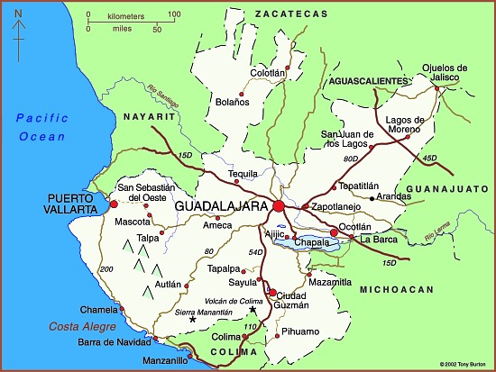
To qualify as genuine tequila, the drink has to be made in the state of Jalisco or in certain specific areas of the states of Nayarit, Guanajuato, Michoacán and Tamaulipas. (We will take a closer look at this distribution in a future post).

The ideal growing conditions are found in semiarid areas where temperatures average about 20 degrees Centigrade, with little variation, and where rainfall averages 1000 mm/yr. In Jalisco, this means that areas at an elevation of about 1,500 meters above sea level are favored. Agaves prefer well-drained soils such as the permeable loams derived from the iron-rich volcanic rocks in Mexico’s Volcanic Axis.

Production of tequila has tripled within the last 15 years to about 250 million liters a year (2010). About 65% of this quantity is exported. Almost 80% of exports are to the USA, with most of the remainder destined for Canada and Europe.

Connoisseurs argue long and loud as to which is the better product, but all agree that the best of the best is made from 100% Agave tequilana Weber azul. I’m no connoisseur, but my personal favorite is Tequila Herradura, manufactured in Amatitán, a town between Tequila and Guadalajara. Anyone interested in the history of tequila will enjoy a visit to Herradura’s old hacienda “San José del Refugio” in Amatitán, where tequila has been made for well over a century. The factory is a working museum with mule-operated mills, and primitive distillation ovens, fueled by the bagasse of the maguey. The Great House is classic in style, with a wide entrance stairway and a first floor balustrade the full width of the building.

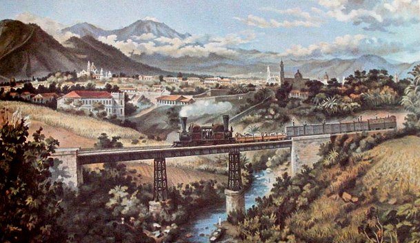
Visitors to the town of Tequila, with its National Tequila Museum, can  enter any one of several tequila factories to watch the processing and taste a sample. They can also admire one of the few public monuments to liquor anywhere in the world – a fountain which has water emerging from a stone bottle supported in an agave plant. “Tequila tourism” is growing in popularity. Special trains, such as “The Tequila Express” run on weekends from the nearby city of Guadalajara to Amatitán, and regular bus tours visit the growing areas and tequila distilleries. The town of Tequila holds an annual Tequila Fair during the first half of December to celebrate its famous beverage. Another good time to visit is on 24 July, National Tequila Day in the USA.

In 2006, UNESCO awarded World Heritage status to the agave landscape and old tequila-making facilities in Amatitán, Arenal and Tequila (Jalisco).

Related posts: