Mar 242014
 

According to Eduardo Barroso, the CEO of management consultancy EB Turismo, in his presentation at the XII Foro Nacional de Turismo held in Mérida, Yucatán, in February 2014, Mexico’s 83 Magic Towns (Pueblos Mágicos) attracted more than 4 million visitors in 2013, and tourist spending of more than 6 billion pesos (460 million dollars). However, he also pointed out that the program has not been prudently and carefully developed, but has been distorted by the designation of 46 Magic Towns in just two years (2011 and 2012), compared to the designation of just 37 Magic Towns in the preceding decade. (The Magic Town program started in 2001.)

Magic TownsThe Tourism Secretary Claudia Ruiz Massieu has called a halt to the program while officials work out how to reinstate it in a manner that will ensure that only towns worthy of the designation can actually acquire the status. This will no doubt require establishing new guidelines and regulations governing the program.

Success stories for the Magic Town program include San Miguel de Allende, which was first designated a Magic Town but has since been elevated to the much more exalted status of a World Heritage City;  Real de Catorce, in San Luis Potosí, which has seen visitor numbers jump by 1200% in only 12 years; and the town of Tequila, in Jalisco, where the coordination of three levels of government has seen visitor numbers quickly rise from 18,000 to 165,000 visitors a year.

Related posts:

Cosmic botanical garden in Toluca

 Other  Comments Off on Cosmic botanical garden in Toluca
Mar 152014
 

The city of Toluca (population 1.8 million), the capital of the State of México, was in the news recently as the site for the tri-national meeting between the heads of state of Mexico, the USA and Canada to mark the 20th anniversary of NAFTA.

Nestled away inside the city, away from its burgeoning factories, is the former city market. The market closed in 1975. Plans to demolish it were forestalled when renowned Mexican artist Leopoldo Flores stepped up with a plan to restore the market building, which dated back to 1909, into an artistic gem housing a botanical garden.

Cosmovitral, Toluca

Used under Creative Commons Attribution-Share Alike attribution

The market’s original windows were replaced with large glass murals, comprised of half a million pieces of glass and covering a total area of more than 3,000 square meters. The revamped building, now known as the Cosmovitral, was reopened in 1980. In 2007, the Cosmovitral narrowly missed being named one of the 13 man-made wonders of Mexico.

The centerpiece of the Cosmovitral murals is the stunning image entitled Sun Man (Hombre Sol).

Possibly the world’s best decorated glasshouse, the Cosmovitral houses over 500 different plants from around the world and has become one of the city’s single most popular tourist attractions, though rarely visited by foreign tourists.

Where? The Cosmovitral is located in downtown Toluca at the intersection of Juárez and Lerdo de Tejada streets. Guided tours are available.

When? It is normally open Tuesday to Saturday, 10 a.m. to 6 p.m.; Sundays 10 a.m. to 3 p.m.

Admission? Tickets are 10 pesos (less than a dollar) for adults, 5 pesos for children. Guided tours, mostly to explain the Cosmovitral’s stained glass, are available. Art exhibitions are hosted regularly.

Related posts:

Jan 162014
 

“Holiday in Mexico” is a collection of essays relating to the history of tourism in Mexico. The dozen authors involved are primarily academic historians, but also include a journalist. While the writing style is somewhat varied, this in no way detracts from the overall high quality of the contributions.

As Dina Berger and Andrew Grant Wood, the book’s editors, point out in their introduction, Mexico’s dilemma as regards tourism has always been to “reconcile market demand with a desire for national sovereignty” (p. 1). Tourism may stimulate the economy but can also have adverse environmental, social, and cultural consequences. Tourism promoters have always sought to “package” Mexico in a way that will attract tourists. The tourism sector’s portrayals of Mexico are inevitably subjective and seek to influence the perceptions of potential visitors.

The book’s 14 chapters (including the introduction) span 3 time periods:

  • 1840s-1911
  • 1920-50
  • 1960-present

and examine three main themes:

  • how Mexicans promoted and imagined their country and culture
  • the political lenses through which Mexicans and tourists have interacted with each other
  • the advantages and disadvantages of tourism

1840s to 1911

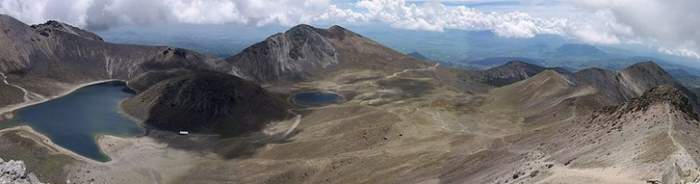
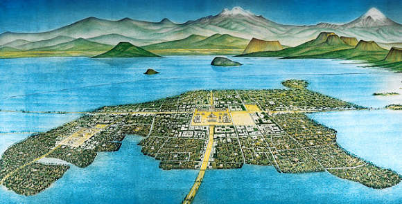
Two chapters look at the early history of tourism in Mexico. Andrea Boardman links the early days of American tourism in Mexico to the US soldiers who entered Mexico during the Mexican-American War. Among other achievements, American soldiers climbed Mexico’s highest peak, El Pico de Orizaba, though they were certainly not the first foreign nationals to do so. The accounts written by soldiers helped the American public appreciate that Mexico was worth exploring. Visiting Mexico became easier once the major railway lines had been completed at the end of the nineteenth century.

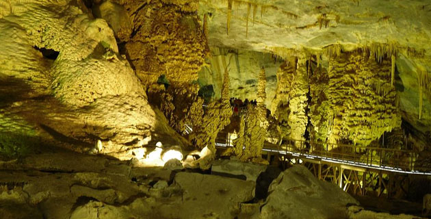
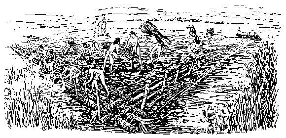
Christina Bueno offers a detailed look at the contested reconstruction of Teotihuacan, the earliest major archaeological site to be opened for tourism, its “restoration” timed to coincide with the celebrations for Mexico’s centenary of independence. Cultural and historical tourism have remained important aspects of tourism in Mexico ever since. Such tourism simultaneously stresses the significance of indigenous culture while portraying the nation as “modern” and “forward looking”.

1920-60

Five chapters of “Holiday in Mexico” look at the formative period of tourism development in Mexico that began shortly after the start of the Mexican Revolution in 1910.

cover of holiday in mexico
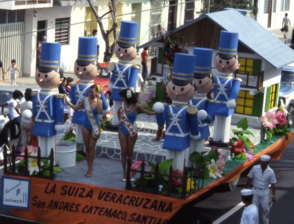
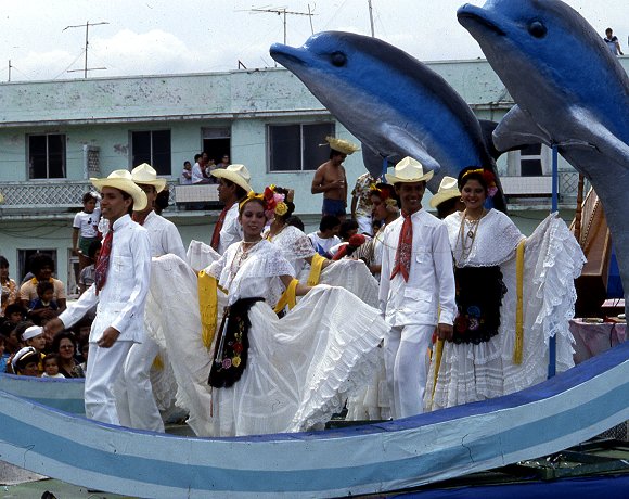
Andrew Grant Wood shows how business leaders in the port of Veracruz were able to reposition the city, changing its image from an insalubrious and unsafe city into a haven for cultural activities, music and dance, centered on annual Carnival celebrations.

Dina Berger looks at tourism, diplomacy and Mexico-USA relations. Mexico’s active promotion of its national progress (such as modern highways), democracy and friendliness coincided with a period when the USA pursued its Good Neighbor policy and Panamericanism (such as the construction of the Pan American Highway).

Eric Schantz’s essay focuses on postwar tourism in Baja California’s border zone, and considers the impacts of gaming, racing, prostitution and the growing tourism entertainment industry. Many of those crossing the border to partake in these activities were, strictly speaking, “visitors” rather than “tourists”, since they remained less than 24 hours, but they had a massive influence on the economy of some border cities.

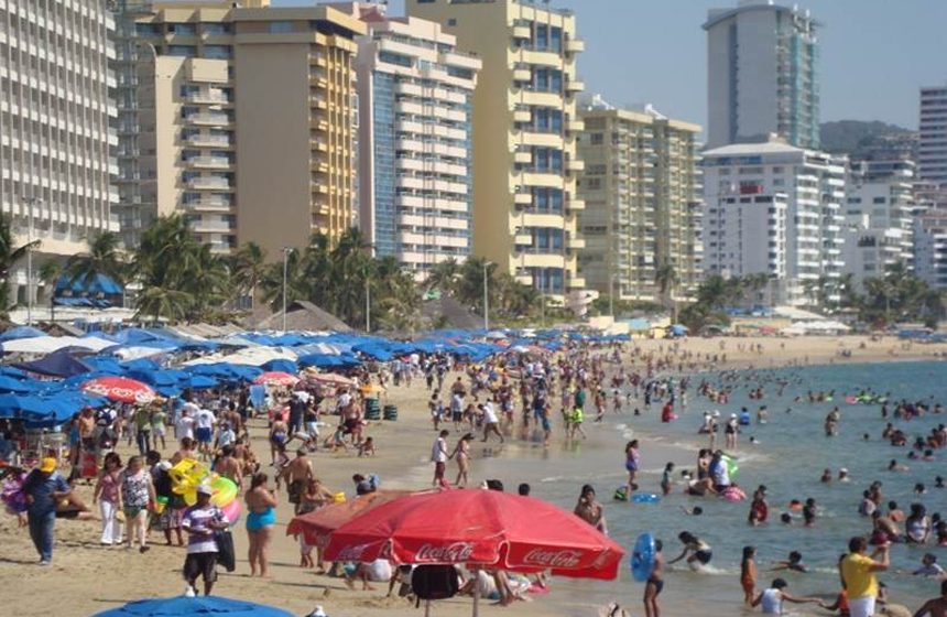
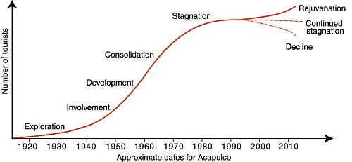
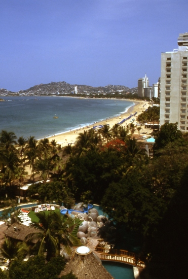
In the next chapter, “Fun in Acapulco? The Politics of Development on the Mexican Rivera,” Andrew Sackett weaves a carefully-crafted narrative that encompasses Acapulco cliff divers, Hollywood movie stars, state intervention, poor ejido farmers being dispossessed of their land, and the capriciousness of resort developers. This is possibly the strongest chapter in the book from a geographical perspective, though Sackett overstates the significance of a 1946 map of the city, since all maps are perceptual statements and necessarily simplify the landscape and select the most appropriate points of reference for their intended audience.

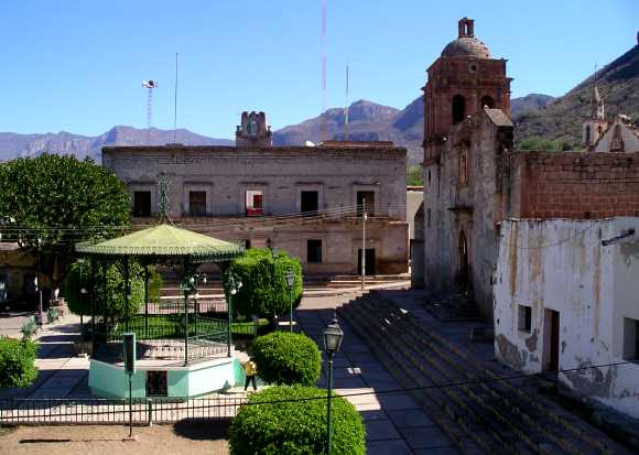
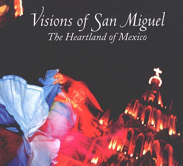
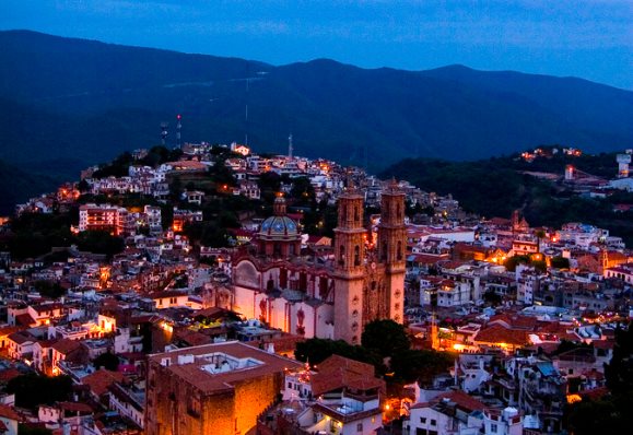
Lisa Pinley Covert then looks at how San Miguel de Allende’s tourist industry developed from a combination of local, national and international factors and players. In this case (unlike Acapulco) local efforts were preeminent in establishing the city’s reputation as a center for cultural tourism. Interestingly, no distinction is drawn in this chapter between the impacts of “tourists” and the impacts of the longer-term, non-tourist foreign residents that now comprise a distinctive segment of the city’s population.

1960-present

The final five chapters have greater contemporary relevance. Jeffrey Pilcher gives an engrossing account of how culinary tourism emerged, of how restauranteurs created “authentic” Mexican cuisine, a kind of “gentrification” of Mexican food. This account supports the view that cultural imperialism has not led to the food homogenization of North America, but, on the contrary, has led to varied, glocalized responses including innovatory regional and local cuisine.

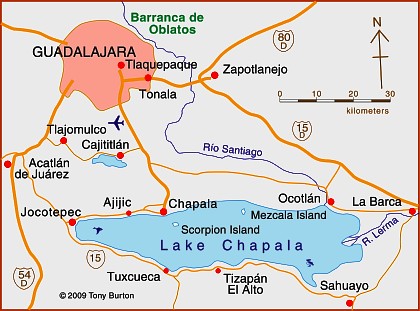
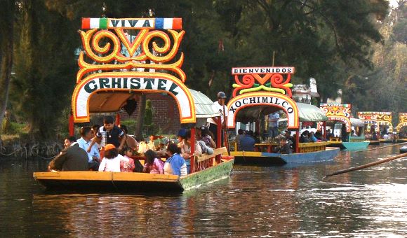
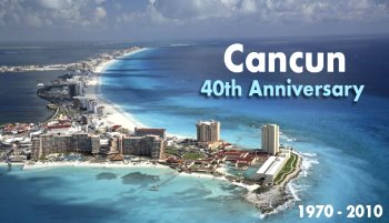
M. Bianet Castellanos looks at the lesser-known face of mass tourism in the centrally-planned FONATUR resort of Cancún: the many service workers who migrated from nearby indigenous communities, and their perceptions of the resort and its tourist industry.

Adopting a national viewpoint, Mary K. Coffey examines how federal government policies in the past decade or so have sought to promote Mexico’s artistic and folk art culture as a powerful magnet for tourism. To remain competitive on the world stage, and counteract the impacts of events elsewhere (such as 9/11), Mexico’s tourism sector needs to continually reinvent itself. This is an excellent example of how changing policies and rhetoric can help keep Mexico in the world tourist spotlight.

In looking at Los Cabos, another centrally-planned resort, Alex M. Saragoza emphasizes how it was designed specifically to appeal to wealthy US tourists, hence its emphasis on golf courses, and its grandiose plans (now scaled-back) for the “Escalera Náutica”, a network of marina resorts.

The final essay, by travel writer Barbara Kastelein, looks at some of the forces behind the development of tourism in three contrasting locales: Acapulco, Oaxaca and Amecameca, considering some of the broader aspects including race, gender, and class dynamics.

The geographical coverage of “Holiday in Mexico” is quite broad but certainly not comprehensive. The use of case studies allows the authors to explore the many subtexts in depth, but it may be that some of the insights arrived at fail to hold up when a regional or national scale is considered.

The book certainly provides plenty of ideas worth further discussion, along with thoughtful analysis of different stakeholders, different types of tourism and their relative merits. The authors do not shy away from looking at the impacts of the massive socioeconomic gaps between tourists and their Mexican hosts, or of the corruption that has unfortunately accompanied many tourism developments in Mexico.

If I have one minor reservation about this book, it is that it is overly US-centric. The history of tourism in Mexico deserves a more nuanced approach, one in which the role of European and Latin American tourists is also closely examined. This clearly opens up many possibilities for future research.

Dina Berger and Andrew Grant Wood (eds). 2010 “Holiday in Mexico: Critical reflections on tourism and tourist encounters.” Duke University Press.

Related posts:

Retirees and “residential tourism”: a case study of Chapala-Ajijic in Jalisco

 Excerpts from Geo-Mexico  Comments Off on Retirees and “residential tourism”: a case study of Chapala-Ajijic in Jalisco
Jan 162014
 

Retirees, mainly from the USA and Canada, form a special subgroup of tourists. About 1 million US visitors to Mexico each year are over the age of 60. Their total expenditure is about $500 million a year. Three-quarters arrive by air; half of these stay 4-8 days and almost one in ten stays 30 days or longer. Half stay in hotels, and one-third in time-shares; the remainder either stay with family or friends, or own their own second home. Of the 25% arriving by land, almost one in three stays 30 days or more. For Canadians, the patterns are broadly similar except that a higher percentage arrive by air.

The number of retiree tourists is relatively easy to quantify. However, it is extremely difficult to place accurate figures on the number of non-working, non-Mexicans who have chosen to relocate full-time to Mexico. Technically, these “residential tourists” are not really tourists at all but longer-term migrants holding residency visas. They form a very distinct group in several Mexican towns and cities, with lifestyle needs and spending patterns that are very different from those of tourists. Their additional economic impact is believed to exceed $500 million a year.

Map of Lake Chapala, Jalisco, Mexico

Map of Lake Chapala, Jalisco, Mexico. Credit: Tony Burton; all rights reserved.

The largest single US retirement community outside the USA is the Guadalajara-Chapala region in Jalisco, according to state officials (see map). The metropolitan area of Guadalajara, Mexico’s second city, has a population of about 4 million. The villages of Chapala and Ajijic (combined population about 40,000) sit on the north shore of Lake Chapala some 50 km (30 mi) to the south. Historically, Chapala was the first lakeshore settlement to attract foreign settlers, as early as the start of the 20th century. Today the area is home to a mix of foreign artists, intellectuals, escapees (of various non-judicial kinds), pensioners and ex-servicemen. In the last 40 years, Ajijic has become the focal point of the sizable non-Mexican community living on the lakeshore. Depending on how they are defined, there are probably between 6000 and 10,000 foreign residents in the Chapala-Ajijic area, the higher number reflecting the peak winter season. About 60% of retirees in the area own their own homes or condos, though many still own property in the USA or Canada as well, and many make regular trips north of the border.

The main pull factors for residential tourists are an amenable climate; reasonable property prices; access to stores, restaurants and high quality medical service; an attractive natural environment; a diversity of social activities; proximity to airports; tax advantages, and relatively inexpensive living costs.

David Truly has suggested that conventional tourist typologies do not work well with Ajijic retirees. He identified migrant clusters with similar likes and dislikes. Retirees vary in education, travel experience and how they make decisions about relocation. Early migrants tended to dislike the USA and Canada and adapted to life in Mexico. They were generally content with anonymity unlike many more recent migrants. Traditional migrants appreciate all three countries, but have chosen Mexico as their place of permanent residence. Many new migrants do not especially like the USA or Canada but are not particularly interested in Mexico either. They seek familiar pastimes and social settings and are content to have relatively little interaction with Mexicans.

The large influx of residential tourists into small lakeside communities like Ajijic inevitably generates a range of reactions among the local populace. From empirical studies of regular tourism elsewhere, George Doxey developed an “irritation index” describing how the attitudes of host communities change as tourist numbers increase. His model applies equally well to residential tourists. In the initial stage the host community experiences euphoria (all visitors are welcome, no special planning occurs). As numbers increase, host attitudes change to apathy (visitors are taken for granted) and then annoyance (misgivings about tourism are expressed, carrying capacities are exceeded, additional infrastructure is planned). If numbers continue to grow, hosts may reach the stage of antagonism, where irritations are openly expressed and incomers are perceived as the cause of significant problems.

Residential tourism in the Chapala-Ajijic area has certainly wrought great changes on the landscape. Residential tourists have created a distinct cultural landscape in terms of architectural styles, street architecture and the functions of settlements. (Browse the Chapala Multiple Listing Service New Properties). Gated communities have been tacked on to the original villages. Subdivisions, two around golf courses, have sprawled up the hillsides. Swimming pools are common. Much of the signage is in English. Even the central plazas have been remodeled to reflect foreign tastes. Traditional village homes have been gentrified, some in an alien “New Mexico” style.

On the plus side, many retirees, as a substitute for the family they left behind, engage in philanthropic activities, with a particular focus on children and the elderly. Retiree expenditures also boost the local economy. Areas benefiting from retirees include medical, legal and personal services, real estate, supermarkets, restaurants, gardening and housecleaning. Employment is boosted, both directly and indirectly, which improves average local living standards.

On the minus side, decades of land speculation have had a dramatic impact on local society. Land and property prices have risen dramatically. Many local people have become landless domestic servants, gardeners and shop-keepers with a sense that the area is no longer theirs. Crime levels have risen and some local traditions have suffered. The abuse of water supplies has resulted in declining well levels. Over zealous applications of fertilizers and pesticides have contaminated local water sources.

Other locations besides Chapala-Ajijic where a similar influence of non-Mexican retirees on the landscape can be observed include San Miguel de Allende (Guanajuato), Cuernavaca (Morelos), Mazatlán (Sinaloa), Puerto Peñasco (Sonara), Rosarito (Baja California) and Todos Santos (Baja California Sur). The most preferred locations are all on the Pacific coast side of Mexico.

As more baby-boomers reach retirement age, residential tourism offers many Mexican towns and cities a way of overcoming the seasonality of conventional tourism. Lesser-developed regions have an opportunity to cash in on their cultural and natural heritage and improve their basic infrastructure.

This is a lightly edited excerpt from chapter 19 of Geo-Mexico: the geography and dynamics of modern Mexico.

References:

  • Boehm S., B. 2001 El Lago de Chapala: su Ribera Norte. Un ensayo de lectura del paisaje cultural. 2001. Relaciones 85, Invierno, 2001. Vol XXII: 58-83.
  • Burton, T. 2008 Lake Chapala Through the Ages, an Anthology of Travellers’ Tales. Canada: Sombrero Books.
  • Doxey G.V. 1975 A causation theory of visitor‑resident irritants: methodology and research inferences. Proceedings of the Travel Research Association, San Diego, California, USA: 195‑8.
  • Stokes, E.M. 1981 La Colonia Extranero: An American retirement Community in Ajijic, Mexico. PhD dissertation, University of New York, Stony Brook, cited in Truly, D. 2002.
  • Truly, D. 2002 International Retirement migration and tourism along the Lake Chapala Riviera: developing a matrix of retirement migration behavior. Tourism Geographies. Vol 4 # 3, 2002: 261-281.
  • Truly, D. 2006 The Lake Chapala Riviera: The evolution of a not so American foreign community, in Bloom, N.D. (ed) 2006 Adventures into Mexico: American Tourism beyond the Border. Rowman & Littlefield: 167-190

Related posts:

The transformation of Real de Catorce from ghost town to film set and Magic Town

 Other  Comments Off on The transformation of Real de Catorce from ghost town to film set and Magic Town
Dec 262013
 

Both the name and the coat-of-arms of the state of San Luis Potosi recall the tremendous importance of mining to Mexico’s economy.

SLP-coat-of-armsCalled Potosí in emulation of the mines of that name high in the Bolivian Andes, the city’s coat-of-arms, awarded in 1656, has its patron saint standing atop a hill in which are three mine shafts. Left of the hill are two gold ingots, and right of it, two silver ones.

Some of the early mining towns in San Luis Potosí faded into obscurity, others became centers for ranching and commerce. The best known former mining town, Real de Catorce, for long considered a ghost town, has been resuscitated by tourism.

For visitors planning to see Real de Catorce, the best place to stay the night before is Matehuala, on highway 57, which has a full range of tourist services. From Matehuala, it is short distance west to Cedral. Shortly after Cedral a 24-kilometer-long cobblestone road climbs up the mountain to Real de Catorce, which sits at an elevation of  2,743 meters (9,000 ft) in the Sierra de Catorce range.

Real de Catorce

Main street of Real de Catorce. Credit: Tony

Main street of Real de Catorce. Credit: Tony Burton

The first surprise for visitors is the single file 2,300 meter long Ogarrio tunnel – the only entrance to the town from the north – a unique introduction to the many strange things awaiting you on the other side. The second surprise  is how such a large place, which produced more than 3 million dollars worth of silver each year, could ever have become a ghost town. Between 1788 and 1806, the La Purisima mine alone yielded annually more than $200,000 pesos of silver– and that was when a peso of silver was equivalent to a dollar.

The large, stone houses, often of several stories, with tiled roofs, wooden window frames and wrought-iron work, were so well built that they have survived to tell you their tales as you wander through the steep streets, soaking up the atmosphere of one of Mexico’s most curious places.

You need time to really appreciate the former grandeur of Real de Catorce. Fortunately, there are several simple hotels and restaurants. It is well worth hiring a local guide.  An enthusiastic guide will wear your feet out long before you tire of their informative commentaries.

Seek out the beautifully restored palenque (cock-fighting pit). Pause in the church to examine the mesquite floor, imaginatively described in some guidebooks as comprised of a mosaic of coffin lids. The church is dedicated to Saint Francis of Assisi. The two week long fiesta in his honor, centered on October 4th, is a huge affair, attended by hundreds of returning Real de Catorce families.

In front of the church, across the small plaza of Carbón, is the former mint. This gorgeous building is well worth visiting and now used for cultural events such as photographic exhibitions. Look in the gallery and perhaps you’ll find an irresistible, original, handcrafted item made of locally mined silver.

The town of Real de Catorce and its surroundings are sufficiently photogenic that several movies have been filmed here, including Bandidas (featuring Salma Hayek and Penélope Cruz) and The Mexican (featuring Brad Pitt and Julia Roberts).

The town, designated a Magic Town in 2001, has several small hotels and restaurants for those wanting to spend more time here.

This area has close associations with the indigenous Huichol (Wixarika) Indians who call this area Wirikuta. Each spring, they visit Cerro del Quemado, a hill within easy hiking distance of Real de Catorce, to leave religious offerings. The Huichol collect the hallucinogenic cactus peyote, used in some of their ceremonies, from the surrounding desert during an annual spiritual pilgrimage to Wirikuta from their heartland in northern Jalisco, 400 km (250) miles away. Cerro del Quemado was declared a National Sacred Site in 2011. An upcoming full length documentary about the Huichol Indians, the “Huicholes: The Last Peyote Guardians“, includes shots of the pilgrimage, while looking at how the continuation of the pilgrimages could be threatened by proposed mining projects.

Related posts:

Dec 162013
 

In October 2013, the protection status of the Nevado de Toluca, Mexico’s fourth highest peak, was downgraded from National Park to Wildlife Reserve (Area of Protection for Flora and Fauna).

On paper, this is a significant downgrade that may now open the door to greater economic activity in the former National Park area with adverse environmental consequences. In practice, it might turn out to be a blessing in disguise and herald the start of a more pragmatic approach to environmental protection.

Is this good news or bad? This post considers some of the possible implications of the volcano’s recent change of status.

El Volcán Nevado de Toluca

El Volcán Nevado de Toluca

Background:

The Nevado de Toluca (also known as Chicnautécatl) is Mexico’s fourth highest peak, with a summit elevation of 4680 m (15,354 ft) above sea level. Located in central Mexico, southwest of the city of Toluca (the capital of the state of Mexico) and 80 km (50 miles) from Mexico City, the Nevado de Toluca is one of the most accessible volcanic peaks in the country. During the warmer months, regular vehicles can be driven very close to the volcano’s crater with its small lakes. During cooler months, when snow blankets the top portions of the mountain, the access road is popular with Mexico City families wanting to show their children what snow looks and feels like.

The area was granted National Park status in 1936, during the administration of President Lázaro Cárdenas, at a time when deforestation threatened to undermine the mountain’s ability to capture rainwater and be used as a water source for Mexico City and Toluca. (1936 was an important year in the history of environmental protection in Mexico because it was when the International Parks Commission was established which led to a series of protected areas–National Parks, Wildlife Areas and Forest Reserves–being established on either side of the Mexico-USA border).

The decree establishing the Nevado de Toluca National Park called for the expropriation of all the land around the volcano that was over 3000 m in elevation. The total area involved was about 536 sq. km. (207 square miles). While, for a variety of reasons, this expropriation was never fully implemented, deforestation of the volcano’s slopes was halted and tree-cutting banned.

In the succeeding decades, settlement expansion gradually ate away at the lower slopes with the result that the original National Park area now houses more than 5000 inhabitants in at least 16 distinct villages.

The newly designated Wildlife Reserve has a nucleus, centered on the crater, of 1.9 sq km, surrounded by a buffer zone of 51.7 sq. km.

A draft of the management plan for the Wildlife Reserve has been published by the National Commission for Protected Natural Areas (Comisión Nacional de Áreas Naturales Protegidas, CNANP) and made available for public consultation. The statuary 60-day consultation period began in mid-November.

The draft management plan [Map and plan both dated 5/11/2013] has met with considerable criticism in the popular press. The main issue is whether or not any such plan, however well intentioned, will be effectively enforced.

Several journalists have highlighted the very real danger that the new status will allow changes of land use in the former park that could lead to serious environmental degradation. The possible expansion of mineral extraction and of tourism within the Wildlife Reserve are of particular concern.

Nevado de Toluca Crater June 1986.

Nevado de Toluca Crater, June 1986. Photo: copyright Christopher Kessler (Wikimedia Commons)

Mining

In “Se tolerará la minería dentro del Nevado de Toluca“, Paris Martínez looks at the situation of several mining operations in the former park currently quarrying volcanic sand and gravel. Only one of these companies apparently had the requisite permit from the State of Mexico to quarry within the National Park area. The draft management plan allows all the quarries to continue operating for at least five years. Effectively, as Martínez points out, the change of status of the Nevado de Toluca means that mining operations that were operating illegally within the park are now “regularized”, for at least five years.

The main existing sand and gravel quarries are: El Atorón and Loma Alta in the municipality of Zinacantepec La Loba, El Capulín, Las Lágrimas (the only one with a state permit) and El Varal in Temascaltepec.

There are also reported to be many smaller illegal quarries extracting tepojal, a volcanic deposit similar to pumice, used in the construction industry. Unsupervised and unauthorized extraction is especially prevalent on the southern and eastern sides of the Wildlife Reserve.

Local residents say that quarrying, together with the construction of the access roads required to access the quarries, has resulted in serious environmental damage to the slopes of the volcano. Specifically, quarrying activities have led to:

  • deforestation
  • erosion, soil loss, degraded hydrology
  • loss of soil water absorbing capacity
  • particle emissions
  • loss of slope stability
  • visual pollution

The impacts of quarrying are not confined to the slopes of the volcano. The increased erosion of the lower slopes has led to local streams having to cope with a higher sediment load, reducing their capacity to carry the heavy rainy-season precipitation. This has led to flooding damage downstream in municipalities such as Tenango del Valle, Calimaya and Rayón.

The management plan appears to lack a clear pathway for the regulation or limitation of quarrying activities. At the same time, it calls for short-term remediation of areas that have been subject to soil degradation, but only for former mining areas that are not currently being exploited. It does nothing to reduce soil impacts in areas where quarrying is ongoing.

While the management plan does not discuss how or when the quarries might be closed, it does propose establishing workshops to develop “alternative productive activities” for the owners of small quarries, to provide them with an alternative source of income. However, the workshops are only mentioned as part of the long-term plan, ie to be introduced at some point at least 5 years down the road.

What’s more, only one alternative productive activity – public use, open-air recreation and tourism- is actually mentioned in the plan, alongside those activities that would provide products or services for tourism. Surely the final version of the plan should also suggest other viable options?

The plan calls for compensation for the owners of property where quarrying is halted, and who opt for alternative activities. However, this too is only mentioned as part of the longer term plan, so many landowners may well be tempted to start mining in the interim, in order to be able to claim compensation in a few years’ time!

Tourism

The decision to change the protection status of the Nevado de Toluca was based on a commissioned study that showed the area had potential for “intensive tourism” and “private infrastructure”. The study identified potential “tourism nuclei” or “sites for intensive tourism” where the construction of cabins was considered “feasible”. Following criticism and opposition that included almost 30,000 signatures on a change-org petition, the draft Management Plan does not use terms like “intensive tourism” and states that “tourism developments and ski runs may NOT be built in the area”, nor may subdivisions, hotels, golf courses or weekend homes.

The draft plan calls for “low-impact tourism” which is environmentally aware, defined as being suitable for activities such as hiking trails, camping and bird-watching. The plan allows for this form of tourism to be developed in most of the core area of the crater of the Nevado de Toluca as well as in a 3-square-kilometer section on the slopes of the volcano. The plan also allows existing settlements (whose area is not precisely defined) to develop tourism infrastructure; this could easily result in some short-term land-grabbing. Equally, precisely what counts as tourism infrastructure is not clearly defined.

Accepting that the National Park was never adequately patrolled or regulated, then if the new Wildlife Reserve Management Plan is tightly written and backed up by effective monitoring and the enforcement of regulations, then the volcano’s change of status may yet prove to be the best way to preserve the mountain’s unique character.

The draft plan is a valuable step forward, but Geo-Mexico hopes that the final Management Plan will address the many concerns raised in the press, to the benefit of both the volcano itself and its local residents.

Thanks to Arq. Ricardo Warman for first alerting us to the Nevado de Toluca’s change of protected status.

Related posts:

Dec 052013
 

After studying 22 countries with sizable retirement communities, International Living (a consultancy group) rated Mexico as the fourth most attractive country for foreigners to retire to in 2013, after Ecuador, Panama and Malaysia. The study looked at eight factors: real estate, benefits for retired people, cost of living, integration, entertainment, health, infrastructure and climate.

According to the US Census Bureau, there are 41 million people of retirement age in the USA. More than half of them have annual incomes of between 70,000 and 150,000 dollars, and they are expected, on average, to live to the age of 83; 80% are home owners. This number will swell to 72.8 million by 2030, 40% of whom may have difficulties maintaining their previous lifestyles during retirement. Given its proximity, this makes Mexico an attractive destination for many baby-boomers seeking a comfortable retirement lifestyle.

But where in Mexico will these retirees choose to live?

According to this analysis by the consultancy Aregional, there are 36 specific areas in Mexico where the real estate market is targeting US baby boomers seeking a place to retire. About half of these locations (see map) are in central and western Mexico. Locations in these regions include Guanajuato and San Miguel de Allende (both in the state of Guanajuato), Colima, Comala and Manzanillo (Colima); Chapala, Ajijic and Puerto Vallarta (Jalisco); and Nuevo Vallarta and Punta Mita (Nayarit).

Locations of retiree real estate developments. Credit: Aregional

Locations of retiree real estate developments. Credit: Aregional

Locations in northern Mexico important for retiree real estate include Rosarito, Ensenada and Los Algodones (Baja California); Los Cabos, La Paz and Loreto (Baja California Sur); Puerto Peñasco (Sonora) and Mazatlán (Sinaloa). [Kudos to RickS for noticing that Puerto Peñasco is not located very accurately!]

Retiree real estate is also prominent in several places in the south and south-east of Mexico, including  Acapulco and Punta Ixtapa (Guerrero); Huatulco (Oaxaca); Playa del Carmen and Cancún  (Quintana Roo); Puerto Progreso (Yucatán), as well as the cities of Campeche and Veracruz.

It is not known how many US retirees have already chosen to live in Mexico. While it is relatively easy to quantify the number of retiree tourists (those staying more than one night, but less than six months), it is impossible to accurately quantify the number of non-working, non-Mexicans who have chosen to relocate full-time to Mexico. Technically, these “residential tourists” are not really tourists at all but longer-term migrants holding residency visas.

Residential tourists already form a very distinct group in several Mexican towns and cities, with lifestyle needs and spending patterns that are very different from those of regular tourists. Their additional economic impact is believed to exceed $500 million a year.

A case study of residential tourism, and its pros and cons, in Chapala-Ajijic on the northern shore of Lake Chapala is an integral part of chapter 19 of Geo-Mexico: the geography and dynamics of modern Mexico.

Posts related to retirees in Mexico:

Nov 162013
 

In an alliance with the Sonoran Institute, the National Geographic Center for Sustainable Destinations helped the region’s communities create the first transborder Geotourism MapGuide, covering northern Sonora and southern Arizona. The mapguide was published in 2007:

The maps  have vignettes of information about history, culture, geology and many other aspects of the region, making it a useful guide for geo-tourists. While some might argue about the choice of locations and attractions described on the maps, this is a useful addition to the background reading for anyone thinking of traveling to this region with some time on their hands to explore.

Surprisingly, the map has only a very brief and somewhat dismissive mention of the El Pinacate and Gran Desierto de  Altar Biosphere Reserve:

“Stand at the rim of this mile-wide volcanic crater and you may feel as if you’re on the moon. This land of ancient lava, sand, and cinder cones is sacred to the O’Odham people. Today, those on the Sonora side of the border call themselves “Pápago.”

Related posts:

Nov 142013
 

About 160 kilometers (100 miles) north of Guadalajara as the crow flies is a wild and inhospitable arm of the Western Sierra Madre called the Sierra of Bolaños, a rugged northern extension of Jalisco most easily reached by light aircraft. The one way trip by road requires driving more than 320 kilometers (200 miles) from Guadalajara, half the distance being inside the adjacent state of Zacatecas. The Bolaños region has for centuries been an important silver mining area, and British capital and engineers left an indelible mark on the towns there.

Bolaños, the setting.

Bolaños, the setting. Credit: Tony Burton; all rights reserved

The once-grand colonial mining town of Bolaños fits snugly between the river and the rocky cliffs into which the first mine shafts were sunk. Its numerous old stone buildings, often with ornately carved doorways and windows, make it a fascinating place to wander around. With judicious restoration, Bolaños could undoubtedly find its way onto anyone’s list of Mexico’s top mining towns to visit. The town’s hanging bridge (puente colgante) links Bolaños, on the edge of mestizo territory, with the Huichol Indian villages in the mountains on the far side of the river. Huichol artwork, including colorful beadwork, is on sale in several stores in the town and it is common to see traditionally-dressed Huichol Indians in the streets.

Map of Jalisco state

Map of Jalisco. Copyright 2010 Tony Burton. All rights reserved.

Mineral riches

Relatively little is known of the pre-Columbian history of the Sierra of Bolaños but the area was probably only sparsely peopled, perhaps by Tepecano Indians. By the beginning of the seventeenth century, Spanish adventurers had founded the town of Chimaltitán which later served as their base for both subduing the natives militarily and converting them to Christianity. They later founded the towns of Bolaños, a short distance to the north, and San Martín de Bolaños to the south.

By the mid-eighteenth century, the Spanish were in complete control and the Bolaños mines were producing between 2 and 3 million pesos worth of silver per year, or about 25% of the silver production in the whole of New Spain—a very considerable amount, bearing in mind that each peso was then worth about a dollar.

By the 1760s, 16,000 people lived here. Overlooking an attractive small park in Bolaños is the rococo Guadalupe Chapel (the church of San José), a gift to the town from Antonio de Vivanco, owner of several mines. In 1789, de Vivanco became Marquis Vivanco, Viscount of Bolaños.The prosperity of these times is reflected in the sumptuous architecture of the buildings in Bolaños that date from this period. Two particularly fine examples are the Casa de la Condesa, and Antonio de Vivanco’s former home, with its unusual frescoes, both on the street which parallels the river. Bolaños even boasted a two-story Royal Mint, with a lovely facade. Built on one side of the main plaza in the 1750s, this partially restored gem has an Austrian Hapsburg two-headed eagle carved in the stone above its main door. This royal crest may have inspired the local Huichol Indians to use two and even four-headed eagles (a head for each cardinal direction) in their handicrafts.

Main plaza in Bolaños

Main plaza in Bolaños. Photo: Tony Burton; all rights reserved

But the boom times of the 1750s were not to last for ever. Following a series of floods (the most serious of which occurred in 1757 and 1781), land disputes, the ever-increasing quantities of costly mercury required for smelting, and disagreements over mining rights, Bolaños’s first boom period came to an abrupt end. By 1798 the town was virtually abandoned. Its largest church, begun in 1778, still stands half-finished; today, this is probably the only place in the world where you can play basketball under floodlights in the shell of an ancient church!

A new company and British miners

British influence in Mexico quickly gained momentum following Mexico’s Independence in 1821. On 27 September 1821, Agustín de Iturbide entered Mexico City in triumph. Most gachupines (Spanish-born residents of Mexico) had fled with whatever assets they could muster back to Spain. The rest were expelled in 1829. Iturbide desperately needed funds, to pay his 80,000-strong army and to set up an administration but, after eleven years of war and chaotic politics, the nation was fatigued and the Treasury empty.

In order to stimulate the Mexican economy, Iturbide needed to revive the mines, many of which had been abandoned during the Independence War. However, the mines had drainage problems and needed large investments of capital. Mexico’s need, coupled with the aspirations and greed of England’s capitalists, proved to be an unstoppable combination. Between 1820 and 1824, no fewer than seven different mining corporations relying on U.K. capital were formed in Mexico. One of these was the Venture Company of the Mines of Bolaños.

The Bolaños Company commissioned a full inspection of their mines. This concluded that, given “modern technology”, a fortune in silver was awaiting exploration, with a potential profit of over a million dollars. The firm’s investors were happy to pour money into bringing British machinery and the ingenuity of expert tin miners from Cornwall to back up their intentions.

In the early days, it was difficult and even dangerous to travel to the mines. No fewer than 15 of the 45 Cornish miners who accompanied the first shipment of machinery for Bolaños in 1825, died through accidents or disease before taking up their posts.

Mine owners had their own agenda. Most insisted that their miners worked completely naked in an effort to thwart any attempted pilfering of ore. Miners grew ever more ingenious in trying to circumvent the rules. They were discovered concealing silver ore in their hair, hollowed-out hammer handles, their mouths and ears, and even, on one occasion, inside the disemboweled body of an overseer killed in an accident!

Despite all the problems the British were determined to succeed. They built a reservoir above the village of Tepec and then a five kilometer long canal, much of it underground, to bring water to the town of Bolaños. On the east side of the small church in Tepec, a camposanto (cemetery) was built specifically for the English miners and their descendants since they were not Catholics and should not therefore be buried in the town’s main graveyard.

To assist in drainage, the British assembled two massive hydraulic wheels, one 12 meters, and the other 14 meters in diameter. Their most important contribution, though, was to import a 32-ton steam engine from the U.K. It took 106 days for this engine to be hauled over the mountains from Veracruz. Locals say that the reason the San José church now has only small bells is because the large ones were melted down to make wheel rims to help move the steam engine.

Bolaños grew into a town of more than 30,000 people, with seven major mines in production, employing thousands of workers. However, despite the mammoth injection of British capital and technology, the company failed to extract enough silver to obtain any return on its investment. In 1842, amidst political rumblings after several accidents and a fire which cost the lives of more than 150 miners, and with the Mexican government delaying payments for silver bars “bought” by the Mint, the company was wound up and Bolaños once again echoed to the sounds of bird-song rather than of hammer, chisel and steam engine.

The town’s population declined to fewer than 5000. It became a ghost town, another casualty of the ever-changing fortunes of mining centers around the world. Various attempts to revive the mines in the late nineteenth century by North American interests came to nothing. At the end of the last century, a U.S.-Mexico joint venture mined successfully for some years but finally went out of production in about 1998. Today, Bolaños is still a small town, a mere shadow of its former self, though one offering a few small hotels and ample opportunities for adventure, eco- and cultural tourism.

Twenty kilometers south of Bolaños, down the valley and past Chimaltitán, is San Martín de Bolaños. The El Pilón mine, near San Martín, opened in the 1980s, is the only mine currently operating in the valley. By 2007, it had produced over 30 million ounces of silver, as well as some ancillary gold.

A visit to this remote corner of Jalisco provokes deep feelings of admiration for the courage and audacity of all those who chose to settle here, including the nineteenth century British immigrants who left a Europe torn by upheaval, in search of fame and fortune in Mexico.

This is a lightly edited excerpt from chapter 23 of my Western Mexico: A Traveler’s Treasury (4th edition, 2013)

Other posts related to Bolaños:

San Miguel de Allende: the “world’s best city”?

 Mexico's geography in the Press  Comments Off on San Miguel de Allende: the “world’s best city”?
Oct 212013
 

San Miguel de Allende has been selected as the “World’s Best City”, in the  Condé Nast Traveler‘s 26th annual Readers’ Choice Awards, announced 16 October 2013. (See also, The world’s best city is… by Frances Cha, CNN)

While being declared “the world’s best city” is an honor for San Miguel, and will no doubt increase tourism, it should be noted that it is merely a popularity contest among people visiting a website. Visitors to the website are given a list of candidates in each category and asked to rate them as excellent, very good, good, fair and poor. Within each category, voters rate individual criteria. For example, for resorts, visitors assess food/dining, location, overall design, rooms, and service. The percentage of excellent and very good ratings is used to compile the “best” lists.

smdcover

San Miguel de Allende (one of Mexico’s 31 UNESCO World Heritage sites) is noted for its well preserved colonial center, as well as for its atmosphere, culture, artist community and shopping opportunities. It beat out Budapest and Florence which tied for second. Salzburg placed 4th while last year’s winner, Charleston, South Carolina, was tied for 5th with San Sebastian, Spain. Other North American cities in the top 25 were Quebec City (10th), Vancouver, BC (13th) and Victoria, BC with Santa Fe, NM which tied for 17th. Four of the top 25 cities were in Italy: Florence (2nd), Rome (8th),  Sienna (9th) and Venice (24th).

The top five cities in Mexico, according to the Readers of Condé Nast Traveler, were:

  1. San Miguel de Allende
  2. San Cristobal de las Casas
  3. Guanajuato
  4. Morelia and Puebla – tied

However, the only Mexican cities on the questionnaire were: Acapulco, Cancún, Ciudad Juárez, Cuernavaca, Guadalajara, Guanajuato, Mérida, Mexico City, Monterrey, Morelia, Oaxaca, Puebla, Puerto Vallarta, San Cristobal de las Casas, San Miguel de Allende, Tijuana, Veracruz and Zacatecas. Each of these cities was rated with respect to cultural/sites, friendliness, atmosphere/ambiance, restaurants, lodging, and shopping. Obviously, many other Mexican cities, such as Mazatlán, are far from happy at being excluded from the list of candidate cities.

Other Condé Nast Traveler reader’s selections for Mexico included “top 15 hotels in Mexico”, “top 10 resorts in the Pacific Riviera, Mexico”, “top 10 resorts in Baja, Mexico”, and “top 30 resorts in Cancun and the Yucatan, Mexico”.

Clearly, hotels and resorts that are not included in the Condé Nast candidate list for this popularity contest miss out on a great deal of free publicity.

Related posts:

New Durango-Mazatlán highway officially open

 Other  Comments Off on New Durango-Mazatlán highway officially open
Oct 172013
 

President Enrique Peña Nieto has officially opened the new Durango-Mazatlán highway which has taken more than a decade to complete. He inaugurated the new highway early today (17 October), Mexico’s annual “Road Workers’ Day” (“Día del Caminero”).

The new 1.2-billion-dollar, partly 4-lane, 230-kilometer highway will slash the time taken to drive from the city of Durango to the Pacific coast resort of Mazatlán, from 5 hours to about 3 hours. It is by far the single most important and complex road project in Mexico in recent years.

Mexico's major highways (Fig 17-3 of Geo-Mexico, the geography and dynamics of modern Mexico).

Mexico’s major highways (Fig 17-3 of Geo-Mexico, the geography and dynamics of modern Mexico). All rights reserved.

The most spectacular part of the highway is the Baluarte Bridge (Puente Baluarte), the tallest cable-stayed bridge in the world, which straddles the border between the states of Sinaloa and Durango and circumvents the need to negotiate the twisting and dangerous route taken by the old highway through the Espinazo del Diablo (Devil’s Spine). The Baluarte Bridge is a 1,124-meter-long bridge that rises almost 400 meters above the river below. The highway also includes 63 tunnels, the longest of which (El Sinaloense) is 2800 meters in length.

Durango-Mazatlan highwayThe firms involved in constructing the highway included Omega Corp, Tradeco Industrial, FCC Construcción, La Peninsular Compañía Constructora, Grupo Mexicano de Desarrollo and Grupo Hermes.

The highway has four toll booths; car drivers will pay about $500 pesos in total for a one-way trip along the entire length of the new highway. The highway is expected to carry 3,000 vehicles a day during its first year of operation, a figure expected to rise to 6,000 vehicles a day within the next six years.

Note: We are still waiting for a first-hand report from anyone who has driven the new highway. While the highway has been officially opened, at least one section of the highway is not yet open to regular traffic because of on-going repairs due to damage sustained during last month’s storms.

More photos?

Related posts:

Geotourism in Mexico: García Caves (Grutas de García) in Nuevo León

 Other  Comments Off on Geotourism in Mexico: García Caves (Grutas de García) in Nuevo León
Oct 032013
 

The Garcia Caves (Grutas de García) are located in the Cumbres de Monterrey National Park, 9 km from the small town of Villa de García, and about 30 km from the city of Monterrey (state capital of Nuevo León). The highest point in the park is Copete de las Águilas which rises to 2260 m (7,410 ft) above sea level, but its best known peak is Saddle Hill (Cerro de la Silla), the distinctive saddle-shaped hill that overlooks the city.

Much of the park, including the mountains, are composed of sedimentary rocks that were originally laid down as marine sediments and then subsequently folded, uplifted and exposed to erosion. The extensive areas of limestone in the park, which date from the Cretaceous period, have been subject to karstification over 50 to 60 million years, which has resulted in typical karst landforms such as sinkholes, caves, cave formations and underground streams.

The Garcia Caves, one of the largest cave systems in Mexico, are deep inside the imposing Cerro del Fraile, a mountain whose summit rises to an elevation of 1080 meters above sea level, more than 700 meters above the main access road. The entrance to the caves is usually accessed via a short ride on a 625-meter cable car that was built to replace a funicular railway.

The cave system was first reported in 1843 by the Marmolejo family who informed their local prist Juan Antonio Sobrevilla that they had stumbled across it while looking for firewood.

Grutas de García. Credit: María de Lourdes Alonso

Grutas de García. Credit: María de Lourdes Alonso

Guided tours of the cave system show visitors some of its 27 separate chambers along a 2.5-kilometer (1.6 mile) route. The full system extends more than a kilometer further into the mountain reaching depths of more than 100 meters (340 feet) beneath the surface. The limestone of the cave walls contains lots of marine fossils. The caves have extensive and impressive formations of dripstone, including stalactities, stalagmites and other forms.

Unlike the suffocating heat of the Naica Crystal Caves in Chihuahua, the cave temperature here remains about 18̊C (65̊F) all year.

The chambers and formations have been given whimsical and imaginative names such as

  • “El salón de la luz” (The Light Chamber) where the natural translucence of the ceiling rock allows light from the outside to filter through.
  • “La octava maravilla” (The Eighth Wonder), a natural column formed where a stalagmite growing from the floor joined a stalactite, growing from the ceiling
  • “El mirador de la mano”, a stalagmite shaped like a human hand.
  • “El Nacimiento” (The Nativity),
  • “La Fuente Congelada” (The Frozen Fountain),
  • “La Torre China” (The Chinese Tower),
  • “El teatro” (The Theatre), and
  • “El Árbol de Navidad” (The Christmas Tree).

Want to read more about caves in Mexico?

Visit John Pint’s website for a selection of his writing, with many original articles, illustrated with great photographs, about many individual caves in Mexico.

Related posts

Sep 212013
 

Silver working in Mexico

The center of Mexico’s silver craftsmen and silver making industry is the city of Taxco, in the state of Guerrero. Several pre-colonial groups had developed the technical skills needed to fashion elaborate and complex silver items, especially jewelry, but knowledge of these techniques had largely died out by the start of the 20th century. Somewhat surprisingly, the silver-making industry was reignited in Taxco by an American, William Spratling.

taxco silver

Credit: ~ Artesanas Campesinas de Tecalpulco, Taxco, Guerrero

Spratling (1900-1967) was an American-born silversmith and artist, best remembered today for having reinvigorated 20th century Mexican silver design. Spratling started a small silver industry in the picturesque town of Taxco in the state of Guerrero in 1931, with the intention of benefiting local people. Taxco was one of the earliest silver-mining areas exploited during colonial times. Local silver mines were still important in Spratling’s day, but have since closed, with silver brought in to Taxco from elsewhere in Mexico.

William Spratling’s designes were based on pre-colonial motifs and he trained local craftsmen to produce them in his workshop Taller de las Delicias. He gained a reputation for fine designs and excellent workmanship. Many of his apprentices went on to found their own silver workshops. Silver working became very popular in Taxco and the town gradually transformed itself into Mexico’s premier showcase for high quality silver work of all kinds, from jewelry to tableware. Over the years, the town attracted shoppers and has also become a very important tourist destination.

Taxco, Mexico's city of silversmiths

Taxco, Mexico’s city of silversmiths

Sometimes called the “Father of Mexican Silver”, Spratling not only sold silver locally in Taxco, but also supplied silver items to stores such as Neiman Marcus and Saks Fifth Avenue in New York and elsewhere. Some of his earliest work was inspired by stonework reliefs in nearby archaeological sites such as Xochicalco. The William Spratling Museum near Taxco’s main plaza showcases his personal collection of archeological pieces as well as his original silver-work designs and workshops.

Silver-working exists in many other Mexican towns and cities, but Taxco is the premier place in Mexico for tourists interested in seeing or purchasing fine silver. The town celebrates the National Silver Fair (Feria Nacional de La Plata) in late November each year. The 76th annual Silver Fair runs from Saturday 30 November to Saturday, 7 December 2013.

Many of Spratling’s original designs are still being made today. For example, Spratling Renaissance (which sells silver from Taxco via its online store) proudly proclaims that, “The legacy of William Spratling is the powerful motivator of a collaboration between the last of the generation of Taxco master silversmiths and the rural women artisans of Tecalpulco, a village in the Municipio of Taxco de Alarcón, Guerrero. The jewelry employs old-fashioned jewelry-making arts to fashion ornamental esthetic objects worthy of a museum. Every piece coming from this shop is a perfect reproduction of the unique original masterworks of William Spratling.”

Of several books about Spratling, Sandraline Cederwall’s Spratling Silver stands out. Cederwall is a pre-eminent collectector-dealer of Spratling silver. The latest edition of this work includes an expanded text, many new photographs, and a biographical essay by Barnaby Conrad, a friend and contemporary of the noted silver designer. The book features dramatic black-and-white photographs of silver artworks, underscoring the “intelligent, simple, restrained” yet appealing style that makes Spratling’s designs so collectible.

Related posts:

Sep 092013
 

Prior to European contact in 1519, what did the Aztec people eat?

The basis of Aztec diet was corn (maize). They cultivated numerous varieties of corn, as well as many other crops including beans, amaranth and squash. Some dishes were seasoned with salt and chili peppers. This mix of items provided a balanced diet that had no significant vitamin or mineral deficiency.

In addition, the Aztec diet included tomatoes, limes, cashews, potatoes, sweet potatoes, peanuts, cacao (chocolate), wild fruits, cactus, mushrooms, fungi, honey, turkey, eggs, dog, duck, fish, the occasional deer, iguana, alongside insects such as grasshoppers. From the lake water, they scooped high protein algae (tecuitlatl), which was also used as a fertilizer.

How did they obtain their food?

The Mexica (who later became the Aztecs) faced a particular dilemma, largely of their own making. Mexica (Aztec) legend tells that they left their home Aztlán (location unproven) on a lengthy pilgrimage lasting hundreds of years. They were seeking a specific sign telling them where to found their new capital and ceremonial center. The sign was an eagle, perched on a cactus. Today, this unlikely combination, with the eagle now devouring a serpent, is a national symbol and appears on the national flag.

Artist's view of the Aztec capital Tenochititlan in the Valley of Mexico

Artist’s view of the Aztec capital Tenochititlan in the Valley of Mexico

The dilemma arose because they first saw this sign, and founded their new capital Tenochtitlan, on an island in the middle of a lake in central Mexico. An island linked by causeways to several places on the “mainland” might have had some advantages in terms of defense, but supplying the growing settlement with food and fresh water was more of a challenge.

Much of their food came from hunting and gathering, and some food was brought by long-distance trade, but space for farming, especially on the island, was at a premium.

The Aztecs solved their dilemma of how to supply food to their island capital by developing a sophisticated wetland farming system involving raised beds (chinampas) built in the lake (see image below). Originally these chinampas were free-floating but over time they became rooted to the lake floor. The chinampas were separated by narrow canals, barely wide enough for small boats or canoes.

Artist's representation of chinampa farming

Artist’s representation of chinampa farming

From an ecological perspective, these chinampas represented an extraordinary achievement, a food production system which proved to be one of the most environmentally sustainable and high-yielding farming systems anywhere on the planet!

Constructing and maintaining chinampas required a significant input of labor, but the yields per unit area could be very high indeed, especially since four harvests a year were possible for some crops. The system enabled fresh produce to be supplied to the city even during the region’s long dry season, whereas food availability from rain-fed agriculture was highly seasonal.

Artist's interpretation of chinampa construction (from Rojas 1995)

Artist’s interpretation of chinampa construction (from Rojas 1995)

The planting platforms or chinampas were built by hand, with alternate layers of mud, silt and vegetation piled onto a mesh of reeds or branches. Platforms, often but not necessarily rectangular, were about 10 meters wide and could be 100 meters or more in length. Willow trees were often planted on the edges of platforms to help stabilize them and provide shade for other plants and for the canals that separated the platforms. Interplanting crops was common, and polyculture was the norm. For many crops, multicropping (several crops in a single year) was possible.

Because the planting platforms were close to water, extremes of temperature were dampened, and the likelihood of frost damage to crops reduced. The root systems of crops had reliable access to fresh water (sub-irrigation). The canals provided a variety of habitats for fish. The mud from the bottom of canals was periodically dredged by hand and added to the platforms, supplying nutrients and preserving canal depth. Together with the regular addition of waste organic material (compost), this replenished the platforms and meant that their fertility was maintained over very long periods of time.

The system could even cope with polluted water, since the combination of constant filtration on the platforms, and aquatic weeds in the canals, partially removed most impurities from the water.

Where can chinampas be seen today?

Archaeologists have found vestiges of chinampas in several regions of Mexico, some dating back almost 3000 years.

Mexico’s best known chinampas today are those in Xochimilco on the south-eastern outskirts of Mexico City. Xochimilco is a Unesco World Heritage site, but faces heavy pressure from urban encroachment and highway construction. Xochimilco’s canals (with chinampas separating them) are some of the last surviving remnants of the large lake that occupied this valley when the Mexica founded Tenochititlan.

Xochimilco (Wikipedia; creative commons)

Xochimilco (Wikipedia; creative commons)

Visiting Xochimilco’s canals and market is a popular weekend excursion for Mexico City residents and tourists alike. However, the modern-day chinampas of Xochimilco are not the same as they would have been centuries ago. First, the total area of chinampas in Xochimilco is only a fraction of what once existed. Secondly, some of the chinampas have been abandoned, while on others chemical fertilizers and pesticides are often used. Thirdly, the area now has many exotic species, including introduced species of fish (such as African tilapia and Asian carp) that threaten native species. Numbers of the axolotl (a local salamander), a prized delicacy on Aztec dinner tables, are in sharp decline. Fourthly, the water table in this area fell dramatically during the last century as Mexico City sucked water from the underground aquifers causing local springs that helped supply Xochimilco to dry up completely. Rubble from the 1985 Mexico City earthquake was also dumped in Xochimilco’s canals.

Lakes in some other parts of Mexico were also used for chinampa farming. For example, in Jalisco, just west of Guadalajara, Magdalena Lake “was a prime source of food for the 60,000 or so people living close to the Guachimontones ceremonial site (settled before 350 BC) in Teuchitlán. They learned to construct chinampas, fixed mud beds in the lake, each measuring about 20 meters by 15 meters, which they planted with a variety of crops… The remains of hundreds of these highly productive islets are still visible today.” (Western Mexico: A Traveler’s Treasury, p 69)

Chinampa farming was one of the great agricultural developments in the Americas. It was, and still can be, an environmentally-sensitive and sustainable method of intensive wetland agriculture.

If you enjoyed this…

You might well enjoy my latest book: Mexican Kaleidoscope: myths, mysteries and mystique

Want to read more?

Related posts

The Tikul Plantation cacao project near Mérida

 Other  Comments Off on The Tikul Plantation cacao project near Mérida
Sep 072013
 

By way of contrast to the much-criticized, and now collapsed, Maya Biosana chocolate project, the Tikul Plantation, near Merida (Yucatán), is a well thought out cacao-growing project, with an educational component, being carried out by people who have decades of real experience with cacao. (Follow the link for a series of photos which gives a good idea of what is involved). Among the principles adapted by the Tikul project is biodynamic farming, which in this case means that “grafting is carried out when the moon is waxing and we harvest the pods when the moon is waning”.

Tikul-logoThat cacao plantation, begun in 2008 by Belgian firm Belcolade, already has 10 hectares of land planted with 10,000 cacao trees (planting density of 1000 cacao trees/hectare). In addition, “20 more hectares have been cleared and cedar and mahogany trees, amongst others, have been planted”. The developers of that project already have the 20,000 cacao trees to be grafted to complete the planting of this area. The shade plants that have been planted include 2000 yucca (cassava), 4000 banana plants,  10,000 cedar trees and 5000 mahogany trees. This means an average planting distance of “a cacao tree every 3 meters, a cedar tree every 6 meters and a mahogany tree every 12 meters”.

Belcolade produces high quality Belgian chocolate for distribution to over 100 countries. “Belcolade, the Real Belgian Chocolate, is produced solely in Belgium following a long tradition of craftsmanship, quality and refinement. It is made from carefully selected cocoa beans using production processes that have been perfected over time, thus assuring that Belcolade’s exquisite taste is in line with consumers’ expectations.”

Visitors to the Tikul Plantation are introduced to the importance of cacao to the Mayan culture in the “Cacao EcoMuseum” near the Plantation’s entrance.

The Cacao Ecomuseum is not without its critics. According to an article in the Yucatán Times, Becolade never received the appropriate permits from the National Institute for Anthropology and History (INAH) to build a structure in a protected zone. The article alleges that construction was only possible because certain INAH officials acted corruptly.

Meanwhile another enterprise Choco-Story, with local partners, (and which has no connection to Belcolade as we incorrectly claimed in an earlier version of this post) has come under heavy fire in the press in recent months because it also started to build Chocolate Museums on the archaeological zones of Chichen Itza and Uxmal. Construction of both has now been halted, with INAH officials ordering that the partially-completed structures be demolished. The latest reports are that the conflict at Uxmal has been resolved and that the Choco-Story museum at that site will open sometime next year.

Related posts:

Fresnillo, Mexico’s leading silver mining town

 Other  Comments Off on Fresnillo, Mexico’s leading silver mining town
Aug 242013
 

The city of Fresnillo, founded in the sixteenth century, is a place that most people speed by en route to somewhere else. Yet Fresnillo, in the state of Zacatecas, holds several surprises. It was once an important city on the colonial silver route (El Camino Real or Royal Road, the spine of the colonial road system in New Spain), and still boasts many fine buildings, including a lovely old theater and several churches.

fresnillo-plcFresnillo is still an important mining center today. Fresnillo plc, incorporated in the UK, is Mexico’s largest single silver mining company and the country’s second largest gold producer. It operates mines in three major mining zones in Mexico—Fresnillo (Zacatecas), Ciénega (Durango) and Herradura (Sonora)—and is actively developing or exploring numerous other sites.

Fresnillo became a major mining center from 1568, when a garrison of soldiers, complete with a fort, was installed in the town to help protect mule-trains carrying silver from Sombrerete (and the San Martín mine) further north and Zacatecas. By the mid-nineteenth century, Fresnillo’s own mines had serious flooding problems. Mine owners sent to England for experienced Cornish tin miners to come and help. The Cornishmen knew how to assemble and operate powerful steam engines, a novelty at that time in Mexico, and a reliable way to help drain deeper mine shafts.

Location of mining districts near Fresnillo. Credit: 321gold.com

Location of mining districts near Fresnillo. Credit: 321gold.com. Click to enlarge

George Ruxton, a nineteenth century traveler and author, described Fresnillo when he visited as “paltry” but “busy and frenzied” with 2500 miners hacking away at the nearby mountains. Ruxton thought the work ethic of the Cornish was superior to other English settlers and to the local Mexicans. He was especially impressed by how the miners had planted a beautiful garden, full of fruit-bearing trees, complete with a fountain and ornamental summerhouse.

Silver bars were regularly taken from Fresnillo to Zacatecas for smelting and subsequent stamping in the Zacatecas mint. The wagon-trains carrying silver bars, called conductas while under military protection, were frequently assaulted by large groups of bandits, up to several hundred strong.

Fresnillo also has significant artistic interest. Two very famous, yet very different, Mexican artists—musician Manuel M. Ponce and painter Francisco Goitia—were born in (or at least very near) the city in the same year, 1882.

The patron saint of silversmiths

From Fresnillo, it is only seven kilometers along a wide, well-paved road to Plateros, a place of pilgrimage. The baroque Santuario de Plateros was built at the end of the eighteenth century to be a suitable residence for the Santo Niño de Atocha and the Señor de Plateros (the patron saint of silversmiths). The fame of the Santo Niño de Antocha spread rapidly following a fight between two miners. One miner was sure he had killed the other but then prayed to this saint for his recovery. Lo and behold, his companion recovered! Ex-votos (retablos) tell the stories of the numerous “miraculous” interventions performed by the Santo Niño de Antocha to resolve all manner of problems in more recent years.

Source: Most of this post is based on chapter 20 of my “Western Mexico: A Traveler’s Treasury” (link is to Amazon’s “Look Inside” feature), also available as either a Kindle edition or Kobo ebook.

Other Mexican mining towns previously described on Geo-Mexico.com include:

New public transportation system should help rejuvenate Acapulco

 Other  Comments Off on New public transportation system should help rejuvenate Acapulco
Aug 222013
 

Several developments connected to public transportation are an integral part of Acapulco’s ongoing efforts to modernize and rejuvenate itself as a tourist destination.

ACAbús

Acapulco city authorities have been working hard to complete a new public rapid transit system called ACAbús in time for the next influx of sun-seeking winter tourists. The system represents an investment of around $140 million, roughly two-thirds for highway and transit stop refurbishment and one-third for operating equipment (vehicles and travel card machines).

acabus

ACAbús will connect the resort’s many tourism attractions and facilities. The main central axis is a 16-km (10 mile) long route from Las Cruces along Avenida Cuauhtémoc to Caleta, with 18 stops along the way. This portion will be confined solely to rapid transit articulated buses. Five trunk routes will supplement this central axis, each with a limited number of stops. The one of interest to most tourists will be that along the main Costera Miguel Alemán highway. When the system is complete, the number of bus routes in Acapulco will be reduced from about 220 to 120, but travel times will actually be greatly improved. Authorities estimate that the system should cut regular traffic by about 25%, and claim that everyone will benefit as it will lead to older vehicles being removed from the roads and a decrease in total emissions.

Caleta Beach, Acapulco. Photo: Vanguardia/El Universal

Caleta Beach, Acapulco. Photo: Vanguardia/El Universal

Maribús

At a later stage, the ACAbús system will be complemented by a maritime equivalent Maribús. This water taxi system will operate over about 3 kilometers of coast and have six access wharves: Acapulco Diamante, Puerto Marqués, Icacos, The Maritime Terminal (Terminal Marítima), Playa Manzanillo and Caleta. It would cut some transfer times in half. For example, it is estimated that the Golden Zone-Zona Diamante trip would take about 16 minutes.

Acabici

A bike-sharing system, Acabici, is also planned. This would initially have 450 bikes distributed between 30 “stations”.

The Scenic Alternative

Drivers of private vehicles in Acapulco will benefit from construction of an alternative route to the slow and congested Scenic Highway (Carretera Escénica) that links the resort’s airport to its Zona Dorada (Golden Zone) hotels and main beach, Playa Icacos, via the rapidly growing upscale Acapulco Diamante district. Acapulco Diamante is the newest of Acapulco’s three major tourist zones, known for its exclusive homes, stores, hotels and resorts. ,

The 270-million-dollar project, just begun by Mexican firm ICA, and dubbed Avenida Escénica (Scenic Alternative), is a 5 mile (8 km) toll highway that includes a tunnel 2 miles (3.3 km) long. It will slash travel time to a few minutes, instead of the hour or more sometimes required at present when traffic is heavy. This is the state of Guerrero’s largest infrastructure project for several decades. It will cost around $270 million, involve 1,000 workers and will take two years to complete. When the new link is opened, the tunnel will be the longest highway tunnel anywhere in Mexico.

Related posts:

Does tourism in Acapulco match Butler’s resort cycle model?

 Excerpts from Geo-Mexico  Comments Off on Does tourism in Acapulco match Butler’s resort cycle model?
Aug 082013
 

Butler’s resort cycle model applied to Acapulco

Butler’s model (see graphic below) describes the evolution of a tourist resort. His model, similar to a product life cycle model, is quite a good fit with the evolution of Acapulco, a traditional resort which evolved over several decades.

Butler's Model applied to Acapulco (Geo-Mexico Fig 19.7; all rights reserved)

Butler’s Model applied to Acapulco (Geo-Mexico Fig 19.7; all rights reserved)

The model would not be expected to work as well with resorts such as Cancún and Huatulco, which were planned from the start and developed rapidly with the infusion of millions of dollars of federal funds.

In the case of planned resorts, the stages of exploration and involvement are unlikely to apply. The adapted model for such places might perhaps start at the development phase.

Reference for Butler’s Model:

Butler, R.W. 1980. The Concept of the tourist area cycle of evolution: Implications for management of resources. Canadian Geographer 24 (1): 5‑12.

Related posts

Aug 012013
 

Acapulco was Mexico’s first major resort. Overlooking the Pacific, Acapulco had been fashionable among wealthy Mexicans since the 1920s. The first road from Mexico City to Acapulco opened in 1927; this became a four-lane highway in the 1955 and is now a toll super-highway.

Acapulco, Mexico's first major resort. Photograph by Tony Burton. All rights reserved.

Acapulco, Mexico’s first major resort (Tony Burton; all rights reserved)

The development of Acapulco during the 1940s and 1950s, with new roads, hotels and an airport, provided alternative employment for peasants who had left their land, and helped to reduce the flow of migrants out of the poverty-stricken state of Guerrero. Some viewed Acapulco as a growth pole for further coastal development, but most other coastal towns continued to lag behind for decades. By the 1950s, it had become the playground for Hollywood’s jet set, the world’s first major resort to rely mainly on tourists arriving by air. In the 1960s, Acapulco’s city center was redeveloped and a new airport was built inland.

Acapulco began a prolonged period of stagnation during the 1970s, struggling to cope with urban growth, the provision of adequate urban services and air and water pollution. In the past decade, it has turned things around based on a series of major gated hotel developments that overcome visitors’ security concerns.

Related posts

Foreign runners help preserve an ancient Tarahumara tradition

 Other  Comments Off on Foreign runners help preserve an ancient Tarahumara tradition
Jul 262013
 

While generally referred to in English as the Tarahumara, the people’s own name for themselves is Raramuri“, literally “the light‑footed ones” or “footrunners”. The Tarahumara live in the Copper Canyon region of Mexico and are renowned for their long distance running exploits across some of the world’s most inhospitable terrain. As “modern” life encroaches on the Tarahumara and begins to change their traditional way of life, bringing problems like environmental damage, loss of native lands, and narco-trafficking, will they manage to preserve their ancient traditions such as long distance foot races?

As his contribution towards helping the Tarahumara preserve their foot races, a few years ago, Micah True, an American better known as ultramarathon runner “Caballo Blanco”, who regularly visited the town of Urique in the Copper Canyon, organized a Copper Canyon Ultramarathon. True, who died in 2012, was featured in Christopher McDougall’s book Born to Run. As True hoped, the Copper Canyon Ultramarathon has become an annual event, now known as the Ultra Caballo Blanco that helps maintain the running heritage aspect of Tarahumara culture. The event is usually held in March. Completing the race requires running an estimated 50 miles (80 km) of tracks, trails and and dirt roads, which start and finish in the main plaza of the town of Urique. The event has become the focal point for a cultural celebration.

This short 9-minute Youtube video–Super Athletes of the Sierra Madre–describes the 2009 Copper Canyon Ultramarathon.

Ini additional to some great shots of the rugged scenery and the race itself, the video includes brief references to the history of the area, and details some of the current pressures on the Tarahumara way of life. The Copper Canyon ultramarathon is aptly labelled “the greatest race the world has never seen”. The race is not sponsored and there are no huge monetary prizes for the race winners. Donations are accepted to offset the cost of prizes. Anyone who completes the course within the 14-hour time limit is awarded a voucher for 500 lb of corn. Foreign athletes who compete alongside the Tarahumara in this event donate their corn and prizes back to the community. The event attracts more than 200 runners, with about half of them normally completing the course.

Route of Ultra Caballo Blanco

Route of Ultra Caballo Blanco

This image of the course (from Ultra Caballo Blanco) gives some idea of the terrain in which this race is run. The race starts with a 21+ mile loop up-river from Urique, followed by another 18+ mile loop down-river, and then a final loop (up to the Tarahumara village of Guadalupe Coronado and back down to Urique) adding another 10+ miles to the total distance.

The 12th Annual Ultra Caballo Blanco will take place on March, 2, 2014.

Related posts:

Mexico’s geomorphosites: the Primavera Forest, Guadalajara, Jalisco

 Other  Comments Off on Mexico’s geomorphosites: the Primavera Forest, Guadalajara, Jalisco
Jun 012013
 

The Primavera Forest (aka Bosque de la Primavera, Sierra de la Primavera) is a volcanic region located immediately west of Mexico’s second-largest city, Guadalajara. The Primavera Forest occupies an ancient volcanic caldera, where the last eruptions are thought to have been about 30,000 years ago. The Primavera is a wilderness area of pine and oak woodland, with hot-water rivers, nature-trails and thermal spas. The park, which is about 30 km (19 mi) across (see map), serves as the lungs of Guadalajara and is popular, especially on weekends, for activities such as picnics, birdwatching, hiking, climbing, mountain biking and motocross.

The Primavera Forest. Credit: Semarnat, 2003

Basic map of the Primavera Forest. The distance between Tala and Guadalajara is about 35 km (22 miles). Credit: Semarnat, 2003

The main geographic and geological attractions of the Primavera Forest include:

Scenery, views, flora and fauna

The average elevation of the Primavera Forest is about 2200 m above sea level, rising to 2270 m (7447 ft) towards the eastern edge of the forest which overlooks the city of Guadalajara. The three main summits are El Pedernal, San Miguel and Las Planillas. There is easy access to the 30,000 ha of protected natural area from various points, including the town of Tala and from Highway 15 (the main Guadalajara-Tepic highway) which skirts the northern edge of the Primavera. Agriculture and settlement have made incursions into the edges of the park, with land cleared for subdivisions or for fields of sugarcane and agave (for tequila). A major wildfire raged through parts of the forest in 2012.

The park is home to about 1000 different plant species as well as 137 different birds and at least 106 terrestrial animals, including deer, puma, opossums (tlacuaches), armadillos and rabbits.

Hot springs

Thermal springs are common throughout the Volcanic Axis of Mexico, and the hot river and many hot springs in the Primavera Forest are a legacy of its volcanic history. Río Caliente, the main developed spa in the Primavera Forest, famous for several decades as one of the country’s top vegetarian and health spas, closed in 2011, following some years of uncertainty regarding its land tenure status and increasing security concerns because of its relatively remote location.

The hot springs in the park have been subject to numerous exploratory studies by the Federal Electricity Commission (CFE) which considers the park a potential source of geothermal power. The CFE drilled a dozen wells in the 1980s, finding that six of them offered sufficient flow for power production. The CFE believes the park could support at least three 25 megawatt geothermal plants. Drilling was suspended between 1989 and 1994 when the Jalisco state government ordered the CFE to carry out environmental restoration to areas damaged by drilling activities, and the plants have not yet been approved.

Pumice deposits

As veteran explorer-author John Pint points out in “A geopark in my back yard?”, the Primavera Forest is well known to geologists for its giant blocks of pumice, up to several meters across, which are among the largest found anywhere in the world. One of the best locations for seeing these is in the 50-meter-high walls of the Río Seco arroyo on the northern edge of the park, on the outskirts of the small community of Pinar de la Venta. The cliff face has a thick band of pumice overlying numerous thin layers of lake sediments. The pumice blocks are highly vesicular (full of holes) and therefore surprisingly light for their size.

Obsidian deposits

The Primavera Forest is also well known to geologists (and archaeologists) because it has significant amounts of obsidian, a hard, glassy, usually black rock. Obsidian is easy to find (often in big chunks) in several parts of the park. The obsidian formed when blocks of hot lava, still molten, rained into the cold waters of a lake, cooling instantaneously. When fractured, pieces of obsidian acquire very, very sharp edges. Even today, some surgeons still prefer obsidian scalpel blades, recognizing that they are far sharper than those made from even the best steel.

Obsidian was in great demand in precolonial times for use as mirrors, arrowheads and knives, as well as jewelry:

“Among the people to prize obsidian were the residents of Iztépete (often spelt Ixtépete), “hill of obsidian or knife blades”, located just outside the eastern edge of La Primavera. This small, largely forgotten, and poorly-signed archaeological site in a southern suburb of Guadalajara is within a stone’s throw of the city’s periférico (ring-road).”

“Large, angular chunks of obsidian litter the slopes of Cerro Colli, the hill rising behind the 6-meter-high pyramid, which conceals at least five earlier pyramids, each superimposed over the one before. Ceramics found here suggest that occupation stretches back at least to the fifth century, but little is known about the people who built this site.”  [Quotes are from the recently published 4th edition of the author’s “Western Mexico, A Traveler’s Treasury”]

Obsidian is found throughout this region, and while usually black in color, it can also be found in a range of hues, including red and even rainbow patterns. Not far from the western edge of Primavera, at the foot of a steep-sided knoll called El Picacho is El Pedernal, reputed to be the largest obsidian deposit in the world, covering 4 square kilometers, from which an astonishing 40,000 cubic meters of rock have been extracted over the centuries. Sophisticated chemical techniques have shown that El Pedernal obsidian was widely used in Mesoamerica, finding its way as far north as California and as far south as Oaxaca!

The pre-Columbian obsidian jewelry from this region, consisting of very thin wafers of rock, is unique to this area, and clearly the work of highly skilled specialist craftsmen. One particularly fine example (now in the museum in Tala) is a necklace fashioned out of wafer-thin obsidian carvings of human figures, each pierced by a tiny hole. In the absence of metal tools, the patience and dexterity required to have made these is truly amazing.

The art of obsidian carving has not been lost. Skilled artisans in Navajas, another nearby village, continue to this day to chip and shape chunks of obsidian into spheres, chess boards and beautiful works of art, often representing animals.

In future posts we will consider the formation of the La Primavera Forest in more detail, and also look at the extent to which the pressures resulting from its proximity to the city of Guadalajara threaten the park’s long-term health.

Want to read more?

John Pint is one of those spearheading the proposal of seeking UNESCO designation for La Primavera as a GeoPark.

U.S. Peace Corps Volunteer and geologist Barbara Dye has written a beautifully-illustrated  72-page guide (in Spanish) to the geology of the Primavera Forest: “La Apasionante Geología del Área de Protección de Flora y Fauna La Primavera”.

Related posts:

Swim at your peril through the murky data for Mexico’s beaches

 Other  Comments Off on Swim at your peril through the murky data for Mexico’s beaches
May 062013
 

In the past few months, it has become harder than ever to assess the cleanliness of Mexico’s beaches. Alejandro Calvillo, director of the consumer rights organization “El Poder del Consumidor” recently published an alarming blog post alleging that Mexican authorities have gone to considerable lengths in recent months to mask the true state of Mexico’s contaminated beaches. (Playas contaminadas en México, un secreto de Estado)

Drain on Mocambo Beach, Veracruz. Credit: La Voz del Sureste.

Drain on Mocambo Beach, Veracruz. Credit: La Voz del Sureste.

Calvillo explains that for several years, government agencies published regular monthly statistics relating to the cleanliness of all the country’s major swimming beaches. While some people queried the veracity of some figures, at least the data was publicly available, and provided some starting point for analysis and discussion. Indeed, this data allowed us to write in Geo-Mexico (p 46) that,

“Coastal waters are also regularly monitored for contamination. The percentage of Mexico’s resort beaches that met national water quality norms rose from 93.7% in 2003 (when 226 beaches in 35 destinations were tested) to 98.4% in 2007 (276 beaches in 46 destinations). Seawater at all coastal resorts is now well within the national standard except for Ixtapa-Zihuatanejo on the Guerrero coast.”

However, soon after the new administration (of president Enrique Peña Nieto) took office, Calvillo claims that a decision was made to cease releasing regular monthly data for beach contamination and to remove the historical time series of beach cleanliness data from government internet sites (such as those of the Health Secretariat and Environment Secretariat). Fortunately, Calvillo’s claims are not the whole truth. Data are still being published for many beaches, via an interactive webpage titled Playas Limpias (Clean Beaches) hosted by the Health Secretariat. However, it does appear to be true that the historical series of pre-2013 data have vanished, and that no data is available, even in 2013, for several beaches that were previously regularly monitored.

There is no doubt that in recent years hundreds of Mexican beaches have on occasion had excessive levels of Enterrococos faecalis, the main bacteriological indicator. (About a decade ago, counts of Enterococcus spp. replaced fecal coliform counts as the best way to assess the water quality at public salt water beaches.) The major source of contamination, despite years of campaigning by environmental groups, comes from hotels, towns and cities that continue to dispose of their effluent directly into the sea, often in close proximity to popular swimming beaches (see photo). Progress has been made in some states, including Jalisco, Nayarit and Veracruz, but there is still a long way to go.

water quality on beaches

Water quality on Mexican beaches, 2011. Source: Atlas Digital del Agua México 2012;
(green=good; yellow=moderate; red=poor)

Calvillo writes that official reports in 2011 (see map) listed 99 beaches where Enterococus levels had been found in excess of 200 Enterococci/100 ml of water on at least one occasion. Values over 200 Enterococci/100 ml are considered to pose a “health risk”, according to Mexican norms. Of these 99 beaches, 70 were on the Pacific coast. The worst beaches included 1 in Baja California Sur (La Paz), 4 in Nayarit (including Sayulita, Rincón de Guayabitos), 3 in Jalisco (including Playa del Cuale in Puerto Vallarta), 10 in Michoacán (including Caleta de Campos, Chuquapan and Playa Nexpa) and 3 in Guerrero. In the worst locations, the Enterococci count was over 20,000/100 ml.

Of the 29 beaches with excessive values on the Gulf of Mexico and on the Caribbean coast, the most polluted were on the Gulf of Mexico, including locations in Tamaulipas, Veracruz and Campeche.

In summer 2012, the 22 beaches that posed a health risk according to the data included Regatas (Veracruz), Rincón de Guayabitos (Nayarit) and Playa Carabali (aka Playa Hornos) in Acapulco (Guerrero).

Despite having made less data available for 2013, in the days leading up to the 2013 Easter vacation period, federal and state government officials repeatedly stressed that all beaches were clean and ready to receive the anticipated hordes of holidaymakers. It is difficult to assess the accuracy of these claims in the absence of more data. Were the beaches really clean, or were tourists in some destinations risking potentially serious gastrointestinal and other diseases every time they went swimming?

Adding another layer of complexity to interpreting the statistics is the fact that several states have massaged the data tables by selectively changing the names of some beaches, and omitting others. For example, Calvillo points out that in 2011 the state government of Veracruz renamed four beaches that had previously experienced high pollution levels so that their historical records would be hard to find:

  • Costa de Oro I became Gaviota II
  • Iguana Norte was renamed Tortuga II
  • Iguana Sur became Pelícano II
  • Penacho del Indio was renamed Pelícano I.

In 2012 Veracruz removed two beaches from its list completely: Iguana Centro and Acuario, which it deemed “no longer of interest to tourists,” perhaps because its 2009 count was a record-breaking 159,490 Enteroccocus/100 ml.

Veracruz is not the only state to have “tweaked” its data. Jalisco decided (in 2009) not to monitor either Conchas Chinas or Boca de Tomatlán, both of which had registered high levels of contamination in previous years. In the state of Guerrero, the main beach in Zihuatanejo (historically one of the most polluted beaches) has not been monitored since 2011 because of “technical problems”. [Note: Measurements began again here in 2013, at about the time this post was first published.]

The moral of this post? The absence of data for any particular beach should not be taken as indicating that it is not contaminated. On the contrary, the absence of data might perhaps better be interpreted as a sure sign that the beach HAS or MIGHT HAVE a problem!

Related posts:

Mexico’s geomorphosites: El Sótano de las Golondrinas (Cave of the Swallows)

 Other  Comments Off on Mexico’s geomorphosites: El Sótano de las Golondrinas (Cave of the Swallows)
Apr 112013
 

El Sótano de las Golondrinas, in the municipality of Aquismón in the state of San Luis Potosí, is a massive limestone sinkhole (pit cave), one of the largest known in the world. In terms of depth, it is thought to be the second deepest sinkhole in Mexico and is probably in the world’s top 20.

The depth of sinkholes can be difficult to determine. For example, in the case of El Sótano de las Golondrinas, its surface opening is about 50 meters by 60 meters (160 by 200 ft) in size, but is on a slope. The depth on the high side is about 376 meters (1220 ft); the depth on the low side is about 330 meters (1090 ft).

sotano-de-las-golon

Below the surface (see profile) the sinkhole is roughly bottle-shaped. The floor of the sinkhole is about 300 x 135 meters (990 by 440 ft) in area. However, the sinkhole is believed to have formed from the collapse of the roof of an underground cave. As a result, the floor of the sinkhole is not solid rock but rubble that presumably came from the walls and former roof. A shaft on one side extends down at least another 100 m, suggesting that the true floor of the original cave lies at least that far beneath the current rubble-strewn floor.

US photographer Amy Hinkle shot some spectacular images earlier this year in this cave.  The accompanying article highlights the “secret garden” that “nestles 300 meters beneath the surface of the earth”.

The cave’s name (literally “basement of the swallows”) derives from the thousands of white-collared swifts that inhabit the overhanging walls of its interior. They spiral out of the cave every morning over a period of 25-30 minutes and return to their cave homes close to sunset. Large numbers of green parakeets also live in the cave.

The floor of the sinkhole is home to a rich plant life, as well as a diverse selection of  fungi, millipedes, insects, snakes, and scorpions.

The original cave is thought to have been formed by a lengthy period of water erosion along a major fault line in the lower Cretaceous limestone in the Sierra Huasteca (part of Mexico’s Eastern Sierra Madre). Over time, the cave became larger as a consequence of both the water erosion and due to mass movements (landslides, rockfalls) on its walls. Eventually, the size of the cave was so large that its walls could no longer support its roof which then collapsed into the cave, leaving the open air sinkhole seen today. Following heavy rain, short-lived waterfalls cascade down the sides of the sinkhole.

The first documented exploration of El Sótano de las Golondrinas was apparently in 1966. Since that time, the cave has become a popular destination for various adventure sports including rappelling, abseiling and base jumping (no longer allowed).

There are several other very deep sinkholes in the same general area, including Hoya de las Guasguas (with a 202 m deep entrance shaft) and Sótano del Barro (402 m in depth).

Some ornithological studies have found that the bird population of El Sótano de las Golondrinas is decreasing, perhaps due to the disturbance caused by the increasing number of human visitors. To limit disturbance, access and activities are more tightly controlled. For instance, descents into the cave are now strictly limited to daylight hours when the birds are absent, and a no-fly zone has been established around the cave, primarily to avoid helicopter disturbance.

El Sótano de las Golondrinas is yet another outstanding example of a geomorphosite in Mexico. Mexico has literally thousands of geomorphosites. Among those described in previous Geo-Mexico posts are:

References:

Related article:

Popocatapetl Volcano and Colima Volcano continue to erupt

 Mexico's geography in the Press, Updates to Geo-Mexico  Comments Off on Popocatapetl Volcano and Colima Volcano continue to erupt
Mar 302013
 

In our series of brief updates on topics featured in previous Geo-Mexico posts, we look this week at the continuing eruption of two major volcanoes: Popocatapetl Volcano (between Mexico City and Puebla) and Colima Volcano (on the Jalisco-Colima state border in western Mexico).

Popocatepetl, 30 July 2012

Popocatepetl, 30 July 2012

Since our previous post, about a year ago, entitled Alert level rises as Popocatepetl volcano starts to erupt, Popocatapetl Volcano (photo) has continued to be active, with up to 250 activity events a day. The alert level has been reduced slightly to Yellow Phase 2, the fourth highest level. This level indicates intermediate scale explosive activity and possible expulsion of lava, explosions of increasing intensity and wind-blown ash falling on nearby villages. The volcano is monitored daily, and updates from CENAPRED  (in Spanish and English) are issued every 24 hours.

The report issued on 27 March is typical of recent months. In the previous 24 hours, there were 83 low intensity events with emissions of gas, water vapor and ash. The two largest events sent material rising 1000 meters and 600 meters into the atmosphere respectively, before the wind blew the material north eastwards (away from Mexico City).

Colima Volcano

In January 2013, we reported how Colima Volcano erupts, destroying lava dome first created in 2007. The volcano has continued to erupt in the ten weeks since then. The experts monitoring the volcano have reported up to 200 eruptive events a day, with numerous minor emissions of lava. Local villagers have been asked to remain on alert, though the experts are not yet calling for any villages to be evacuated.

The image below (source: Nasa Earth Observatory) shows Colima Volcano in 2010, part way into its current eruptive phase which is expected to last several years. The image shows the evidence at that time of four different types of volcanic activity:

  • lava dome growth
  • explosive eruptions
  • flank collapse
  • lava flows.

(Note that the 2013 eruptions have significantly altered the top of the volcano since this image was taken).

Nasa Earth Observatory)

Colima Volcano in 2010 (Nasa Earth Observatory)

Related posts:

Map of Yucatán Peninsula including Campeche, Mérida, Cancún, Riviera Maya and Cozumel

 Maps  Comments Off on Map of Yucatán Peninsula including Campeche, Mérida, Cancún, Riviera Maya and Cozumel
Mar 092013
 

Mexico’s Yucatán Peninsula, a low, flat limestone platform, is the most recently formed part of Mexico. The low topography, which is quite similar to western Cuba and southern Florida, is virtually all below 150 m (500 ft). The submerged western and northern portion of this platform is known as the Campeche Bank. The peninsula was connected to Cuba until the bridging section sank below sea level forming the Yucatán Channel. The west and north coasts are marked by lagoons, mangrove swamps and sand bars. The emergence and infilling of coastal lagoons in the southeastern and southwestern extremities of the peninsula have resulted in areas of marshland interspersed with remnants of the original lagoons.

Offshore to the east lie coral reefs. Most of the peninsula has shallow, highly permeable soils and virtually no surface water. However, underground water is relatively abundant. The peninsula is honeycombed with extensive underground cave systems, which are connected periodically to the surface via hundreds of natural sinkholes (cenotes). The ancient Maya believed that these cenotes led to the underworld.

Map of Yucatán Peninsula. Copyright 2010 Tony Burton. All rights reserved.

Mexico’s Yucatán Peninsula includes three states: Campeche, Yucatán and Quintana Roo. This region is the ancestral home of the Maya. There are about 800,000 Maya-speakers in Mexico, almost all of them living in this region. There are literally thousands of archaeological sites scattered across the peninsula, including many that are open to the public. Among the more famous are Uxmal, Chichen Itza, Calakmul (all three are UNESCO World Heritage sites), Tulum and  Coba. The city of Campeche (capital of the state of the same name) is also a World Heritage site on account of it being a walled city, one of the very few remaining in Mexico.

The state of Yucatán was important for sisal production. Between 1870 and 1920 the area experienced an economic boom based on the production of twine from sisal (oro verde or green gold). In order to transport the  sisal from the fields to processing centers and from there to the port of Sisal for export, plantation owners built an extensive (4500-km-long) network of narrow gauge railroads:

Quintana Roo is best known today for its tourism industry. The centrally planned resort of Cancún is Mexico’s leading tourist destination:

In Quintana Roo, 54% of the residents were born outside the state. These residents were mostly attracted to Quintana Roo by the rapidly growing tourist industry in Cancún and further south in the area known as the Maya Riviera. Almost 13% of Quintana Roo residents moved into the state within the last five years.

The Yucatán Peninsula has several important biosphere reserves:

  • Ría Celestún (Yucatán and Campeche): coastal region including important wetlands and drowned river valley (ría) with diverse fauna and flora, including flamingos.
  • Región de Calakmul (Yucatán): diverse tropical rainforests; the largest forest reserve in Mexico, with important Maya sites; ecotourism project.
  • Ría Lagartos (Yucatán): coastal estuary with diverse birdlife including more than 18000 pink flamingos as well as some 30,000 migratory birds.
  • Arrecife Alacranes (Yucatán): the largest coral reef in the Gulf of Mexico, and the only one in Yucatán state.
  • Sian Ka’an (Quintana Roo): coastal limestone plain, and extensive barrier reef system on Caribbean coast, with numerous archaeological sites; more than 4,000 plant species.
  • Banco Chinchorro (Quintana Roo): mosaic of open water, sea grass beds, mangroves, sandy beaches and coral reefs; more than 95 species of coral.

Related posts:


Mexico’s tourist industry plans to increase tourist expenditures

 Mexico's geography in the Press  Comments Off on Mexico’s tourist industry plans to increase tourist expenditures
Mar 022013
 

The tourism and travel industry in Mexico accounts for about 13% of GDP. Speaking last month at the XI National Tourism Forum in the resort city of Cancún, Mexico’s Tourism Secretary Claudia Ruiz Massieu outlined the National Tourism Strategy 2013-2018. The new plan places more emphasis on increasing the average expenditures of tourists than on boosting total visitor numbers. It aims to revive the appeal and occupancy rates of existing destinations, rather than adding new resorts, and to diversify tourist attractions through programs such as Magic Towns and routes catering to specific interests such as Mexican cuisine. Other objectives include improved airline connectivity and simplified border crossing procedures.

Tourist spending in Mexico rose to 12.72 billion dollars in 2012, 7.17% more than in 2011, but visitor numbers fell by about 1%. The World Tourism Organization ranked Mexico as the 13th most visited country in the world in 2012, a significant drop from the 10th place it had occupied for several years.

cancun-40-yearsCancún has added a major tourist attraction with the opening last year of the Mayan Museum of Cancún in the city’s Hotel Zone. The museum replaces the former Mayan Museum closed in 2005 following damage from Hurricane Wilma. Built by the National Institute of Anthropology and History (INAH) at a cost of $15 million, the museum is that organization’s largest single project for some 30 years. It houses 3500 archaeological pieces, 350 of which are on permanent display, and is expected to attract up to a million visitors a year. Adjacent to the museum is the archaeological site of San Miguelito, the most important Mayan settlement on Cancún Island, also now open to the public.

Related posts:

The crater lake of Santa María del Oro yields evidence for climate change

 Books and resources  Comments Off on The crater lake of Santa María del Oro yields evidence for climate change
Feb 142013
 

A magnificent crater lake nestles in a centuries-old volcanic crater a short distance east of the town of Santa María del Oro in Nayarit.

The connecting road from Highway 15 first passes through the former mining town of Santa María del Oro and then rises slightly to offer a splendid view of the beautiful slate-blue lake (known locally as “La Laguna”), set in a ring of verdant hills. In recent years, the lake, a good example of a geomorphosite, has become important for tourism with accommodations ranging from RV spaces to a boutique hotel. It takes about an hour and a half to stroll round the track that encircles the crater lake. Other attractions include visiting an abandoned gold mine (which offers a glimpse into the area’s past), birding, mountain biking, swimming or hiring a rowboat or kayak to venture out onto the lake.

Crater Lake, Santa María del Oro. Credit: Tony Burton

Crater Lake, Santa María del Oro. Credit: Tony Burton

This usually quiet lake has proved to be a valuable source of information for geologists and climatologists investigating the history of climate change in this region of Mexico.

The researchers who published their findings in 2010 in the Bulletin of the Mexican Geological Society extracted a sediment core from the deepest part of the lake. The relatively small area of the drainage basin surrounding the lake and the relatively steep slopes of surrounding hills mean that the sediments entering the lake are rarely disturbed after they are deposited. Wind and wave action are limited. The depth of the lake (maximum 65.5 meters) also helps to ensure that sediments remain undisturbed for centuries. This gives perfect conditions for a reliable sediment core.

Santa María del Oro. Credit: Google Earth

Santa María del Oro. Credit: Google Earth

The team analyzed the titanium, calcium and magnetism levels of successive thin slices of the core. By comparing the core with historic records and previous tree ring analyses from the same general area, they were able to accurately date each slice. The titanium levels in each slice allowed the researchers to quantify how much runoff occurred in that year, a proxy indicator of precipitation.

The team identified 21 significant drought events over a period of 700 years. The six most marked droughts occurred in 1365–1384, 1526, 1655-1670, 1818, 1900 and 1930-2000. They found periodicities of 25, 39, 50, 70 and 117 years for drought events, meaning that droughts occurred at fairly regular intervals of about 20-25 years.

The researchers then looked at the possible correlation between periods of drought and two distinct climatological factors: a shift to the south in the position of the Inter Tropical Convergence Zone (ITCZ) in summer and the occurrence of El Niño Southern Oscillation (ENSO) events. When the ITCZ does not extend as far north as usual during Mexico’s summer rainy season, states such as Nayarit and Jalisco receive less than their normal amount of rainfall. During ENSO events, rainfall is also diminished in central and western Mexico.

Of the 21 droughts identified and studied, 7 proved to be statistically linked to ENSO events, 10 to ITCZ movements, and the remaining 4 events were closely linked to a combination of both.

As the study concludes, titanium analysis of sediments may allow for a more refined record of climate change in the period prior to reliable historic or instrumental records which might improve the understanding of how and why climate change occurred in past

Santa María del Oro is also worth visiting because it is only a short distance away from the edge of the canyon of the River Santiago and the El Cajón hydro-electric power project, one of three major HEP projects located along that river.

Source article:

Susana Sosa-Nájera, Socorro Lozano-Garcí, Priyadarsi D. Roy and Margarita Caballero. Registro de sequías históricas en el occidente de México con base en el análisis elemntal de sedimentos lacustres: El caso del lago de Santa María del Oro. Boletín de la Sociedad Geológica Mexicana, Vol 62, #3, 2010, p 437-451.

Santa María del Oro and surrounding areas are described in chapter 24 of the recently published 4th (Kindle/Kobo) edition of my Western Mexico: A Traveler’s Treasury (Sombrero Books, 2013).

Related articles:

Ecological footprints, marine conservation and Cancun’s underwater sculpture park

 Mexico's geography in the Press  Comments Off on Ecological footprints, marine conservation and Cancun’s underwater sculpture park
Feb 112013
 

The Global Ocean Commission, a new, high-level international effort to try to stave off eco-disaster in the world’s oceans, is being launched tomorrow in London, U.K.. Headed by former UK foreign secretary, David Miliband, former South African finance minister Trevor Manuel, and José María Figueres, a former president of Costa Rica, the Commission will promote international efforts to ensure the effective governance of international waters, and agreements governing such activities as deep sea fishing, pirate fishing, sea-floor mining and geo-engineering, all considered to be potential threats to the long-term viability of ocean ecosystems.

Miliband is quoted as saying that “We are living as if there are three or four planets instead of one, and you can’t get away with that.” Actually, the ecological footprint of the USA, as one example, is much closer to ten “global hectares per person” than three or four. (Each global hectare encompasses the average annual productivity of all biologically productive land and ocean areas in the world). The world’s biocapacity—the amount of resources its ecosystems can supply each year—is only equivalent to about 2 global hectares per person, a value that is declining each year as population increases (see Mexico’s ecological footprint compared to that of other countries).

2002 Postage Stamp: reef conservation

2002 Postage Stamp: reef conservation

Mexico is one of the six most biodiverse countries in the world. While it has taken many steps to protect its marine resources, by enacting legistlaiton establishing fishing restrictions and protected areas, much remains to be done. Mexico’s coral reefs are particularly vulnerable. For example, the Cancún Marine Park is one of the most visited stretches of water in the world with over 750,000 visitors each year, placing immense pressure on its resources. We described one unusual conservation effort related to this area in “Artificial reef near Cancún doubles as an underwater art gallery” [Mar 2012] which looked at the work of Artist Jason deCaires Taylor, who created an underwater sculpture park, the Underwater Art Museum (Museo Subaquatico de Arte, MUSA), near Cancún.

The museum, begun in 2009, currently consists of more than 450 permanent life-size sculptures set in the waters surrounding Cancún, Isla Mujeres and Punta Nizuc. Taylor is adding sixty additional underwater sculptures to the park, many of them modeled after local residents. This underwater museum is both attractive and functional, providing new habitat for coral and other marine life, as well as diverting snorkelers and divers away from fragile coral reefs, allowing them more chance to recover from the impacts of overuse.

The cultural geography of Mexico’s carnival celebrations

 Other  Comments Off on The cultural geography of Mexico’s carnival celebrations
Feb 092013
 

Carnival celebrations are underway in many Mexican towns. Carnival (carnaval) is a time for merry-making in the days prior to Ash Wednesday, the beginning of Lent in the Christian liturgical calendar. (In 2013, Ash Wednesday falls on 13 February.) Carnival originated in Italy and was introduced into Mexico several centuries ago by the Spaniards. Even though the proportion of Mexico’s population that is Catholic has fallen steadily in recent decades – see Religious diversity is increasing in Mexico – the popularity of carnival shows no signs of decline.

Carnival float, Veracruz

Carnival float, Veracruz

According to Wikipedia, more than 220 towns in Mexico celebrate Carnival. Frances Toor, an authority on Mexican folklore, claims that carnival festivities in Mexico City “reached their climax about the middle of the nineteenth century and have died out since the 1910–1920 Revolution.” Very few large cities in Mexico have important carnival celebrations, the most notable exceptions being Veracruz, Mérida and Mazatlán.

Carnival float, Veracruz

Carnival float, Veracruz

By far the most interesting carnival celebrations in Mexico are those held in smaller towns and villages in non-tourist areas. In this regard, the carnival in Huejotzingo, in the state of Puebla, stands out. It is aptly labeled by Toor in “A Treasury of Mexican Folkways”, published in 1947, as “the most elaborate and brilliant of the village carnivals”. Toor describes this carnival in considerable detail, saying that it “dramatizes the capture and death of Agustín Lorenzo, a famous bandit, who with his men used to rob convoys between Mexico City and Vera Cruz and then hide in the near-by gorges or mountains. According to the carnival plot, he ran off with the beautiful young daughter of a rich hacendado, took her to one of his hideouts and was having a wedding celebration when the federal soldiers fell upon them.”

In Toor’s time, about 1000 villagers participated each year, dressed as soldiers in elaborate costumes representing several different battalions. She notes that “In recent years [1940s] some new features have been added to the Huejotzingo carnival. At dawn, all the forces fight against the French, who occupy the plaza, which is besieged and taken. The bride is said to be the beautiful daughter of the French Emperor Maximilian, instead of a rich hacendado”. Today, more than 2000 villagers take part. Most modern descriptions of the carnival in Huejotzingo describe it is an intermixing of three separate plots: the Battle of Puebla (where Mexican forces defeated the French on 5 May 1842), the kidnapping of the mayor’s daughter, and the first Christian marriage in Mexico.

Other places with idiosyncratic carnival celebrations include Huixquilucan (State of México), Calnali (Hidalgo), Tlayacapan (Morelos), Tuxpan de Bolaños (Jalisco), San Juan Chamula and Chenalho (both in Chiapas) and Zaachila (Oaxaca).

This Youtube video clip shows 2012 carnival revelry in Cozumel:

As with almost every aspect of Mexico’s cultural geography, there is no one fixed or rigid “tradition”. Instead, there have been so many significant changes over time that today’s celebrations of carnival across Mexico are characterized as much by their distinctive regional variations as by their similarity.

Related post:

Mexico’s Magic Town program loses its shine

 Other  Comments Off on Mexico’s Magic Town program loses its shine
Jan 212013
 

Regular readers will be well aware of our concern about the number of towns in Mexico designated Magic Towns in the past few months. As we have written previously, some of the towns chosen are far from “Magic” and offer very little indeed of interest to any regular tourist.

Not content with devaluing the program by some dubious choices, at the end of November 2012, the outgoing administration of President Felipe Calderón rushed through the designation of no fewer than 17 more towns in its last few days in office, to bring the total number of Magic Towns to 83.

Added to the list at the end of November 2012 were:

  • 67   Tacámbaro, Michoacán
  • 68    Calvillo  Aguascalientes
  • 69    Nochistlán, Zacatecas
  • 70    Jiquilpan, Michoacán
  • 71    Tlatlauquitepec, Puebla
  • 72    Tzintzuntzan, Michoacán
  • 73    Mapimí, Durango
  • 74    Papantla, Veracruz
  • 75    Tecate, Baja California
  • 76    Arteaga, Coahuila
  • 77    Viesca, Coahuila
  • 78    Jalpa de Cánovas, Guanajuato
  • 79    Salvatierra, Guanajuato
  • 80    Yuriria, Guanajuato
  • 81     Xicotepec, Puebla
  • 82     Jala, Nayarit
  • 83     El Rosario, Sinaloa

The considerable charms of Mapimí, Durango were described in a previous post. Several of the latest towns to be included are well worthy of Magic Town status, but others are not. In future posts, we will take a closer look at some of the other towns on this list, and their relative merits for inclusion as Magic Towns. For now, we content ourselves with presenting an updated map of the distribution of Mexico’s Magic Towns, as of 1 January 2013:

Mexico's Magic Towns, as of 1 December 2012. Credit: Tony Burton / Geo-Mexico

Mexico’s Magic Towns, as of 1 December 2012. Credit: Tony Burton / Geo-Mexico

The domination of central and western Mexico is clear. All states (excluding the D.F.) now have at least one Magic Town, but southern Mexico still appears to be somewhat undervalued in terms of its cultural tourism potential.

Note: Four towns in the latest list—Tacámbaro, Jiquilpan and Tzintzuntzan (all in Michoacán) and Jala (in Nayarit)—are described in the recently published 4th (Kindle/Kobo) edition of my “Western Mexico: A Traveler’s Treasury” (Sombrero Books, 2013). The book describes no fewer than 17 of Mexico’s Magic Towns as well as several more (such as Ajijic and Bolaños) that are reported to have begun their approval process.

Related posts: